")
Shop
Showing 601–682 of 682 results
-
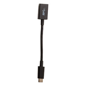
Trimble TSC5 Accessory
Call for Price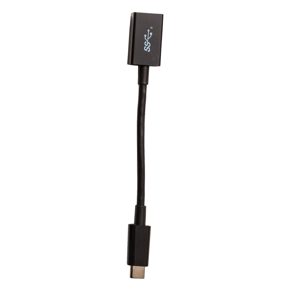
Trimble TSC5 Accessory
Call for PriceQuick View -
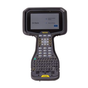
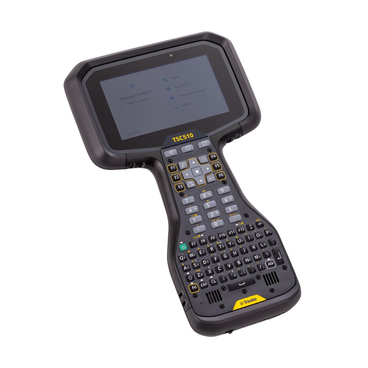
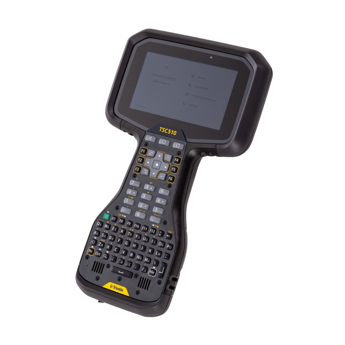
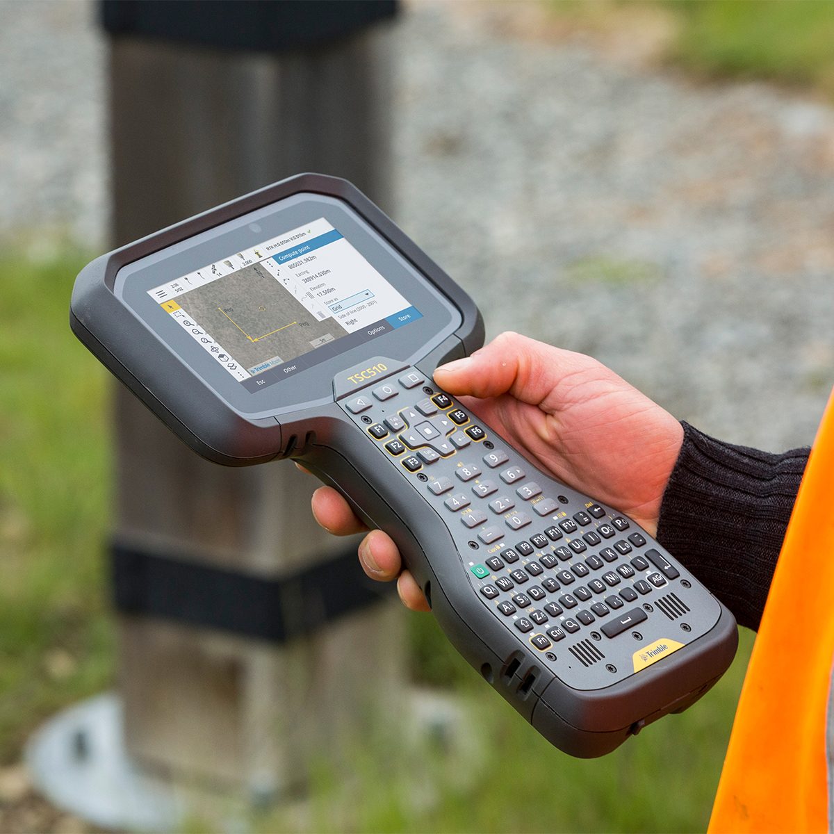
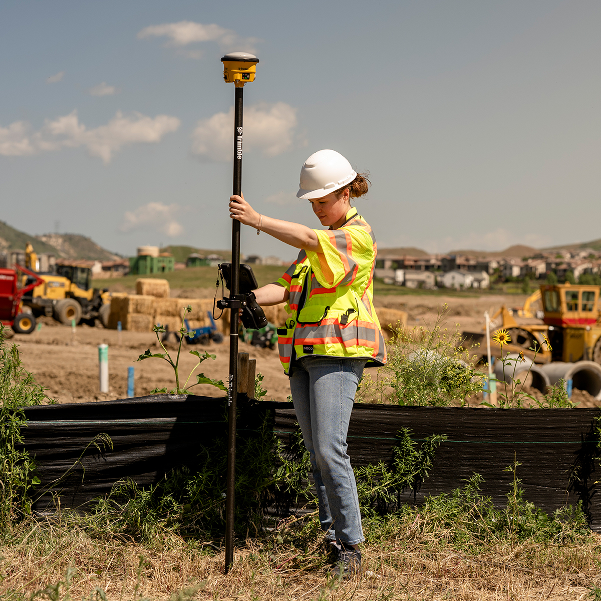
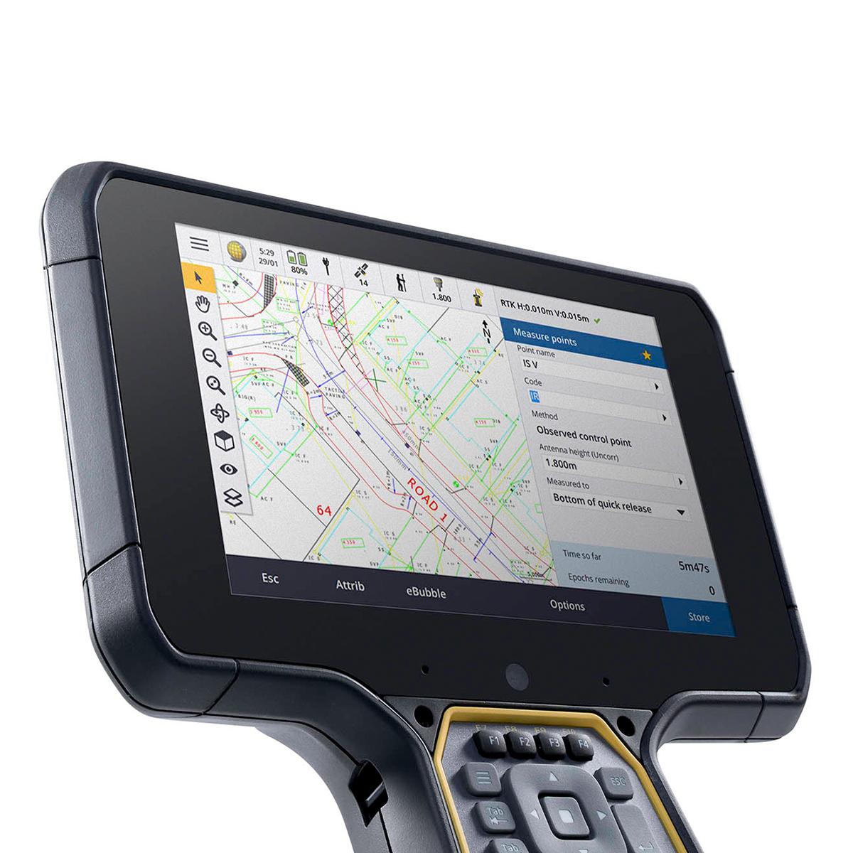
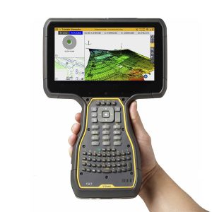
Trimble TSC510-1-1100-00 TSC510 Survey Controller
Call for Price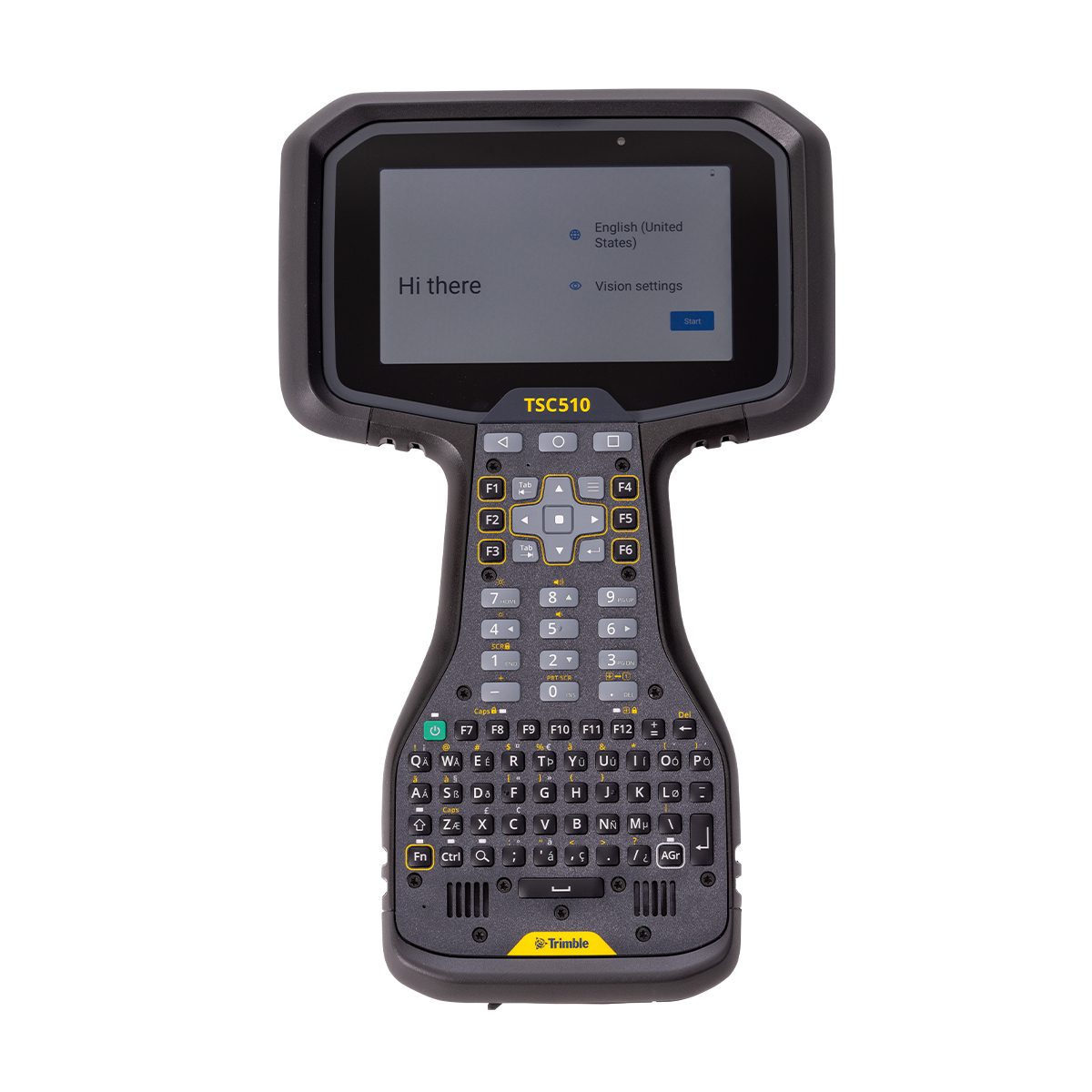


Trimble TSC510-1-1100-00 TSC510 Survey Controller
Call for PriceONLY AVAILABLE FOR DELIVERY IN ND, SD, MN, CO, AK, MT, ID, HI, WY, OR, & WA.
Trimble TSC510-1-1100-00 TSC510 Survey Controller
Get to work immediately with this fully connected, powered-up, and rugged solution.
Boost your field efficiency with the Trimble® TSC510 controller. Designed for optimal performance, this robust handheld device is built to streamline your data collection and surveying tasks. Its intuitive interface and powerful processing capabilities ensure accuracy and speed, even on complex projects. With a focus on durability and connectivity, the TSC510 is equipped to handle challenging environments while keeping your team connected through various communication options. Experience seamless workflows and reliable data management with the TSC510, your essential partner for productive field operations.
Quick View -
Trimble TSC510-1-1100-00-HH TSC510 Heavy Civil Construction Controller
Call for Price

Trimble TSC510-1-1100-00-HH TSC510 Heavy Civil Construction Controller
Call for PriceONLY AVAILABLE FOR DELIVERY IN ND, SD, MN, CO, AK, MT, ID, HI, WY, OR, & WA.
Trimble TSC510-1-1100-00-HH TSC510 Heavy Civil Construction Controller
Get to work immediately with this fully connected, powered-up, and rugged solution.
Boost your field efficiency with the Trimble® TSC510 controller. Designed for optimal performance, this robust handheld device is built to streamline your data collection and surveying tasks. Its intuitive interface and powerful processing capabilities ensure accuracy and speed, even on complex projects. With a focus on durability and connectivity, the TSC510 is equipped to handle challenging environments while keeping your team connected through various communication options. Experience seamless workflows and reliable data management with the TSC510, your essential partner for productive field operations.
Quick View -

Trimble TSC7 Accessory – Glass Screen Protector (1 per pkg)
Call for Price
Trimble TSC7 Accessory – Glass Screen Protector (1 per pkg)
Call for PriceQuick View -
Trimble TSC7 Controller – QWERTY Keypad, USB/Serial Boot, Worldwide Region, Standalone
Call for Price
Trimble TSC7 Controller – QWERTY Keypad, USB/Serial Boot, Worldwide Region, Standalone
Call for PriceONLY AVAILABLE FOR DELIVERY IN ND, SD, MN, CO, AK, MT, ID, HI, WY, OR, & WA.Quick View -
Trimble TSC7-2-1111-00 TSC7 V2 Controller – QWERTY keypad, USB/Serial boot, NA/EMEA region, Standalone
Call for Price

Trimble TSC7-2-1111-00 TSC7 V2 Controller – QWERTY keypad, USB/Serial boot, NA/EMEA region, Standalone
Call for PriceONLY AVAILABLE FOR DELIVERY IN ND, SD, MN, CO, AK, MT, ID, HI, WY, OR, & WA.
Quick View -
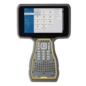
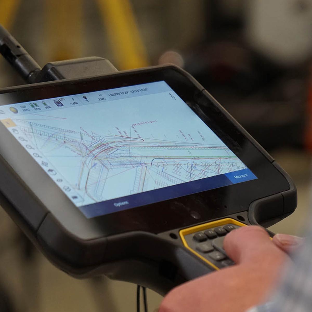
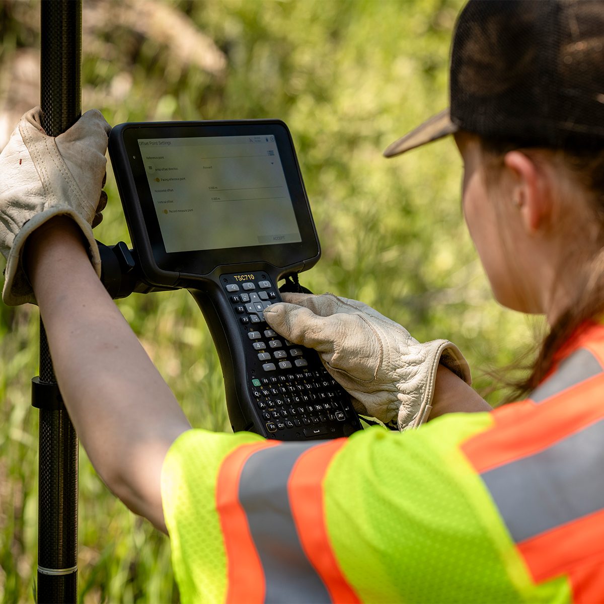
Trimble TSC703 TSC7 Controller
Call for Price

Trimble TSC703 TSC7 Controller
Call for PriceONLY AVAILABLE FOR DELIVERY IN ALASKA.
Trimble TSC703 TSC7 Controller
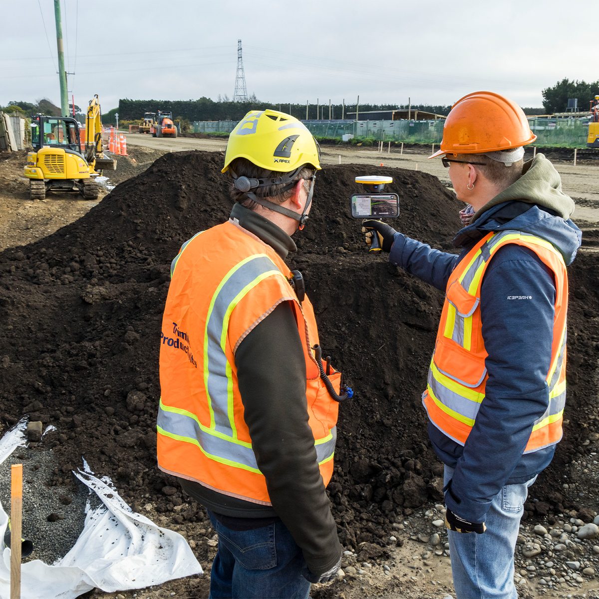
Built for the Construction Site
The Trimble TSC7 Controller is a wirelessly connected, rugged handheld controller for GNSS or total station operations. It gives construction surveyors, grade checkers, and site engineers total control over their on-site tasks. Designed for construction site operations, the TSC7 offers integrated Wi-Fi and Bluetooth, built-in cameras, and GPS in a lightweight, shock, dust and water resistant package.Quick View -
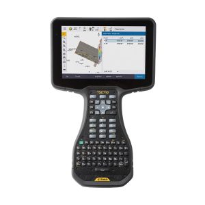
Trimble TSC710-1-1100-00 TSC710 Survey Controller
Call for Price
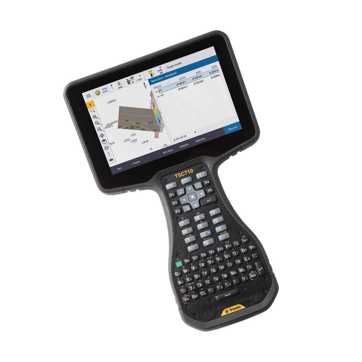
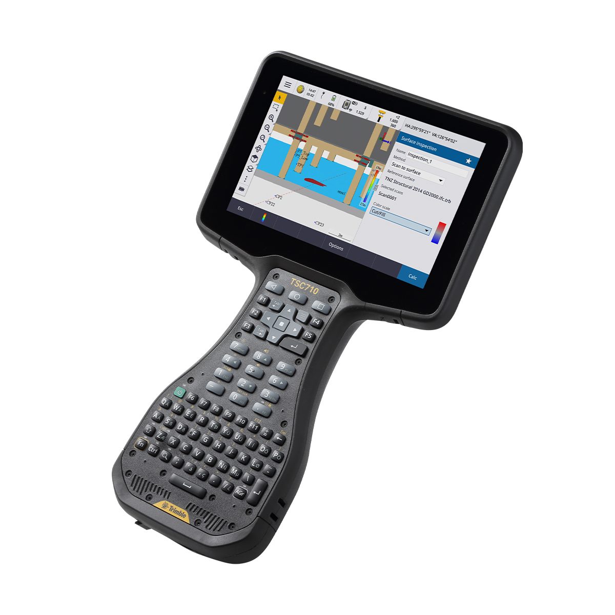
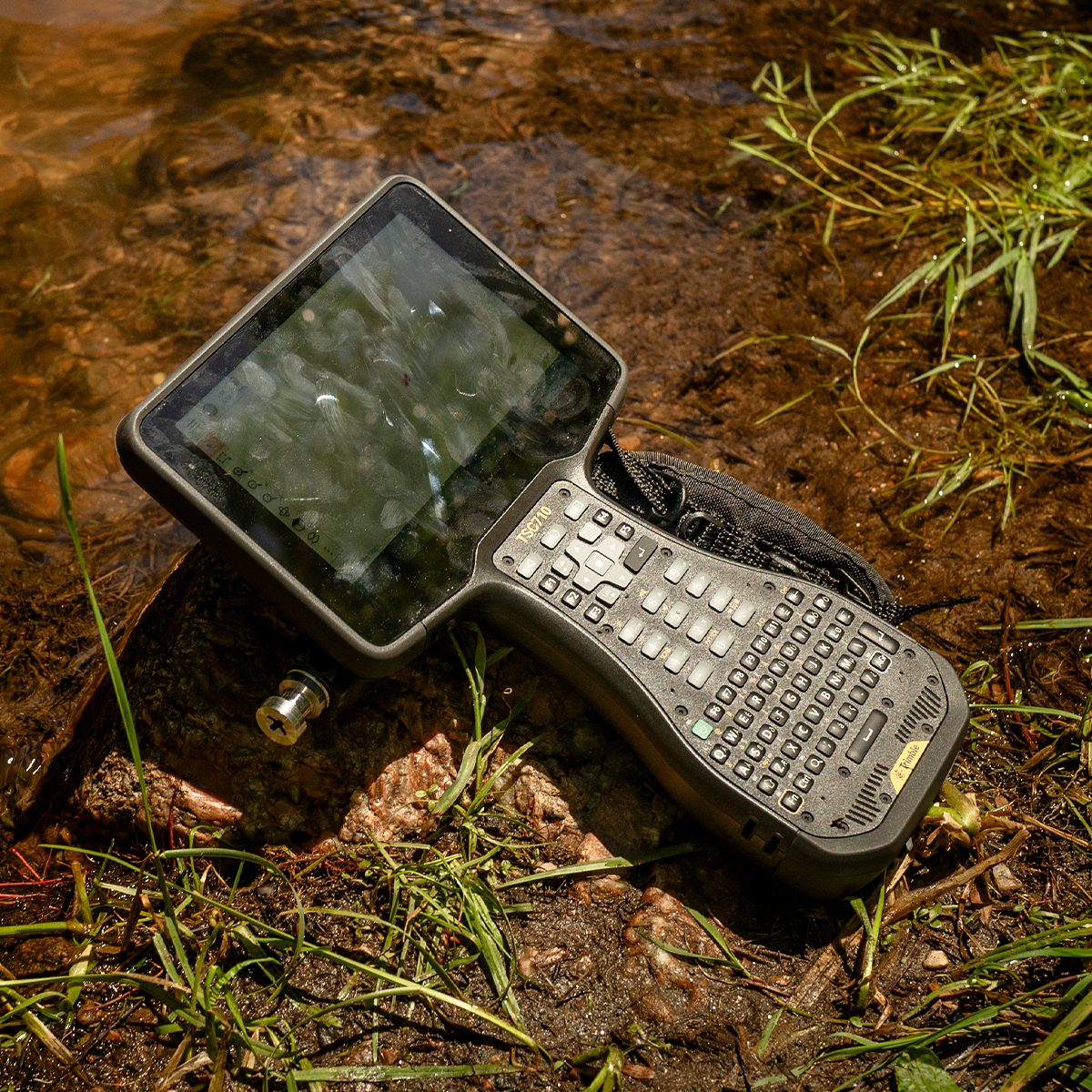
Trimble TSC710-1-1100-00 TSC710 Survey Controller
Call for PriceONLY AVAILABLE FOR DELIVERY IN ND, SD, MN, CO, AK, MT, ID, HI, WY, OR, & WA.
Trimble TSC710-1-1100-00 TSC710 Survey Controller
Connect to a Better Way to Work
The Trimble® TSC710 controller boosts your performance with more memory and power. Its 7-inch screen, full keyboard and robust processing in a compact design ensure seamless field-to-office connectivity with versatile communication capabilities.Quick View -
Trimble TSC710-1-1100-00-HH TSC710 Heavy Civil Construction Controller
Call for Price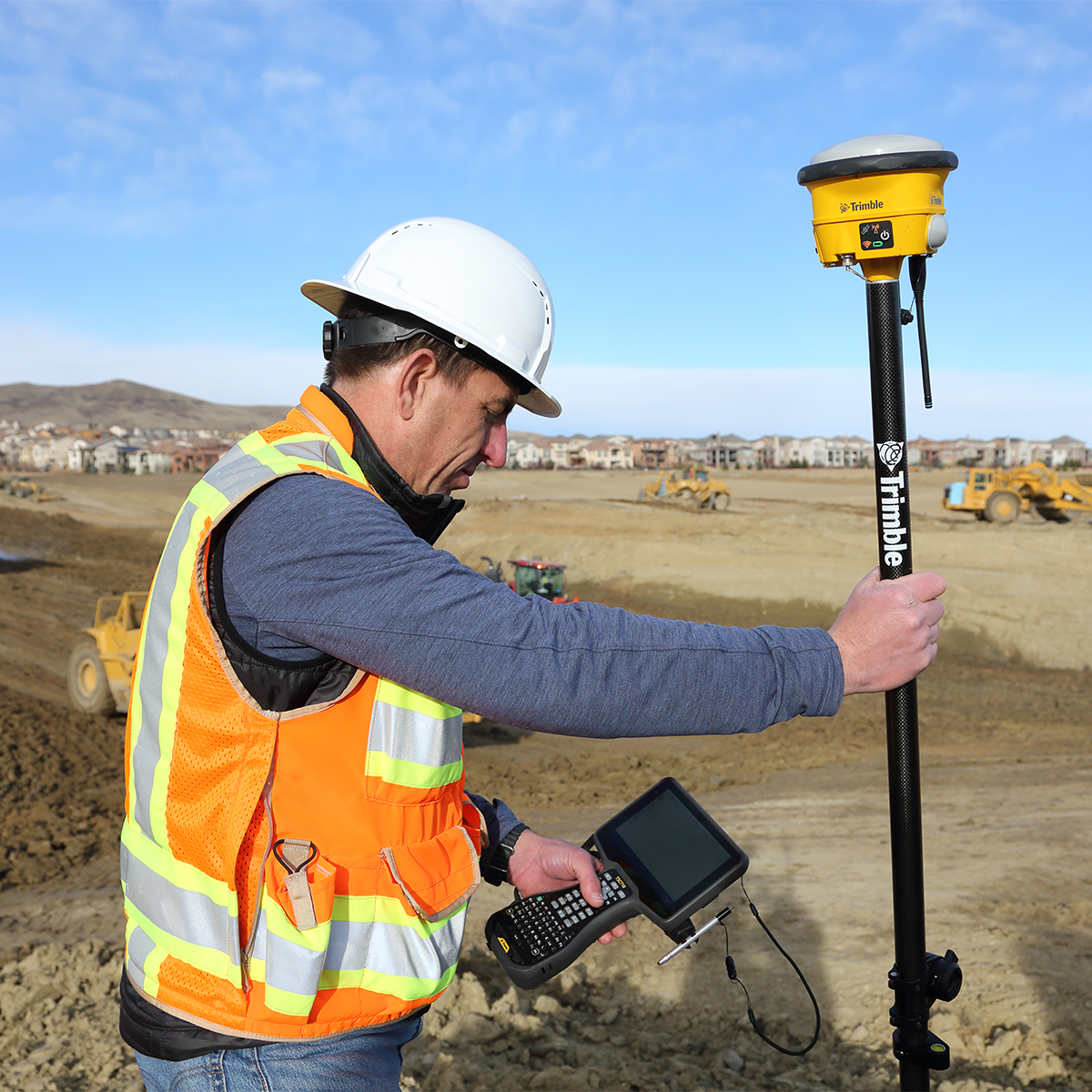

Trimble TSC710-1-1100-00-HH TSC710 Heavy Civil Construction Controller
Call for PriceONLY AVAILABLE FOR DELIVERY IN ND, SD, MN, CO, AK, MT, ID, HI, WY, OR, & WA.
Trimble TSC710-1-1100-00-HH TSC710 Heavy Civil Construction Controller
Connect to a Better Way to Work
The Trimble® TSC710 controller boosts your performance with more memory and power. Its 7-inch screen, full keyboard and robust processing in a compact design ensure seamless field-to-office connectivity with versatile communication capabilities.Quick View -

Trimble TSV-YR-GEO-NR SiteVision Augmented Reality Unlimited – Annual Subscription
Call for Price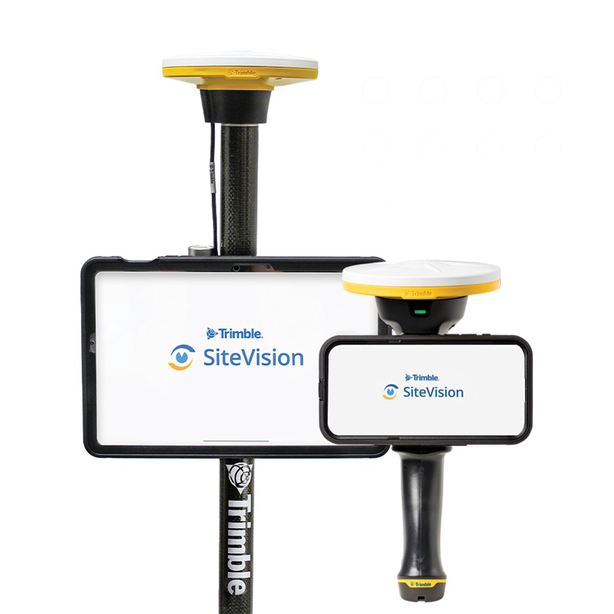
Trimble TSV-YR-GEO-NR SiteVision Augmented Reality Unlimited – Annual Subscription
Call for PriceONLY AVAILABLE FOR DELIVERY IN ND, SD, MN, CO, AK, MT, ID, HI, WY, OR, & WA.Trimble TSV-YR-GEO-NR SiteVision Augmented Reality Unlimited – Annual Subscription
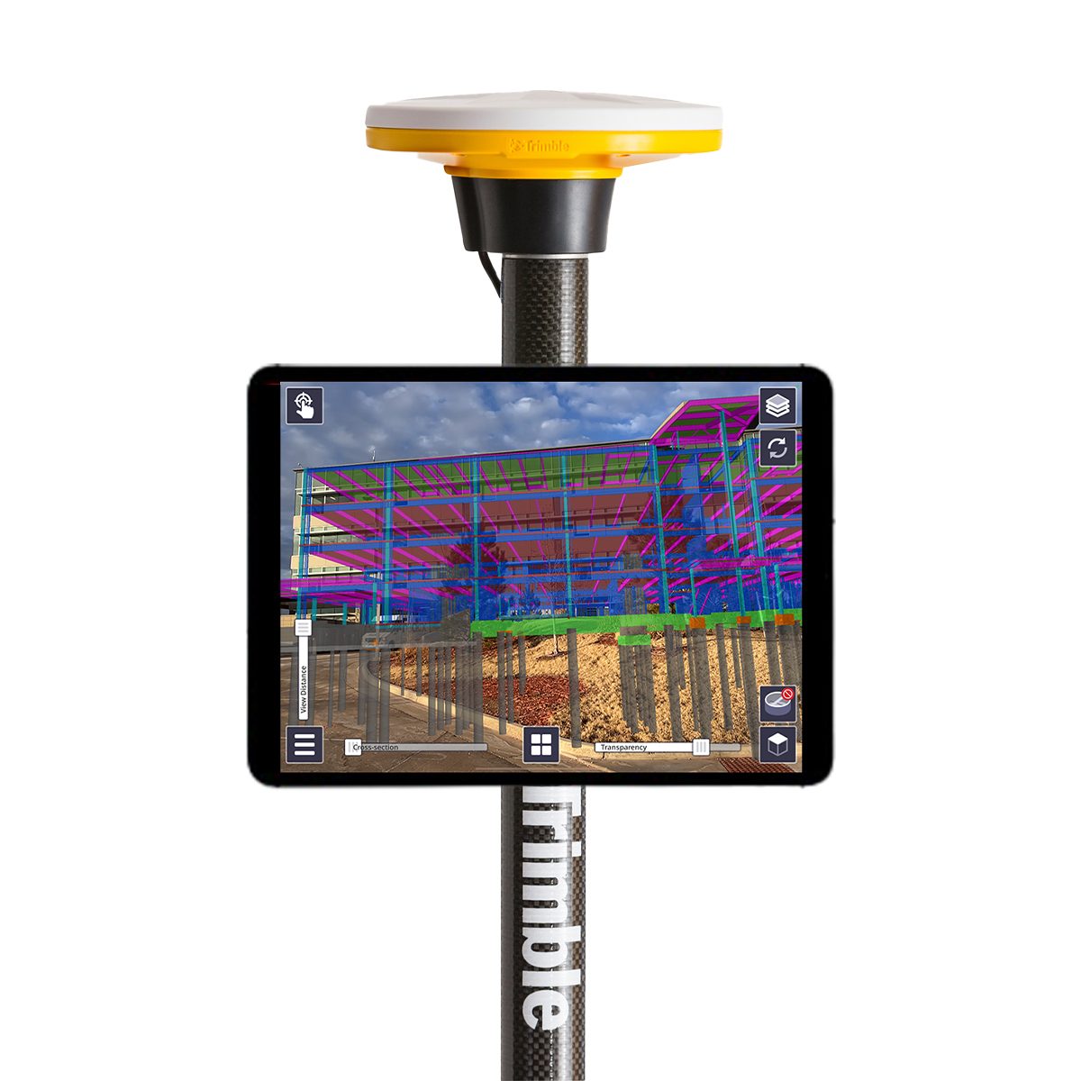
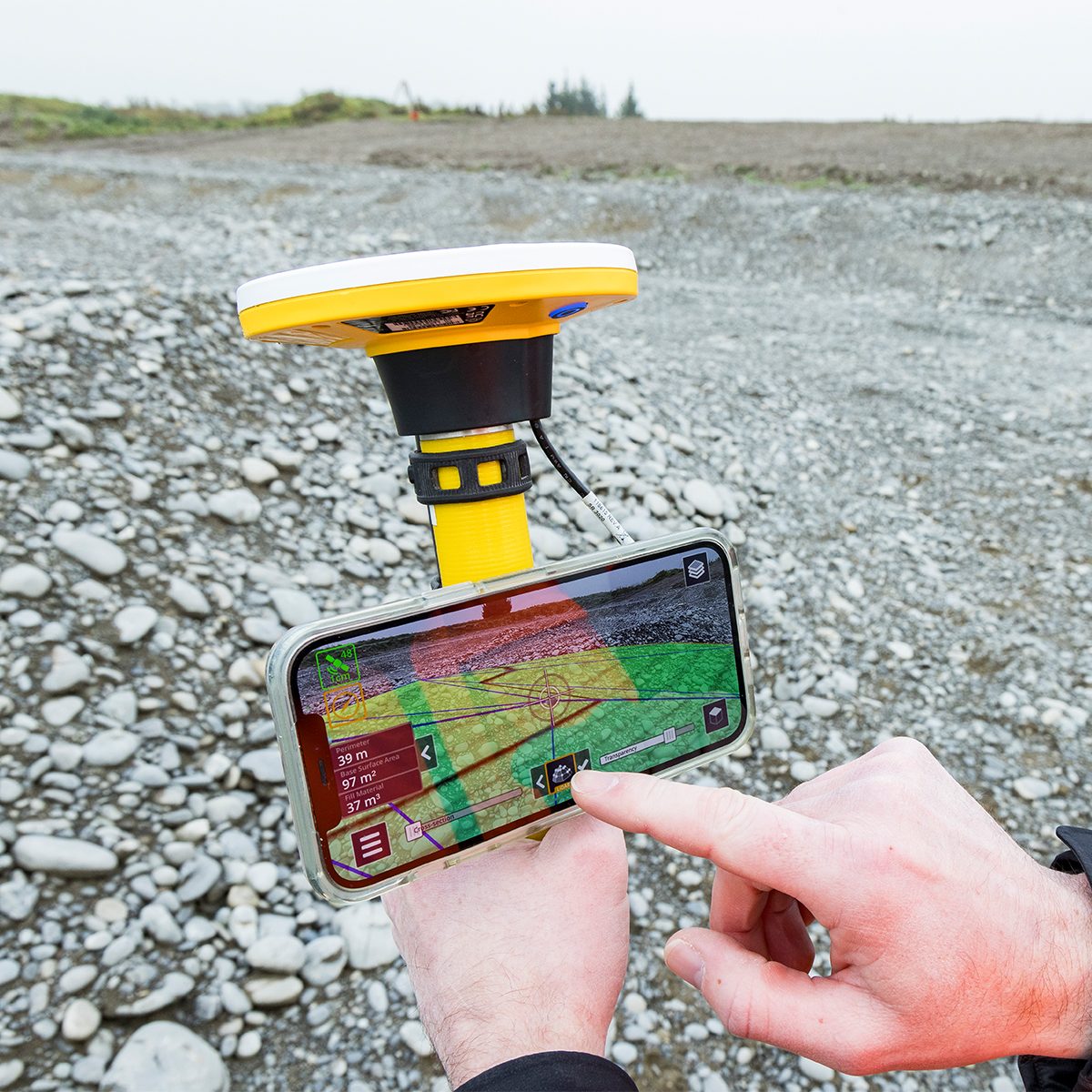
Augmented Reality | Trimble SiteVision
Instant visualization for immediate insights.Trimble® SiteVision® is a real-time, in-field visualization software for collaborating on project progress and detecting design changes or conflicts. Choose your hardware configuration to collect images, GNSS points, EDM points or LiDAR scans.Quick View -
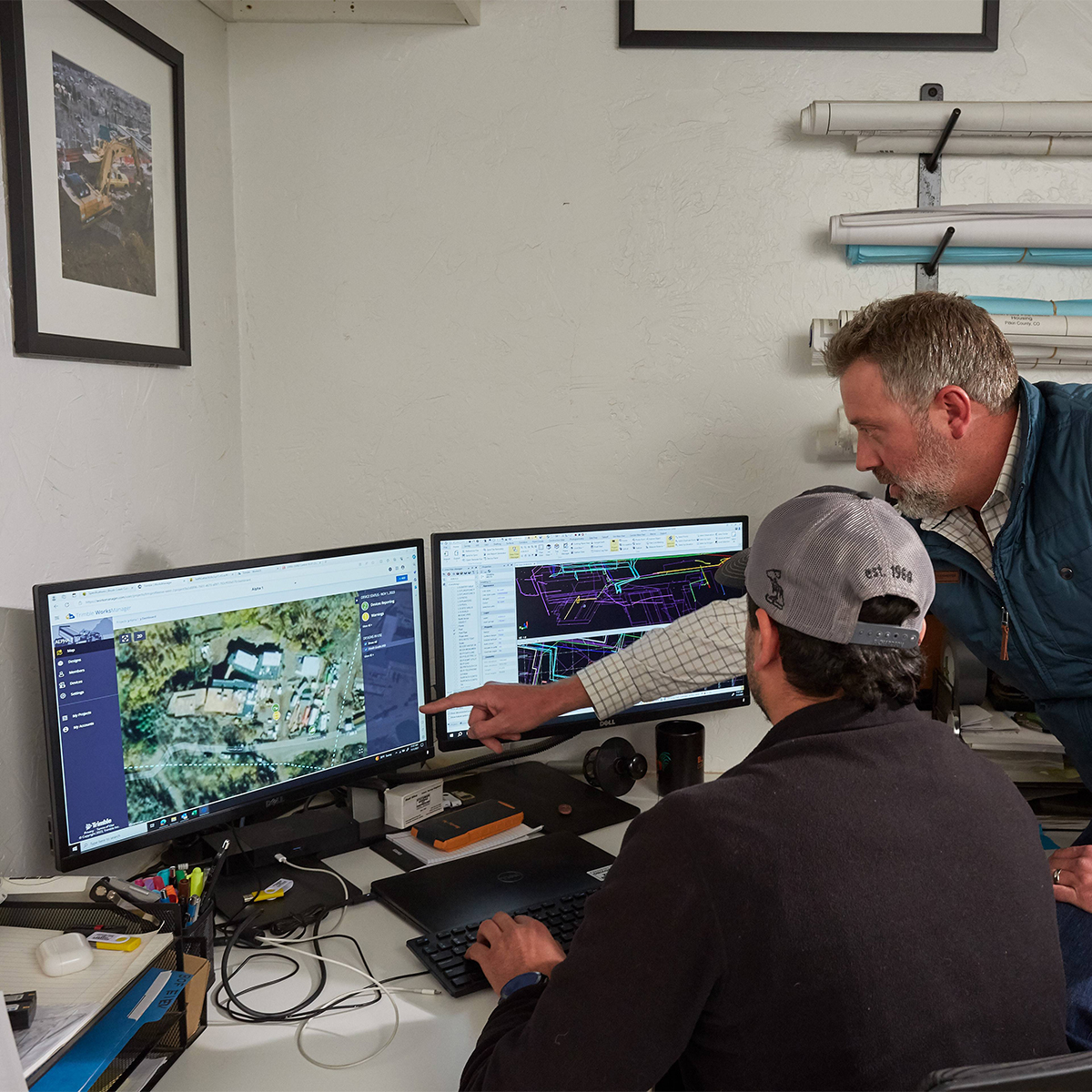
Trimble WorksManager Office Software for Construction
Call for Price


Trimble WorksManager Office Software for Construction
Call for PriceONLY AVAILABLE FOR DELIVERY IN ALASKA.
Trimble WorksManager Office Software for Construction
Trimble® WorksManager is a mobile-friendly site-management software that keeps machine operators and survey crews connected to the information they need to get the job done right the first time. Easily transfer data to the jobsite without leaving the office, reducing delays and minimizing downtime.
Quick View -
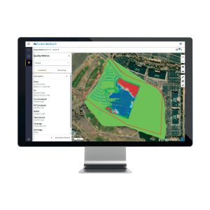
Trimble WorksOS Office Software
Call for Price


Trimble WorksOS Office Software
Call for PriceONLY AVAILABLE FOR DELIVERY IN ALASKA.
Trimble WorksOS Office Software | Jobsite Progress Monitoring Software
Monitor Jobsite Activity and Progress-to-plan
Trimble® WorksOS software collects information straight from your machines, giving site supervisors and project managers real-time visibility into civil construction jobsite progress and project status. This insight empowers better decision-making and enables you to make proactive adjustments to stay on budget and on schedule. The software’s intuitive interface makes it easy to create and configure activities. Monitor jobsite metrics without needing to understand or set up complex filter settings. Remotely push design updates to machines direct from the office, reducing unnecessary site visits and machine idling.Quick View -

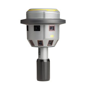
Trimble X12 Kit with T10x Tablet
Call for Price


Trimble X12 Kit with T10x Tablet
Call for PriceONLY AVAILABLE FOR DELIVERY IN ND, SD, MN, CO, AK, MT, ID, HI, WY, OR, & WA.
Call 1-800-359-3703 for pricing and quote on configuration.
Quick View -
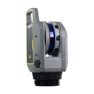
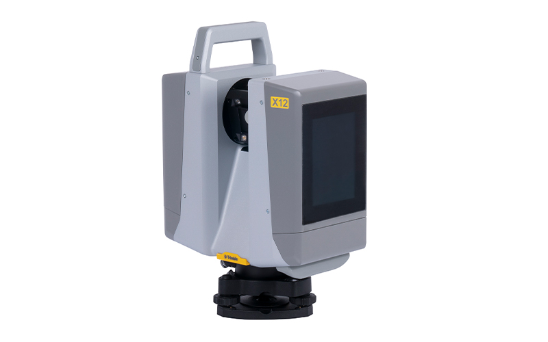
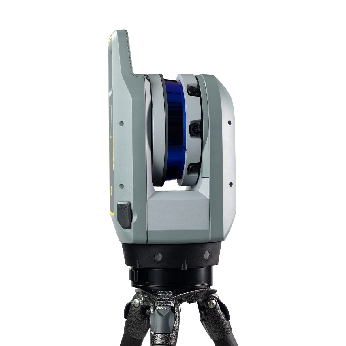
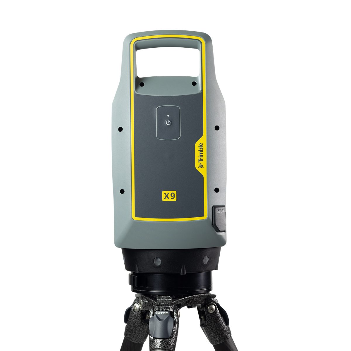
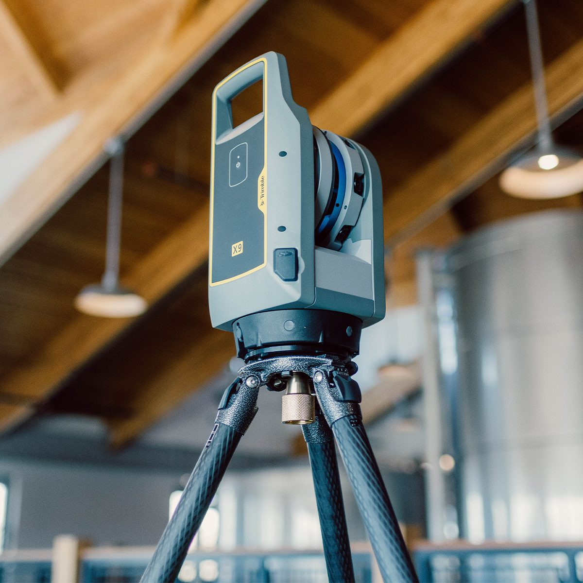
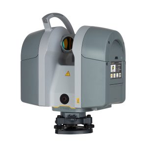
Trimble X9-100-01-GEO X9 3D Laser Scanning System
Call for Price

Trimble X9-100-01-GEO X9 3D Laser Scanning System
Call for PriceONLY AVAILABLE FOR DELIVERY IN ND, SD, MN, CO, AK, MT, ID, HI, WY, OR, & WA.
Trimble X9-100-01-GEO X9 3D Laser Scanning System
The power to do more, on your terms.The Trimble® X9 3D laser scanning platform leverages proven Trimble technology to deliver the range, accuracy, speed and sensitivity you need to do more. With flexible licensing plan options, choose the scanning functionality that fits your project needs.
Quick View -
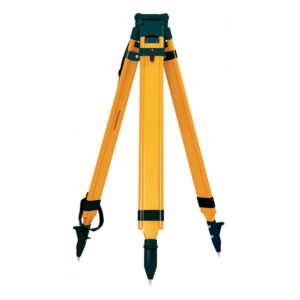
Tripod, PRM, Quick Clamp, Wood/Fiber
Call for Price
Tripod, PRM, Quick Clamp, Wood/Fiber
Call for PriceQuick View -
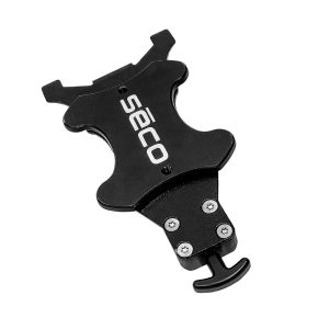
TSC5 Controller Magnetic Attachment
Call for Price

TSC5 Controller Magnetic Attachment
Call for PriceQuick View -
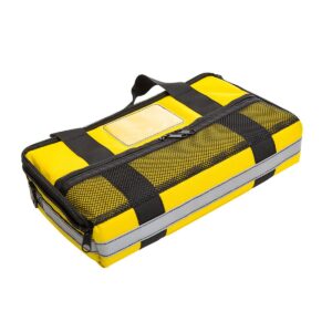
TSC5 Pouch
Call for Price
TSC5 Pouch
Call for PriceQuick View -

TSC7 Controller Magnetic Attachment
Call for Price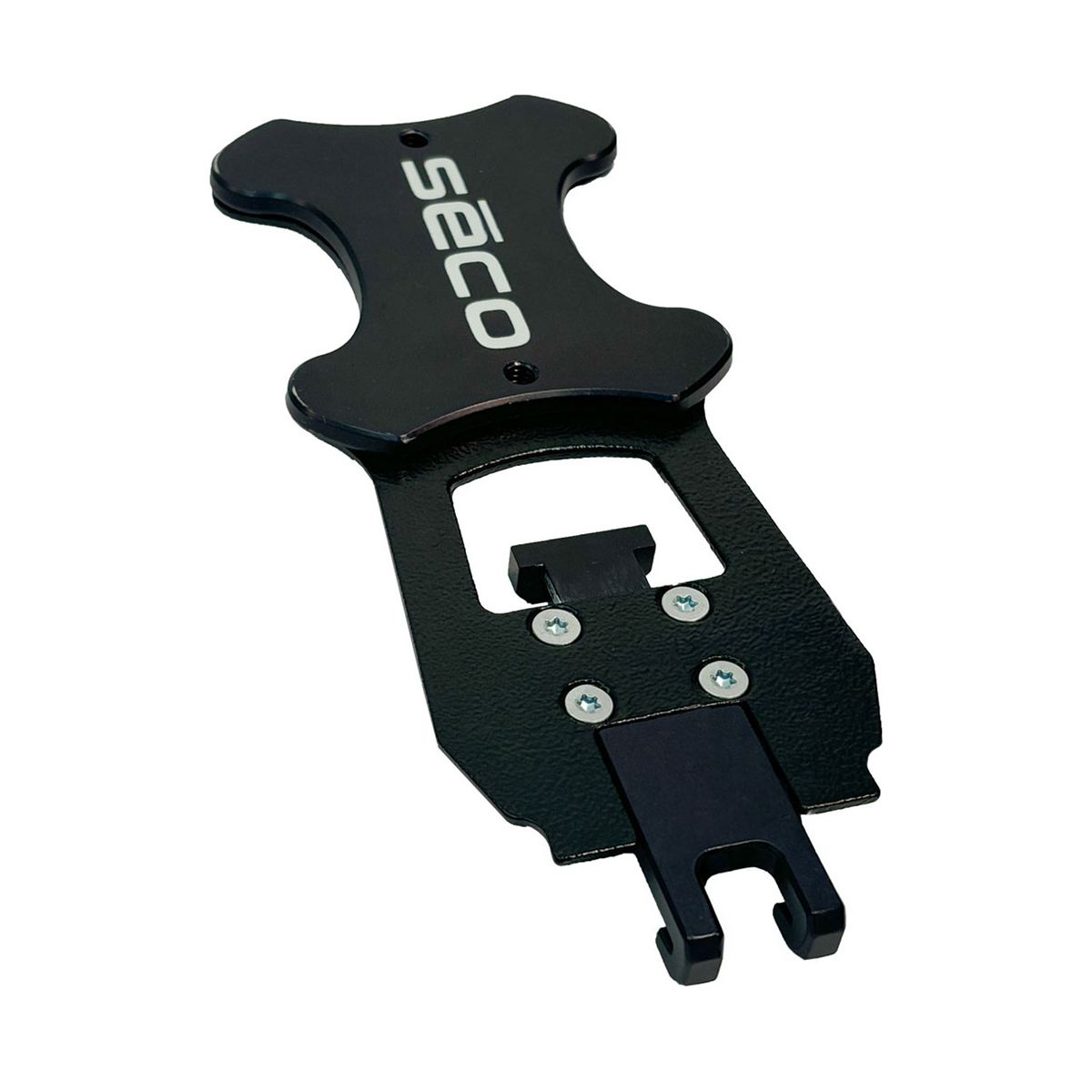
TSC7 Controller Magnetic Attachment
Call for PriceQuick View -

TSC7 Magnetic Pole Bracket
Call for Price
TSC7 Magnetic Pole Bracket
Call for PriceQuick View -

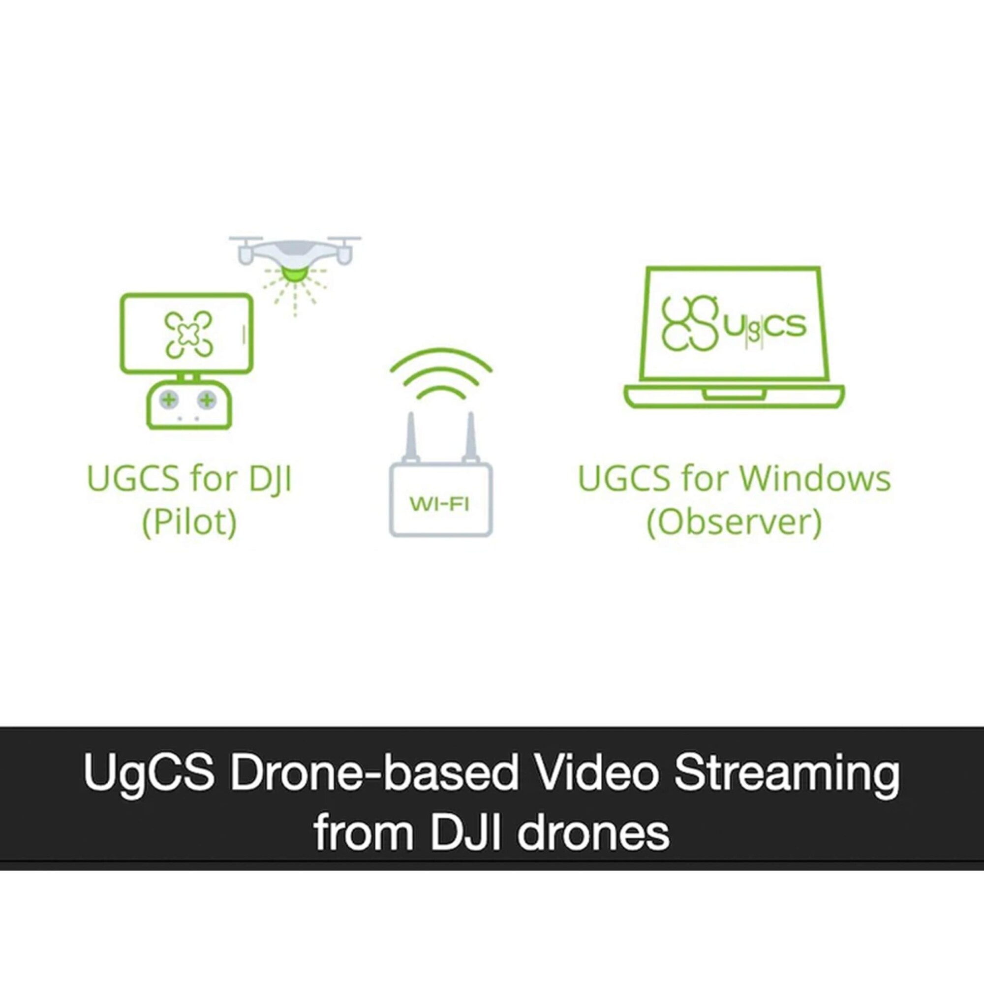
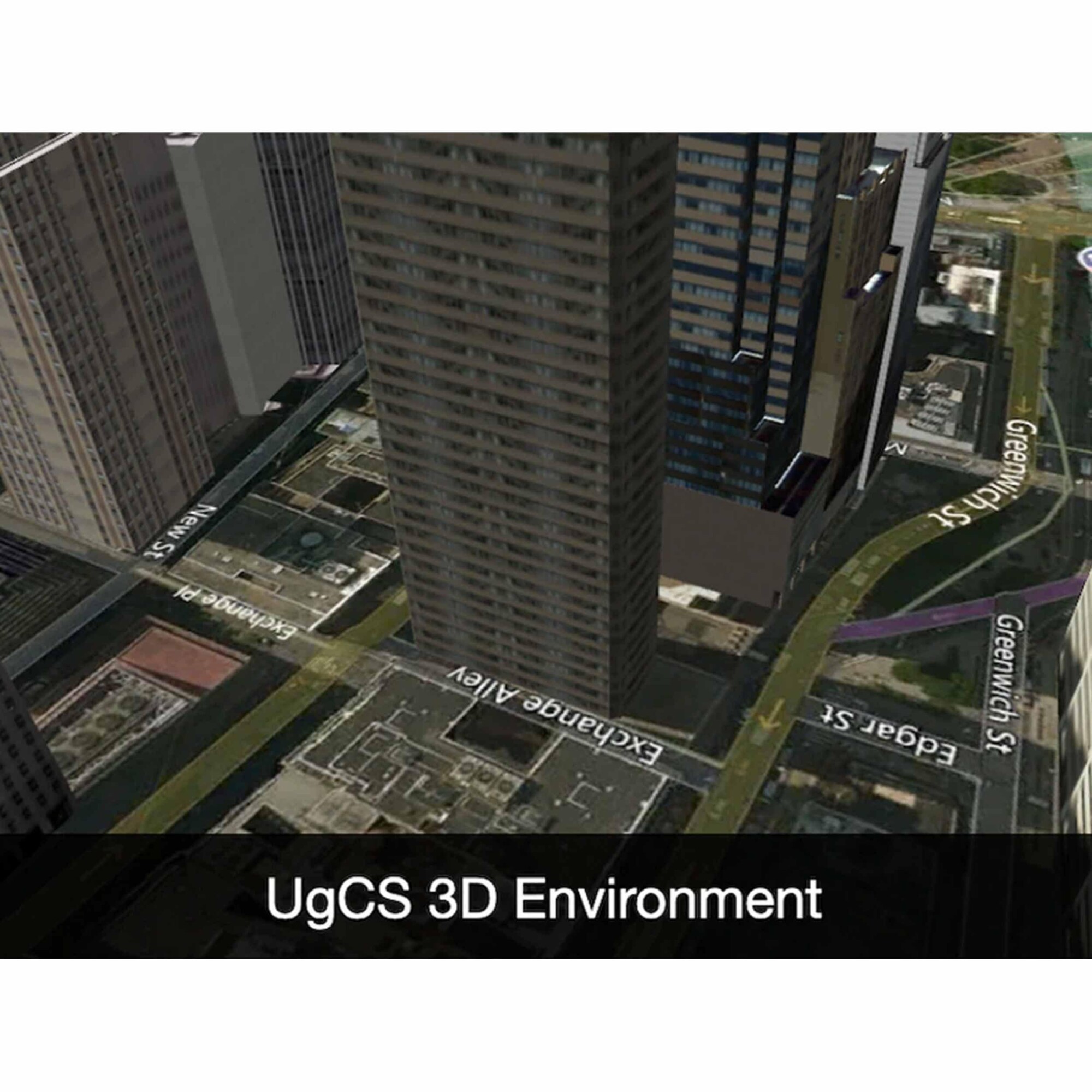
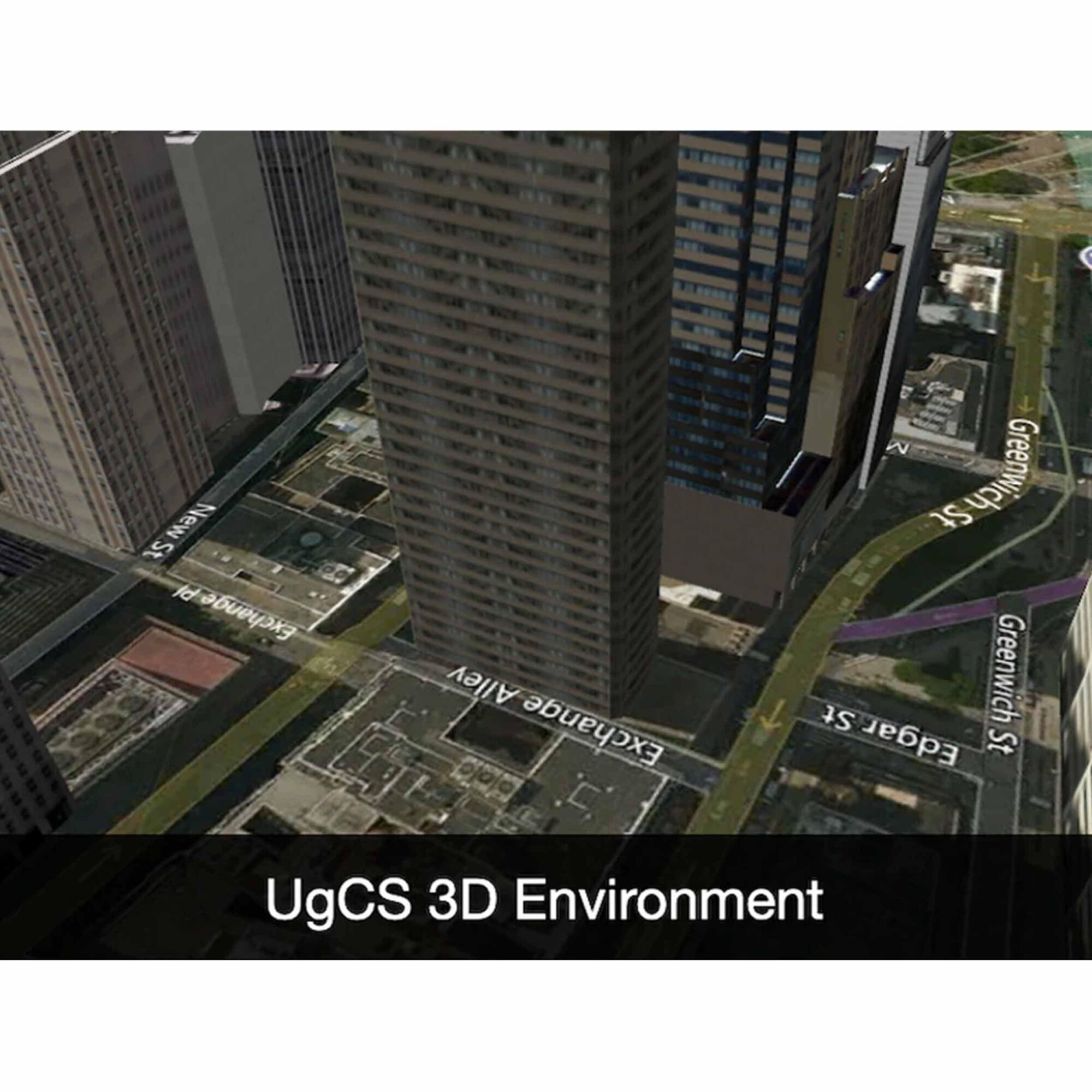
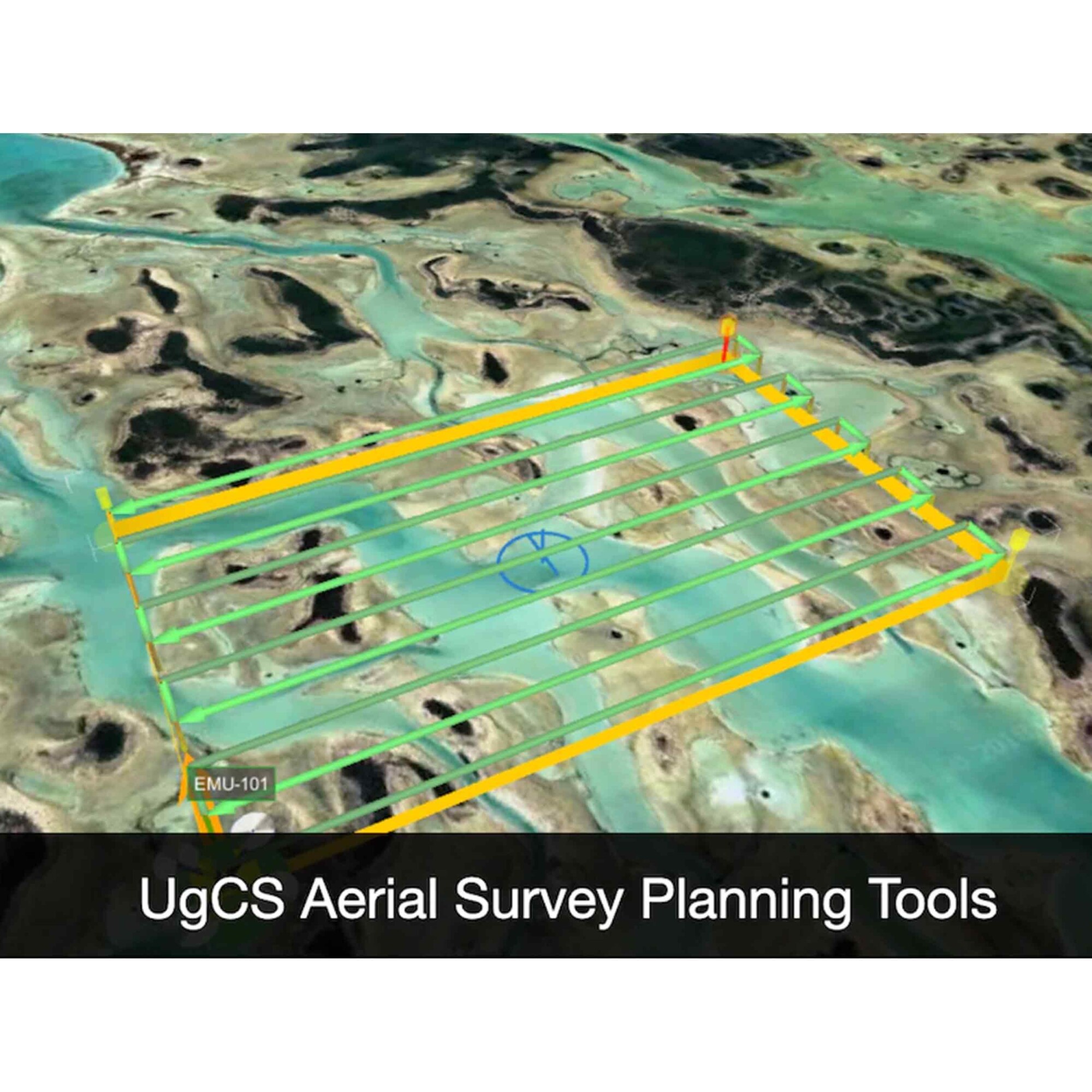
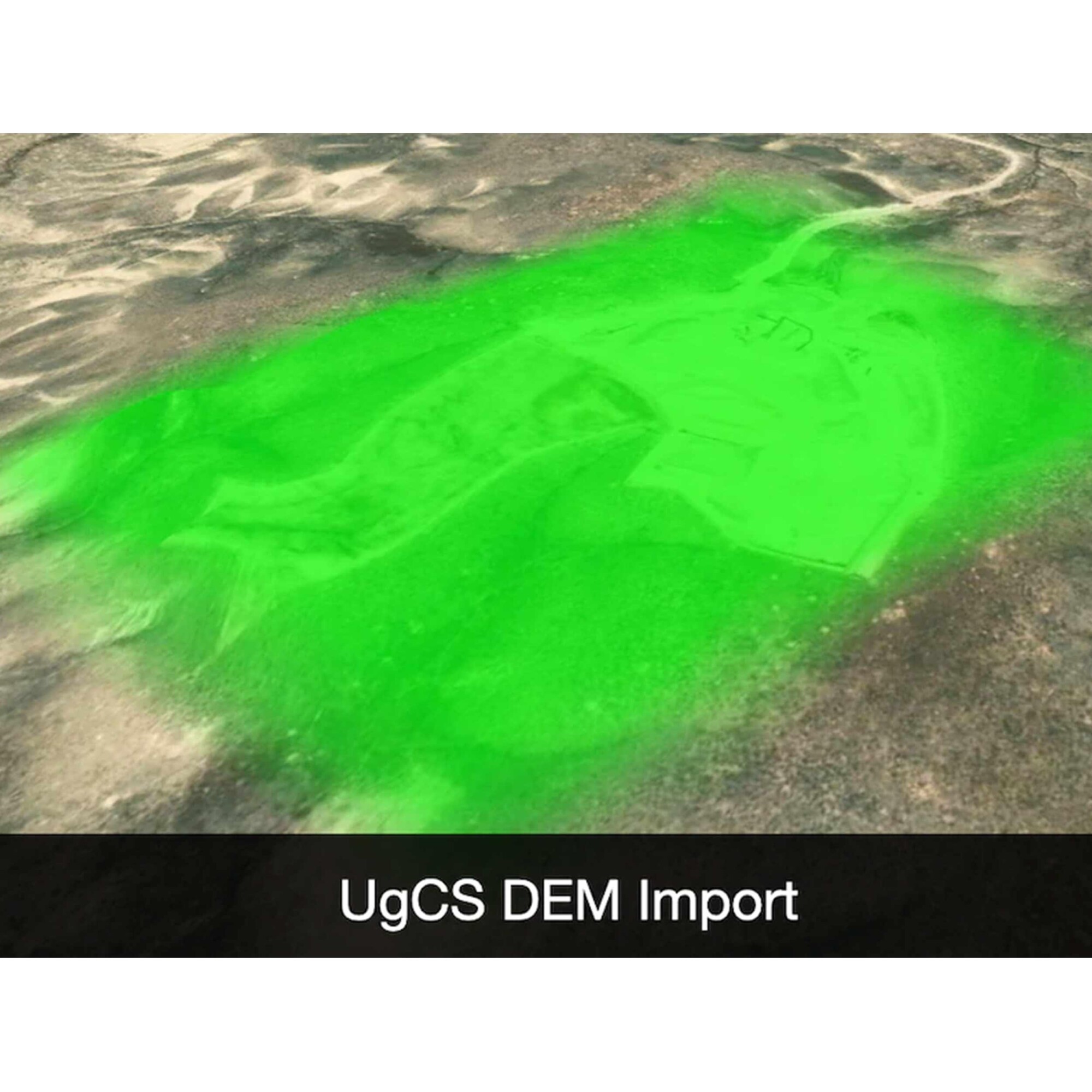
UgCS Enterprise Perpetual
Call for Price

 Quick View
 -

UgCS Expert Perpetual
Call for Price
UgCS Expert Perpetual
Call for PriceQuick View -

UgCS Pro Perpetual
Call for Price

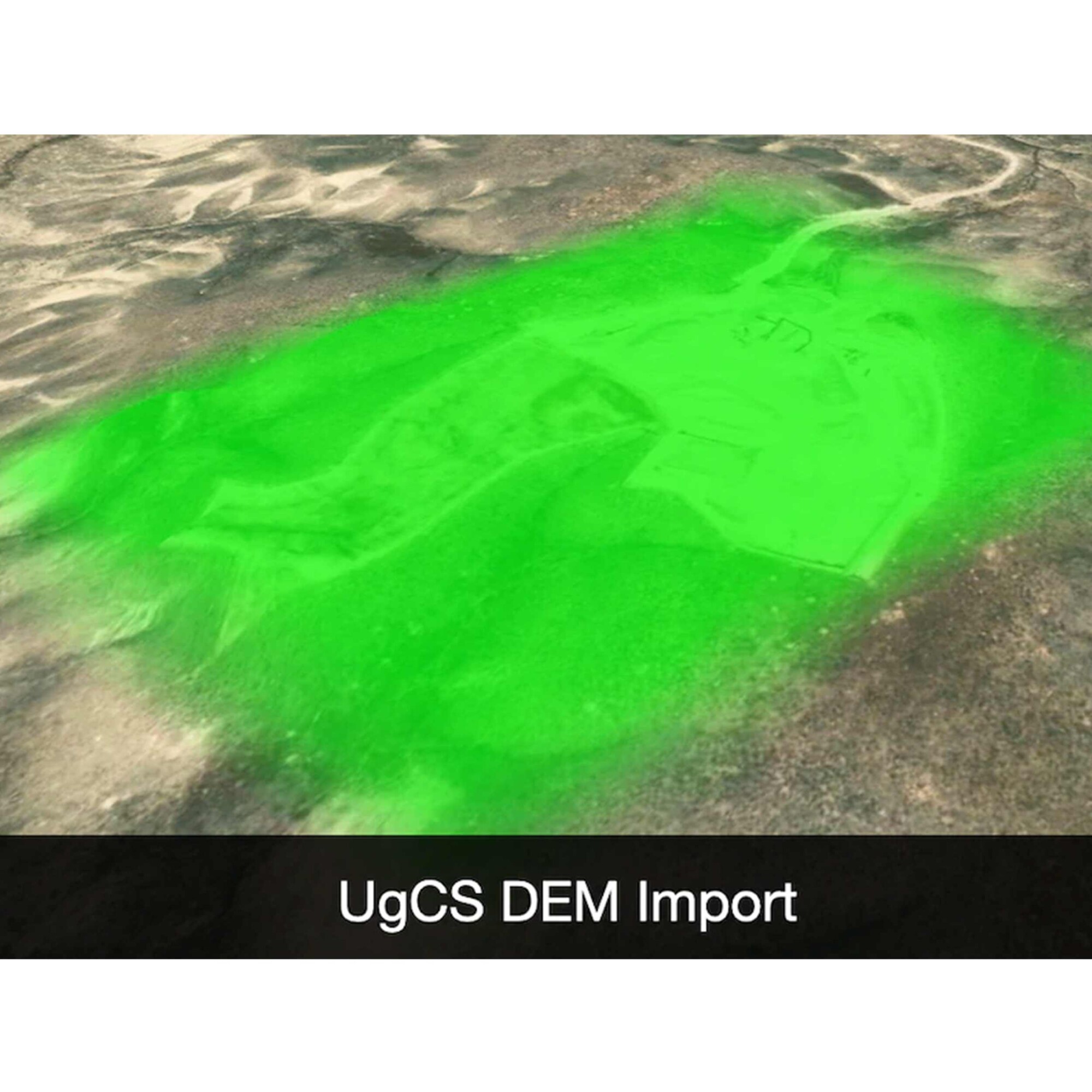 Quick View
 -

UL633N Laser w/ RC603N Remote; 2 x HL760 Receiver w/ Clamp; SF601; NIMH and Universal Charger
Call for Price


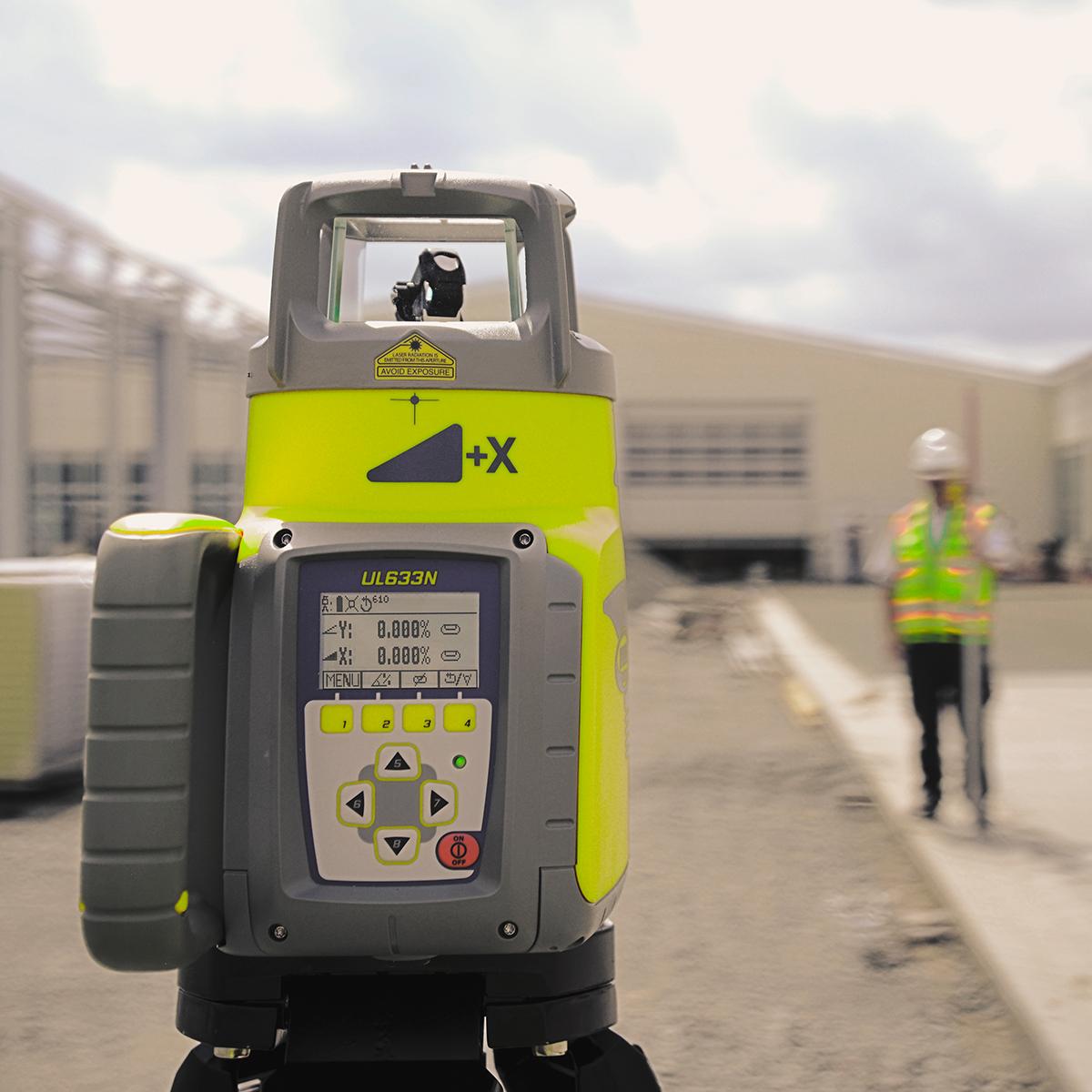
UL633N Laser w/ RC603N Remote; 2 x HL760 Receiver w/ Clamp; SF601; NIMH and Universal Charger
Call for PriceQuick View -
USB 2.0 Type A to USB Micro 3ft
Call for Price
USB 2.0 Type A to USB Micro 3ft
Call for PriceQuick View -
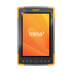
Used Juniper Systems Mesa 3 Windows Rugged Tablet
Call for Price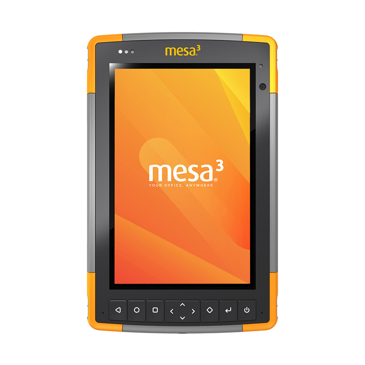
Used Juniper Systems Mesa 3 Windows Rugged Tablet
Call for PriceThe Mesa 3 Rugged Tablet offers powerful functionality. The Mesa 3’s Quad-core Pentium processor is ready to run even the most demanding field data collection applications, and its rugged ergonomic design is ready to handle a long day on the job in some of the harshest environments out there.
Quick View -
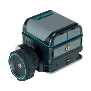
Used Screening Eagle GP8800 Proceq Concrete Scanner
Call for Price
Used Screening Eagle GP8800 Proceq Concrete Scanner
Call for PriceConcrete inspections and structural imaging with SFCW ground penetrating radar technology now fits at the palm of your hand with the Screening Eagle GP8800 Proceq Concrete Scanner.
Quick View -

Used Spectra Precision Ranger 5 Controller
Call for Price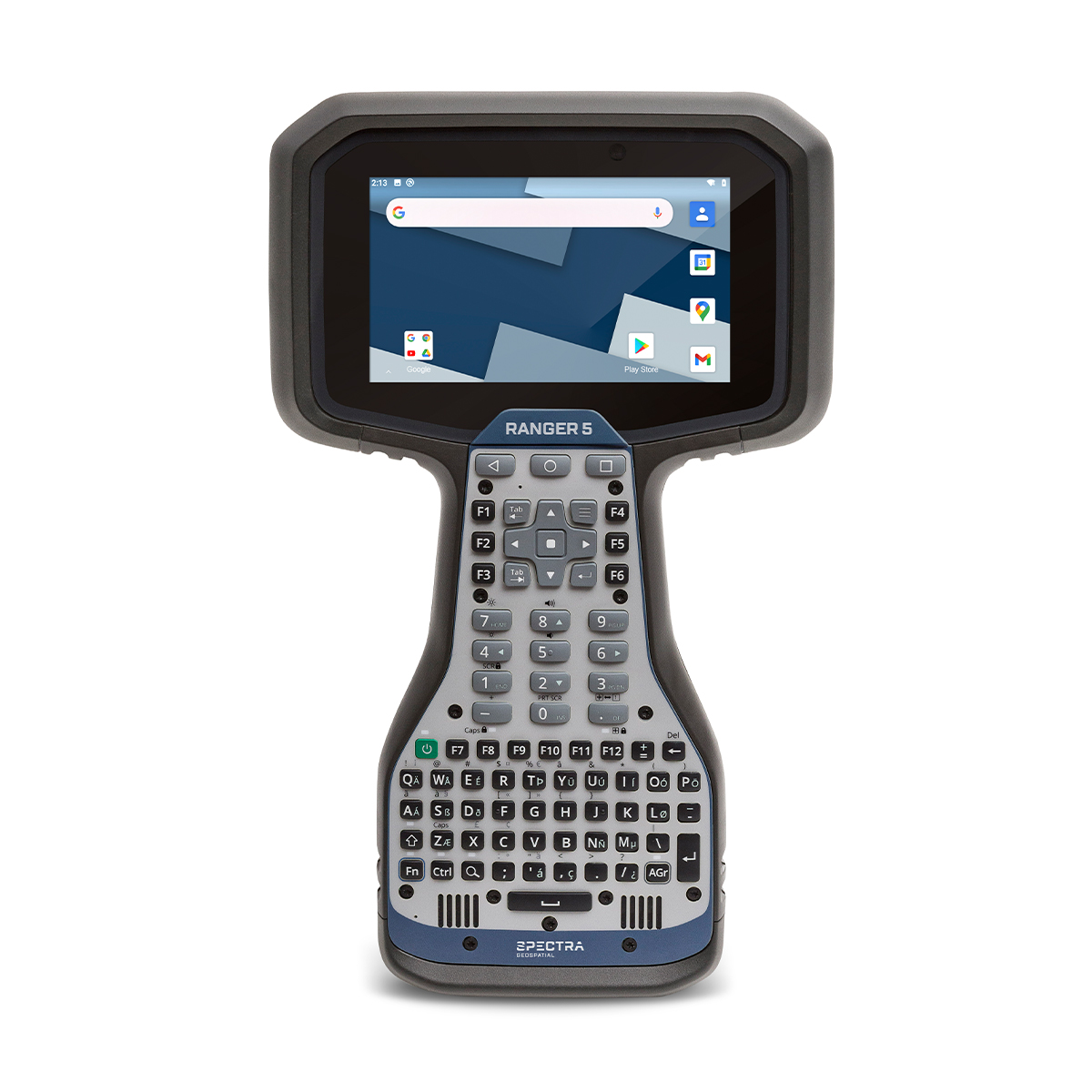
Used Spectra Precision Ranger 5 Controller
Call for PriceThe Spectra Geospatial Ranger 5 is the fifth-generation with a heritage that traces back to the first modern field computer for land surveyors. From the beginning, the Ranger has been designed to help you get every job done consistently, efficiently–and right.
Quick View -
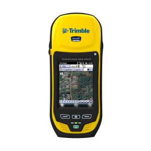
Used Trimble Geo 6000 XT Submeter Handheld
Call for Price
Used Trimble Geo 6000 XT Submeter Handheld
Call for PriceBringing together the essential functionality for productive GIS data collection in one device, the Trimble® GeoExplorer® XH 6000 series also delivers positioning accuracy in challenging GNSS situations such as under trees and near buildings with Trimble Floodlight™ technology. Wherever you work, it just works.
Quick View -
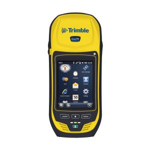
Used Trimble Geo 7X Handheld
Call for Price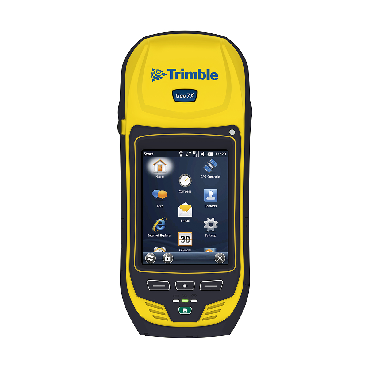
Used Trimble Geo 7X Handheld
Call for PriceThe Trimble Geo 7X handheld is from the Trimble GeoExplorer® series family of integrated, rugged, and high-accuracy GNSS handhelds. As a streamlined solution that enables faster and more productive data collection, the Geo 7X is ideal for organizations, such as utility companies, municipalities, and environmental agencies, requiring mobile data collection and asset management solutions.
Quick View -
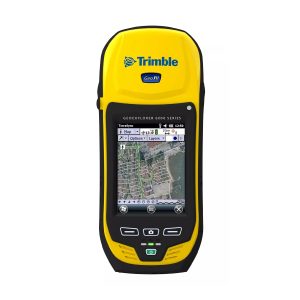
Used Trimble Geo XH 6000 3.5G Handheld
Call for Price
Used Trimble Geo XH 6000 3.5G Handheld
Call for PriceBringing together the essential functionality for productive GIS data collection in one device, the Trimble® GeoExplorer® XH 6000 series also delivers positioning accuracy in challenging GNSS situations such as under trees and near buildings with Trimble Floodlight™ technology. Wherever you work, it just works.
Quick View -
Used Trimble Geo XH 6000 Handheld
Call for PriceUsed Trimble Geo XH 6000 Handheld
Call for PriceBringing together the essential functionality for productive GIS data collection in one device, the Trimble® GeoExplorer® XH 6000 series also delivers positioning accuracy in challenging GNSS situations such as under trees and near buildings with Trimble Floodlight™ technology. Wherever you work, it just works.
Quick View -

Used Trimble HPB450 Radio
Call for Price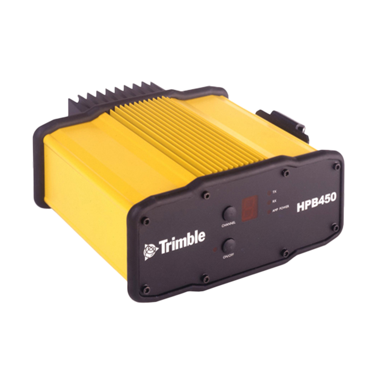
Used Trimble HPB450 Radio
Call for PriceThe Trimble® HPB450 radio modem is a powerful and rugged 450 MHz radio specifically designed for GPS surveying systems.
Quick View -

Used Trimble M3 Mechanical Total Station
Call for Price
Used Trimble M3 Mechanical Total Station
Call for PriceLightweight, compact and streamlined, the Trimble® M3 Total Station provides everything you need to get the job done right in demanding situations.
Quick View -
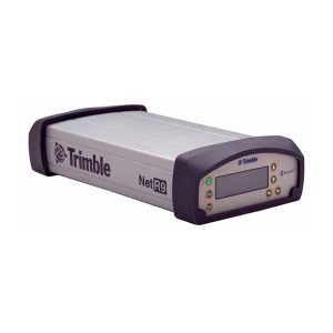
Used Trimble NetR9 Receiver
Call for Price
Used Trimble NetR9 Receiver
Call for PriceThe Trimble® NetR9 Geospatial is a GNSS receiver designed to provide Survey professionals with maximum features and flexibility. The Trimble technologies provided in the NetR9 Geospatial are a unique and comprehensive combination.
Quick View -

Used Trimble NetR9 Ti-2 Reference Station
Call for Price
Used Trimble NetR9 Ti-2 Reference Station
Call for PriceThe Trimble NetR9 Global Navigation Satellite System (GNSS) reference receiver series consists of full-feature, top-of-the-line receivers designed to provide network operators with maximum features and functionality from a single receiver platform.
Quick View -

Used Trimble R10-1 GNSS Receiver
Call for Price
Used Trimble R10-1 GNSS Receiver
Call for PriceThe Trimble R10 GNSS system is designed to help you work more effectively, no matter how extreme the environment. Going beyond comprehensive GNSS support with technologies like the Trimble HD-GNSS™ processing engine, Trimble SurePoint ™ electronic bubble and traceable tilt values, Trimble 360 satellite tracking, and Trimble xFill™ which keeps you working in radio and cellular black spots, this powerful system ensures you can collect better, more accurate data faster and easier no matter how challenging the job.
Quick View -
Used Trimble R10-2 GNSS Receiver
Call for PriceUsed Trimble R10-2 GNSS Receiver
Call for PriceDesigned to help surveyors in a wide range of industries work more effectively and productively, the Trimble R10-2 GNSS receiver enables reliable, fast and accurate collection of survey data in the field.
Quick View -
Used Trimble R2 Centimeter GNSS Receiver
Call for Price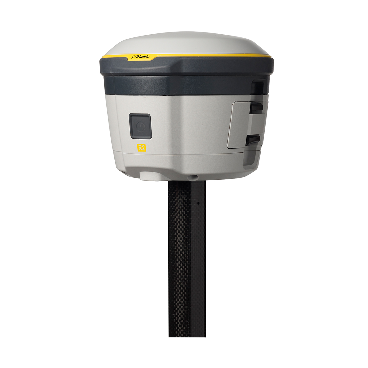
Used Trimble R2 Centimeter GNSS Receiver
Call for PriceThe Trimble R2 is a compact, durable, high-accuracy GNSS receiver with flexible workflow solutions to let you work the way you want.
Quick View -
Used Trimble R2 Sub-foot GNSS Receiver
Call for PriceUsed Trimble R2 Sub-foot GNSS Receiver
Call for PriceThe Trimble R2 is a compact, durable, high-accuracy GNSS receiver with flexible workflow solutions to let you work the way you want.
Quick View -
Used Trimble R2 Sub-meter GNSS Receiver
Call for PriceUsed Trimble R2 Sub-meter GNSS Receiver
Call for PriceThe Trimble R2 is a compact, durable, high-accuracy GNSS receiver with flexible workflow solutions to let you work the way you want.
Quick View -
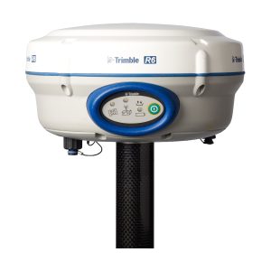
Used Trimble R6-4 GNSS Receiver
Call for Price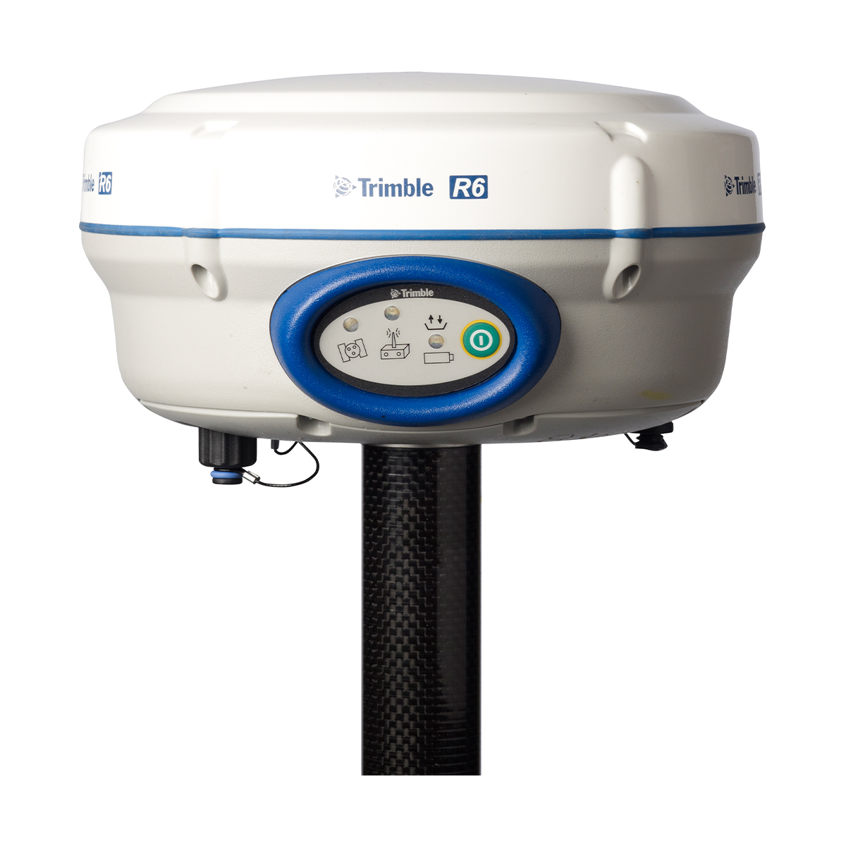
Used Trimble R6-4 GNSS Receiver
Call for PriceThe Trimble R6 combines a highly integrated and advanced GNSS receiver, precision antenna, long-life battery and integrated communications into a rugged and reliable body.
Quick View -
Used Trimble R780 GNSS Receiver
Call for Price
Used Trimble R780 GNSS Receiver
Call for PriceThe Trimble® R780 GNSS receiver is a highly accurate GNSS system built to hand the toughest survey environments. Powered by industry-leading Trimble GNSS positioning technologies, the ultra-rugged R780 elevates productivity in one adaptable, scalable system. Enjoy the freedom to choose the configuration and features tailored precisely to meet the needs of your job, and the flexibility to add more functionality as requirements change. Build the receiver you need today. Scale with ease tomorrow.
Quick View -
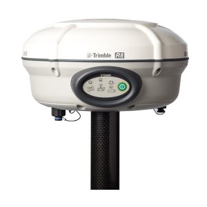
Used Trimble R8-4 GNSS Receiver
Call for Price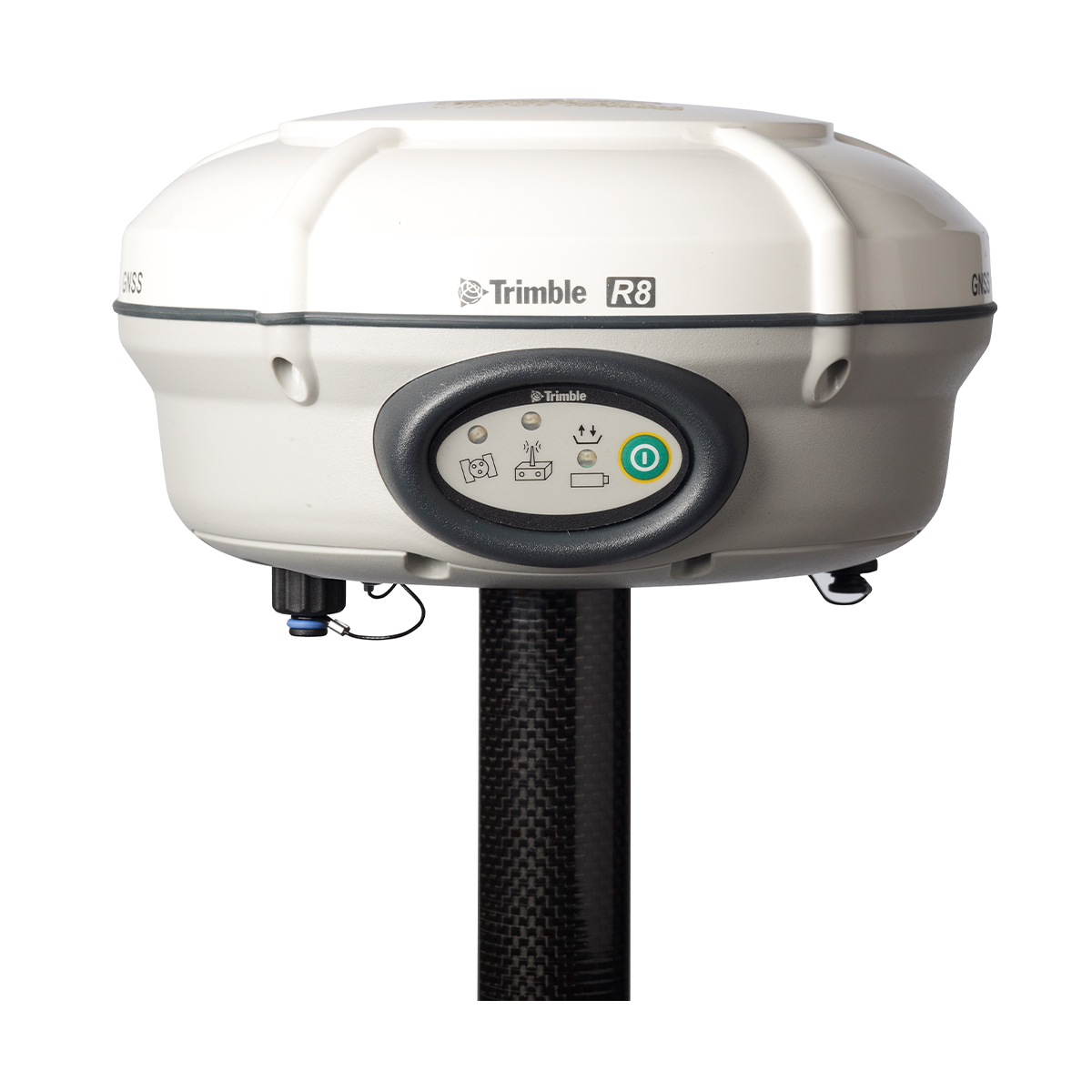
Used Trimble R8-4 GNSS Receiver
Call for PriceThe Trimble® R8 GNSS system has long set the bar for advanced GNSS surveying systems. Through advanced Trimble 360 tracking technology and a comprehensive set of communication options integrated into a flexible system design, this integrated GNSS system delivers industry-leading performance. For surveyors facing demanding RTK applications, the Trimble R8 is an invaluable GNSS partner.
Quick View -

Used Trimble R8s GNSS Receiver
Call for Price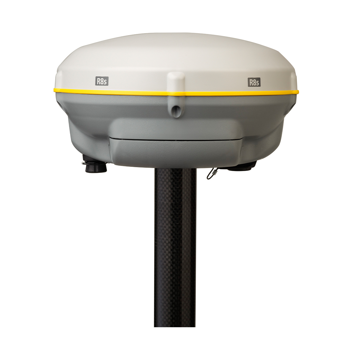
Used Trimble R8s GNSS Receiver
Call for PriceThe Trimble R8s GNSS receiver gives you just the features and benefits you need, in one flexible, scalable system. Simply choose the configuration level that suits your needs best, whether it’s post-processing, base, rover, or a combination of base and rover functionality. The Trimble R8s offers the most in scalability.
Quick View -

Used Trimble RTS555 5″ Robotic Total Station
Call for Price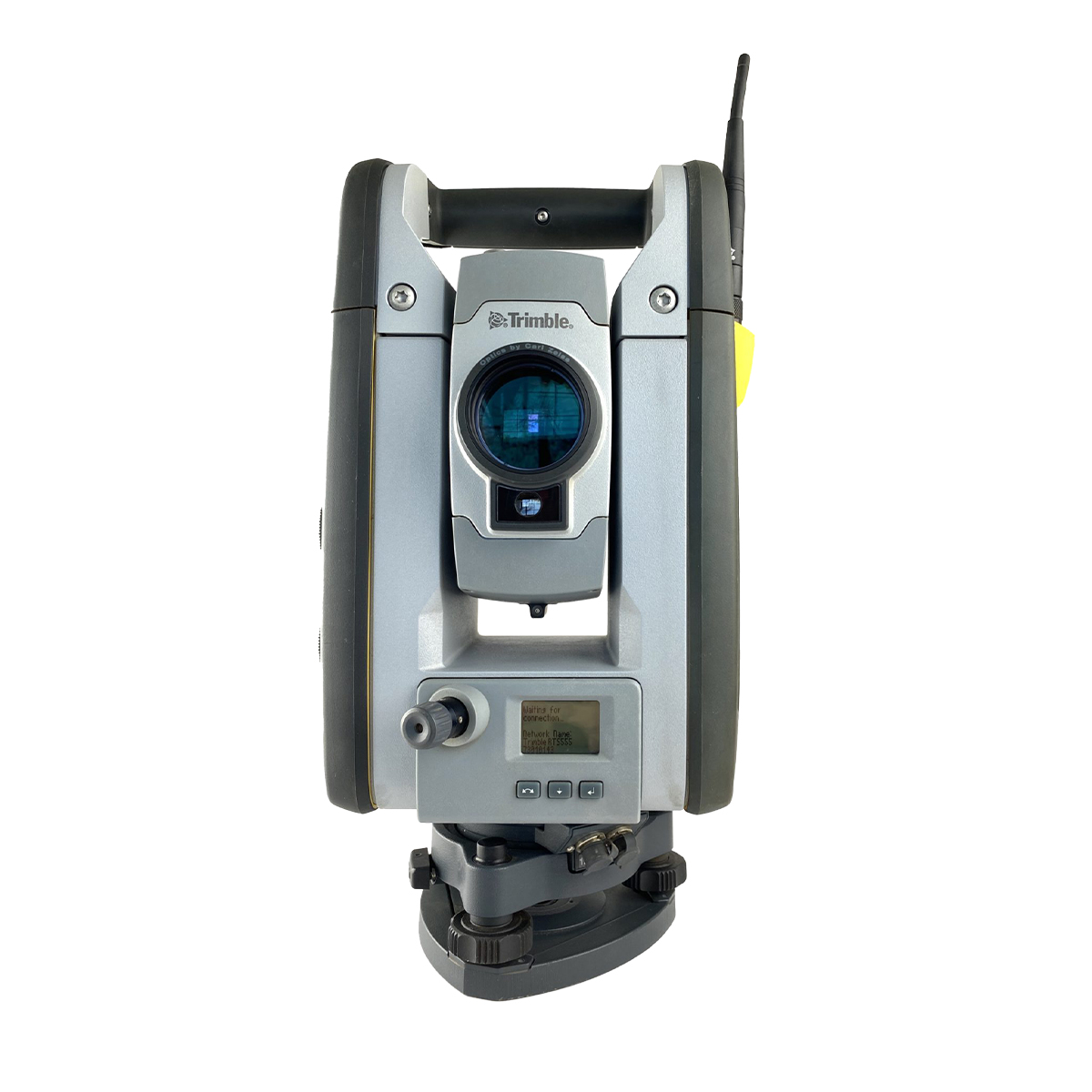
Used Trimble RTS555 5″ Robotic Total Station
Call for PriceThe Trimble RTS555 robotic total station helps contractors perform layout tasks significantly more efficiently than with conventional mechanical systems for residential and building construction. Designed specifically for concrete, MEP, and general construction contractors, the Trimble RTS Series Robotic Total Stations offer construction-specific functionality and one-person operation so you can perform all jobsite layout and measurement tasks for maximum flexibility and cost savings.
Quick View -
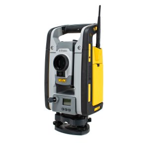
Used Trimble RTS655 5″ Robotic Total Station
Call for Price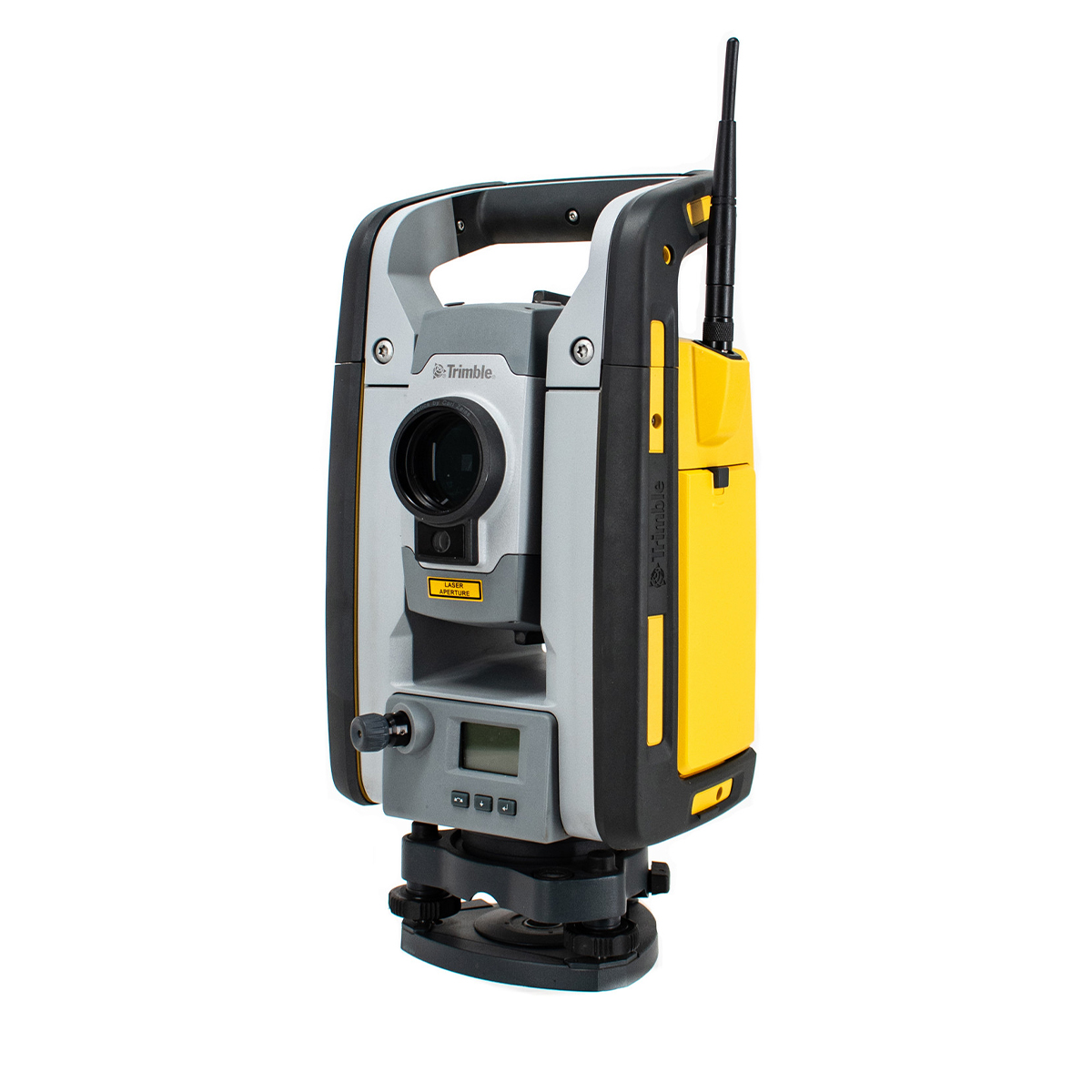
Used Trimble RTS655 5″ Robotic Total Station
Call for PriceWith the Trimble RTS655 Robotic Total Station contractors can improve efficiency and accuracy for common layout tasks in building construction.
Quick View -

Used Trimble RTS773 3″ DR Robotic Total Station
Call for Price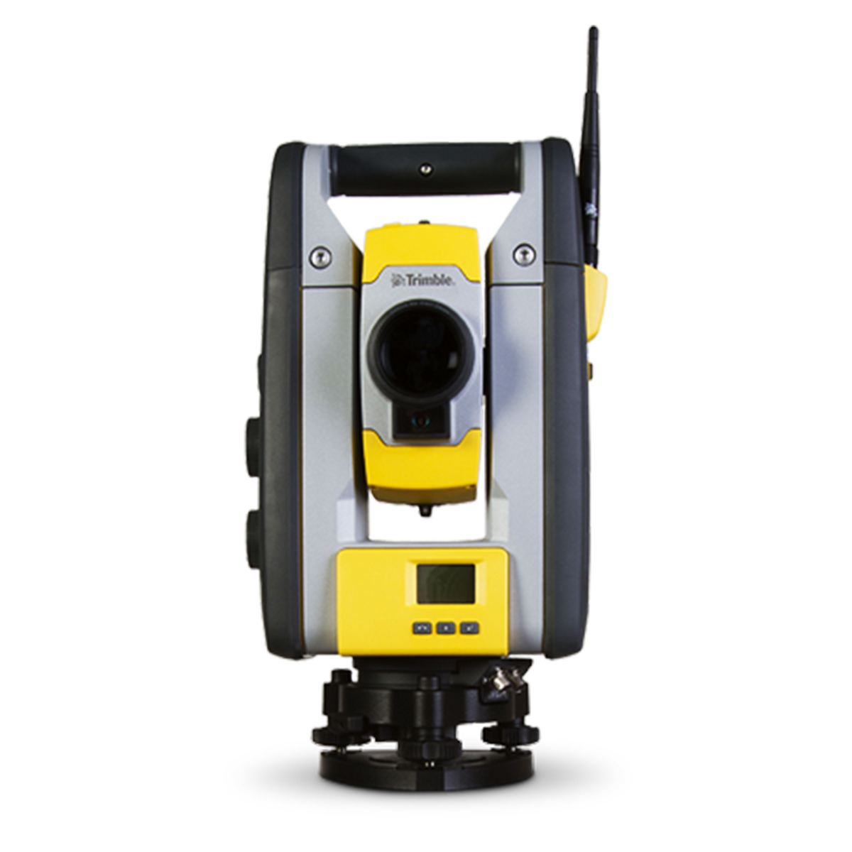
Used Trimble RTS773 3″ DR Robotic Total Station
Call for PriceThe RTS773 incorporates advanced technologies to deliver accurate and reliable layout fast, to ensure that design intent is executed correctly the first time.
Quick View -

Used Trimble S6 3” Robotic Total Station
Call for Price
Used Trimble S6 3” Robotic Total Station
Call for PriceThe Trimble® S6 Robotic Total Station provides the power and flexibility required by today’s Surveying Professionals. With the industry’s most advanced technology and available feature set, the Trimble S6 Robotic Total Station will meet the changing needs of your business, allowing your investment to go further.
Quick View -

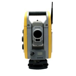
Used Trimble SPS610 5″ DR Robotic Total Station
Call for Price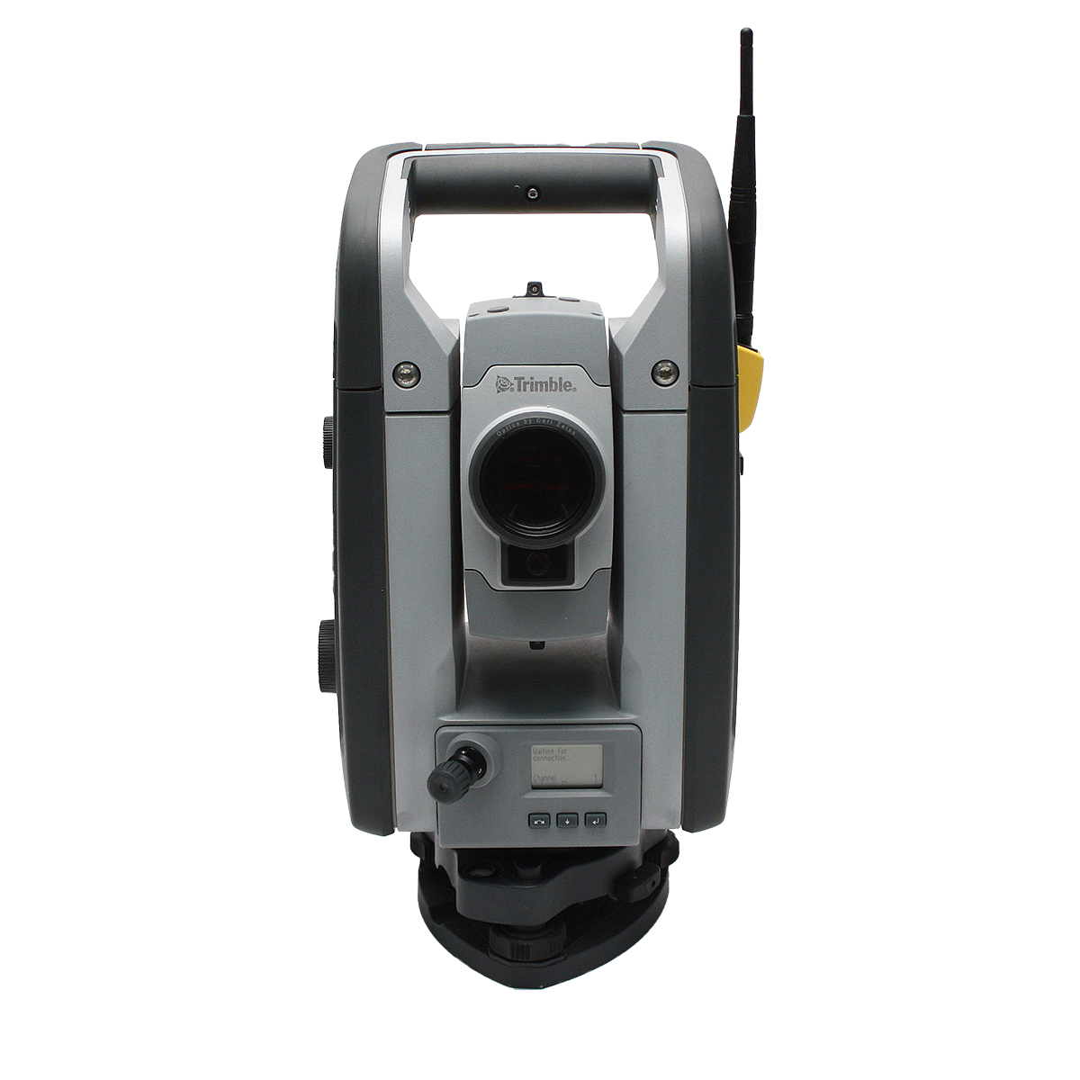
Used Trimble SPS610 5″ DR Robotic Total Station
Call for PriceWith cable-free operation in Autolock, Servo or Robotic modes, the Trimble ® SPS610 Total Station is the straightforward solution for site measurement, stakeout, and reflectorless measurement needs. This versatility provides the contractor with an easy-to-set up, easy-to-use positioning sensor that increases productivity in the field.
Quick View -
Used Trimble SPS700 5″ Robotic Total Station
Call for Price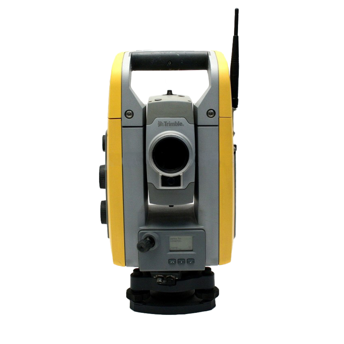
Used Trimble SPS700 5″ Robotic Total Station
Call for PriceThe Trimble® SPS700 Construction Total Station, a key component of the Trimble Site Positioning System, builds on over 50 years of total station technology to deliver unmatched performance for construction jobsite applications.
The simple solution to all your site measurement and stakeout applications, the SPS700 construction total station takes little or no setup time and requires only two known points to establish position and orientation.
Quick View -

Used Trimble SX10 1” Scanning Total Station
Call for Price
Used Trimble SX10 1” Scanning Total Station
Call for PriceThe Trimble® SX10 scanning total station redefines the capabilities of everyday survey equipment by providing the world’s most innovative solution for surveying, engineering, and scanning professionals.
Quick View -

Used Trimble T10 Tablet
Call for Price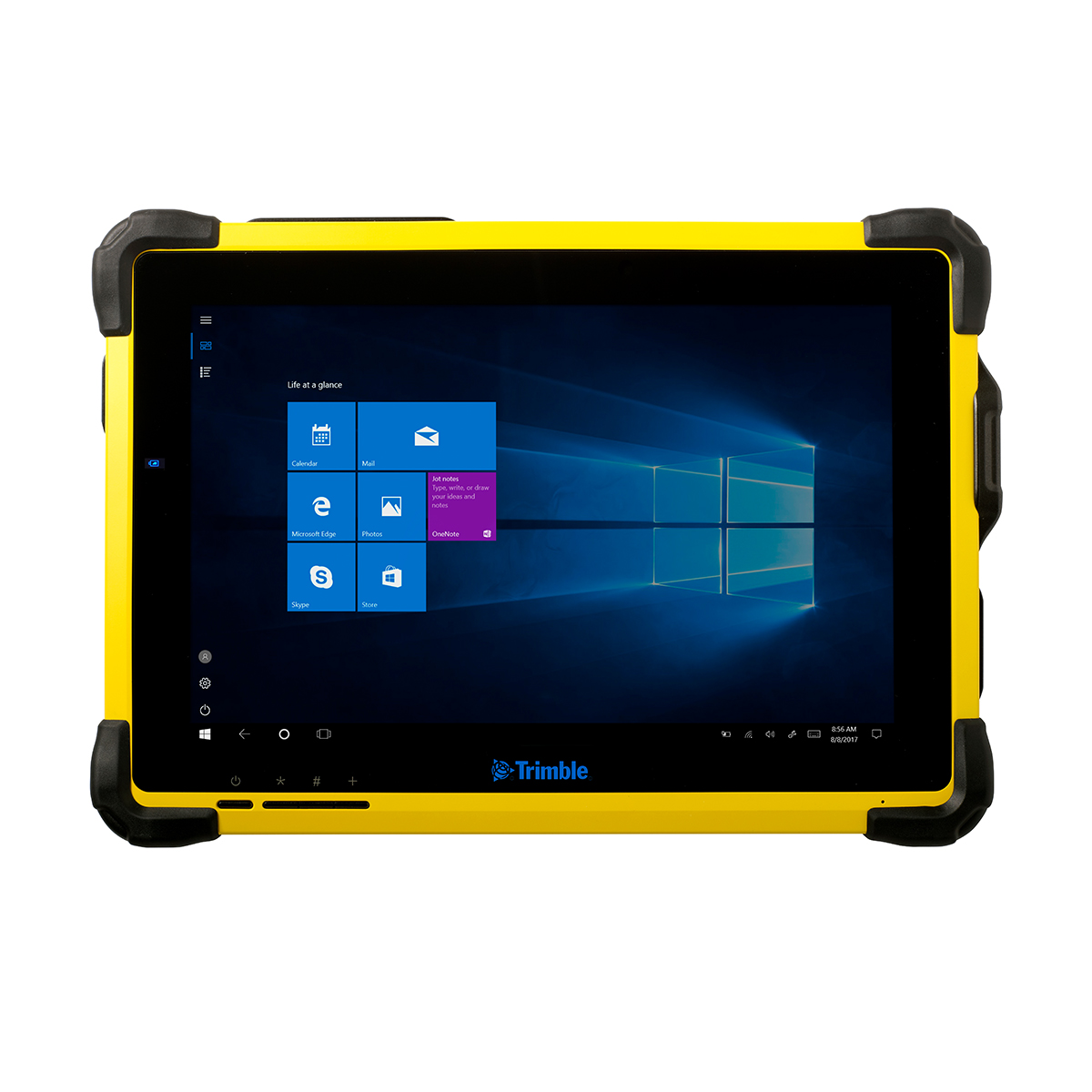
Used Trimble T10 Tablet
Call for PriceThe Trimble® T10 tablet brings the advantages of fast computing power and a large screen to the field. Combined with integrated GNSS capabilities, the T10 is a powerful, rugged device created for survey fieldwork and GIS data collection and at the same time supports demanding desktop applications.
Quick View -
Used Trimble T7 Tablet
Call for Price
Used Trimble T7 Tablet
Call for PriceThe Trimble® T7 tablet is a rugged field controller that provides flexibility for survey and GIS applications that integrates seamlessly with Trimble field software and Trimble’s suite of GNSS receivers and total stations to provide a complete, fully integrated field solution for surveyors and GIS professionals.
Quick View -
Used Trimble TDC150 Handheld
Call for Price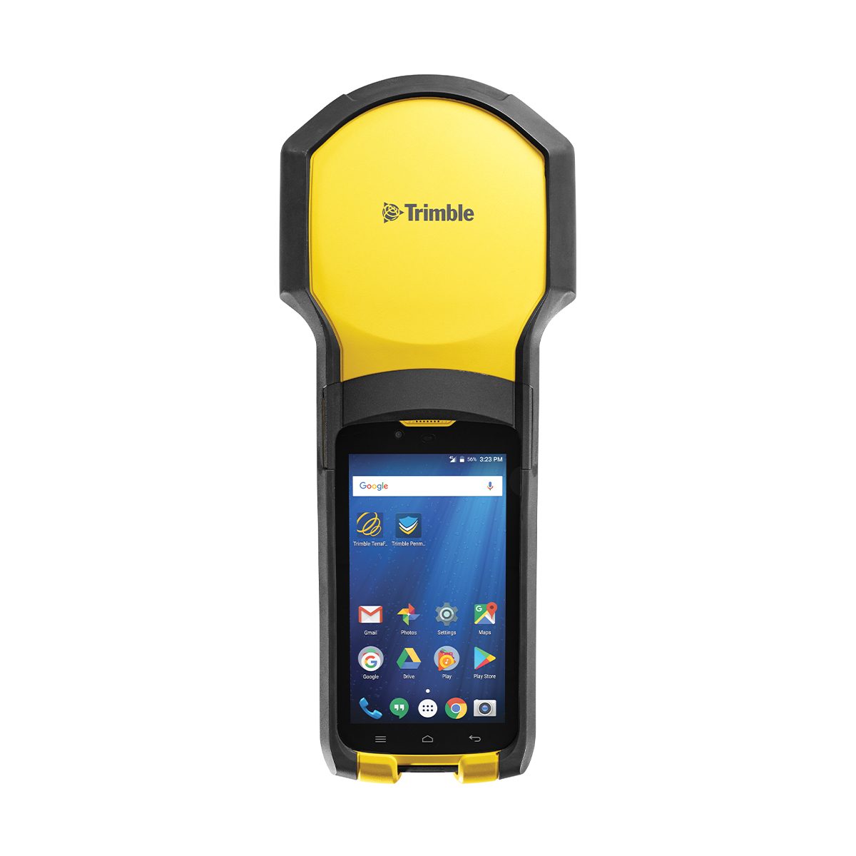
Used Trimble TDC150 Handheld
Call for PriceThe Trimble TDC150 GNSS handheld receiver is built for GIS users who demand maximum productivity and positioning accuracy out on the job. Offering a fully integrated, ultra-rugged solution that has the flexibility of a handheld, an intuitive Android-based user interface, and scalable high accuracy positioning, the high-performing TDC150 is your productive partner in the field.
Quick View -
Used Trimble TDC600 Handheld
Call for Price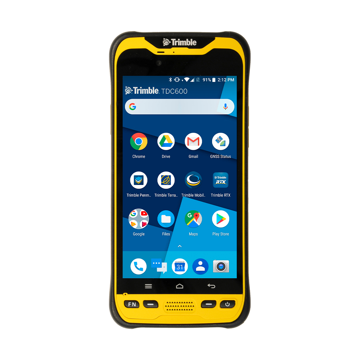
Used Trimble TDC600 Handheld
Call for PriceThe Trimble® TDC600 handheld is a sleek, all-in-one rugged smartphone with a built-in professional GNSS receiver. Designed for ease-of-use in a wide range of GIS applications, the TDC600 helps you collect and retrieve highly accurate spatial information while staying in touch with the office—all with a single device. It’s the smart, productive way to collect data and communicate from the field.
Quick View -
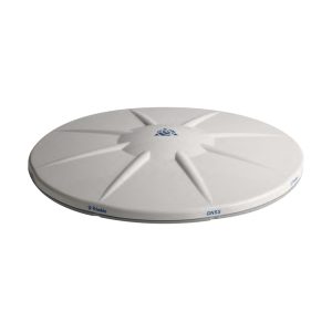
Used Trimble Tornado Antenna
Call for Price
Used Trimble Tornado Antenna
Call for PriceThe Trimble® Tornado™ external dual frequency antenna contains advanced technology for extremely low multipath, outstanding low elevation satellite tracking, and high phase center accuracy. Use the Tornado antenna together with a Trimble H-Star enabled handhelds and receivers for high-accuracy mapping and GIS data collection.
Quick View -

Used Trimble TSC2 Controller
Call for Price
Used Trimble TSC2 Controller
Call for PriceThe Trimble® TSC2® Controller is an advanced handheld computer especially designed for Trimble optical and GPS surveying systems.
Quick View -
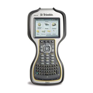
Used Trimble TSC3 Controller
Call for Price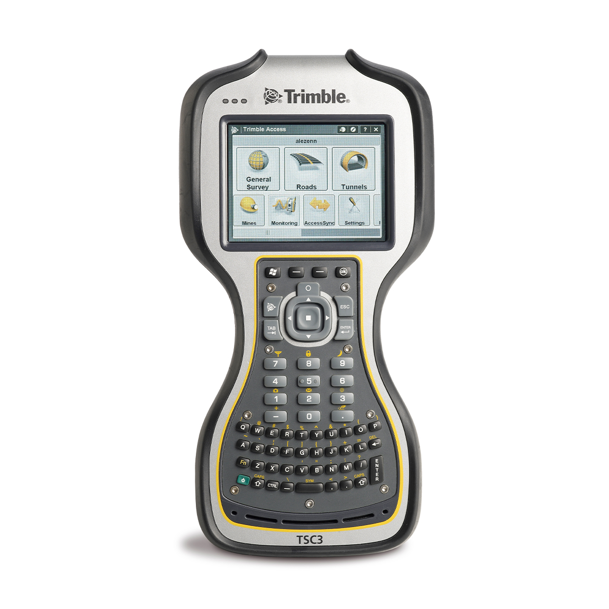
Used Trimble TSC3 Controller
Call for PriceStreamline the flow of everyday surveying work to make field work more efficient with the fully integrated TSC3 controller.
Quick View -

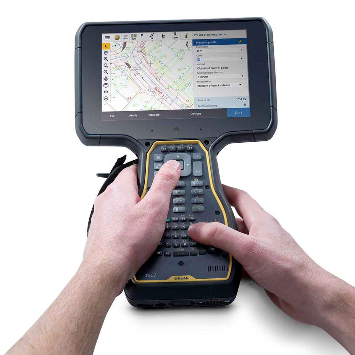
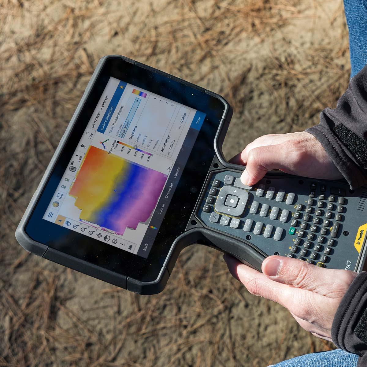
Used Trimble TSC7 Controller
Call for Price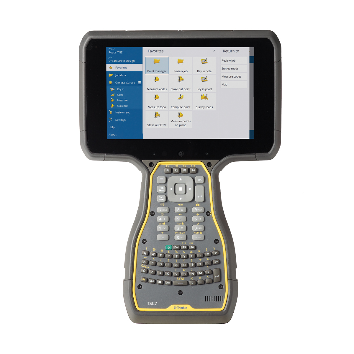
Used Trimble TSC7 Controller
Call for PriceThe Trimble® TSC7 + Trimble Access software make it the must‑have controller for survey fieldwork and scanning. Faster and more powerful than its predecessors, the TSC7 Controller offers a modern 7-inch touchscreen and more memory, improving overall productivity and efficiency.
Quick View -
Used Trimble TX8 Laser Scanner
Call for Price
Used Trimble TX8 Laser Scanner
Call for PriceThe Trimble TX8 delivers the power and flexibility to tackle even the most demanding projects. Designed for performance the Trimble TX8 enables you to complete 3D laser scanning projects faster than ever.
Quick View -
Used Trimble V10 Imaging Rover
Call for Price
Used Trimble V10 Imaging Rover
Call for PriceThe Trimble V10 Imaging Rover with Trimble VISION™ technology is an integrated camera system that precisely captures 360-degree digital panoramas for efficient visual documentation and measurement of the surrounding environment. As a complete system solution, the Trimble V10 enables you to capture more critical information that can be transformed into enhanced, rich geospatial deliverables.
Quick View -

Used Trimble Yuma 2 Rugged Tablet
Call for Price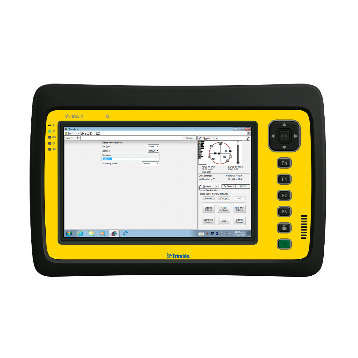
Used Trimble Yuma 2 Rugged Tablet
Call for PriceThe Trimble® Yuma® 2 rugged tablet computer is designed for ease of use and high performance mobility. Great for GIS applications – it’s like bringing a complete PC out into the field. The big bright screen makes it easy to view and use detailed maps, and with more processing power, it is fast. Safeguard your data in the face of dust, sand, mud, humidity, and extreme temperatures. Collect information, capture photos, and communicate with headquarters, all with the assurance that your data is protected.
Quick View -

Used Trimble Zephyr 2 Antenna
Call for Price
Used Trimble Zephyr 2 Antenna
Call for PriceThe Trimble Zephyr 2 is a high-performance lightweight GNSS rover antenna optimized for precision RTK applications. The Zephyr 2 GNSS antenna is typically used in roving applications. It minimizes multipath and offers robust low-elevation tracking and sub-millimeter phase center repeatability.
Quick View -
Used Trimble Zephyr 2 Geodetic Antenna
Call for Price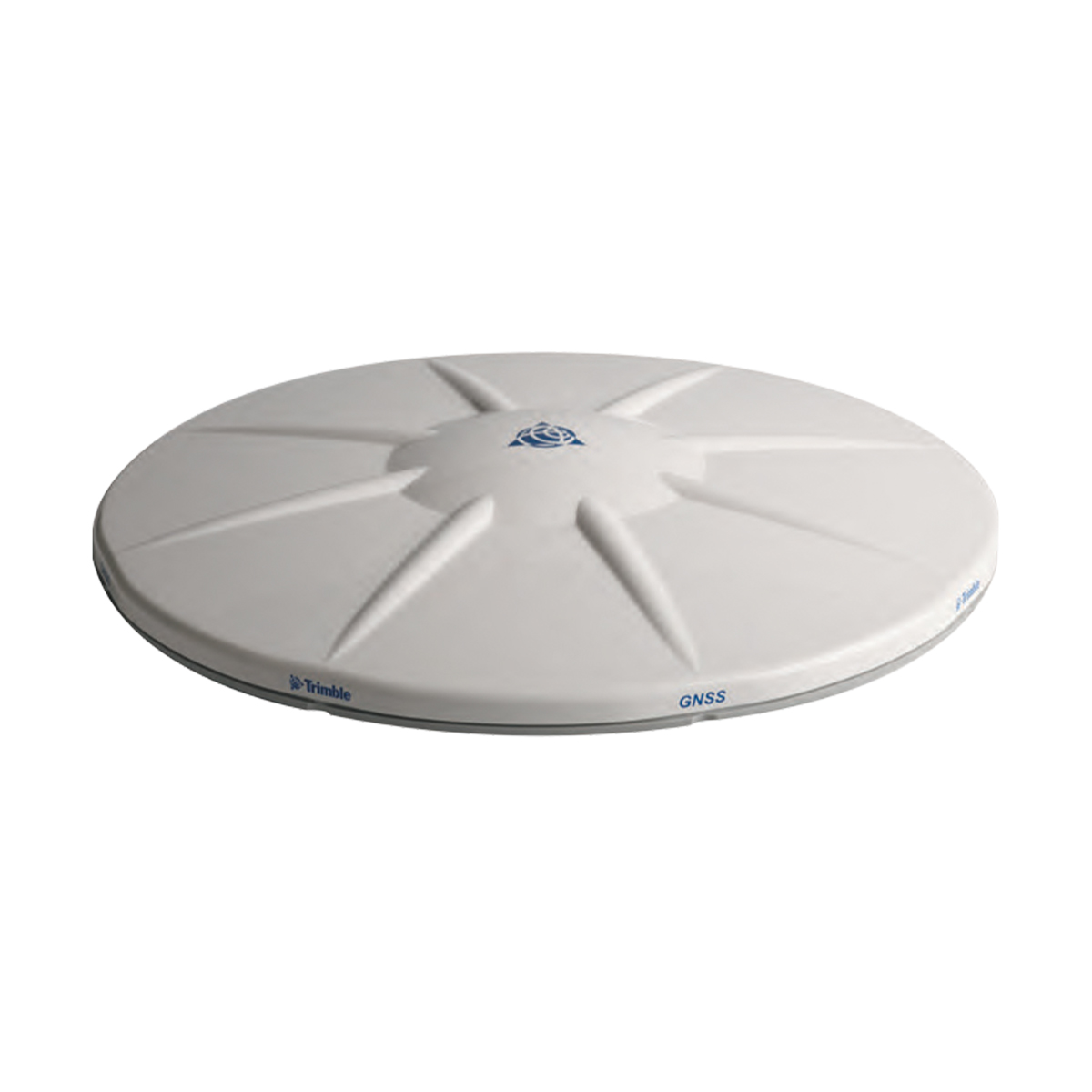
Used Trimble Zephyr 2 Geodetic Antenna
Call for PriceThe Trimble Zephyr 2 Geodetic antenna is extremely rugged and ideal for control work. The Zephyr 2 Geodetic is recommended for all base station applications. This antenna is also suitable as a fixed rover antenna for use in high multi-path environments. The Zephyr 2 Geodetic antenna’s quality performance and extreme accuracy are achieved through sub-millimeter phase center repeatability, robust low-elevation tracking and significantly reduced ground-based multipath.
Quick View -
Used Trimble Zephyr 3 Geodetic Antenna
Call for PriceUsed Trimble Zephyr 3 Geodetic Antenna
Call for PriceThe Trimble Zephyr 3 antennas offer full support for current and near future GNSS signals including GPS, GLONASS, Galileo, BeiDou, OmniSTAR, Trimble RTX and SBAS.
Quick View -

Vision Aerial Vector Hexacopter with Blue Herelink
Call for Price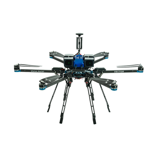
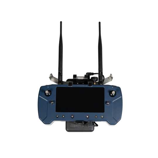

Vision Aerial Vector Hexacopter with Blue Herelink
Call for PriceQuick View -
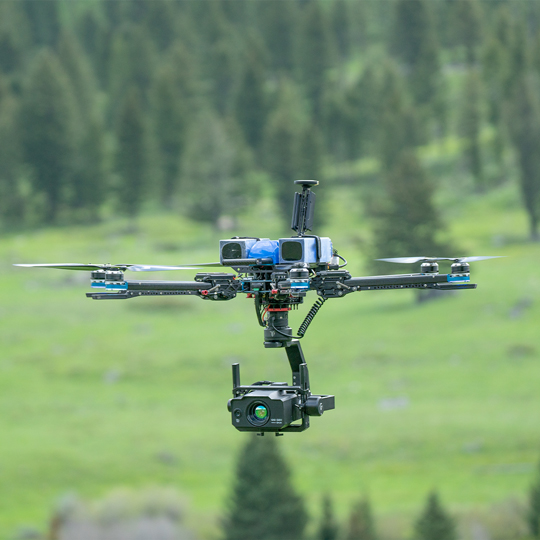
Vision Aerial Vector Solid State Indefinite Flight Package
Call for Price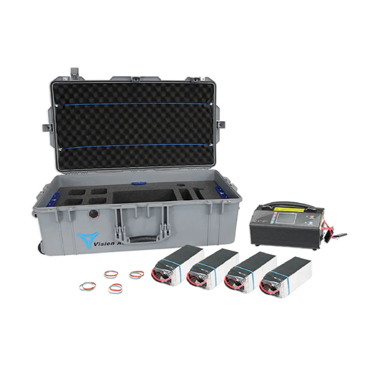
Vision Aerial Vector Solid State Indefinite Flight Package
Call for PriceQuick View -
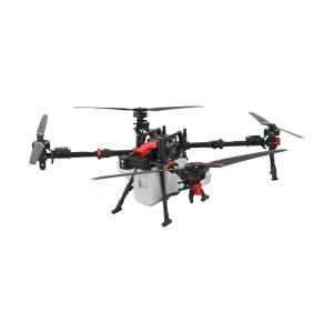
XAG 09-007-00148 P150 Agricultural Drone
Call for Price
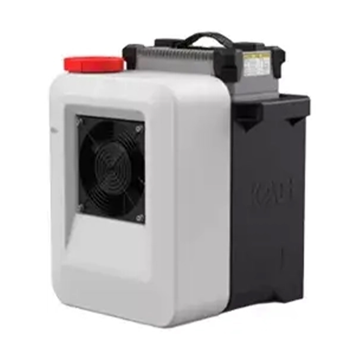
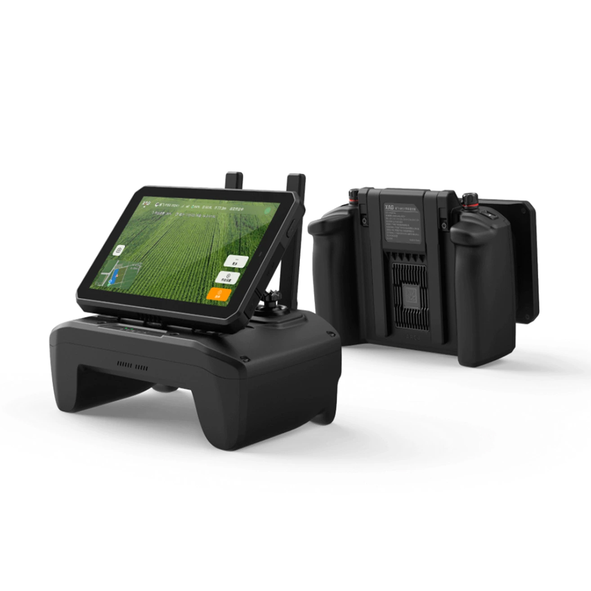

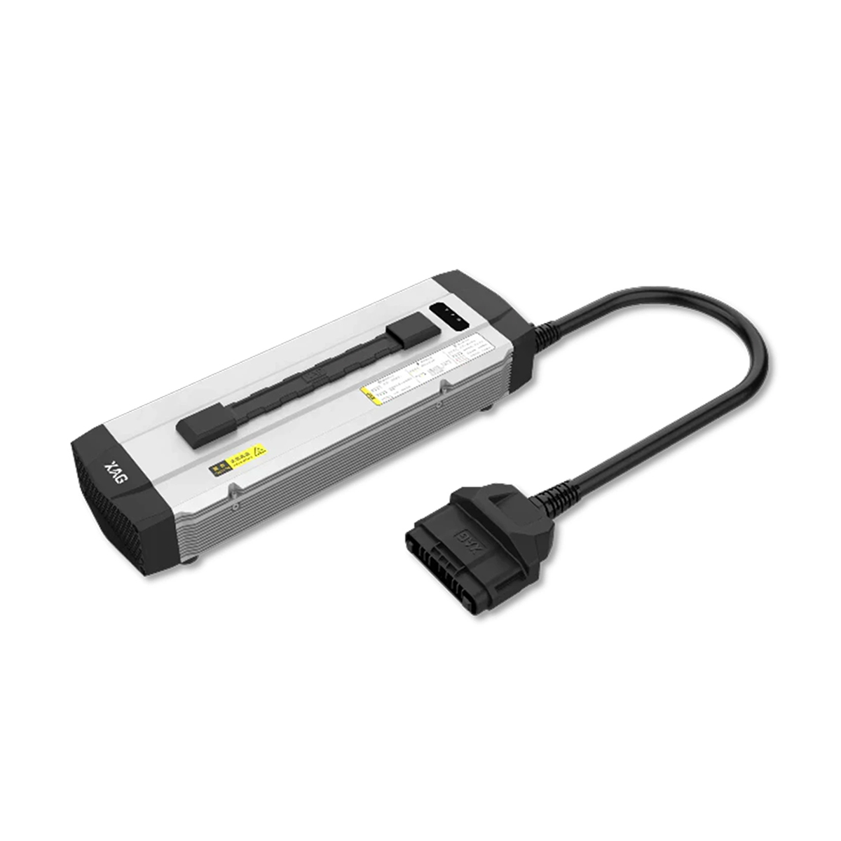
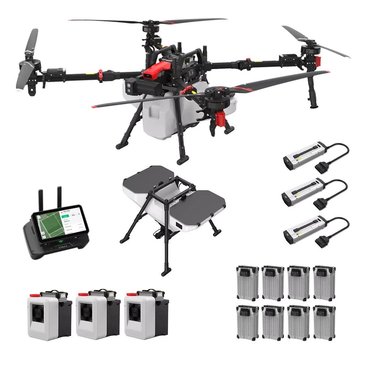

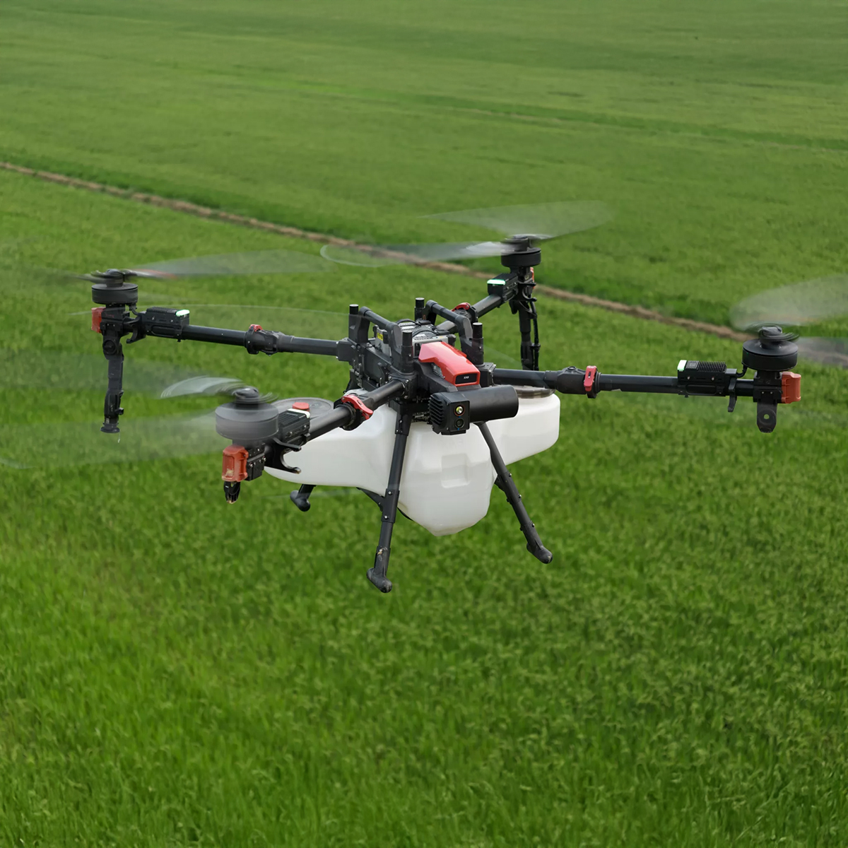


XAG 09-007-00148 P150 Agricultural Drone
Call for PriceXAG 09-007-00148 P150 Agricultural Drone
The Next-Level Efficiency
The XAG P150 is the ultimate agricultural drone designed for spraying, spreading, and field mapping. With a 70 kg maximum payload, it takes efficiency to the next level, helping you farm more sustainably and optimizing inputs.Quick View -

Yellow Hard Hat
Call for Price
Yellow Hard Hat
Call for PriceQuick View -

YellowScan Mapper (Version 3) YM3CAMKIT & Single Camera Module 20MP
Call for Price


YellowScan Mapper (Version 3) YM3CAMKIT & Single Camera Module 20MP
Call for PriceYellowScan Mapper
Jump into LiDAR revolution.Easy mapping redefined. Start your LiDAR journey with our easy-to-use Mapper system. Its low weight, mid-range capability, top-end point density, as well as advanced accuracy and precision, make this LiDAR system the best value for money. Then add the Sony APS-C size Exmor™ CMOS image sensor with a BIONZ X™ processor to produce high-precision 20 MP images.
Quick View -
YellowScan Mapper (Version 3) YSM3KIT15 Integrated System
Call for Price YellowScan Mapper (Version 3) YSM3KIT15 Integrated System
Call for PriceYellowScan Mapper
Jump into LiDAR revolution.Easy mapping redefined. Start your LiDAR journey with our easy-to-use Mapper system. Its low weight, mid-range capability, top-end point density, as well as advanced accuracy and precision, make this LiDAR system the best value for money.
Quick View -

YellowScan Mapper+ (Version 3) YSM3+KIT Integrated System
Call for Price


YellowScan Mapper+ (Version 3) YSM3+KIT Integrated System
Call for PriceYellowScan Mapper+
Small & compact. Mighty & powerful.Advanced performance fitted into a compact survey solution. The YellowScan Mapper+ is an efficient 3 echoes, high-density LiDAR system for all mapping applications.
Quick View -

YellowScan Navigator YSNVGTRKIT
Call for Price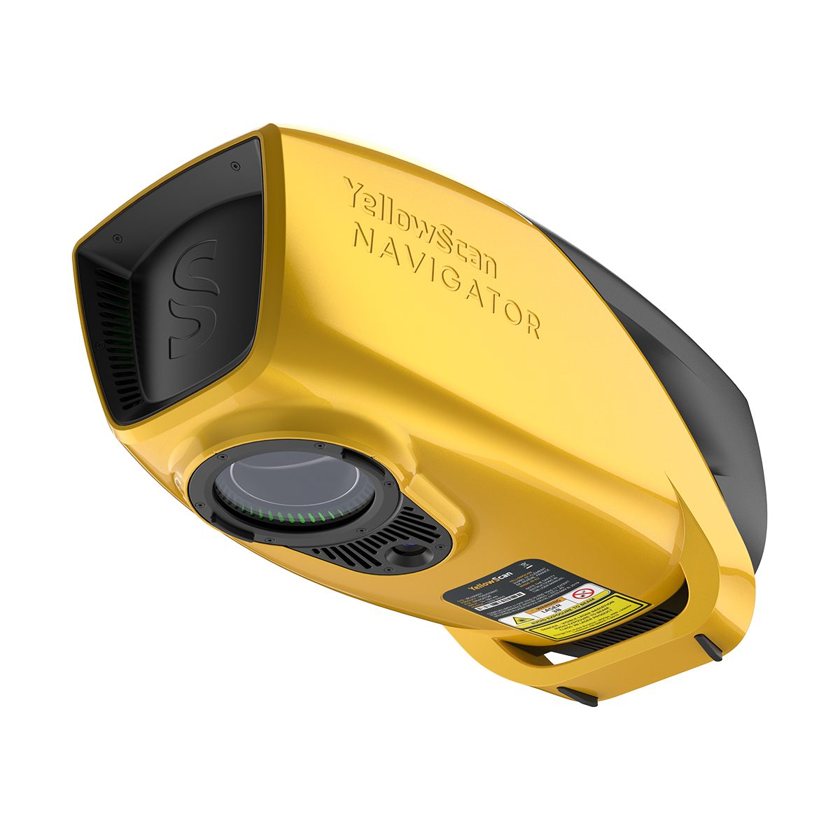
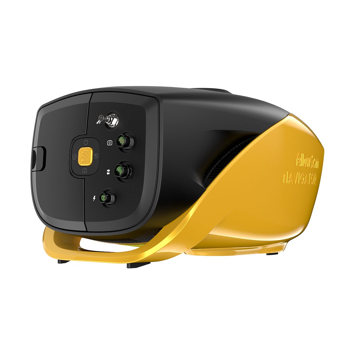
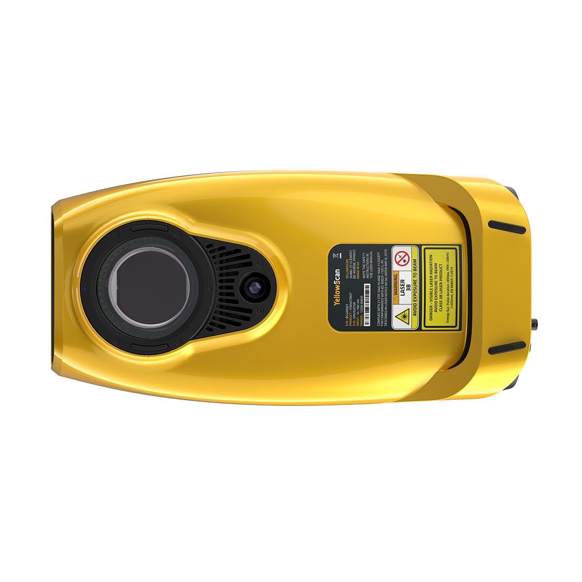
YellowScan Navigator YSNVGTRKIT
Call for PriceYellowScan Navigator
Depths to heights: operating bathymetric LiDAR with one button.The YellowScan bathymetric LiDAR is an innovative solution for exploring underwater and ground topography with a single-button operation. Its lightweight design allows for versatile platform selection without compromising water penetration.
Quick View -
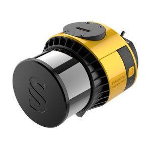
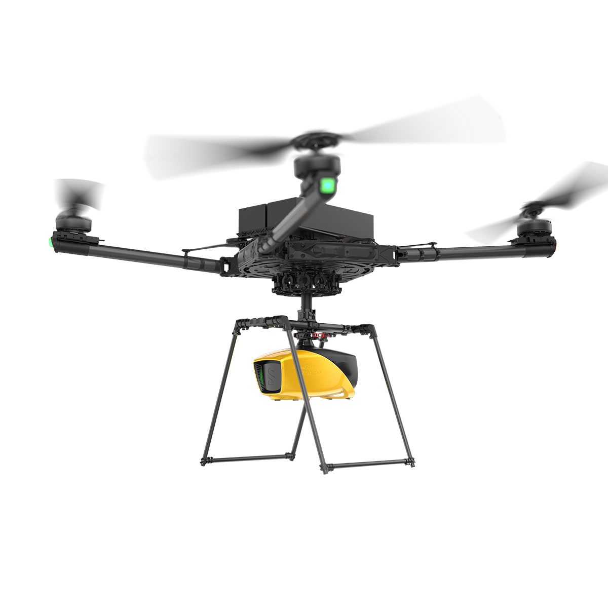
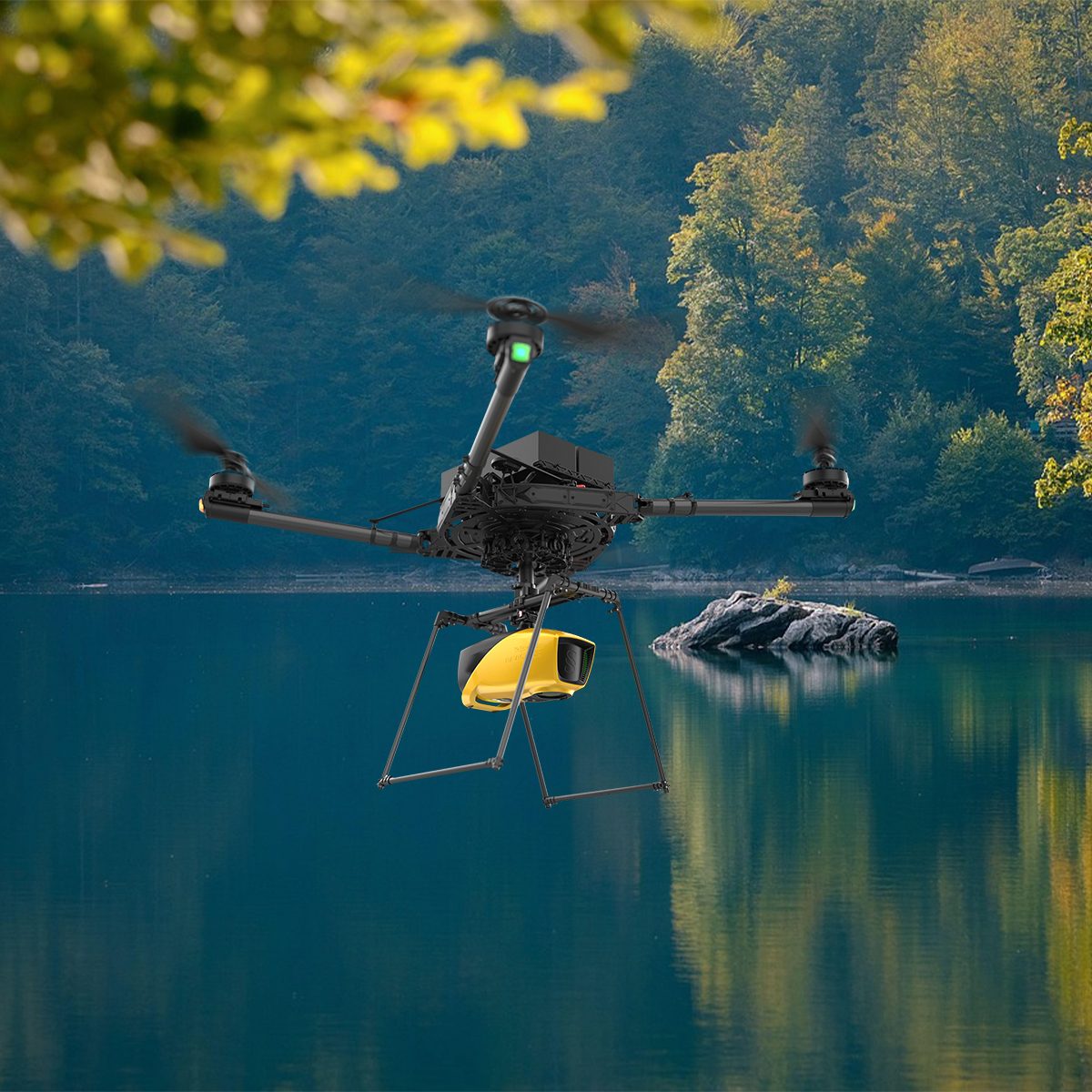
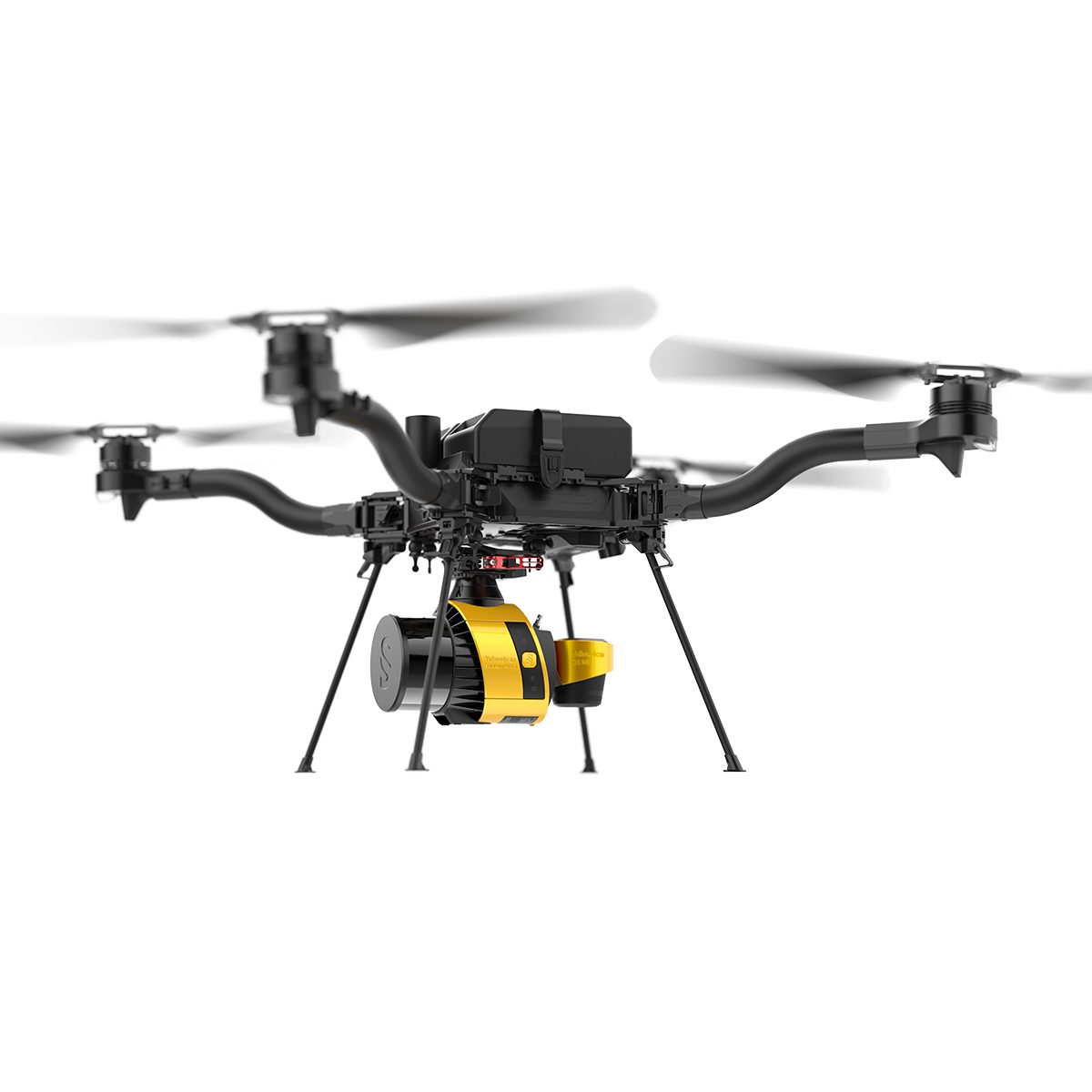
YellowScan Surveyor Ultra 3 YSSVKIT30 Integrated System
Call for Price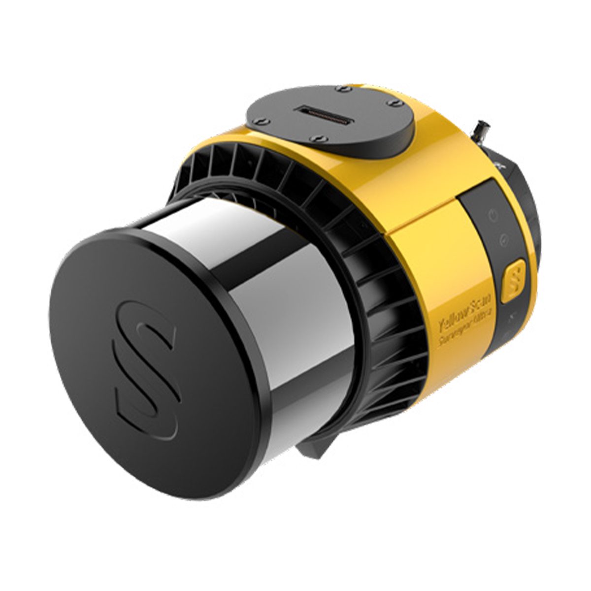
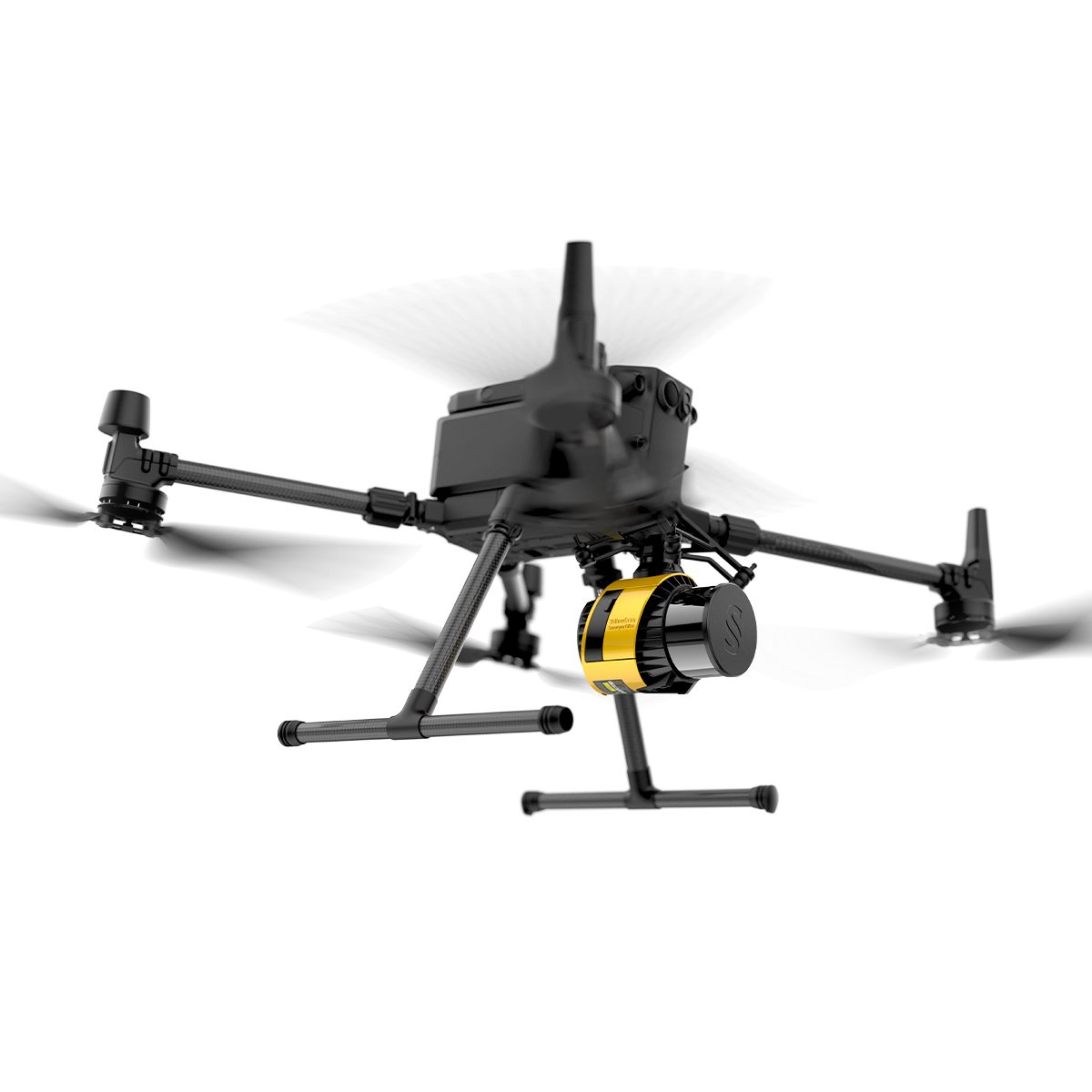
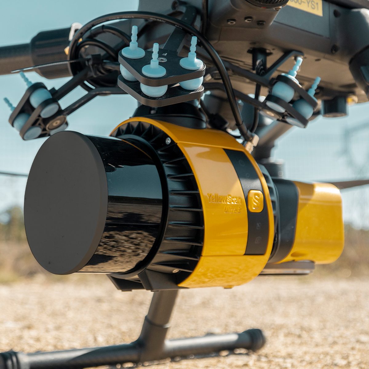
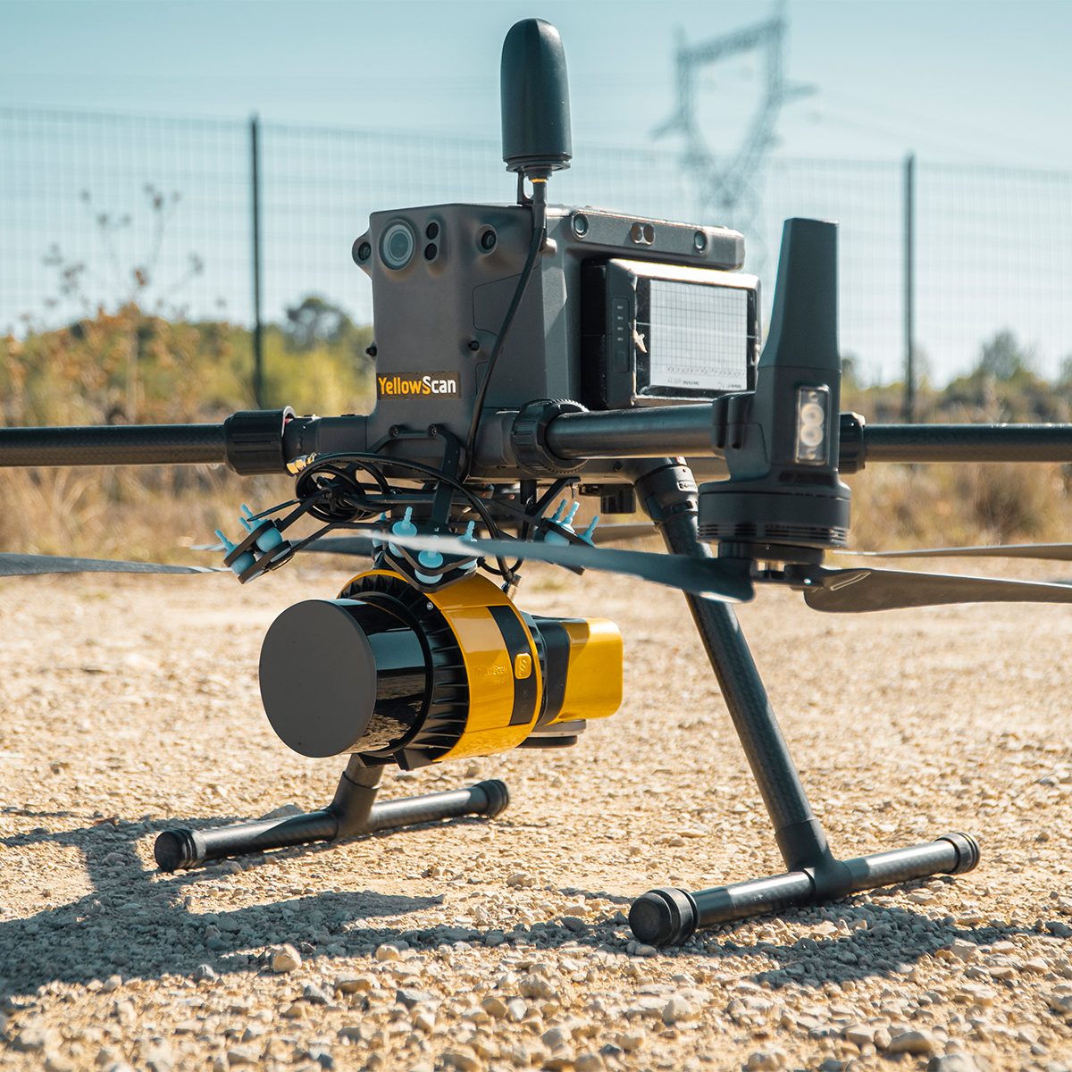
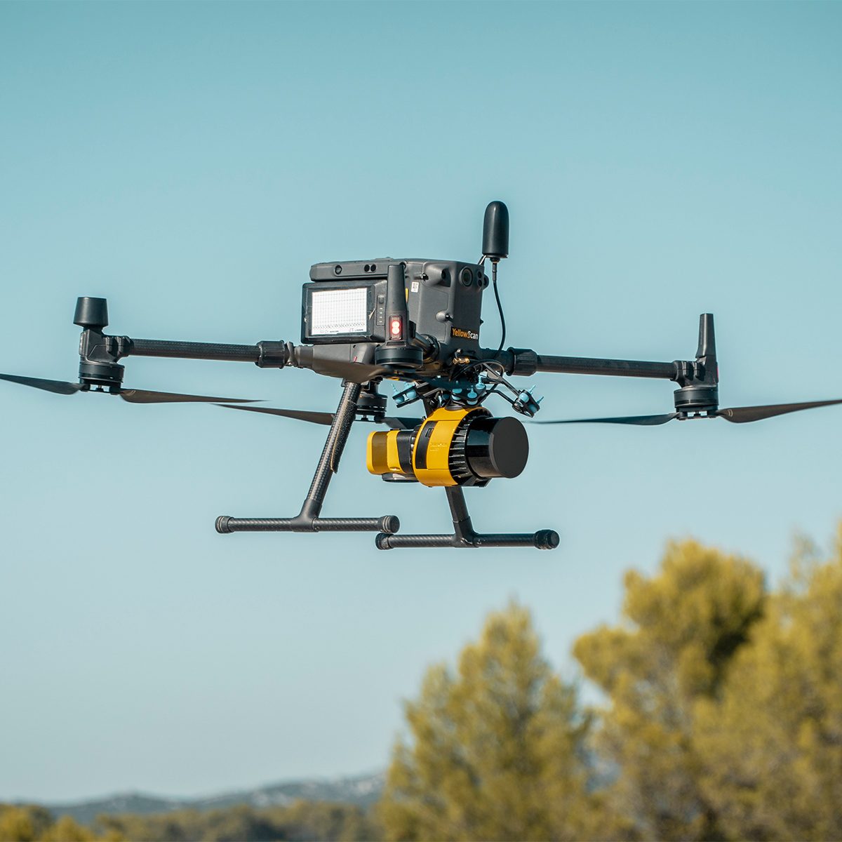
YellowScan Surveyor Ultra 3 YSSVKIT30 Integrated System
Call for PriceYellowScan Surveyor Ultra
Affordability. Flexibility. Productivity.
The YellowScan Surveyor Ultra marks a new generation of YellowScan LiDAR systems integrating SBG Systems’ IMU, combined with an integrated RGB camera for colorization purposes. Combining light weight and high density, its flexiblity makes a great addition anywhere.
Quick View -

YellowScan Surveyor Ultra 3 YSV3SCAM61KIT & Single Camera Module 61MP
Call for Price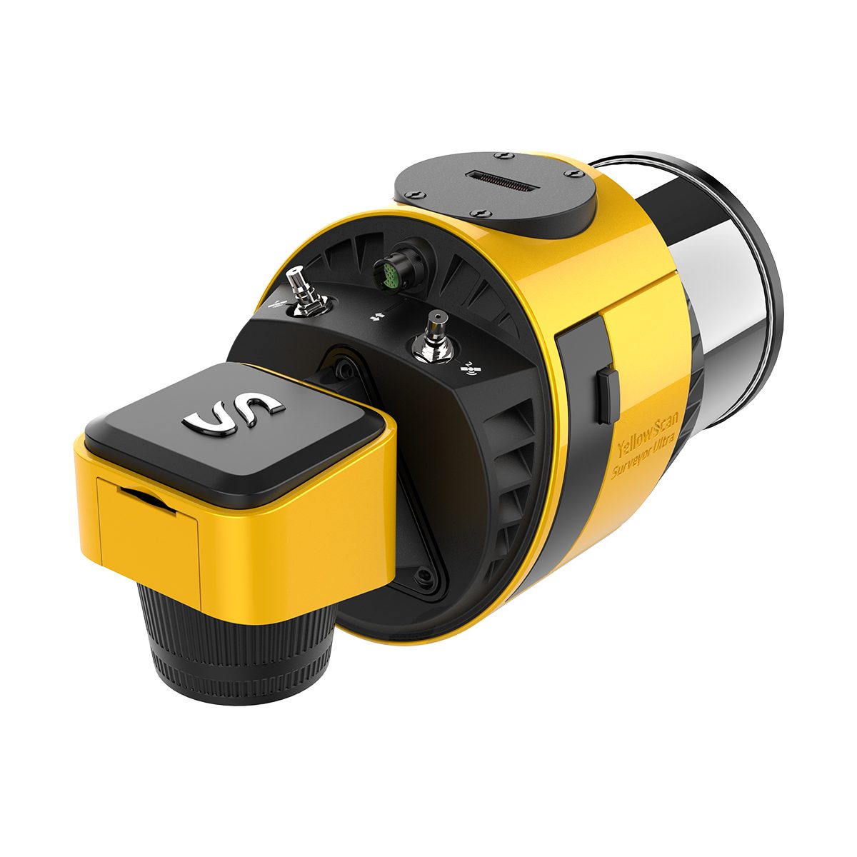
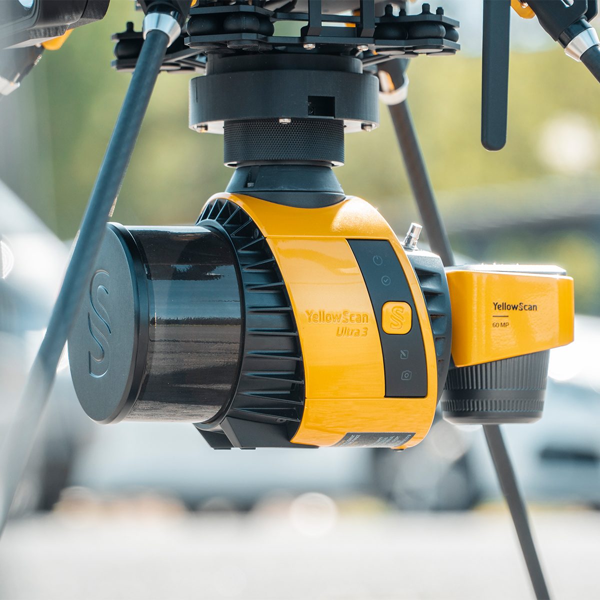
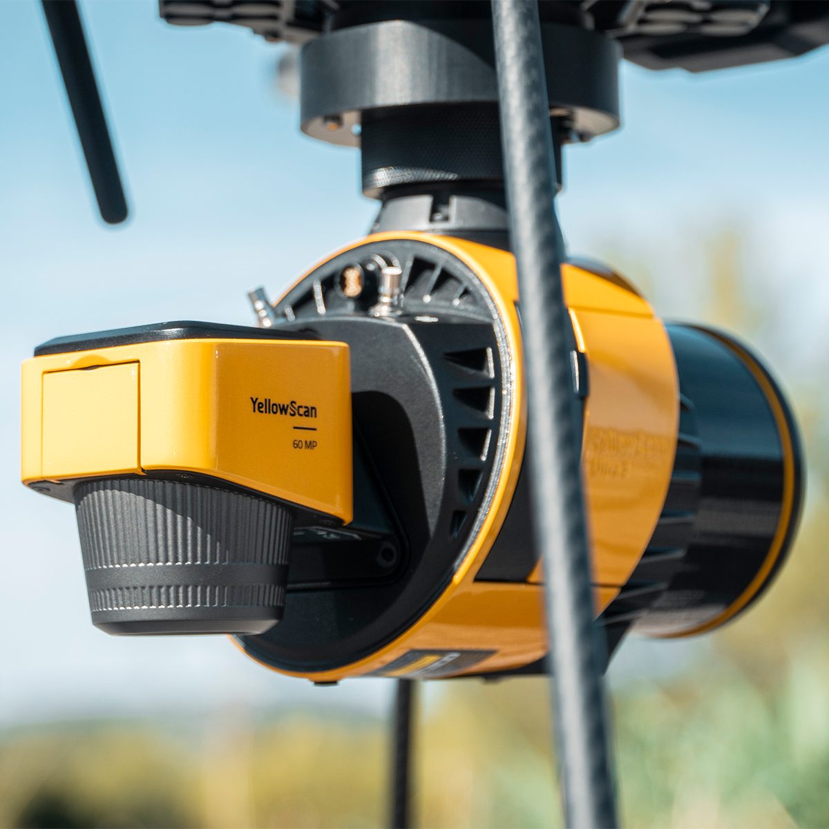

YellowScan Surveyor Ultra 3 YSV3SCAM61KIT & Single Camera Module 61MP
Call for PriceYellowScan Surveyor Ultra & Single Camera Module 61MP
Lightweight 360° LiDAR System for UAV Integration
Affordability. Flexibility. Productivity.
The YellowScan Surveyor Ultra marks a new generation of YellowScan LiDAR systems integrating SBG Systems’ IMU, combined with an integrated RGB camera for colorization purposes. Combining light weight and high density, its flexibility makes a great addition anywhere. Add the Sony Full-Frame CMOS image sensor to produce combined high-precision 61MP images.
Quick View -

YellowScan Venturer YSVENTKIT-AP LiDAR System
Call for Price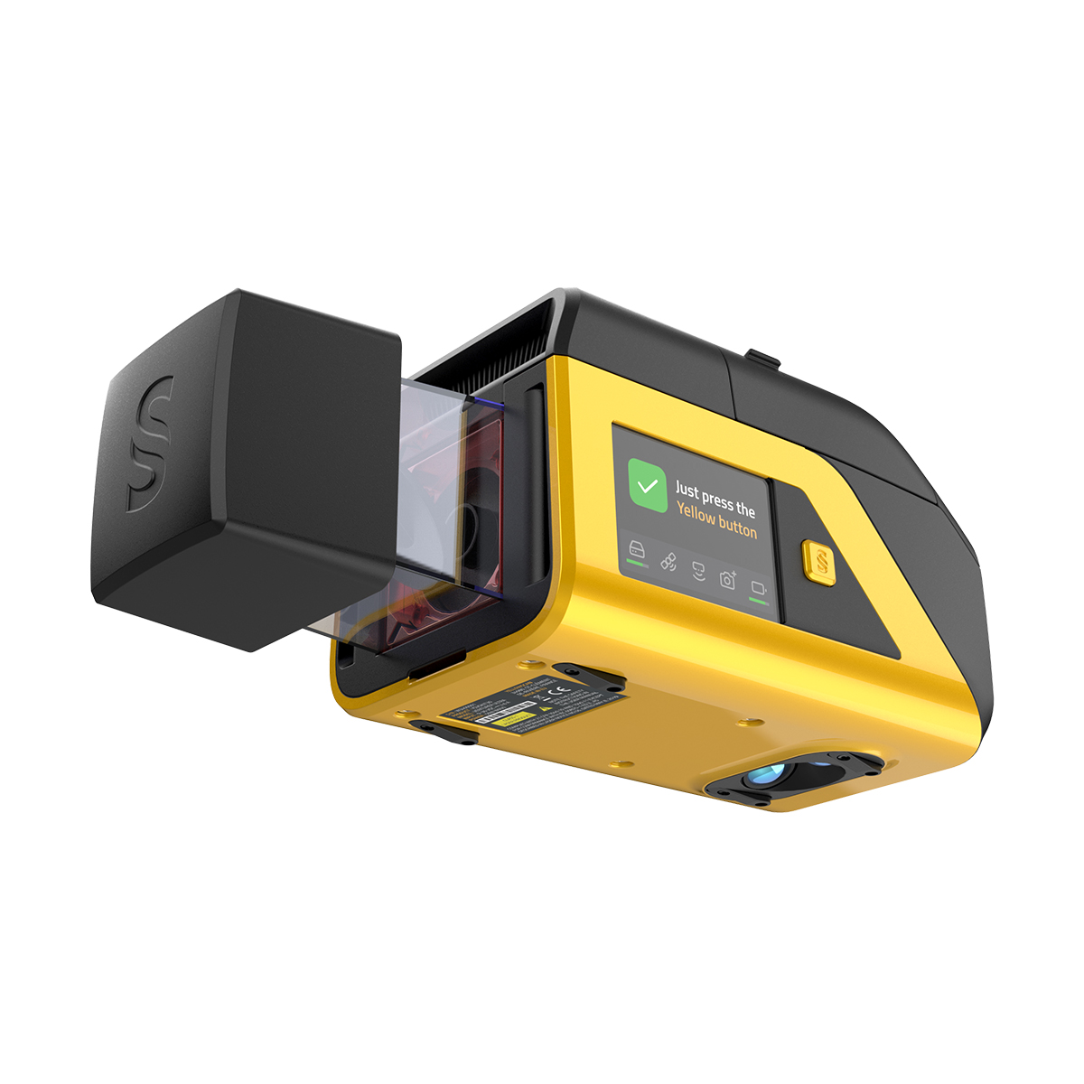
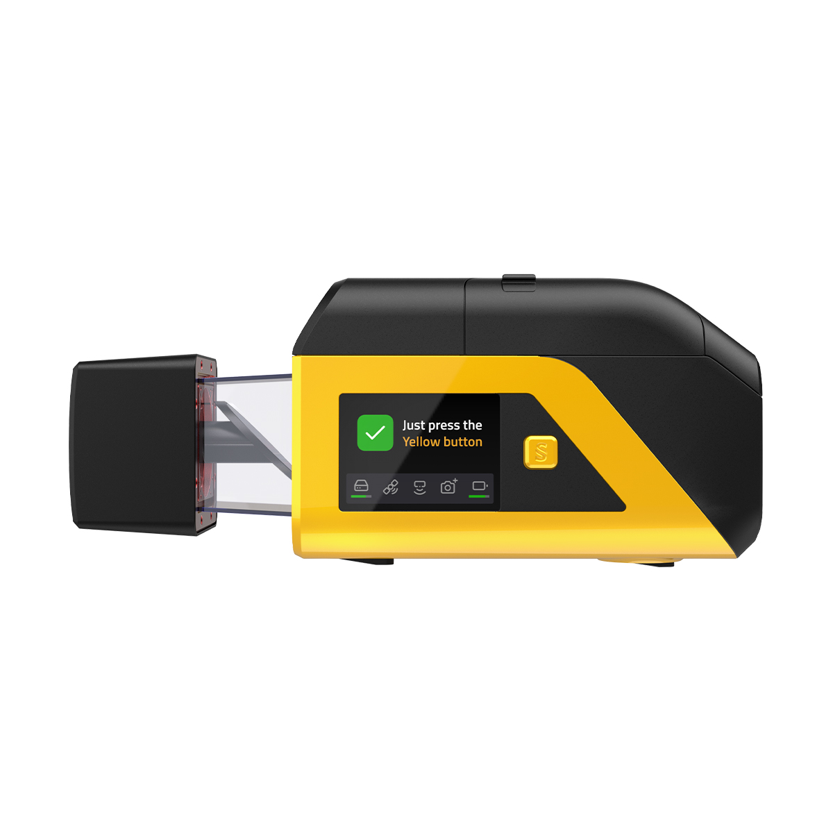

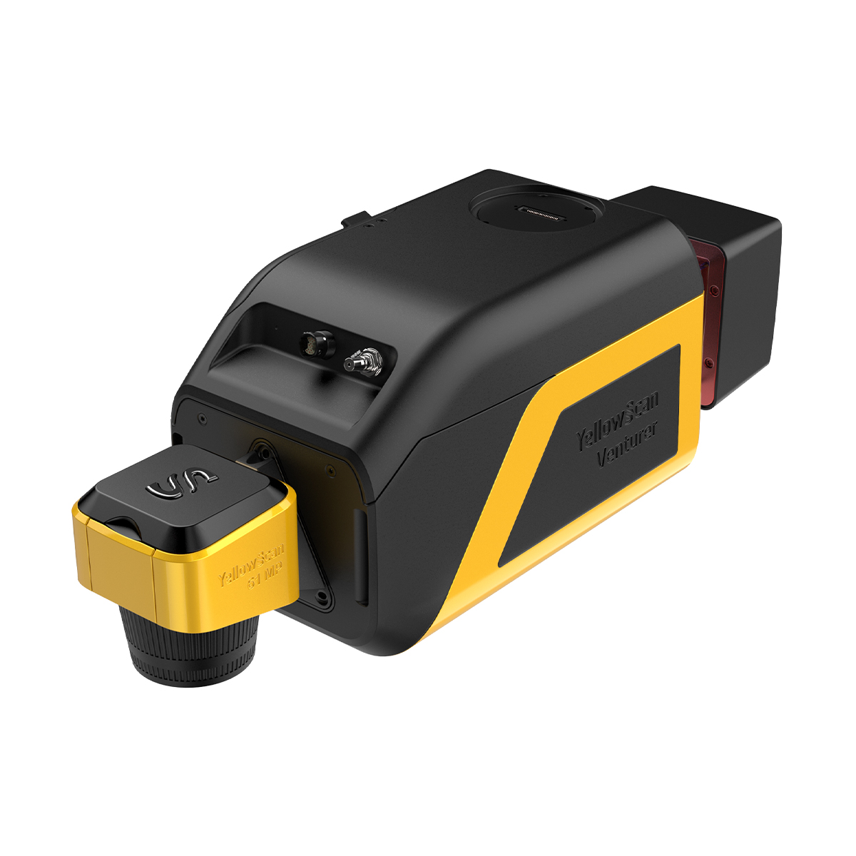
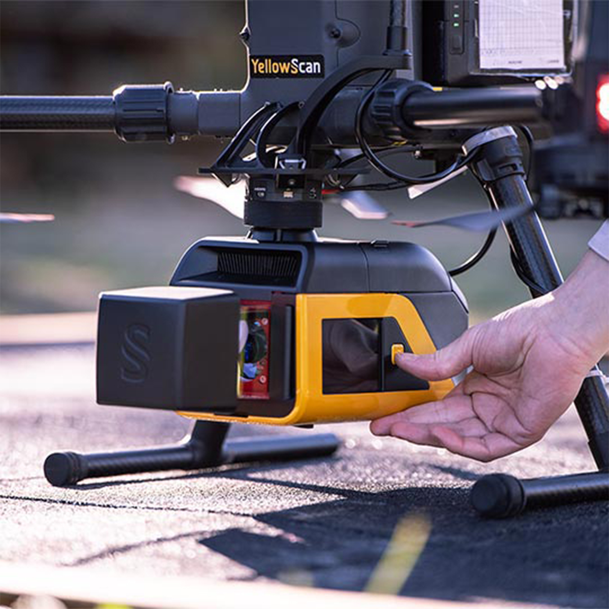
YellowScan Venturer YSVENTKIT-AP LiDAR System
Call for PriceYellowScan Venturer YSVENTKIT-AP LiDAR System
Confidence When it Matters Most
Built for survey and government missions where there is no second chance to fly, the YellowScan Venturer is an NDAA-compliant, survey-grade LiDAR system designed to remove uncertainty in the field. It gives teams confidence at takeoff, reliable results and full control over locally processed data through our dedicated CloudStation software.
Quick View -

YellowScan Voyager 50 YSVXKIT51 Integrated System
Call for Price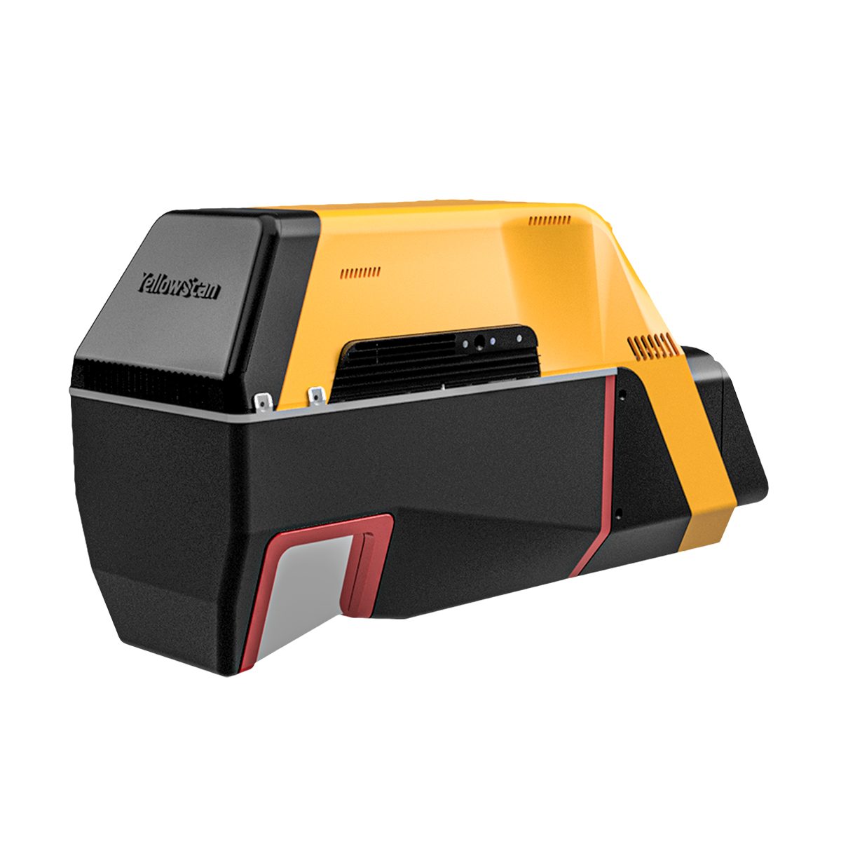


YellowScan Voyager 50 YSVXKIT51 Integrated System
Call for PriceYellowScan Voyager
Precision meets reality.Complete more mission profiles with the YellowScan Voyager. The Voyager’s 100° FOV laser scanner and its extremely fast data acquisition rate of up to 2400 kHz while keeping top-of-the-line precision and accuracy makes this solution the best option for projects requiring both high density and quality.
Quick View -
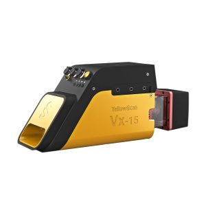
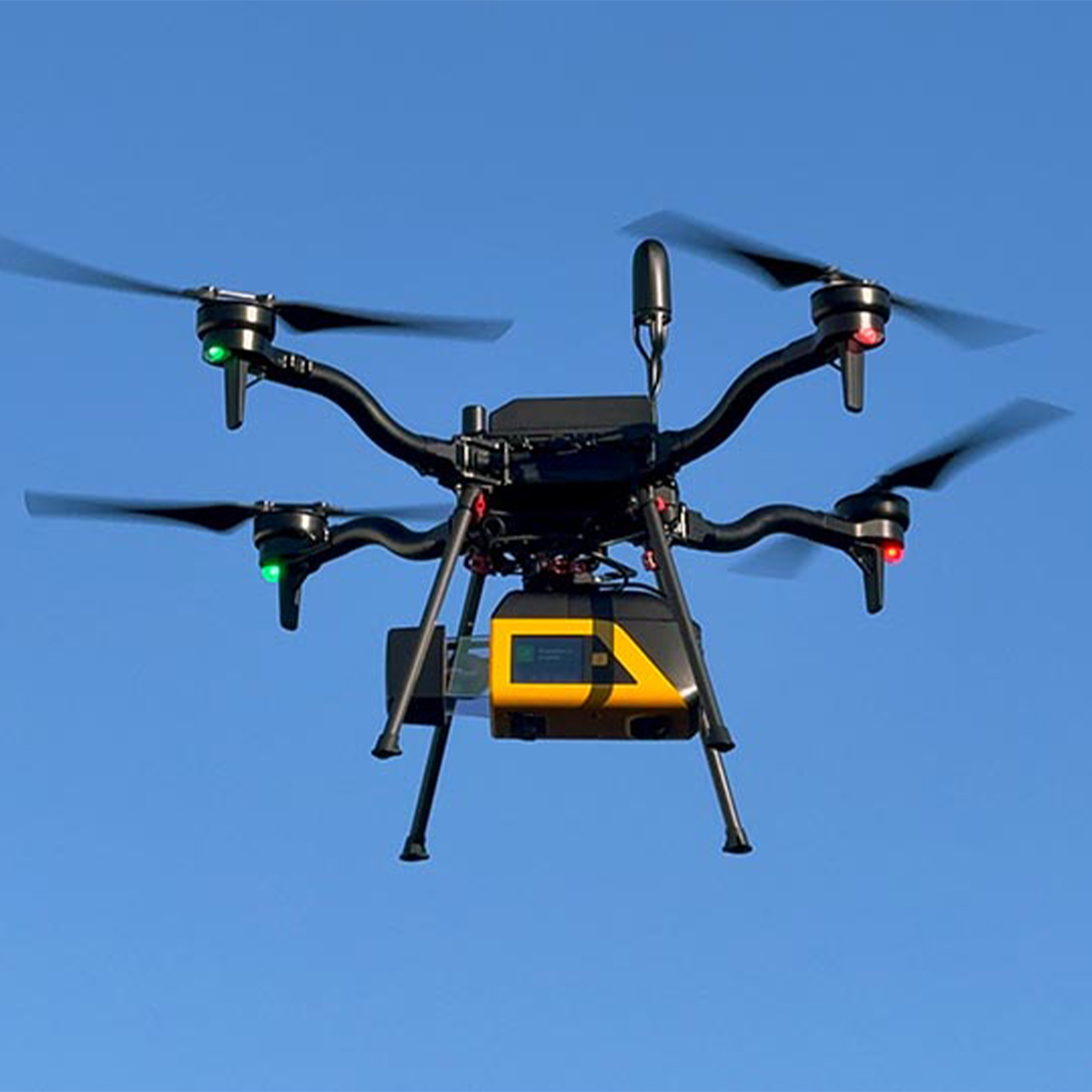
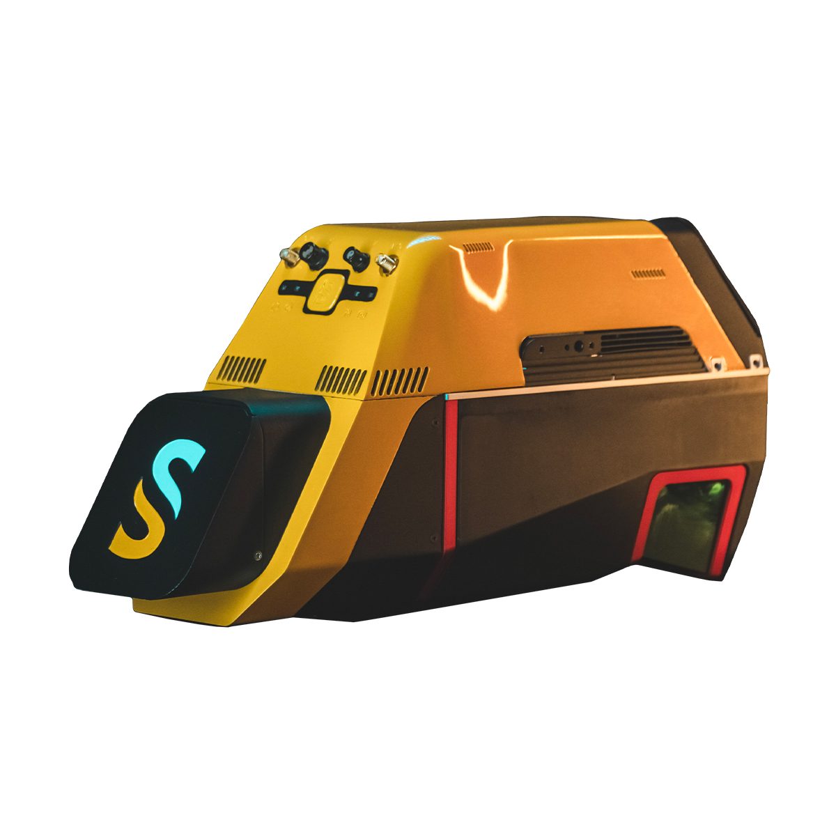
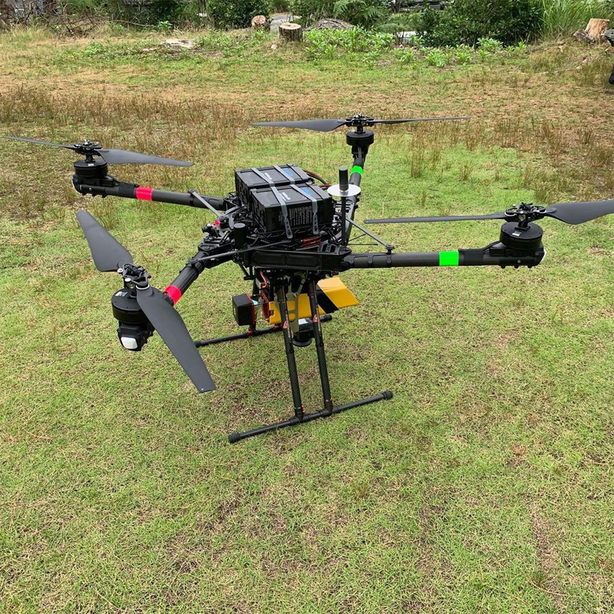
YellowScan Vx15-100 YSVXKIT11 Integrated System
Call for Price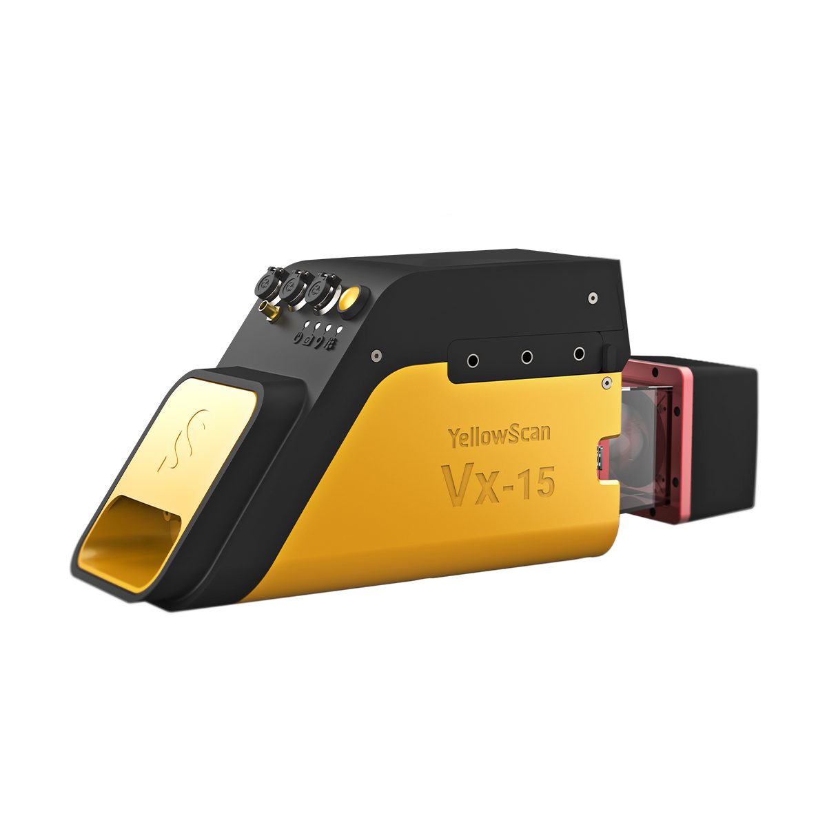
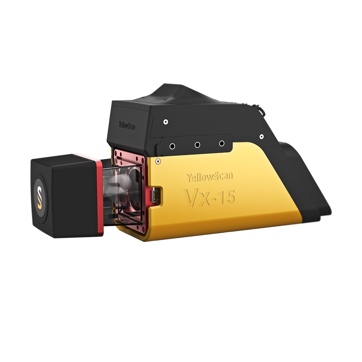
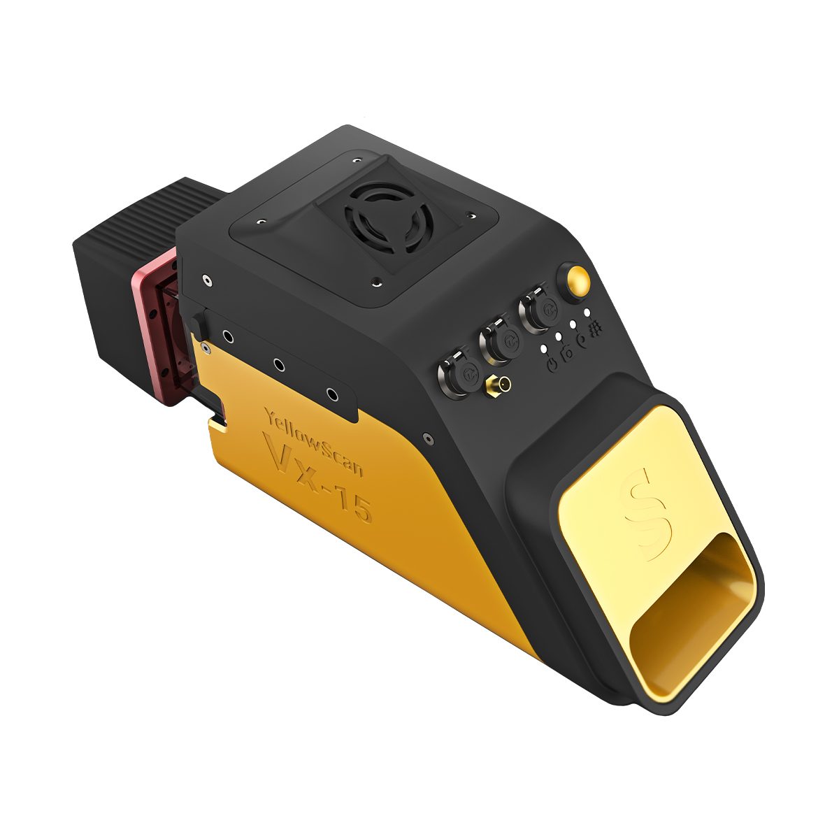
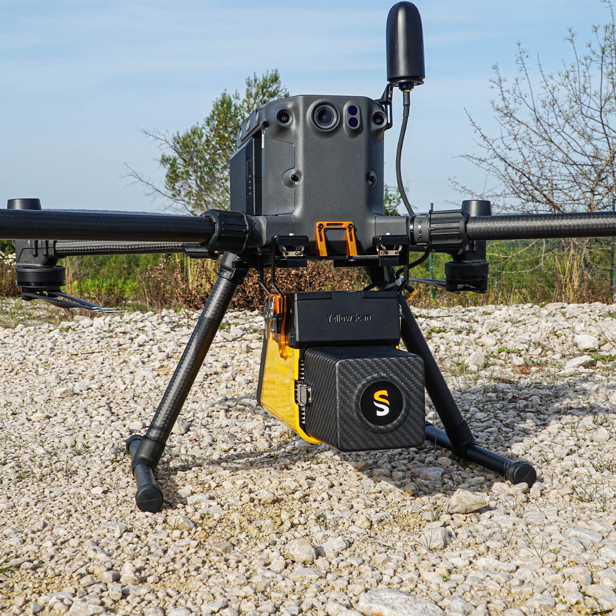

YellowScan Vx15-100 YSVXKIT11 Integrated System
Call for PriceYellowScan Vx15 Series
The long range & high precision UAV LiDAR solution.YellowScan Vx15 is the lightest system integrating the Riegl Mini-VUX. Ideally suited for high precision surveys such as civil engineering. Coupled with the DJI M300 it allows over 25 min flight time maximizing your survey production.
Quick View -
YellowScan Vx15-300 YSVXKIT13 Integrated System
Call for Price YellowScan Vx15-300 YSVXKIT13 Integrated System
Call for PriceYellowScan Vx15 Series
The long range & high precision UAV LiDAR solution.YellowScan Vx15 is the lightest system integrating the Riegl Mini-VUX. Ideally suited for high precision surveys such as civil engineering. Coupled with the DJI M300 it allows over 25 min flight time maximizing your survey production.
Quick View -
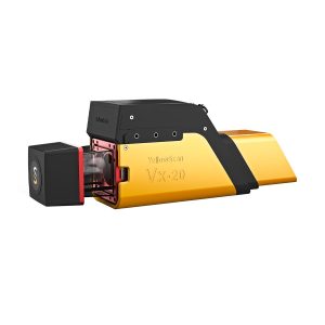
YellowScan Vx20-100 YSVXKIT21 Integrated System
Call for Price
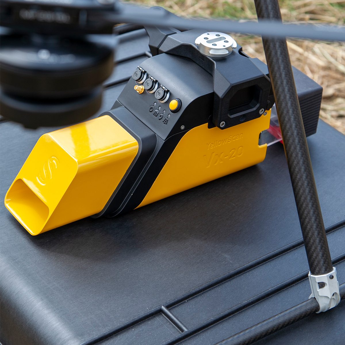
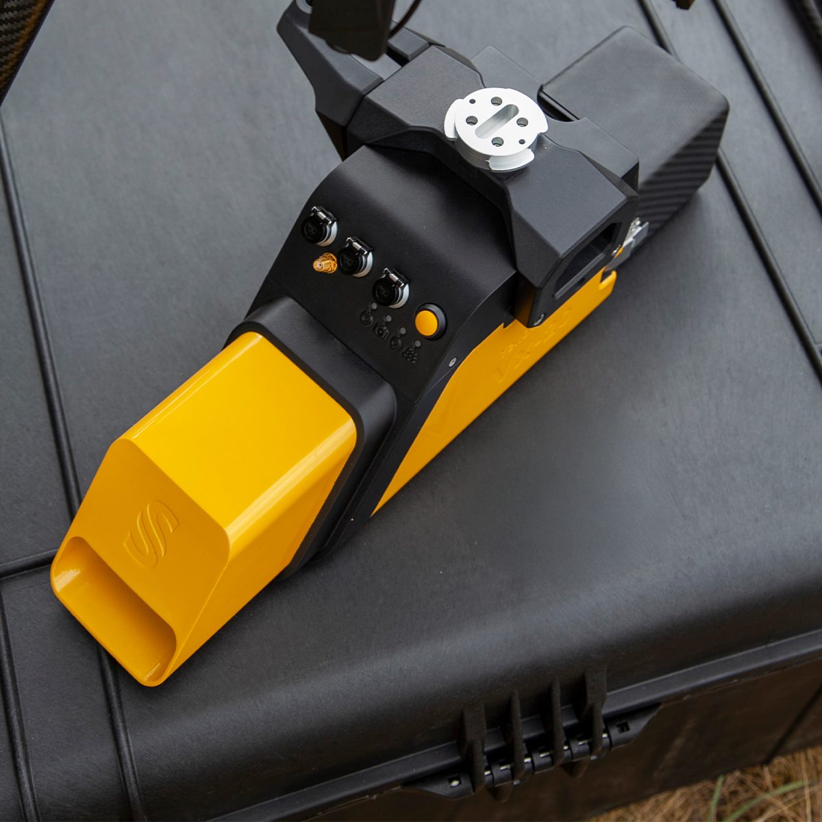

YellowScan Vx20-100 YSVXKIT21 Integrated System
Call for PriceYellowScan Vx20 Series
The most accurate and high precison UAV LiDAR solution.YellowScan Vx20 is the most accurate fully integrated system from YellowScan’s product range. It can fly up to 100m while maintening accuracy throughout the point cloud. Ideally suited for applications that requires sharp and accurate descriptions.
Quick View -
YellowScan Vx20-300 YSVXKIT23 Integrated System
Call for Price YellowScan Vx20-300 YSVXKIT23 Integrated System
Call for PriceYellowScan Vx20 Series
The most accurate and high precison UAV LiDAR solution.YellowScan Vx20 is the most accurate fully integrated system from YellowScan’s product range. It can fly up to 100m while maintening accuracy throughout the point cloud. Ideally suited for applications that requires sharp and accurate descriptions.
Quick View -

Zenmuse P1 w/ DJI Care Enterprise Basic
Call for Price


Zenmuse P1 w/ DJI Care Enterprise Basic
Call for PriceQuick View