![]()
TRIMBLE PRODUCTS ARE ONLY AVAILABLE FOR DELIVERY IN ND, SD, MN, CO, AK, MT, ID, HI, WY, OR, & WA WHEN ORDERED FROM FRONTIER PRECISION.
Please contact us at 800-359-3703 for more information.
")
Call for Price
ONLY AVAILABLE FOR DELIVERY IN ND, SD, MN, CO, AK, MT, ID, HI, WY, OR, & WA.
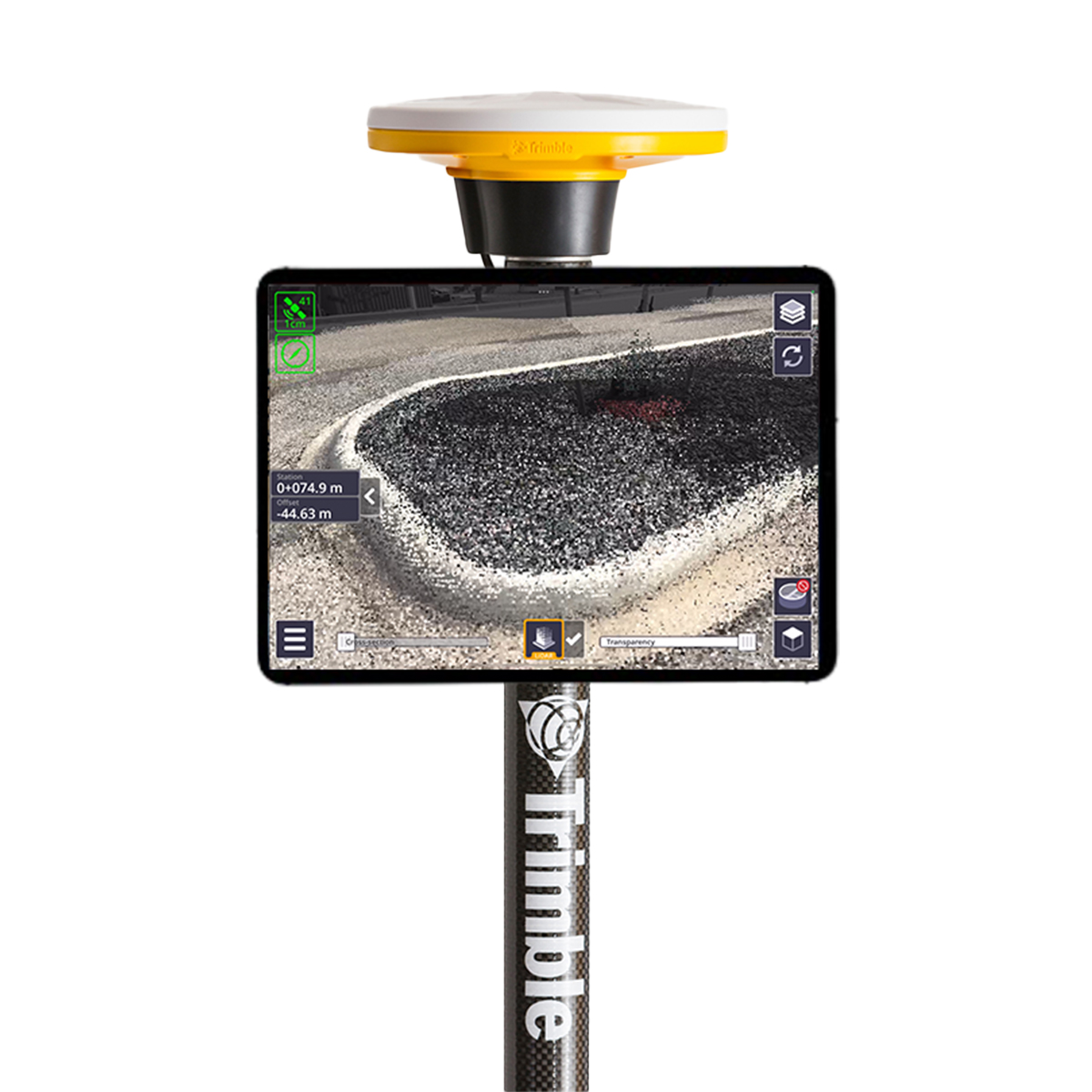
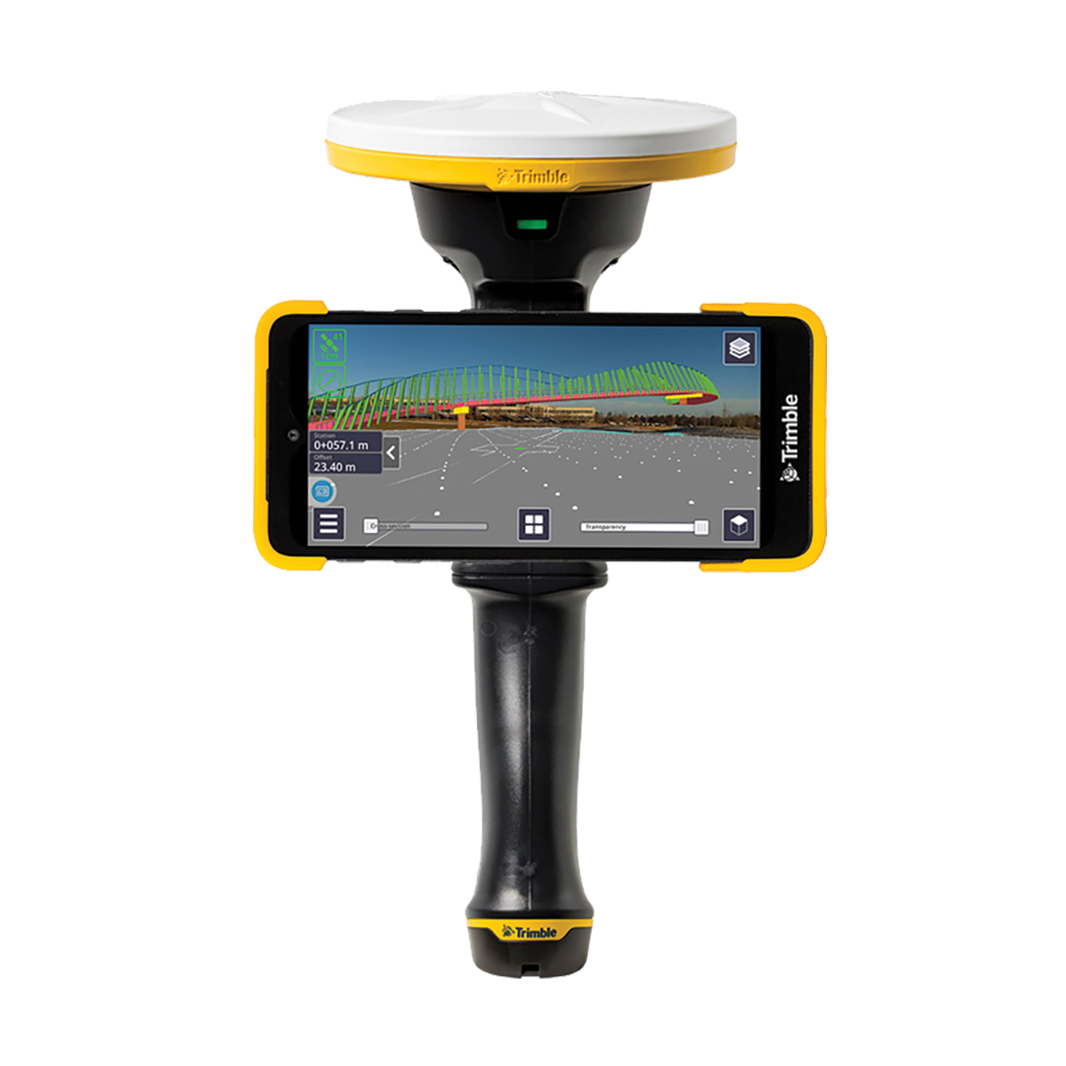
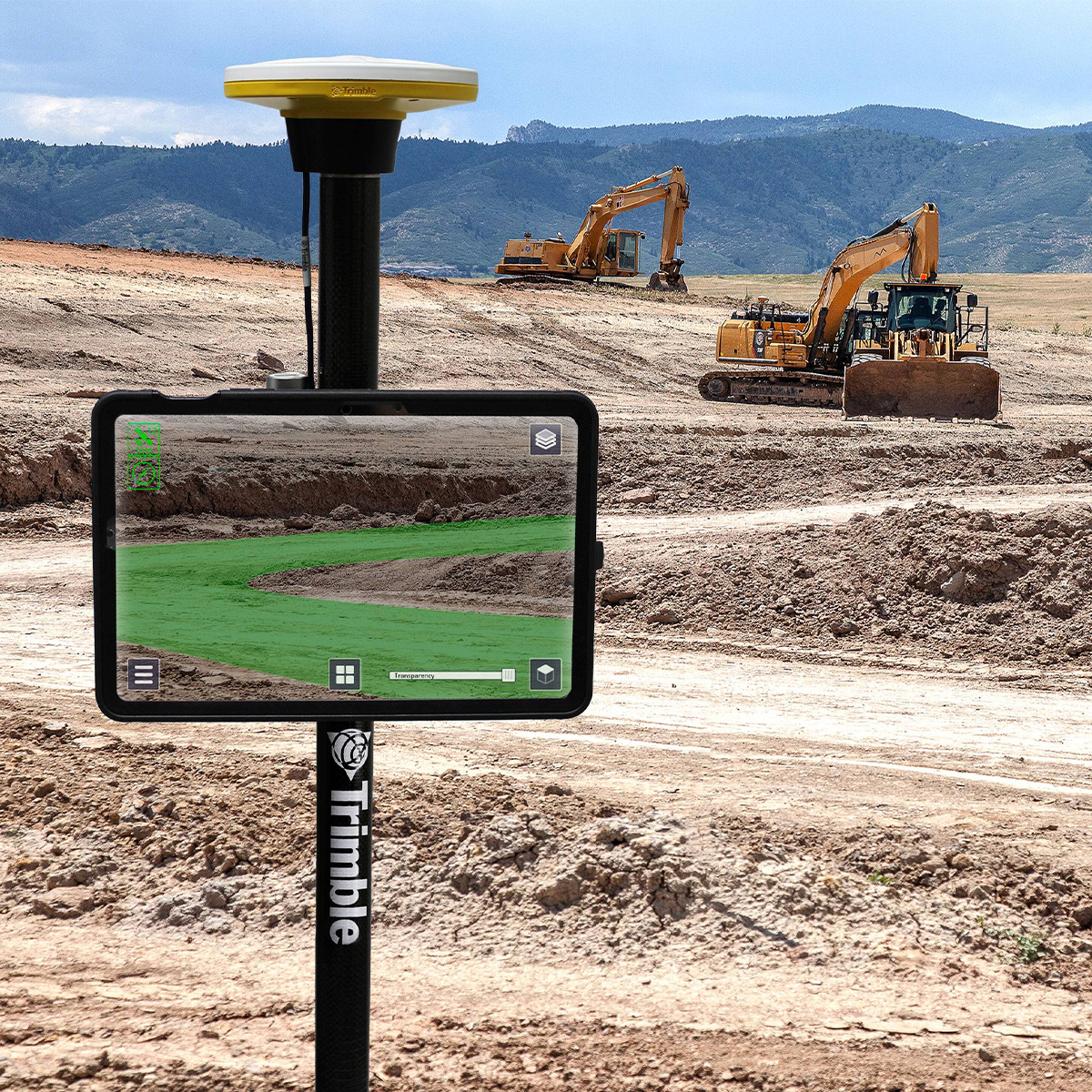
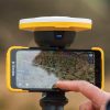
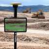
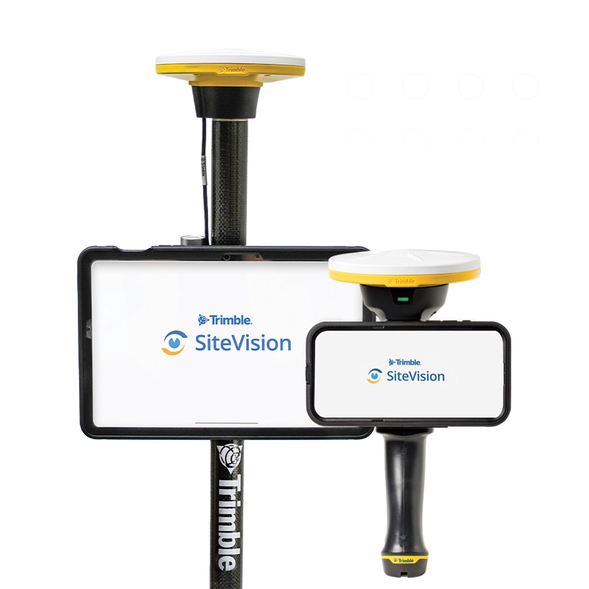
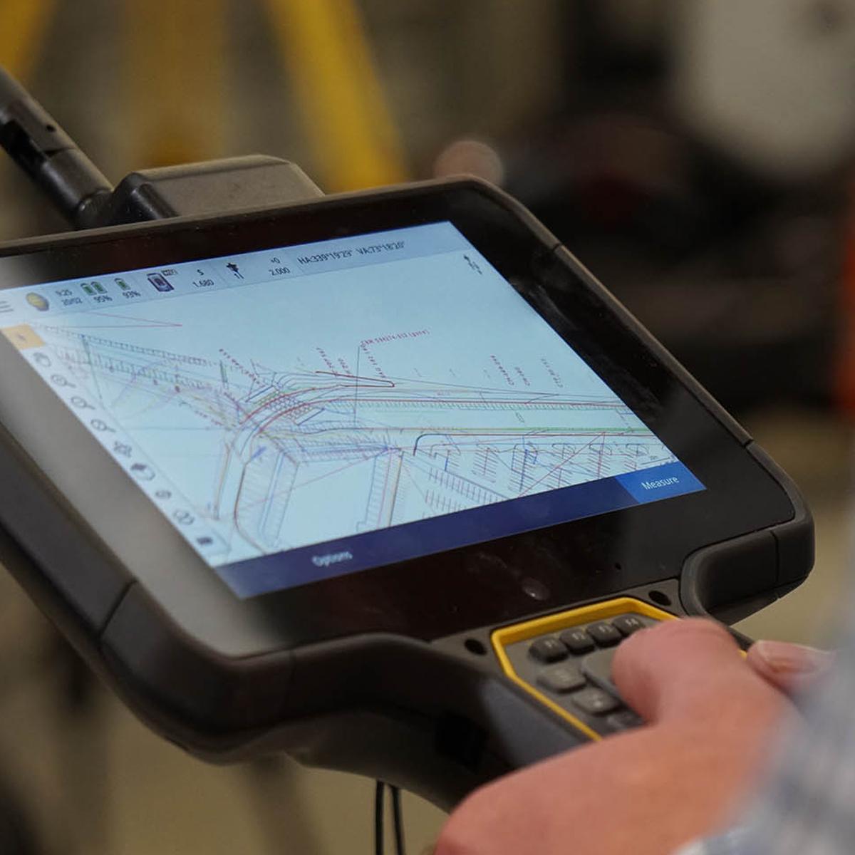
Trimble SiteVision Field Software | Augmented Reality System
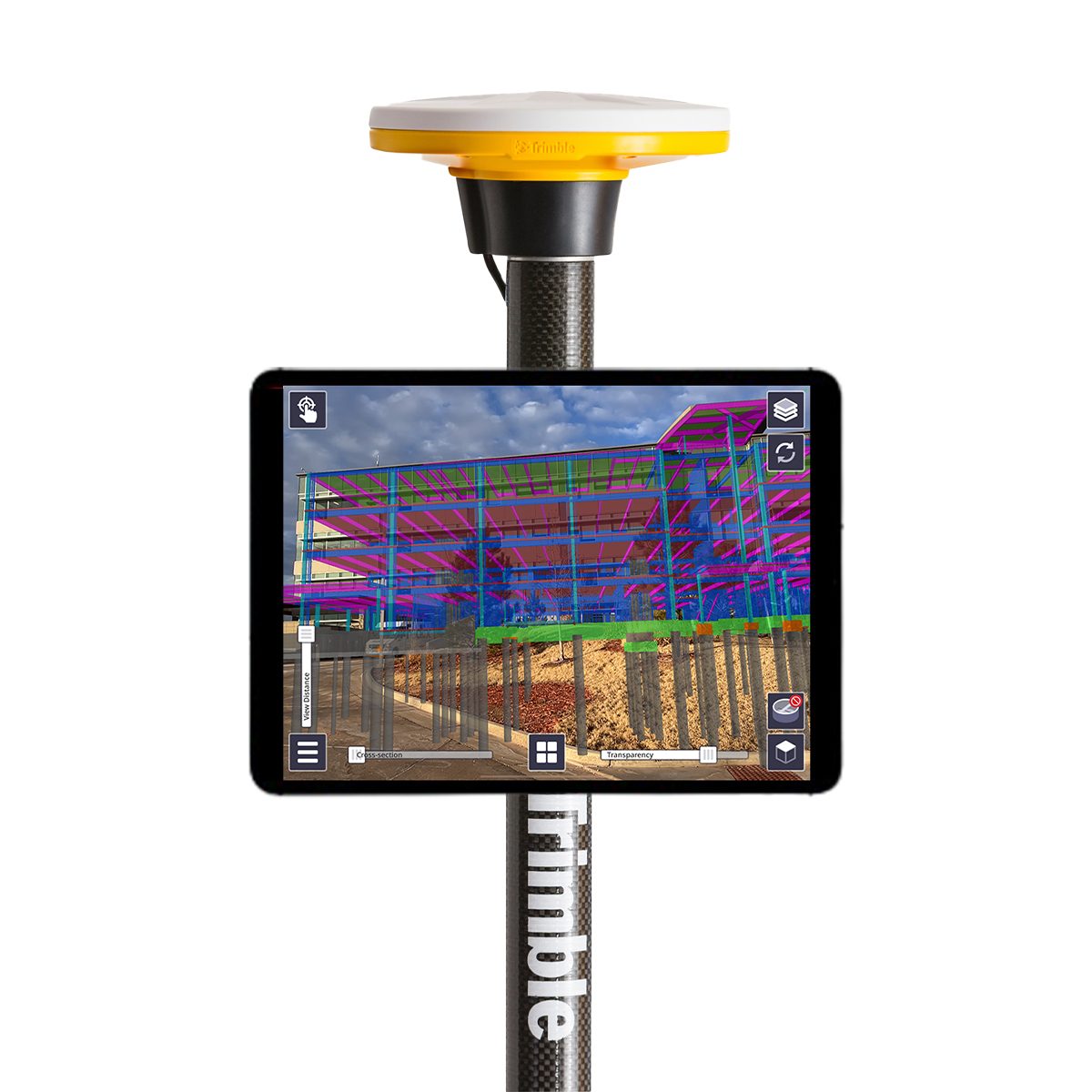
Visualize Data in the Field
Trimble® SiteVision® Software brings spatial data to life in real-world environments so you can easily visualize, explore and understand complex designs — right on your own mobile device. With centimeter-level accuracy, this user-friendly tool provides reliable visuals that are stable and smooth. SiteVision plays a key role in all stages of the construction life cycle: planning and initial visualization, checking progress, and preventing issues to reduce cost and increase efficiency.

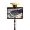
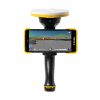

Trimble SiteVision Field Software
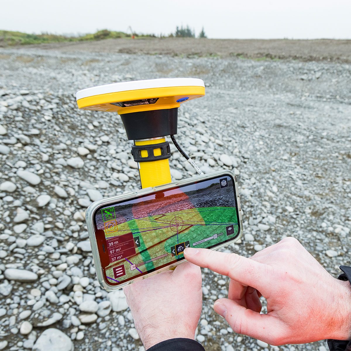
Simpler Scanning
Gain the power of scanning in a simpler, faster and more cost‑effective mobile solution. Capture 3D data on LiDAR‑equipped devices* in a fraction of the time it takes to set up and move expensive laser scanners. Work faster by scanning on the move with the precision of GNSS, and obtain accurately georeferenced points that are exported directly to Trimble Connect®.
Make Decisions in the Field
With simple tools for measurement, volume calculations and 3D scanning, you can empower your team to perform estimates and make decisions in the field — without a comprehensive survey. Don’t waste time waiting for surveyors when anyone on the team can use SiteVision for accurate and timely information.
Utilize Your Existing Equipment
Reduce costs by making use of equipment you already own. Transform your phone or tablet into a multi-purpose tool with the addition of the low cost, high performing Trimble DA2 GNSS Smart Antenna. Work more efficiently in the field with the DA2 providing a seamless experience that is less demanding on your device.
Power the receiver via USB directly from your device or use your existing batteries to eliminate downtime and maximize insights in the field.
For a lighter and more convenient option, use your phone with the feature‑rich Trimble HPS2 handle. Its magnetic mount and built-in battery simplify usage, while integrated Electronic Distance Measurement (EDM) enables accurate measurements on the spot.
*3D scanning is only available with certain LiDAR-equipped devices.
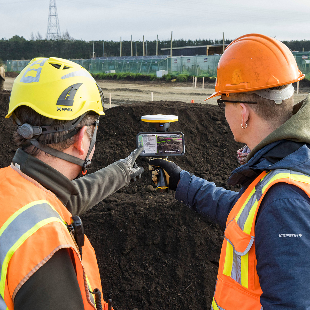
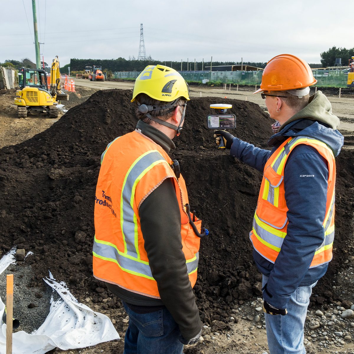
Communicate and Collaborate
Share, communicate and collectively interact with easy-to-understand visualizations to efficiently collaborate with people of all skill levels.
Applications:
Planning
Collect Data on Site
Monitoring and Inspection


ONLY AVAILABLE FOR DELIVERY IN ND, SD, MN, CO, AK, MT, ID, HI, WY, OR, & WA.
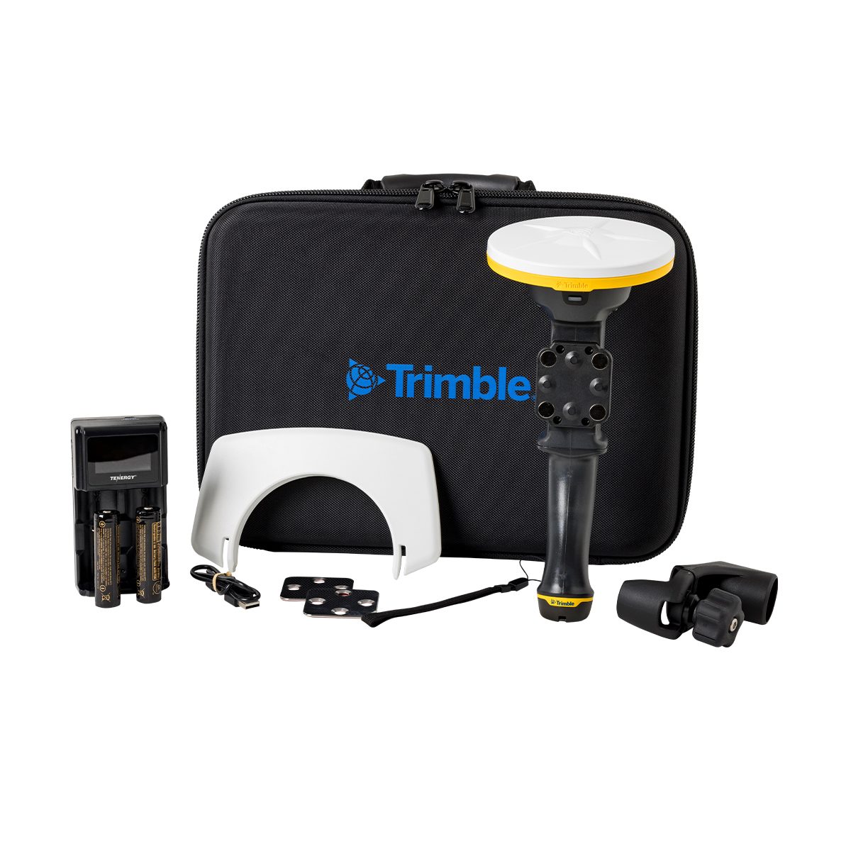
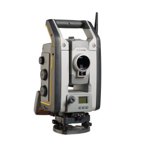
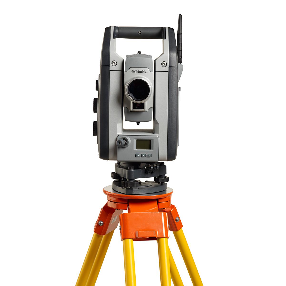
Trimble S7353200 S7 Robotic Total Station
A powerful instrument for surveyors.
As a feature-rich robotic total station with an included radio, Trimble® S7 total station enables single-user operation. It’s the only instrument you need on the jobsite, maximizing your efficiency every day.