by Jenn Heinrich | Nov 11, 2024
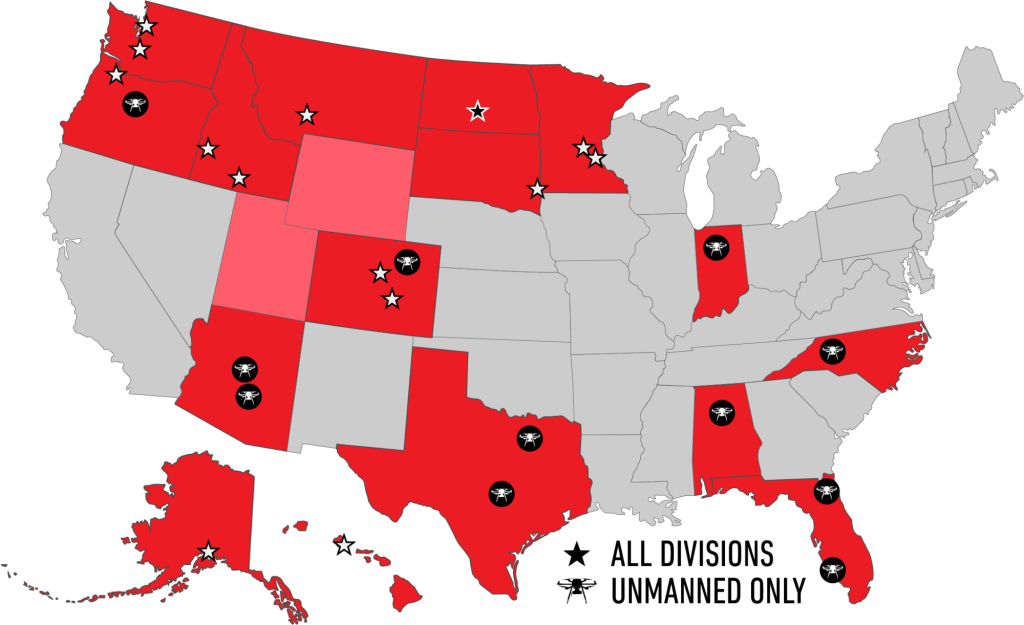
Many products have several units available. The cost MAY differ due to condition, accompanying accessories, or other factors. Contact Bobbi at 320-654-6411 to discuss what options are available for your Used equipment needs! Your Name(Required) First Last Your...
by SCS Cloud | Jun 15, 2024
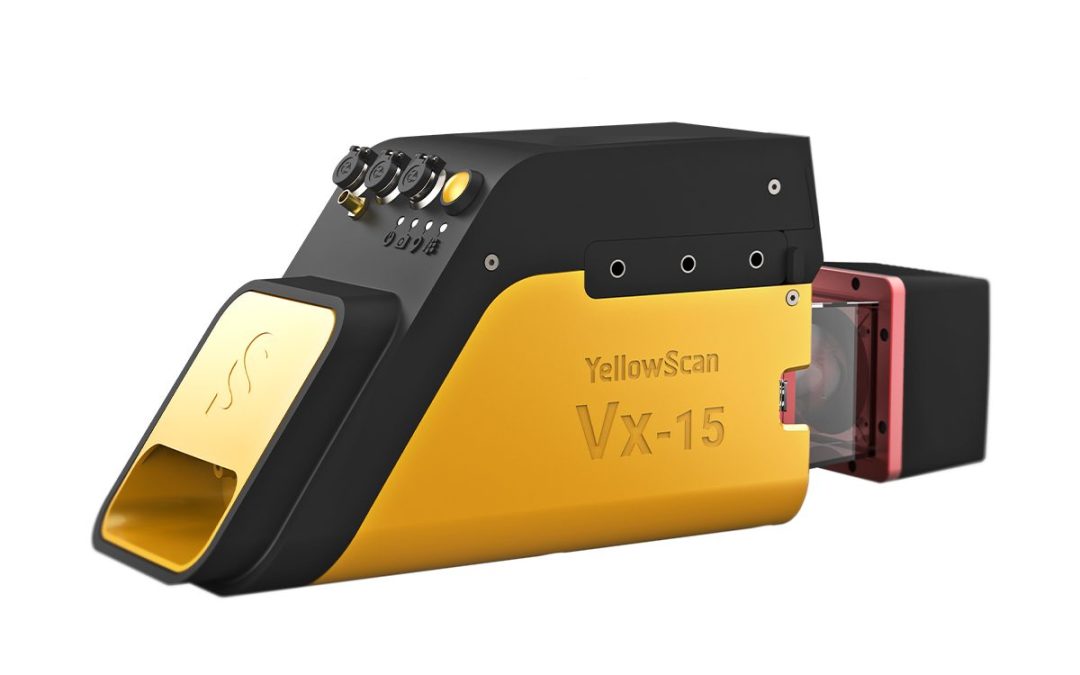
YellowScan designed a fully-integrated, easy-to-use LiDAR system that includes the renowned Riegl laser scanner and Applanix UAV IMU APX-15. YellowScan Vx15 is an excellent solution for your high flight UAV projects with quick data processing needs. It is ideally...
by SCS Cloud | Jun 15, 2024
YellowScan designed a fully-integrated, easy-to-use LiDAR system that includes the renowned Riegl laser scanner and Applanix UAV IMU APX-15. YellowScan Vx15 is an excellent solution for your high flight UAV projects with quick data processing needs. It is ideally...

by SCS Cloud | Jun 15, 2024
The YellowScan Mapper+ is the next generation of integrated LiDAR solutions. This particularly lightweight system with long range capabilities, high-end point density, as well as advanced accuracy and precision, make it the perfect UAV LiDAR mapping tool for...

by SCS Cloud | Jun 15, 2024
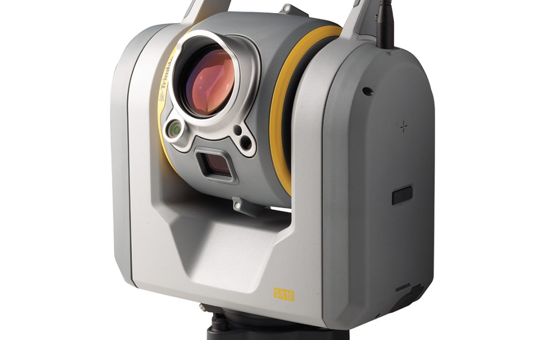
Trimble X12 Kit with T10x Tablet High-end Laser Scanning • Accessible – reduces complexities normally associated with high-end scanning with unparalleled ease of use • Productive – improves business efficiencies by offering the best scanner and software available to...
by SCS Cloud | Jun 15, 2024
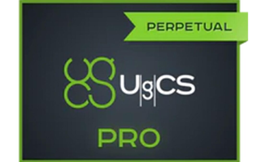
Save Time and Money• No need to learn diverse software – UgCS enables supports for the majority of drones• The import and route creation from customer provided KML data will save 50% of your time• Save days of traveling and before leaving the site, validate acquired...

by SCS Cloud | Jun 15, 2024
• LiDAR Survey Planning Tools• Live Video Stream from UgCS for DJI to UgCS (currently compatible only with Android and Win)• Multiple SDK Connections• ADS-B Transponder• Compatible with UgCS Mapper to Perform Live Video Mapping

by SCS Cloud | Jun 15, 2024
The Trimble® TSC7 controller integrates a tablet experience with a physical keypad into survey workflows. Featuring a processor with plenty of power, it makes quick work of large projects and handles 3D data visualization and manipulation with ease. Its comprehensive...

by SCS Cloud | Jun 15, 2024
Trimble TAB-T100-1110-00 – T100 Data Collector Benefits and Performance Work smarter, not harder with the T100. Tackle even the toughest projects without sacrificing speed and efficiency with an ergonomic design and reliable performance. Efficiency Meets Power...
by SCS Cloud | Jun 15, 2024
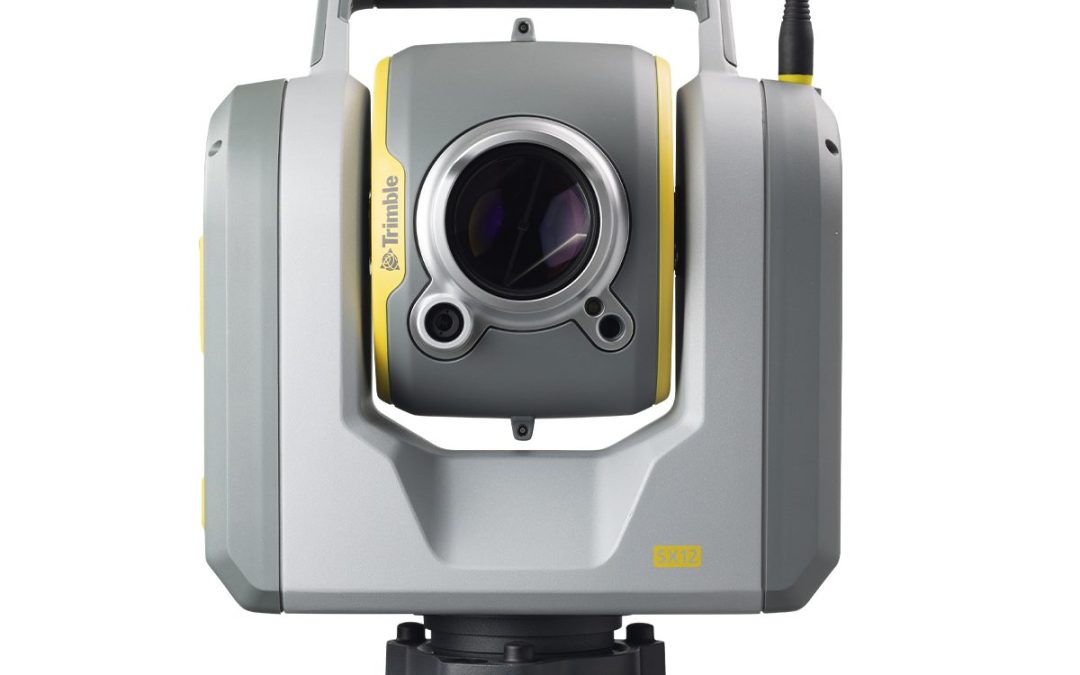
Trimble SX12 1″ with Wi-Fi HaLow™ Trimble® SX12 is the one instrument you need to handle any survey project by integrating surveying, imaging and 3D scanning capabilities into your everyday workflow. The SX12 features our smallest and brightest laser pointer,...

by SCS Cloud | Jun 15, 2024
Smi-Carr, Inc. SMI-YELLOW Stake Chaser Marking Whiskers Over the years these safe and easy-to-spot Whiskers have become a prime choice for marking buried utility lines, survey points, and even athletic fields. 6in Stake Chasers can be easily hammered into a wooden...
by SCS Cloud | Jun 15, 2024
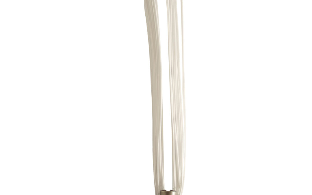
Smi-Carr, Inc. SMI-WHITE Stake Chaser Marking Whiskers Over the years these safe and easy-to-spot Whiskers have become a prime choice for marking buried utility lines, survey points, and even athletic fields. 6in Stake Chasers can be easily hammered into a wooden...

by SCS Cloud | Jun 15, 2024
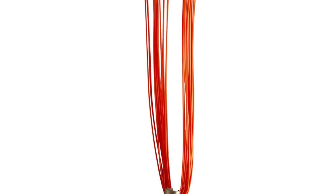
Smi-Carr, Inc. SMI-RED Stake Chaser Marking Whiskers Over the years these safe and easy-to-spot Whiskers have become a prime choice for marking buried utility lines, survey points, and even athletic fields. 6in Stake Chasers can be easily hammered into a wooden stake...
by SCS Cloud | Jun 15, 2024
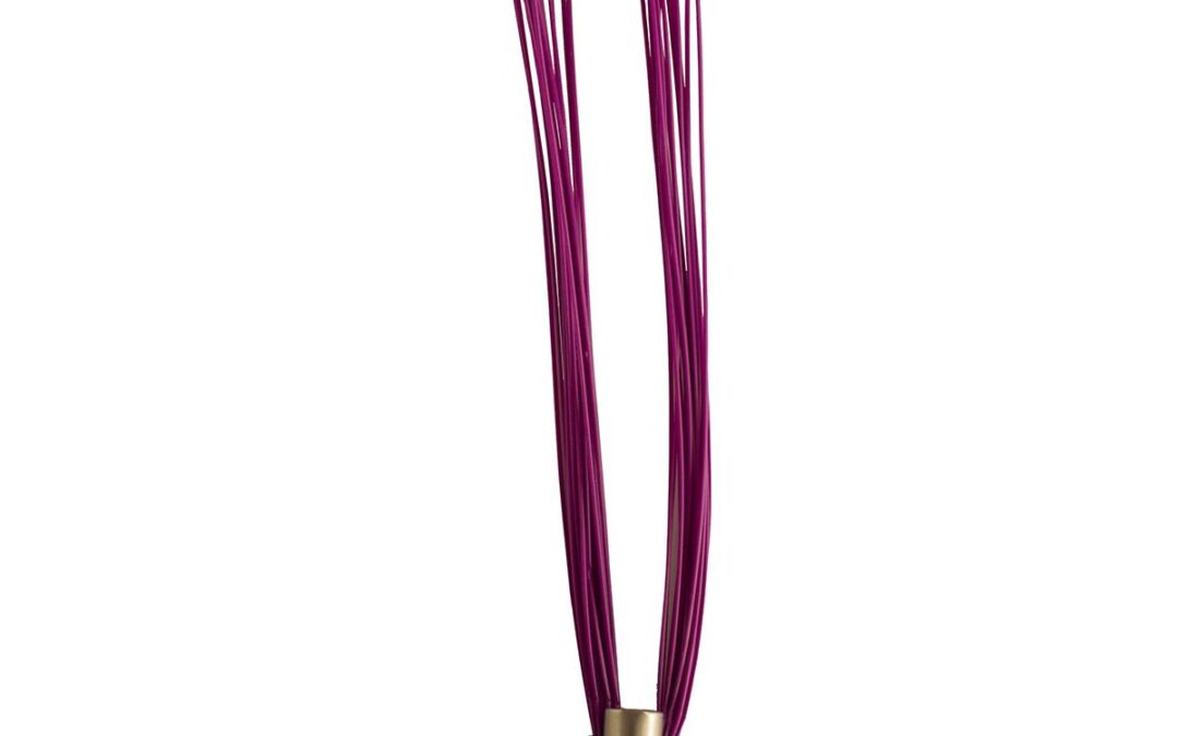
Smi-Carr, Inc. SMI-PURPLE Stake Chaser Marking Whiskers Over the years these safe and easy-to-spot Whiskers have become a prime choice for marking buried utility lines, survey points, and even athletic fields. 6in Stake Chasers can be easily hammered into a wooden...
by SCS Cloud | Jun 15, 2024
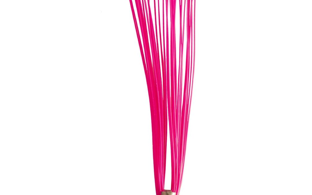
Smi-Carr, Inc. SMI-PINK Stake Chaser Marking Whiskers Over the years these safe and easy-to-spot Whiskers have become a prime choice for marking buried utility lines, survey points, and even athletic fields. 6in Stake Chasers can be easily hammered into a wooden stake...
by SCS Cloud | Jun 15, 2024
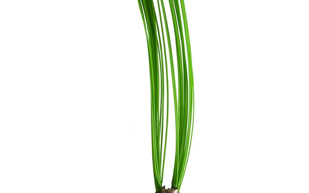
Smi-Carr, Inc. SMI-GREEN Stake Chaser Marking Whiskers Over the years these safe and easy-to-spot Whiskers have become a prime choice for marking buried utility lines, survey points, and even athletic fields. 6in Stake Chasers can be easily hammered into a wooden...
by SCS Cloud | Jun 15, 2024
Smi-Carr, Inc. SMI-FLO ORANGE Stake Chaser Marking Whiskers Over the years these safe and easy-to-spot Whiskers have become a prime choice for marking buried utility lines, survey points, and even athletic fields. 6in Stake Chasers can be easily hammered into a wooden...

by SCS Cloud | Jun 15, 2024
Smi-Carr, Inc. SMI-BLUE Stake Chaser Marking Whiskers Over the years these safe and easy-to-spot Whiskers have become a prime choice for marking buried utility lines, survey points, and even athletic fields. 6in Stake Chasers can be easily hammered into a wooden stake...
by SCS Cloud | Jun 15, 2024
Our most famous and widely used product, our 6in Stake Chaser® brand marking Whiskers® are trusted for their durability and flexibility. Designed to provide maximum visibility and withstand multiple passes of a grader blade, our first product is perfect for road...
by SCS Cloud | Jun 15, 2024
Our most famous and widely used product, our 6in Stake Chaser® brand marking Whiskers® are trusted for their durability and flexibility. Designed to provide maximum visibility and withstand multiple passes of a grader blade, our first product is perfect for road...
by SCS Cloud | Jun 15, 2024
Our most famous and widely used product, our 6in Stake Chaser® brand marking Whiskers® are trusted for their durability and flexibility. Designed to provide maximum visibility and withstand multiple passes of a grader blade, our first product is perfect for road...
by SCS Cloud | Jun 15, 2024
Our most famous and widely used product, our 6in Stake Chaser® brand marking Whiskers® are trusted for their durability and flexibility. Designed to provide maximum visibility and withstand multiple passes of a grader blade, our first product is perfect for road...
by SCS Cloud | Jun 15, 2024
Our most famous and widely used product, our 6in Stake Chaser® brand marking Whiskers® are trusted for their durability and flexibility. Designed to provide maximum visibility and withstand multiple passes of a grader blade, our first product is perfect for road...
by SCS Cloud | Jun 15, 2024
Our most famous and widely used product, our 6in Stake Chaser® brand marking Whiskers® are trusted for their durability and flexibility. Designed to provide maximum visibility and withstand multiple passes of a grader blade, our first product is perfect for road...
")