by Marco Ryan | Apr 13, 2026
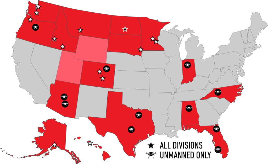
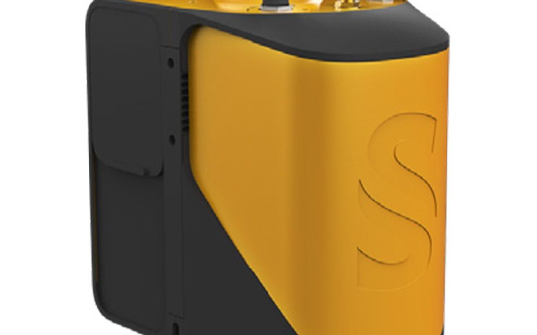
YellowScan Venturer YSVENTKIT-AP LiDAR System UAV NDAA LiDAR for Trusted and Compliant Data Acquisition Explore Without Limits In demanding survey environments, uncertainty is costly. Survey missions are often constrained by tight timelines, limited access, regulated...
by Marco Ryan | Mar 17, 2025
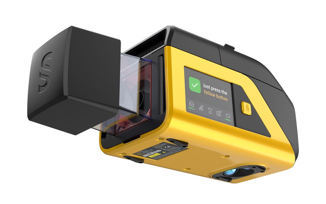
The YellowScan Voyager is our highest range LiDAR solution, with a range of up to 440m. Its laser scanner’s wide field of view of 100° and its extremely fast data acquisition rate of up to 2.4 MHz, makes this solution the best option for projects requiring the highest...

by Marco Ryan | Mar 17, 2025
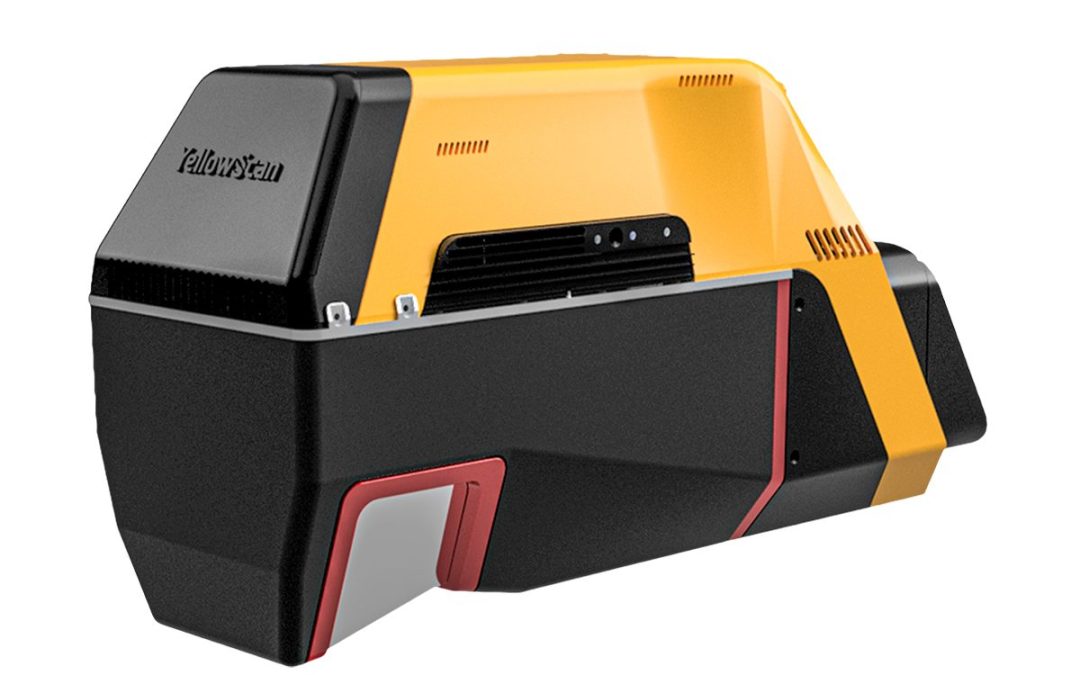
A higher-grade INS integration for more productivity in operation, all in an even lighter package. We’ve kept the great 32-beam, 360° laser scanner and combined it with an INS to reach its full potential at higher altitudes and in Fly & Drive with many...
by Marco Ryan | Mar 17, 2025
A higher-grade INS integration for more productivity in operation, all in an even lighter package. We’ve kept the great 32-beam, 360° laser scanner and combined it with an INS to reach its full potential at higher altitudes and in Fly & Drive with many...

by Marco Ryan | Mar 17, 2025
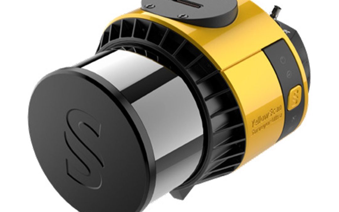
The YellowScan Navigator is an innovative bathymetric LiDAR solution for mapping underwater and ground topography with a single-button operation. Its compact design allows for operating on various UAV platforms without compromising water penetration. Technologies...
by Marco Ryan | Mar 17, 2025
The YellowScan Mapper is the next generation of integrated LiDAR solutions. Its low weight, mid-range capability, great point density as well as advanced accuracy and precision, makes the Mapper the best value for money in our portfolio. Technologies Inside: Applanix...

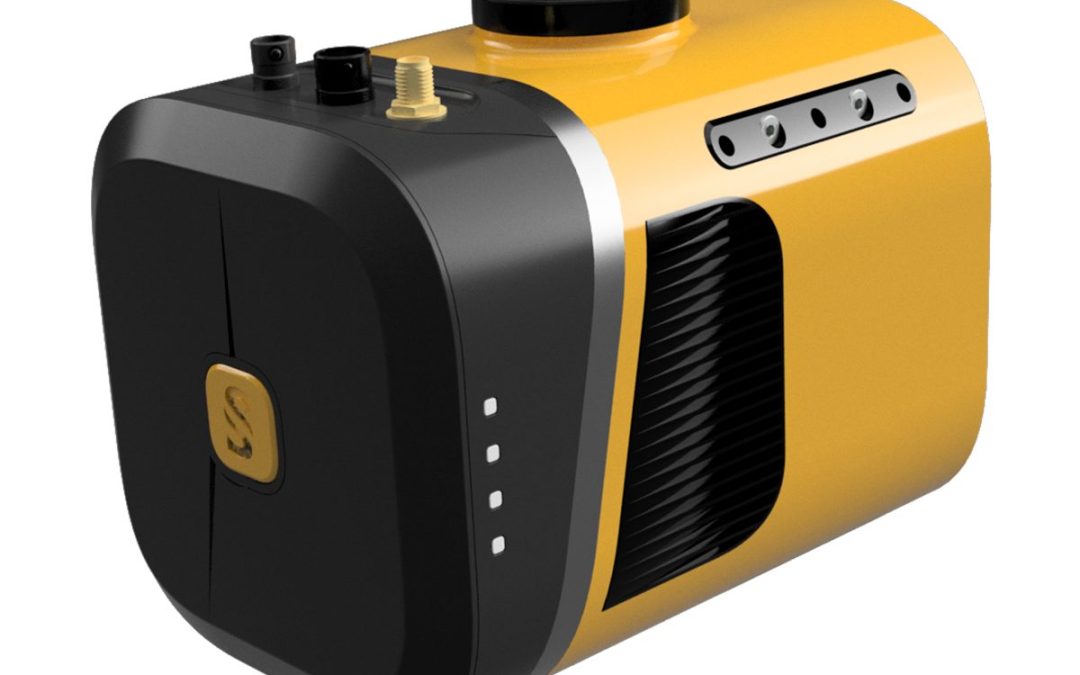
by SCS Cloud | Jun 15, 2024
YellowScan Vx20 is the most accurate fully-integrated system from YellowScan’s product range. It is an excellent solution for your high flight UAV projects with fast data processing. Technologies Inside: Applanix Riegl Key Differentiators: High Precision Point Cloud...
by SCS Cloud | Jun 15, 2024
YellowScan Vx20 is the most accurate fully-integrated system from YellowScan’s product range. It is an excellent solution for your high flight UAV projects with fast data processing. Technologies Inside: Applanix Riegl Key Differentiators: High Precision Point Cloud...
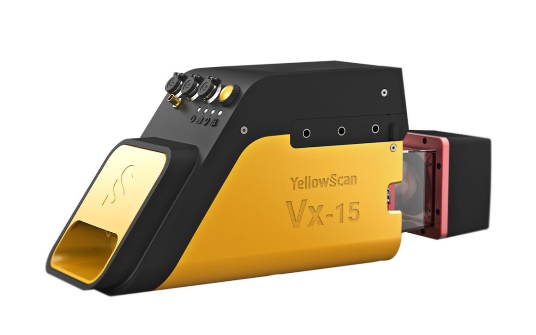
by SCS Cloud | Jun 15, 2024
YellowScan designed a fully-integrated, easy-to-use LiDAR system that includes the renowned Riegl laser scanner and Applanix UAV IMU APX-15. YellowScan Vx15 is an excellent solution for your high flight UAV projects with quick data processing needs. It is ideally...
by SCS Cloud | Jun 15, 2024
YellowScan designed a fully-integrated, easy-to-use LiDAR system that includes the renowned Riegl laser scanner and Applanix UAV IMU APX-15. YellowScan Vx15 is an excellent solution for your high flight UAV projects with quick data processing needs. It is ideally...
by SCS Cloud | Jun 15, 2024
The YellowScan Mapper is the next generation of integrated LiDAR solutions. Its low weight, mid-range capability, great point density as well as advanced accuracy and precision, makes the Mapper the best value for money in our portfolio. Technologies Inside: Applanix...
by SCS Cloud | Jun 15, 2024
The YellowScan Mapper+ is the next generation of integrated LiDAR solutions. This particularly lightweight system with long range capabilities, high-end point density, as well as advanced accuracy and precision, make it the perfect UAV LiDAR mapping tool for...
by SCS Cloud | Jun 15, 2024
A Small and Powerful LiDAR Sensor for the Trinity F90+ UAS The Qube 240 LiDAR sensor inherits the YellowScan Ultra Surveyors LiDAR scanner. This was the first integration into our Tron UAS platform in 2017. Advances in miniaturization and performance improvements...
")