")
SHOP GEOSPATIAL
ACCURATELY COLLECTING DATA GEOGRAPHICALLY & TOPOGRAPHICALLY
FEATURED GEOSPATIAL PRODUCTS
Showing 281–288 of 288 results
-
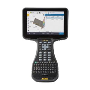
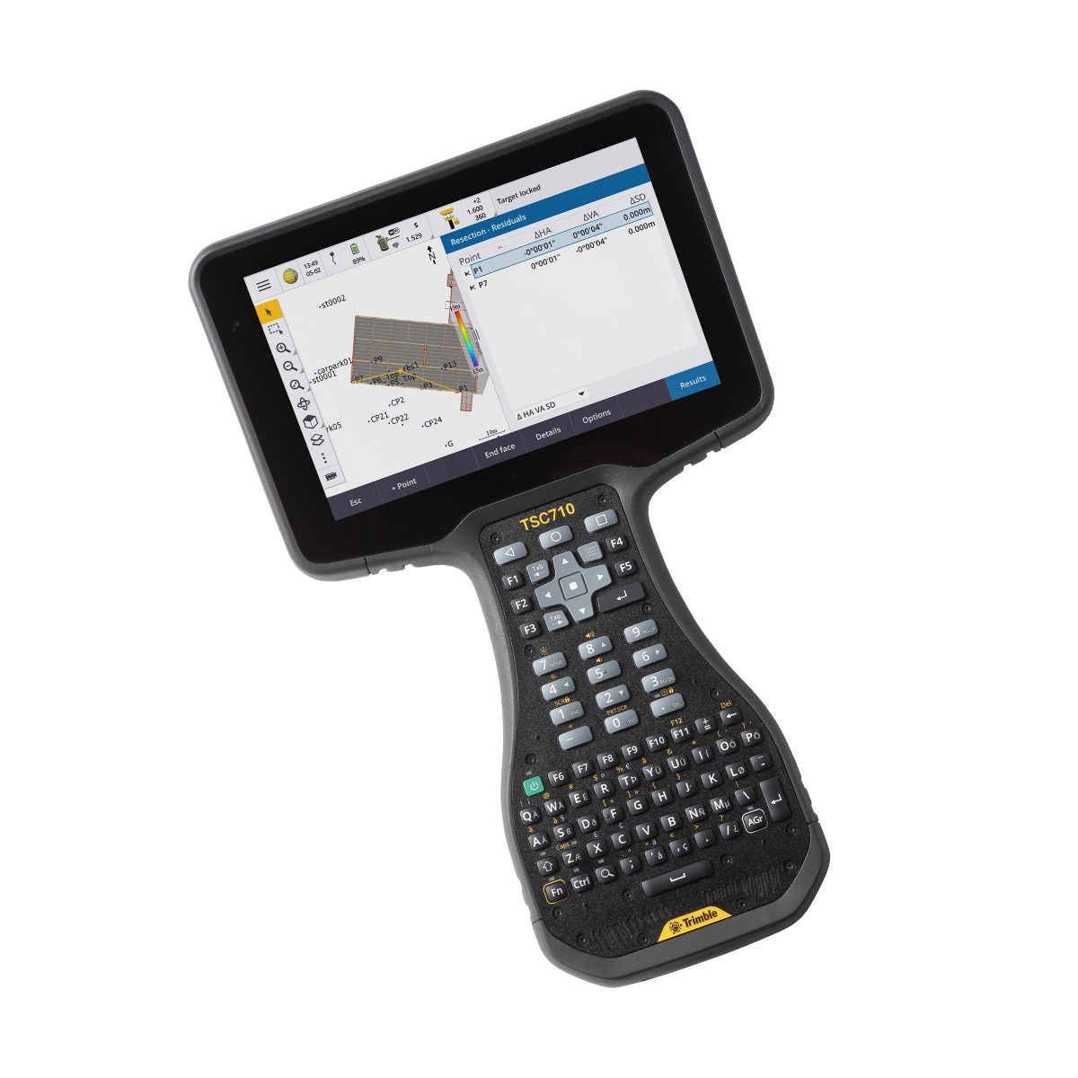
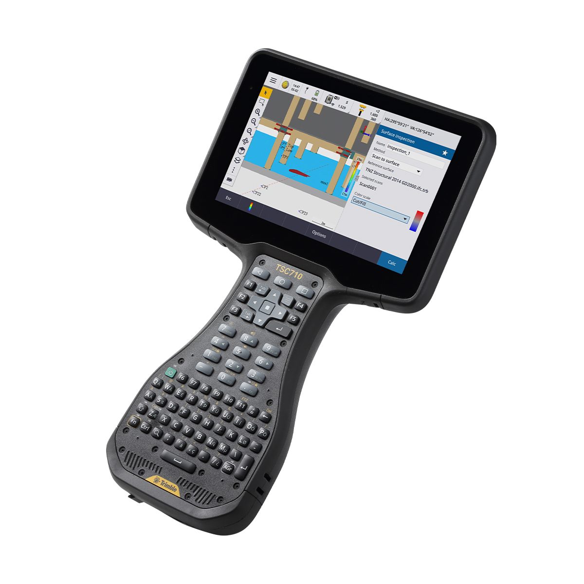
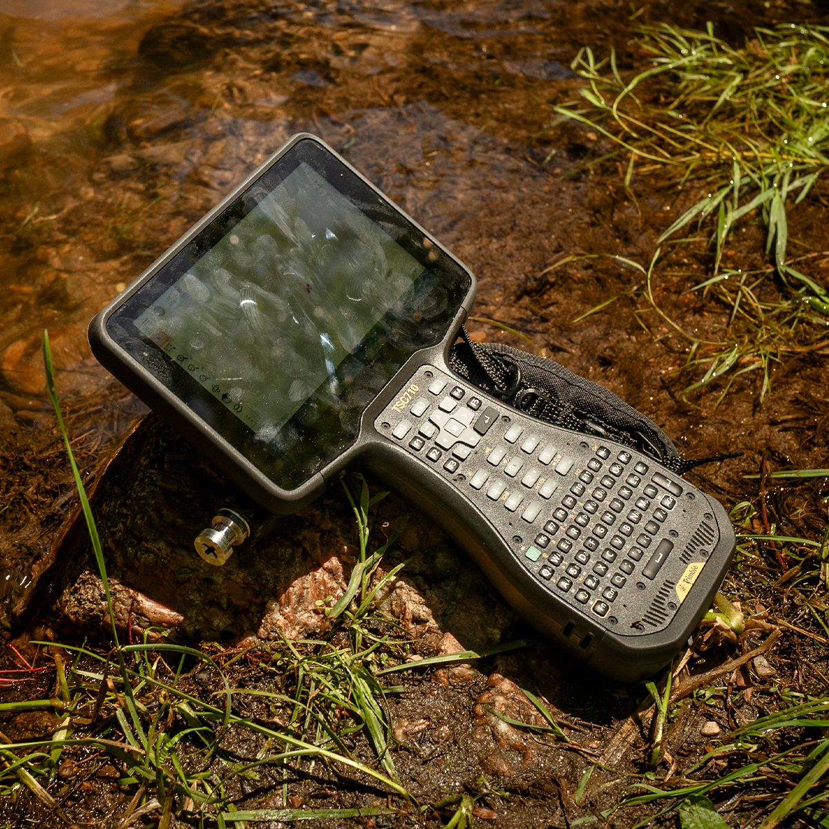
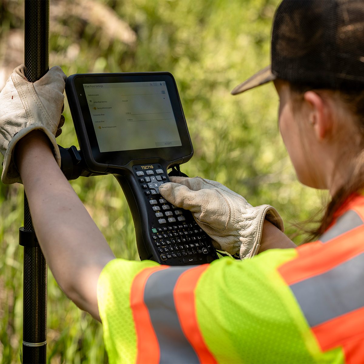
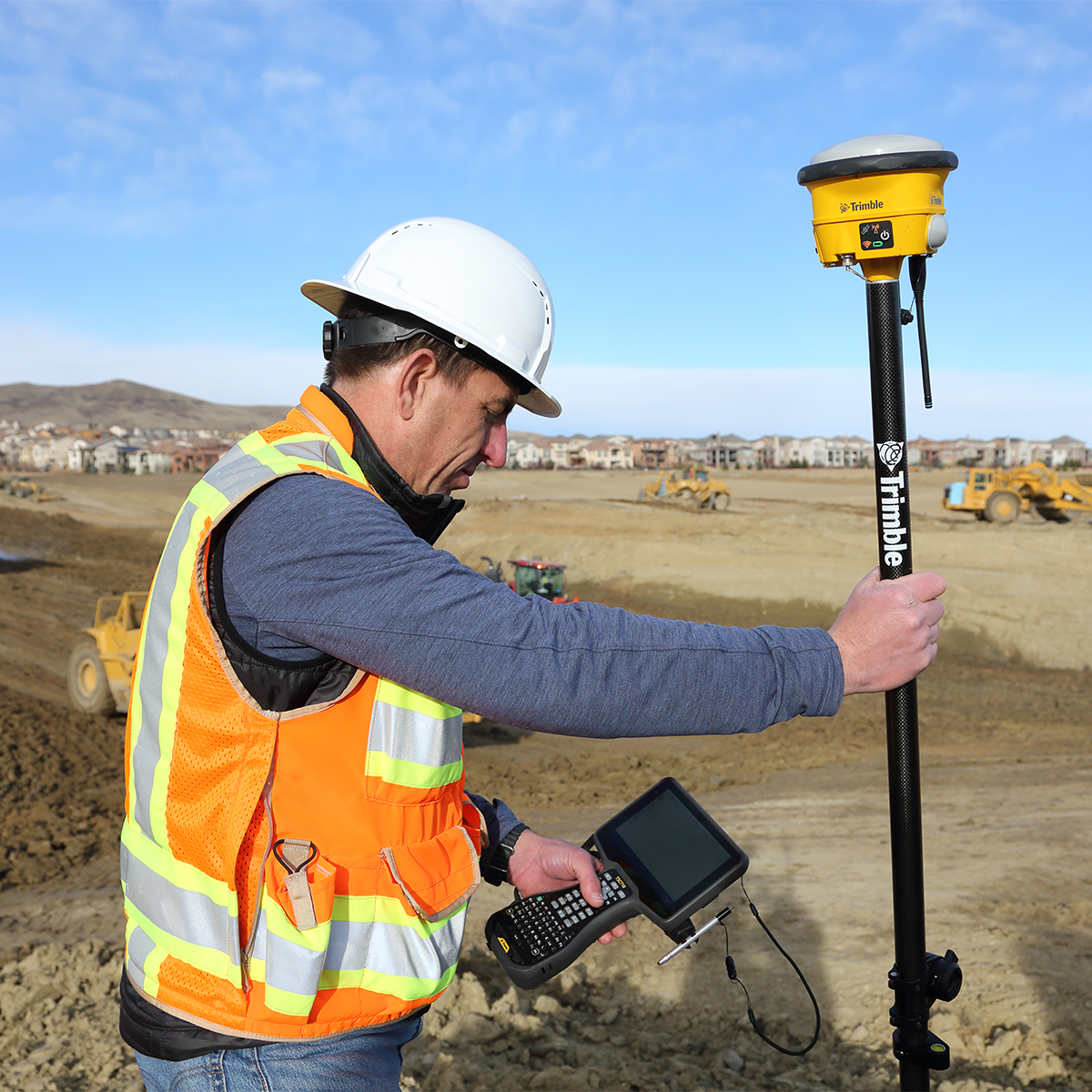
Trimble TSC710-1-1100-00-HH TSC710 Heavy Civil Construction Controller
Call for Price


Trimble TSC710-1-1100-00-HH TSC710 Heavy Civil Construction Controller
Call for PriceONLY AVAILABLE FOR DELIVERY IN ND, SD, MN, CO, AK, MT, ID, HI, WY, OR, & WA.
Trimble TSC710-1-1100-00-HH TSC710 Heavy Civil Construction Controller
Connect to a Better Way to Work
The Trimble® TSC710 controller boosts your performance with more memory and power. Its 7-inch screen, full keyboard and robust processing in a compact design ensure seamless field-to-office connectivity with versatile communication capabilities.Quick View -
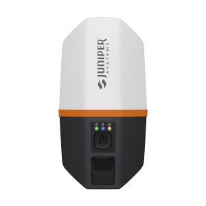
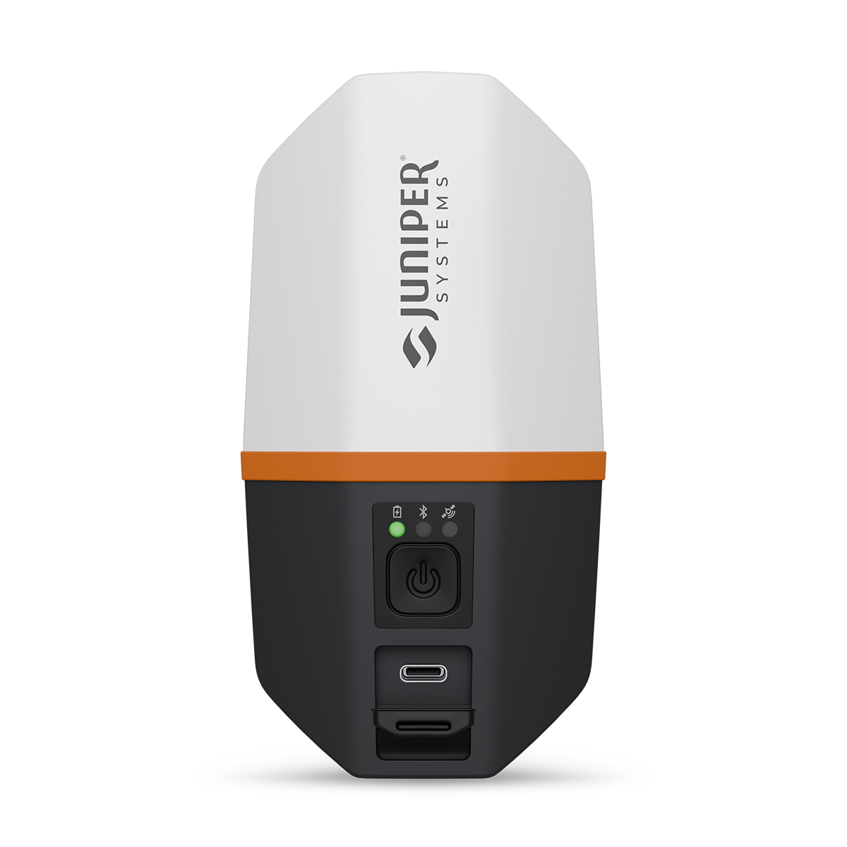
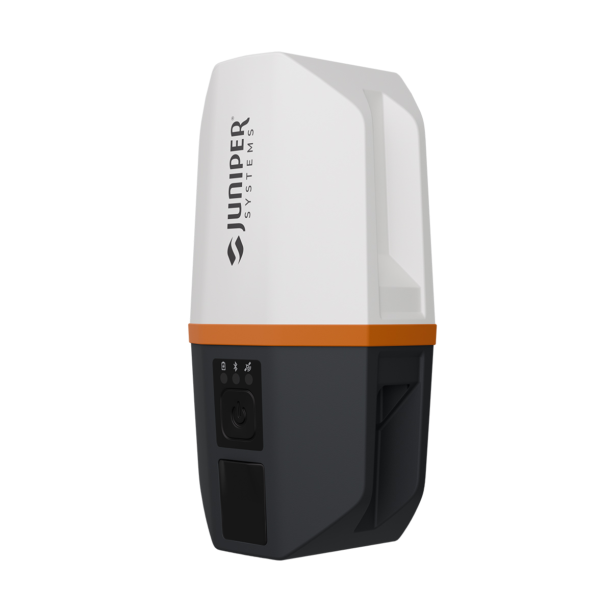
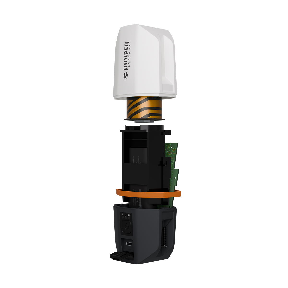
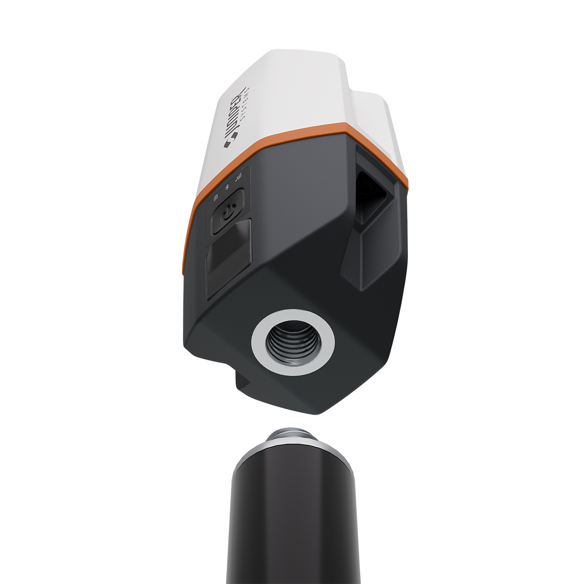
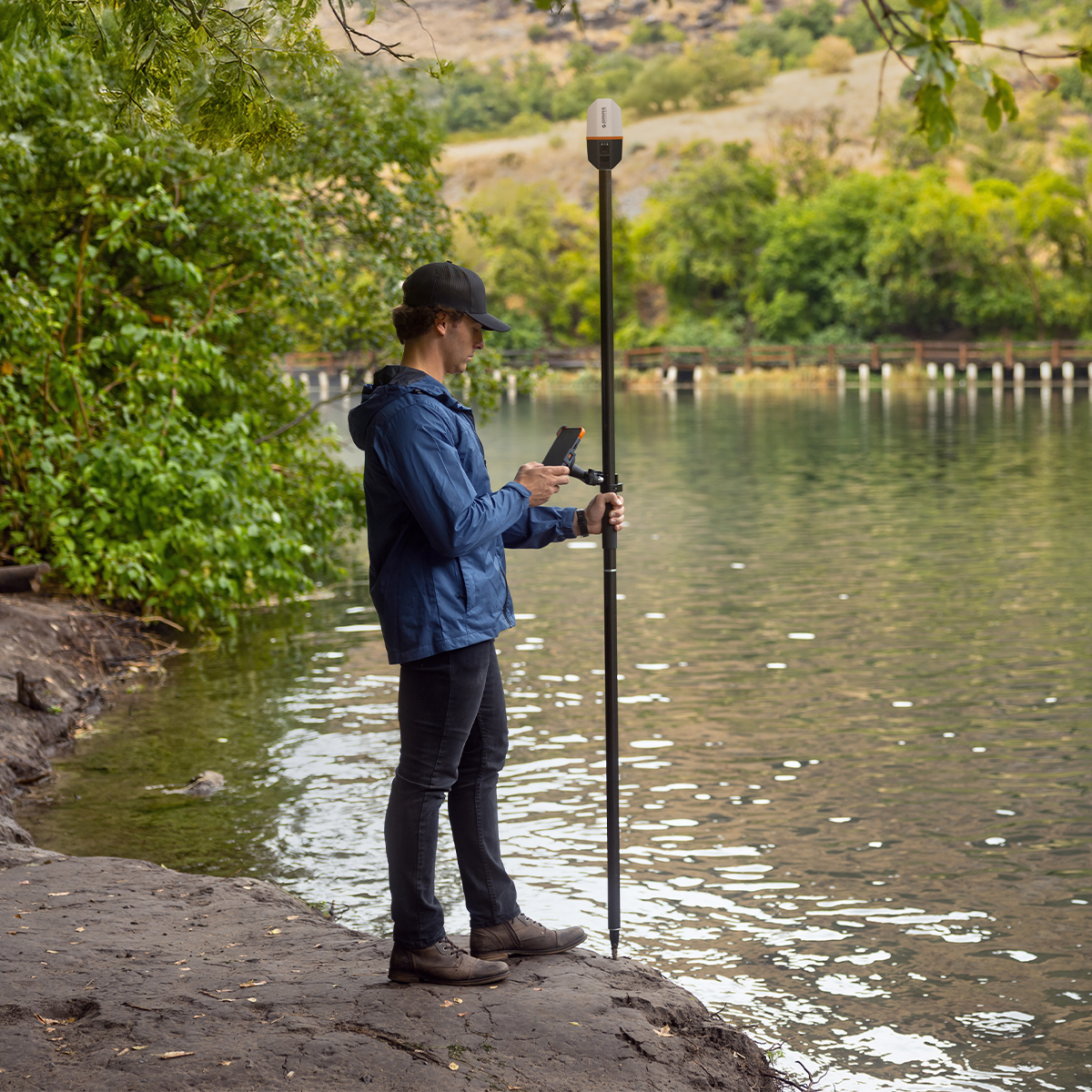
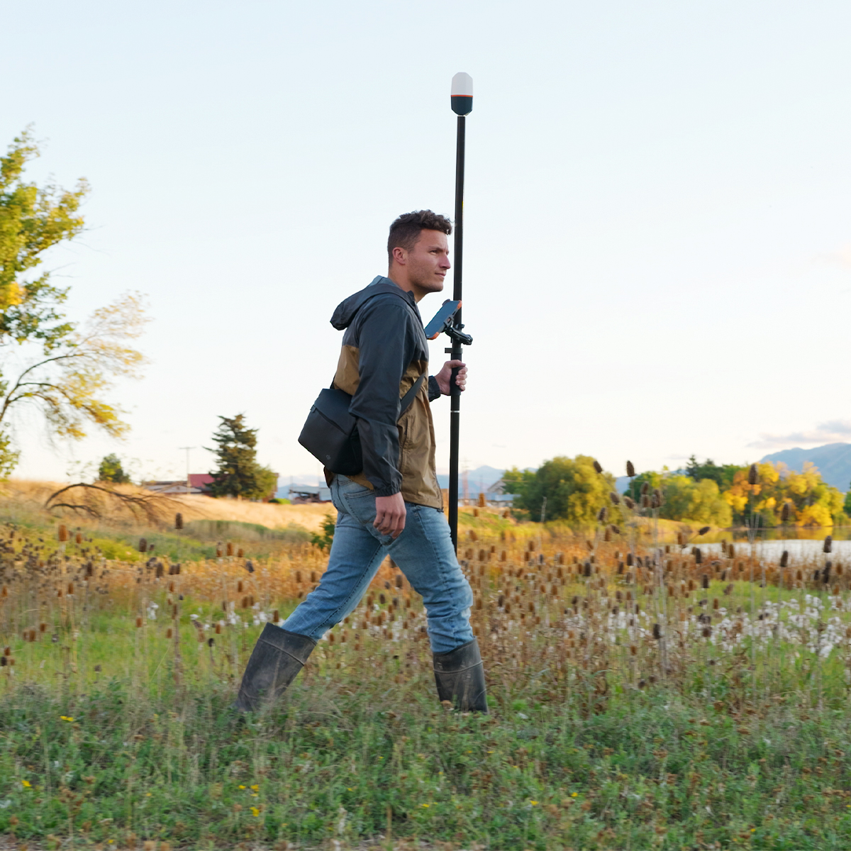
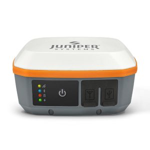
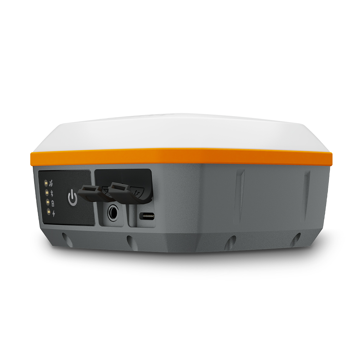
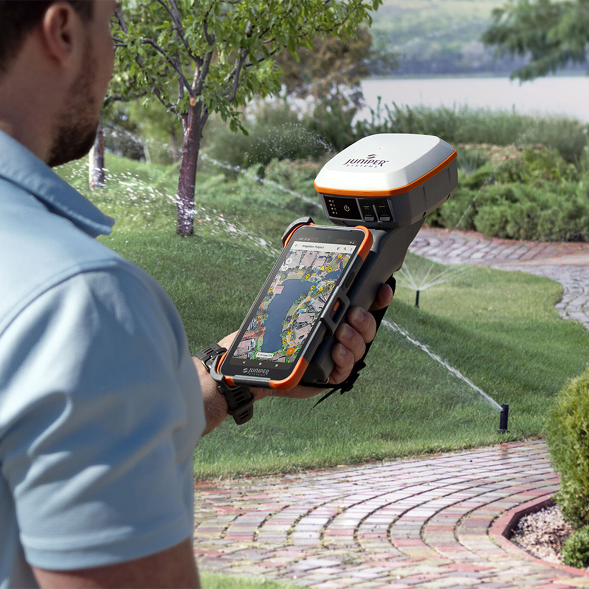
Juniper Systems Spire SP1-CFG(1457) Real-time Ready Receiver
Call for Price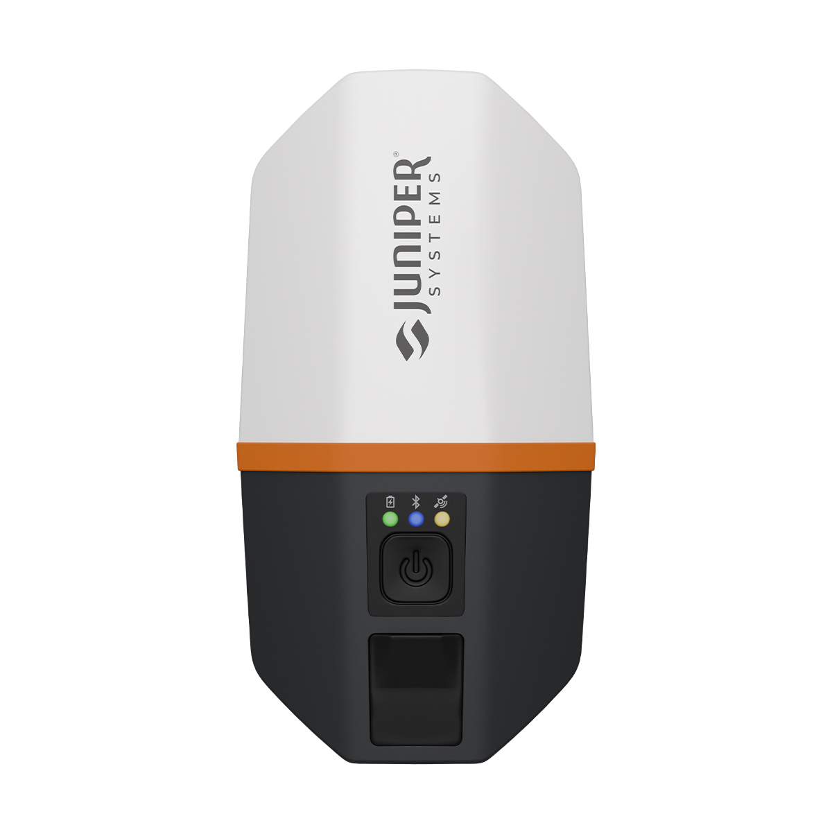

Juniper Systems Spire SP1-CFG(1457) Real-time Ready Receiver
Call for PriceACCEPTING PRE-ORDERS NOW!
Juniper Systems Spire SP1-CFG(1457) Real-time Ready Receiver
Our newest GNSS receiver simplifies location data collection.
Achieve high-accuracy results with a light, compact design, one-button operation and the corrections services you need right out of the box. Built for rugged environments and long workdays, it offers seamless integration with mobile devices and data collection apps, making it a reliable companion for all GIS and asset mapping applications. It just works.Quick View -

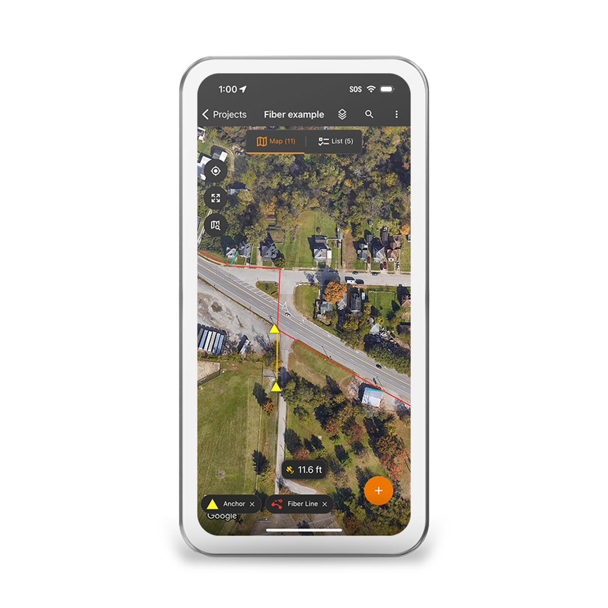
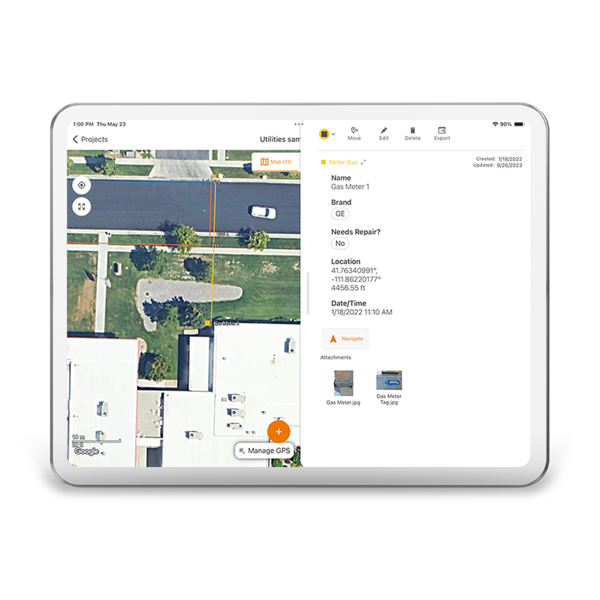
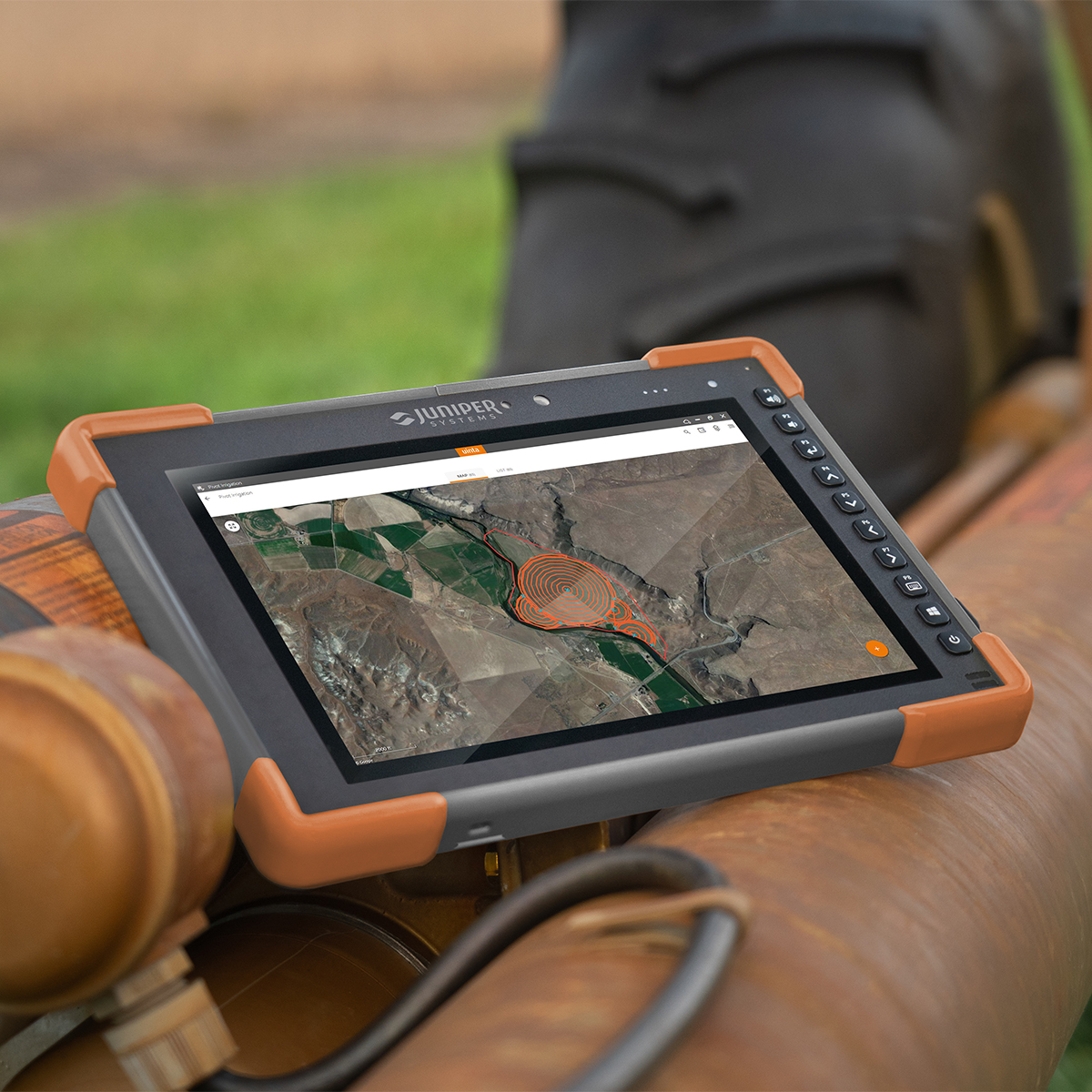
Juniper Systems Uinta 29117 Software (1-Year) – Windows 10 Professional License
Call for Price

Juniper Systems Uinta 29117 Software (1-Year) – Windows 10 Professional License
Call for PriceJuniper Systems Uinta 29117 Software (1-Year) – Windows 10 Professional License
Your Data. Your Way.
With Uinta, field data collection has never been easier. Our intuitive software allows users to effortlessly gather accurate data using customizable forms and real-time GPS integration ensures that your data is not only accurately mapped but also easily accessible for further analysis and reporting. Whether you are conducting environmental surveys, managing assets, or performing inspections, Uinta’s user-friendly interface helps you capture critical information quickly and accurately. The software supports a wide range of data types, including text, photos, and geospatial coordinates, making it versatile enough to handle any project. Cloud storage back-up allows you to save your data in a more accessible place, and when you are offline, Uinta saves your data locally and will upload once connection is reestablished.
Quick View -
Juniper Systems Uinta 29118 Software (3-Year) – License
Call for Price Juniper Systems Uinta 29118 Software (3-Year) – License
Call for PriceJuniper Systems Uinta 29118 Software (3-Year) – License
Your Data. Your Way.
With Uinta, field data collection has never been easier. Our intuitive software allows users to effortlessly gather accurate data using customizable forms and real-time GPS integration ensures that your data is not only accurately mapped but also easily accessible for further analysis and reporting. Whether you are conducting environmental surveys, managing assets, or performing inspections, Uinta’s user-friendly interface helps you capture critical information quickly and accurately. The software supports a wide range of data types, including text, photos, and geospatial coordinates, making it versatile enough to handle any project. Cloud storage back-up allows you to save your data in a more accessible place, and when you are offline, Uinta saves your data locally and will upload once connection is reestablished.Quick View -
Juniper Systems Uinta 29119 Software (1-Year) – Extra Field License
Call for Price Juniper Systems Uinta 29119 Software (1-Year) – Extra Field License
Call for PriceJuniper Systems Uinta 29119 Software (1-Year) – Extra Field License
Your Data. Your Way.
With Uinta, field data collection has never been easier. Our intuitive software allows users to effortlessly gather accurate data using customizable forms and real-time GPS integration ensures that your data is not only accurately mapped but also easily accessible for further analysis and reporting. Whether you are conducting environmental surveys, managing assets, or performing inspections, Uinta’s user-friendly interface helps you capture critical information quickly and accurately. The software supports a wide range of data types, including text, photos, and geospatial coordinates, making it versatile enough to handle any project. Cloud storage back-up allows you to save your data in a more accessible place, and when you are offline, Uinta saves your data locally and will upload once connection is reestablished.
Quick View -
Juniper Systems Uinta 29120 Software (3-Year) – Professional License
Call for Price Juniper Systems Uinta 29120 Software (3-Year) – Professional License
Call for PriceJuniper Systems Uinta 29120 Software (3-Year) – Professional License
Your Data. Your Way.
With Uinta, field data collection has never been easier. Our intuitive software allows users to effortlessly gather accurate data using customizable forms and real-time GPS integration ensures that your data is not only accurately mapped but also easily accessible for further analysis and reporting. Whether you are conducting environmental surveys, managing assets, or performing inspections, Uinta’s user-friendly interface helps you capture critical information quickly and accurately. The software supports a wide range of data types, including text, photos, and geospatial coordinates, making it versatile enough to handle any project. Cloud storage back-up allows you to save your data in a more accessible place, and when you are offline, Uinta saves your data locally and will upload once connection is reestablished.
Quick View -
Juniper Systems Geode GNS3H-CFG(13759) Single-Frequency Antenna Model Receiver
Call for Price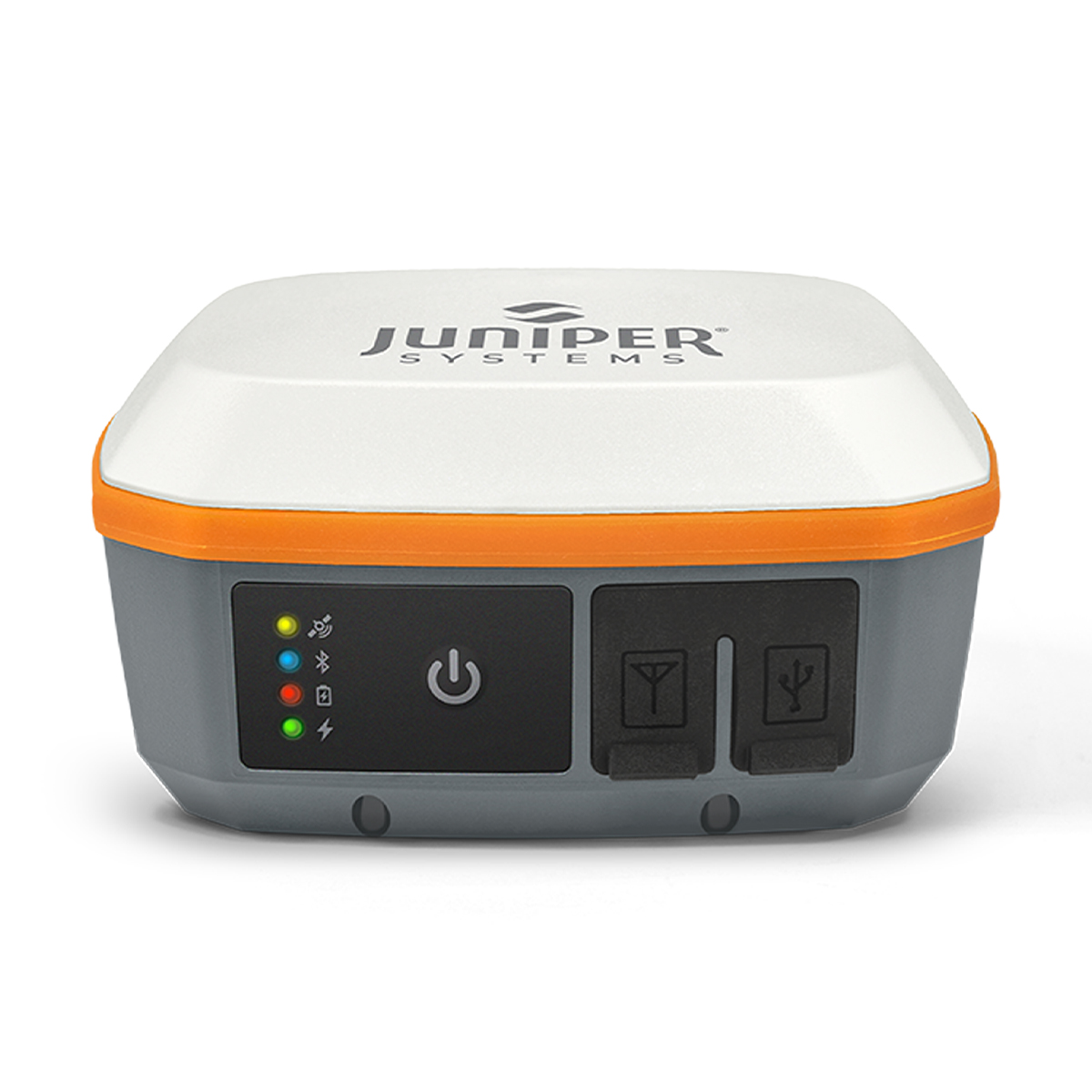
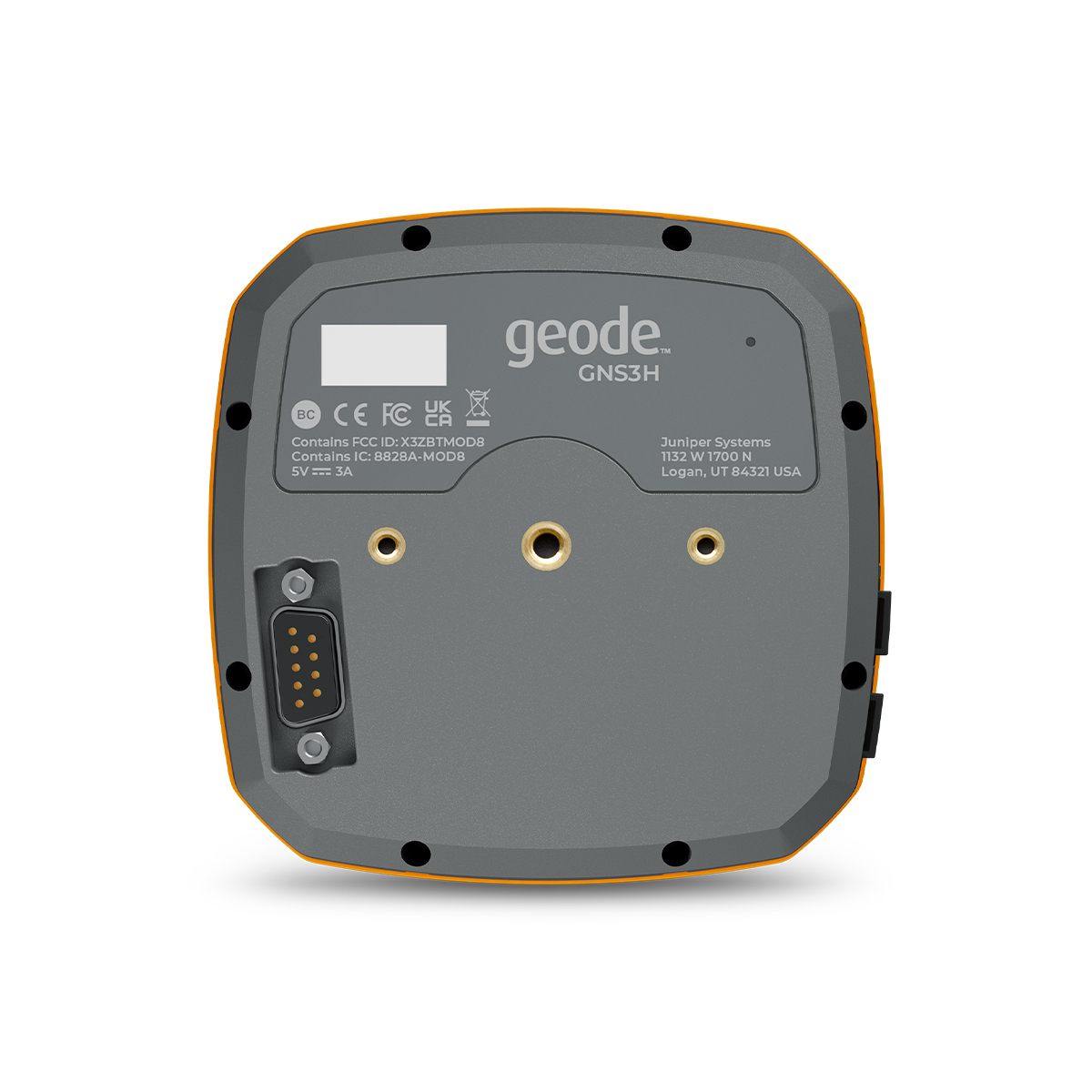
Juniper Systems Geode GNS3H-CFG(13759) Single-Frequency Antenna Model Receiver
Call for PriceQuick View -
New!

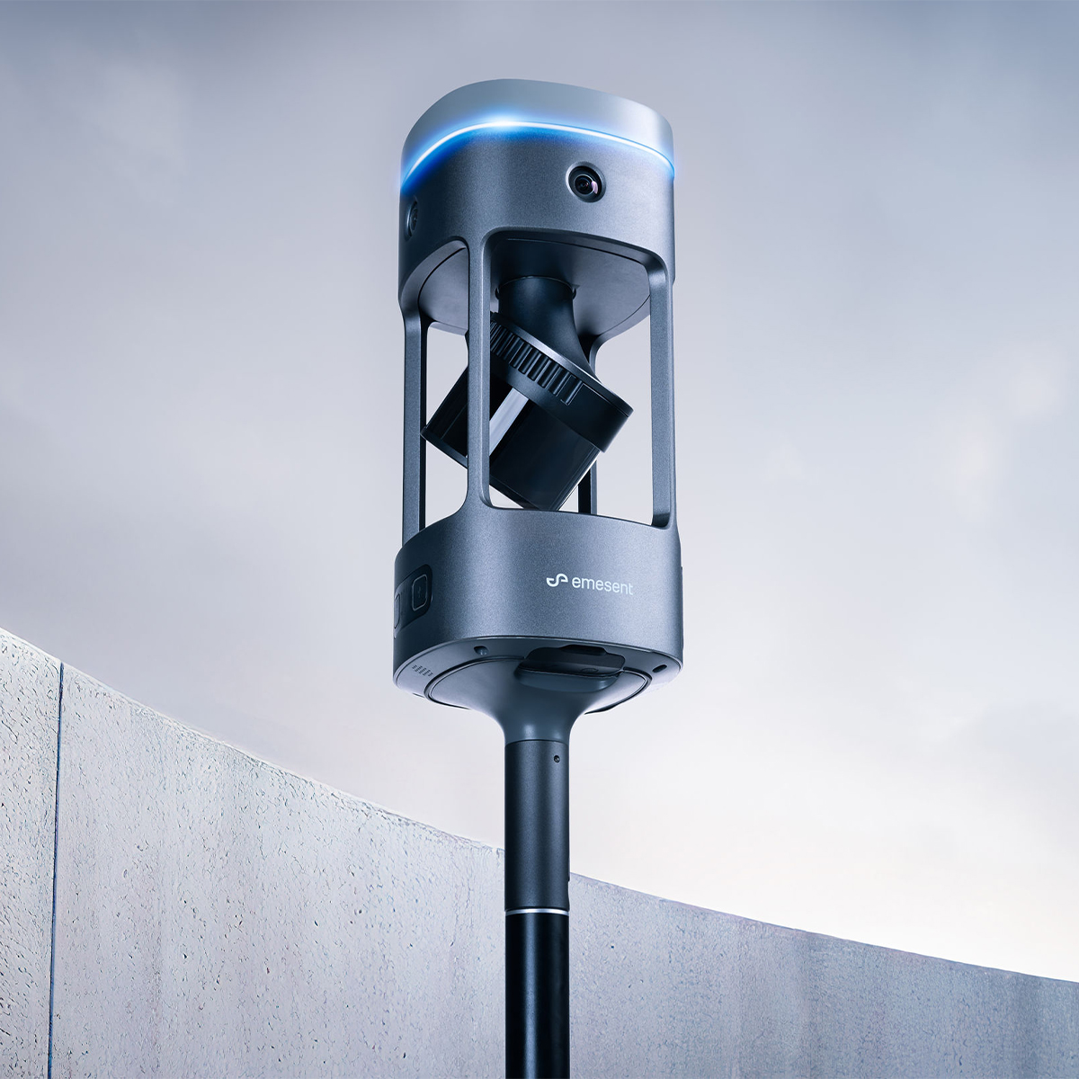
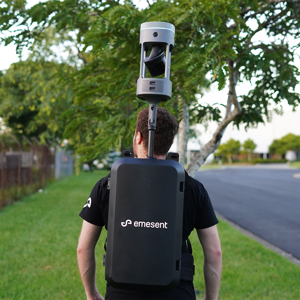
Emesent E00-GX1 RTK SLAM Scanner
Call for Price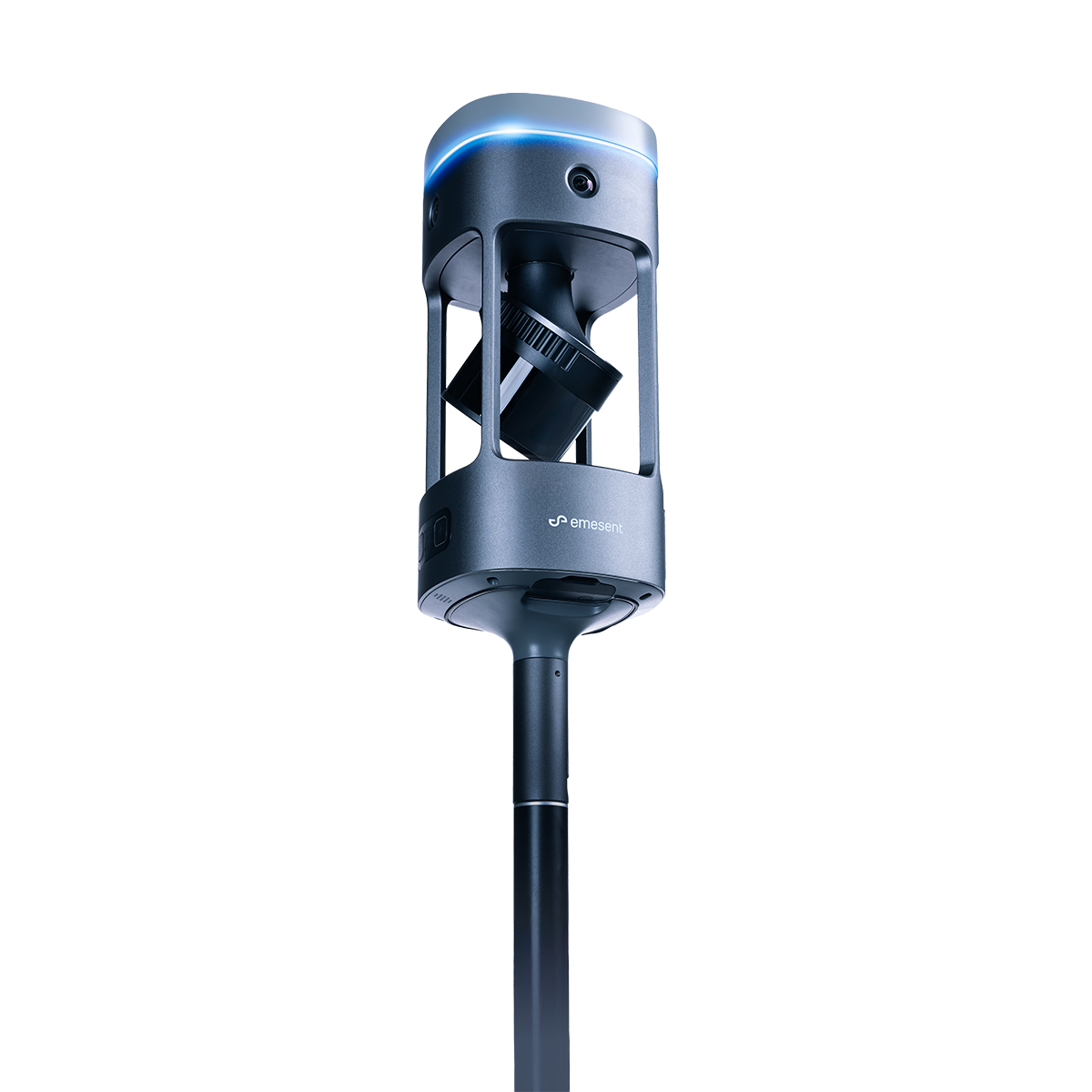


Emesent E00-GX1 RTK SLAM Scanner
Call for PriceEmesent E00-GX1 RTK SLAM Scanner
Reliable, highly accurate SLAM that works in any environment.
Emesent GX1 is the world’s most accurate RTK SLAM scanner, delivering 5-10mm global accuracy with integrated premium RTK georeferencing.Quick View