")
LEADING THE WAY IN TECHNOLOGY SINCE 1988


SHOP SOLUTIONS
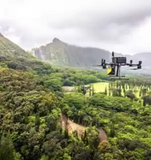
UNMANNED
Every place is in reach with our unmanned solutions.
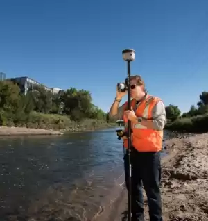
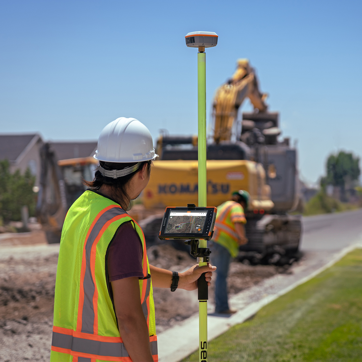
GEOSPATIAL
Accurately collecting data – geographically & topographically.

UNDERGROUND UTILITIES
Damaging buried utilities can be both expensive and dangerous.
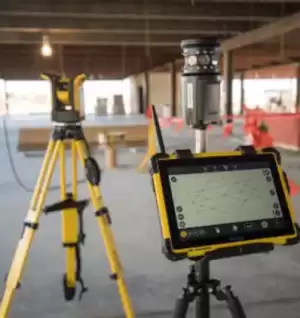
BUILDING CONSTRUCTION
At Frontier Precision, we’re constructing a smarter way to measure.

SOFTWARE & SERVICES
Providing accurate & efficient solutions with confidence.
FEATURED PRODUCTS
Filter By
Showing 217–234 of 687 results
-

Juniper GIS/Survey Pole Adapter 1/4 x 20 to 5/8 x 11
Call for Price

Juniper GIS/Survey Pole Adapter 1/4 x 20 to 5/8 x 11
Call for PriceQuick View -

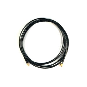
Juniper Systems Archer 2/Archer 3/Geode 26319 Single Frequency GNSS Antenna Kit
Call for Price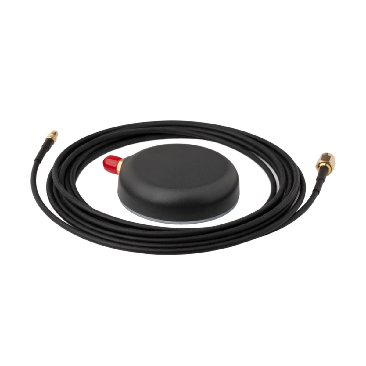

Juniper Systems Archer 2/Archer 3/Geode 26319 Single Frequency GNSS Antenna Kit
Call for PriceThe Archer 2/Archer 3/Geode Single Frequency GNSS Antenna Kit (26319) includes both the Single Frequency External Antenna, SMA Connector (26458) and Archer 2/Archer 3/Geode SMA to Straight MCX 10-ft Cable (26461).
Quick View -
Juniper Systems Archer 2/Archer 3/Geode 26461 SMA to Straight MCX 10-ft Cable
Call for Price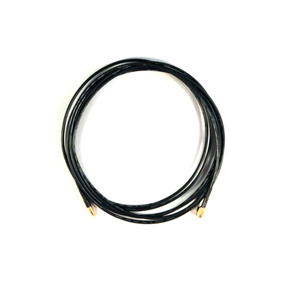
Juniper Systems Archer 2/Archer 3/Geode 26461 SMA to Straight MCX 10-ft Cable
Call for PriceThe Archer 2/Archer 3/Geode SMA to Straight MCX 10-ft Cable (26461) connects your Archer or Geode device to the Single Frequency GNSS Antenna, SMA Connector (26458). Replacement 10ft cable for the Geode Single Frequency GNSS Antenna Kit (26319).
Quick View -
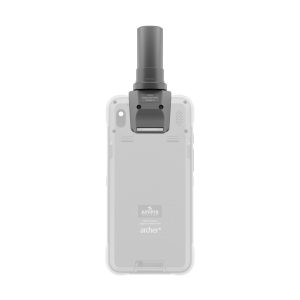
Juniper Systems Archer 4 30770 GNSS Expansion Pod
Call for Price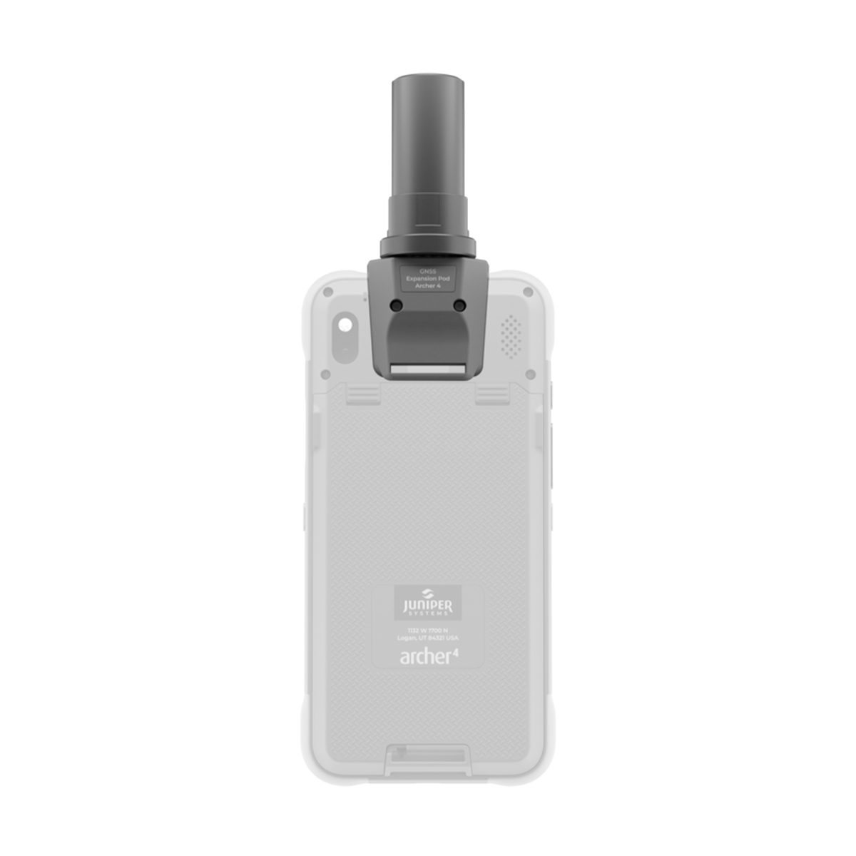
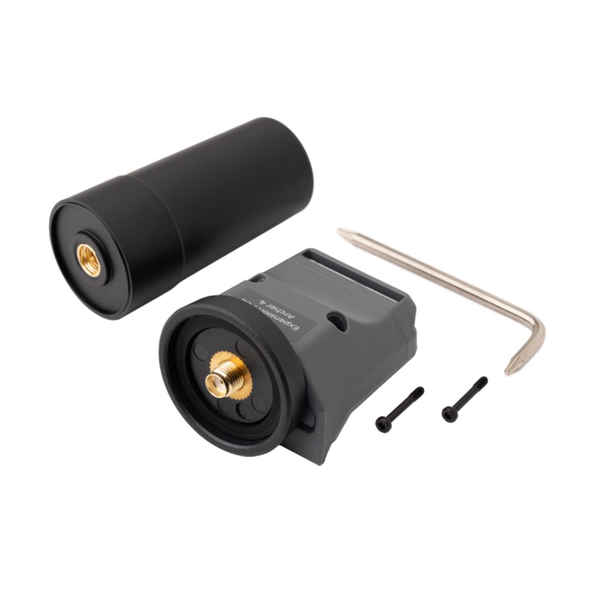
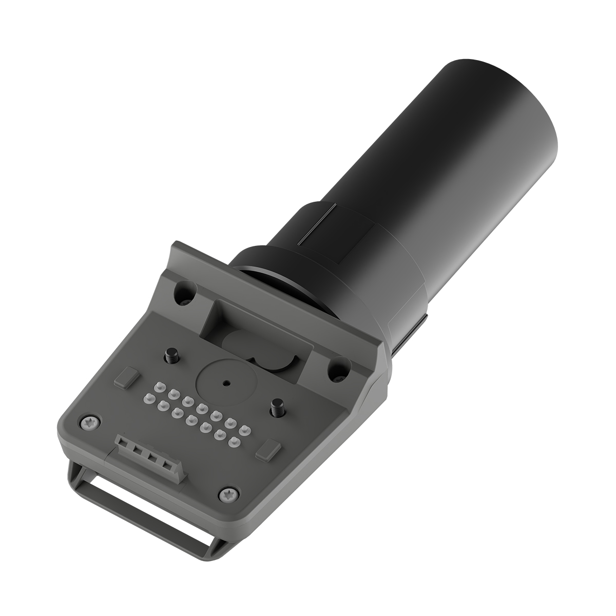

Juniper Systems Archer 4 30770 GNSS Expansion Pod
Call for PriceArcher 4 GNSS Expansion Pod
Ublox F9P receiver + helical antenna provides scalable accuracy from sub-meter (hardware only) to 2-3 centimeter (with subscription and RTK network connection).
Quick View -

Juniper Systems Archer 4 Android AR4-103 GNSS Expansion Pod Rugged Handheld
Call for Price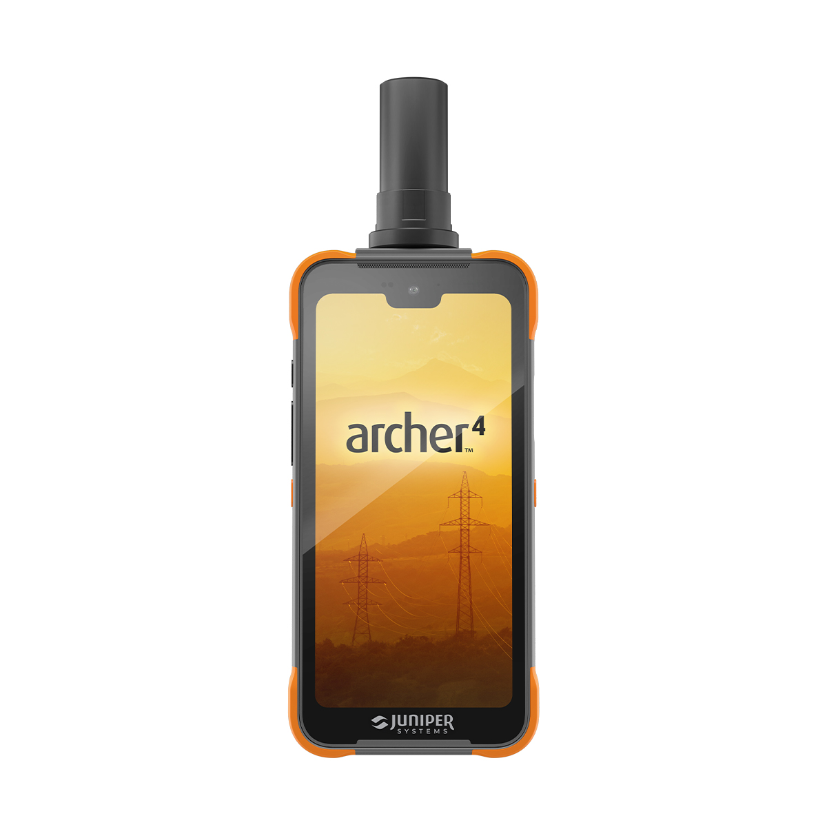
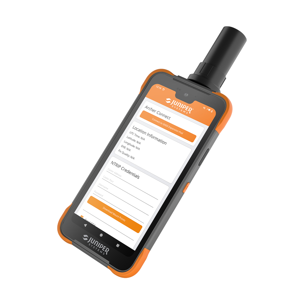
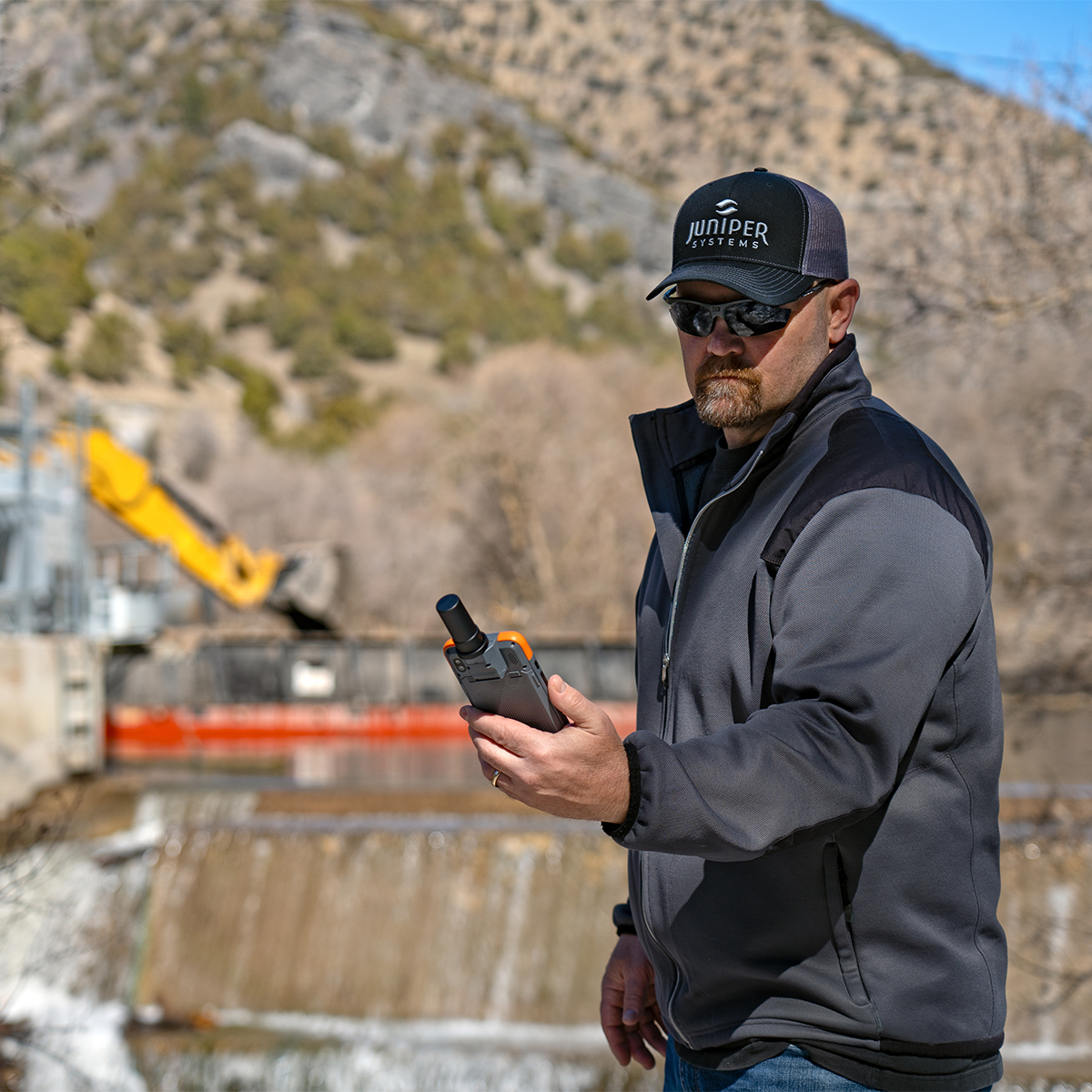
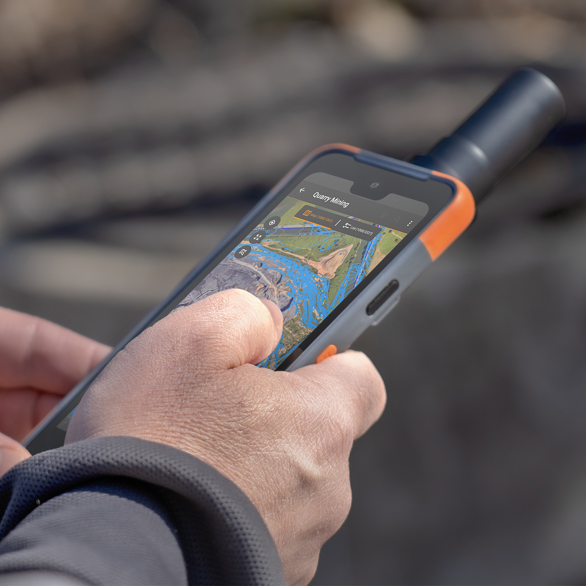
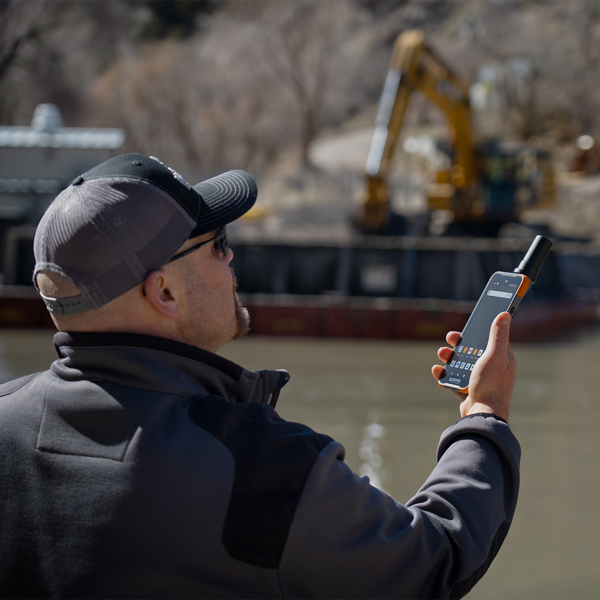
Juniper Systems Archer 4 Android AR4-103 GNSS Expansion Pod Rugged Handheld
Call for PriceDesigned to work. Built to last.
The Archer 4 Rugged Handheld is the latest release in the Archer family of products and is an exciting new platform for today’s mobile data collection. Its power-efficient Qualcomm processor, Android 14 operating system, and ultra-rugged ergonomic design combine to offer users a versatile option for frequent data entry.Quick View -
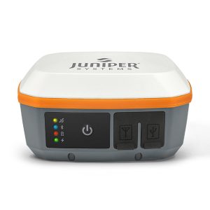
Juniper Systems Geode GNS3H-CFG(13759) Single-Frequency Antenna Model Receiver
Call for Price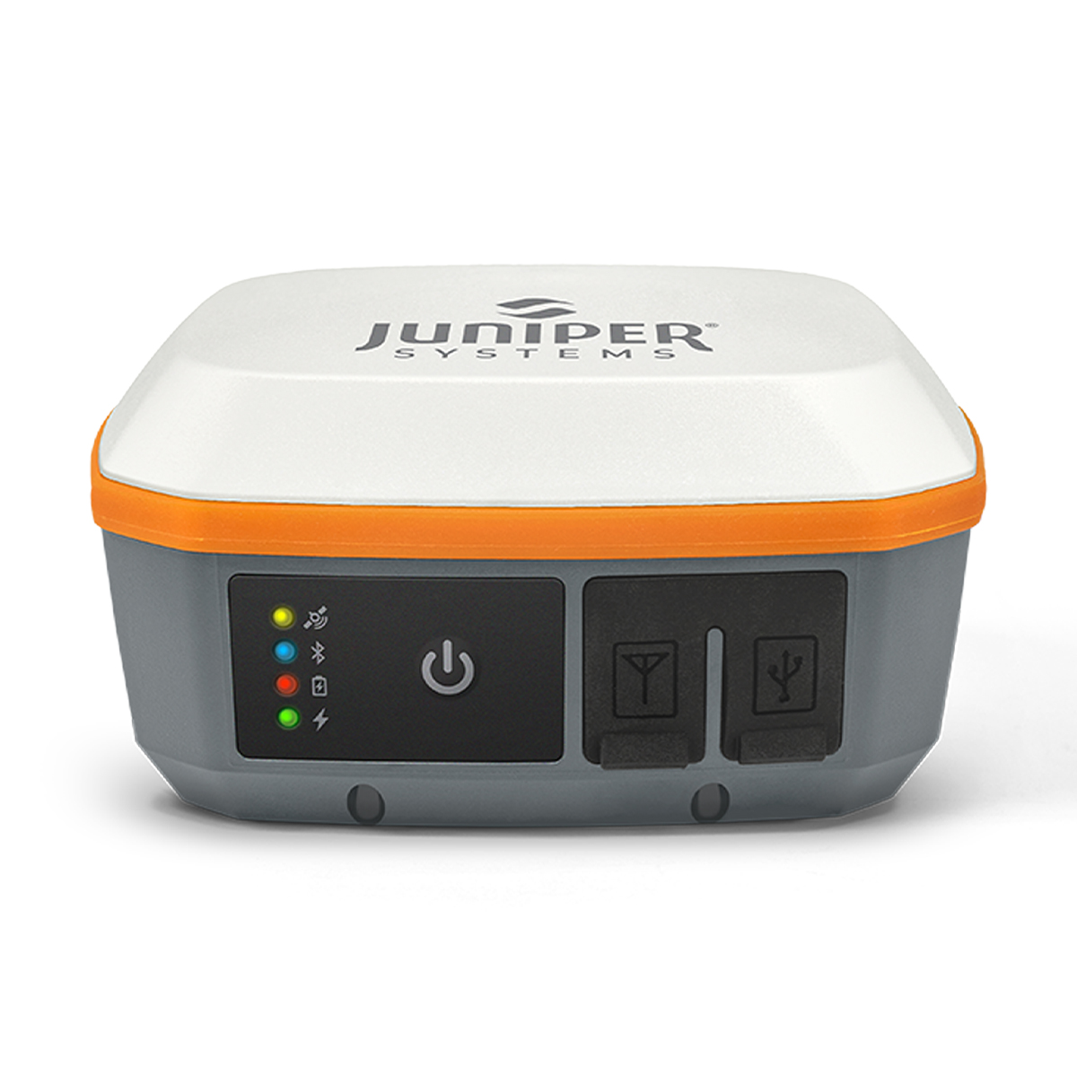
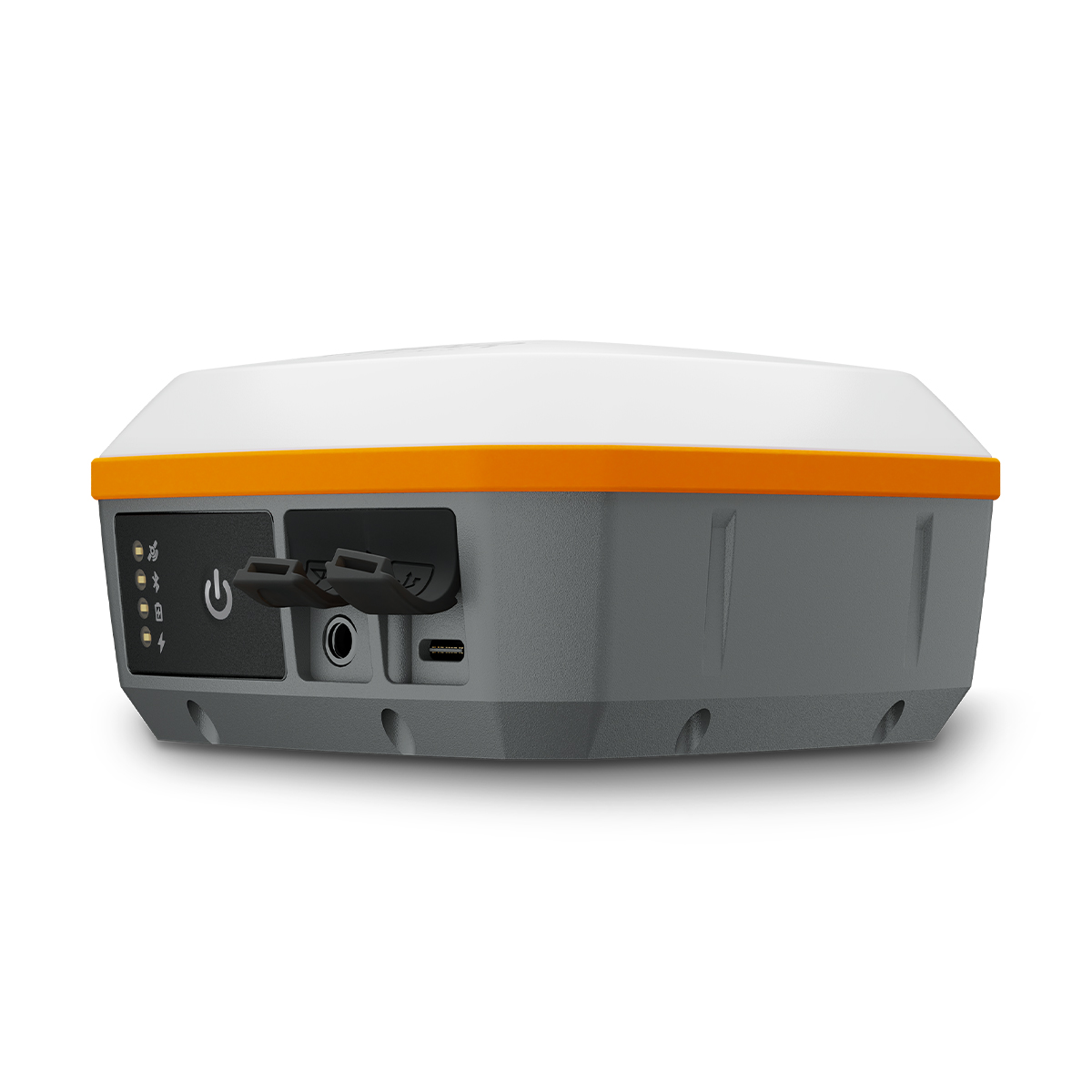
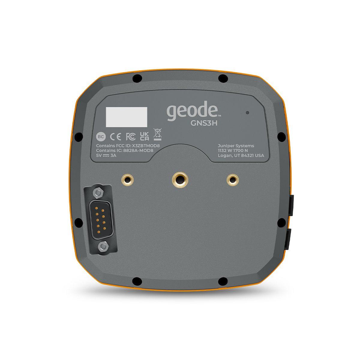
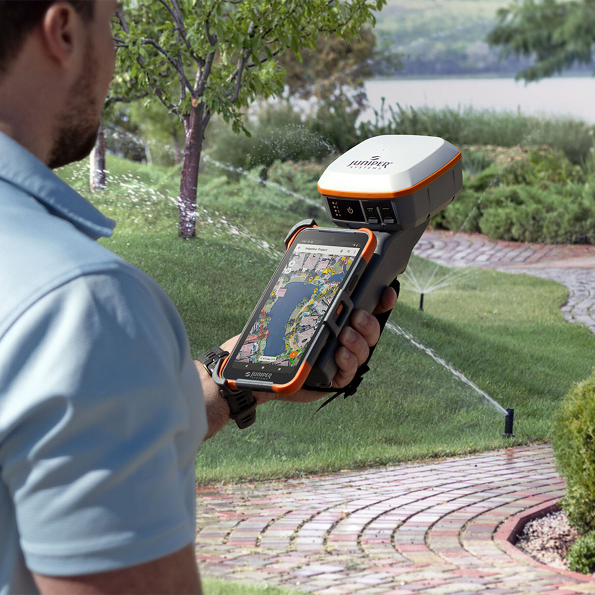
Juniper Systems Geode GNS3H-CFG(13759) Single-Frequency Antenna Model Receiver
Call for PriceQuick View -
Juniper Systems Geode GNS3S-CFG (13817) Single-Frequency Antenna Model Receiver
Call for Price Juniper Systems Geode GNS3S-CFG (13817) Single-Frequency Antenna Model Receiver
Call for PriceYour location, our solution.
With Geode GNSS Receivers, users can easily collect real-time GNSS data with sub-meter, sub-foot, decimeter and centimeter accuracy options. Now you can achieve professional-grade mapping RTK, whether you are a professional or just getting started. Here’s your answer to GNSS data without the huge price tag or complexity of other precision receivers.Quick View -

Juniper Systems Mesa 2 Four-point Harness
Call for Price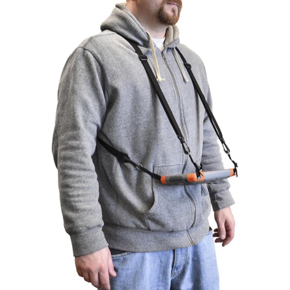
Juniper Systems Mesa 2 Four-point Harness
Call for PriceQuick View -
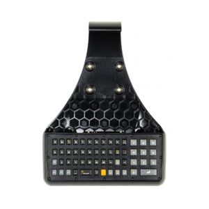
Juniper Systems Mesa 2 Rugged Attachable Keyboard
Call for Price

Juniper Systems Mesa 2 Rugged Attachable Keyboard
Call for PriceQuick View -

Juniper Systems Mesa 25414 7-inch Mounting Bracket
Call for Price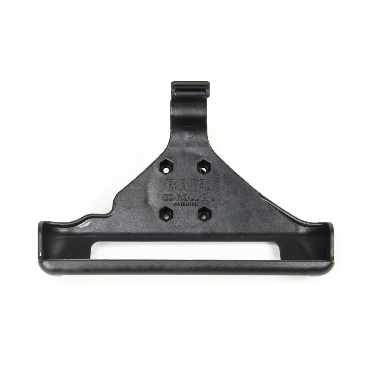
Juniper Systems Mesa 25414 7-inch Mounting Bracket
Call for PriceThe Mesa 7-inch Mounting Bracket (25414) securely grips your Mesa to enable the device to be mounted to a variety of RAM® attachments. Features a RAM® 1.5-inch ball socket. Uses AMPS hole pattern.
Quick View -

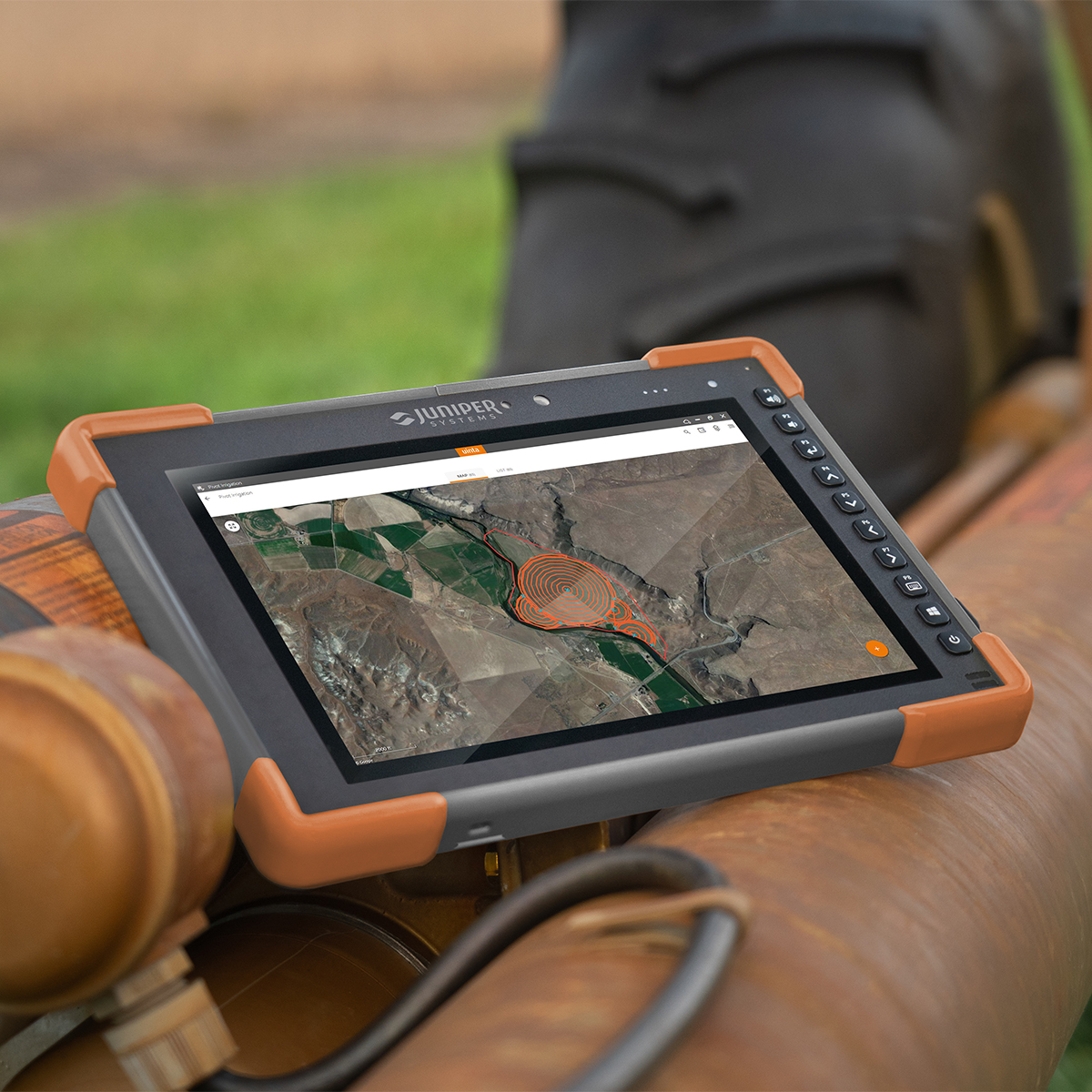
Juniper Systems Mesa 4 MS4-CFG-18340 Rugged Tablet Computer
Call for Price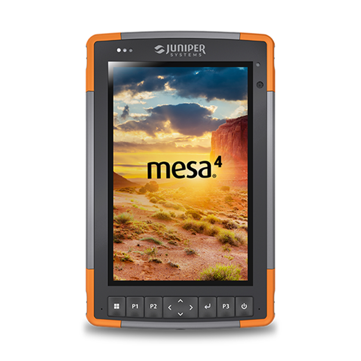
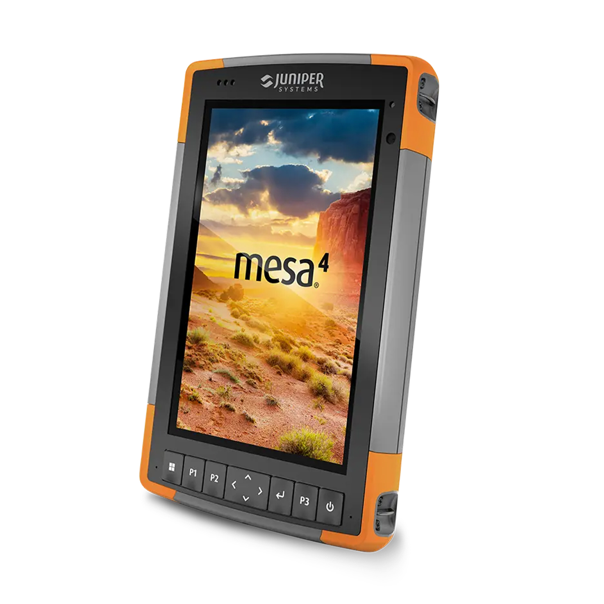
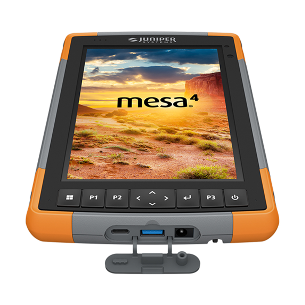
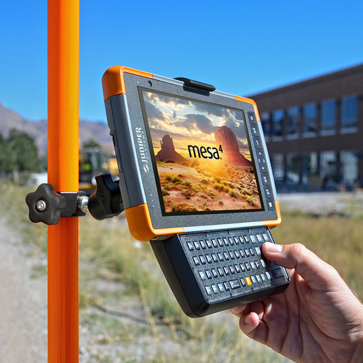
Juniper Systems Mesa 4 MS4-CFG-18340 Rugged Tablet Computer
Call for PriceYour office, anywhere.
The Mesa 4 Rugged Tablet running Windows 11 offers powerful new functionality while retaining impressive features from the popular Mesa 3 Rugged Tablet. Its latest generation Intel® processor is ready to run even the most demanding field data collection applications, and its rugged ergonomic design is ready to handle a long day on the job in some of the harshest environments out there.Quick View -
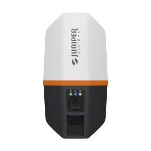
Juniper Systems Spire SP1-CFG(1457) Real-time Ready Receiver
Call for Price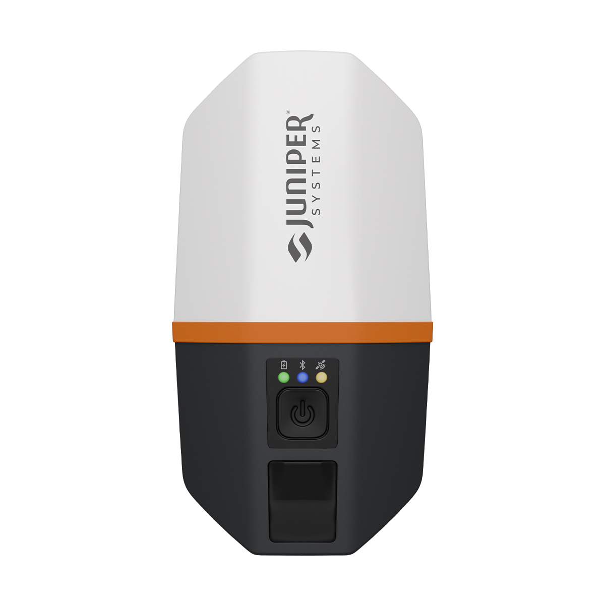
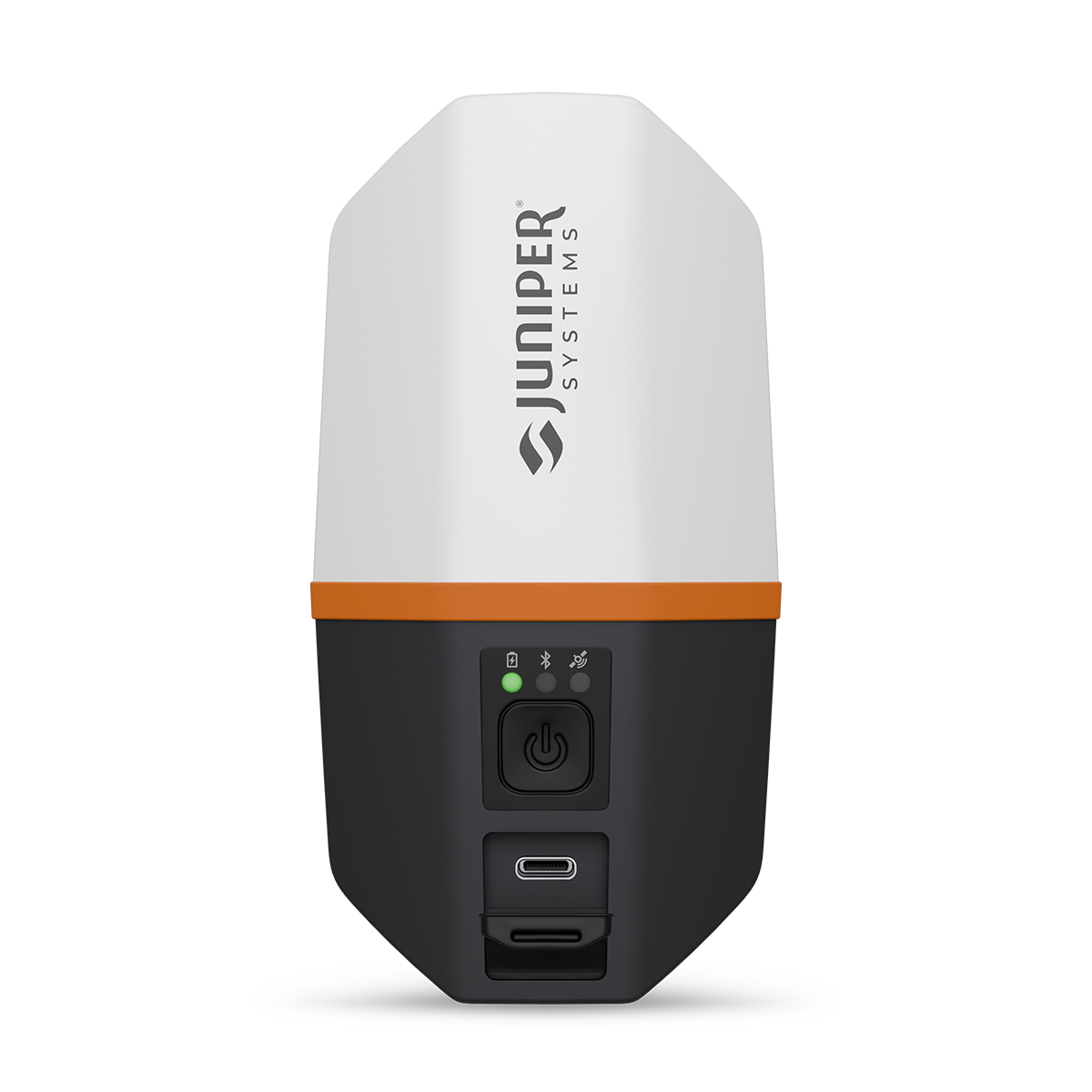
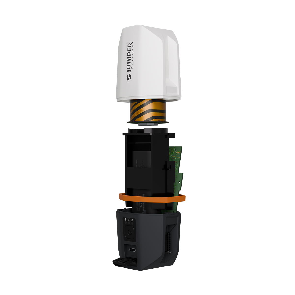
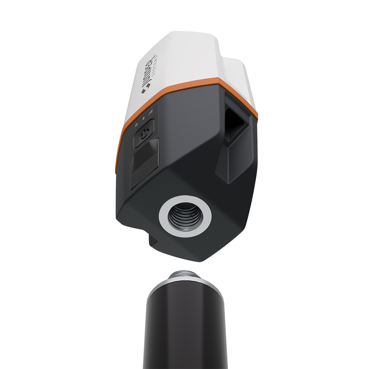
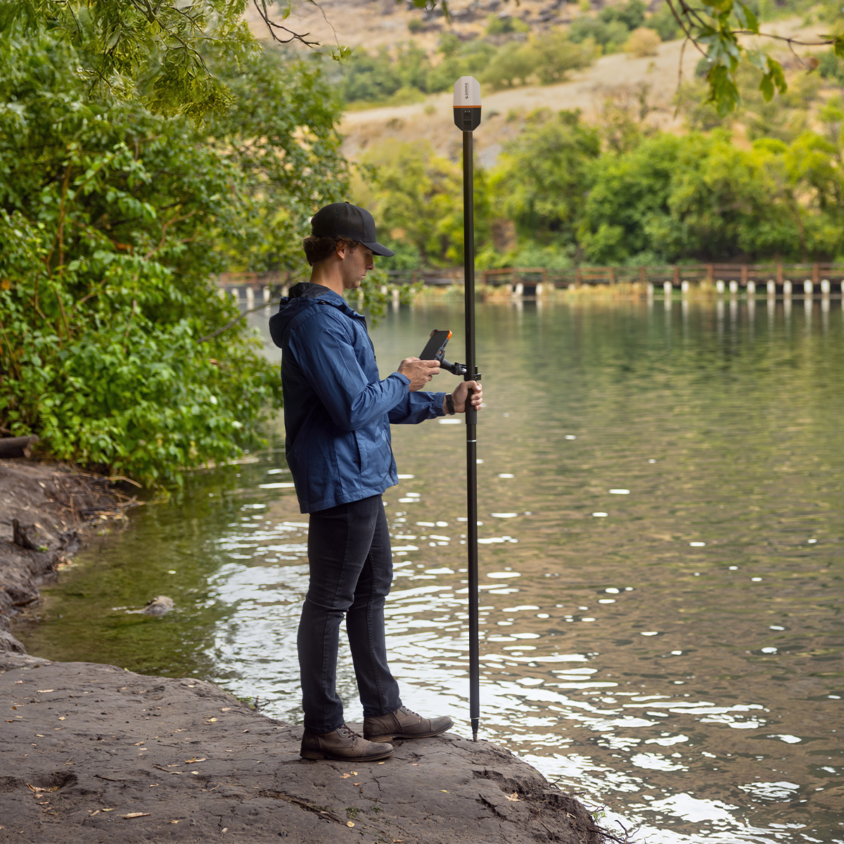
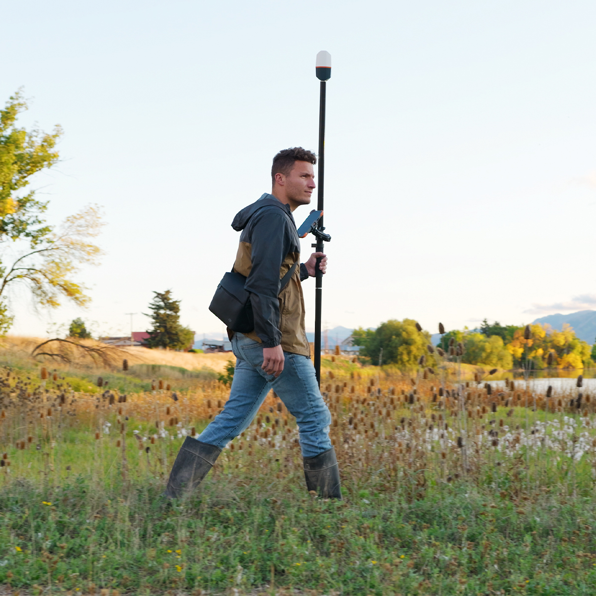
Juniper Systems Spire SP1-CFG(1457) Real-time Ready Receiver
Call for PriceACCEPTING PRE-ORDERS NOW!
Juniper Systems Spire SP1-CFG(1457) Real-time Ready Receiver
Our newest GNSS receiver simplifies location data collection.
Achieve high-accuracy results with a light, compact design, one-button operation and the corrections services you need right out of the box. Built for rugged environments and long workdays, it offers seamless integration with mobile devices and data collection apps, making it a reliable companion for all GIS and asset mapping applications. It just works.Quick View -

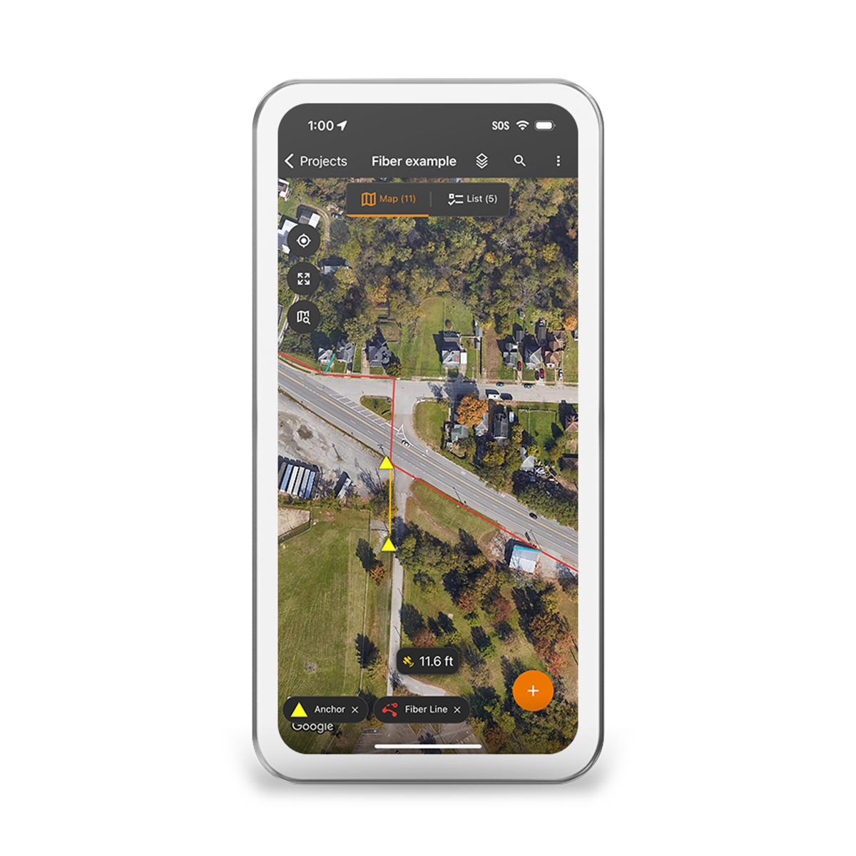
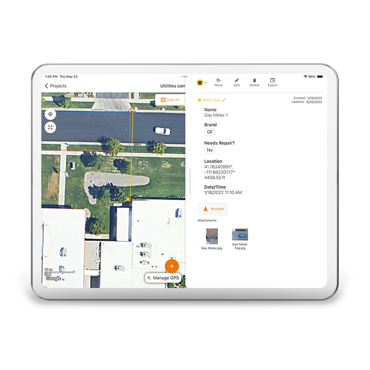
Juniper Systems Uinta 29117 Software (1-Year) – Windows 10 Professional License
Call for Price
Juniper Systems Uinta 29117 Software (1-Year) – Windows 10 Professional License
Call for PriceJuniper Systems Uinta 29117 Software (1-Year) – Windows 10 Professional License
Your Data. Your Way.
With Uinta, field data collection has never been easier. Our intuitive software allows users to effortlessly gather accurate data using customizable forms and real-time GPS integration ensures that your data is not only accurately mapped but also easily accessible for further analysis and reporting. Whether you are conducting environmental surveys, managing assets, or performing inspections, Uinta’s user-friendly interface helps you capture critical information quickly and accurately. The software supports a wide range of data types, including text, photos, and geospatial coordinates, making it versatile enough to handle any project. Cloud storage back-up allows you to save your data in a more accessible place, and when you are offline, Uinta saves your data locally and will upload once connection is reestablished.
Quick View -
Juniper Systems Uinta 29118 Software (3-Year) – License
Call for Price Juniper Systems Uinta 29118 Software (3-Year) – License
Call for PriceJuniper Systems Uinta 29118 Software (3-Year) – License
Your Data. Your Way.
With Uinta, field data collection has never been easier. Our intuitive software allows users to effortlessly gather accurate data using customizable forms and real-time GPS integration ensures that your data is not only accurately mapped but also easily accessible for further analysis and reporting. Whether you are conducting environmental surveys, managing assets, or performing inspections, Uinta’s user-friendly interface helps you capture critical information quickly and accurately. The software supports a wide range of data types, including text, photos, and geospatial coordinates, making it versatile enough to handle any project. Cloud storage back-up allows you to save your data in a more accessible place, and when you are offline, Uinta saves your data locally and will upload once connection is reestablished.Quick View -
Juniper Systems Uinta 29119 Software (1-Year) – Extra Field License
Call for Price Juniper Systems Uinta 29119 Software (1-Year) – Extra Field License
Call for PriceJuniper Systems Uinta 29119 Software (1-Year) – Extra Field License
Your Data. Your Way.
With Uinta, field data collection has never been easier. Our intuitive software allows users to effortlessly gather accurate data using customizable forms and real-time GPS integration ensures that your data is not only accurately mapped but also easily accessible for further analysis and reporting. Whether you are conducting environmental surveys, managing assets, or performing inspections, Uinta’s user-friendly interface helps you capture critical information quickly and accurately. The software supports a wide range of data types, including text, photos, and geospatial coordinates, making it versatile enough to handle any project. Cloud storage back-up allows you to save your data in a more accessible place, and when you are offline, Uinta saves your data locally and will upload once connection is reestablished.
Quick View -
Juniper Systems Uinta 29120 Software (3-Year) – Professional License
Call for Price Juniper Systems Uinta 29120 Software (3-Year) – Professional License
Call for PriceJuniper Systems Uinta 29120 Software (3-Year) – Professional License
Your Data. Your Way.
With Uinta, field data collection has never been easier. Our intuitive software allows users to effortlessly gather accurate data using customizable forms and real-time GPS integration ensures that your data is not only accurately mapped but also easily accessible for further analysis and reporting. Whether you are conducting environmental surveys, managing assets, or performing inspections, Uinta’s user-friendly interface helps you capture critical information quickly and accurately. The software supports a wide range of data types, including text, photos, and geospatial coordinates, making it versatile enough to handle any project. Cloud storage back-up allows you to save your data in a more accessible place, and when you are offline, Uinta saves your data locally and will upload once connection is reestablished.
Quick View -

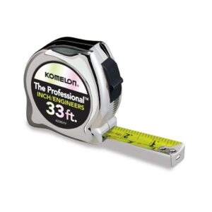
Komelon 25ft Professional Chrome Inches/Engineering
Call for Price
Komelon 25ft Professional Chrome Inches/Engineering
Call for PriceQuick View -
Komelon Measuring Tape
Call for Price
Komelon Measuring Tape
Call for PriceQuick View