")
PAGE-Lidar
Showing all 12 results
-

Emesent E00-HSTX-KIT Hovermap ST-X Kit
Call for Price
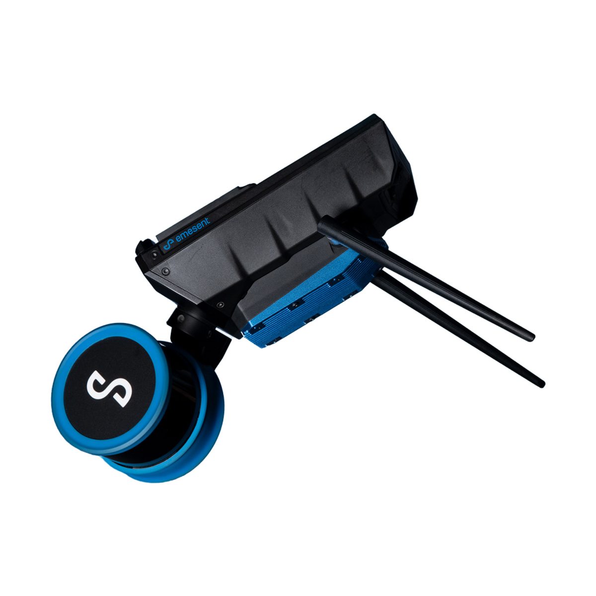
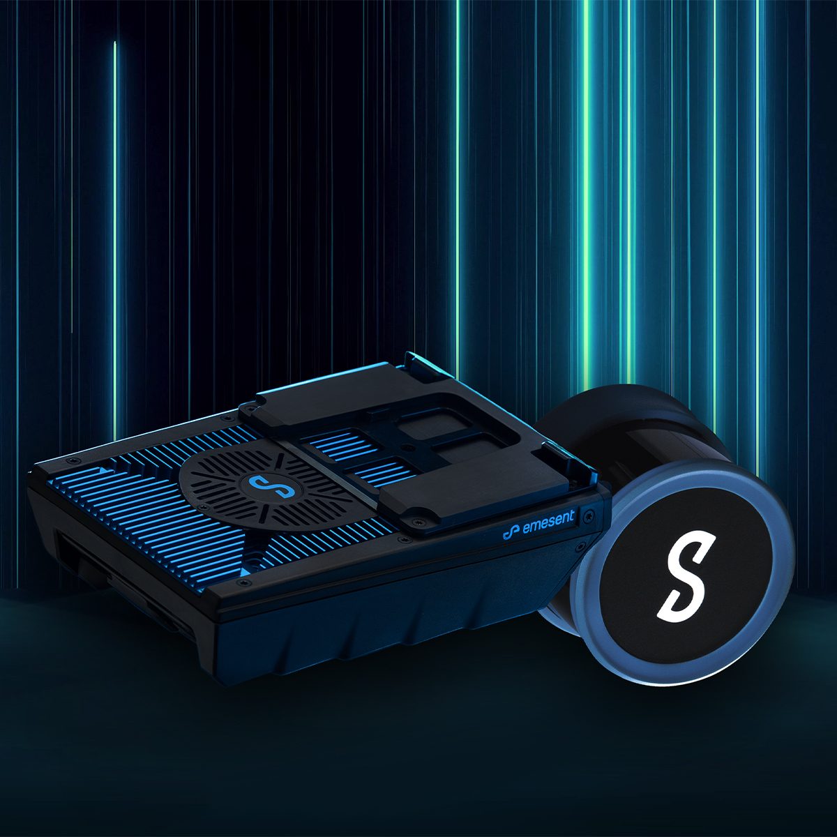
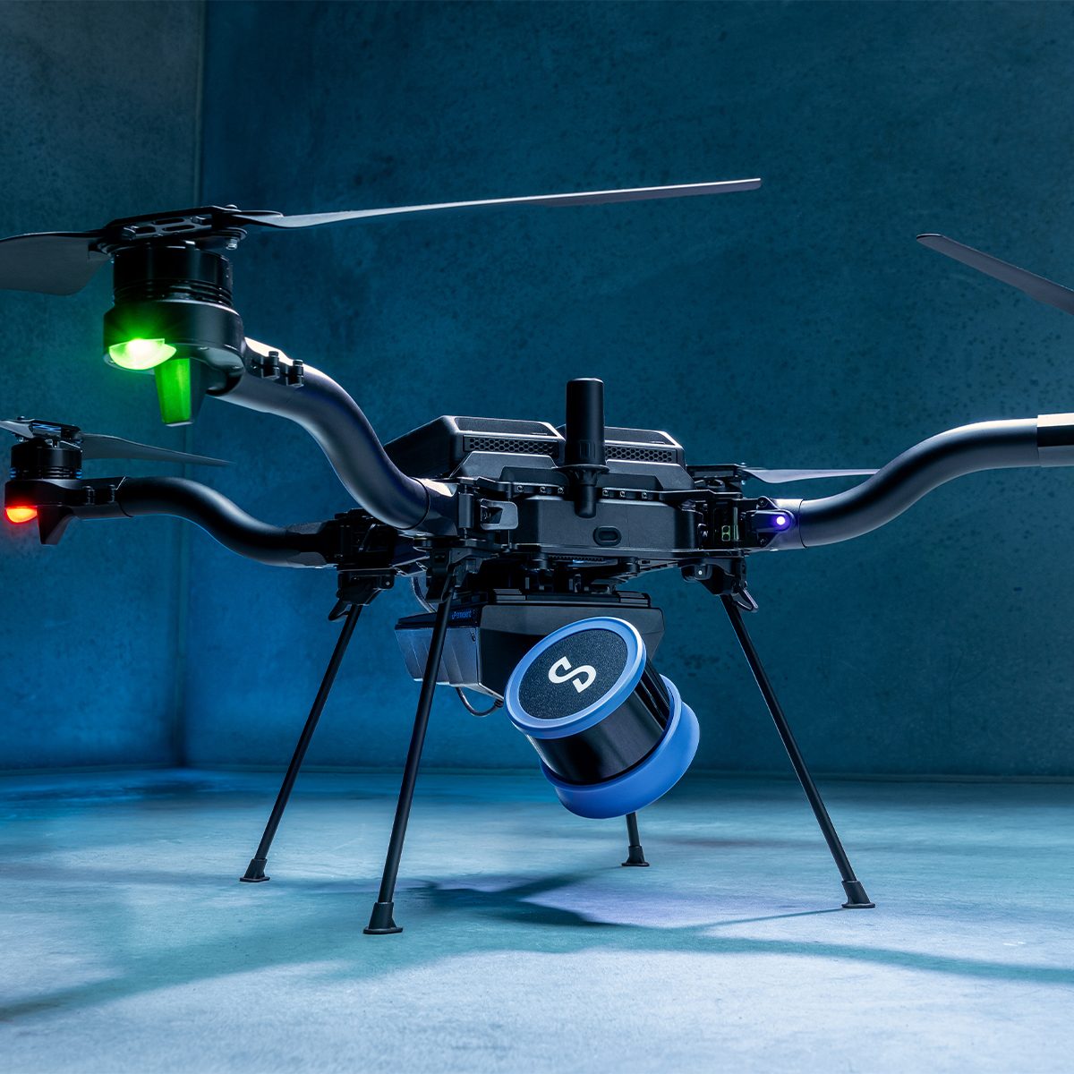
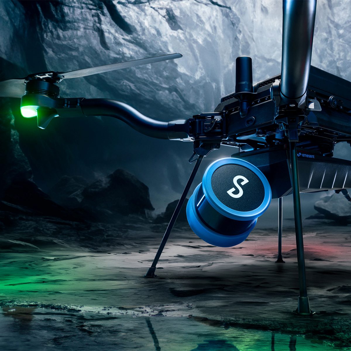
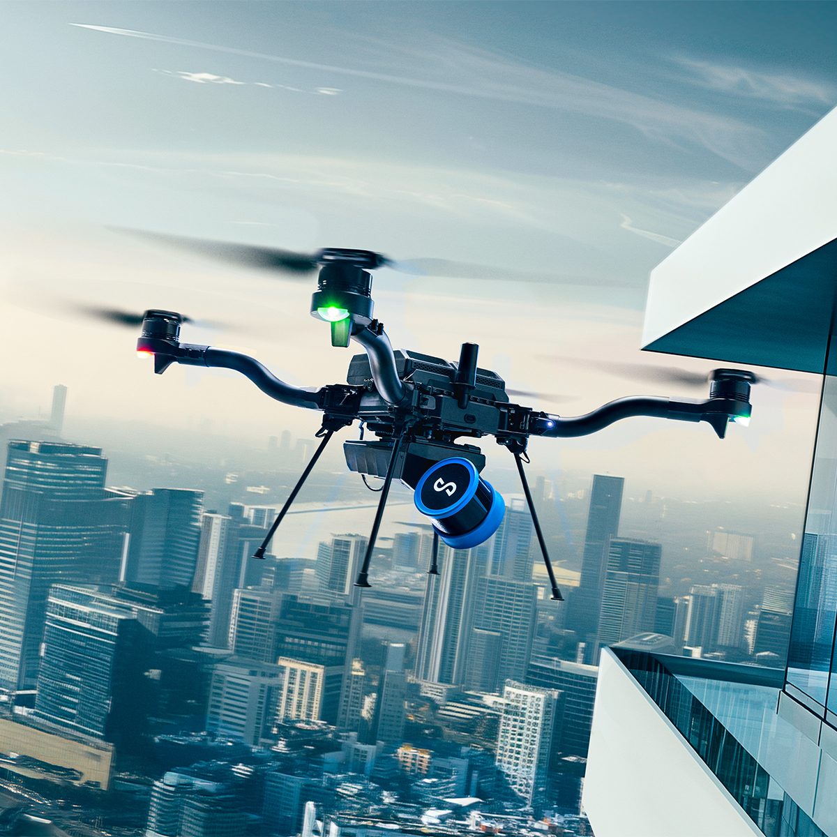
Emesent E00-HSTX-KIT Hovermap ST-X Kit
Call for PriceEmesent E00-HSTX-KIT Hovermap ST-X Kit
Fast, Accurate, High-detail Mobile Data Capture
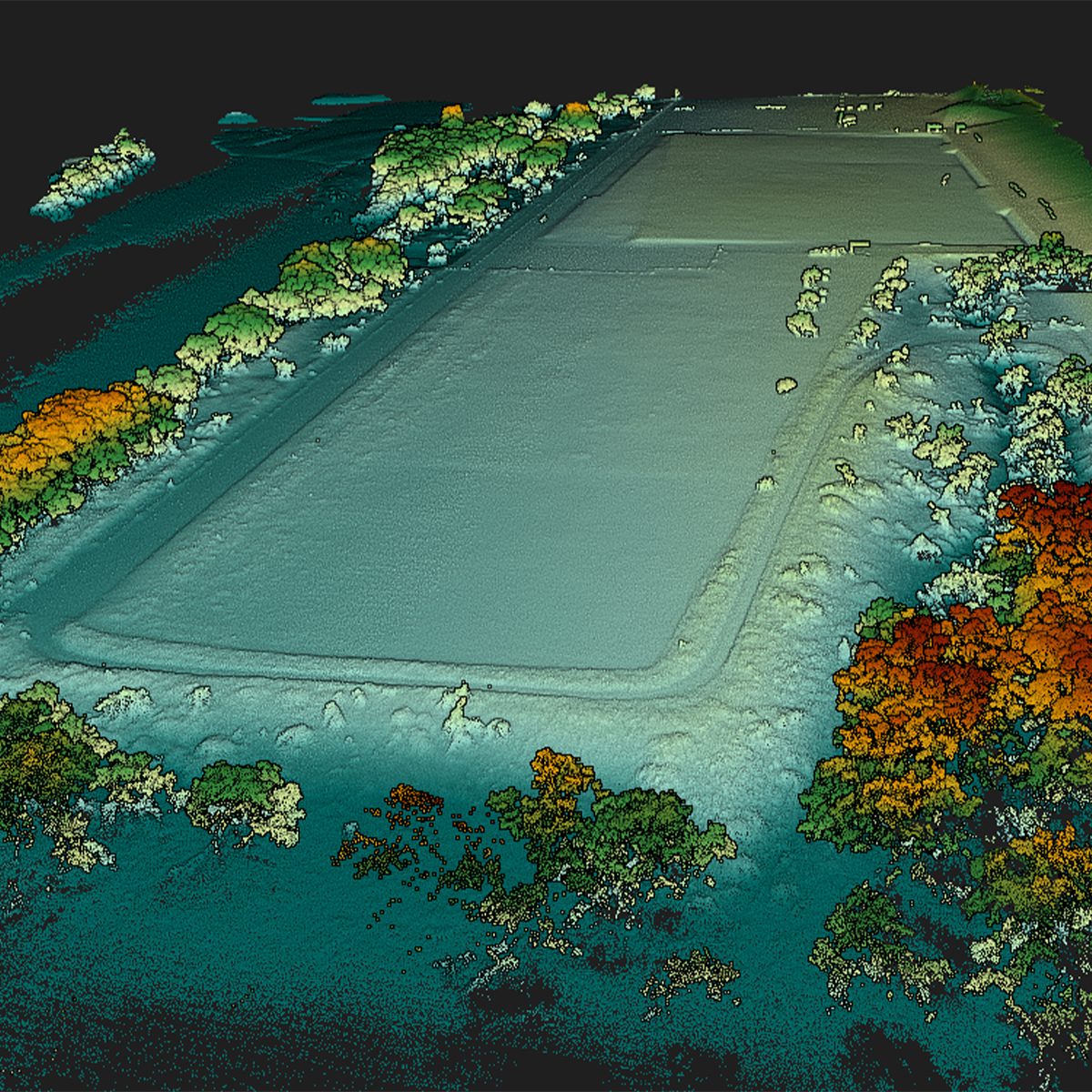
Hovermap incorporates the latest in LiDAR sensing technology to offer high density point clouds with exceptional coverage. Featuring a sensing range of up to 300 meters and more than a million points per second, Hovermap captures detailed, accurate data over a wide area fast – accelerating your time to insight.
Emesent offers a choice of Hovermap business plans designed to match and support your specific LiDAR mapping and data visualization requirements.
Quick View -
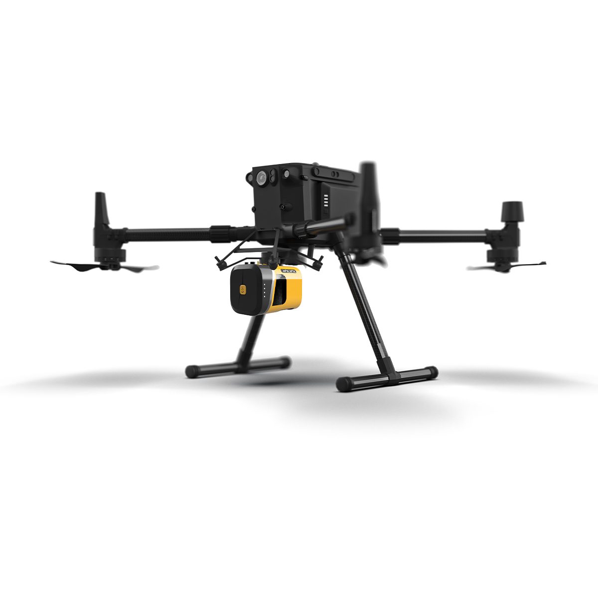
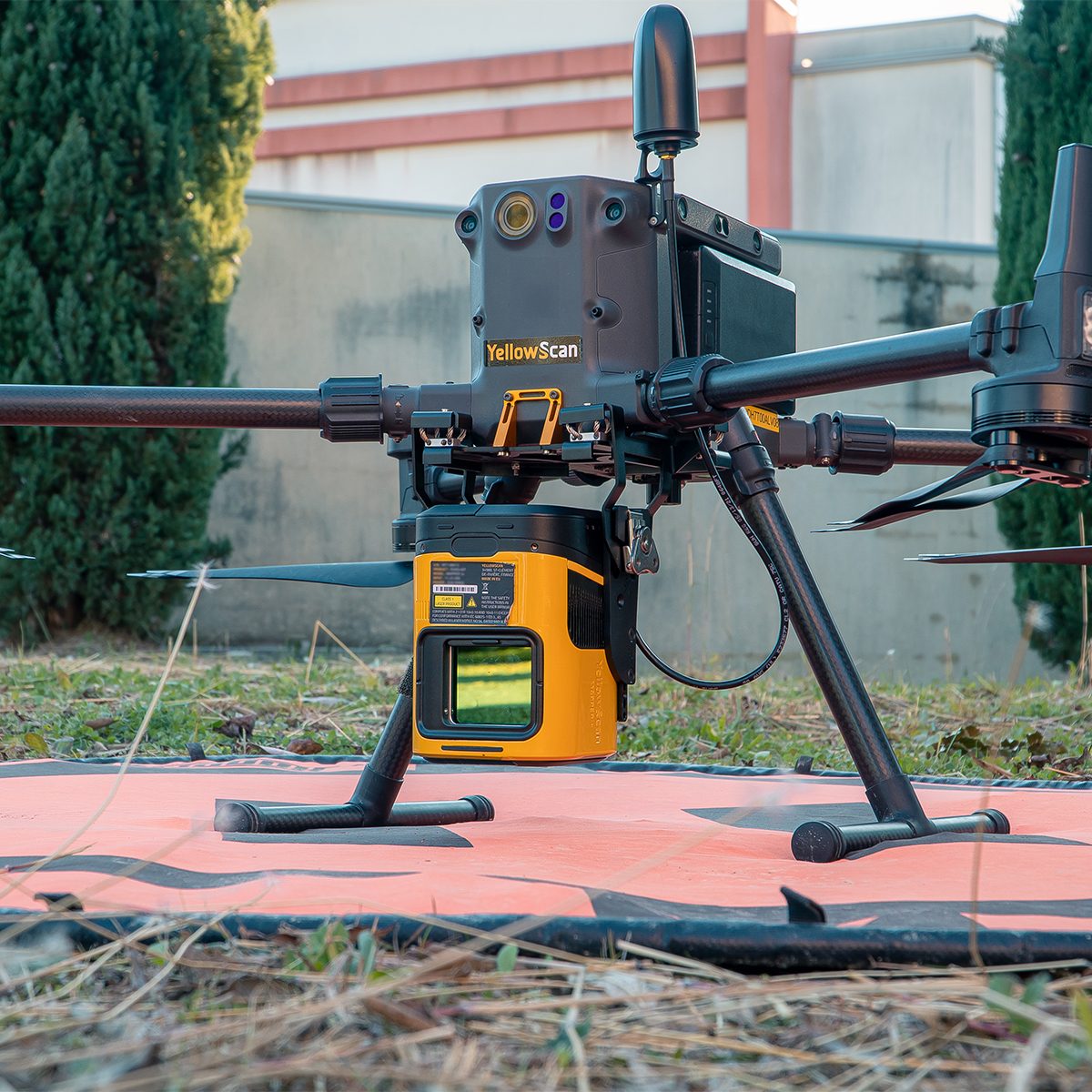
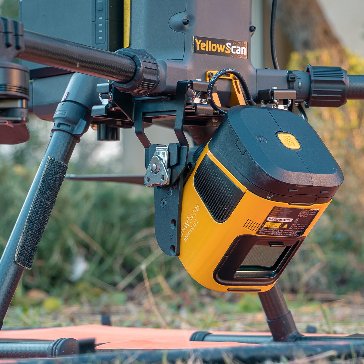
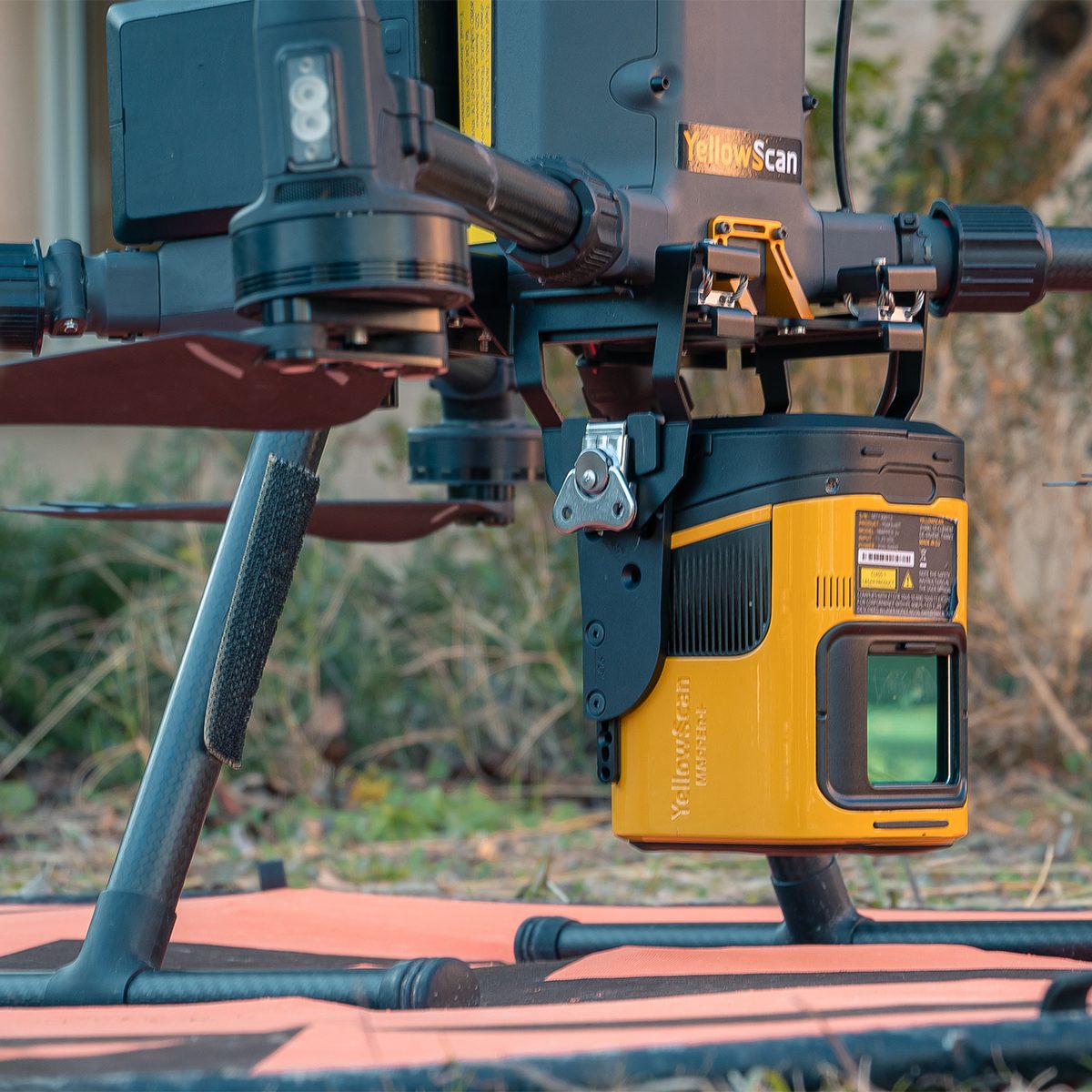
YellowScan Mapper (Version 3) YM3CAMKIT & Single Camera Module 20MP
Call for Price
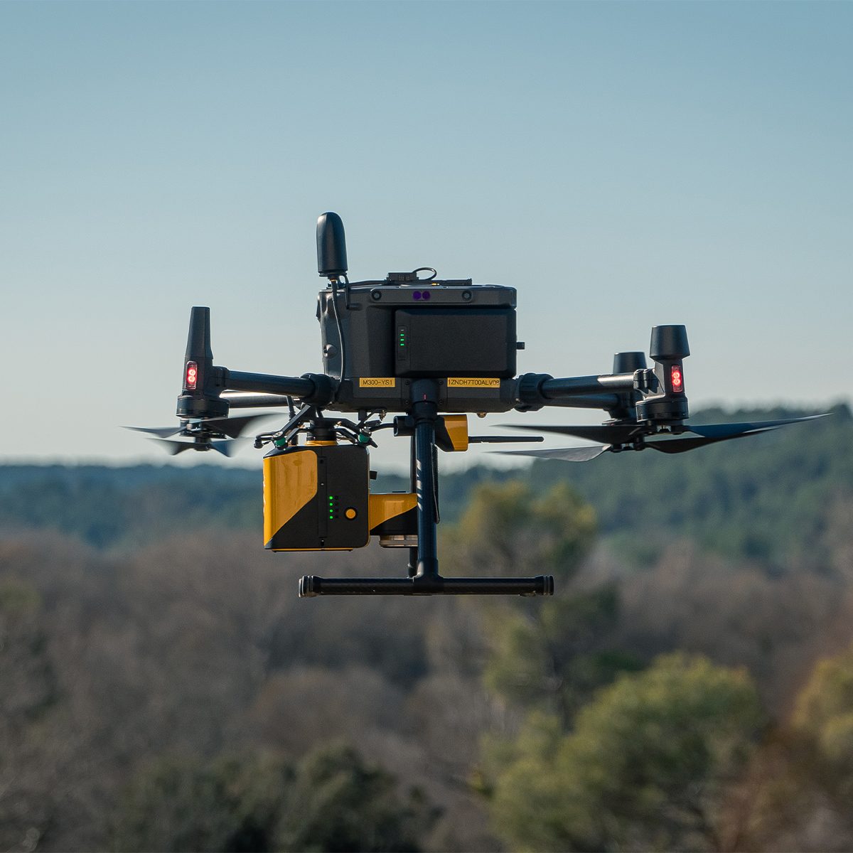
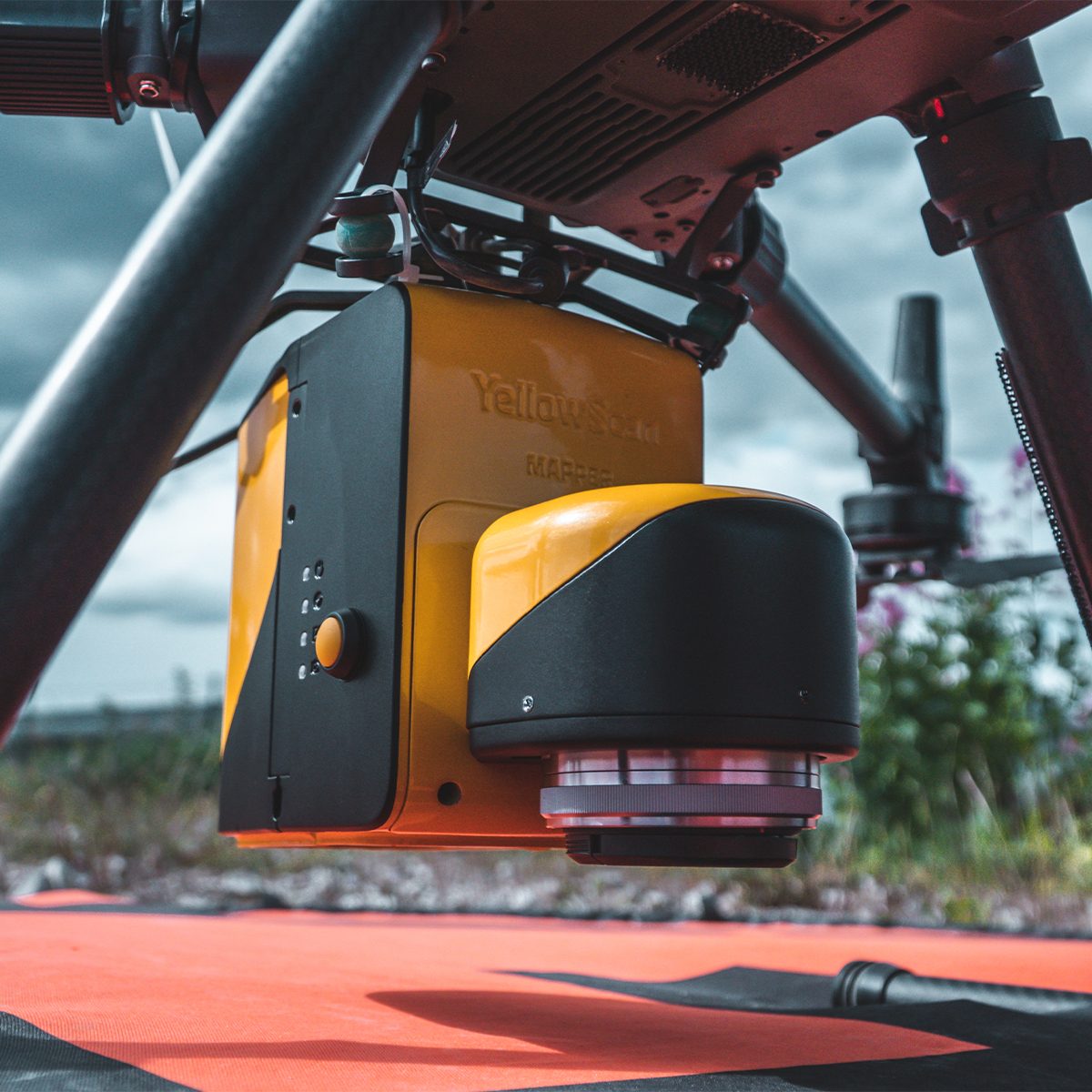


YellowScan Mapper (Version 3) YM3CAMKIT & Single Camera Module 20MP
Call for PriceYellowScan Mapper
Jump into LiDAR revolution.Easy mapping redefined. Start your LiDAR journey with our easy-to-use Mapper system. Its low weight, mid-range capability, top-end point density, as well as advanced accuracy and precision, make this LiDAR system the best value for money. Then add the Sony APS-C size Exmor™ CMOS image sensor with a BIONZ X™ processor to produce high-precision 20 MP images.
Quick View -
YellowScan Mapper (Version 3) YSM3KIT15 Integrated System
Call for Price YellowScan Mapper (Version 3) YSM3KIT15 Integrated System
Call for PriceYellowScan Mapper
Jump into LiDAR revolution.Easy mapping redefined. Start your LiDAR journey with our easy-to-use Mapper system. Its low weight, mid-range capability, top-end point density, as well as advanced accuracy and precision, make this LiDAR system the best value for money.
Quick View -
YellowScan Mapper+ (Version 3) YSM3+KIT Integrated System
Call for Price
YellowScan Mapper+ (Version 3) YSM3+KIT Integrated System
Call for PriceYellowScan Mapper+
Small & compact. Mighty & powerful.Advanced performance fitted into a compact survey solution. The YellowScan Mapper+ is an efficient 3 echoes, high-density LiDAR system for all mapping applications.
Quick View -

YellowScan Navigator YSNVGTRKIT
Call for Price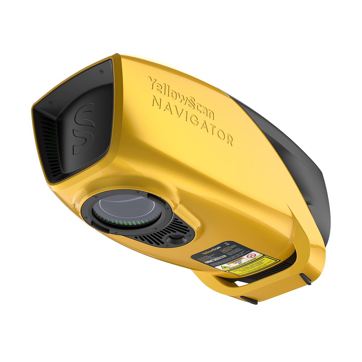
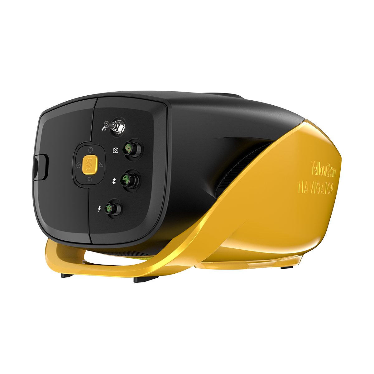
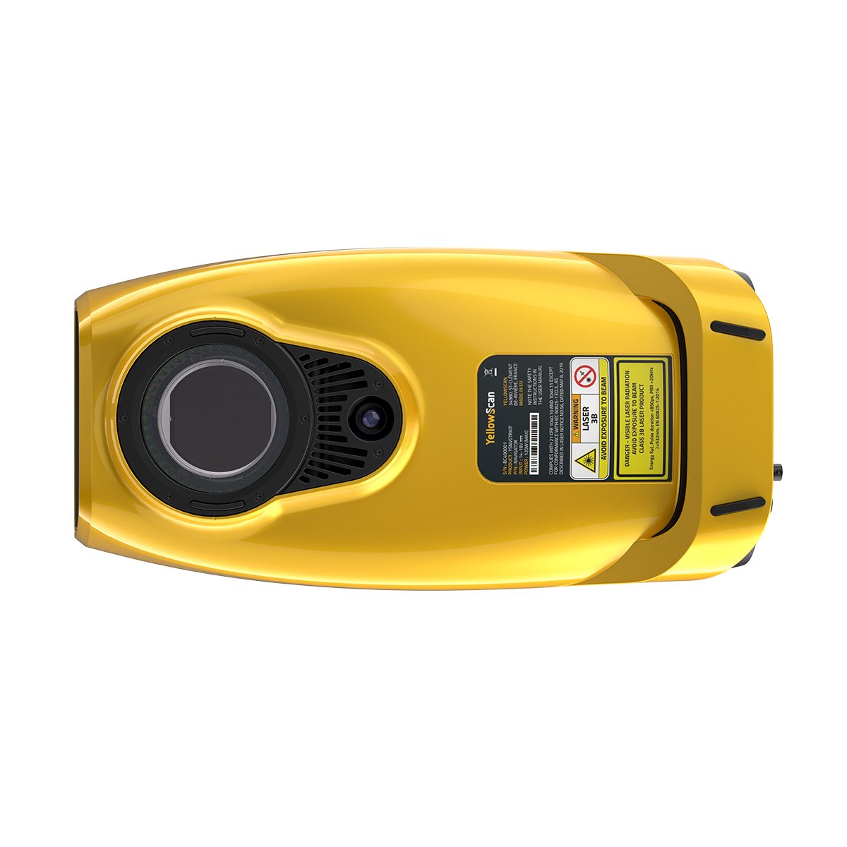
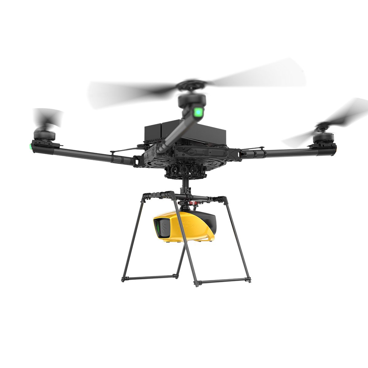
YellowScan Navigator YSNVGTRKIT
Call for PriceYellowScan Navigator
Depths to heights: operating bathymetric LiDAR with one button.The YellowScan bathymetric LiDAR is an innovative solution for exploring underwater and ground topography with a single-button operation. Its lightweight design allows for versatile platform selection without compromising water penetration.
Quick View -
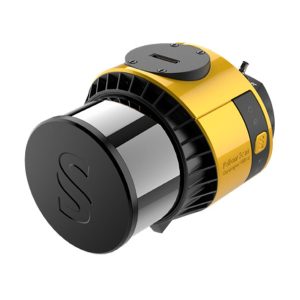
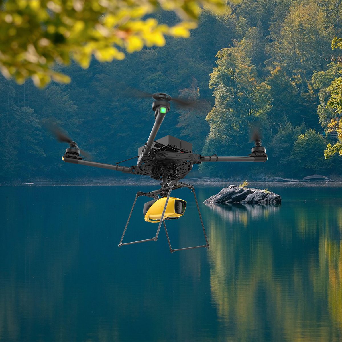
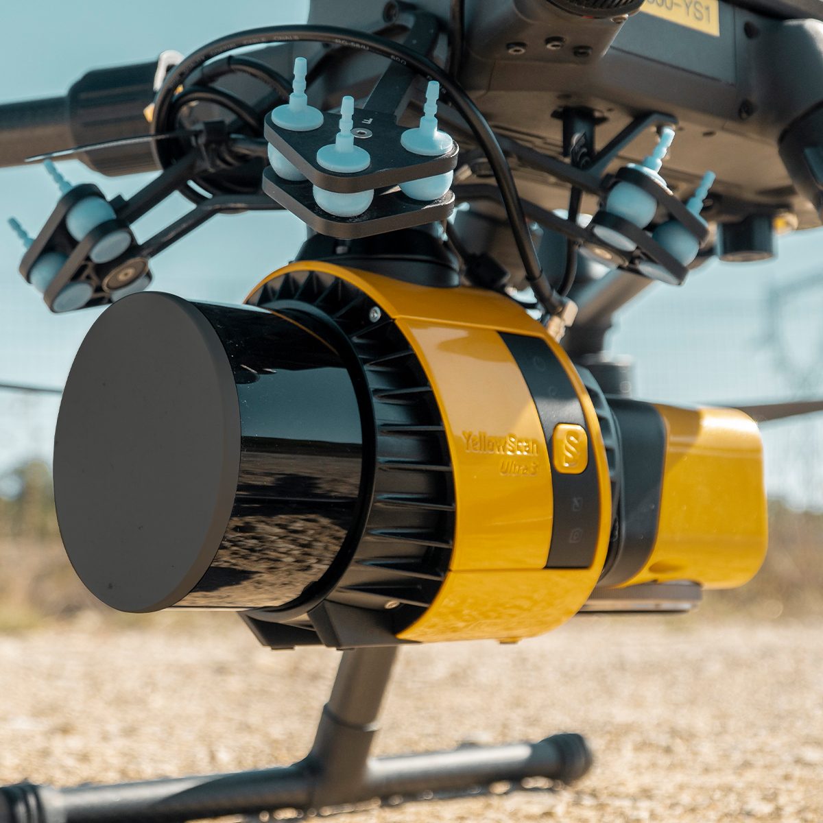
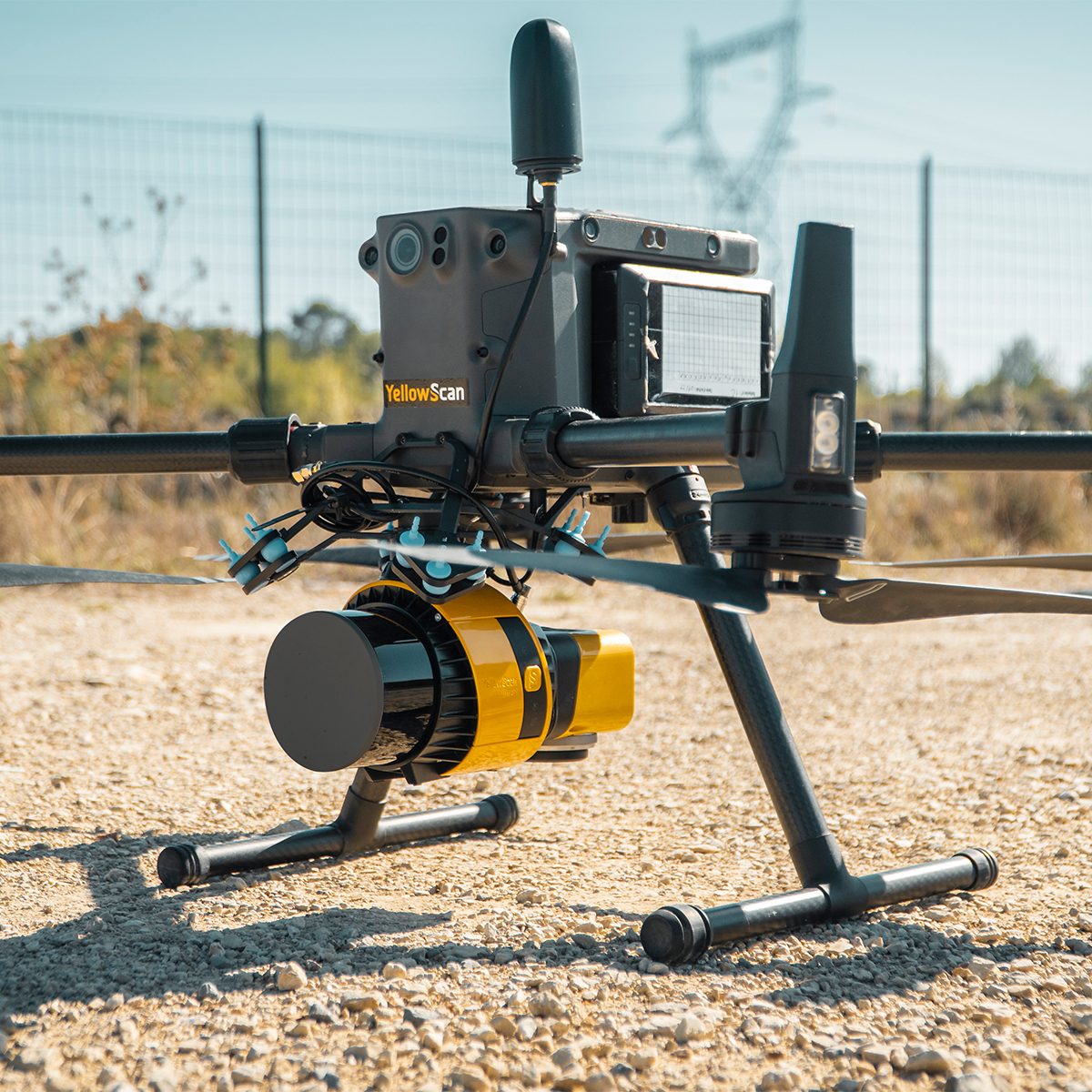
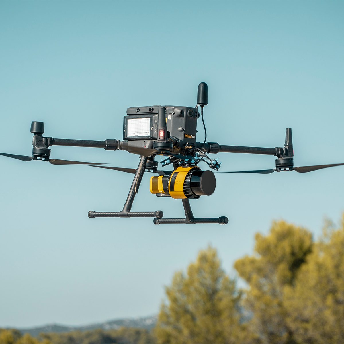
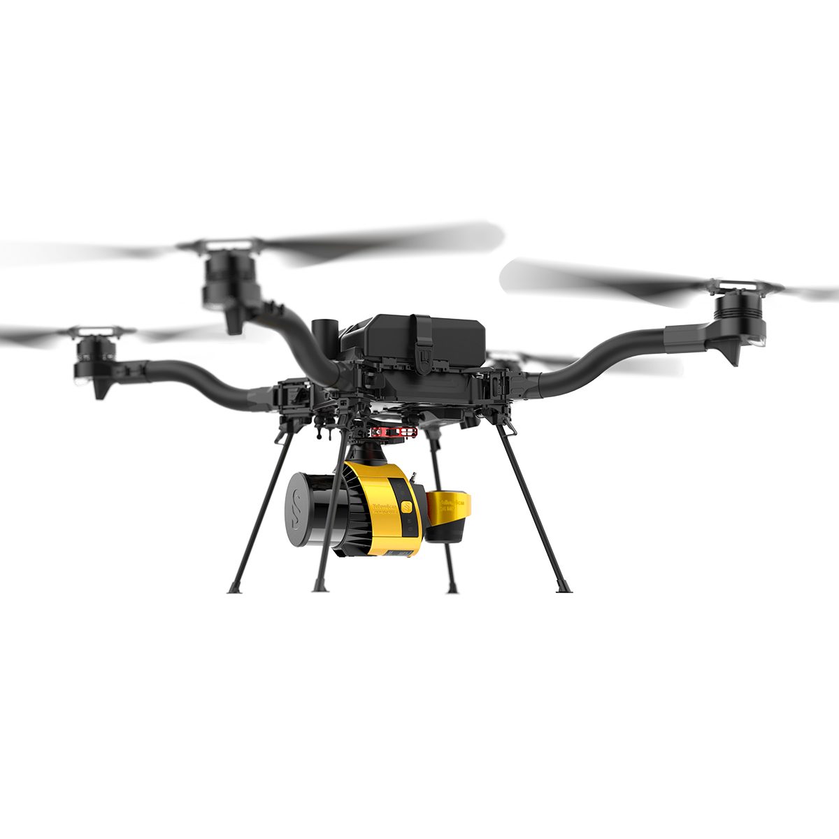
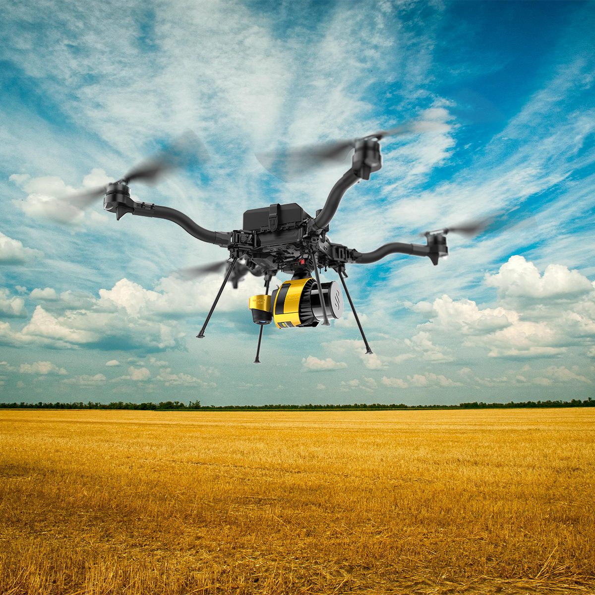
YellowScan Surveyor Ultra 3 YSSVKIT30 Integrated System
Call for Price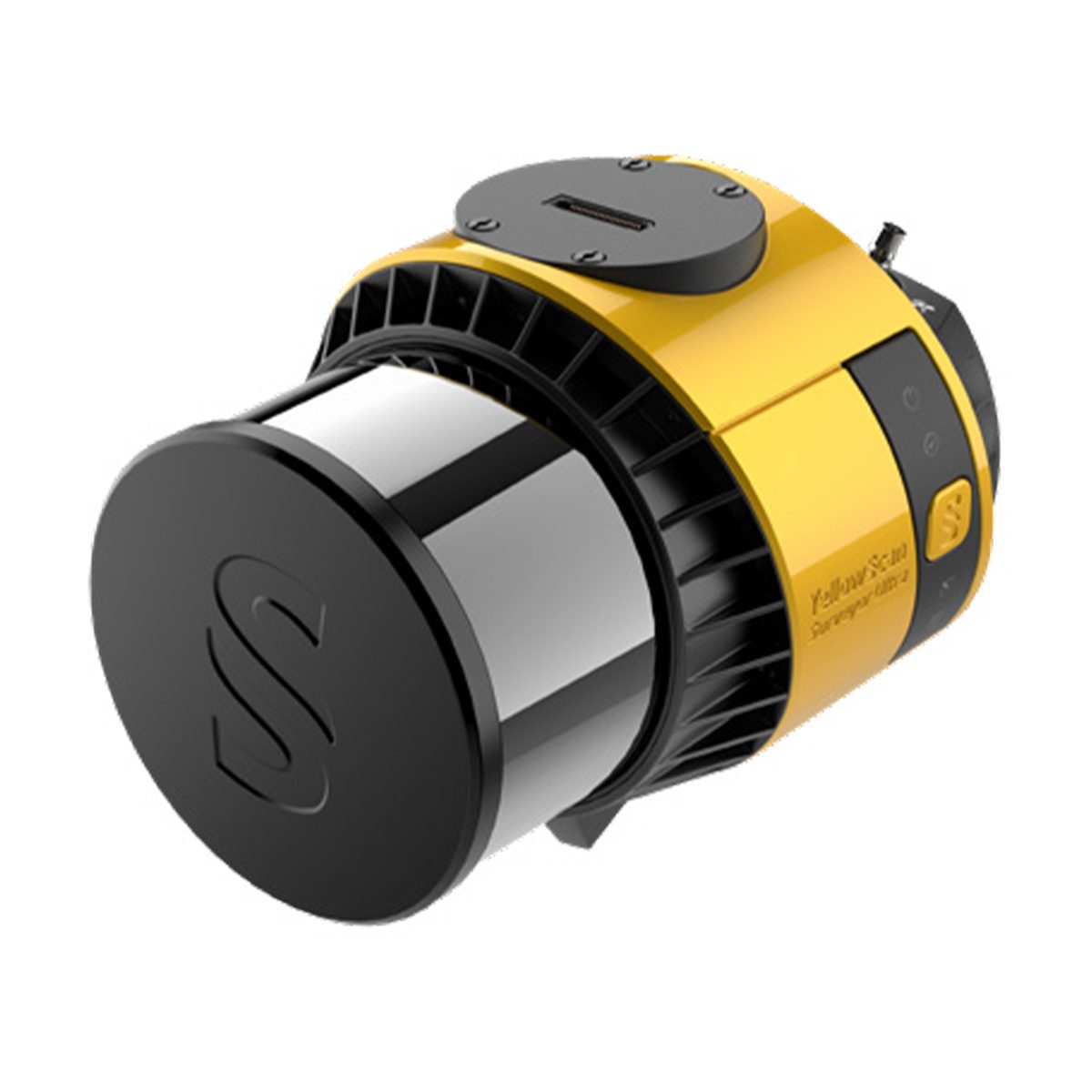
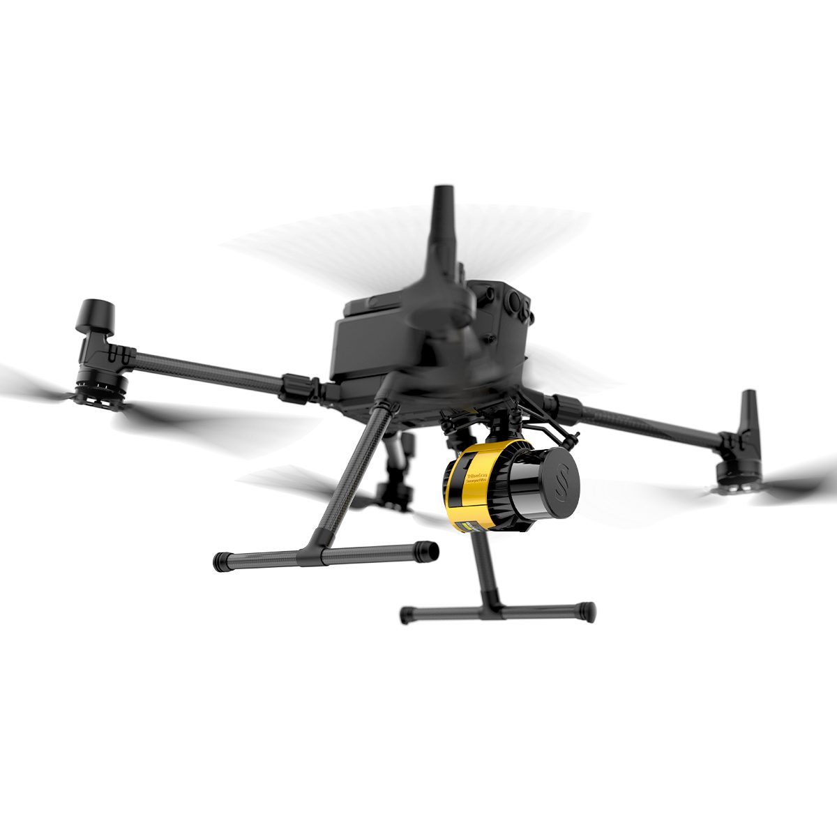
YellowScan Surveyor Ultra 3 YSSVKIT30 Integrated System
Call for PriceYellowScan Surveyor Ultra
Affordability. Flexibility. Productivity.
The YellowScan Surveyor Ultra marks a new generation of YellowScan LiDAR systems integrating SBG Systems’ IMU, combined with an integrated RGB camera for colorization purposes. Combining light weight and high density, its flexiblity makes a great addition anywhere.
Quick View -

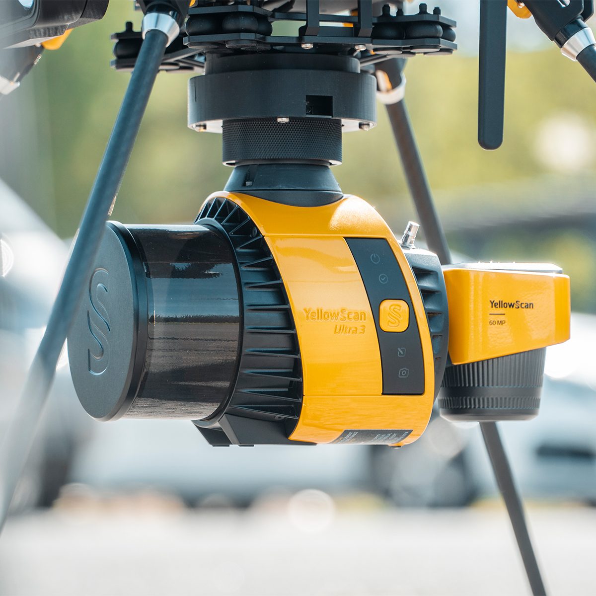
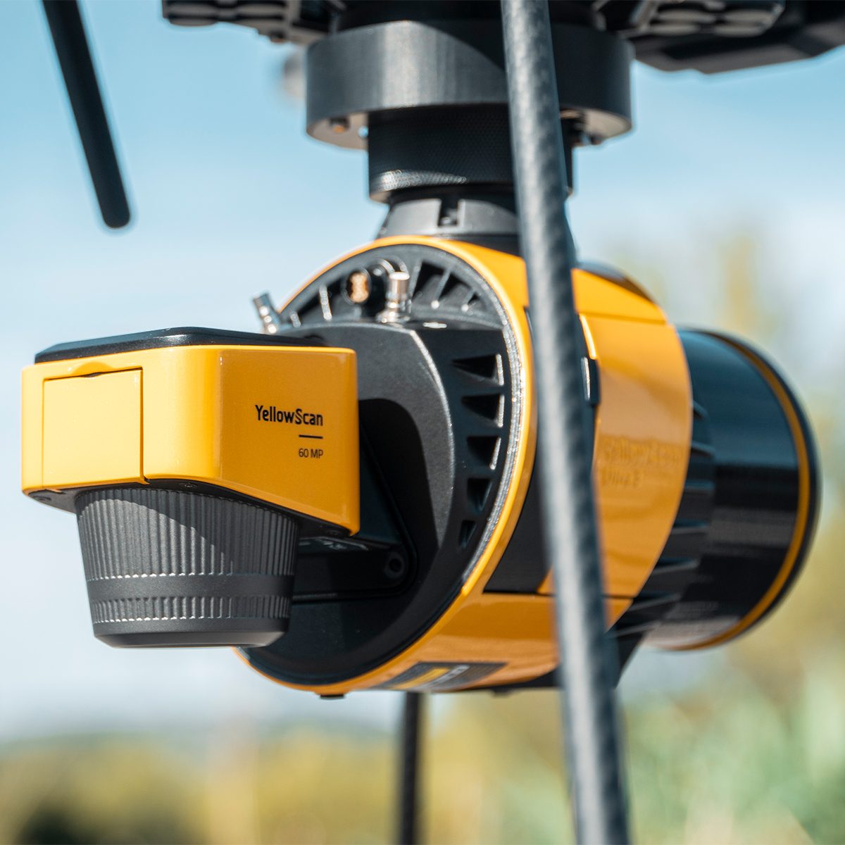
YellowScan Surveyor Ultra 3 YSV3SCAM61KIT & Single Camera Module 61MP
Call for Price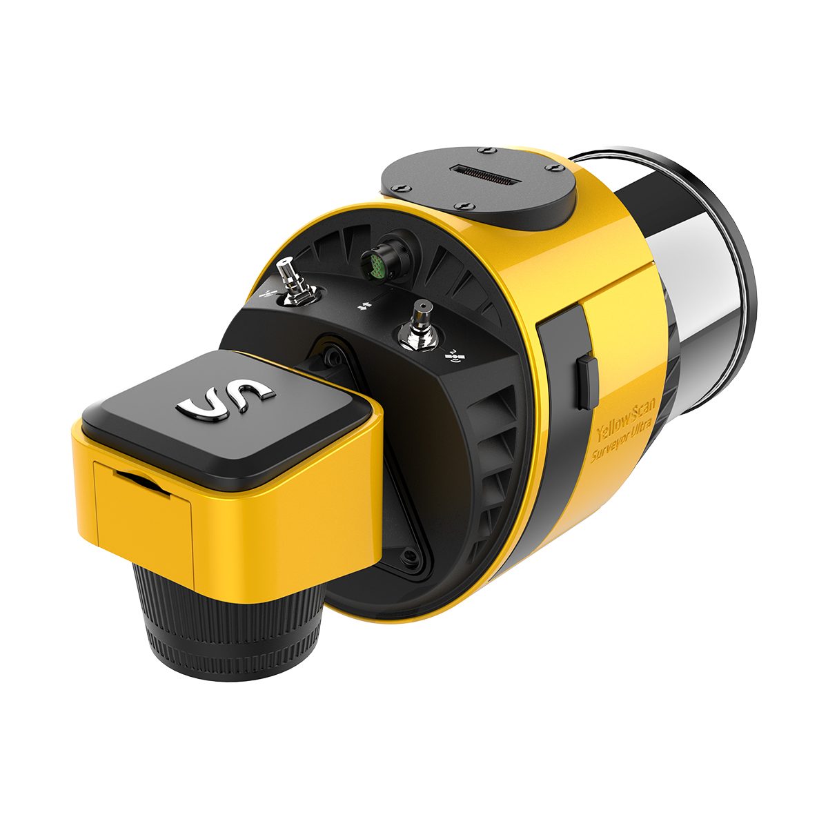
YellowScan Surveyor Ultra 3 YSV3SCAM61KIT & Single Camera Module 61MP
Call for PriceYellowScan Surveyor Ultra & Single Camera Module 61MP
Lightweight 360° LiDAR System for UAV Integration
Affordability. Flexibility. Productivity.
The YellowScan Surveyor Ultra marks a new generation of YellowScan LiDAR systems integrating SBG Systems’ IMU, combined with an integrated RGB camera for colorization purposes. Combining light weight and high density, its flexibility makes a great addition anywhere. Add the Sony Full-Frame CMOS image sensor to produce combined high-precision 61MP images.
Quick View -

YellowScan Voyager 50 YSVXKIT51 Integrated System
Call for Price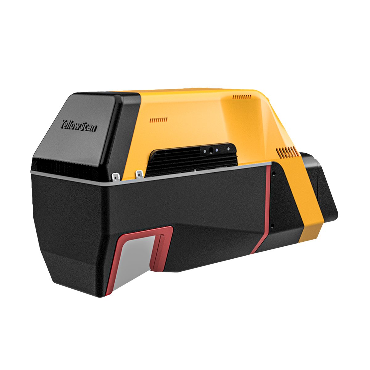

YellowScan Voyager 50 YSVXKIT51 Integrated System
Call for PriceYellowScan Voyager
Precision meets reality.Complete more mission profiles with the YellowScan Voyager. The Voyager’s 100° FOV laser scanner and its extremely fast data acquisition rate of up to 2400 kHz while keeping top-of-the-line precision and accuracy makes this solution the best option for projects requiring both high density and quality.
Quick View -
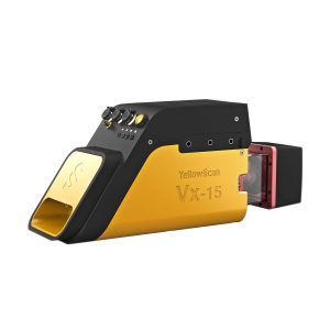
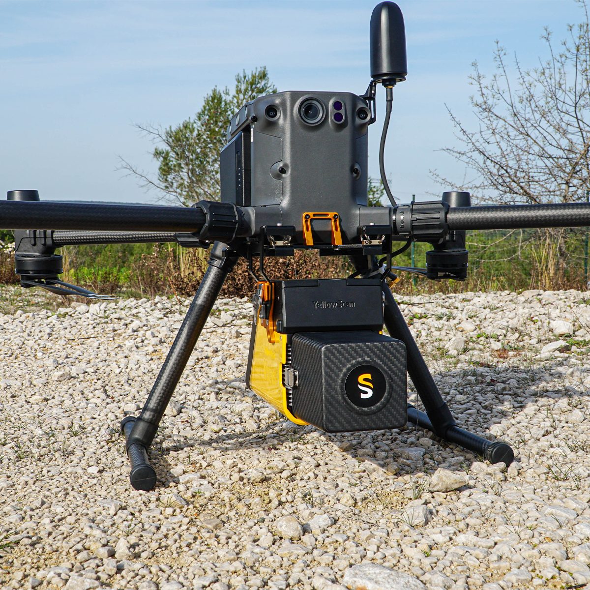
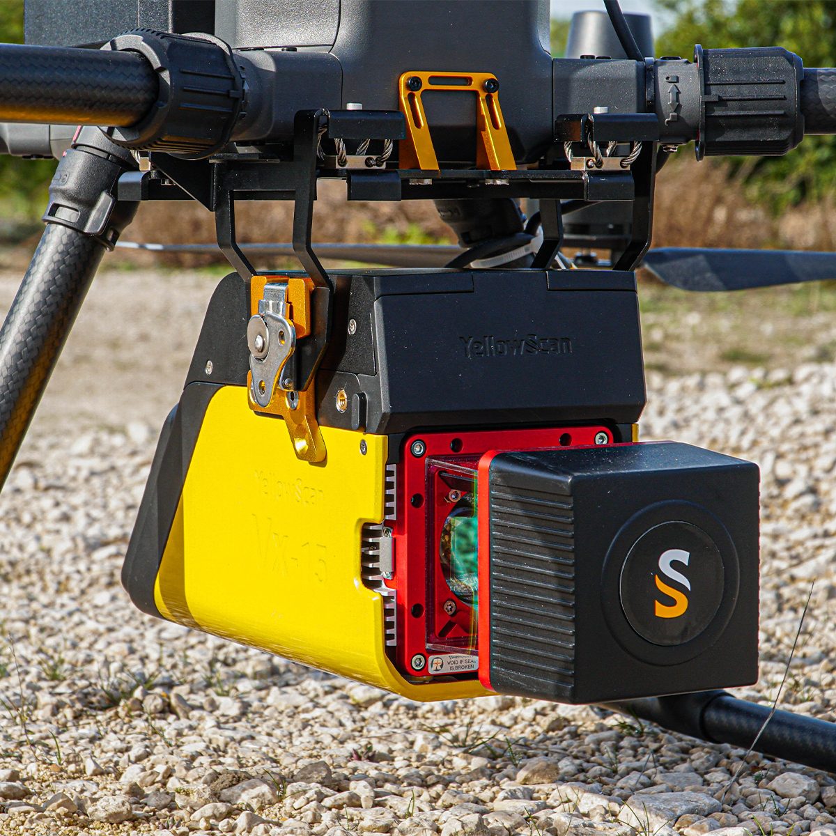
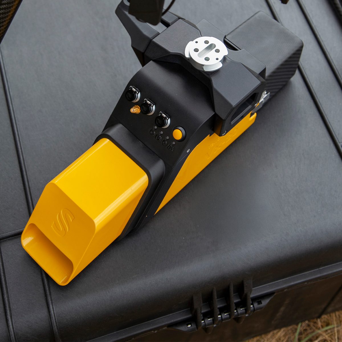
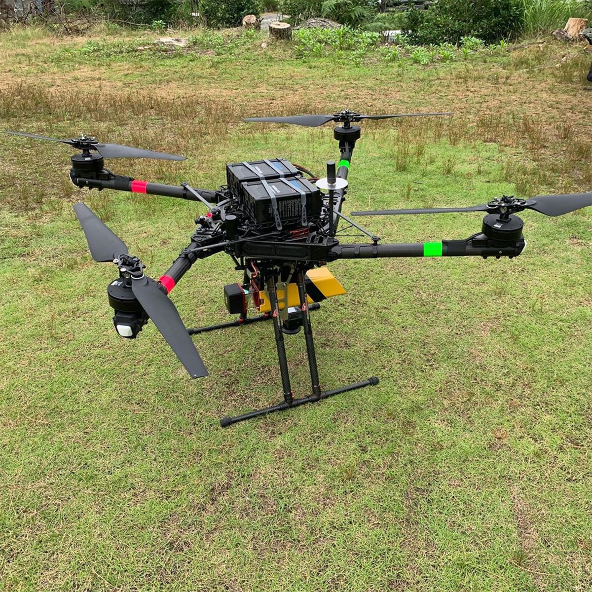
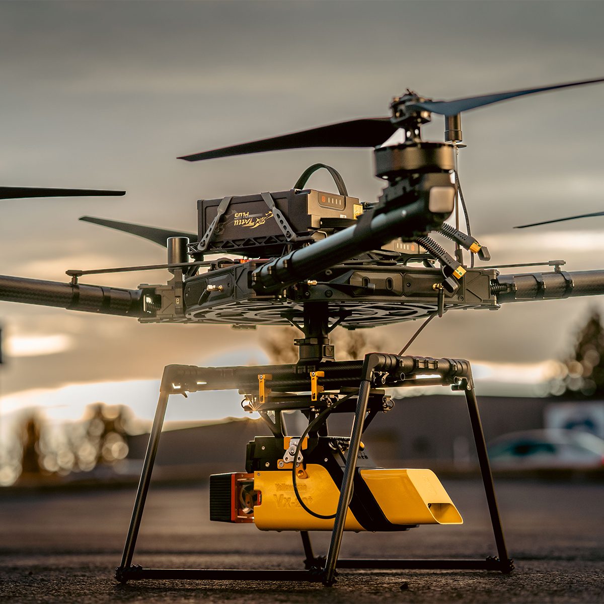
YellowScan Vx15-100 YSVXKIT11 Integrated System
Call for Price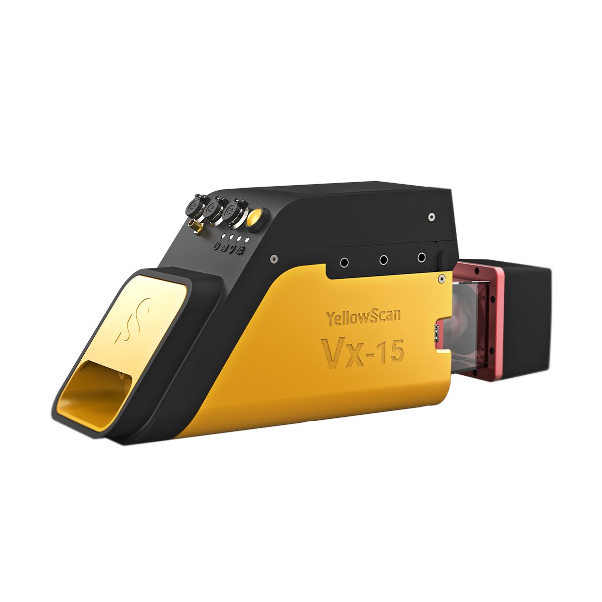
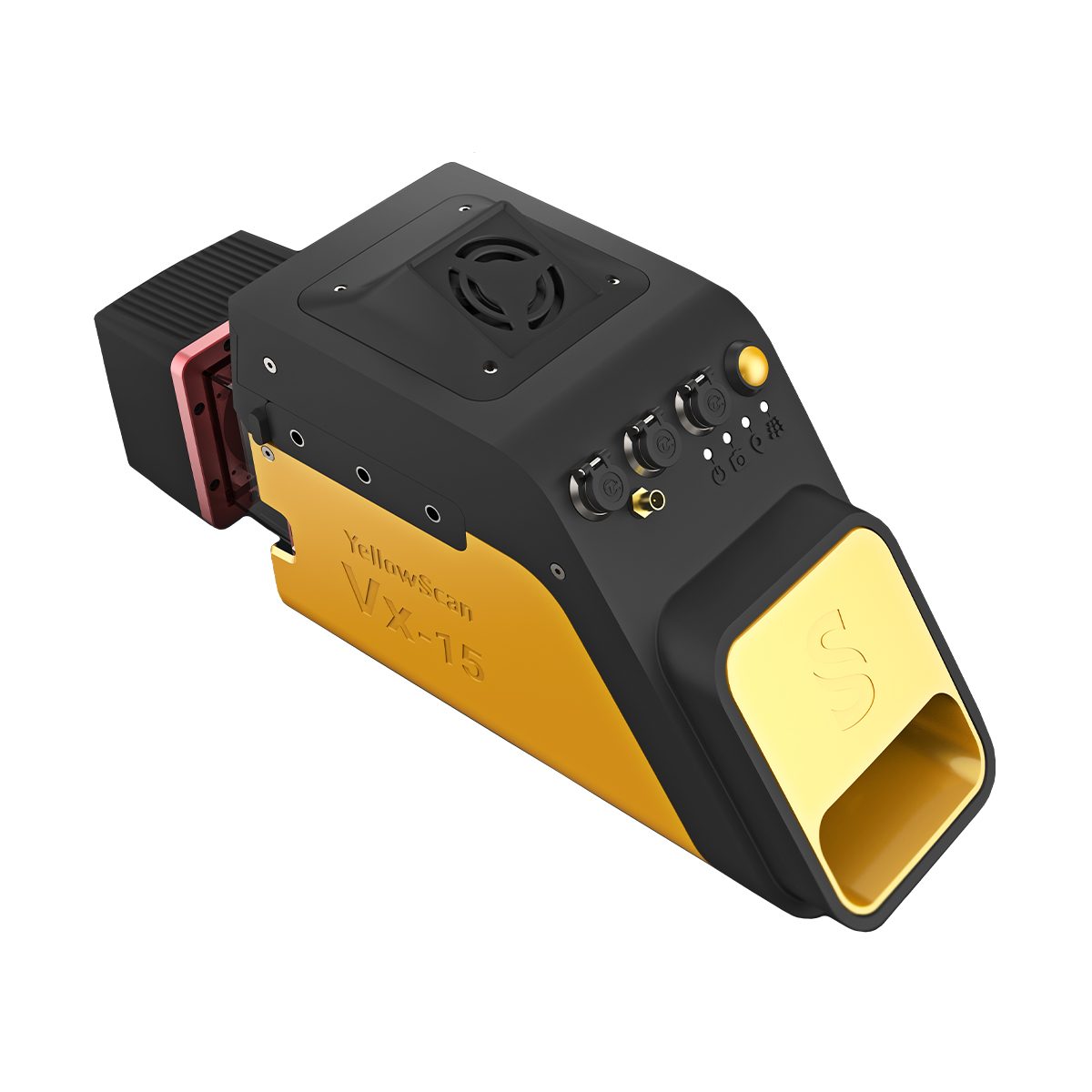
YellowScan Vx15-100 YSVXKIT11 Integrated System
Call for PriceYellowScan Vx15 Series
The long range & high precision UAV LiDAR solution.YellowScan Vx15 is the lightest system integrating the Riegl Mini-VUX. Ideally suited for high precision surveys such as civil engineering. Coupled with the DJI M300 it allows over 25 min flight time maximizing your survey production.
Quick View -
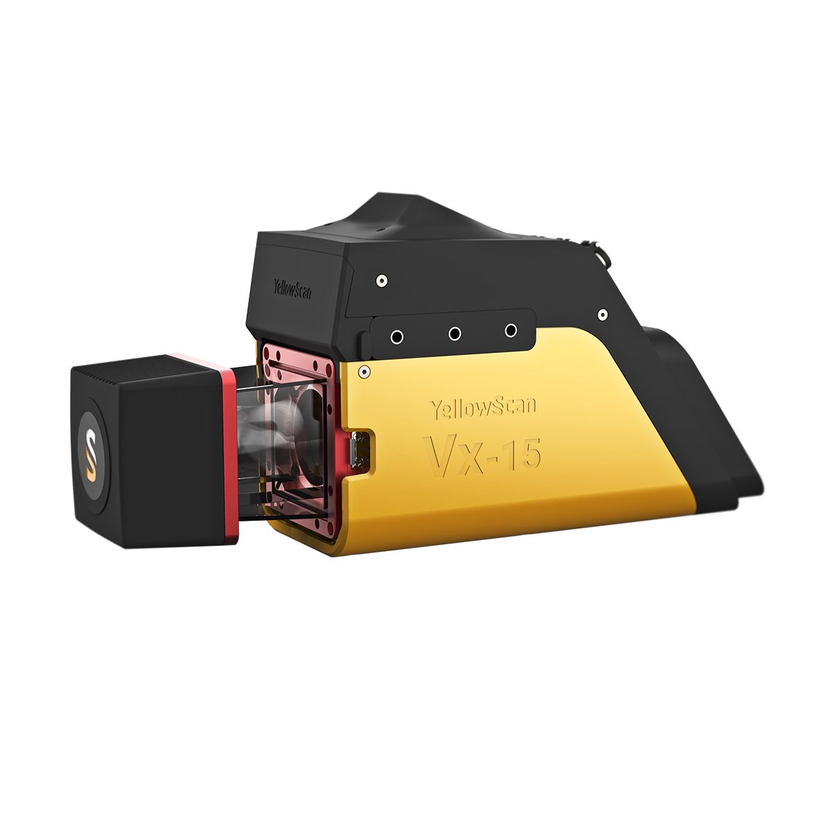
YellowScan Vx15-300 YSVXKIT13 Integrated System
Call for Price YellowScan Vx15-300 YSVXKIT13 Integrated System
Call for PriceYellowScan Vx15 Series
The long range & high precision UAV LiDAR solution.YellowScan Vx15 is the lightest system integrating the Riegl Mini-VUX. Ideally suited for high precision surveys such as civil engineering. Coupled with the DJI M300 it allows over 25 min flight time maximizing your survey production.
Quick View -

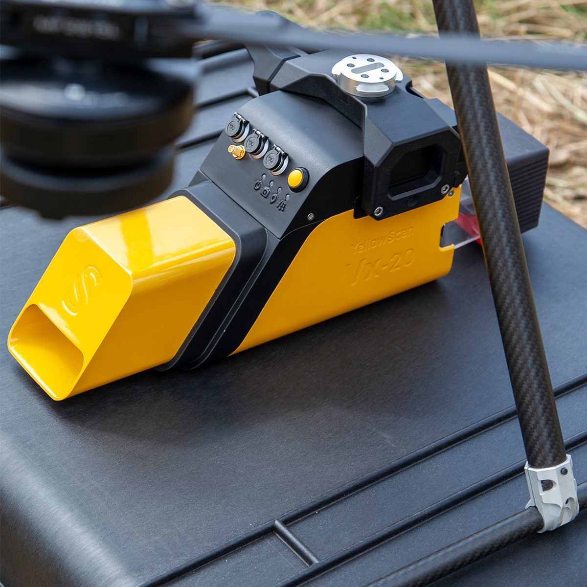
YellowScan Vx20-100 YSVXKIT21 Integrated System
Call for Price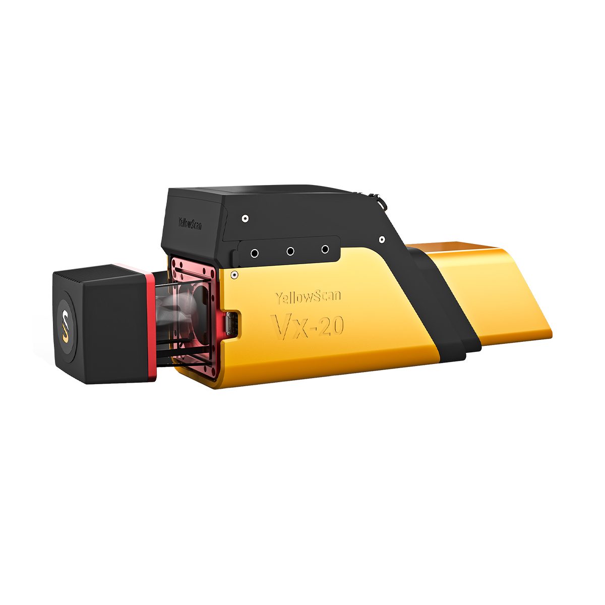
YellowScan Vx20-100 YSVXKIT21 Integrated System
Call for PriceYellowScan Vx20 Series
The most accurate and high precison UAV LiDAR solution.YellowScan Vx20 is the most accurate fully integrated system from YellowScan’s product range. It can fly up to 100m while maintening accuracy throughout the point cloud. Ideally suited for applications that requires sharp and accurate descriptions.
Quick View -
YellowScan Vx20-300 YSVXKIT23 Integrated System
Call for Price YellowScan Vx20-300 YSVXKIT23 Integrated System
Call for PriceYellowScan Vx20 Series
The most accurate and high precison UAV LiDAR solution.YellowScan Vx20 is the most accurate fully integrated system from YellowScan’s product range. It can fly up to 100m while maintening accuracy throughout the point cloud. Ideally suited for applications that requires sharp and accurate descriptions.
Quick View