")
PAGES
Showing 1–100 of 114 results
-

Autel Robotics EVO II Dual 640T V3 Enterprise Bundle
Call for Price


Autel Robotics EVO II Dual 640T V3 Enterprise Bundle
Call for PriceQuick View -

Autel Robotics EVO II Pro 6K RTK V3 Rugged Bundle
Call for Price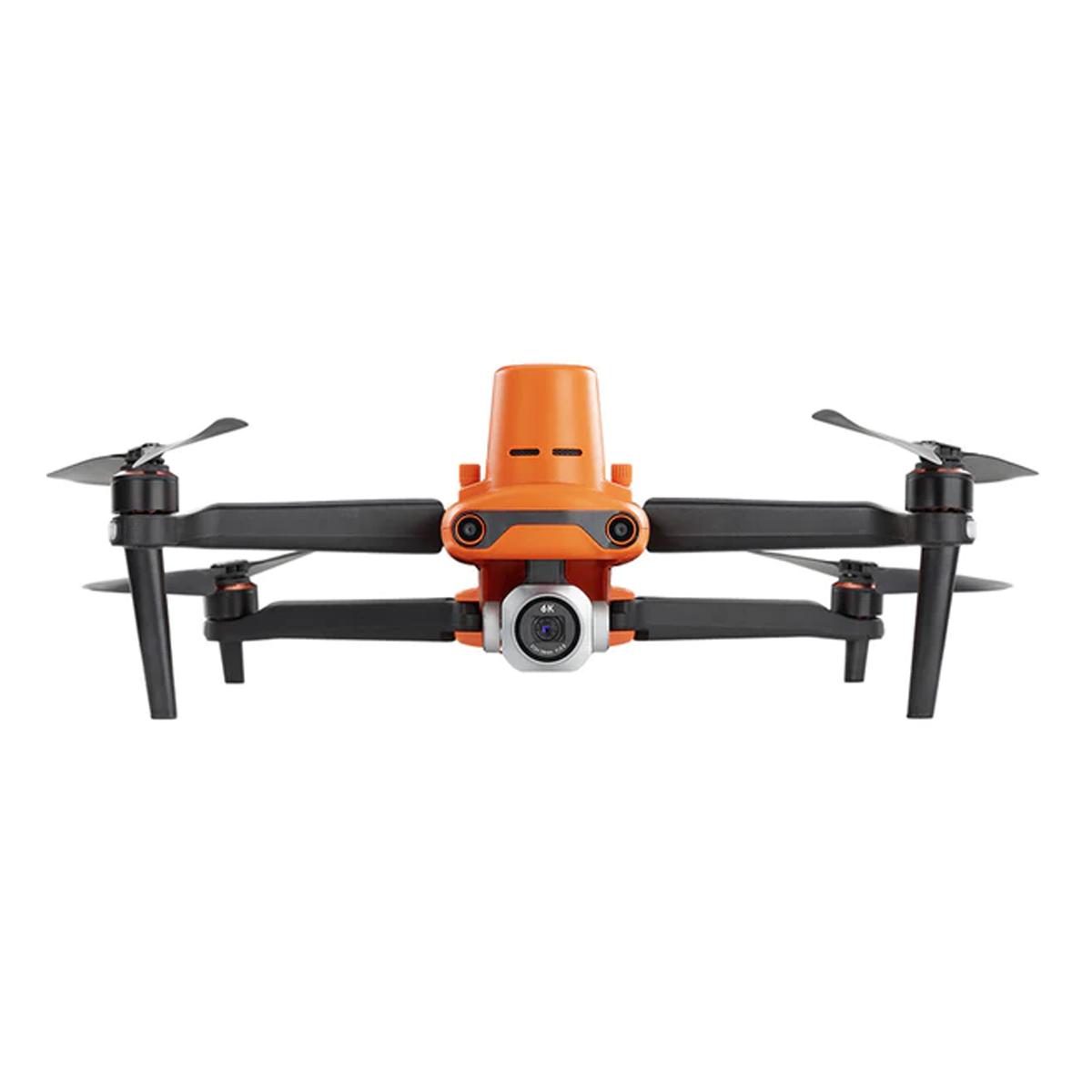

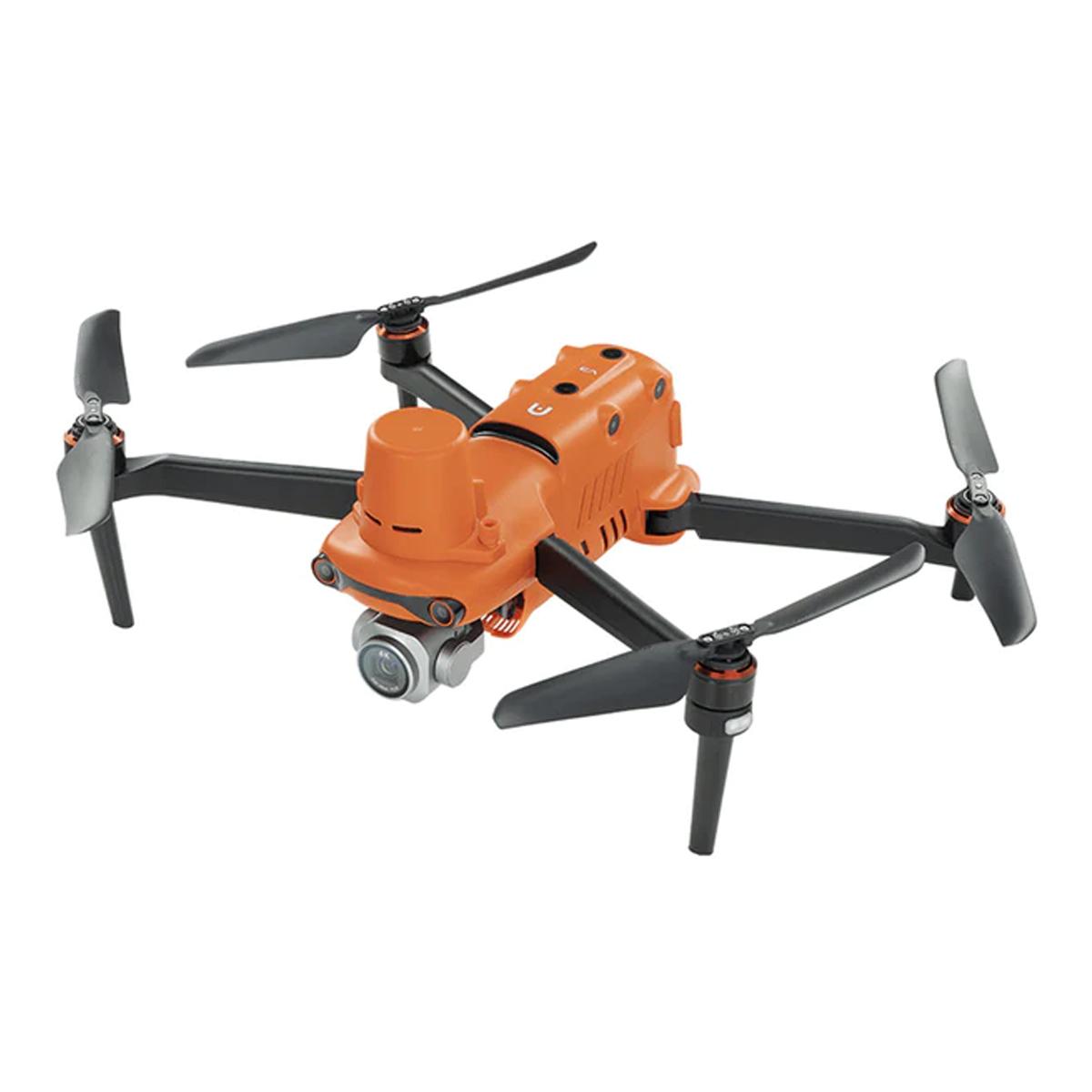

Autel Robotics EVO II Pro 6K RTK V3 Rugged Bundle
Call for PriceQuick View -
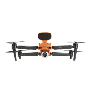
Autel Robotics EVO II Pro 6K V3 Enterprise Bundle
Call for Price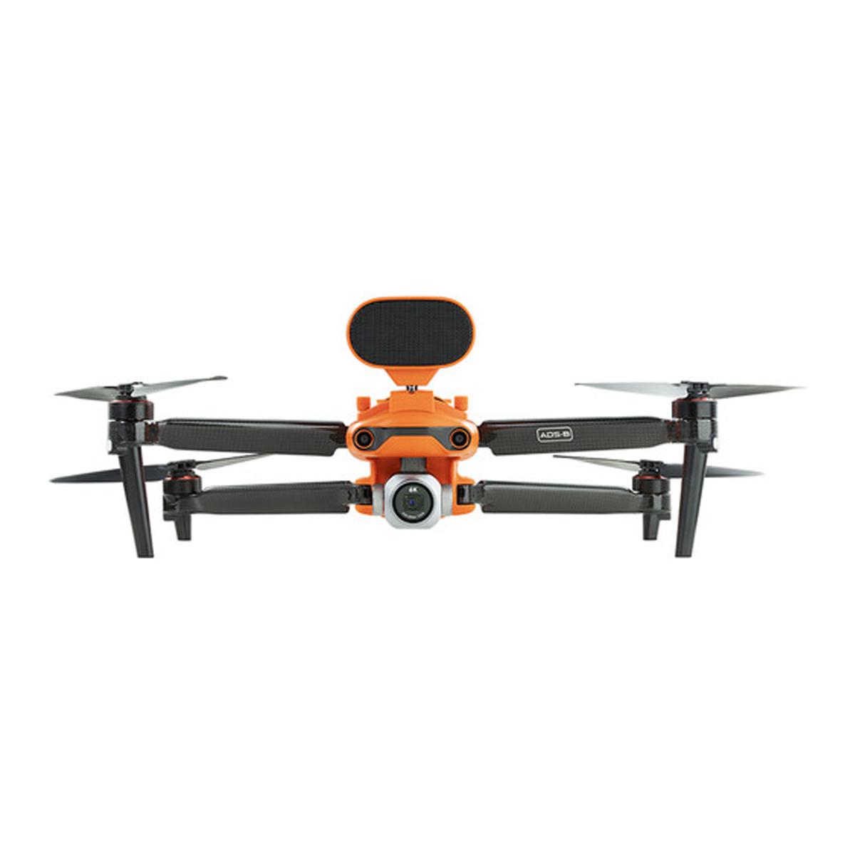
Autel Robotics EVO II Pro 6K V3 Enterprise Bundle
Call for PriceQuick View -

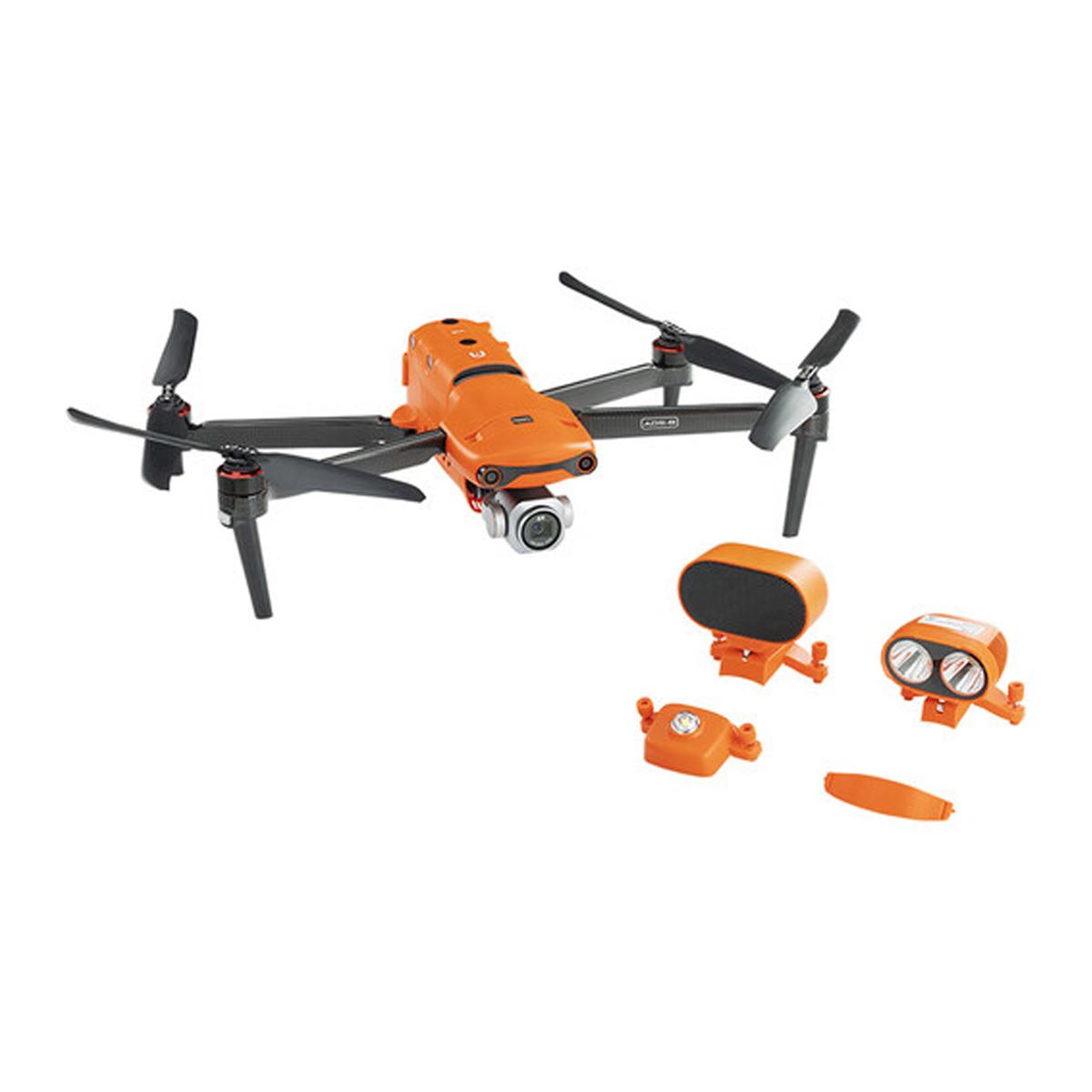
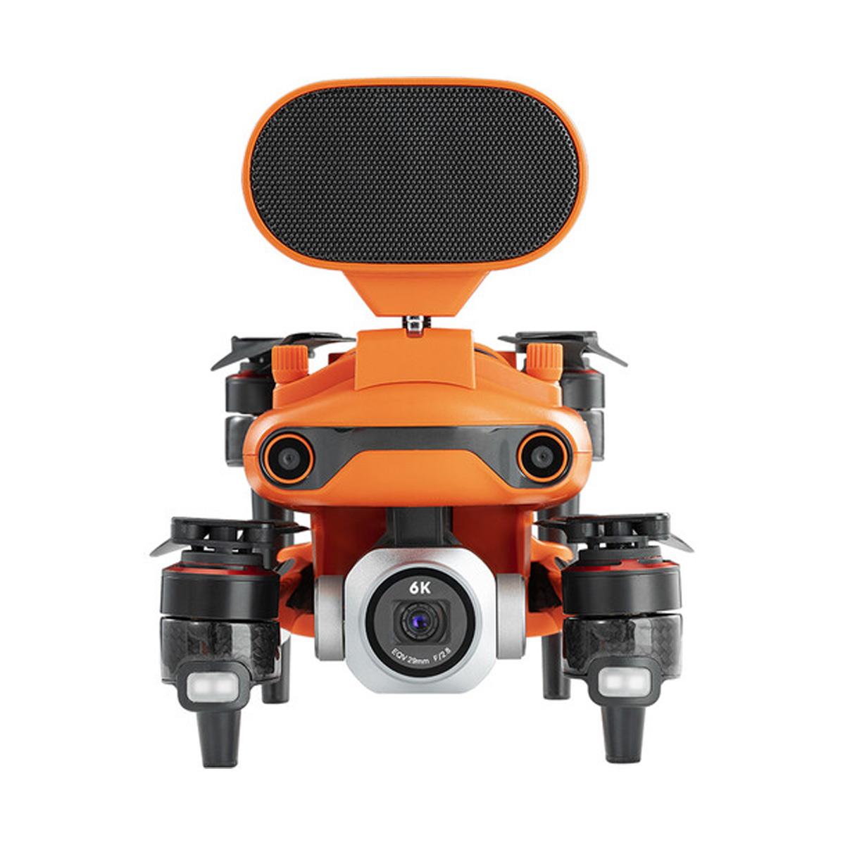
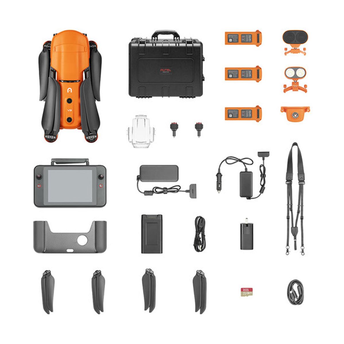
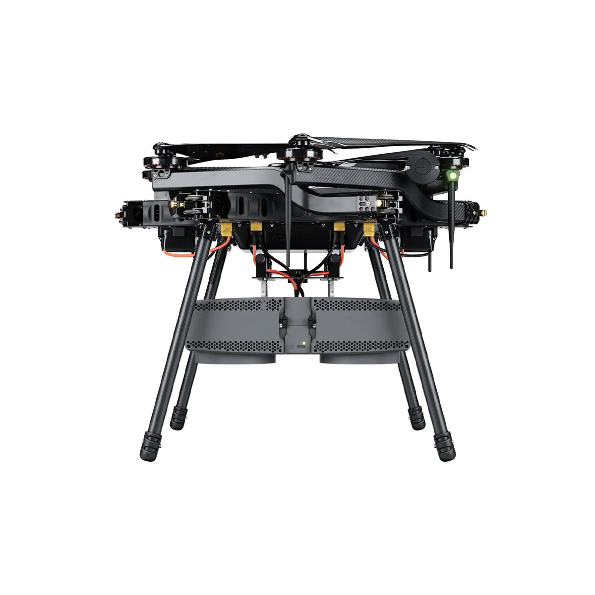
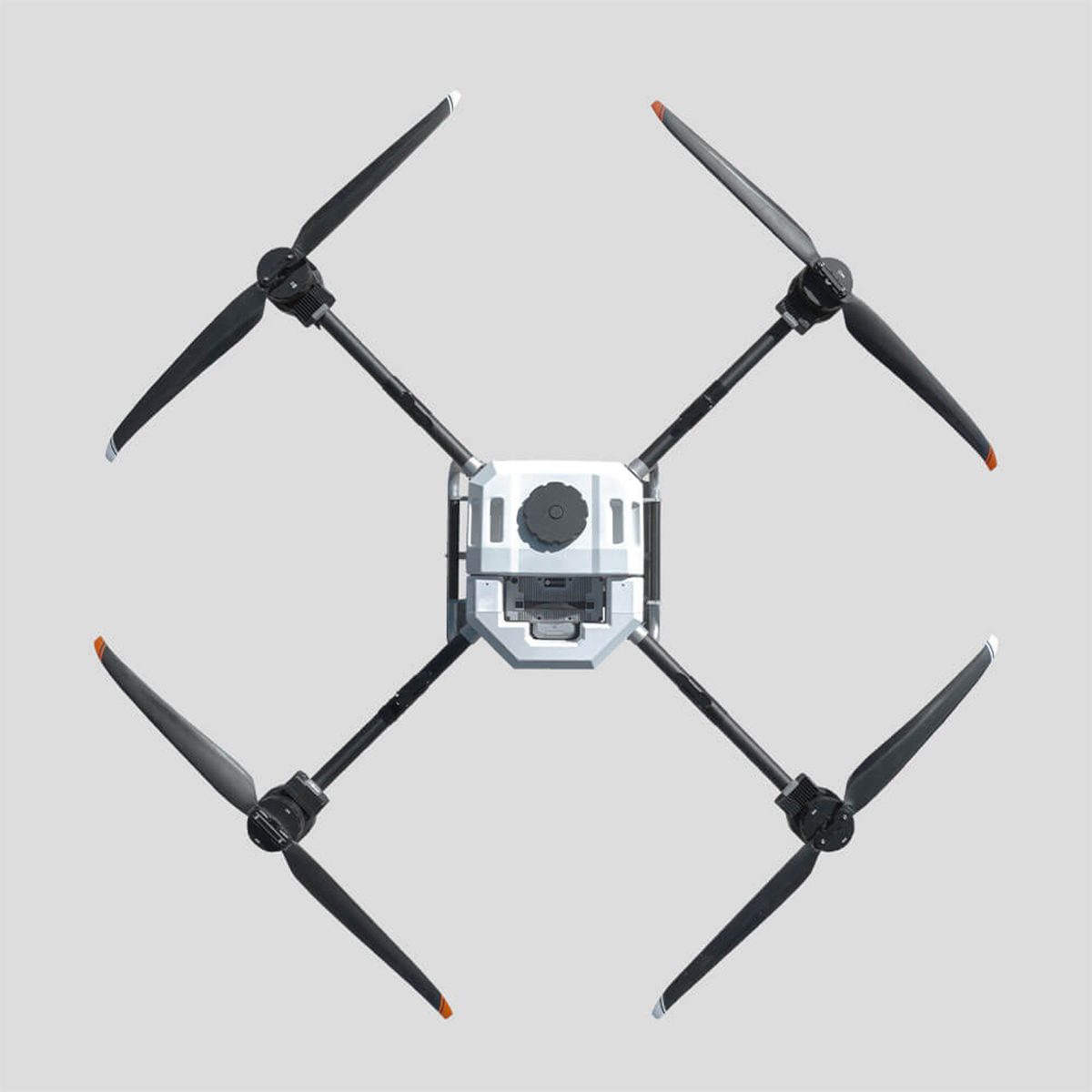
Autel Robotics EVO Max 4T Bundle
Call for Price


Autel Robotics EVO Max 4T Bundle
Call for PriceQuick View -
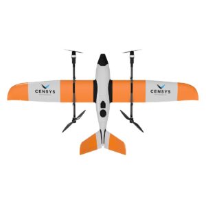
Censys Technologies Sentaero BVLOS
Call for Price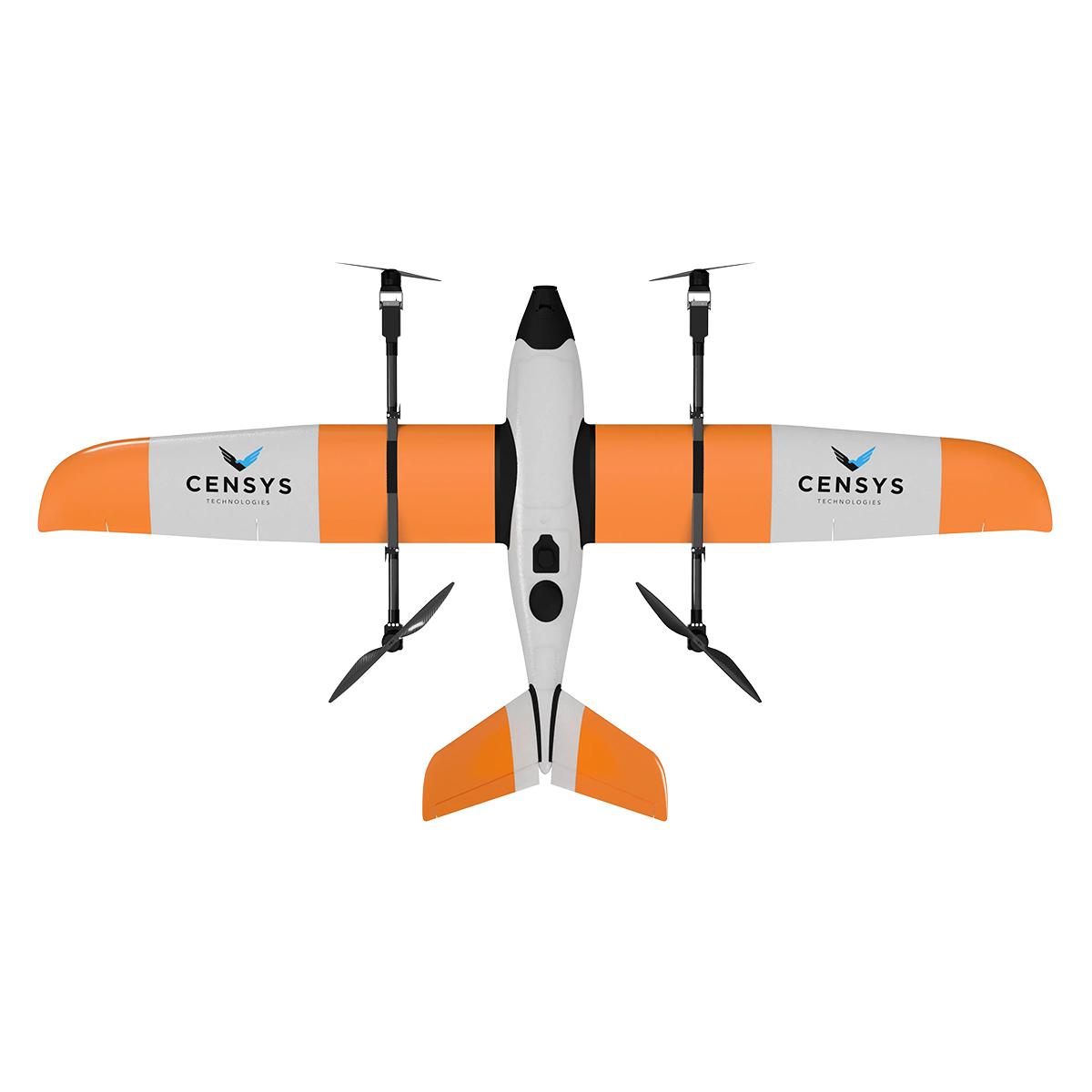
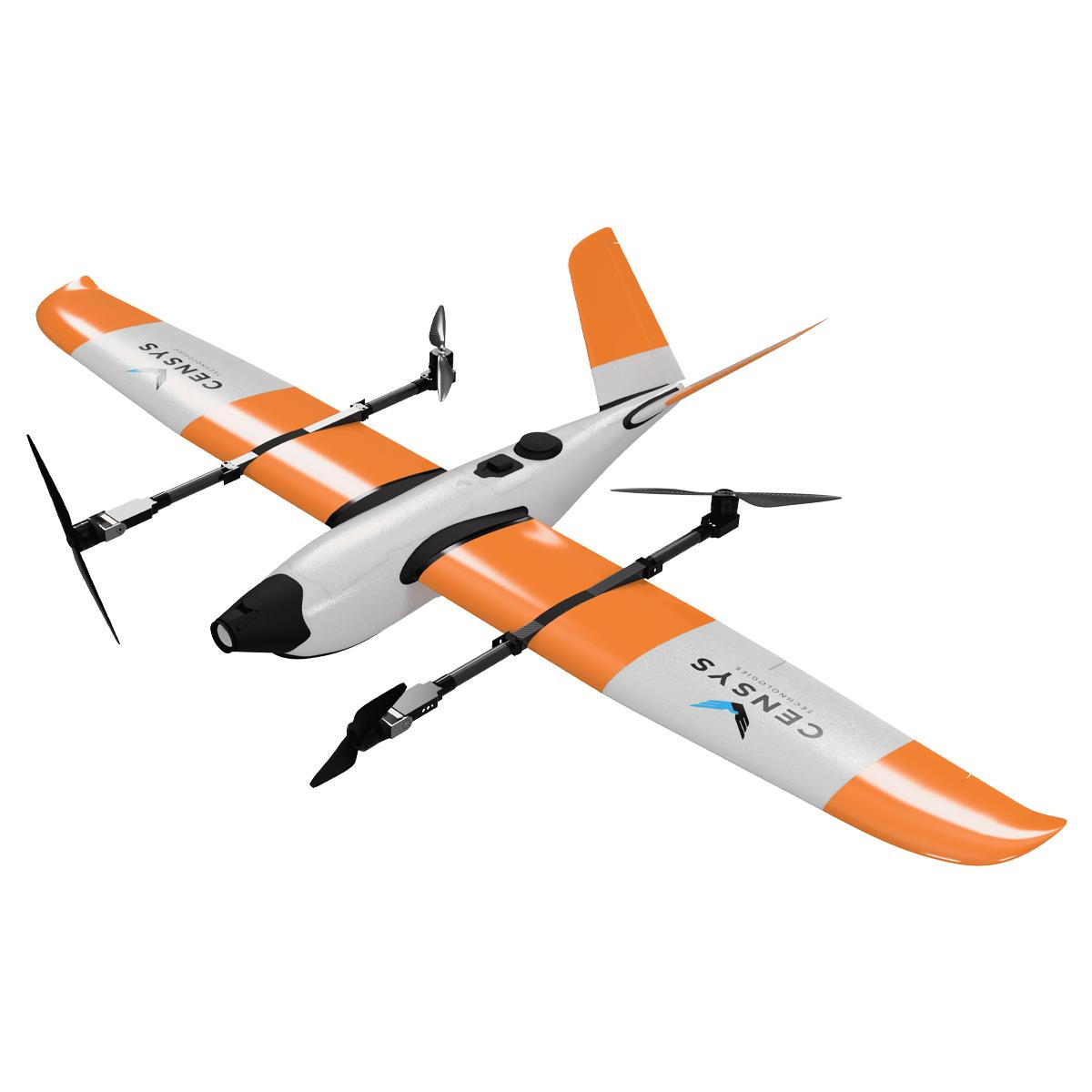
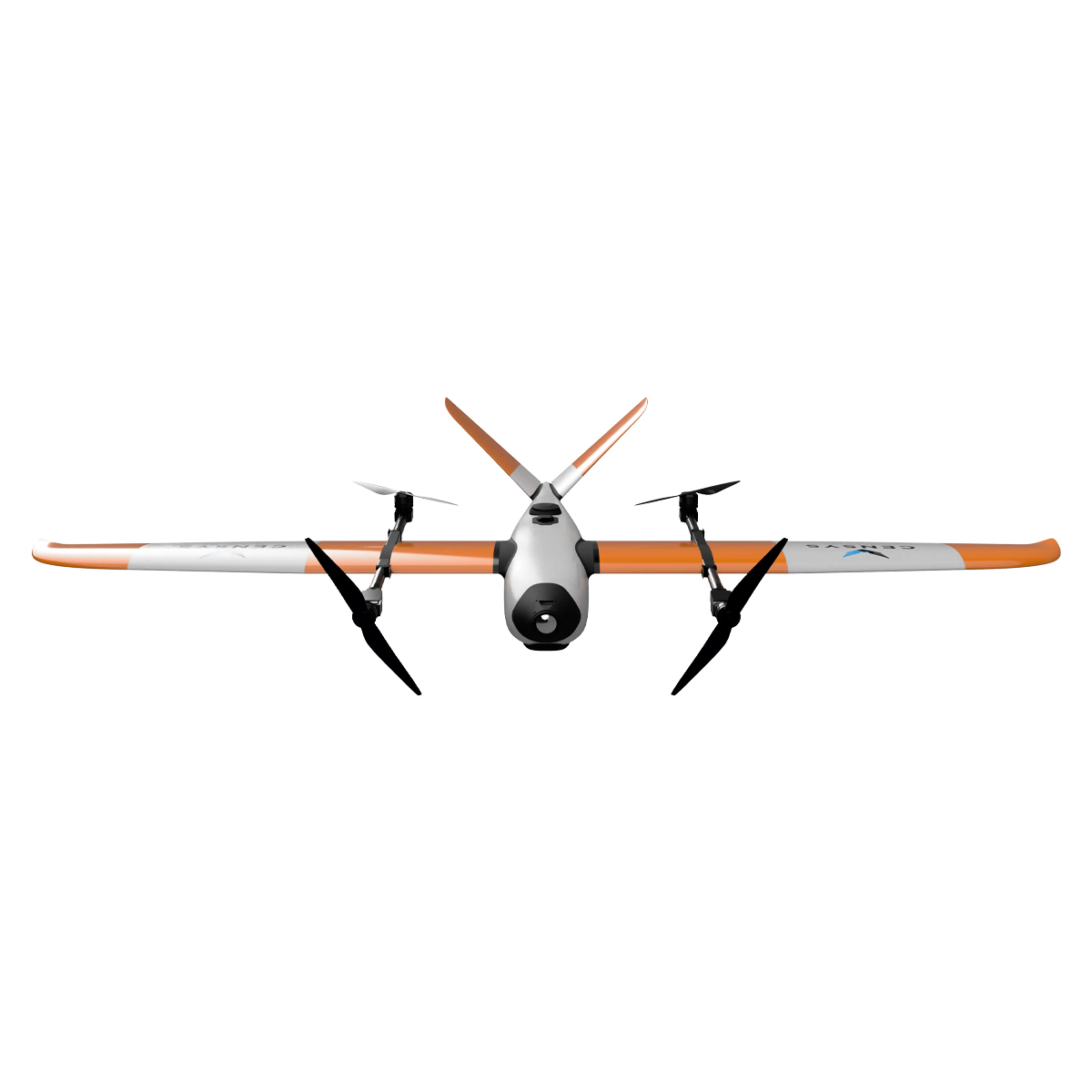
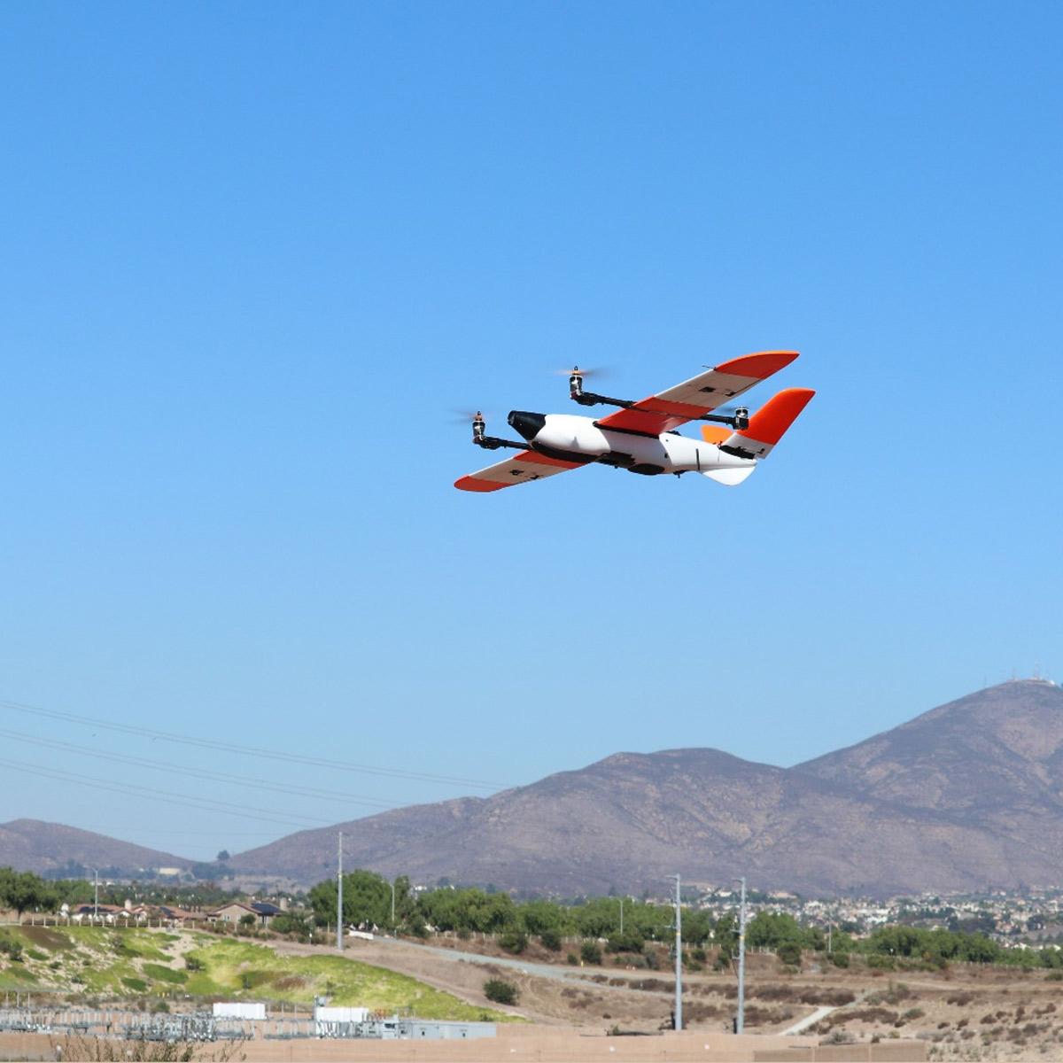
Censys Technologies Sentaero BVLOS
Call for PriceQuick View -
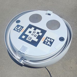
Counterdrone OmniDock-Mini
Call for Price

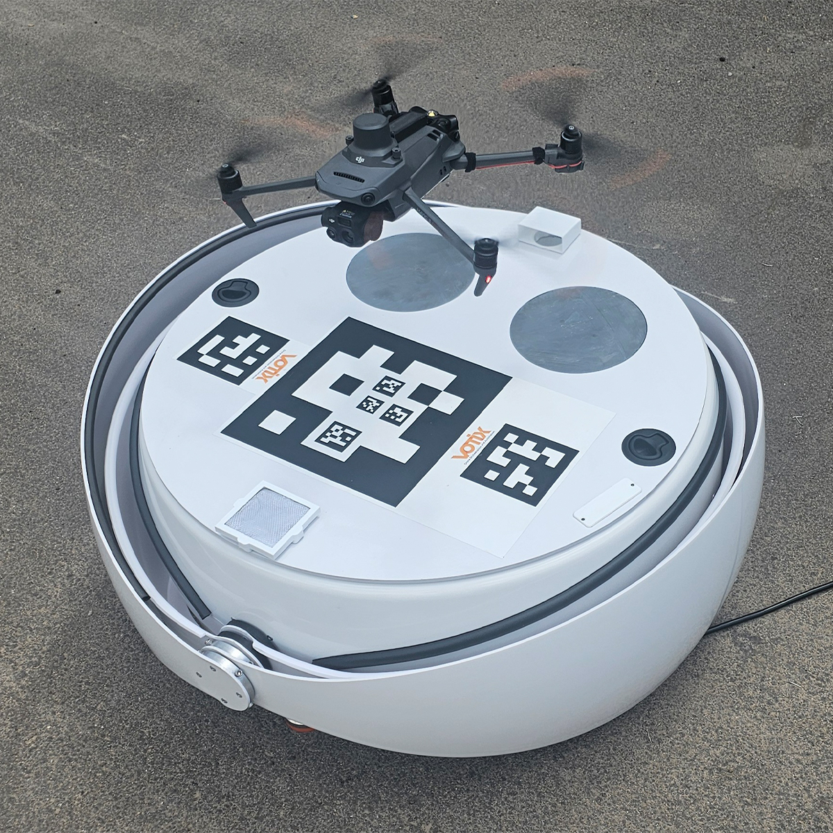
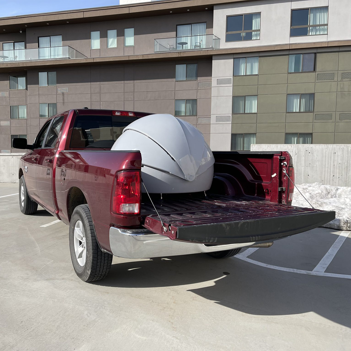

Counterdrone OmniDock-Mini
Call for PriceOmniDock-Mini
The OmniDock™ is a configurable drone-agnostic weatherproof and climate controlled charging station for your drone(s). OmniDock Mini is about half the size of OmniDock Standard and can accommodate a single Mavic sized drone. OmniDock Mini is currently integrated with Mavic 2, Mavic 3, and Anzu Raptor. Mini has all of the features and benefits of its big brother in a much smaller package.
Quick View -
Counterdrone OmniDock-Mini-1yrSub
Call for Price Counterdrone OmniDock-Mini-1yrSub
Call for PriceOmniDock Mini 1-Year Subscription
Experience unmatched reliability and performance with our OmniDock Mini One-Year Subscription Plan. Enjoy nationwide LTE connectivity across the United States, seamless hardware and software upgrades—including new drone integrations as they’re released—and rapid hardware replacement to keep your operations running without interruption. You’ll receive priority technical support from our expert team, free shipping anywhere in the continental U.S., and enhanced situational awareness with an integrated weather station featuring a built-in camera. This plan ensures you stay connected, supported, and fully equipped for every mission.
Quick View -

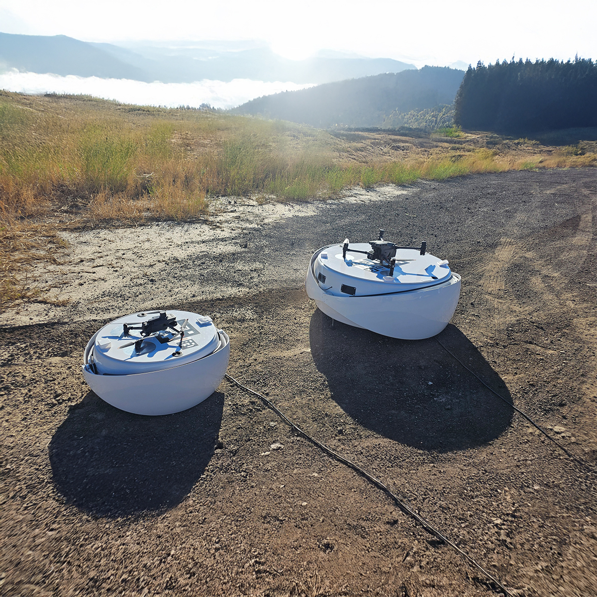
Counterdrone OmniDock-Standard
Call for Price
Counterdrone OmniDock-Standard
Call for PriceOmniDock-Standard
The OmniDock™ is a configurable drone-agnostic weatherproof and climate controlled charging station for your drone(s). OmniDock Standard is designed with configurable floors and can house one large drone or two smaller drones giving you twice the missions, redundancy, and threat response. They can even accommodate cable/winch systems for tethered drones.
Quick View -
Counterdrone OmniDock-Standard-1yrSub
Call for Price Counterdrone OmniDock-Standard-1yrSub
Call for PriceOmniDock Standard 1-Year Subscription
Experience unmatched reliability and performance with our OmniDock Standard One-Year Subscription Plan. Enjoy nationwide LTE connectivity across the United States, seamless hardware and software upgrades—including new drone integrations as they’re released—and rapid hardware replacement to keep your operations running without interruption. You’ll receive priority technical support from our expert team, free shipping anywhere in the continental U.S., and enhanced situational awareness with an integrated weather station featuring a built-in camera. This plan ensures you stay connected, supported, and fully equipped for every mission.
Quick View -

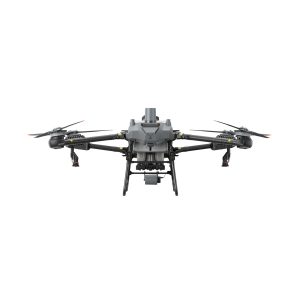
DJI Agras T40
Call for Price


DJI Agras T40
Call for PriceQuick View -
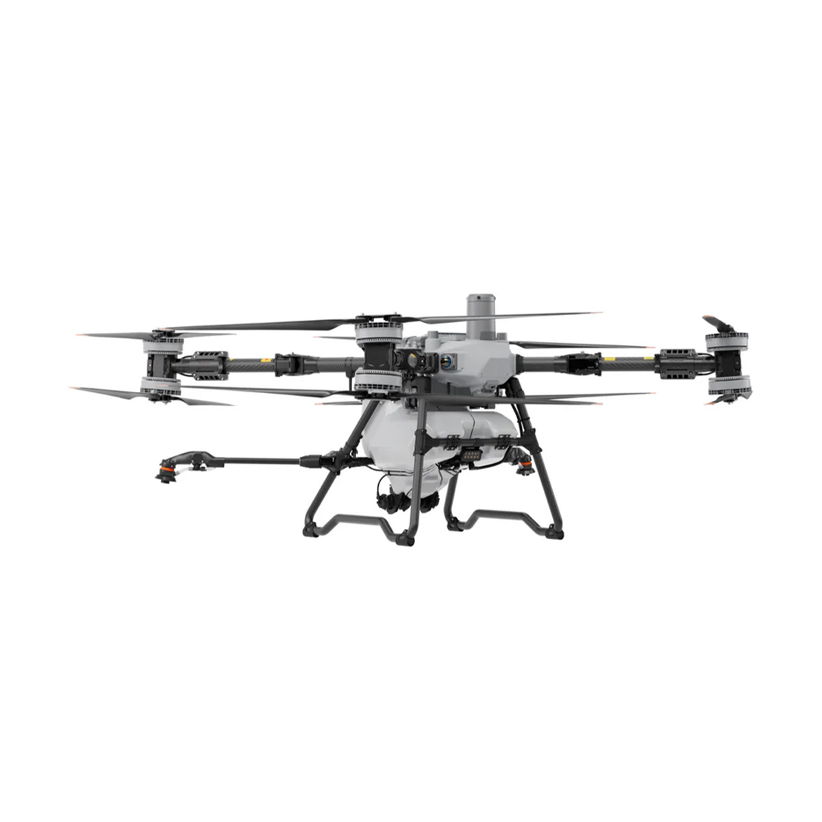
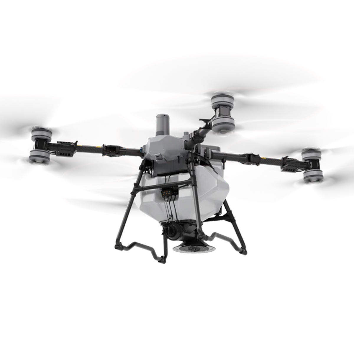
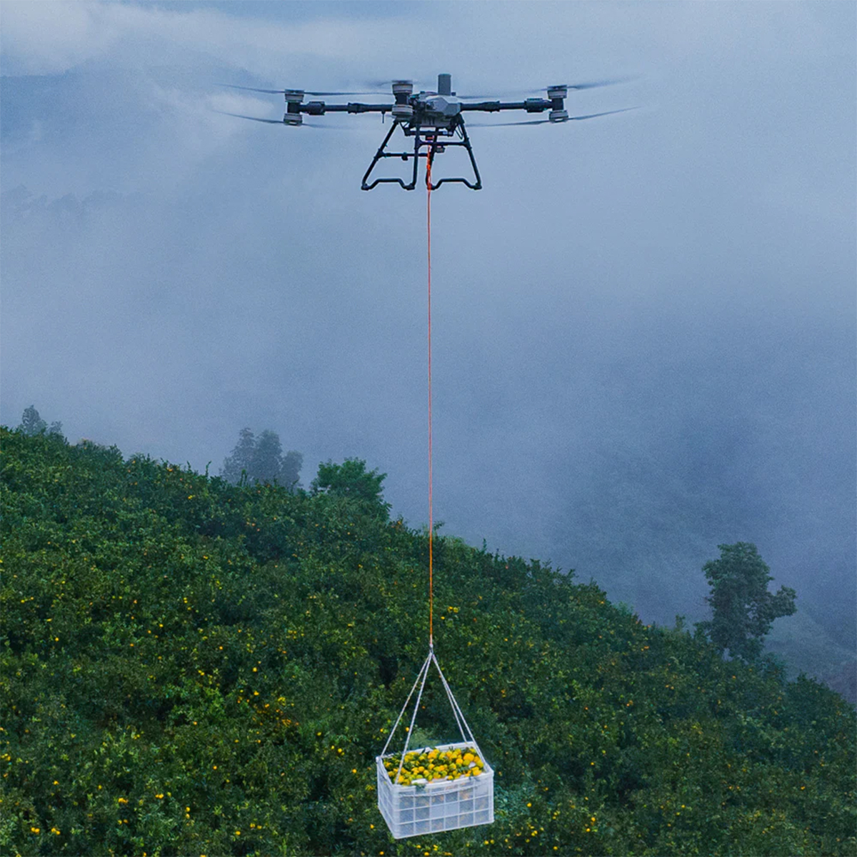
DJI Agras-T100 Sprayer Drone
Call for Price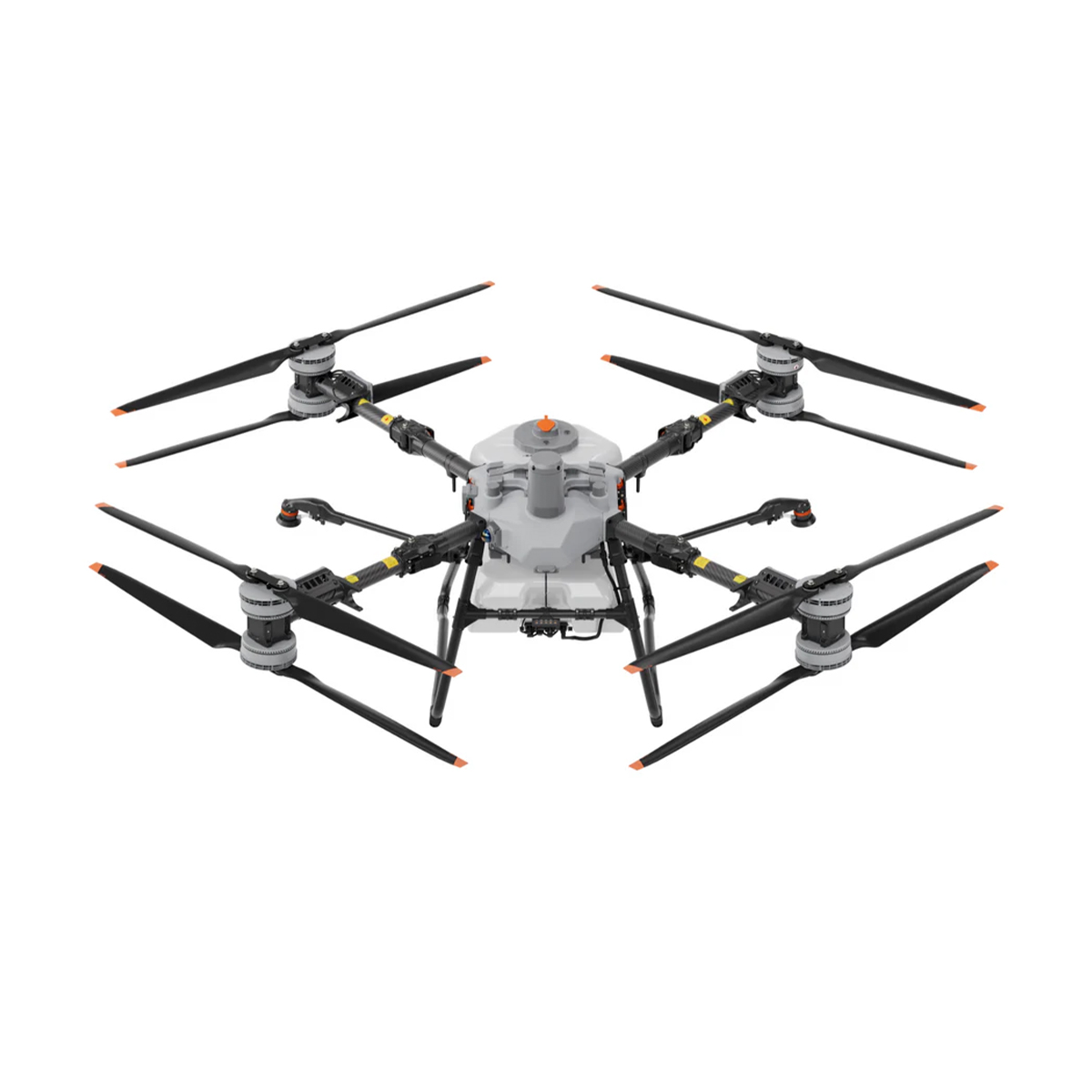


DJI Agras-T100 Sprayer Drone
Call for PriceDJI Agras-T100 Sprayer Drone
The DJI Agras T100 is a next-generation agricultural drone built on over a decade of innovation. With an impressive 220 lbs maximum payload, it delivers unmatched efficiency, doubling productivity across a wide range of applications, including spraying, spreading, and lifting. Equipped with cutting-edge safety systems and advanced intelligent algorithms, the T100 sets a new standard in safety, precision, and ease of operation for modern agriculture.
Quick View -

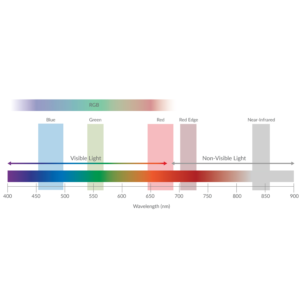
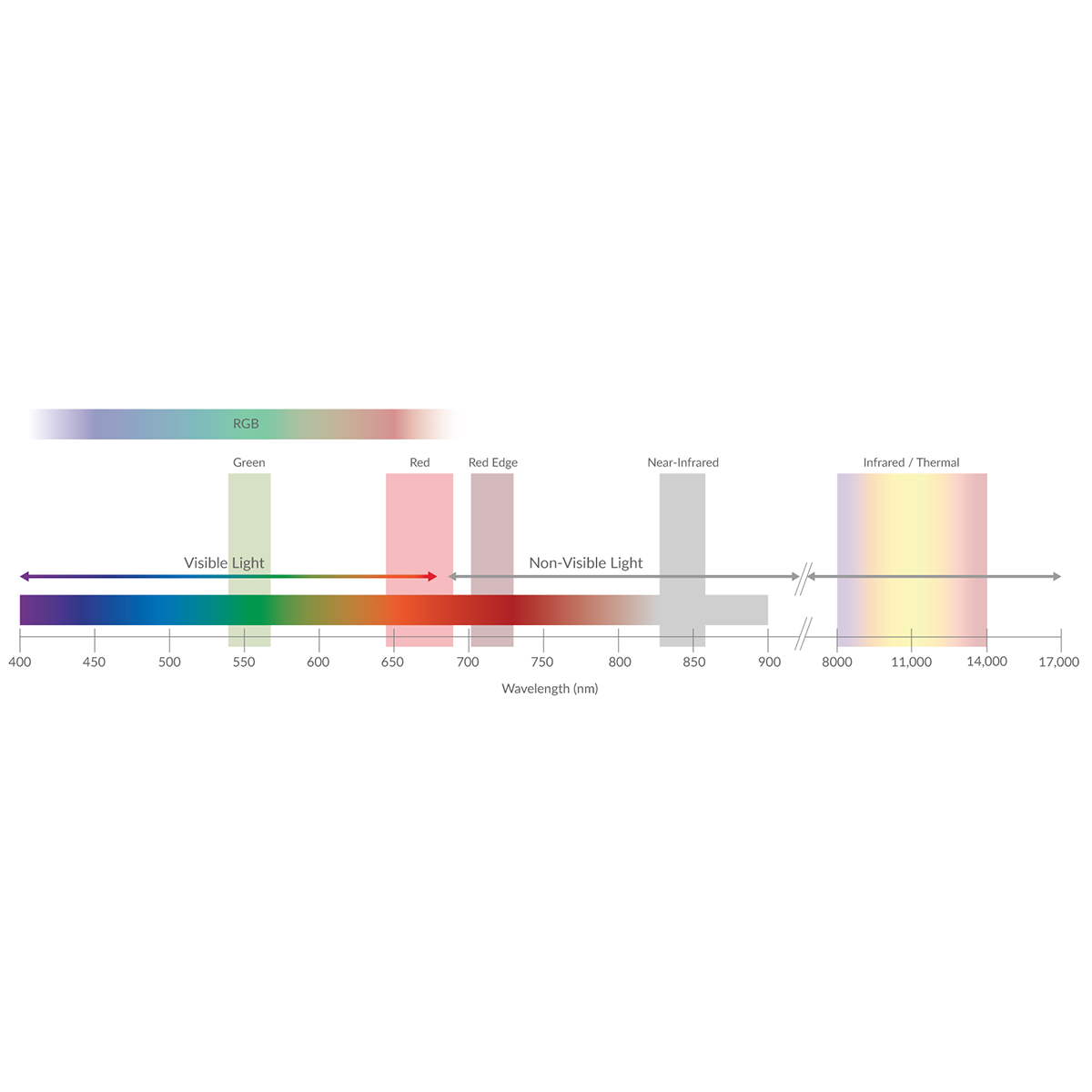
DJI Mavic 3 Multispectral
Call for Price


DJI Mavic 3 Multispectral
Call for PriceSee More, Work Smarter
Effective aerial surveying needs to see the invisible. That’s why Mavic 3 Multispectral has two forms of sight. It combines an RGB camera with a multispectral camera to scan and analyze crop growth with total clarity. Agricultural production management requires precision and data, and Mavic 3M delivers both.Quick View -

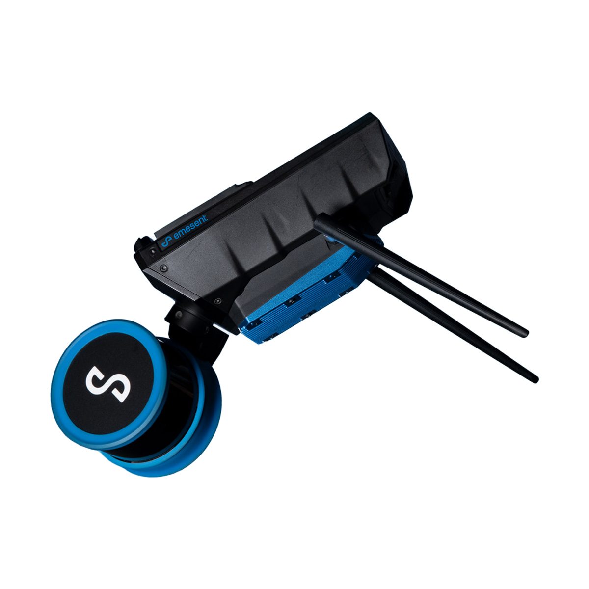
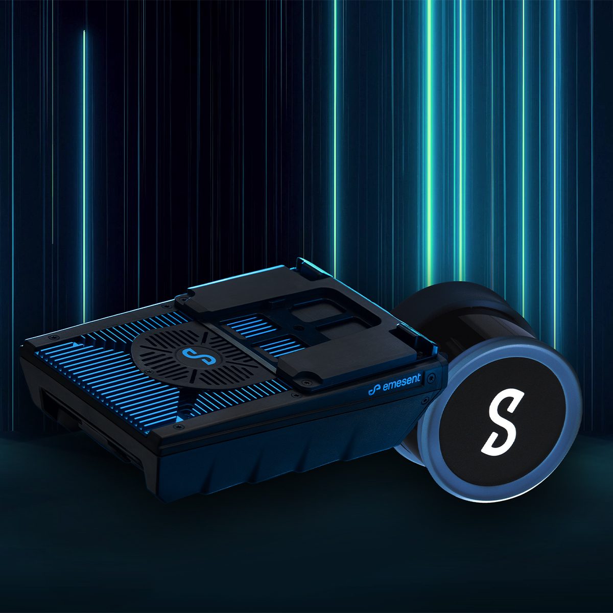
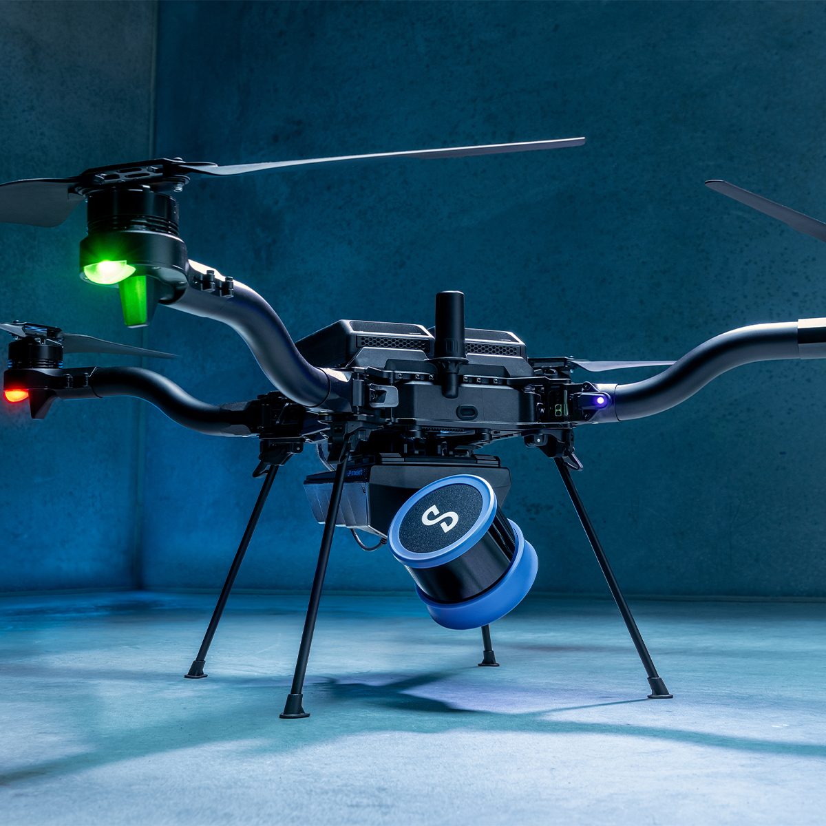
Emesent E00-GX1 RTK SLAM Scanner
Call for Price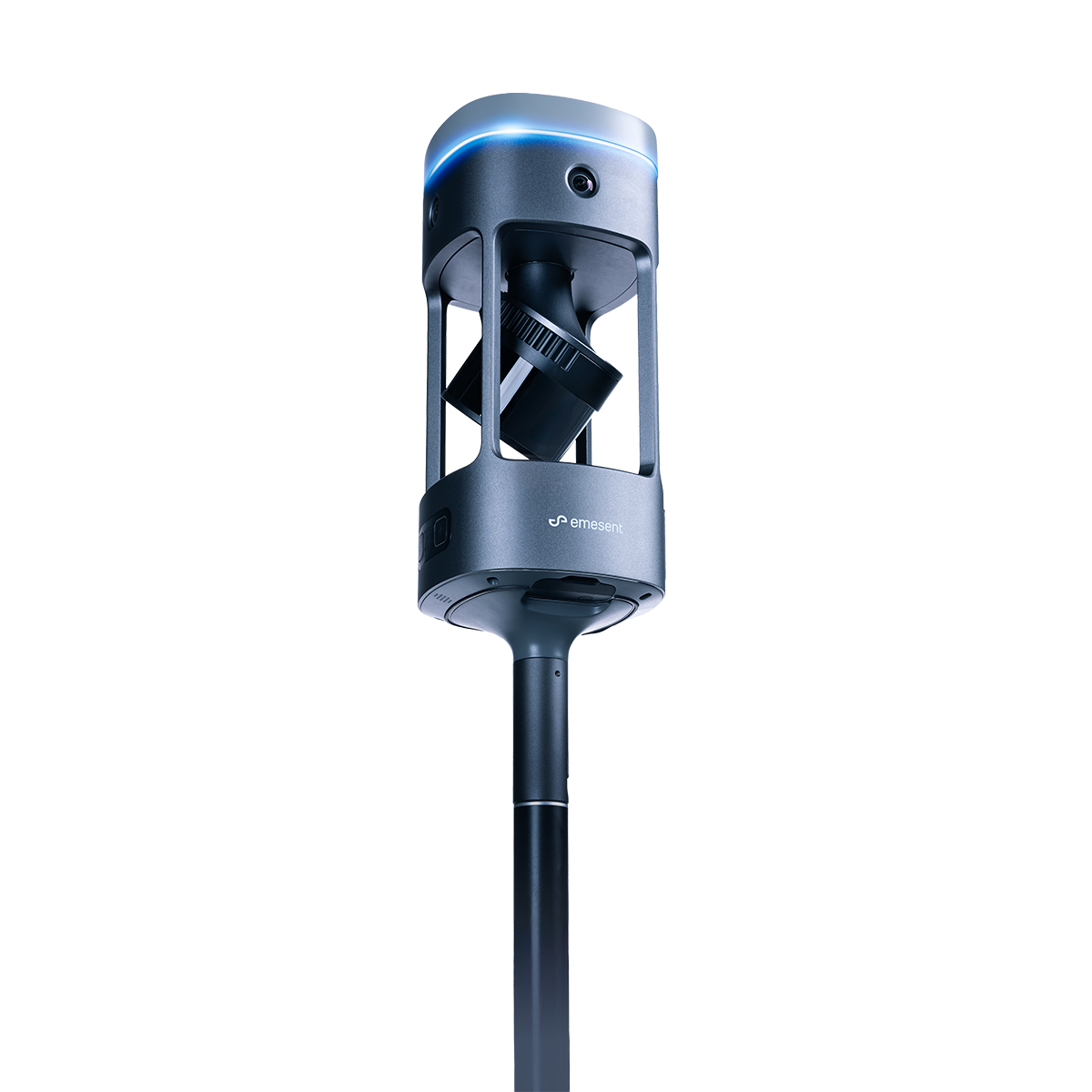


Emesent E00-GX1 RTK SLAM Scanner
Call for PriceEmesent E00-GX1 RTK SLAM Scanner
Reliable, highly accurate SLAM that works in any environment.
Emesent GX1 is the world’s most accurate RTK SLAM scanner, delivering 5-10mm global accuracy with integrated premium RTK georeferencing.Quick View -

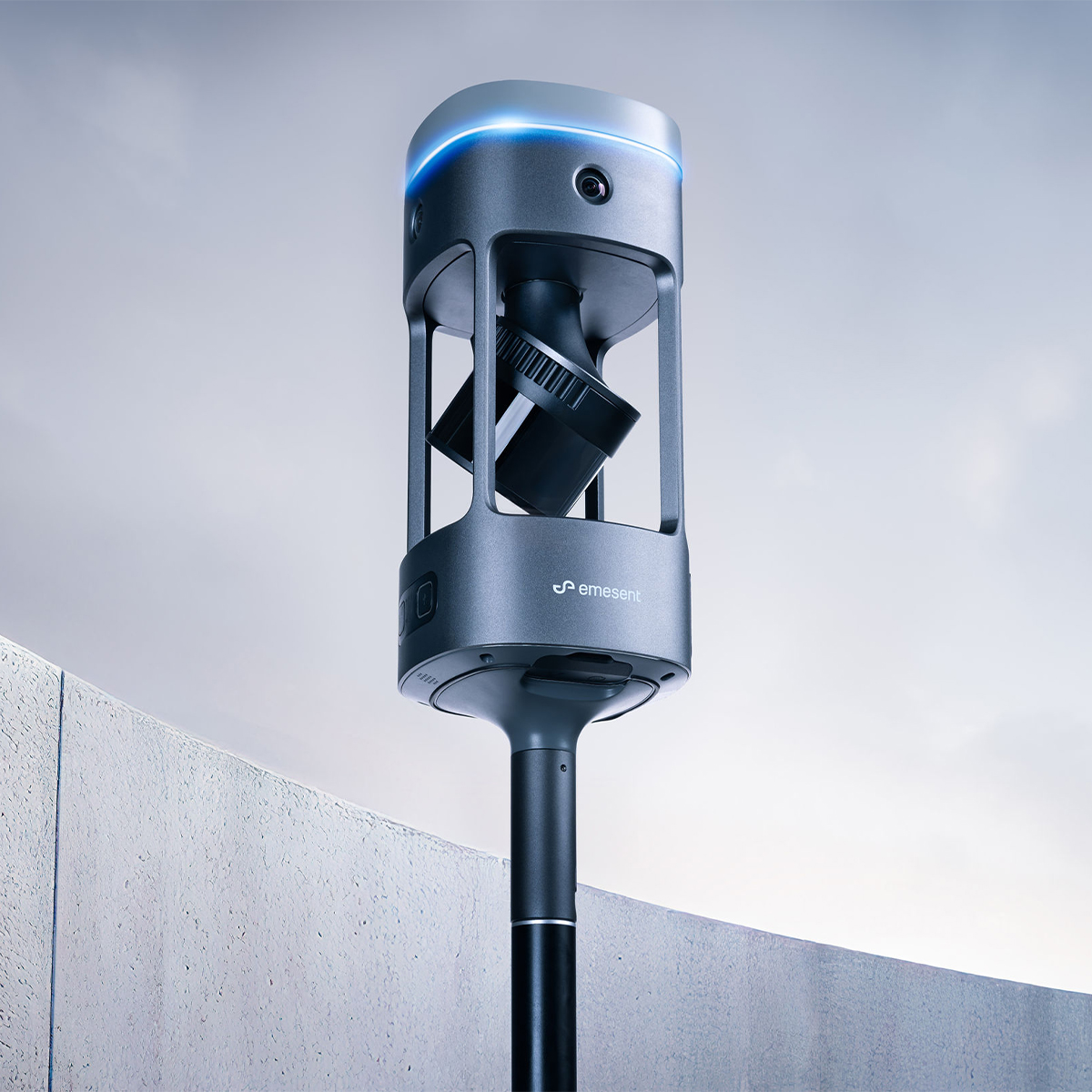
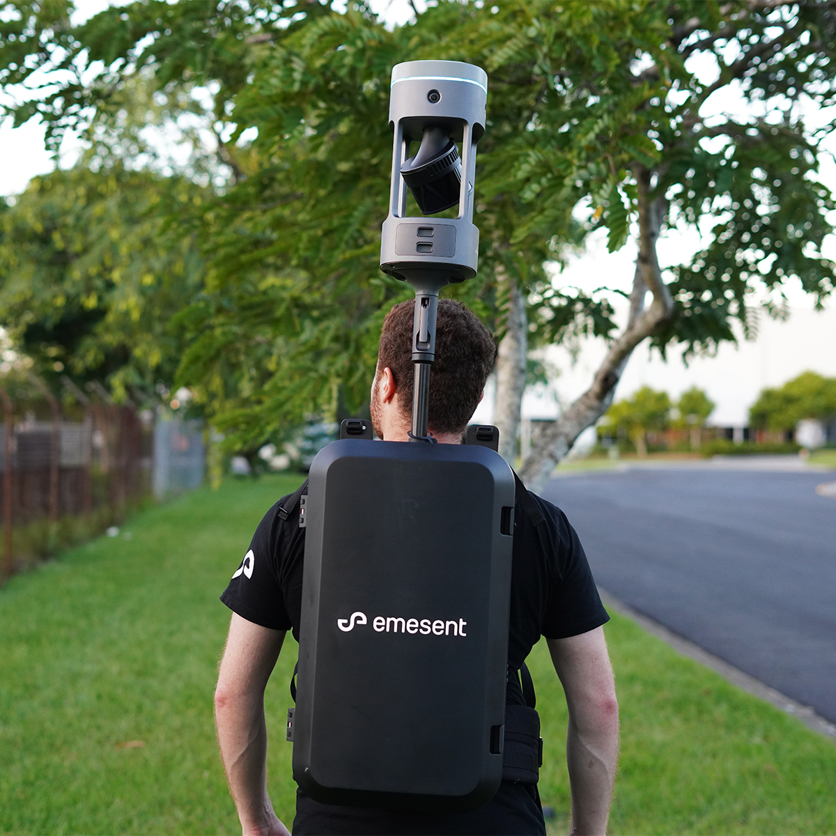
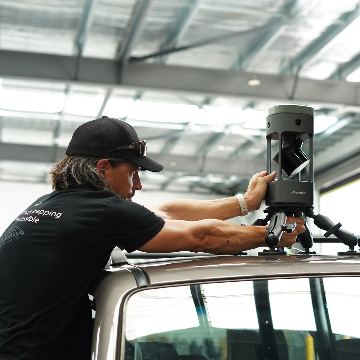
Emesent E00-HSTX-KIT Hovermap ST-X Kit
Call for Price


Emesent E00-HSTX-KIT Hovermap ST-X Kit
Call for PriceEmesent E00-HSTX-KIT Hovermap ST-X Kit
Fast, Accurate, High-detail Mobile Data Capture
Hovermap incorporates the latest in LiDAR sensing technology to offer high density point clouds with exceptional coverage. Featuring a sensing range of up to 300 meters and more than a million points per second, Hovermap captures detailed, accurate data over a wide area fast – accelerating your time to insight.
Emesent offers a choice of Hovermap business plans designed to match and support your specific LiDAR mapping and data visualization requirements.
Quick View -
New!
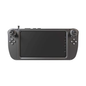
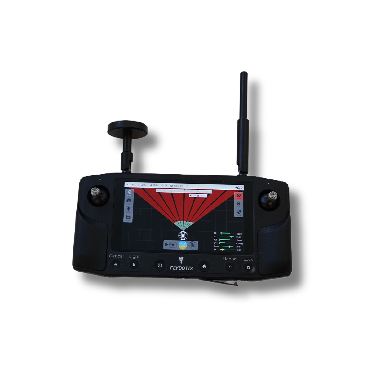
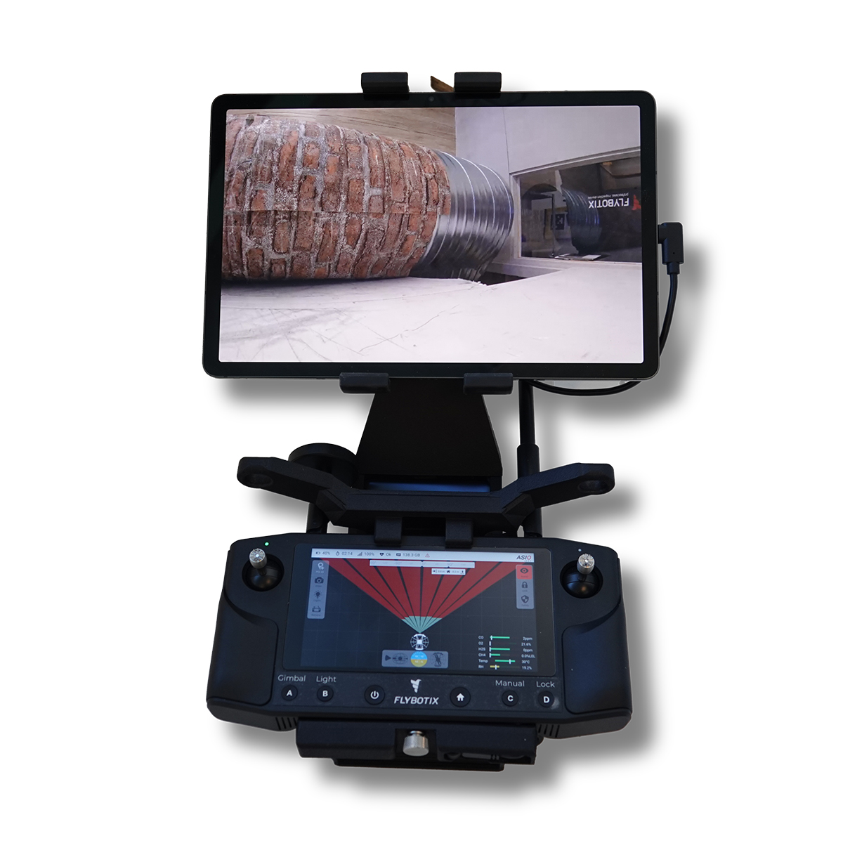
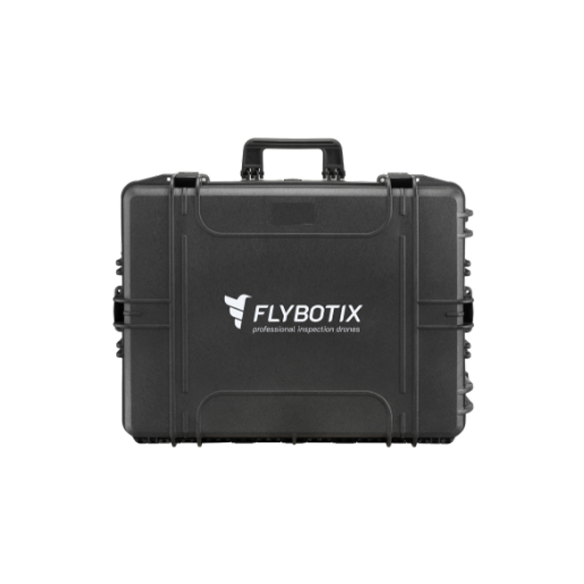
Flybotix AMO0179-00.00 UXV Ground Control Station
Call for Price


Flybotix AMO0179-00.00 UXV Ground Control Station
Call for PriceFlybotix AMO0179-00.00 UXV Ground Control Station
The Tab 5 is a ground control station intended for commercial use, optimizing the user experience with its sleek and improved ergonomic design.
Quick View -
New!

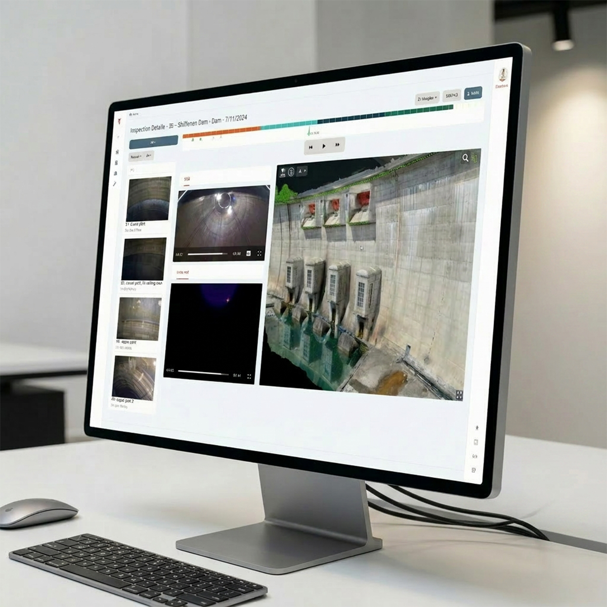
Flybotix FNA0006-00.00 ASIO Connect Premium – Yearly Subscription
Call for Price
Flybotix FNA0006-00.00 ASIO Connect Premium – Yearly Subscription
Call for PriceFlybotix FNA0006-00.00 ASIO Connect Premium – Yearly Subscription
All-in-One Platform for Intelligent Inspection
ASIO Connect enables you to streamline your inspection data processing workflow with a powerful cloud-based platform designed for efficiency and collaboration.Quick View -
New!
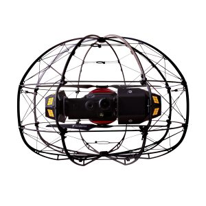
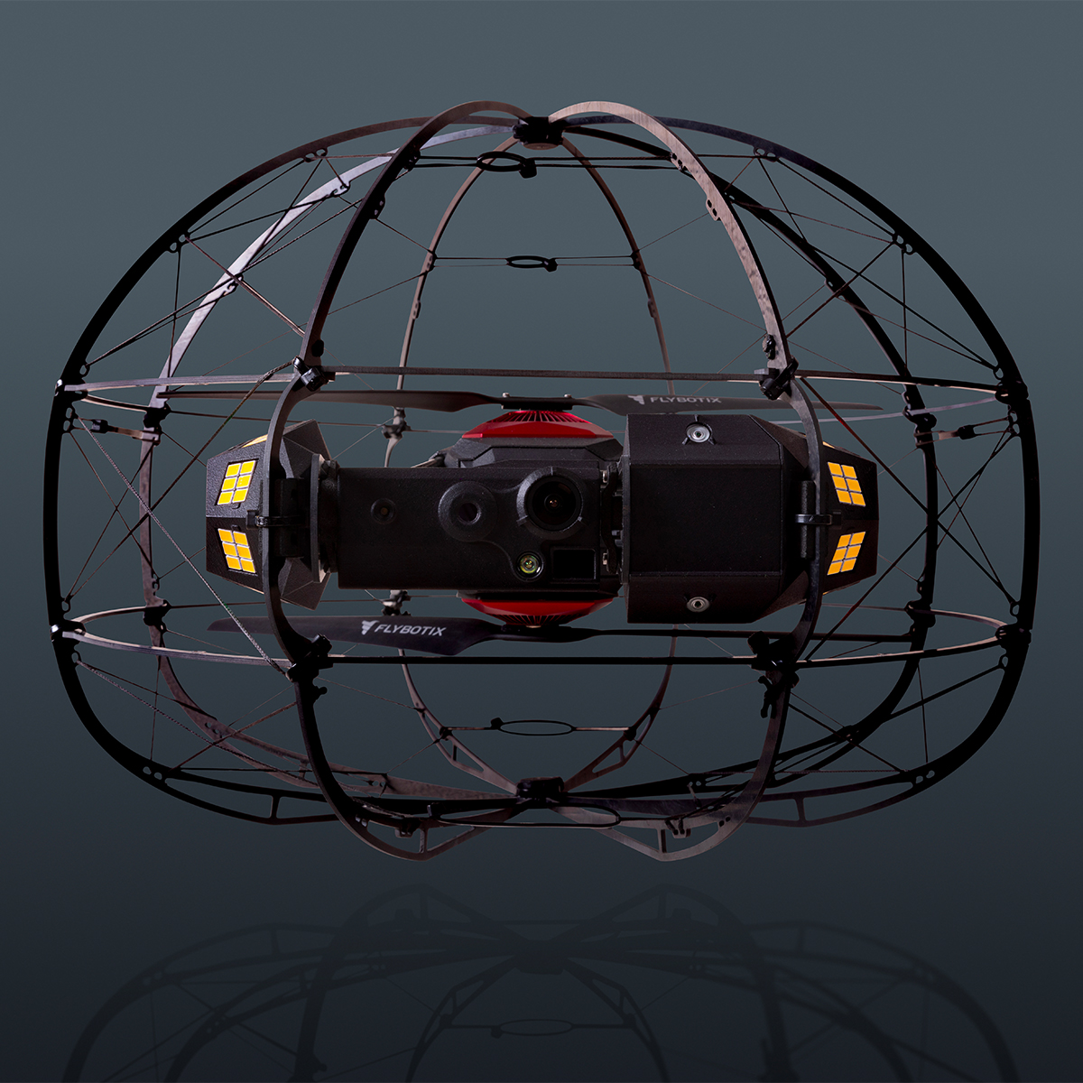
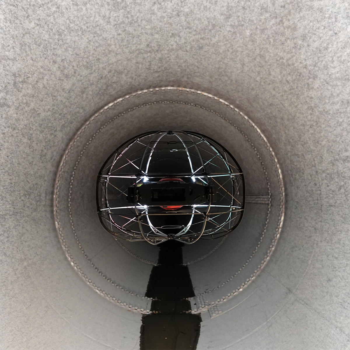
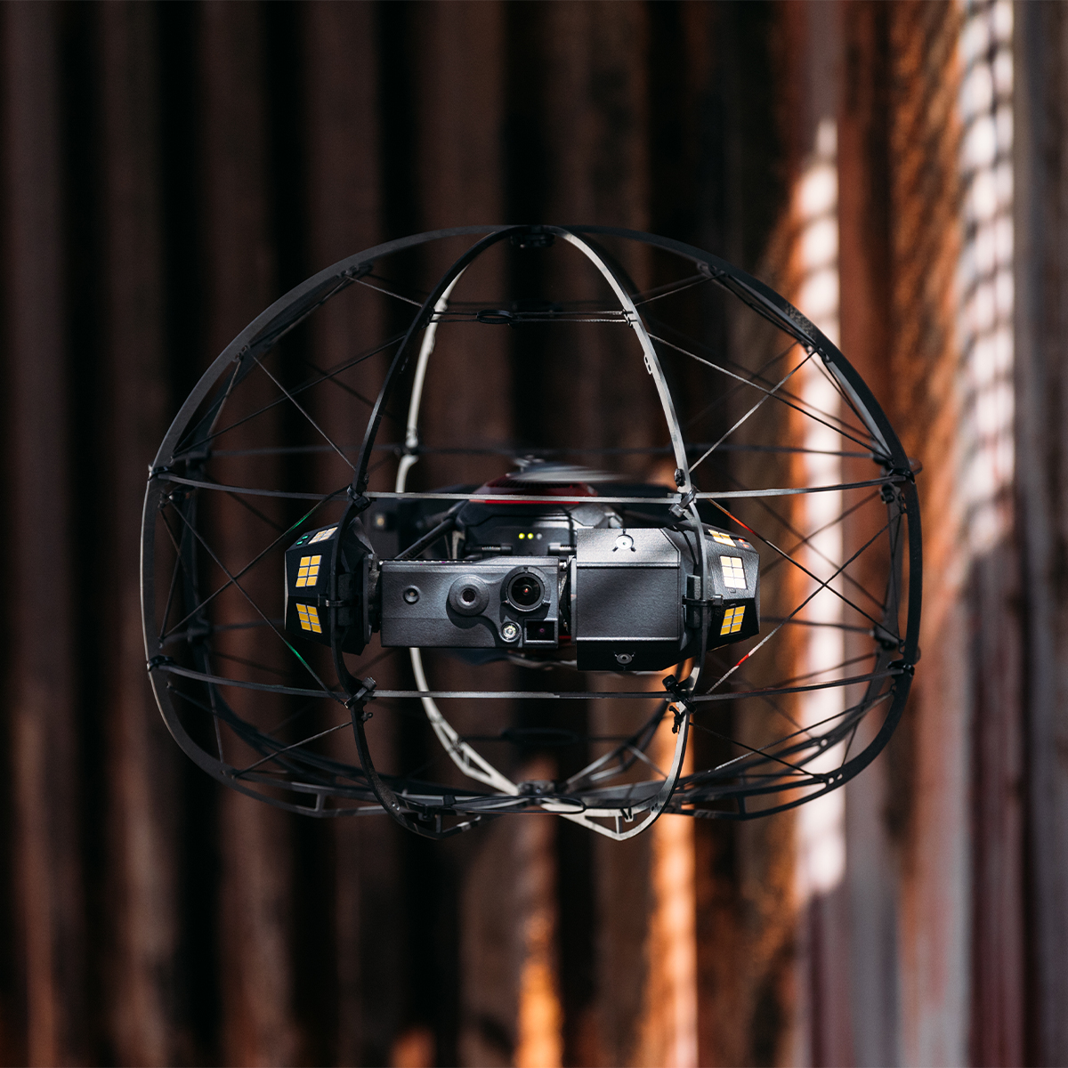
Flybotix KMC0001-02.00_BaHo ASIO X Drone – Black Herelink
Call for Price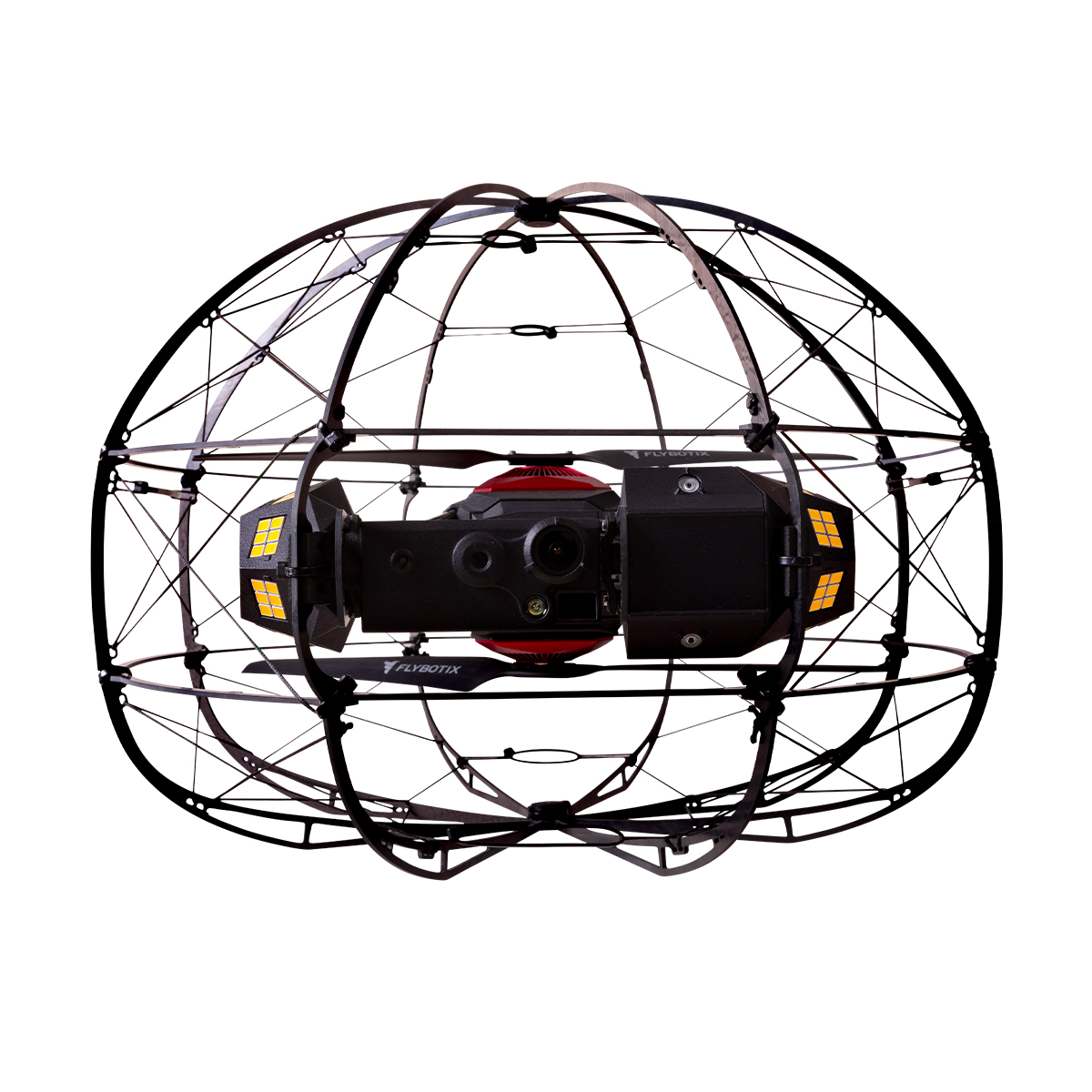


Flybotix KMC0001-02.00_BaHo ASIO X Drone – Black Herelink
Call for PriceFlybotix KMC0001-02.00_BaHo ASIO X Drone – Black Herelink
Drone-based solution for inspection and digitization of confined spaces.
The Flybotix ASIO X is an advanced, commercial-grade indoor inspection drone explicitly engineered to navigate hazardous, GPS-denied, and confined spaces.Quick View -
New!
Flybotix KMC0001-02.00_BuHo ASIO X Drone – Blue Herelink
Call for Price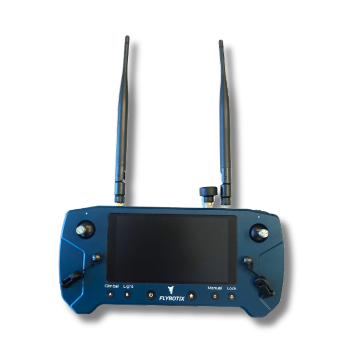
Flybotix KMC0001-02.00_BuHo ASIO X Drone – Blue Herelink
Call for PriceFlybotix KMC0001-02.00_BuHo ASIO X Drone – Blue Herelink
Drone-based solution for inspection and digitization of confined spaces.
The Flybotix ASIO X is an advanced, commercial-grade indoor inspection drone explicitly engineered to navigate hazardous, GPS-denied, and confined spaces.Quick View -
New!
Flybotix KMC0001.02.00_Nd ASIO X Drone – NDAA Approved
Call for Price

Flybotix KMC0001.02.00_Nd ASIO X Drone – NDAA Approved
Call for PriceFlybotix KMC0001.02.00_Nd ASIO X Drone – NDAA Approved
Drone-based solution for inspection and digitization of confined spaces.
The Flybotix ASIO X is an advanced, commercial-grade indoor inspection drone explicitly engineered to navigate hazardous, GPS-denied, and confined spaces.Quick View -

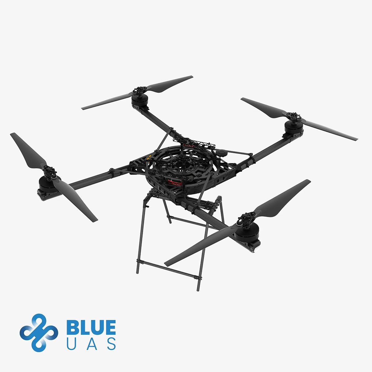
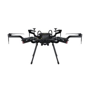
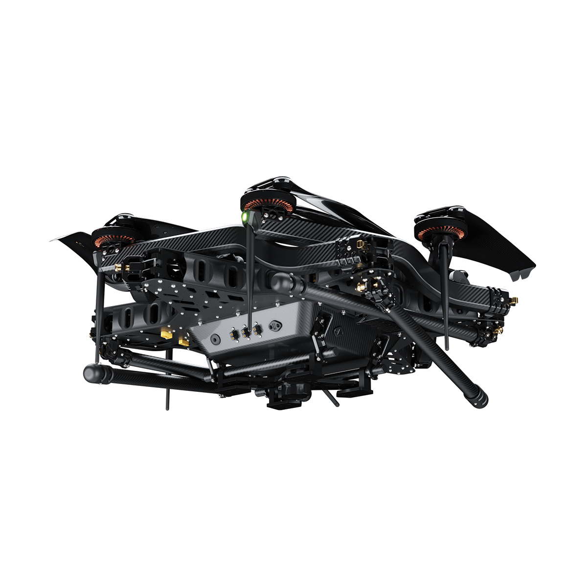
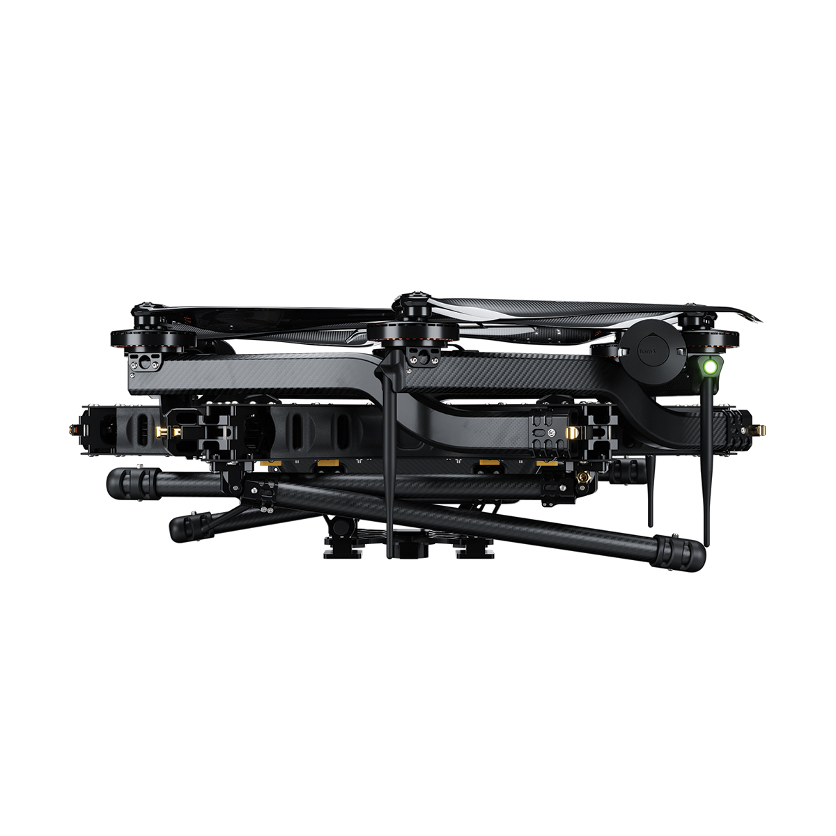
Freefly Alta X – Blue Kit
Call for Price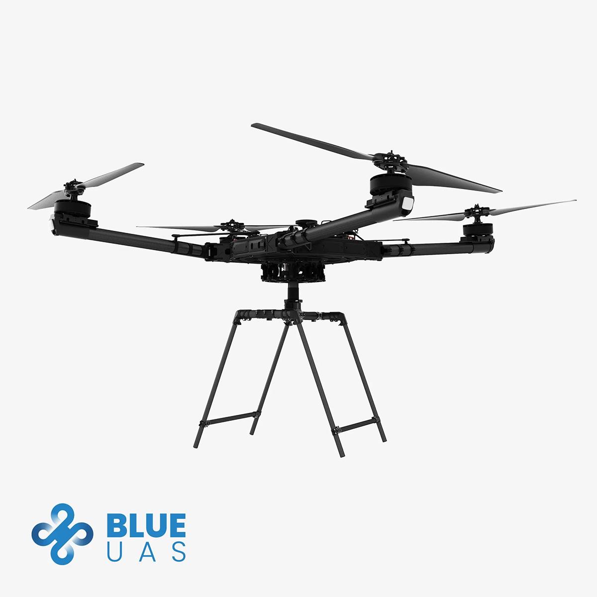

Freefly Alta X – Blue Kit
Call for PriceBLUE UAS CLEARED
Quick View -
Freefly Astro Max
Call for Price
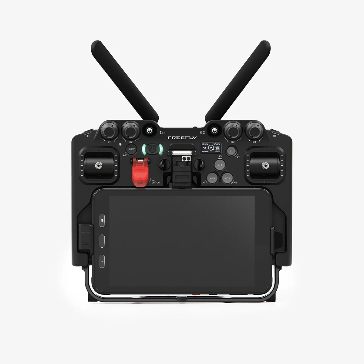

Freefly Astro Max
Call for PriceQuick View -
New!
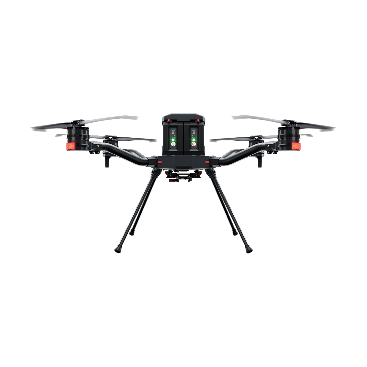
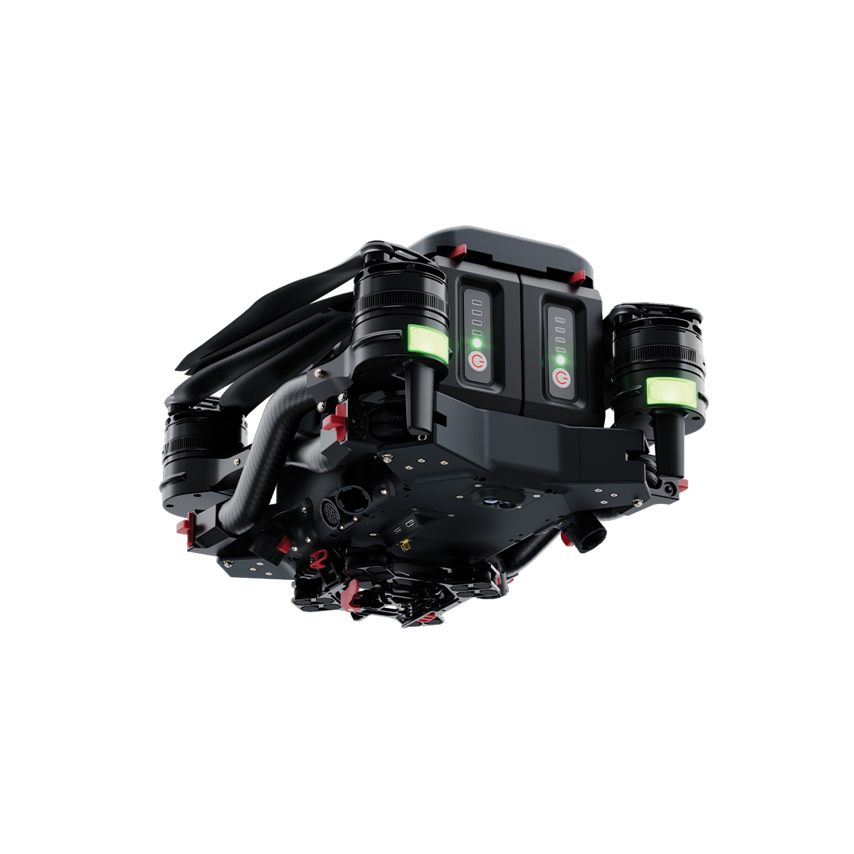
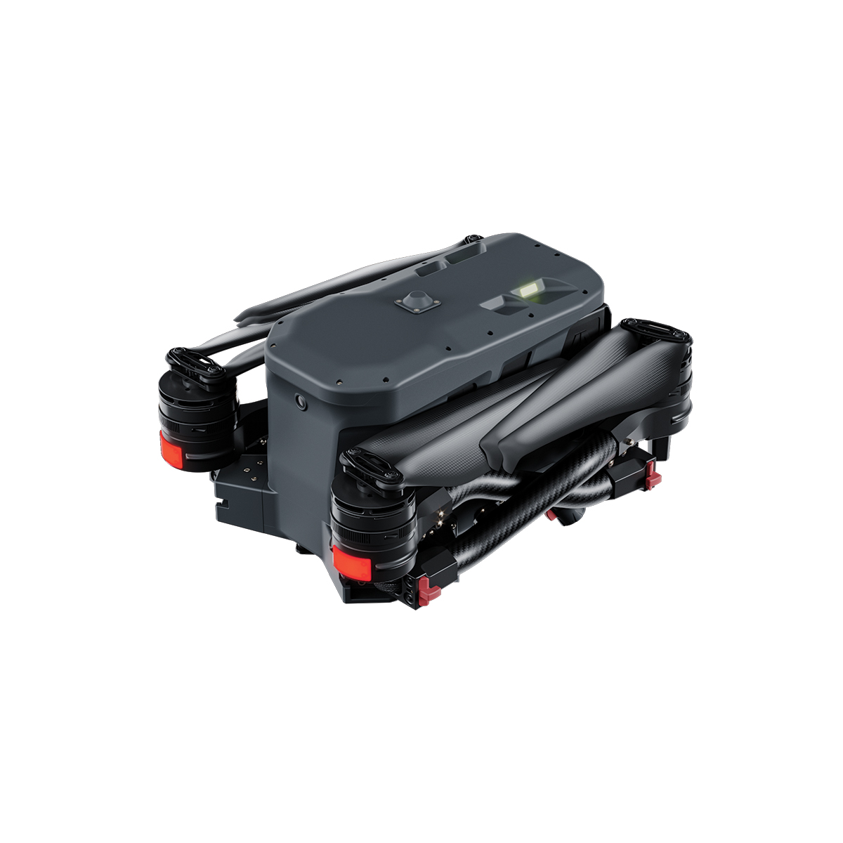
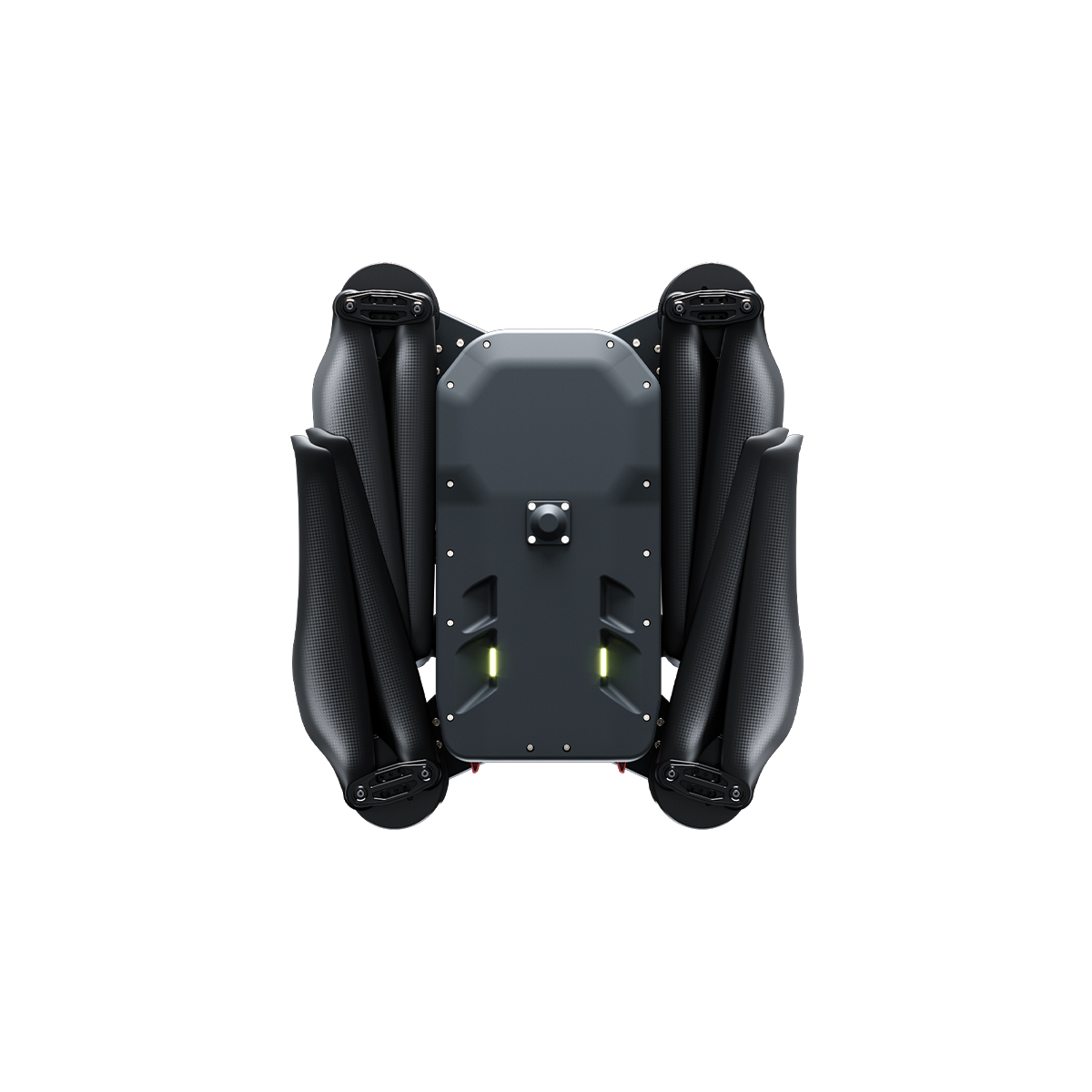
Harris Aerial H4C Quad Drone
Call for Price

Harris Aerial H4C Quad Drone
Call for PriceHarris Aerial H4C Quad Drone
Compact power. Uncompromising precision. The H4C pairs two massive 8 Ah intelligent 12S smart batteries with a foldable, IP54-rated airframe to deliver a true 4 kg payload and up to 50 minutes of flight — in a form factor that fits in a car seat or backpack.
Designed, manufactured, assembled, and supported in the United States. When mission success is non-negotiable, the H4C is your platform.
Quick View -
New!
Harris Aerial H6 Electric Drone
Call for Price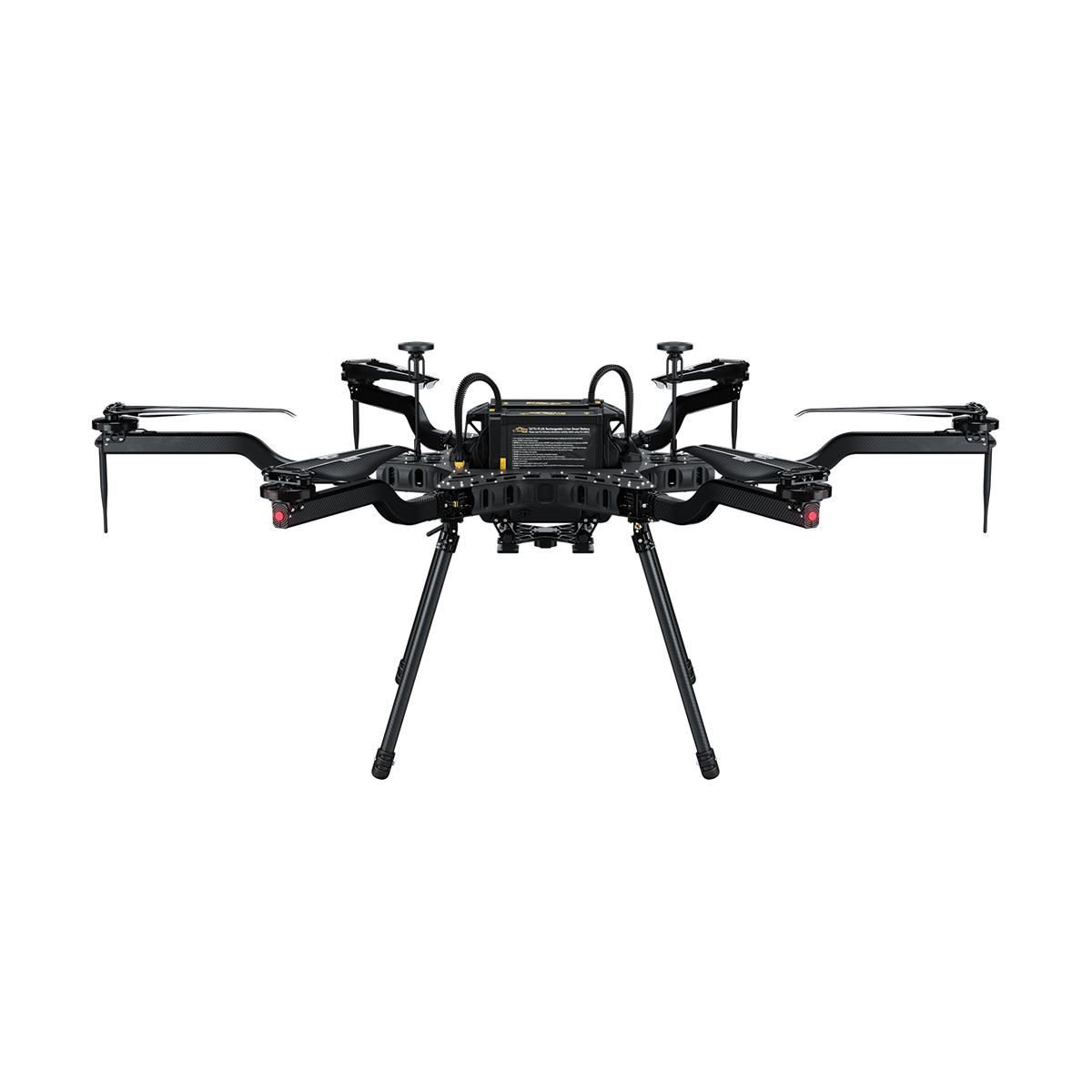
Harris Aerial H6 Electric Drone
Call for PriceHarris Aerial H6 Electric Drone
Revolutionizing Aerial Power. The Carrier H6 Electric is a long-duration, heavy-lift hexacopter optimized for payload versatility across demanding mission profiles. Designed for rapid field deployment, the platform comes ready to plug-and-play.
Smart 12S 16,000 mAh lithium polymer batteries deliver 48 minutes of unloaded endurance and field-swap in seconds. Convertible in minutes to Hybrid EFI or Hydrogen power formats — one airframe, three power systems.
Quick View -
New!
Harris Aerial H6 Hybrid EFI Drone
Call for Price


Harris Aerial H6 Hybrid EFI Drone
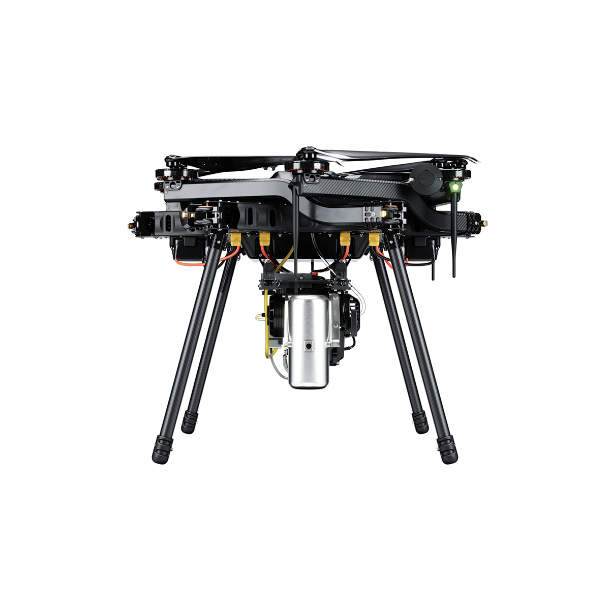
Call for PriceHarris Aerial H6 Hybrid EFI Drone
Multi-hour, high-endurance flight powered by an advanced 2-stroke EFI generator. Built for long-duration operations. The Carrier H6 Hybrid EFI offers unparalleled payload versatility for long-duration mission profiles. Built around a highly efficient electronic fuel injection system, it eliminates range anxiety and minimizes downtime.
This system arrives ready to plug-and-play, maintaining the H6 family’s hallmark ability to convert to all-electric or hydrogen-electric power formats in minutes — one airframe, three power systems.
Quick View -
New!
Harris Aerial H6 Hydrone
Call for Price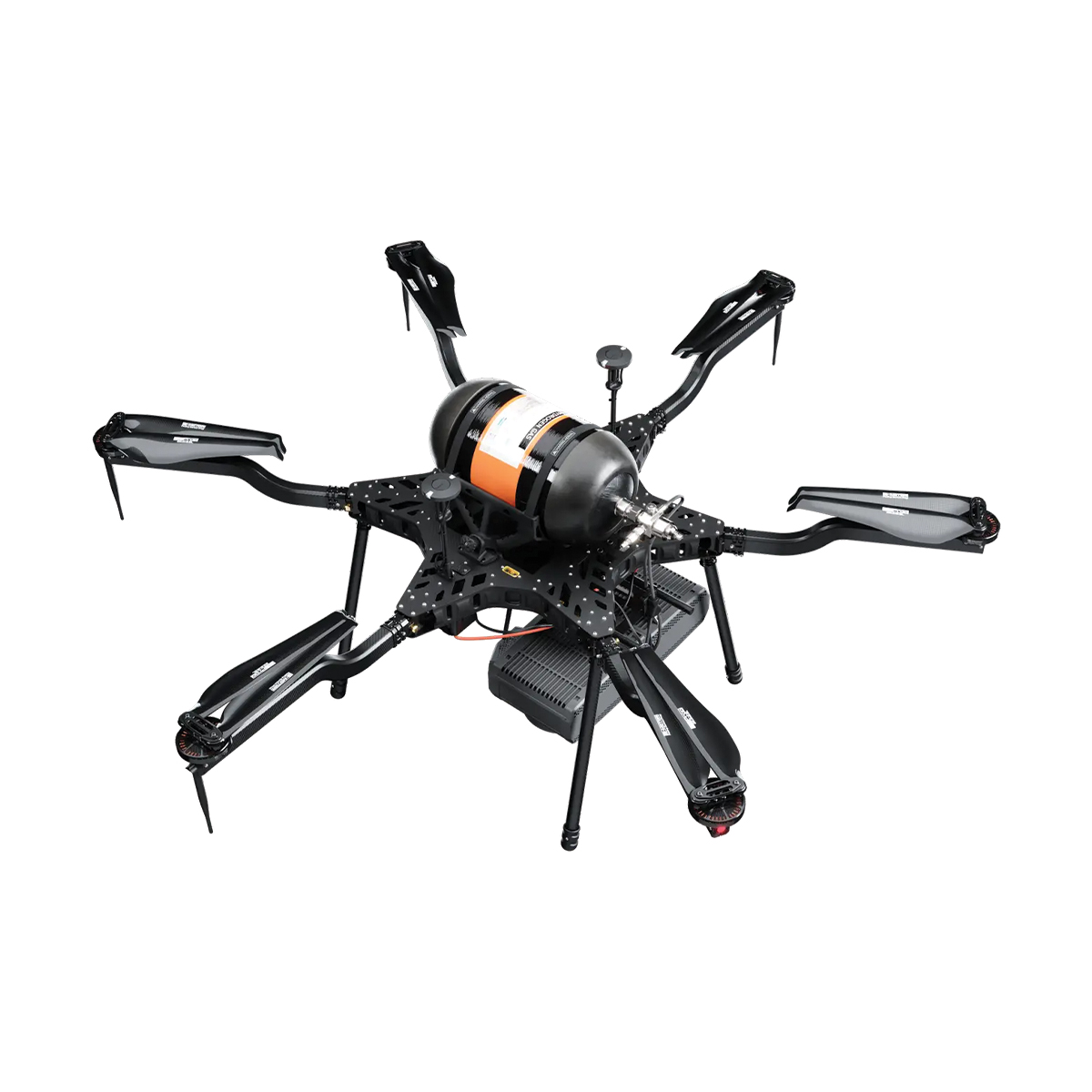
Harris Aerial H6 Hydrone
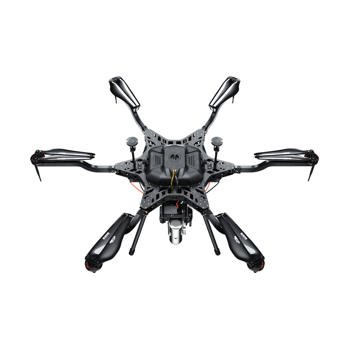
Call for PriceHarris Aerial H6 Hydrone
Extended Silent Flight. The Carrier H6 Hydrone uses highly efficient hydrogen-electric conversion to produce clean DC power in a robust, lightweight package. It delivers extreme hybrid flight times while maintaining the nearly silent operation of an all-electric multirotor.
As part of the H6 family, it remains fully convertible to gas-electric or all-electric power formats in minutes — one airframe, three power systems.
Quick View -
New!
Harris Aerial H6HL Drone
Call for Price


Harris Aerial H6HL Drone
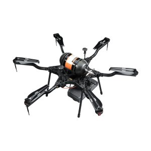
Call for PriceHarris Aerial H6HL Drone
Unmatched heavy-lift capability. Engineered with over 300 lbs of available thrust to tackle the most demanding professional payloads. The Carrier H6HL is in a heavy-lifting weight class of its own. Developed over four years to redefine precision and performance, this drone features a robust framework capable of seamlessly carrying heavy equipment and scientific instruments. Despite its monumental 10.4-foot wingspan, it features a patented design that folds down into a 46×46-inch transport case for efficient transport — from shipping container to mission-ready in minutes.
Quick View -
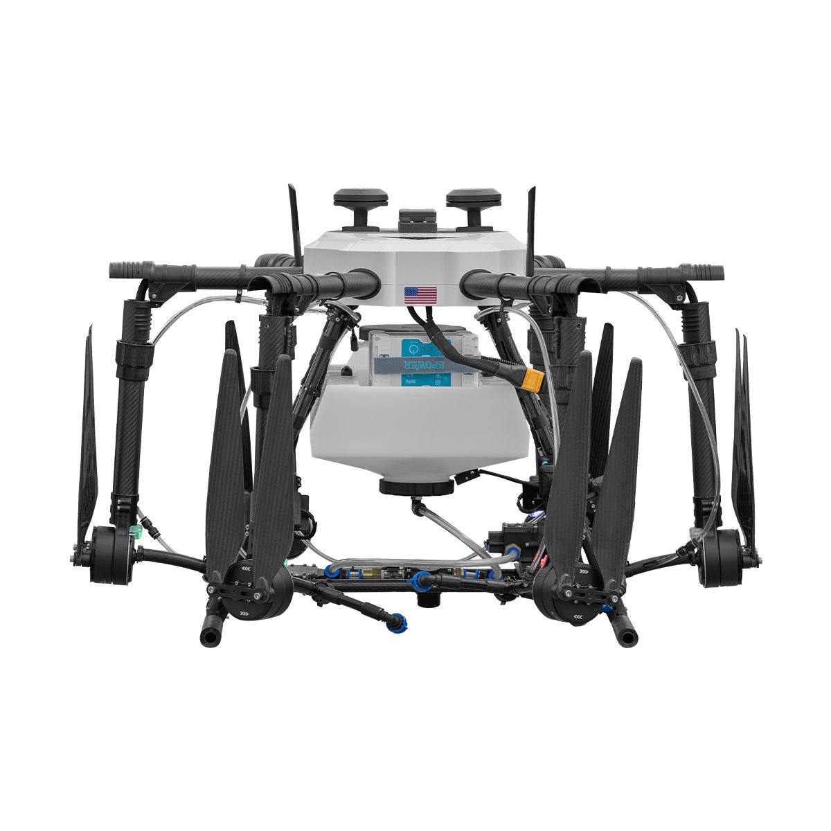
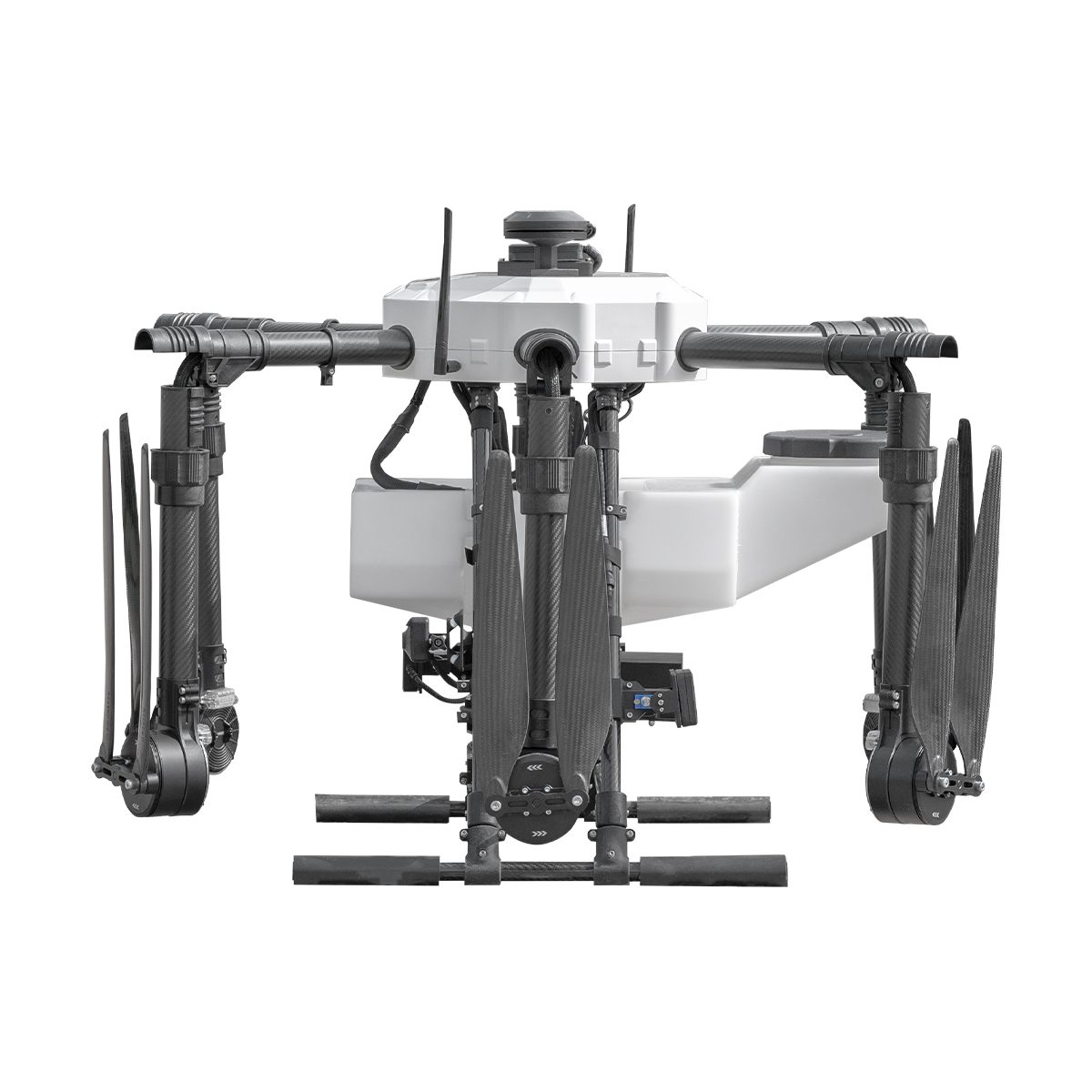
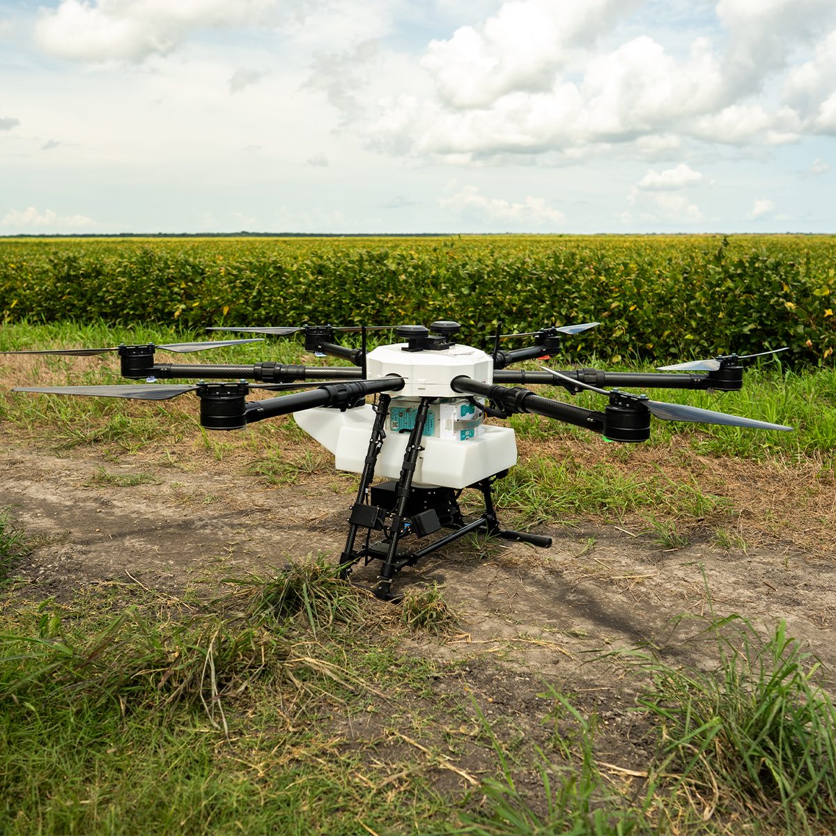
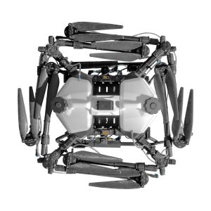
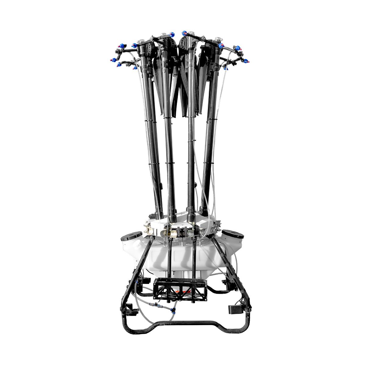
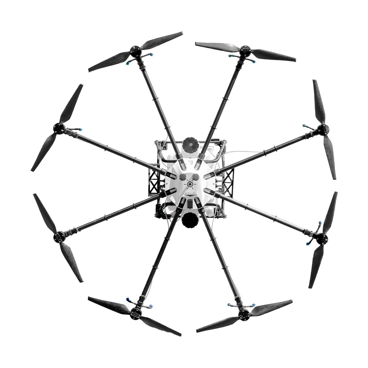
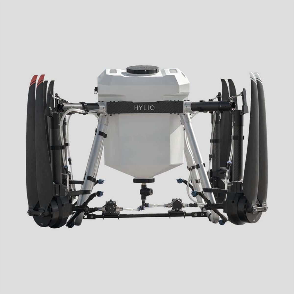
Hylio AG-210 CP-D-210 Drone
Call for Price
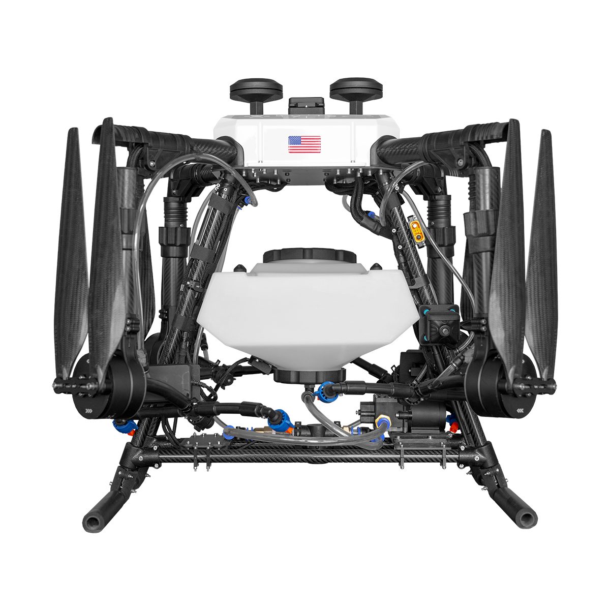
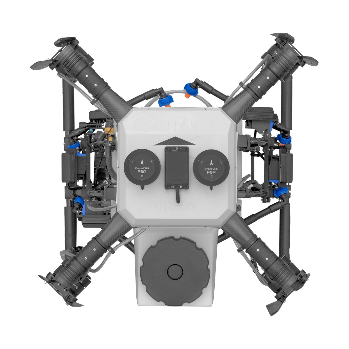
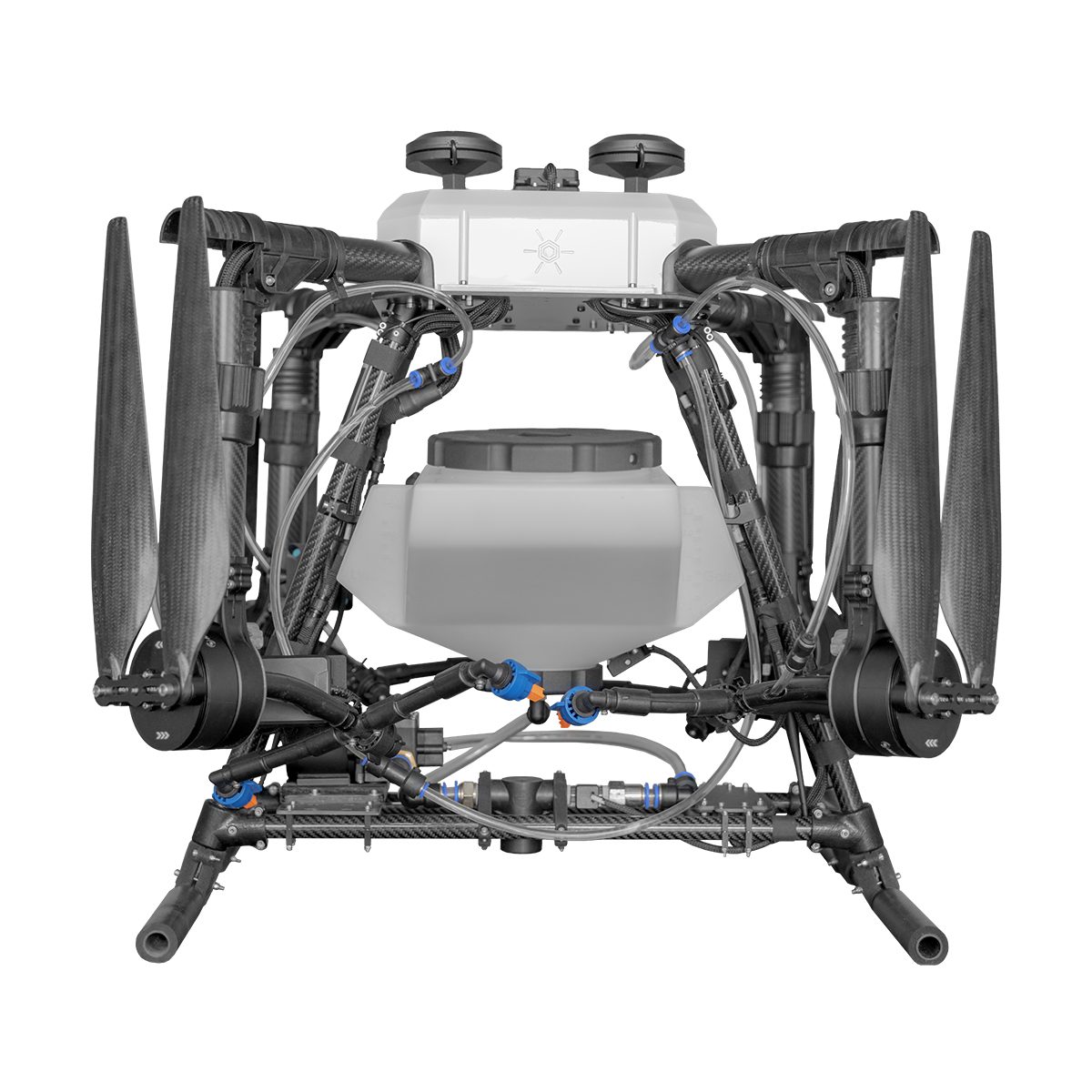

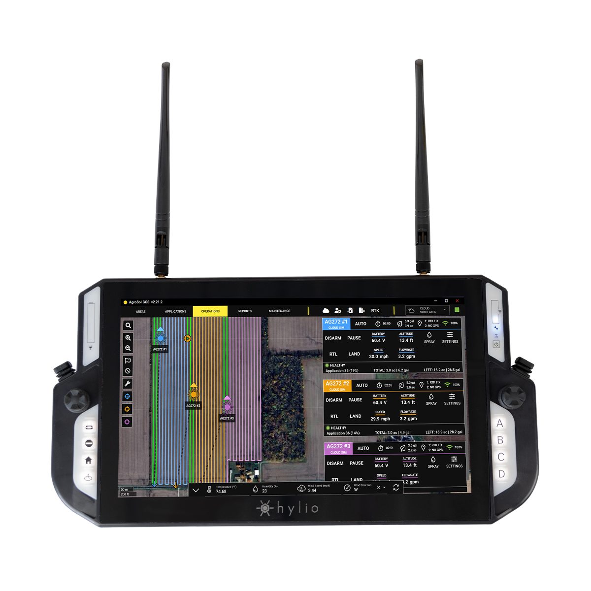
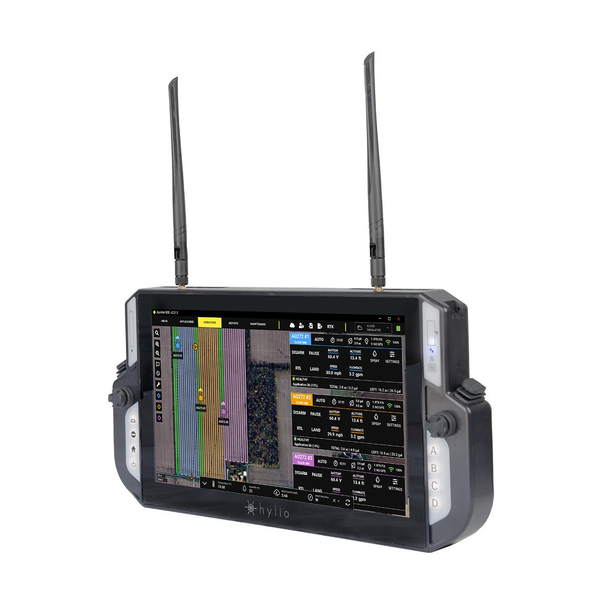

Hylio AG-210 CP-D-210 Drone
Call for PriceDesigned to Get the Job Done
Small but effective, the AG-210 is our most compact model. The AG-210 packs all the same powerful software and spray functionality into a smaller form factor. This platform is great for spot-spraying and can cover significant acreage when deployed in a swarm.Quick View -
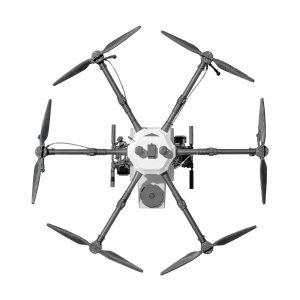
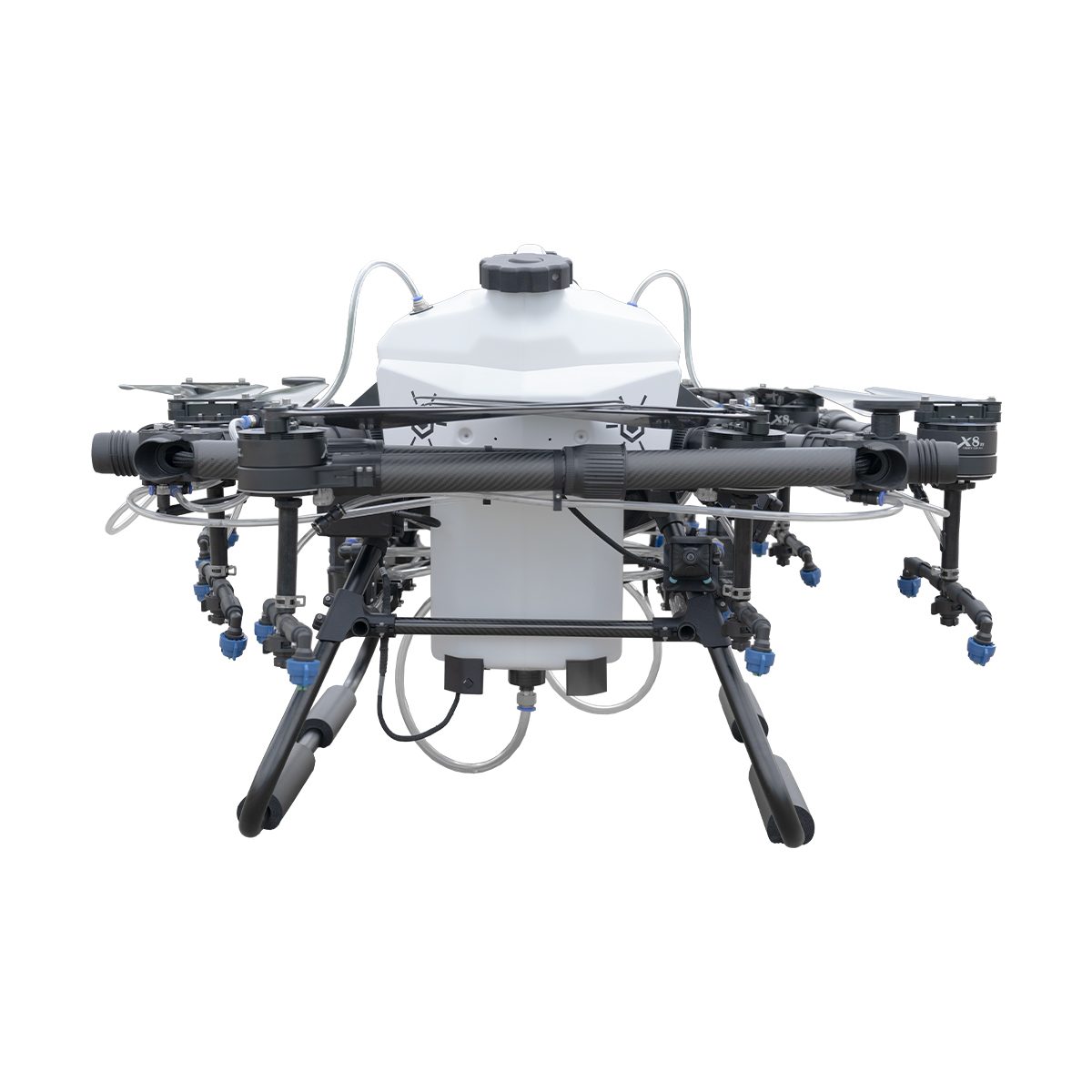
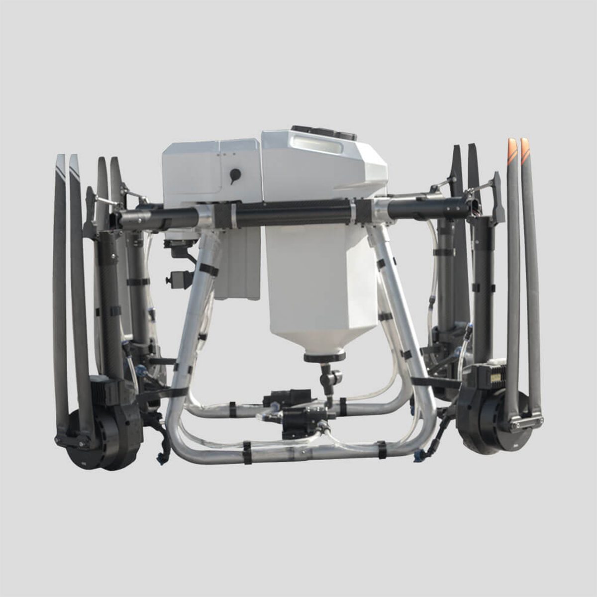
Hylio AG-216 CP-D-216 Drone
Call for Price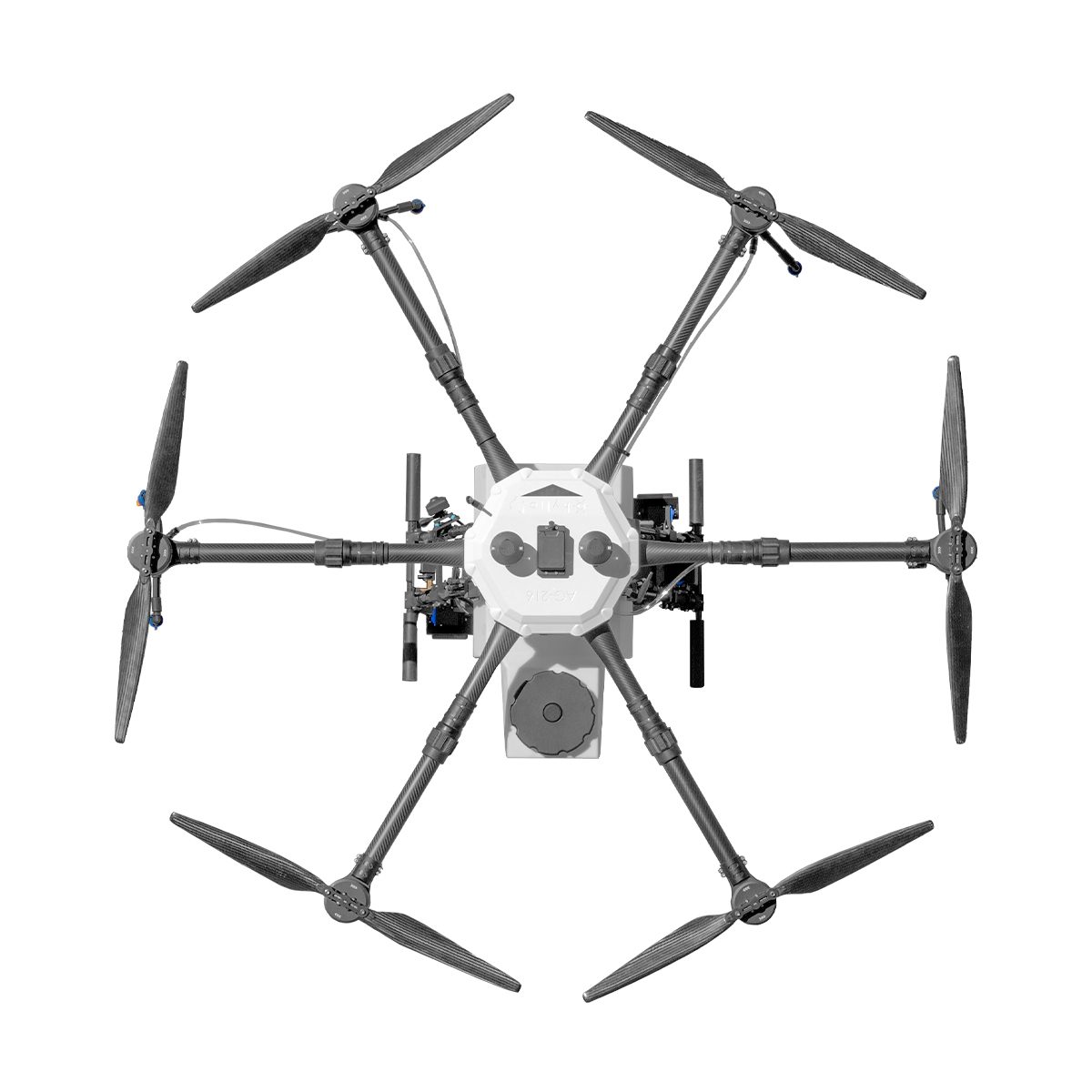
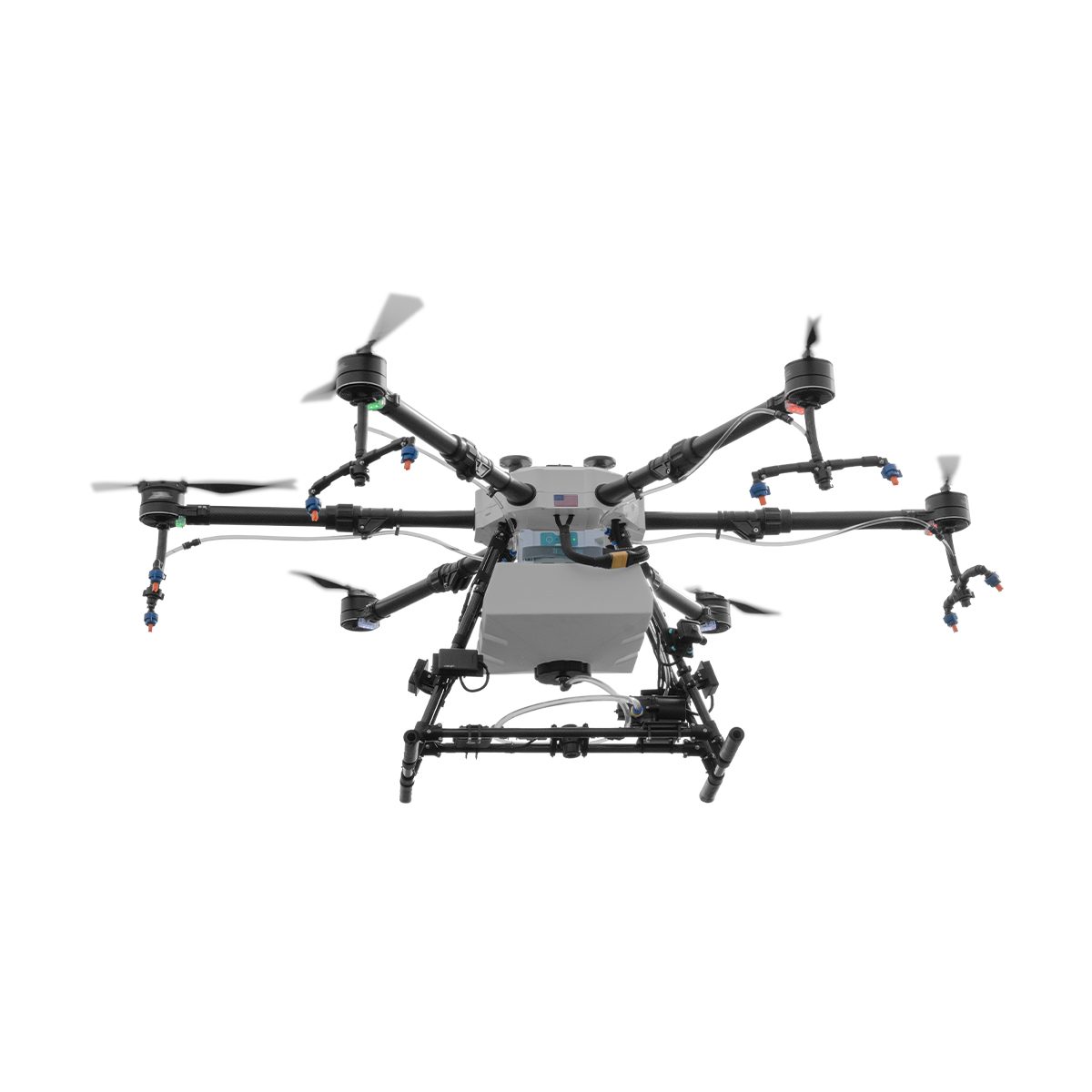

Hylio AG-216 CP-D-216 Drone
Call for PriceDesigned for Versatility
The original AgriDrone. Designed from direct field experience, this reliable UAS excels at both small-scale and large-scale operations. The AG-216 is a great, flexible option for many applicators and producers.
Quick View -
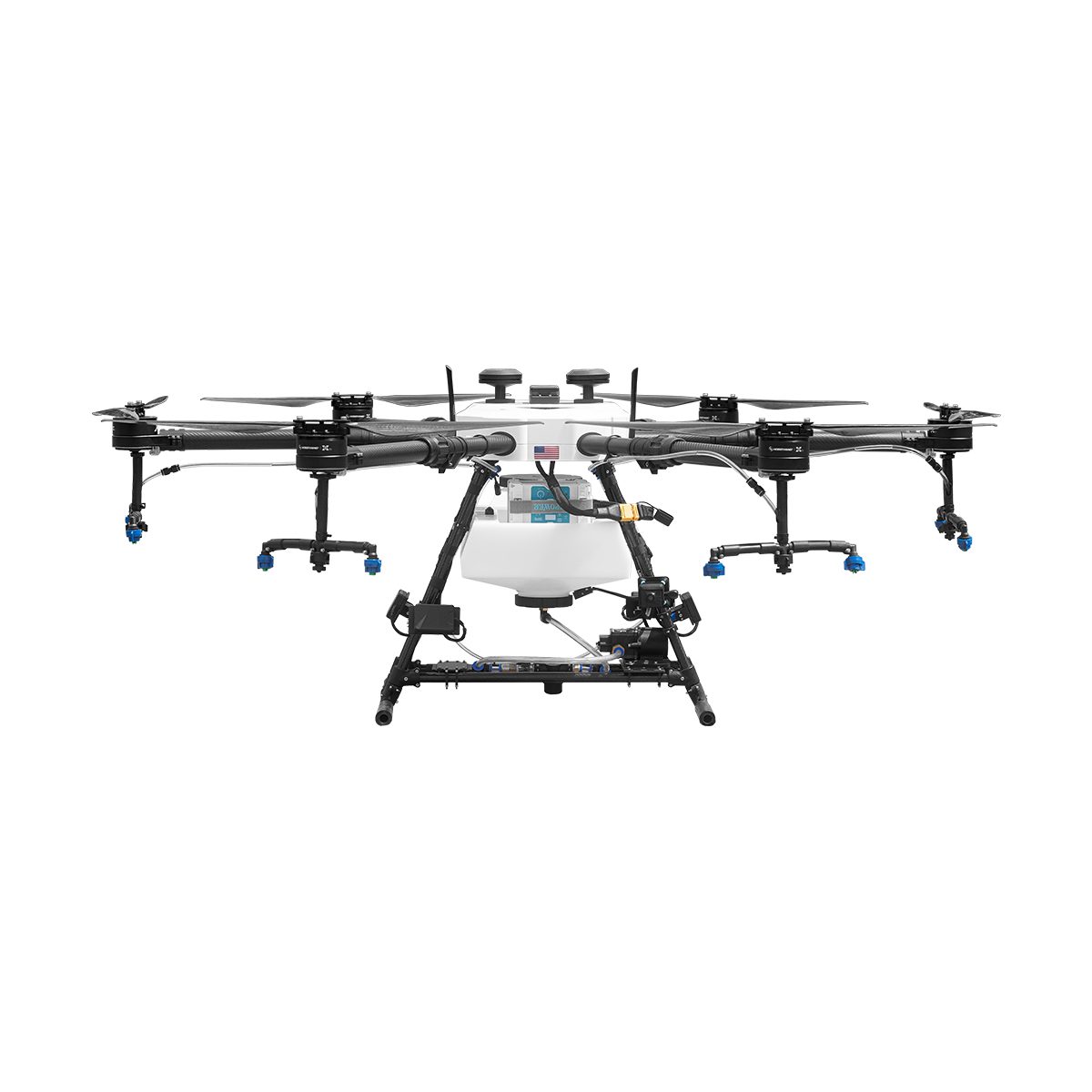
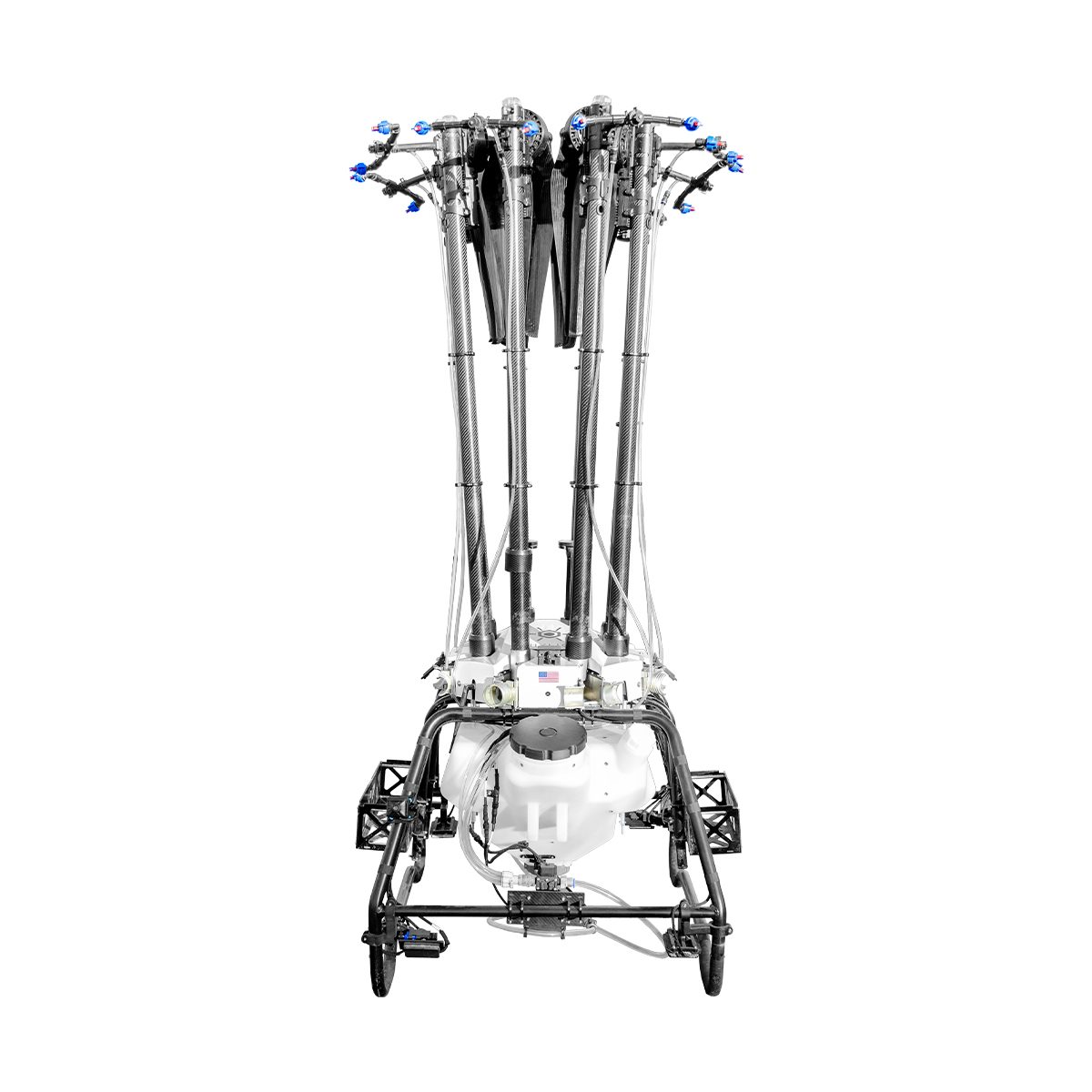
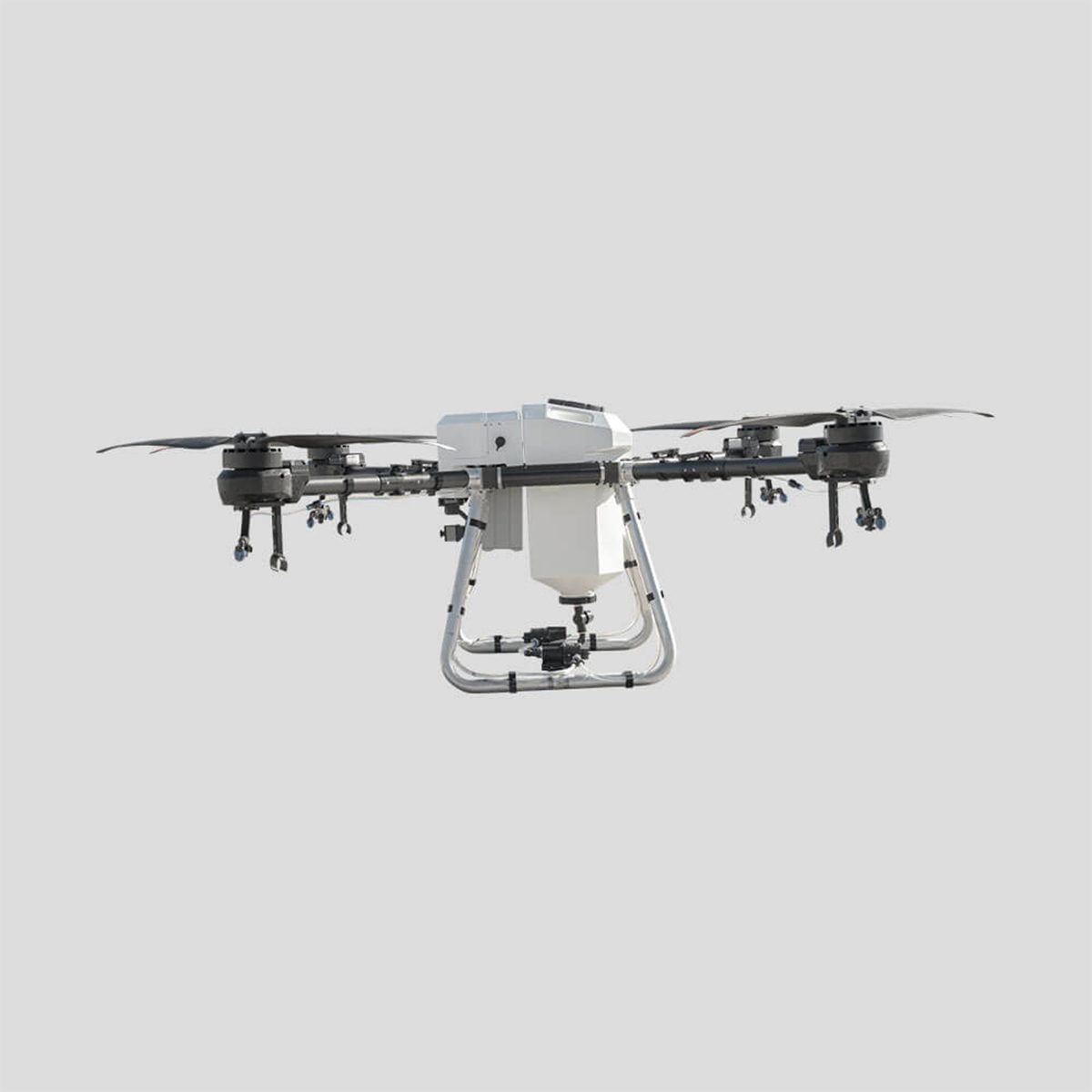
Hylio AG-230 CP-D-230 Drone
Call for Price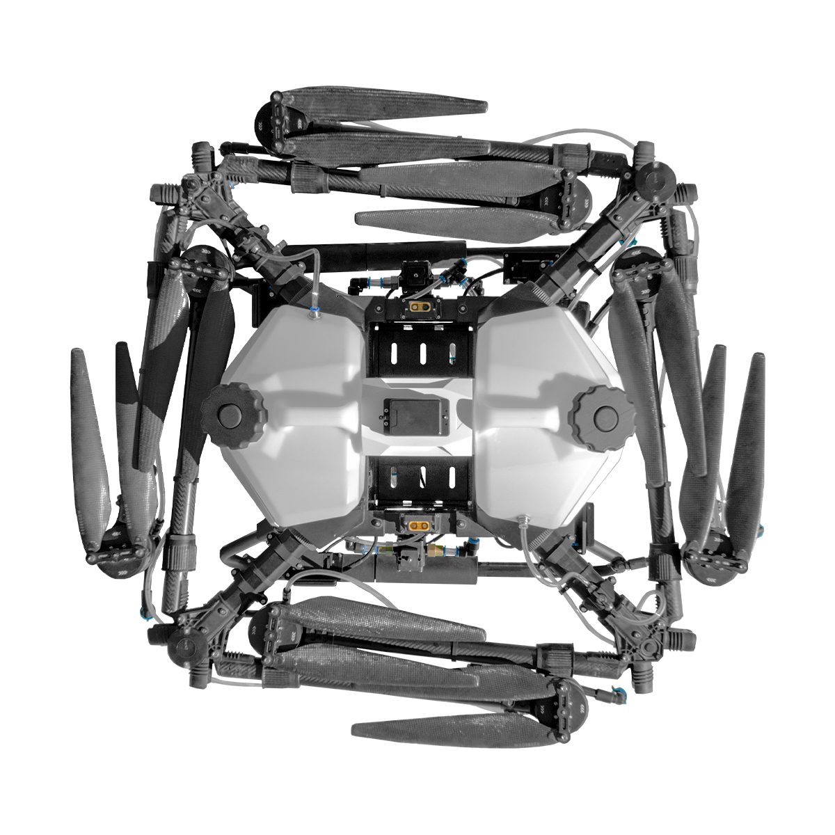
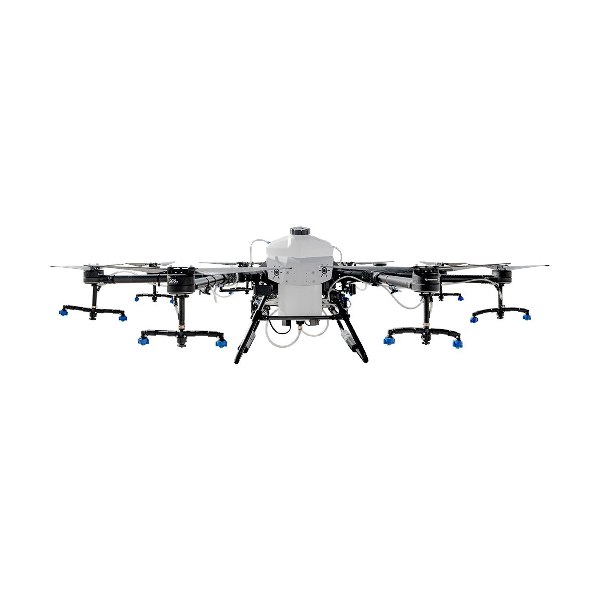
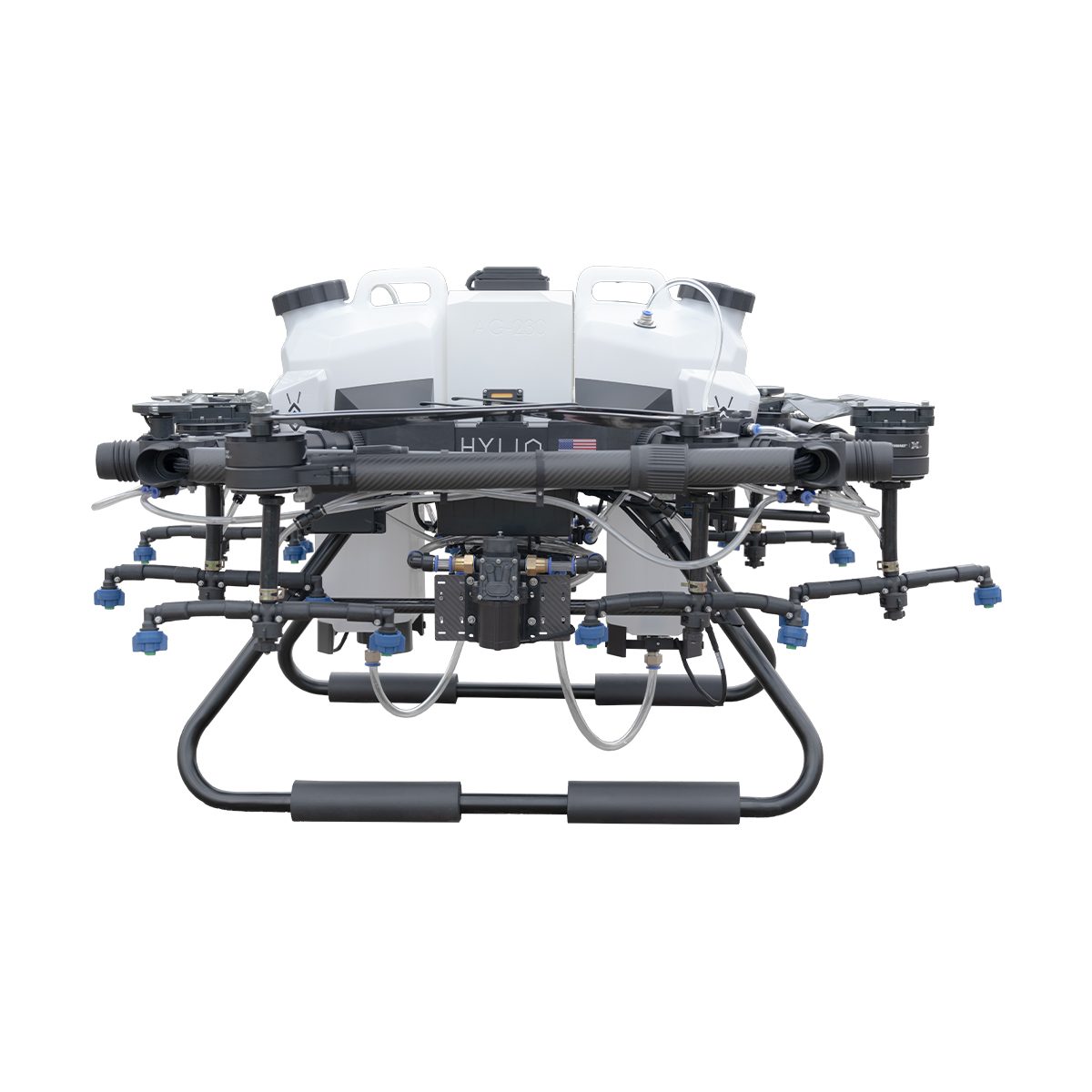
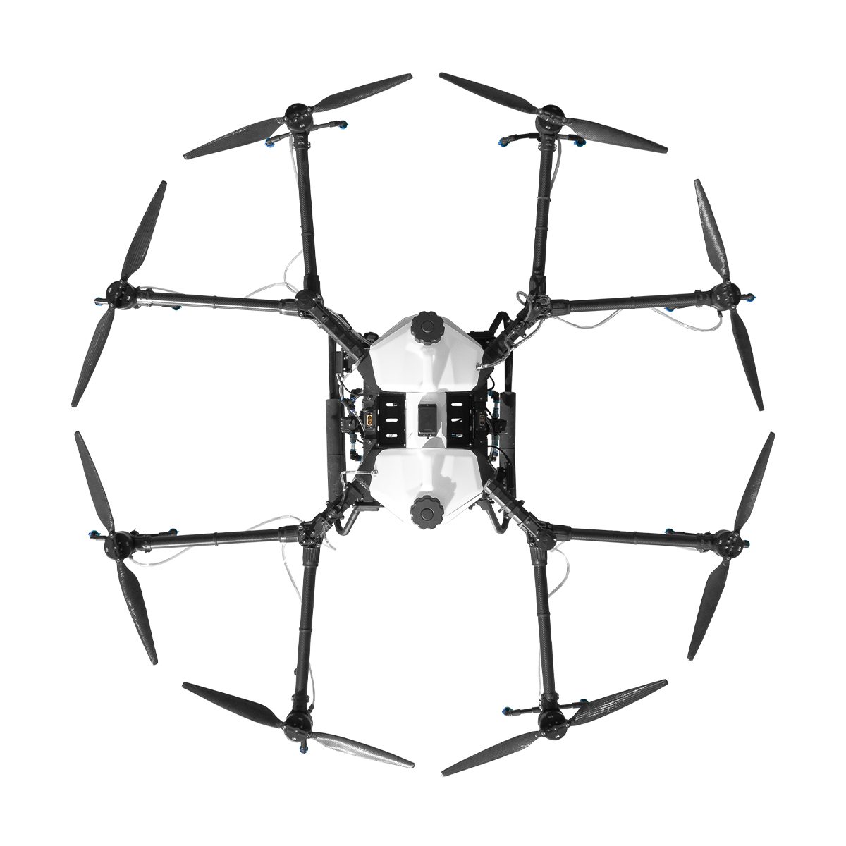


Hylio AG-230 CP-D-230 Drone
Call for PriceBuilt for Large Scale Operations
The AG-230 boasts a large tank capacity and is ideal for industrial-scale applications. The AG-230, alone or in a swarm, is perfect for taking on big acreage.
Quick View -

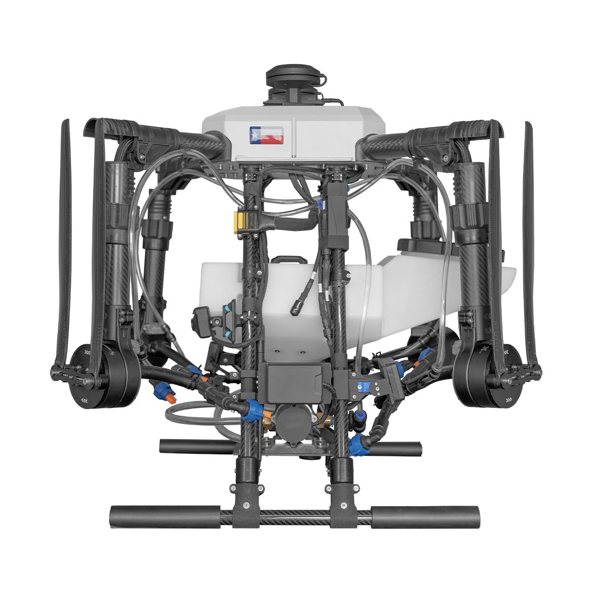
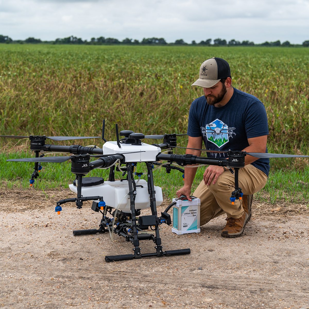
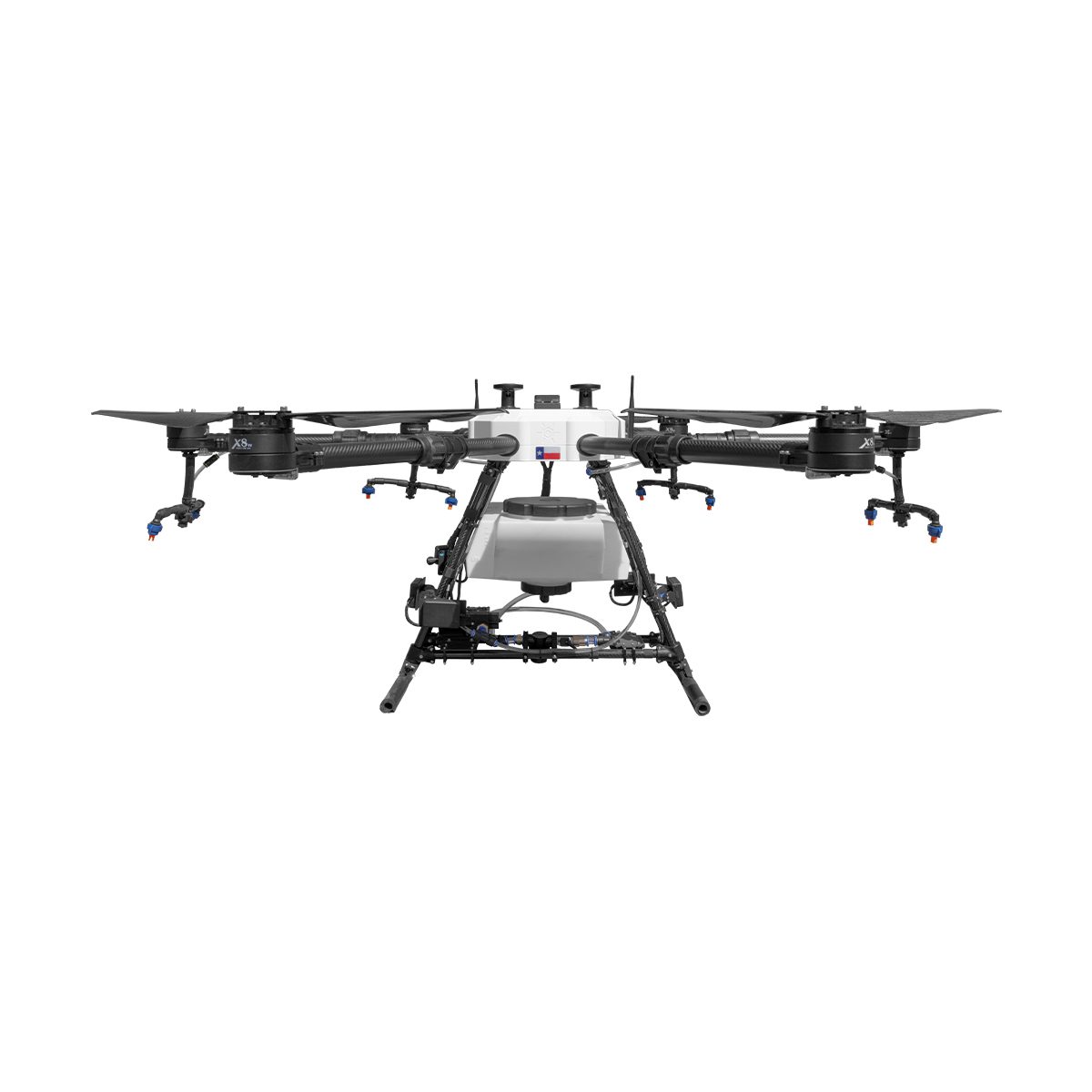
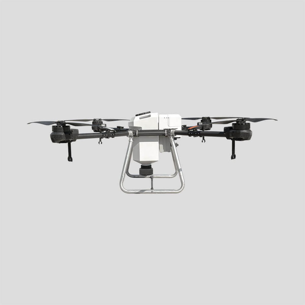
Hylio AG-272 CP-D-272 Drone
Call for Price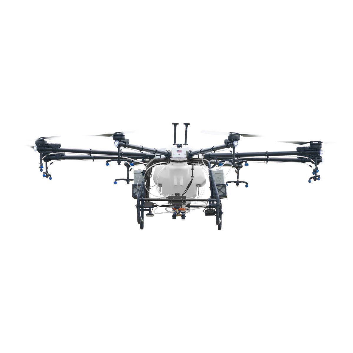
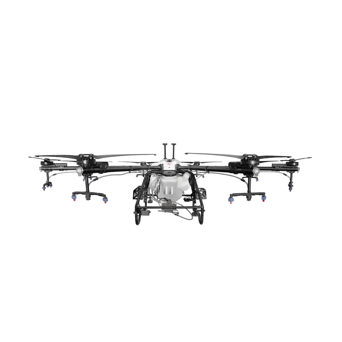
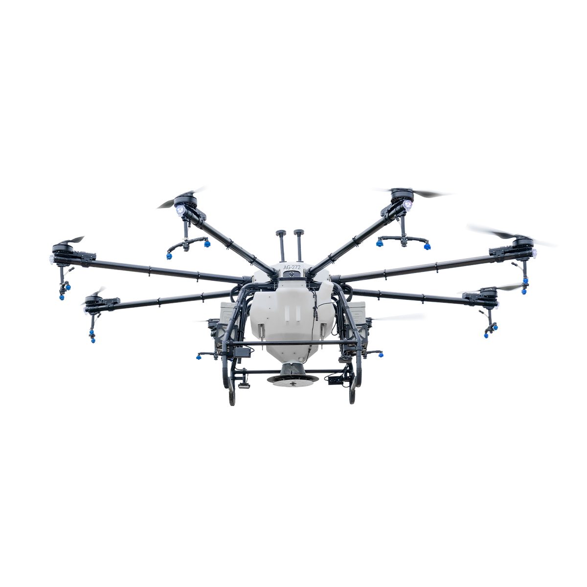
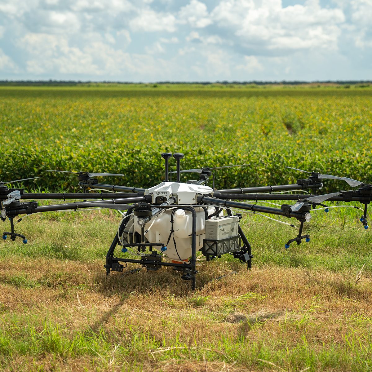
Hylio AG-272 CP-D-272 Drone
Call for PriceThe Biggest Spray Drone On The Market
Our newest, Texas-sized drone! With an 18-gallon capacity and up to 40 foot swath width, the AG-272 can cover up to 50 acres/hour at a 2GPA application rate.
The AG-272 is the perfect system for producers and applicators who want to tackle hundreds, or even thousands, of acres per day.
Quick View -
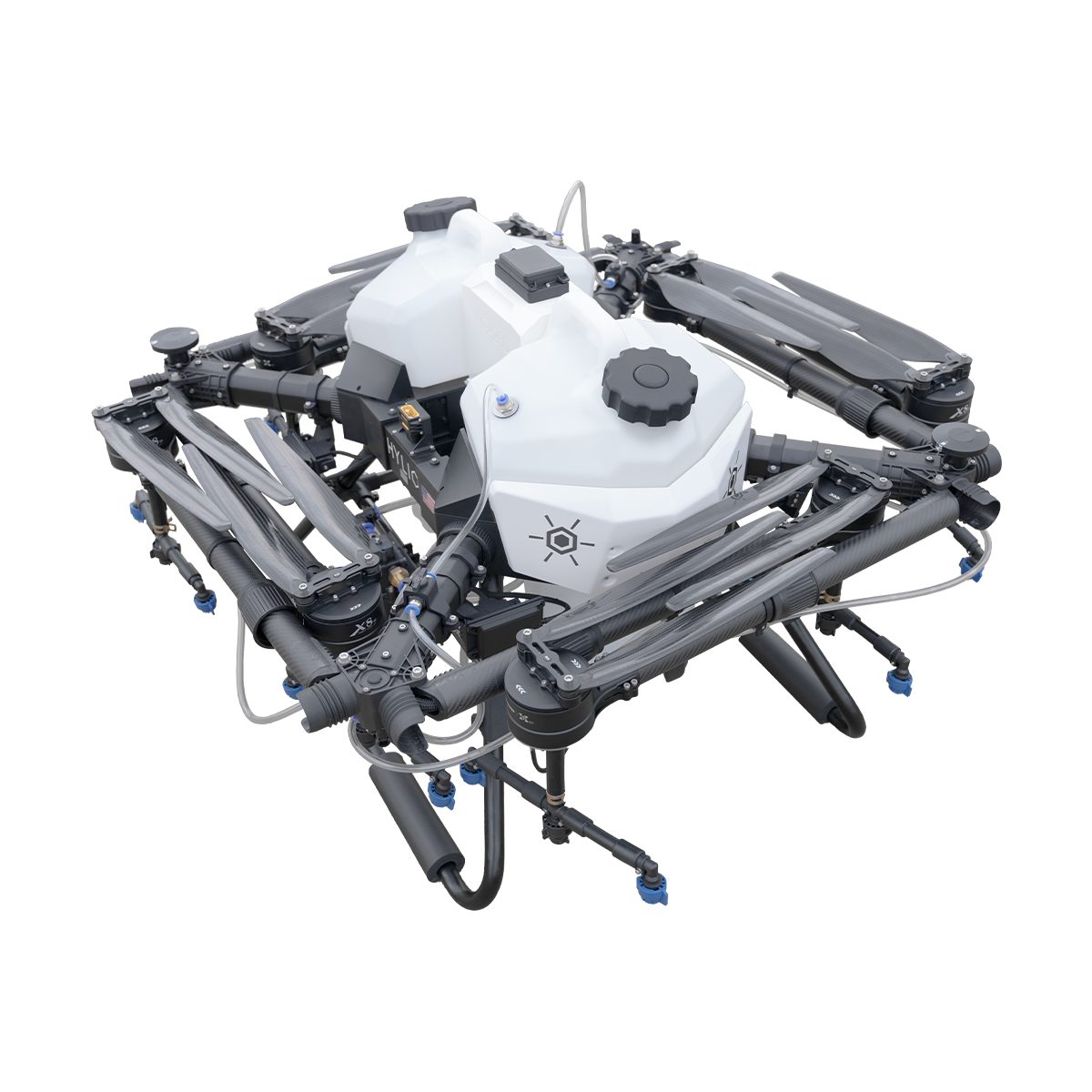
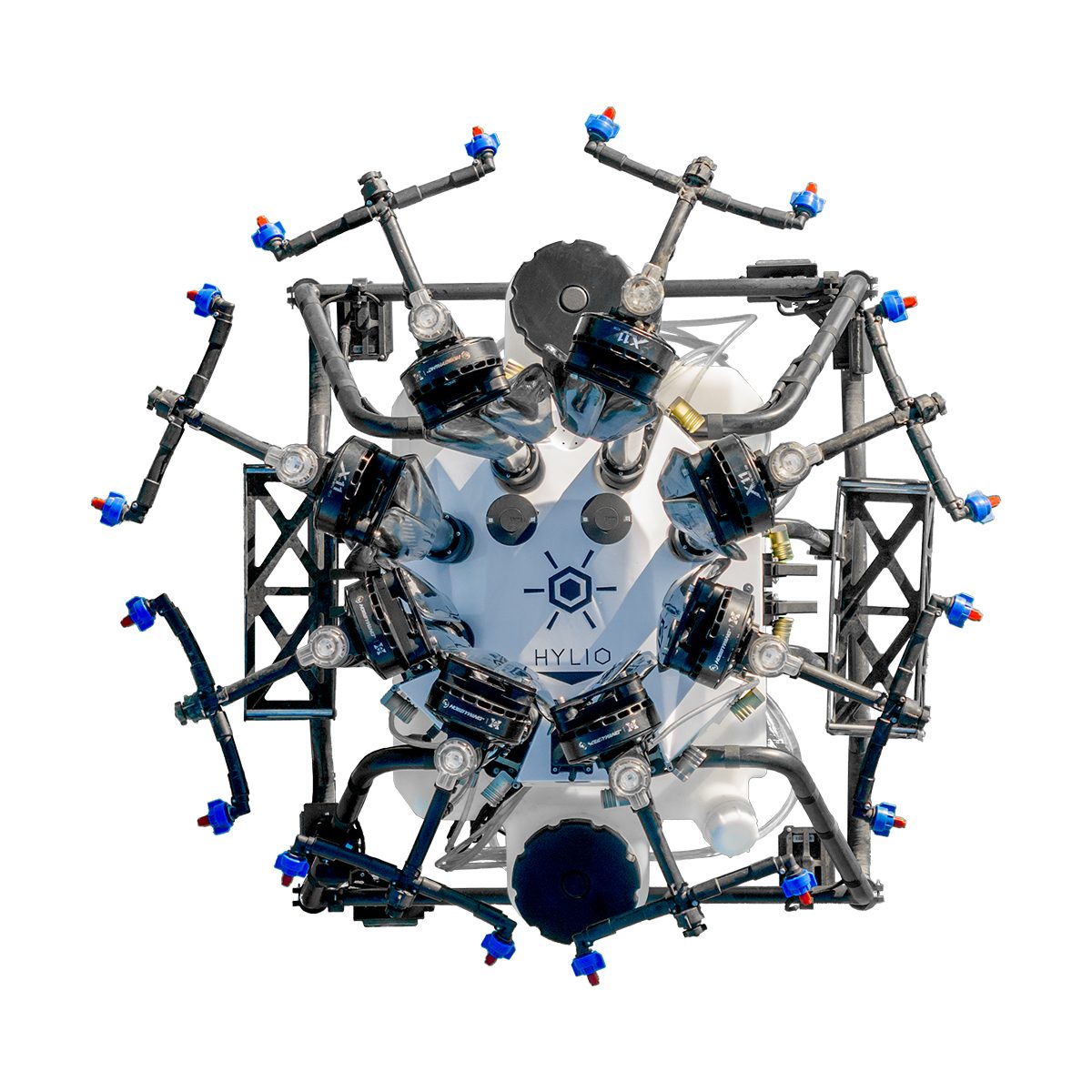
Hylio ARES HYL-150 CP-D-150 Drone
Call for Price

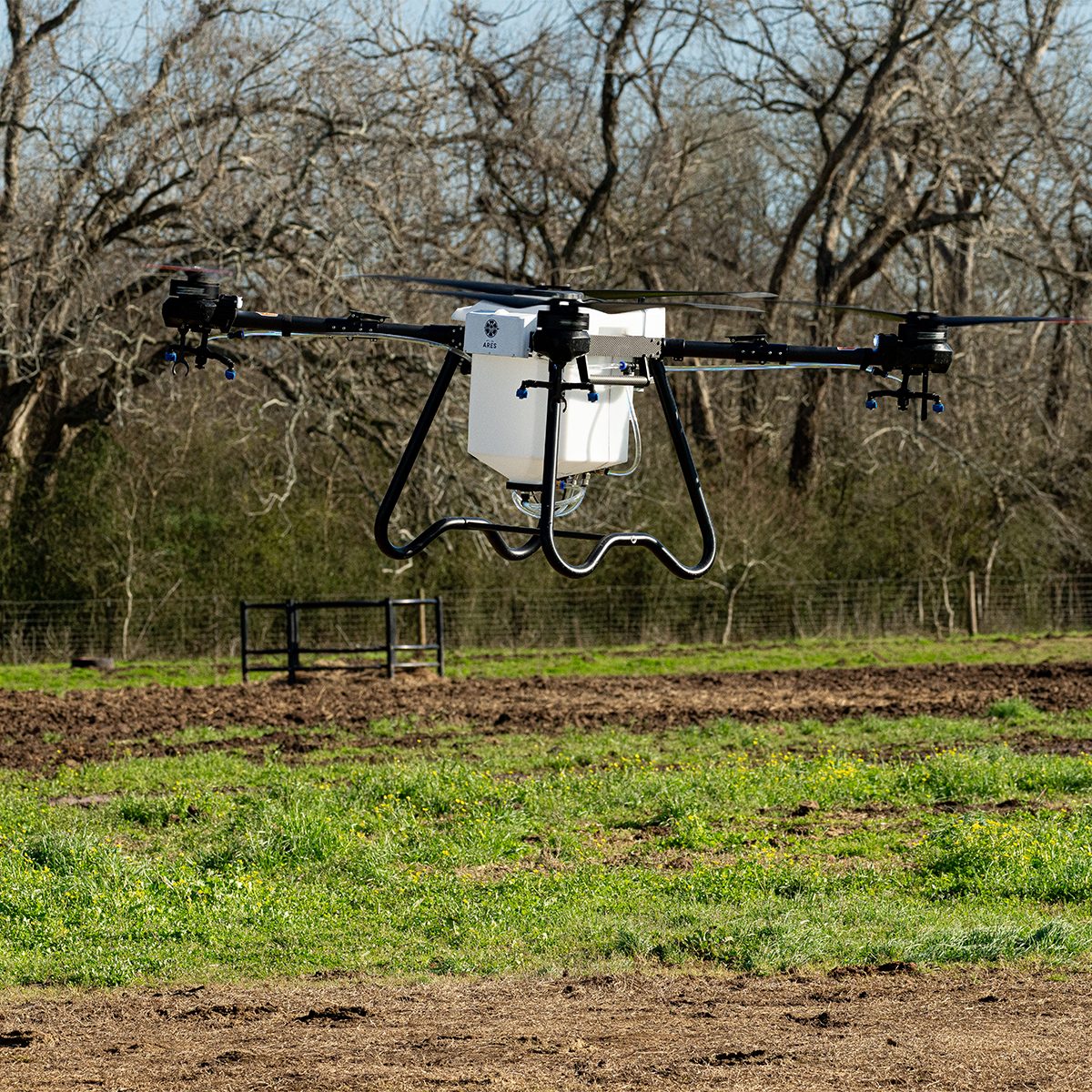
Hylio ARES HYL-150 CP-D-150 Drone
Call for PriceHylio’s Most Advanced System
Designed, engineered, and manufactured from the ground up at Hylio headquarters in Richmond, Texas, the HYL-150 ARES is the result of a decade’s worth of experience in the highly competitive ag-drone sector. Combining a heavy payload, robust and serviceable components, an ergonomic form factor, and Hylio’s swarm-enabling AgroSol Ground Control Software, the ARES checks all of the boxes and is a must have for any serious ag-drone operator.
Quick View -
Inspired Flight IF1200A
Call for Price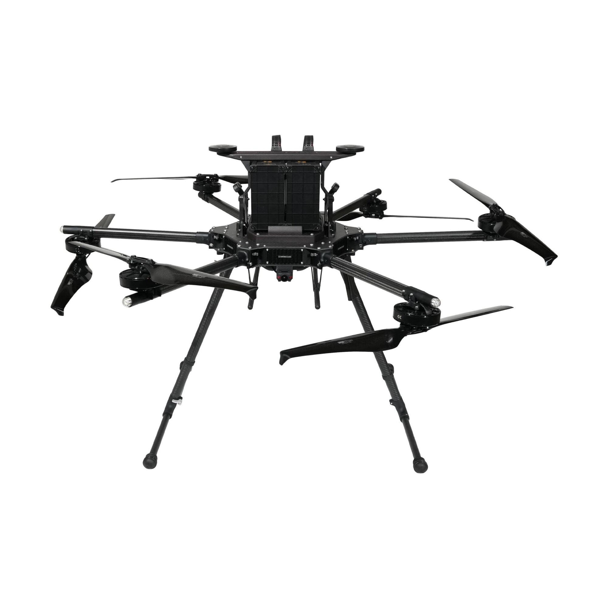
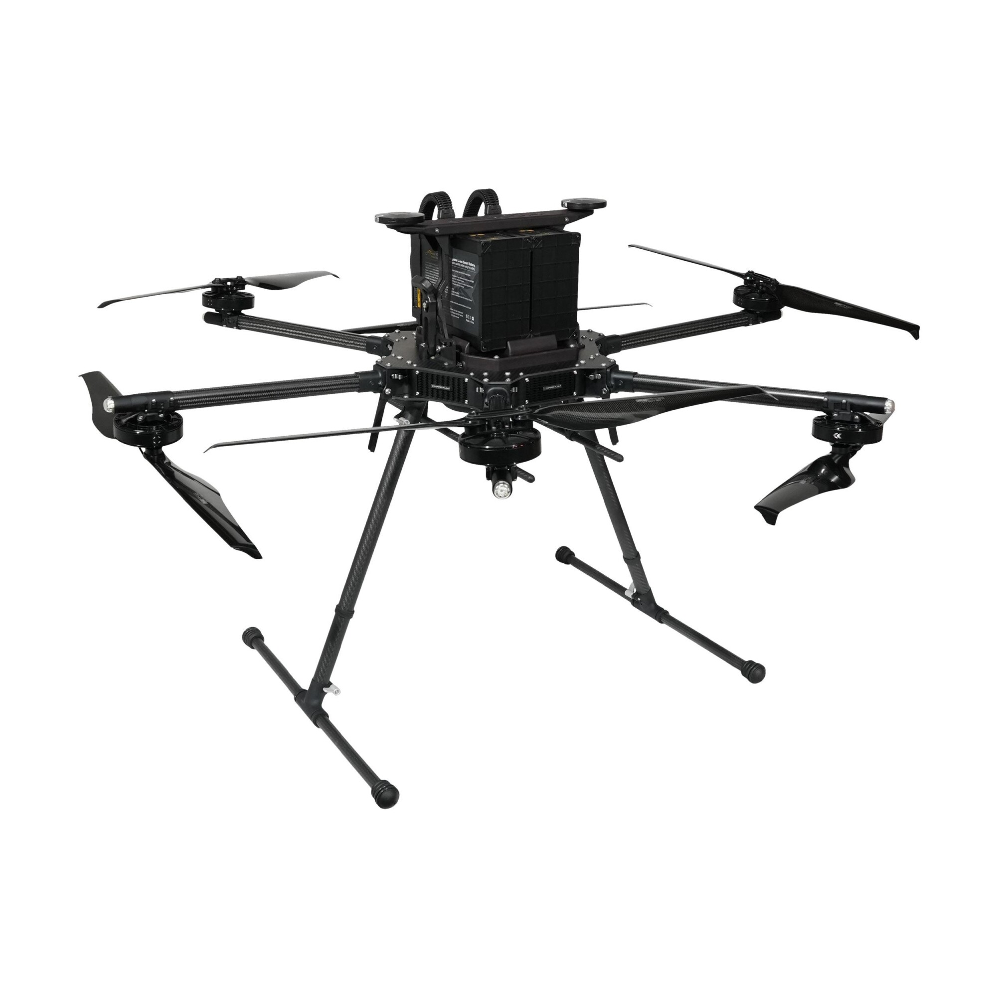
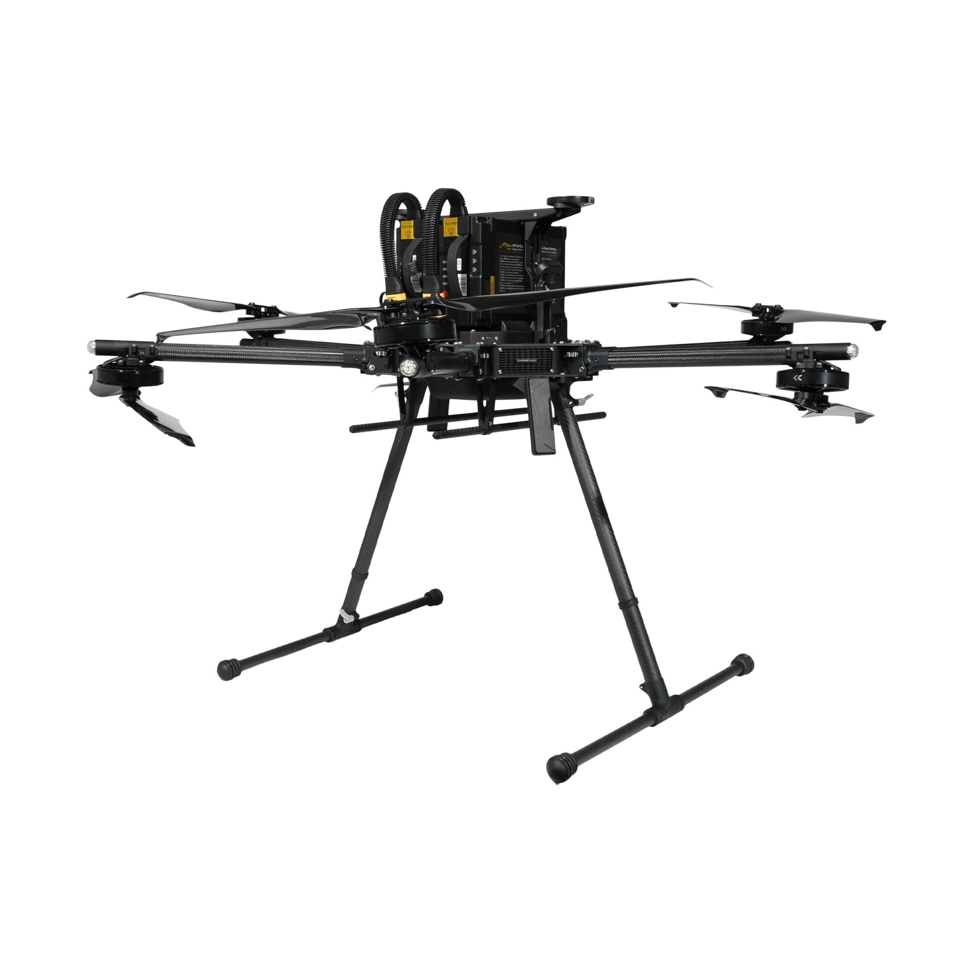

Inspired Flight IF1200A
Call for PriceQuick View -

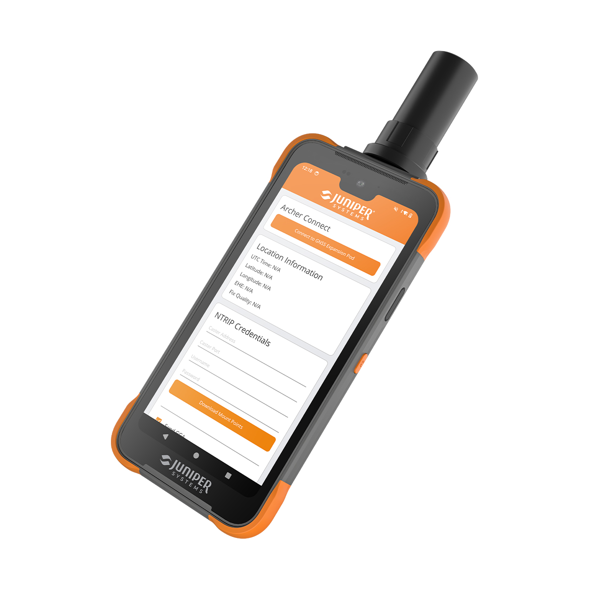
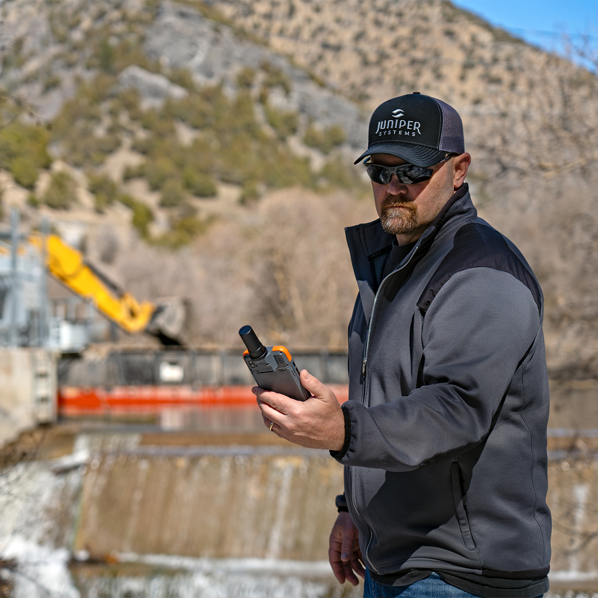
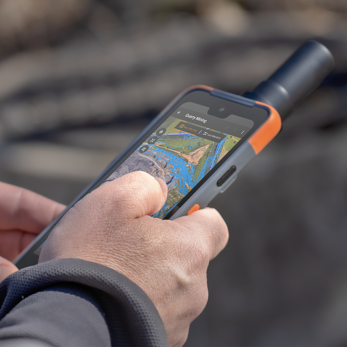
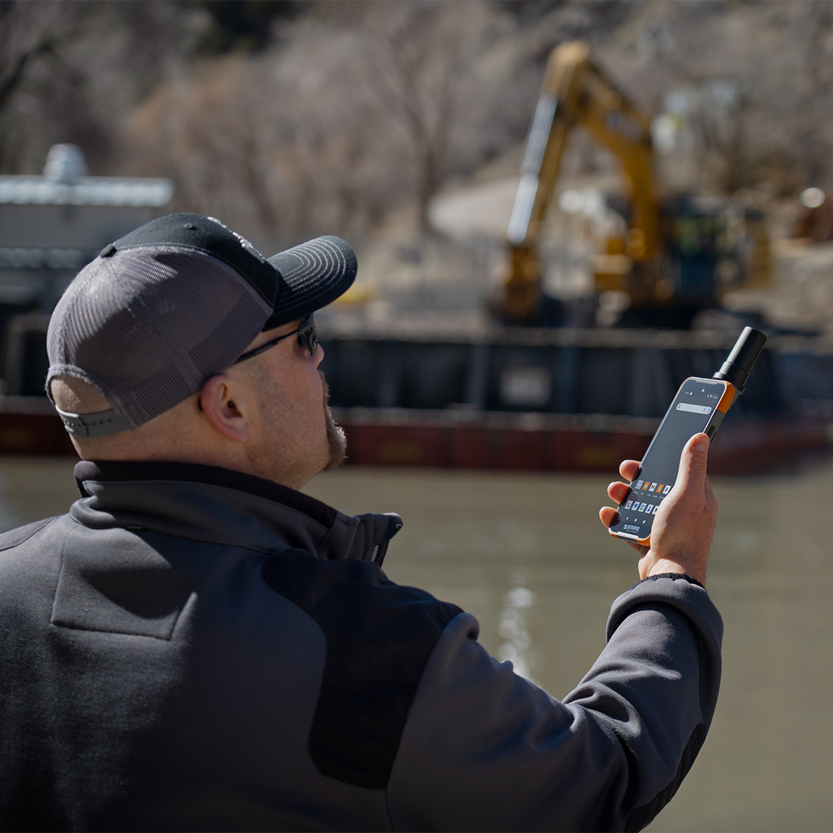
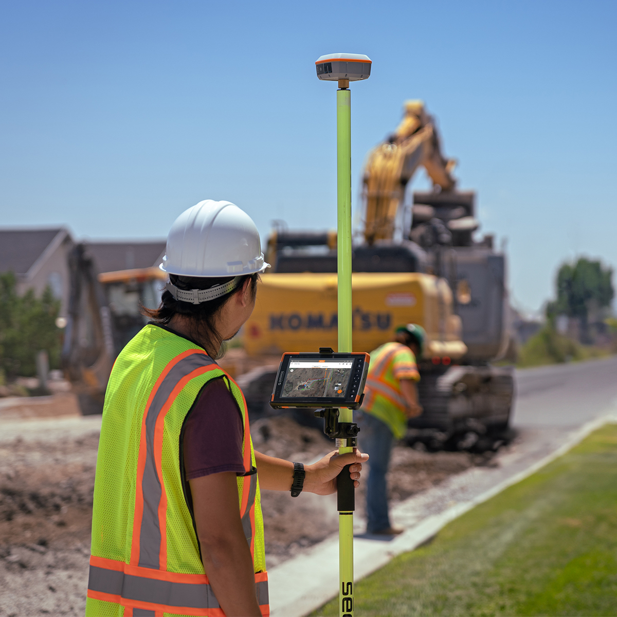
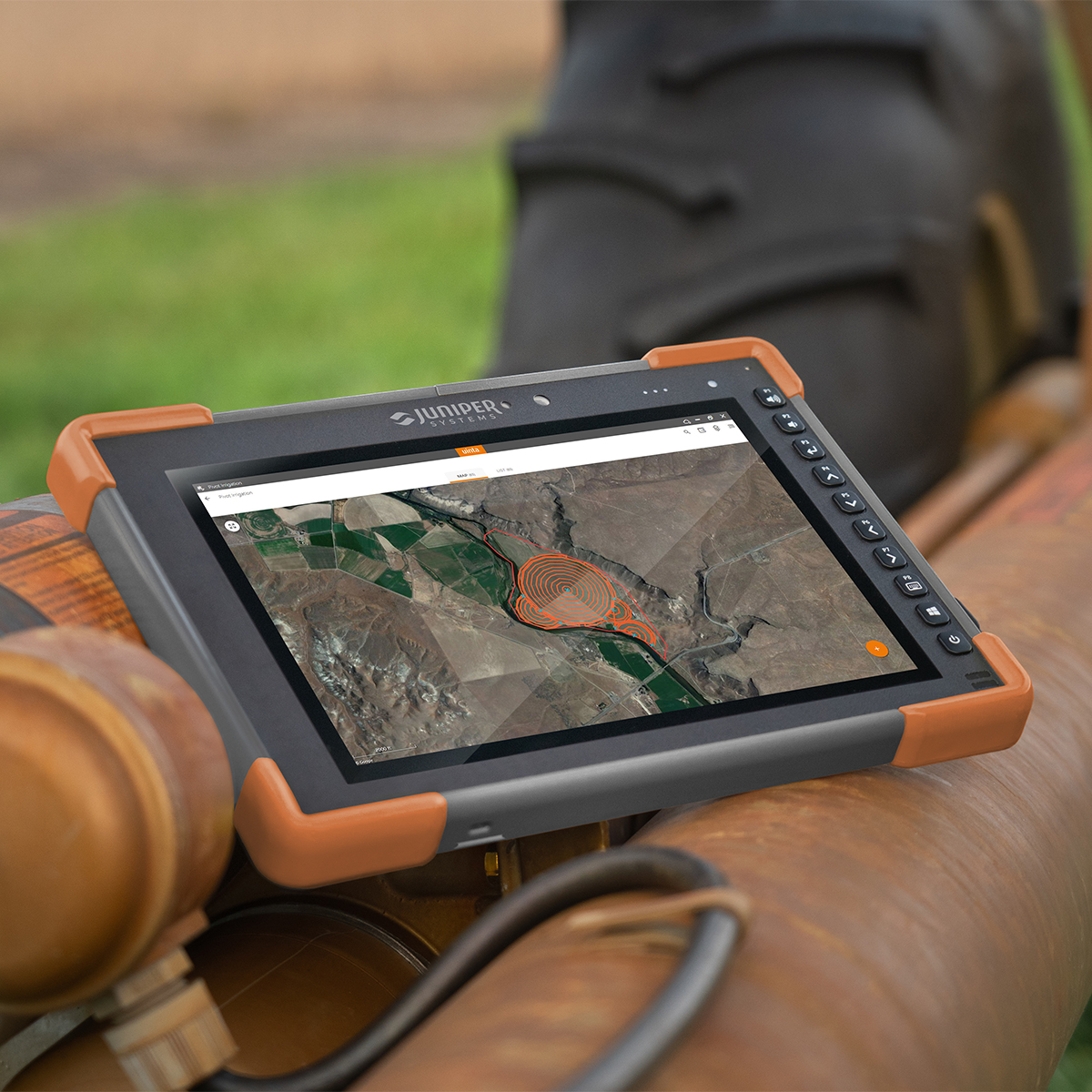
Juniper Systems Archer 4 Android AR4-103 GNSS Expansion Pod Rugged Handheld
Call for Price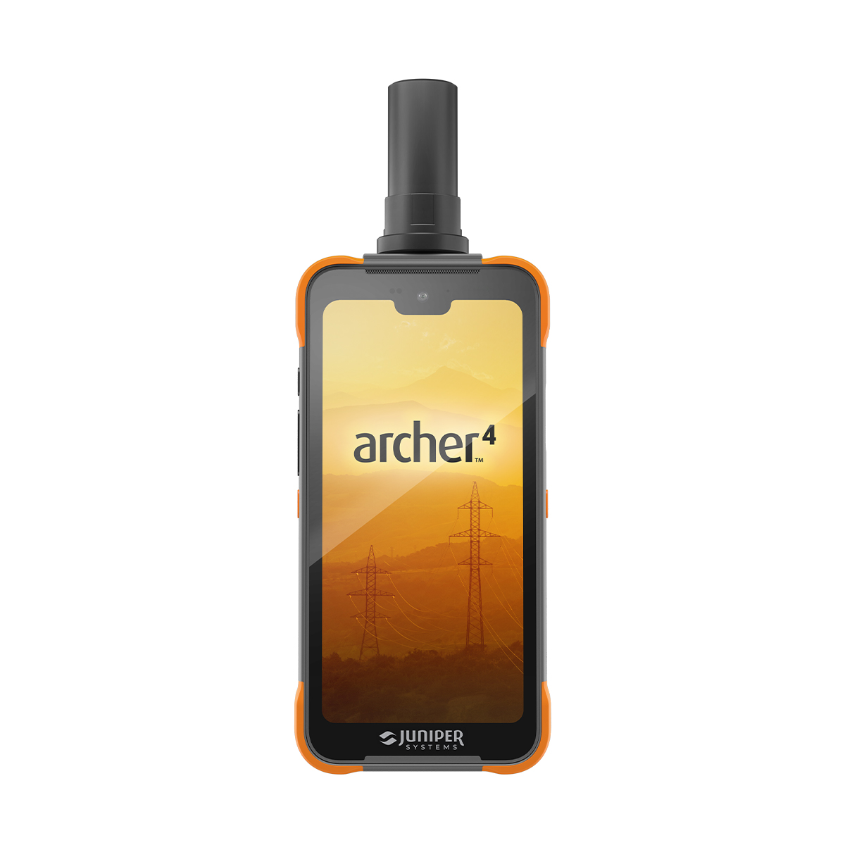

Juniper Systems Archer 4 Android AR4-103 GNSS Expansion Pod Rugged Handheld
Call for PriceDesigned to work. Built to last.
The Archer 4 Rugged Handheld is the latest release in the Archer family of products and is an exciting new platform for today’s mobile data collection. Its power-efficient Qualcomm processor, Android 14 operating system, and ultra-rugged ergonomic design combine to offer users a versatile option for frequent data entry.Quick View -
Juniper Systems Geode GNS3H-CFG(13759) Single-Frequency Antenna Model Receiver
Call for Price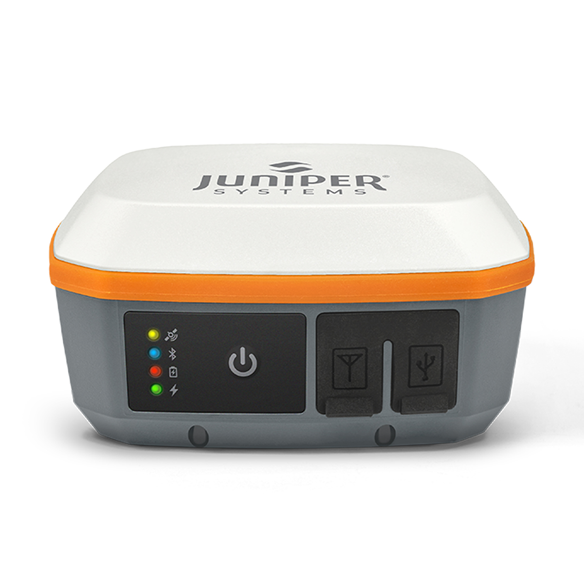
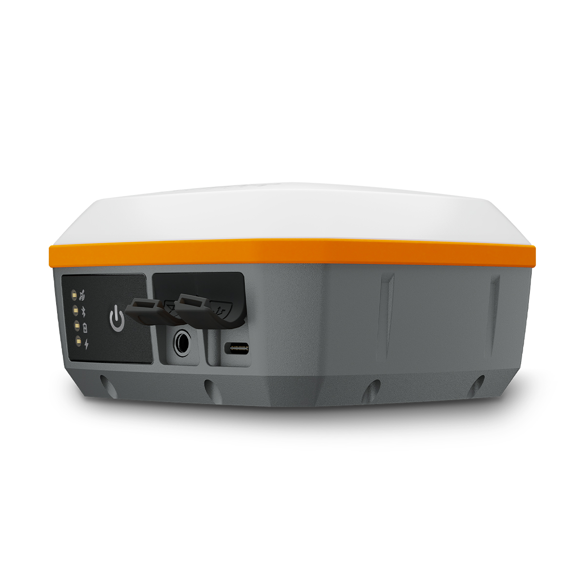
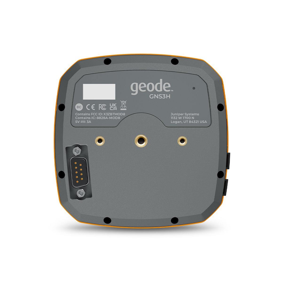
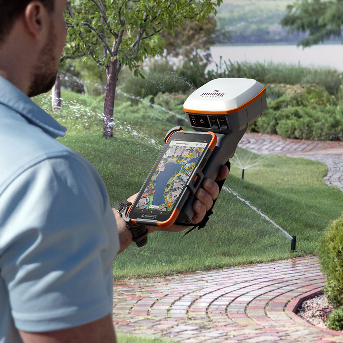
Juniper Systems Geode GNS3H-CFG(13759) Single-Frequency Antenna Model Receiver
Call for PriceQuick View -
Juniper Systems Geode GNS3S-CFG (13817) Single-Frequency Antenna Model Receiver
Call for Price Juniper Systems Geode GNS3S-CFG (13817) Single-Frequency Antenna Model Receiver
Call for PriceYour location, our solution.
With Geode GNSS Receivers, users can easily collect real-time GNSS data with sub-meter, sub-foot, decimeter and centimeter accuracy options. Now you can achieve professional-grade mapping RTK, whether you are a professional or just getting started. Here’s your answer to GNSS data without the huge price tag or complexity of other precision receivers.Quick View -
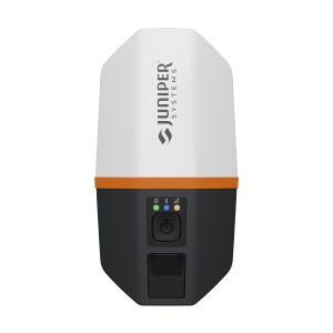
Juniper Systems Spire SP1-CFG(1457) Real-time Ready Receiver
Call for Price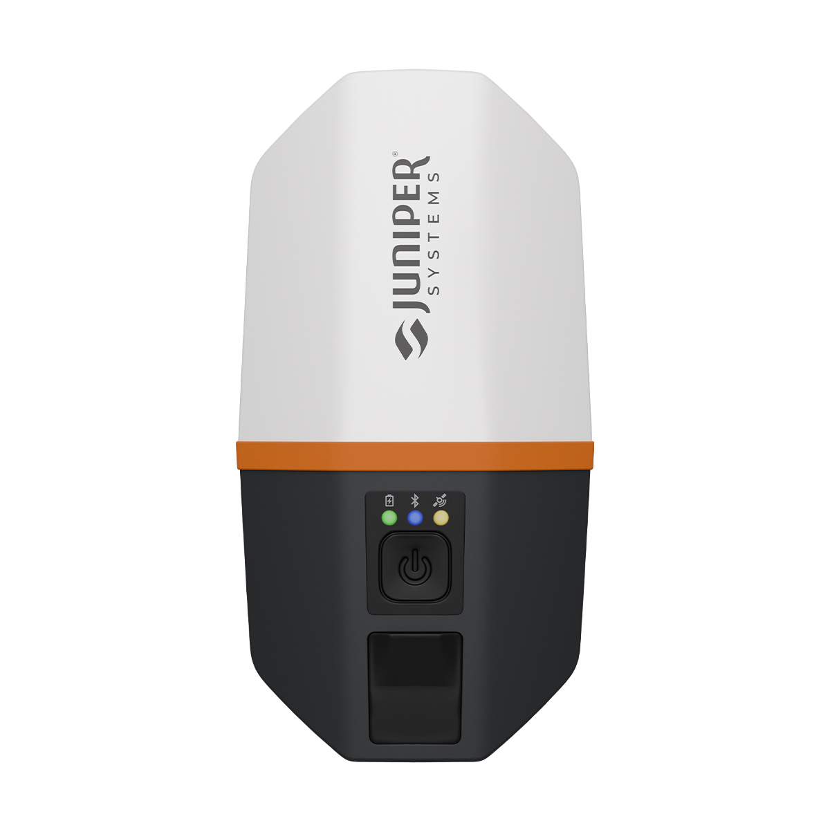
Juniper Systems Spire SP1-CFG(1457) Real-time Ready Receiver
Call for PriceACCEPTING PRE-ORDERS NOW!
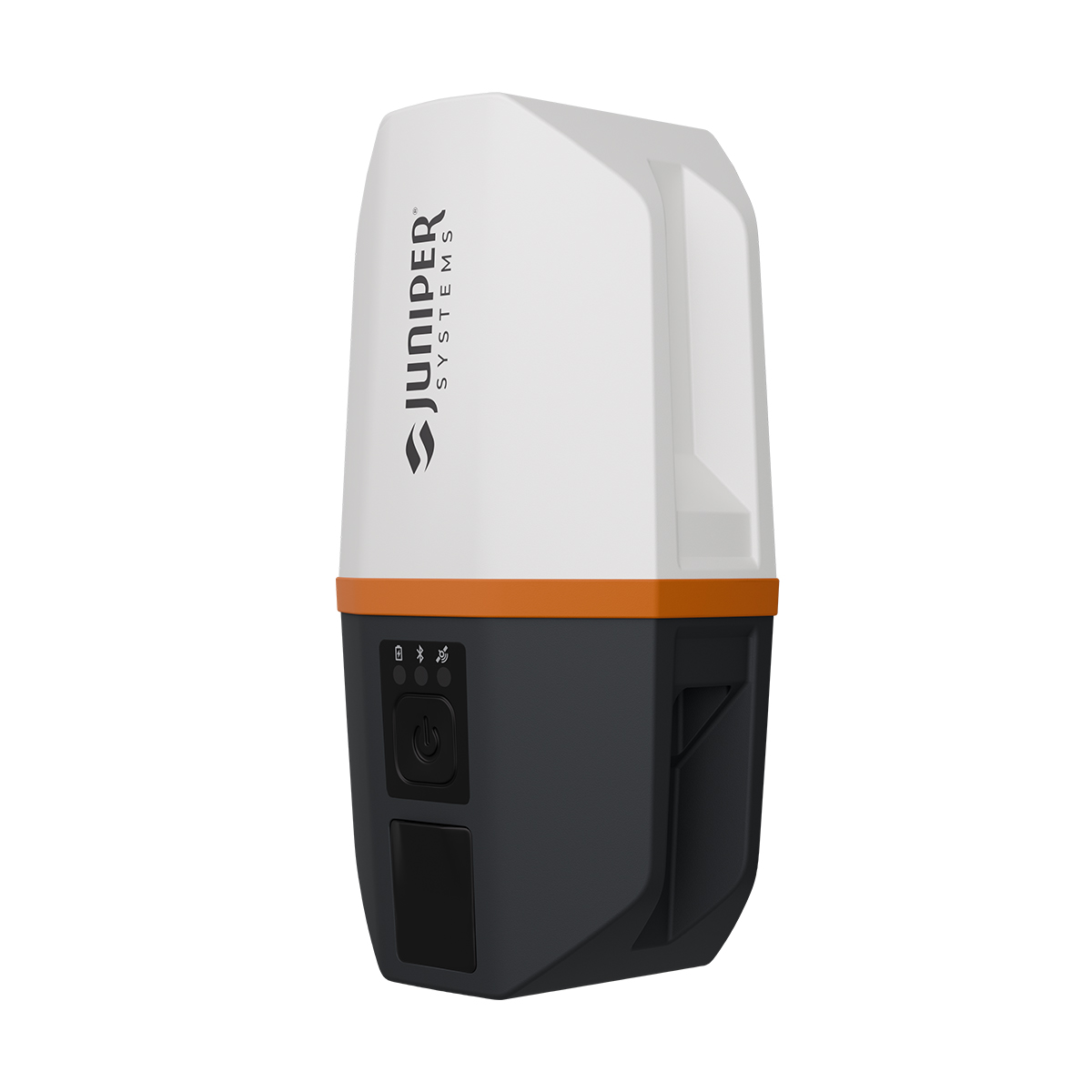
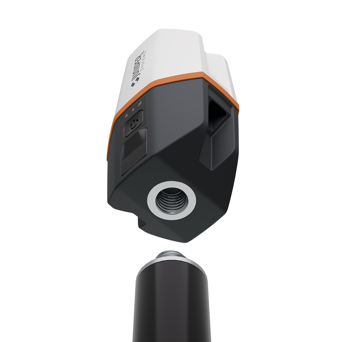
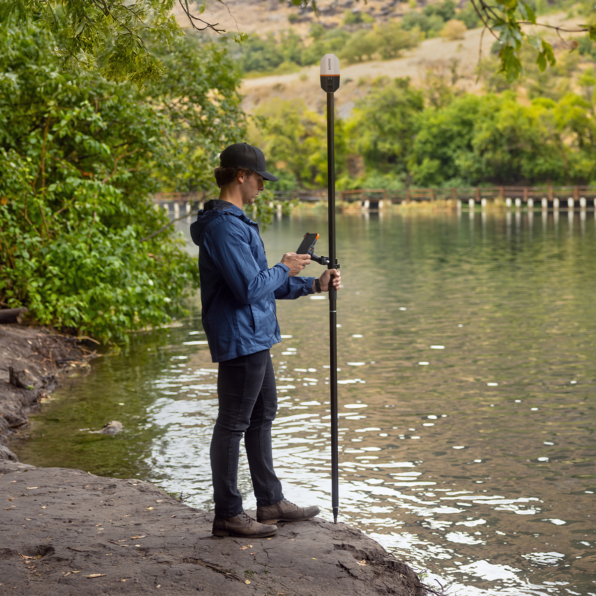
Juniper Systems Spire SP1-CFG(1457) Real-time Ready Receiver
Our newest GNSS receiver simplifies location data collection.
Achieve high-accuracy results with a light, compact design, one-button operation and the corrections services you need right out of the box. Built for rugged environments and long workdays, it offers seamless integration with mobile devices and data collection apps, making it a reliable companion for all GIS and asset mapping applications. It just works.Quick View -

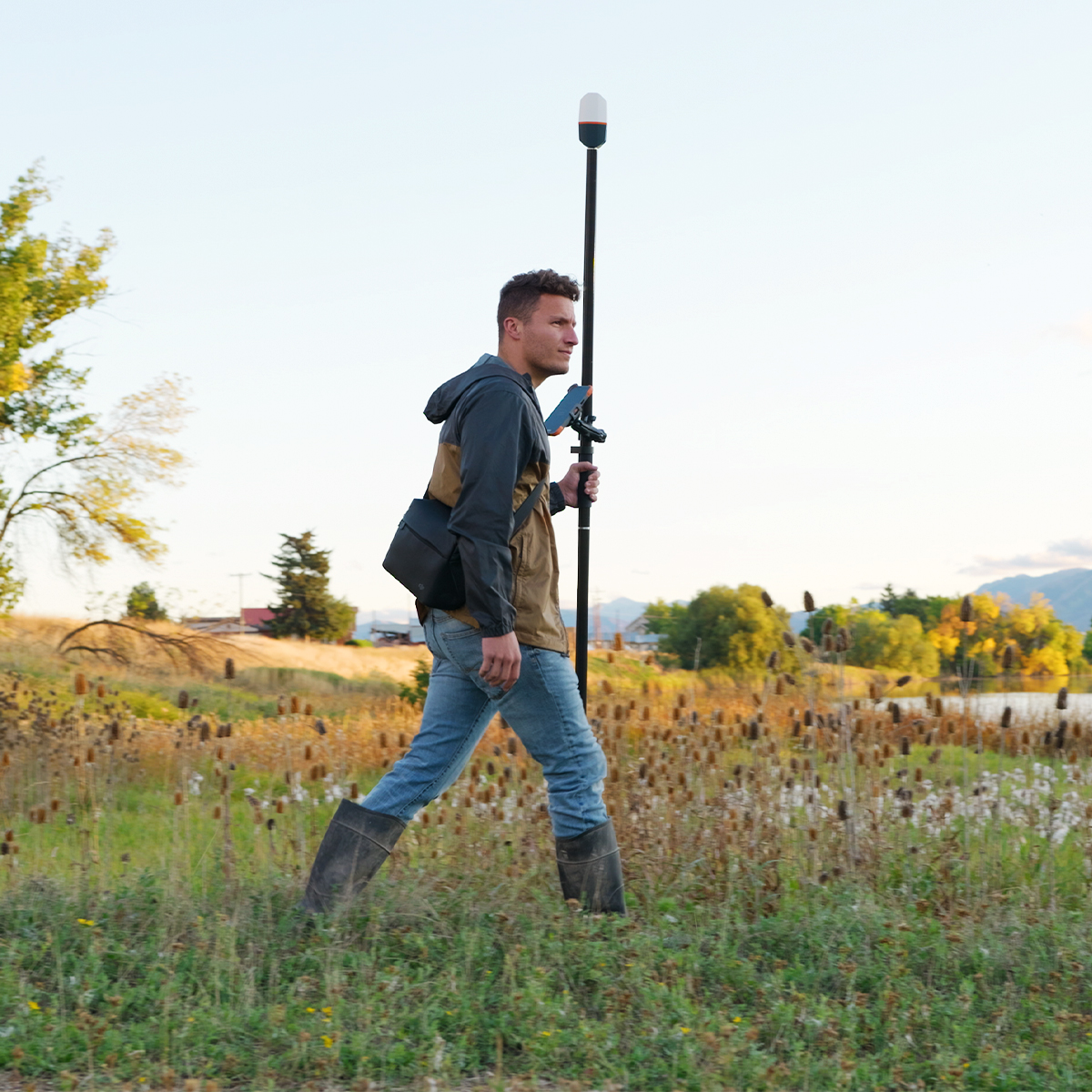
Juniper Systems Uinta 29117 Software (1-Year) – Windows 10 Professional License
Call for Price

Juniper Systems Uinta 29117 Software (1-Year) – Windows 10 Professional License
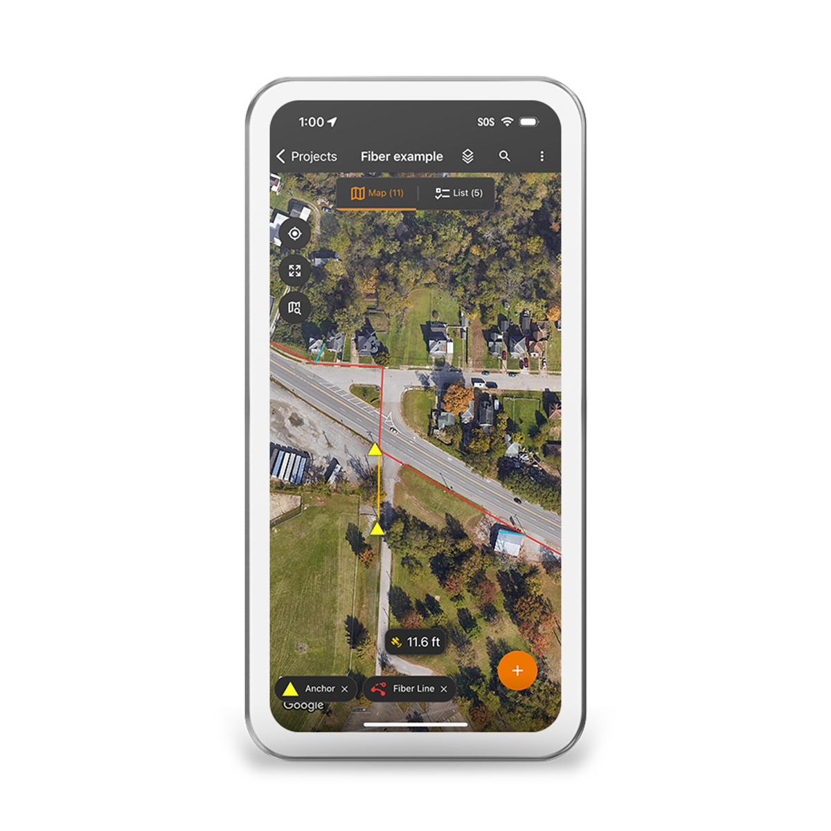
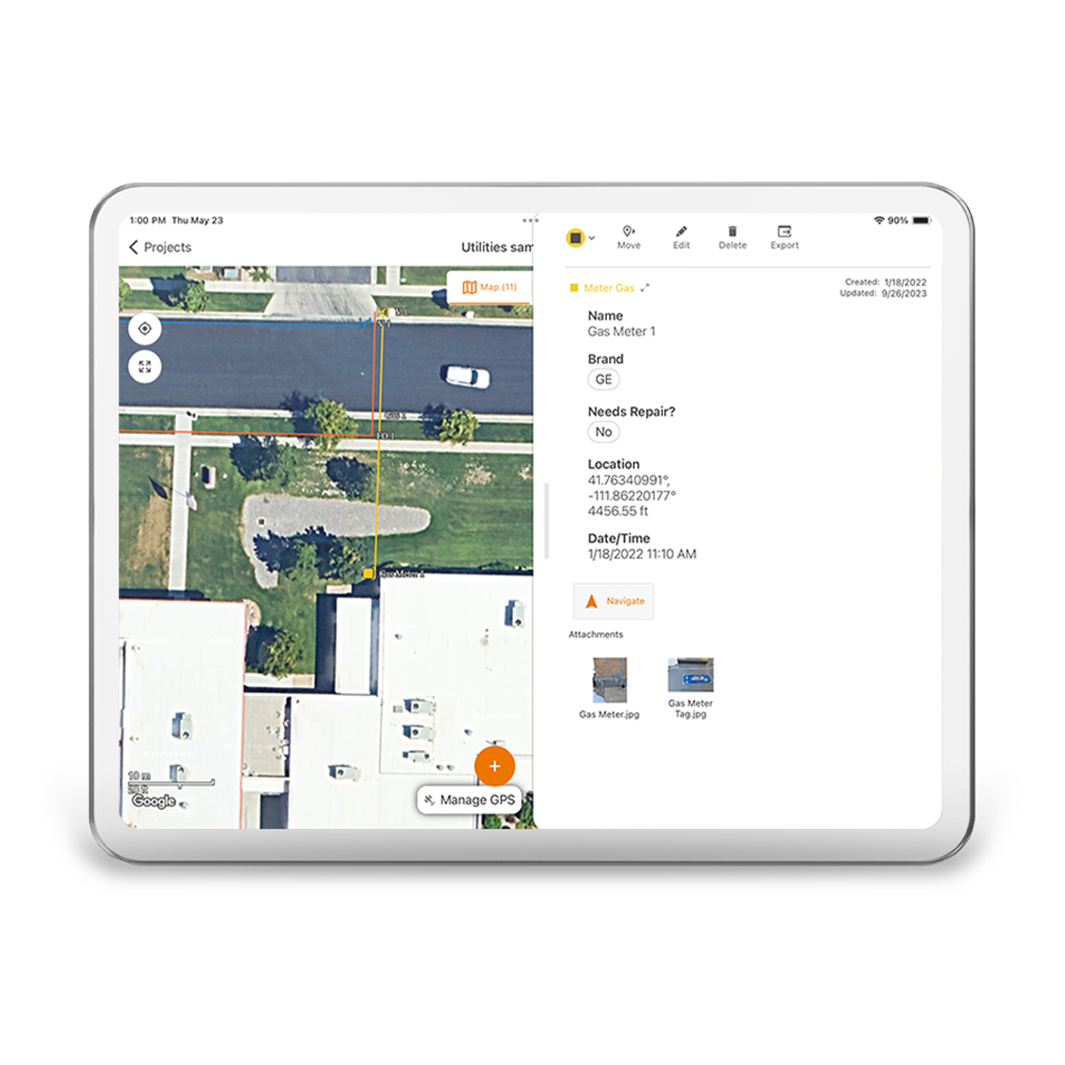
Call for PriceJuniper Systems Uinta 29117 Software (1-Year) – Windows 10 Professional License
Your Data. Your Way.
With Uinta, field data collection has never been easier. Our intuitive software allows users to effortlessly gather accurate data using customizable forms and real-time GPS integration ensures that your data is not only accurately mapped but also easily accessible for further analysis and reporting. Whether you are conducting environmental surveys, managing assets, or performing inspections, Uinta’s user-friendly interface helps you capture critical information quickly and accurately. The software supports a wide range of data types, including text, photos, and geospatial coordinates, making it versatile enough to handle any project. Cloud storage back-up allows you to save your data in a more accessible place, and when you are offline, Uinta saves your data locally and will upload once connection is reestablished.
Quick View -
Juniper Systems Uinta 29118 Software (3-Year) – License
Call for Price Juniper Systems Uinta 29118 Software (3-Year) – License
Call for PriceJuniper Systems Uinta 29118 Software (3-Year) – License
Your Data. Your Way.
With Uinta, field data collection has never been easier. Our intuitive software allows users to effortlessly gather accurate data using customizable forms and real-time GPS integration ensures that your data is not only accurately mapped but also easily accessible for further analysis and reporting. Whether you are conducting environmental surveys, managing assets, or performing inspections, Uinta’s user-friendly interface helps you capture critical information quickly and accurately. The software supports a wide range of data types, including text, photos, and geospatial coordinates, making it versatile enough to handle any project. Cloud storage back-up allows you to save your data in a more accessible place, and when you are offline, Uinta saves your data locally and will upload once connection is reestablished.Quick View -
Juniper Systems Uinta 29119 Software (1-Year) – Extra Field License
Call for Price Juniper Systems Uinta 29119 Software (1-Year) – Extra Field License
Call for PriceJuniper Systems Uinta 29119 Software (1-Year) – Extra Field License
Your Data. Your Way.
With Uinta, field data collection has never been easier. Our intuitive software allows users to effortlessly gather accurate data using customizable forms and real-time GPS integration ensures that your data is not only accurately mapped but also easily accessible for further analysis and reporting. Whether you are conducting environmental surveys, managing assets, or performing inspections, Uinta’s user-friendly interface helps you capture critical information quickly and accurately. The software supports a wide range of data types, including text, photos, and geospatial coordinates, making it versatile enough to handle any project. Cloud storage back-up allows you to save your data in a more accessible place, and when you are offline, Uinta saves your data locally and will upload once connection is reestablished.
Quick View -
Juniper Systems Uinta 29120 Software (3-Year) – Professional License
Call for Price Juniper Systems Uinta 29120 Software (3-Year) – Professional License
Call for PriceJuniper Systems Uinta 29120 Software (3-Year) – Professional License
Your Data. Your Way.
With Uinta, field data collection has never been easier. Our intuitive software allows users to effortlessly gather accurate data using customizable forms and real-time GPS integration ensures that your data is not only accurately mapped but also easily accessible for further analysis and reporting. Whether you are conducting environmental surveys, managing assets, or performing inspections, Uinta’s user-friendly interface helps you capture critical information quickly and accurately. The software supports a wide range of data types, including text, photos, and geospatial coordinates, making it versatile enough to handle any project. Cloud storage back-up allows you to save your data in a more accessible place, and when you are offline, Uinta saves your data locally and will upload once connection is reestablished.
Quick View -
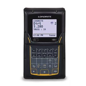
Loadrite 108628-10 X2350 Excavator Scale
Call for Price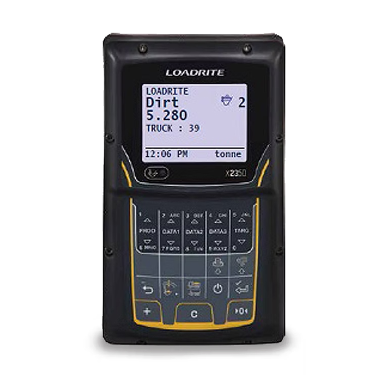

Loadrite 108628-10 X2350 Excavator Scale
Call for PriceLoadrite 108628-10 X2350 Excavator Scale
Payload management starts right here with the Loadrite X2350 Excavator Scale.
Half-full or half-empty, if your haul trucks aren’t carrying their optimized load you’re probably wasting money. With the X2350 on your excavator, you’ll know exactly how much material is loaded in the truck, and you’ll minimize costs and cycles to haul it away.Quick View -

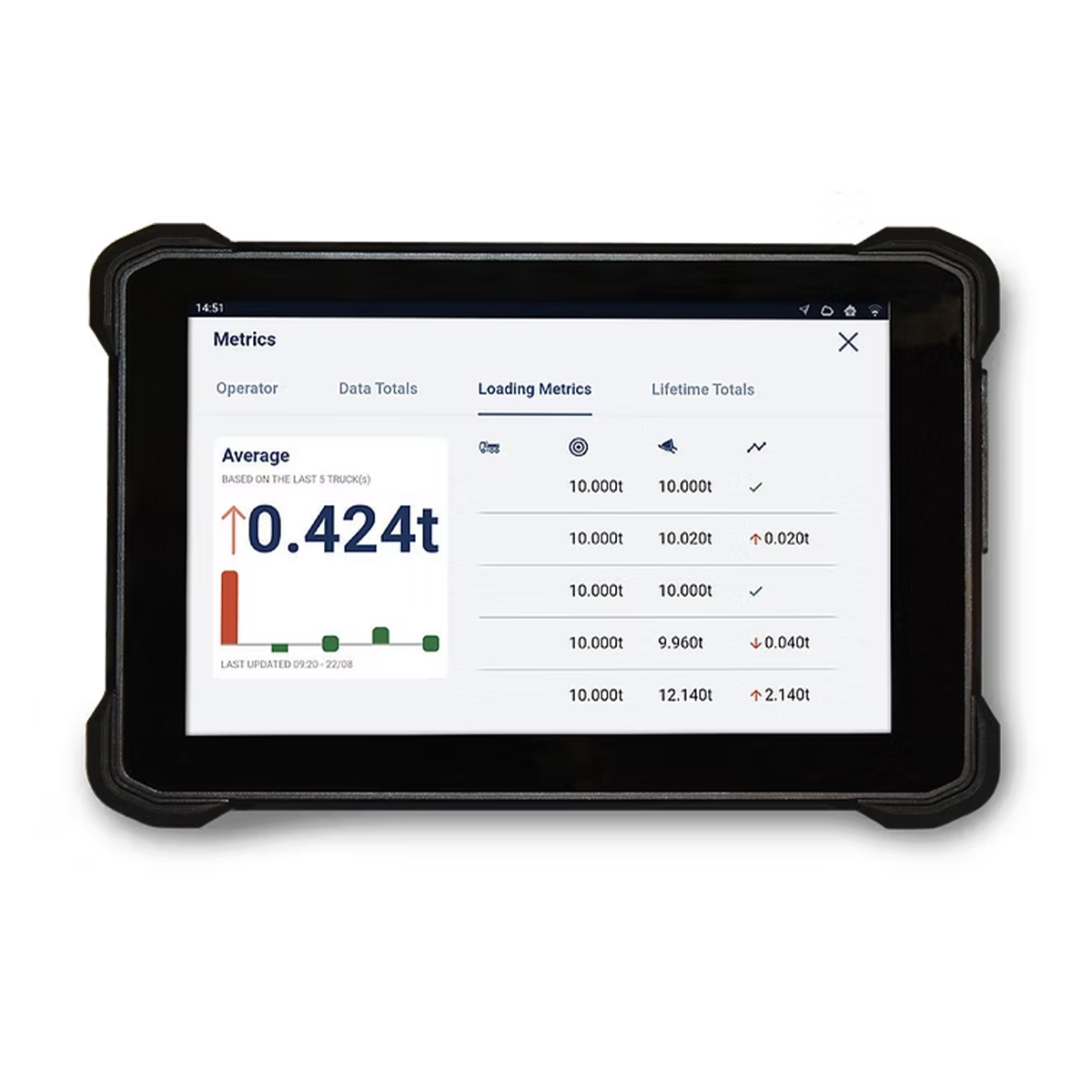
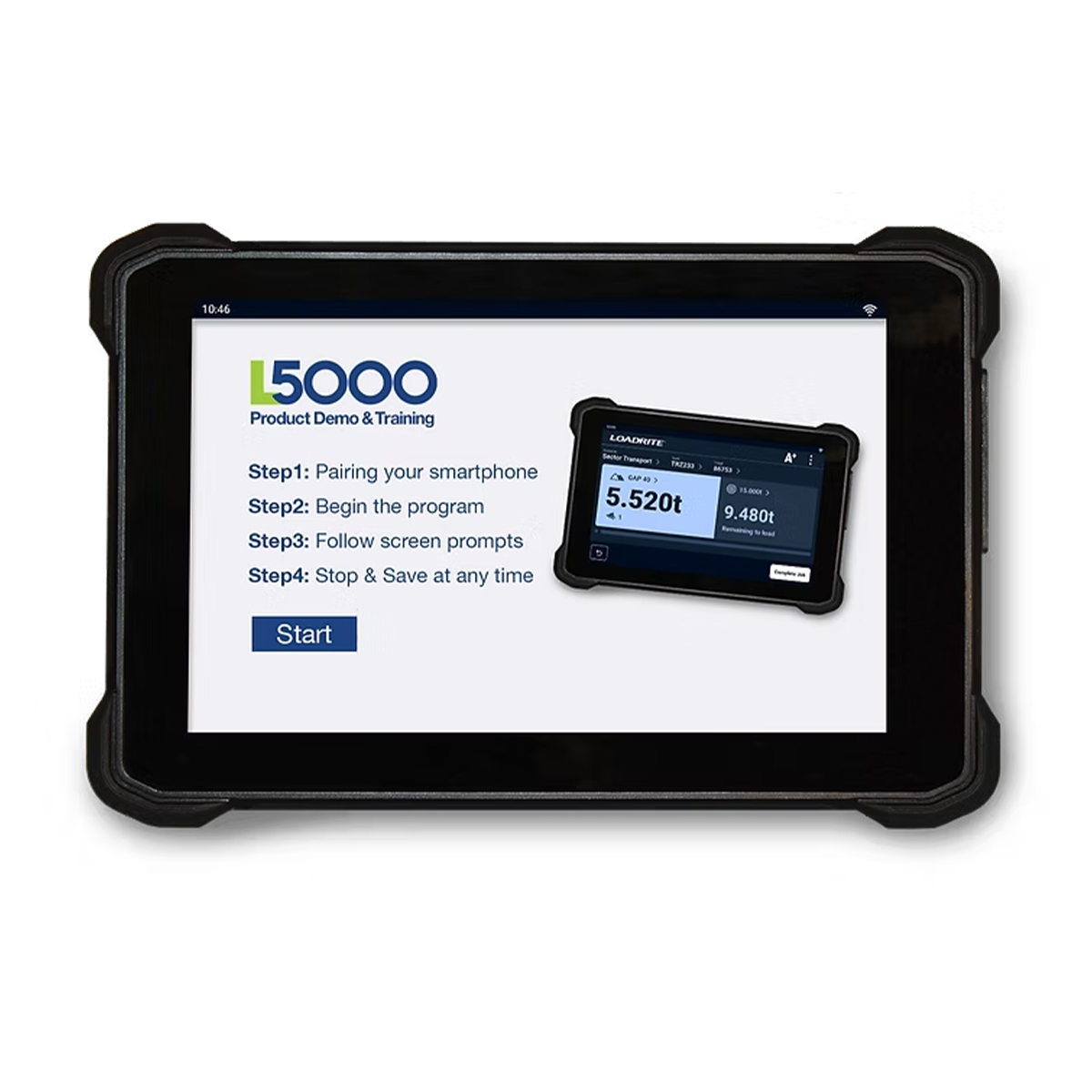
Loadrite 151040-10-A L5000 Wheel Loader Scale
Call for Price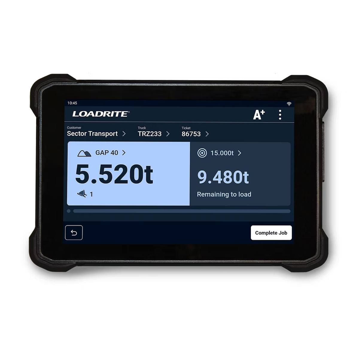
Loadrite 151040-10-A L5000 Wheel Loader Scale
Call for PriceLoadrite 151040-10-A L5000 Wheel Loader Scale
The next generation of onboard weighing systems inspired by smart devices.
Stay on top of every load using the powerful new Loadrite L5000 wheel loader scale. With a modern and easy-to-use interface, built-in connectivity and best-in-class weighing, you can maximize every load with accurate data you can count on. Connect machines, people and the office to make bulk material handling management easier, safer, and more efficient. Capture activity and enable performance improvements with real-time insights and streamlined capabilities. The L5000 is the ultimate choice for any bulk material handling operation.Quick View -

Pipe Trekker A-200X Package
Call for Price


Pipe Trekker A-200X Package
Call for PriceQuick View -

PIVOT Expert
Call for Price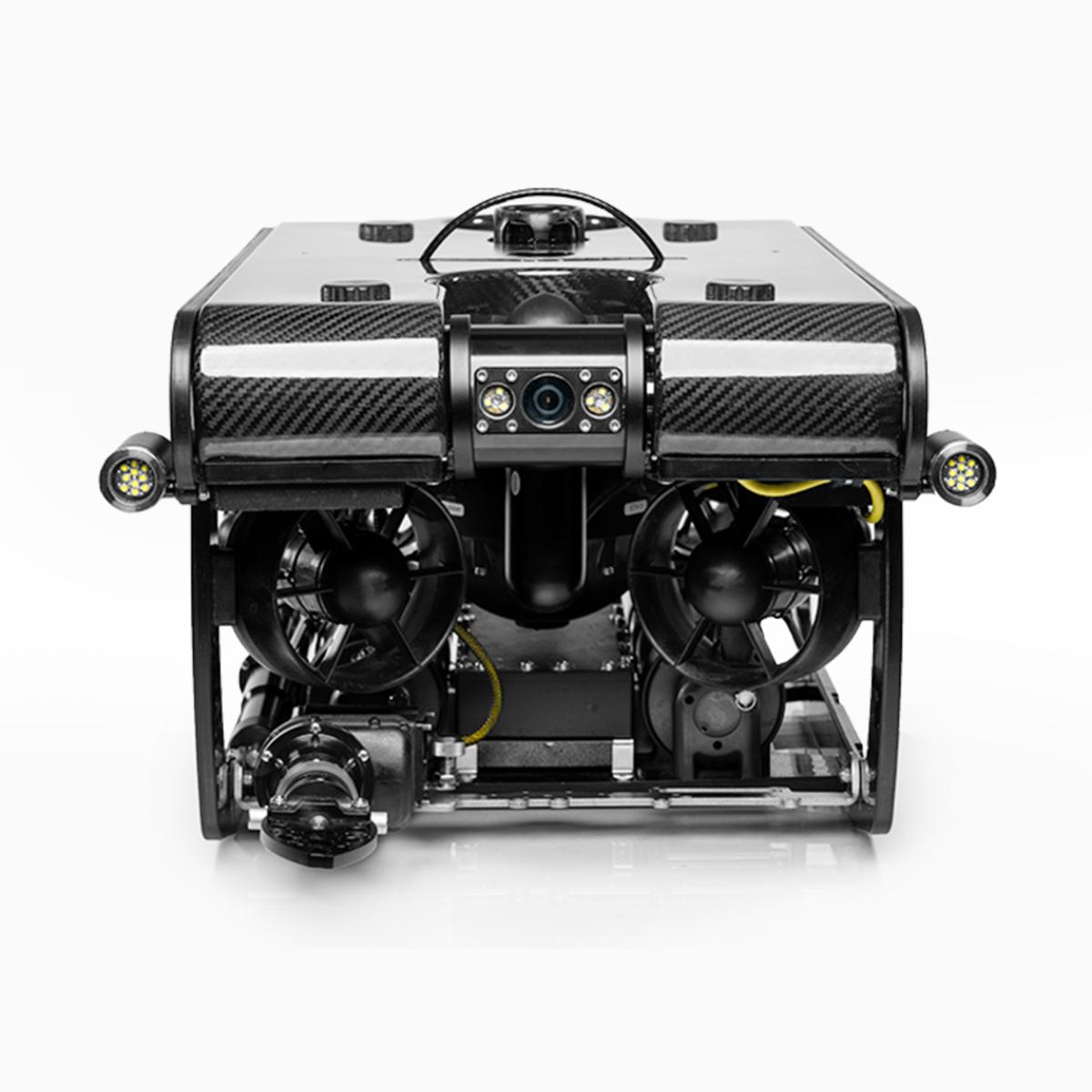


PIVOT Expert
Call for PriceQuick View -

Quantum-Systems 4260574665982 Trinity Pro
Call for Price


Quantum-Systems 4260574665982 Trinity Pro
Call for PriceQuantum-Systems 4260574665982 Trinity Pro
Quick View -
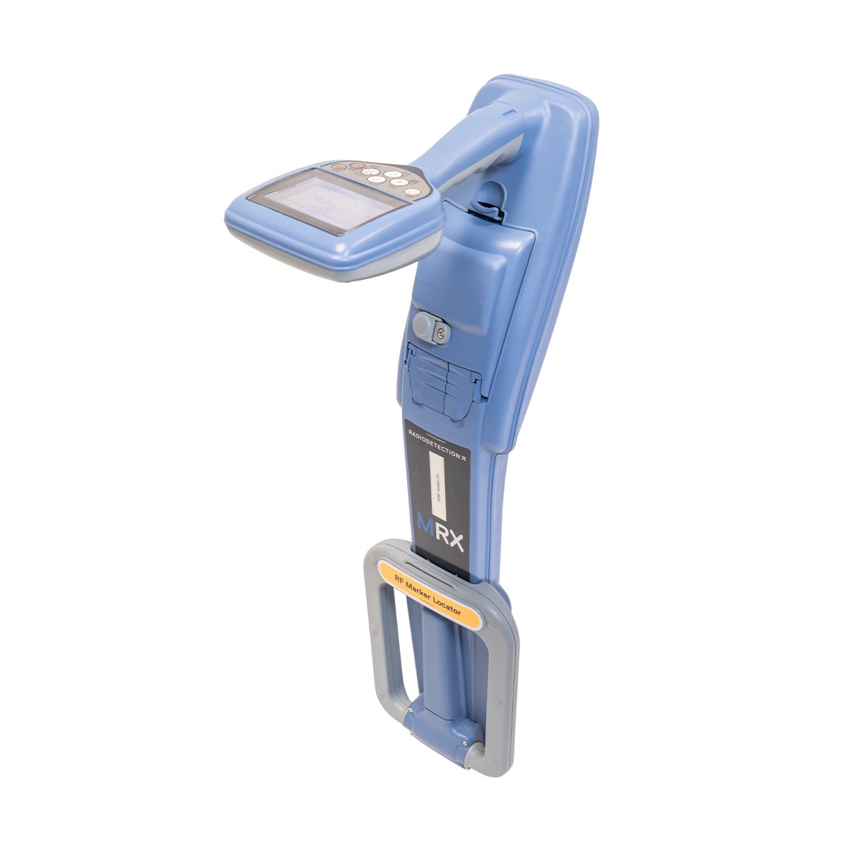
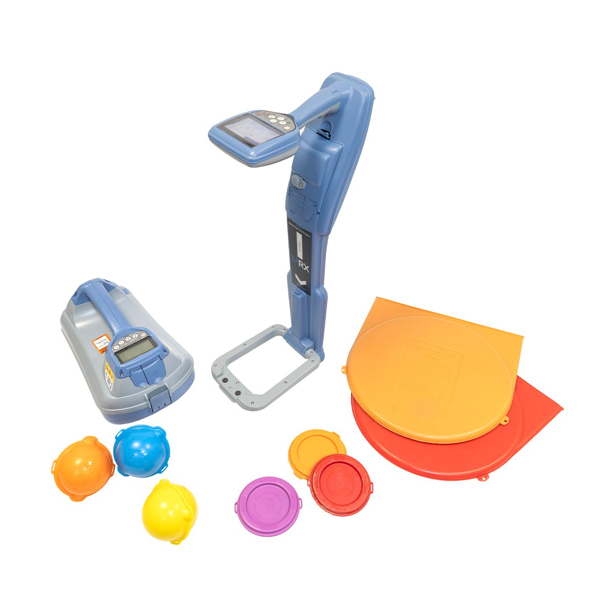
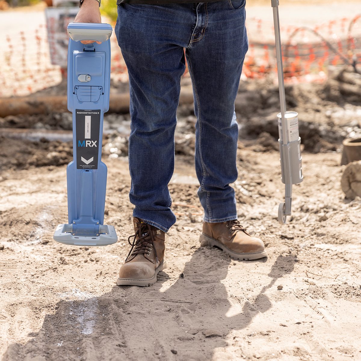
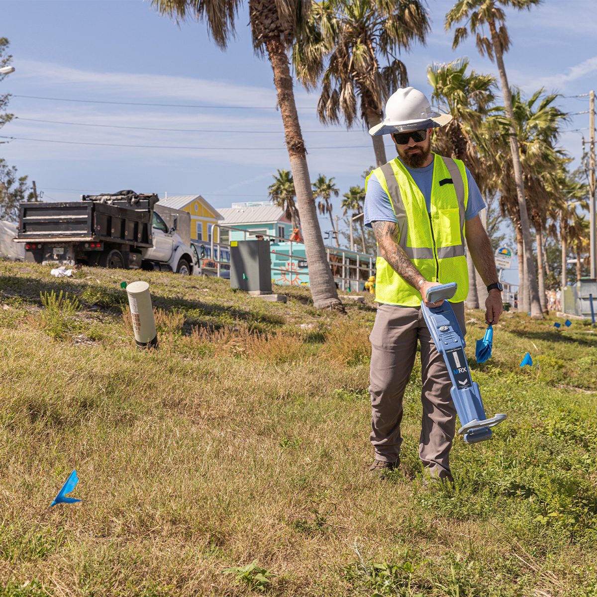
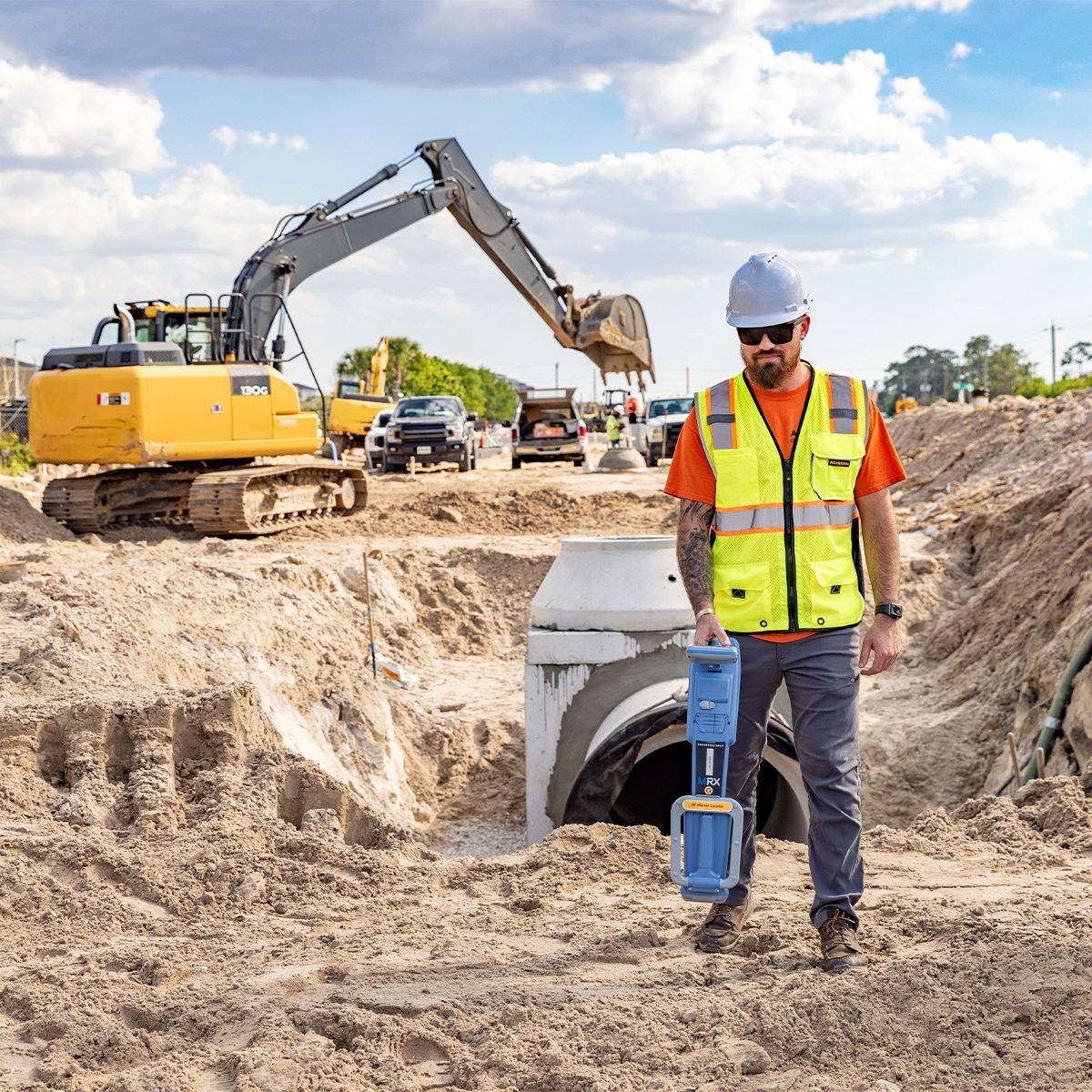
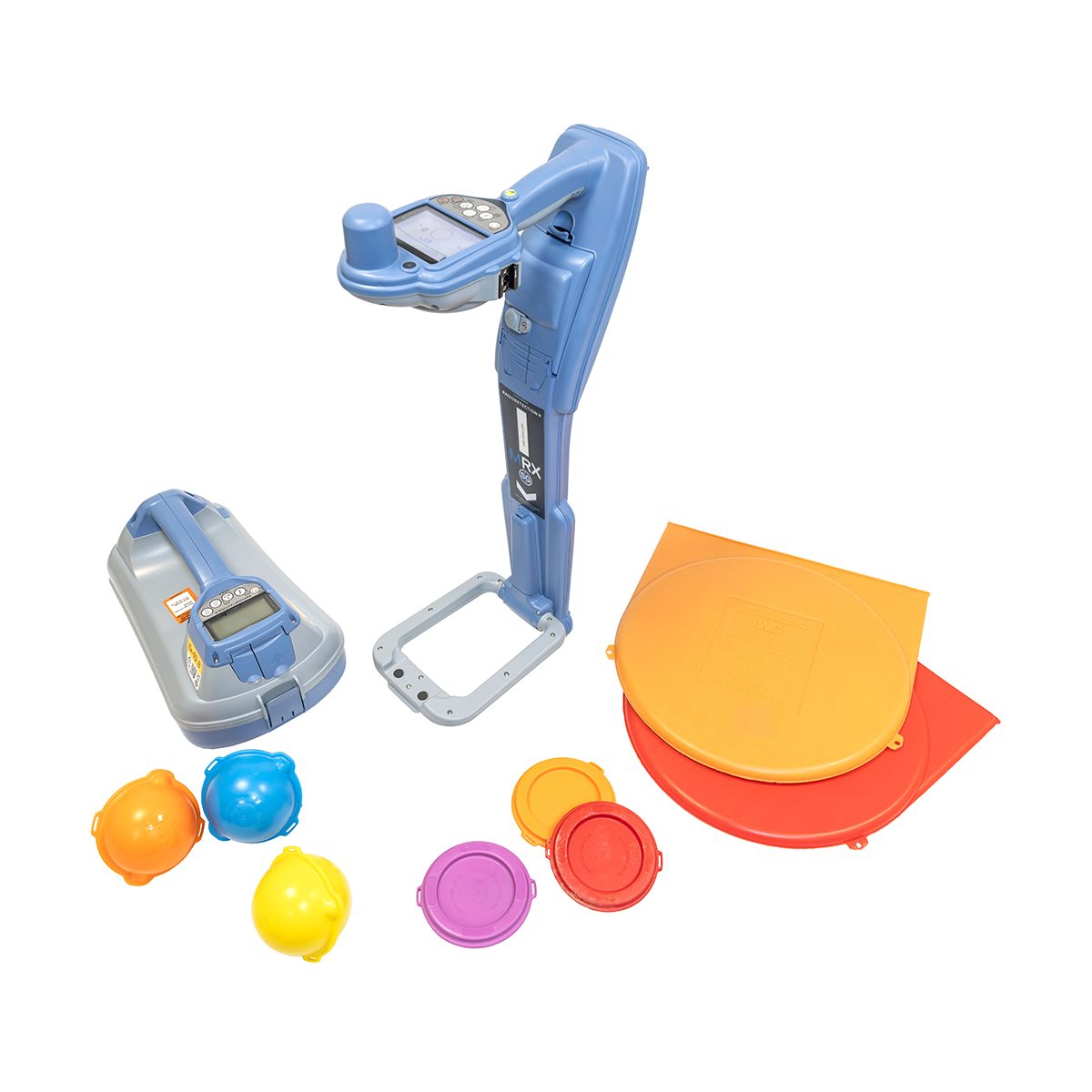
Radiodetection 10/MRX-US MRX RF Marker Locator
Call for Price

Radiodetection 10/MRX-US MRX RF Marker Locator
Call for PriceOnly available in WA, OR, ID, MT, WY, CO, HI, and AK.
Precision and Marker Locator Range
The MRX is a rugged, ergonomic RF (Radio Frequency) marker locator that combines utility and marker ball detection in one dependable tool. Designed for accurate and effective everyday use, it offers powerful performance and the flexibility to handle both line and marker locates without switching equipment.
Quick View -
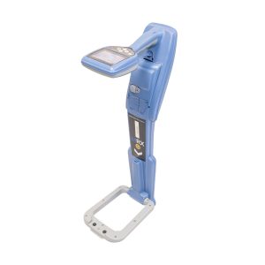
Radiodetection 10/MRXG-US MRX G RF Marker Locator
Call for Price
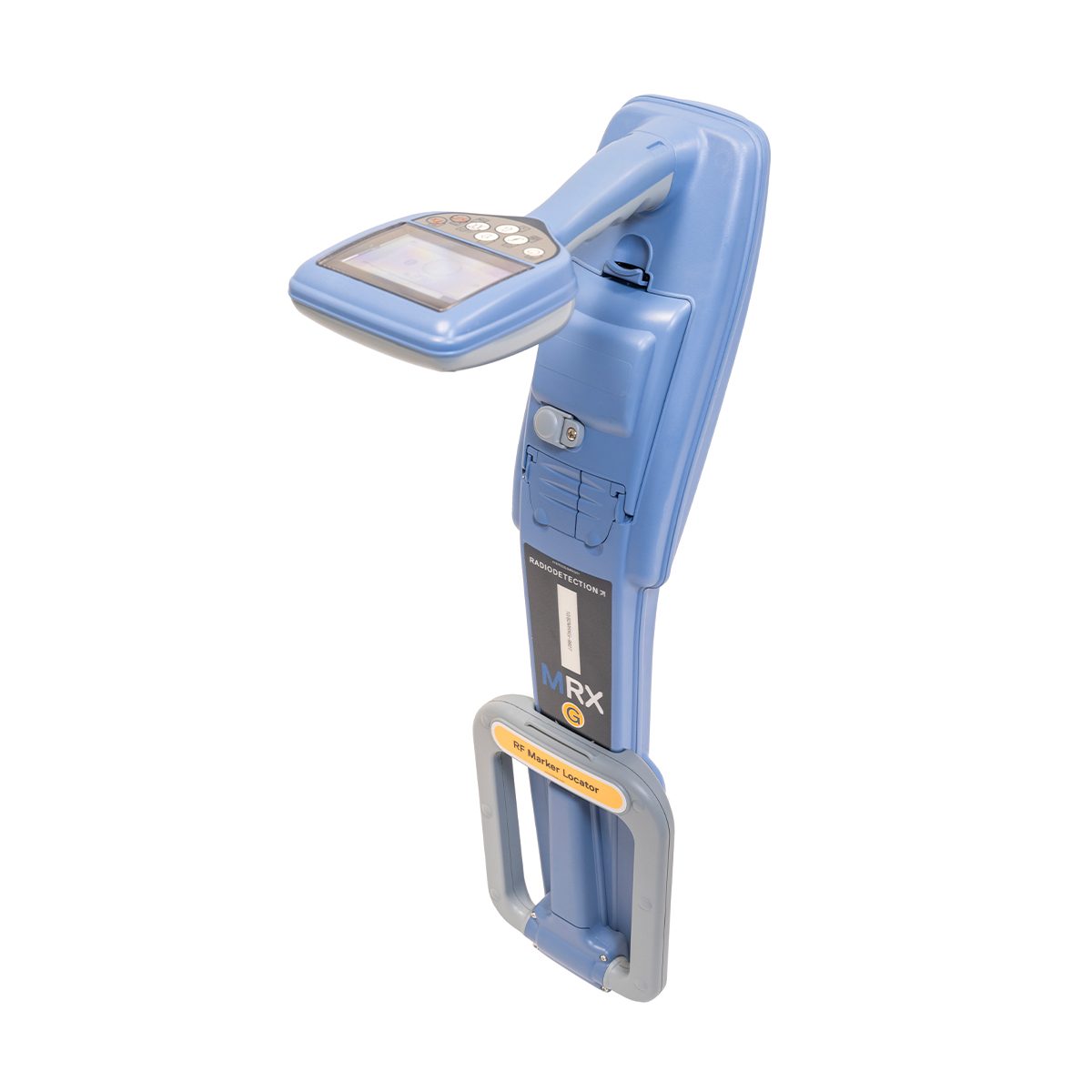
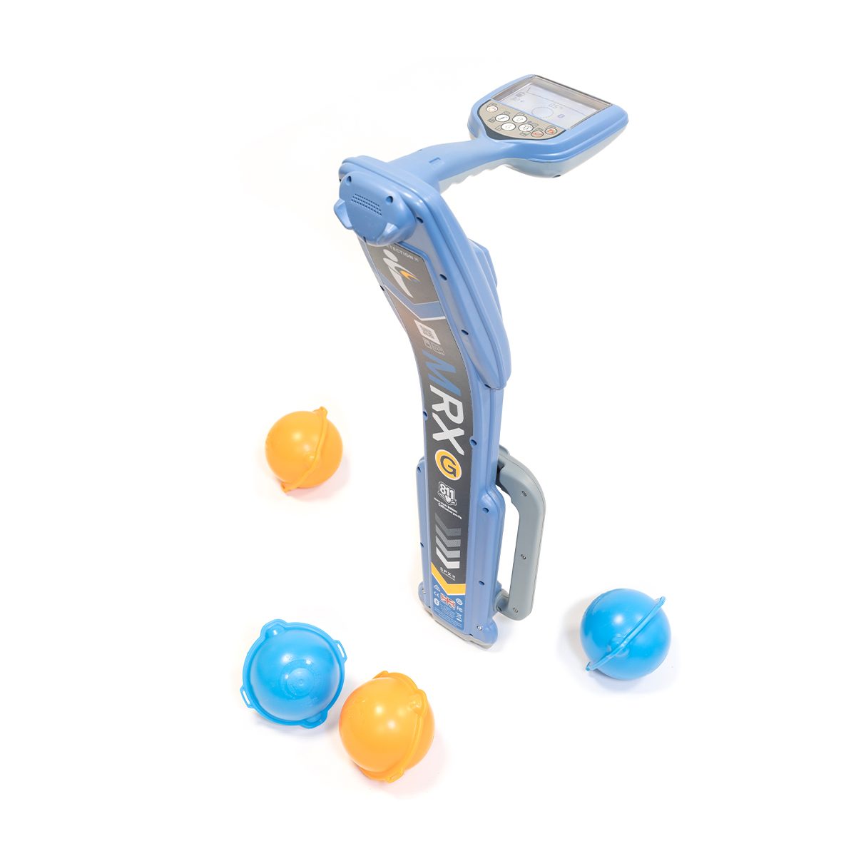
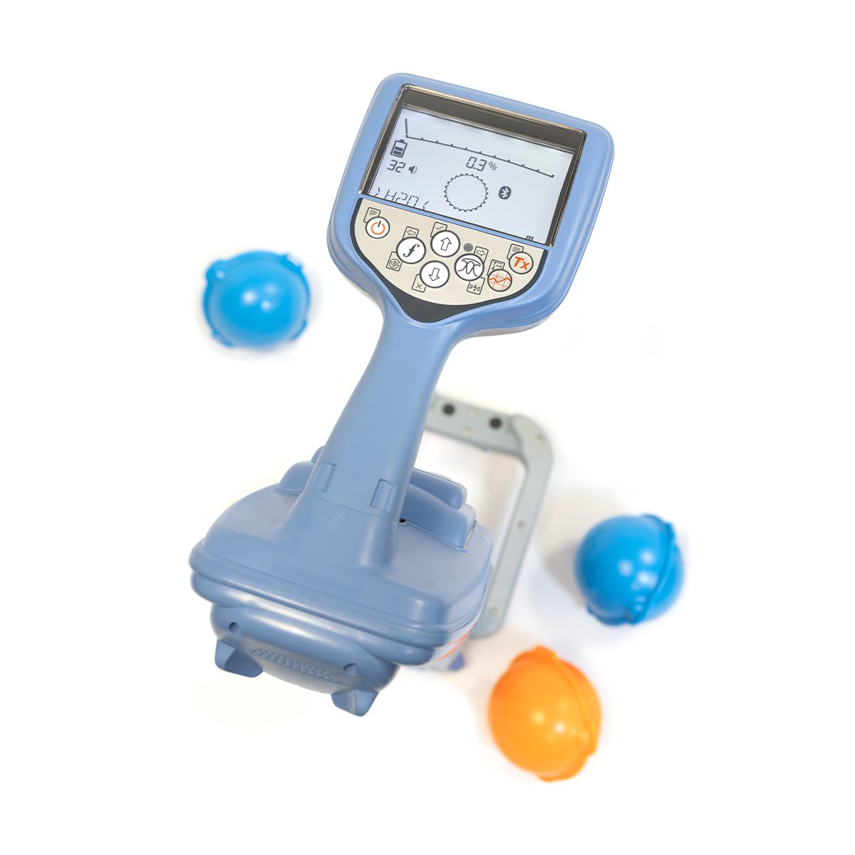
Radiodetection 10/MRXG-US MRX G RF Marker Locator
Call for PriceOnly available in WA, OR, ID, MT, WY, CO, HI, and AK.
Precision and Marker Locator Range
The MRX G is an RF (Radio Frequency) marker locator tailored for advanced locates – it is built for professionals who need more from their locator. A wide range of frequencies, additional active and passive modes, and onboard GPS make it well-suited for challenging environments and congested areas where precision matters.
Quick View -

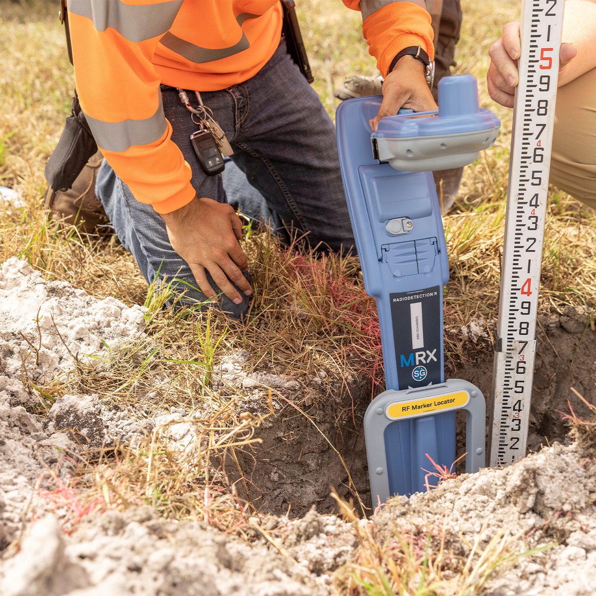
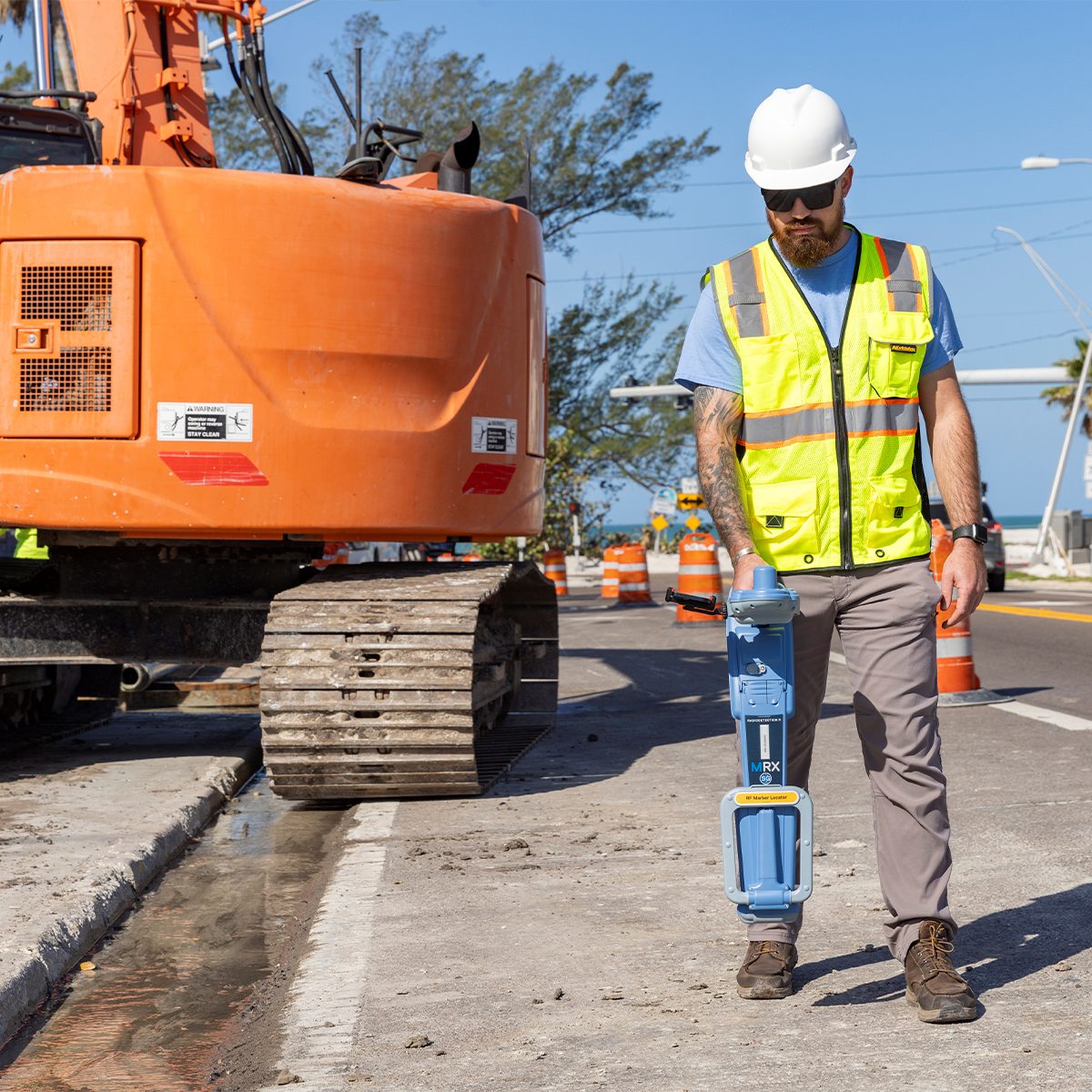
Radiodetection 10/MRXSG-US MRX SG Survey Grade Locator
Call for Price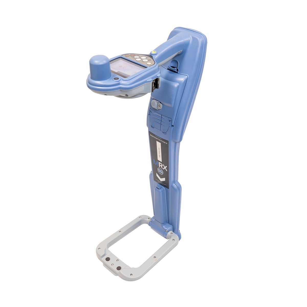
Radiodetection 10/MRXSG-US MRX SG Survey Grade Locator
Call for PriceOnly available in WA, OR, ID, MT, WY, CO, HI, and AK.
Mapping and Digital Solutions
Precision and Marker Locator RangeThe MRX SG is the most advanced RF (Radio Frequency) marker locator in the MRX range, combining precision line locating, marker ball detection, and survey-grade accuracy in a single, powerful solution. Compatible with both Android™ and iOS®, the MRX SG is built for professionals who need to find buried utilities and marker balls, as well as map them with confidence.
The MRX SG delivers precision locating, high accuracy mapping, and rugged reliability for demanding field environments.
Quick View -
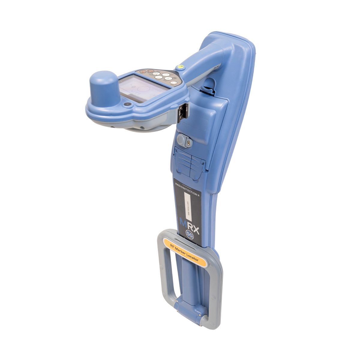
Radiodetection 10/MRXSG-US-KIT MRX SG Survey Grade Locator
Call for Price Radiodetection 10/MRXSG-US-KIT MRX SG Survey Grade Locator
Call for PriceOnly available in WA, OR, ID, MT, WY, CO, HI, and AK.
Mapping and Digital Solutions
Precision and Marker Locator RangeThe MRX SG is the most advanced RF (Radio Frequency) marker locator in the MRX range, combining precision line locating, marker ball detection, and survey-grade accuracy in a single, powerful solution. Compatible with both Android™ and iOS®, the MRX SG is built for professionals who need to find buried utilities and marker balls, as well as map them with confidence.
The MRX SG delivers precision locating, high accuracy mapping, and rugged reliability for demanding field environments.
Quick View -

Radiodetection LMX150 FINDAR GPR
Call for Price


Radiodetection LMX150 FINDAR GPR
Call for PriceOnly available in WA, OR, ID, MT, WY, CO, HI, and AK.
Ground Penetrating Radar (GPR)Our Sensors & Software LMX150™ FINDAR® is a compact, high resolution utility locating system for your locating and mapping needs. LMX150™ FINDAR® GPR complements traditional pipe and cable locators and allows you to locate targets below the surface.
Quick View -
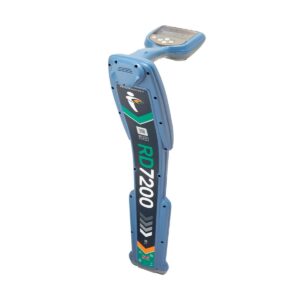
Radiodetection RD7200 Cable and Pipe Locator
Call for Price
Radiodetection RD7200 Cable and Pipe Locator
Call for PriceOnly available in WA, OR, ID, MT, WY, CO, HI, and AK.
Precision Locator Range
Locating and marking buried utilities quickly, accurately, and safely.
The RD7200 is a no-compromise all-industry locator, designed for accurate and effective everyday use.
Quick View -

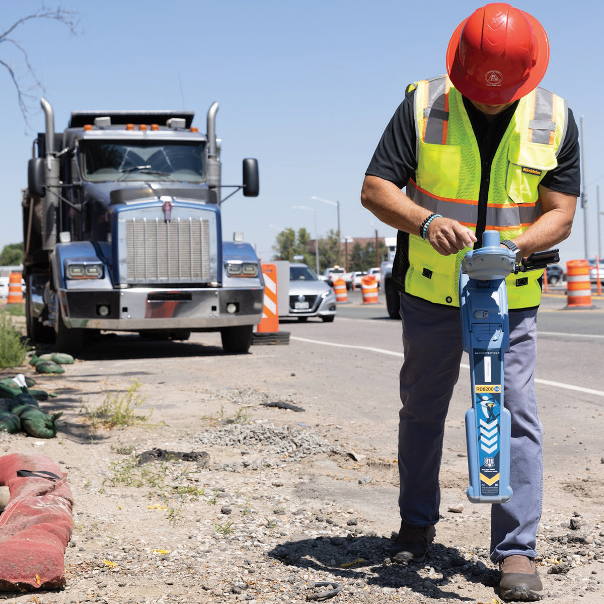
Radiodetection RD8200 Cable and Pipe Locator
Call for Price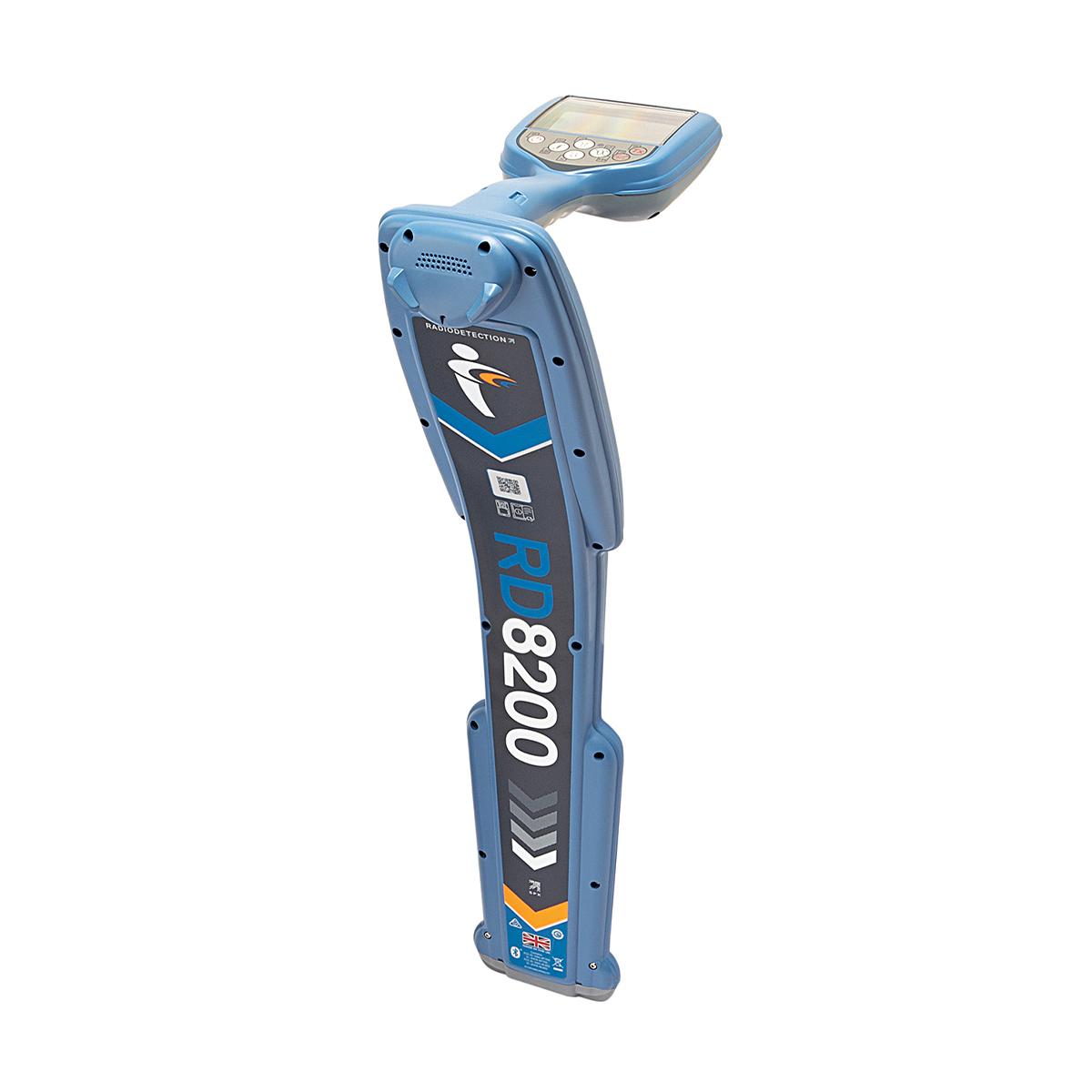
Radiodetection RD8200 Cable and Pipe Locator
Call for PriceOnly available in WA, OR, ID, MT, WY, CO, HI, and AK.
Precision Locator Range
Damage prevention and operational efficiency are the biggest challenges facing our customers.
Solve these problems with the RD8200. Designed with the operator in mind, it is our most advanced and capable range of precision locators.
Quick View -

Radiodetection RD8200SG Survey Grade Cable and Pipe Locator
Call for Price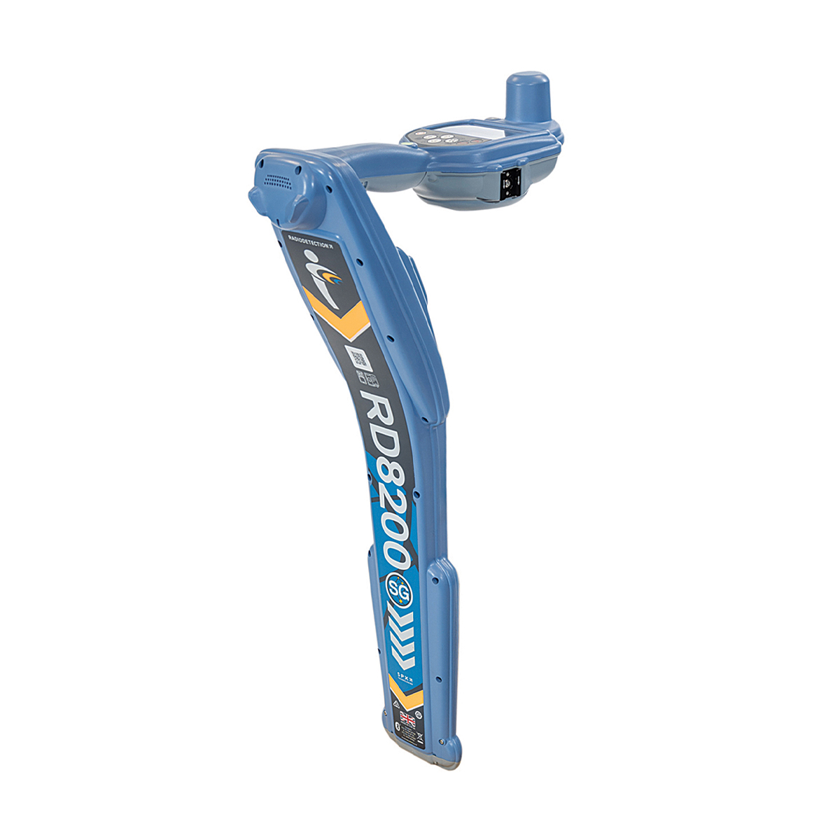


Radiodetection RD8200SG Survey Grade Cable and Pipe Locator
Call for PriceOnly available in WA, OR, ID, MT, WY, CO, HI, and AK.Precision Locator Range
Locate and Map Buried Utilities in a Single Operation
Radiodetection’s most advanced, combined mapping and locating solution.
Quick View -

Revolution ROV NAV
Call for Price


Revolution ROV NAV
Call for PriceQuick View -

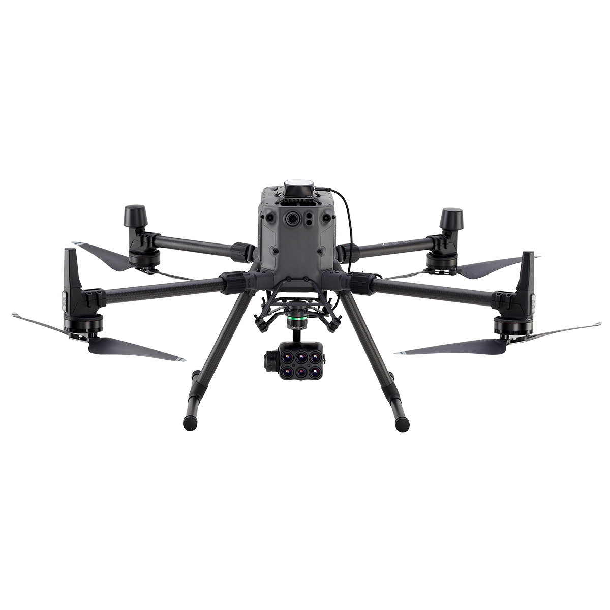
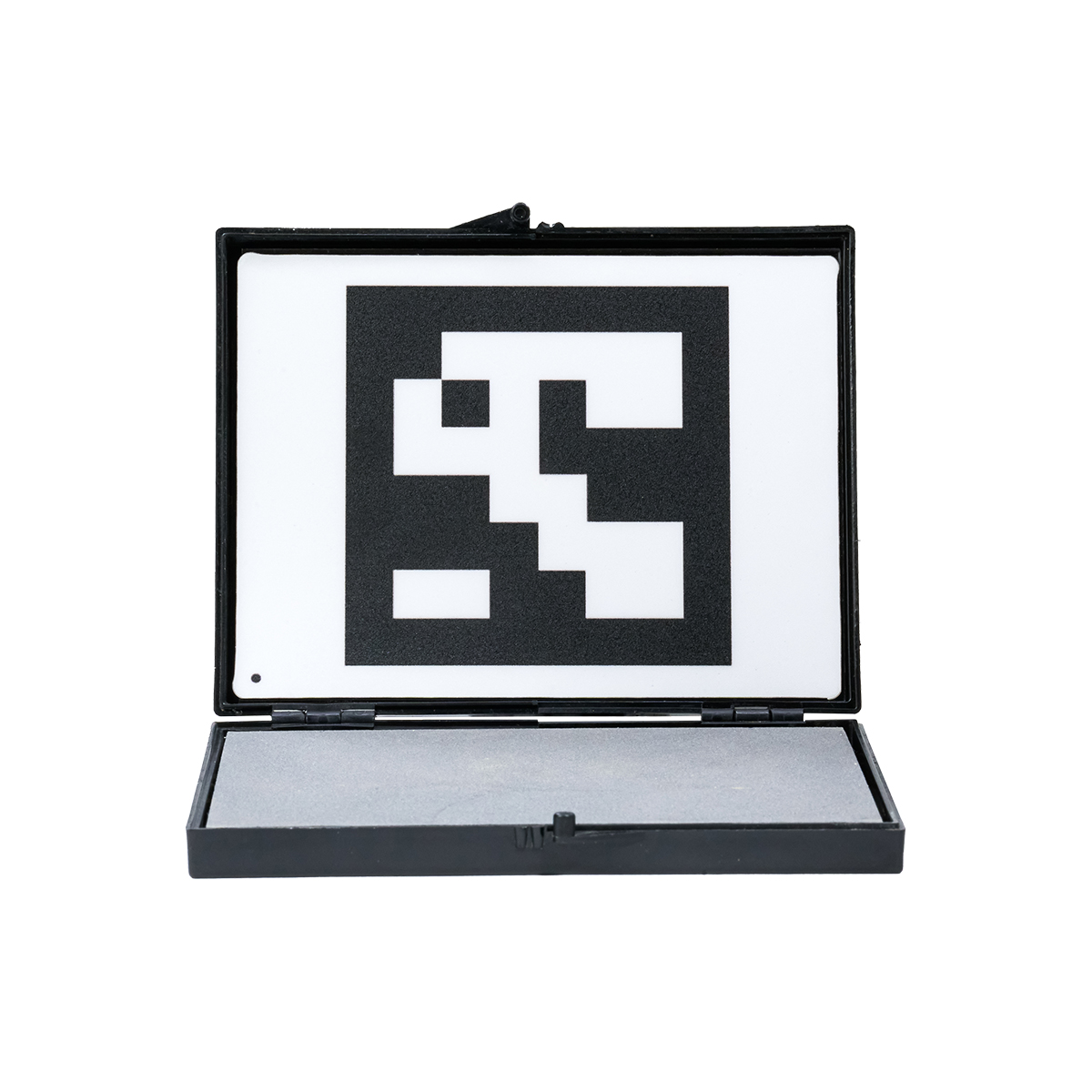
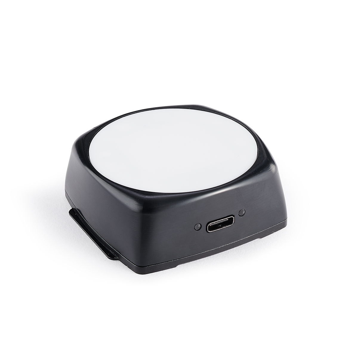
Sentera 6X Multispectral Sensor Kit – DJI Skyport
Call for Price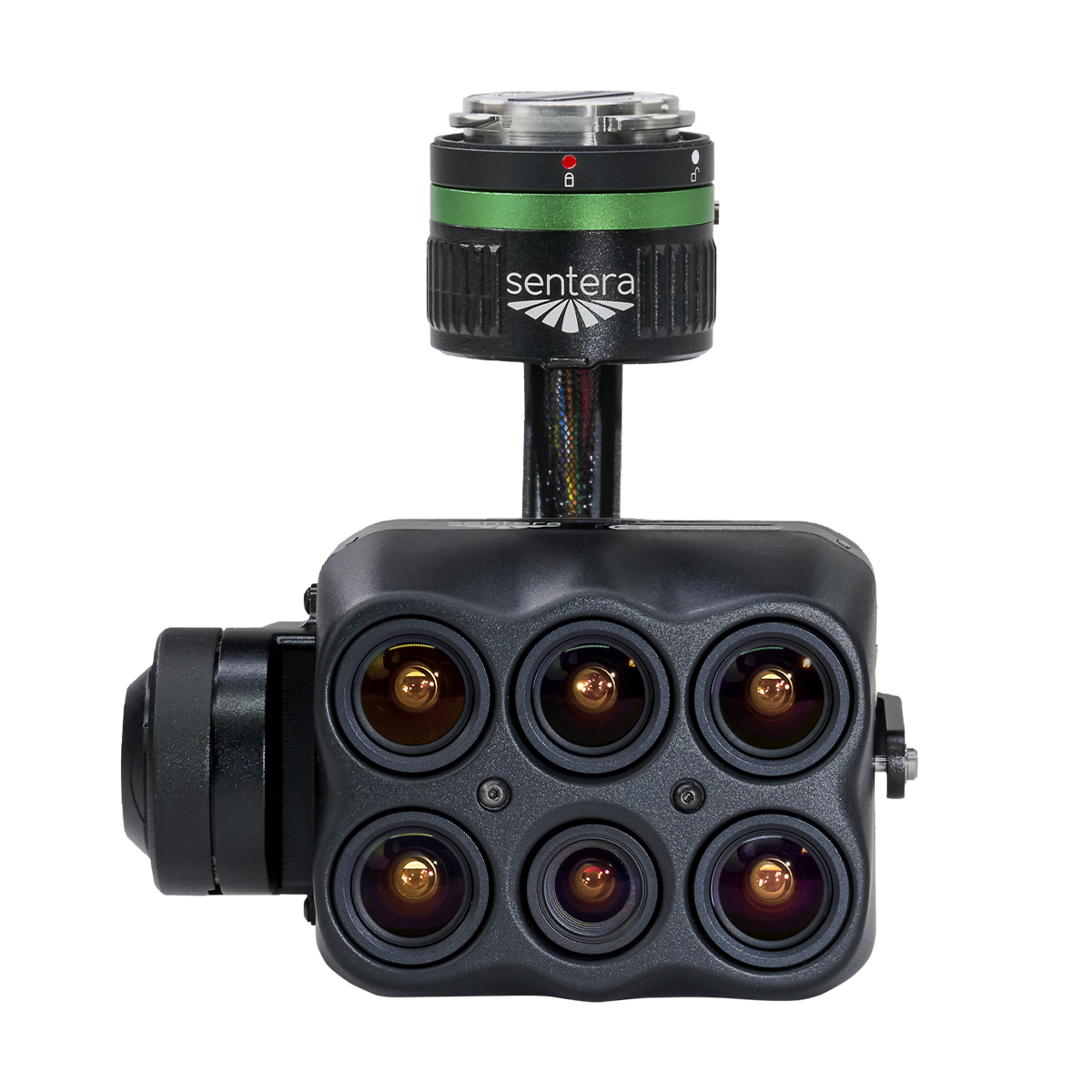

Sentera 6X Multispectral Sensor Kit – DJI Skyport
Call for PriceScience-grade Multispectral Imagery
The Sentera 6X Sensor: The ultimate solution for high-resolution RGB and accurate radiometric multispectral imagery. The 6X offers synchronized capture of radiometric-accurate multispectral and high-resolution RGB imagery. With ample 512GB high-speed internal storage, high-rate capture speed, and gimbal stabilization, it enables longer flights, covering more area. Unmatched in its class, the 6X provides outstanding value, ensuring optimal results for every project.
Quick View -

Sentera 6X Thermal Multispectral Sensor Kit – DJI Skyport
Call for Price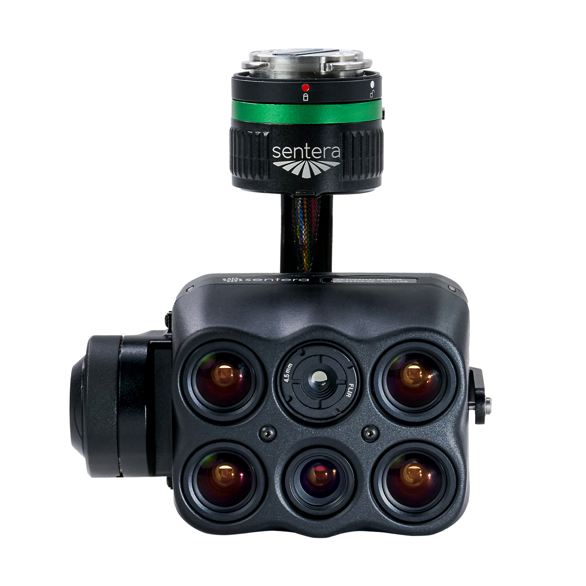
Sentera 6X Thermal Multispectral Sensor Kit – DJI Skyport
Call for PriceScience-grade Multispectral Imagery
The Sentera 6X Thermal Sensor: The ultimate solution for high-resolution RGB, accurate radiometric multispectral, and thermal imagery. The 6X Thermal offers synchronized capture of radiometric-accurate multispectral, thermal, and high-resolution RGB imagery. With ample 512GB high-speed internal storage, high-rate capture speed, and gimbal stabilization, it enables longer flights, covering more area. Unmatched in its class, the 6X Thermal provides outstanding value, ensuring optimal results for every project.
Quick View -

Spectra Precision GL720 Dual Grade Laser
Call for Price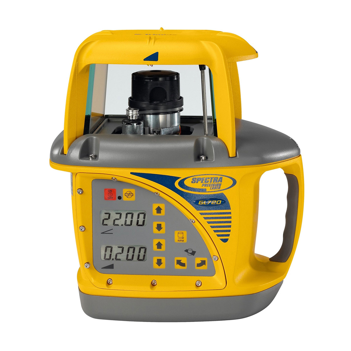

Spectra Precision GL720 Dual Grade Laser
Call for PriceSpectra Precision GL720 Dual Grade Laser
The GL720 features +/- 10% in the X axis grade range and -0.5 to +25% Y-axis grade range with high accuracy up to 3,000 foot (900 meter) diameter. The GL720 is ideal for general construction and machine control grade applications.
Quick View -
TALOS T60X-Drone
Call for Price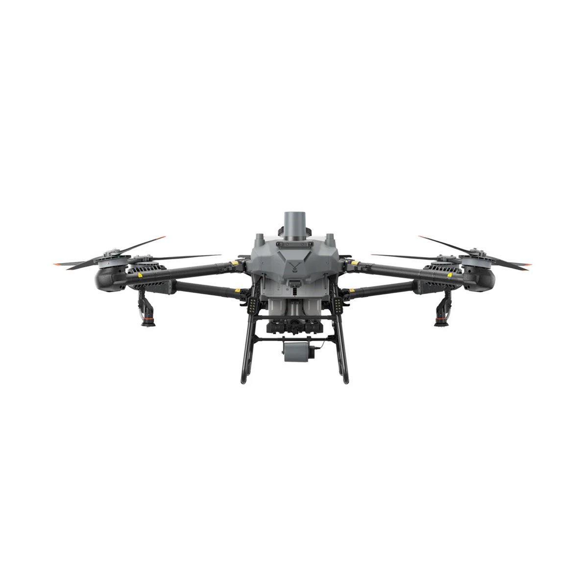


TALOS T60X-Drone
Call for PriceTALOS T60X-Drone
TALOS T60X – the ultimate high-performance agricultural drone, engineered to transform the future of farming. With advanced features designed for maximum efficiency and precision, the T60X delivers unmatched spraying and spreading capabilities.Quick View -
Trimble 109695-00-HH DA2 GNSS Smart Antenna
Call for Price


Trimble 109695-00-HH DA2 GNSS Smart Antenna
Call for PriceONLY AVAILABLE FOR DELIVERY IN ALASKA.Trimble 109695-00-HH DA2 GNSS Smart Antenna
Affordable and Reliable Positioning
The lightweight and compact Trimble® DA2 GNSS Smart Antenna is a high-performing software-based digital GNSS antenna, featuring proven Trimble quality priced for a faster return on investment. Paired with Trimble Siteworks Software, quickly grade check, navigate to points, easily execute positioning tasks, and record features with attributes, pictures, and volumes to be more efficient in the field. The DA2 is a budget-friendly receiver, compatible with the functionality of Siteworks.Quick View -
Trimble 163170-500 Earthworks GO! 2.0
Call for Price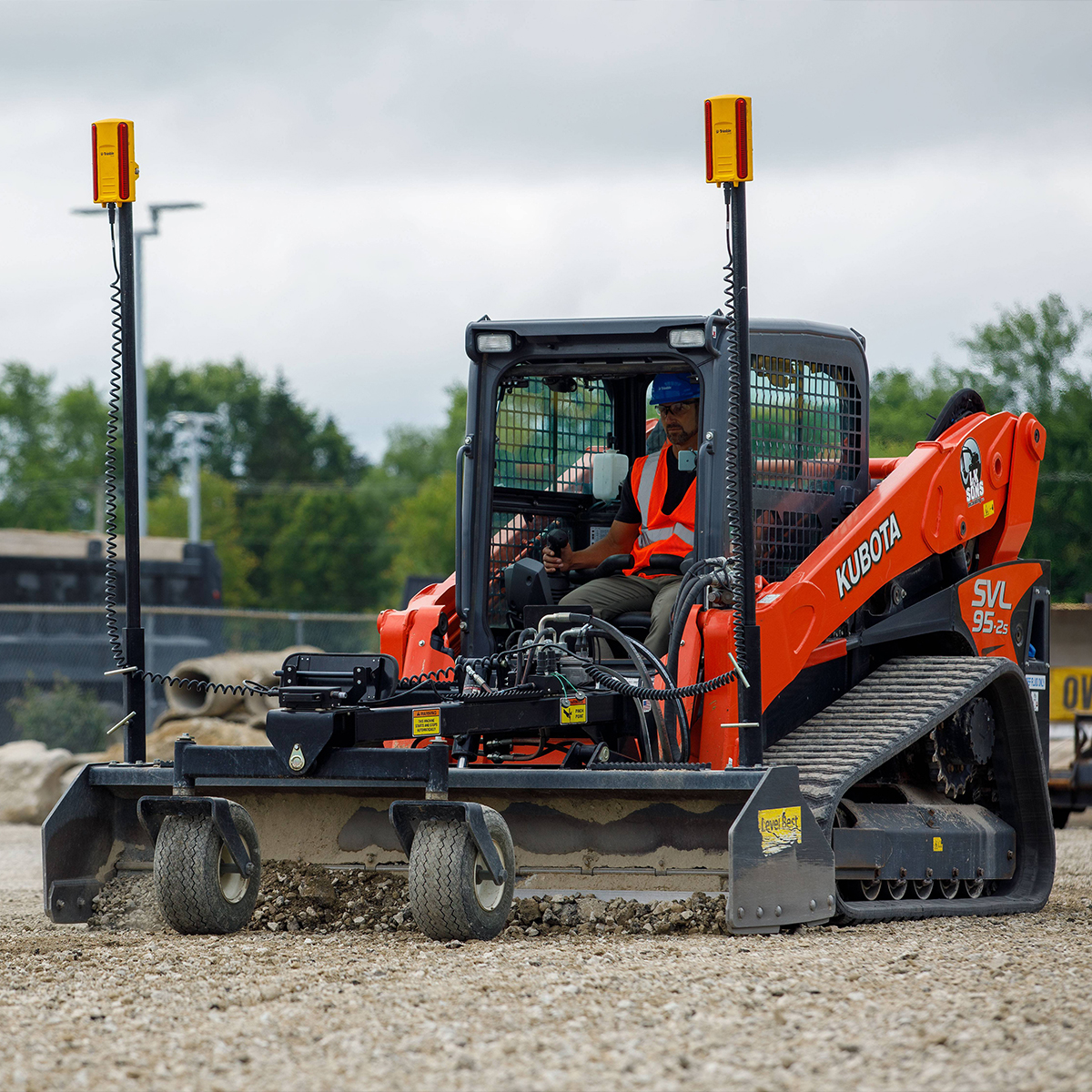

Trimble 163170-500 Earthworks GO! 2.0
Call for PriceONLY AVAILABLE FOR DELIVERY IN ALASKA.
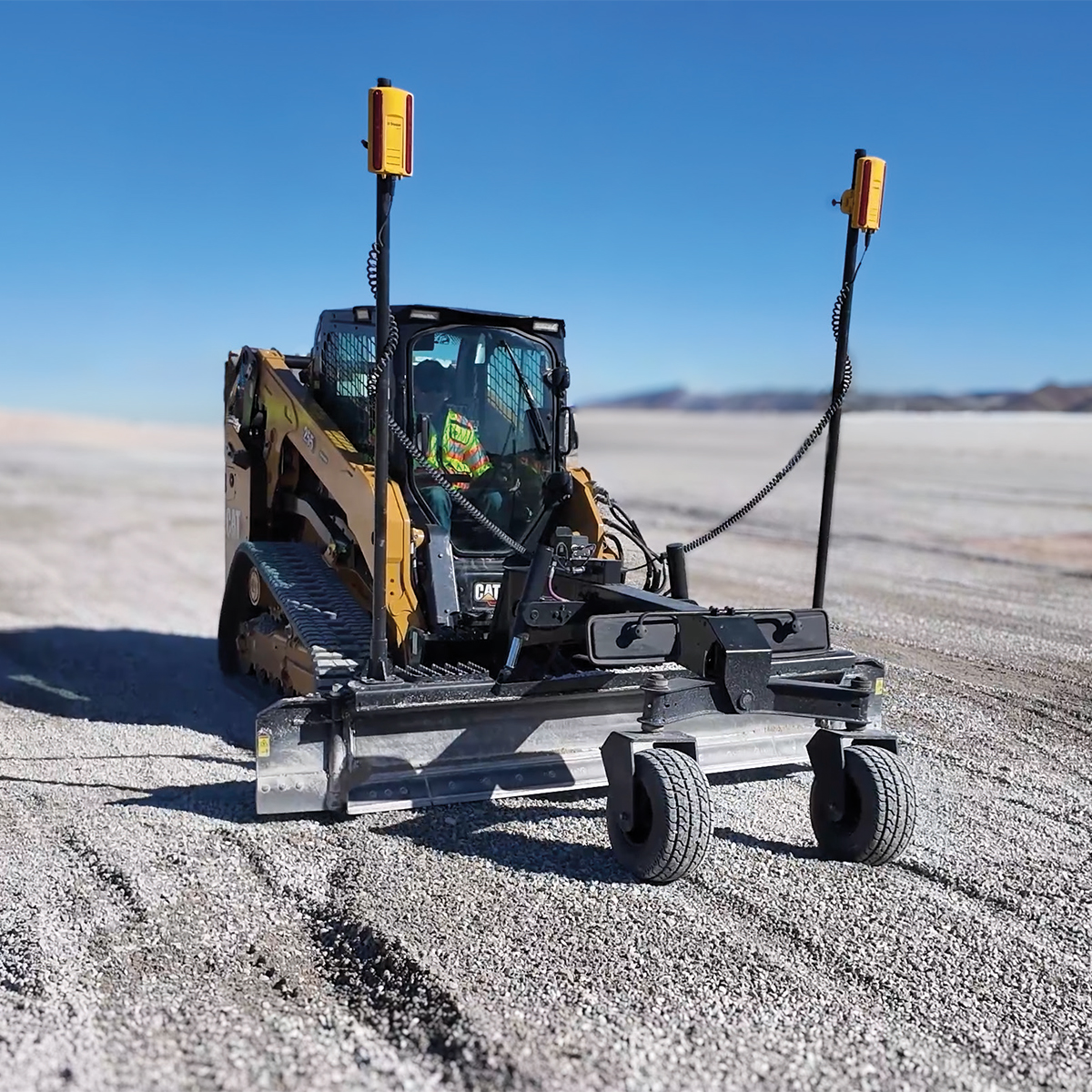
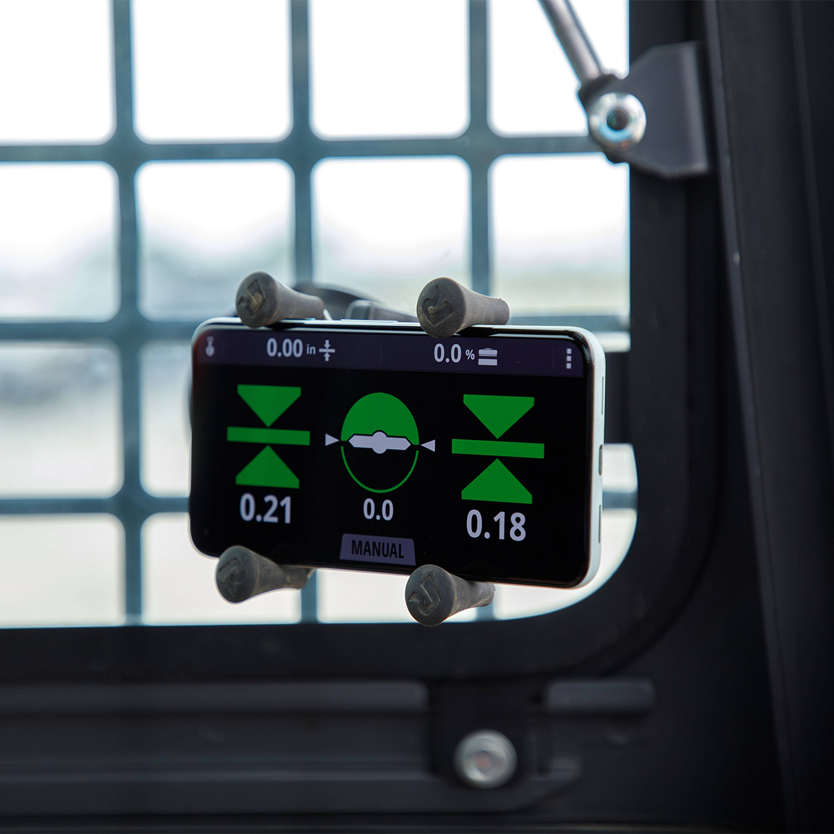
Trimble 163170-500 Earthworks GO! 2.0
2D Grade Control System for Compact Grading Attachments
Trimble® Earthworks GO! 2.0 is the next generation of compact machine control, designed to enable system expandability and upgrades so your investment remains valuable and updated over time. Trimble Earthworks GO! 2.0 provides high-accuracy grading capability while reducing capital expense. This user installable, low-cost solution is the ideal first step into machine control for small contractors and owner operators. Compact, easy-to-use and highly portable, the system can quickly be moved from attachment-to-attachment for increased utilization and fast return on investment.
Quick View -
Trimble 222540-00 TD540 Display
Call for Price
Trimble 222540-00 TD540 Display
Call for PriceONLY AVAILABLE FOR DELIVERY IN ALASKA.
Trimble 222540-00 TD540 Display
The 10-inch (25.4 cm) TD540 display ensures the best user experience with the Trimble® Earthworks grade control platform. With a specialized combination of anti-glare, powerful backlighting and advanced optical bonding techniques, these rugged displays combine at-a-glance sunlight readability with an easy to use, multi-touch interface. Built on top of a powerful 3D graphics engine and processing platform, the Android™ operating system allows you to install additional applications without upgrading hardware or adding an additional display.
Quick View -
Trimble 400956-10 MS956 GNSS Modular Receiver
Call for Price
Trimble 400956-10 MS956 GNSS Modular Receiver
Call for PriceONLY AVAILABLE FOR DELIVERY IN ALASKA.
Trimble 400956-10 MS956 GNSS Modular Receiver
The MS956 is a positioning receiver intended for use with a rugged Trimble Zephyr 3 Antenna. The compact form factor easily fits in the headliner or within cab compartments of heavy equipment. The MS956 is specially designed and tuned to operate through the shock and vibration forces experienced on heavy equipment.
Quick View -
Trimble 400976-05 MS976 GNSS Smart Antenna
Call for Price
Trimble 400976-05 MS976 GNSS Smart Antenna
Call for PriceONLY AVAILABLE FOR DELIVERY IN ALASKA.
Trimble 400976-05 MS976 GNSS Smart Antenna
The MS976 offers a cost-effective alternative for contractors who need a highly accurate GNSS receiver at a lower price point. It is optimized for cab or machine body mount only.
Quick View -

Trimble 400996-00 MS996 GNSS Smart Antenna
Call for Price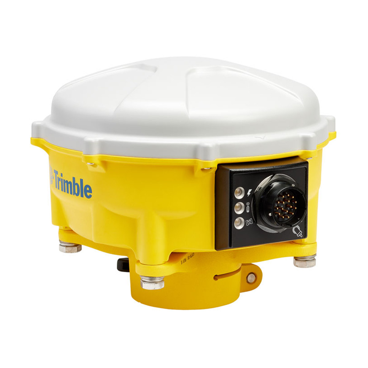
Trimble 400996-00 MS996 GNSS Smart Antenna
Call for PriceONLY AVAILABLE FOR DELIVERY IN ALASKA.
Trimble 400996-00 MS996 GNSS Smart Antenna
The MS996 contains an integrated GNSS receiver, antenna, and isolation system all in a single, durable housing. It uses the advanced Trimble RTK engine for faster initialization times when satellite lock is lost and enhanced performance near obstructions.
Quick View -

Trimble 59701-62 MT900 Machine Target
Call for Price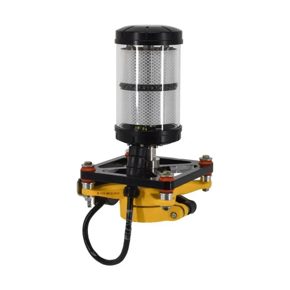
Trimble 59701-62 MT900 Machine Target
Call for PriceONLY AVAILABLE FOR DELIVERY IN ALASKA.
Trimble 59701-62 MT900 Machine Target
The Trimble® MT900 Machine Target offers superior tracking and millimeter grade control accuracy on motor graders and dozers. A rugged 360-degree active target, it was designed specifically for fine grading application with Trimble GCS900 Grade Control Systems and the Trimble SPS730 and SPS930 Universal Total Stations.
Quick View -
Trimble 63610-00 Trimble Business Center Advanced – Dongle License
Call for Price

Trimble 63610-00 Trimble Business Center Advanced – Dongle License
Call for PriceONLY AVAILABLE FOR DELIVERY IN ND, SD, MN, CO, AK, MT, ID, HI, WY, OR, & WA.Trimble Business Center Advanced – Dongle LicenseQuick View -

Trimble 66491-05 LR410 Laser Receiver
Call for Price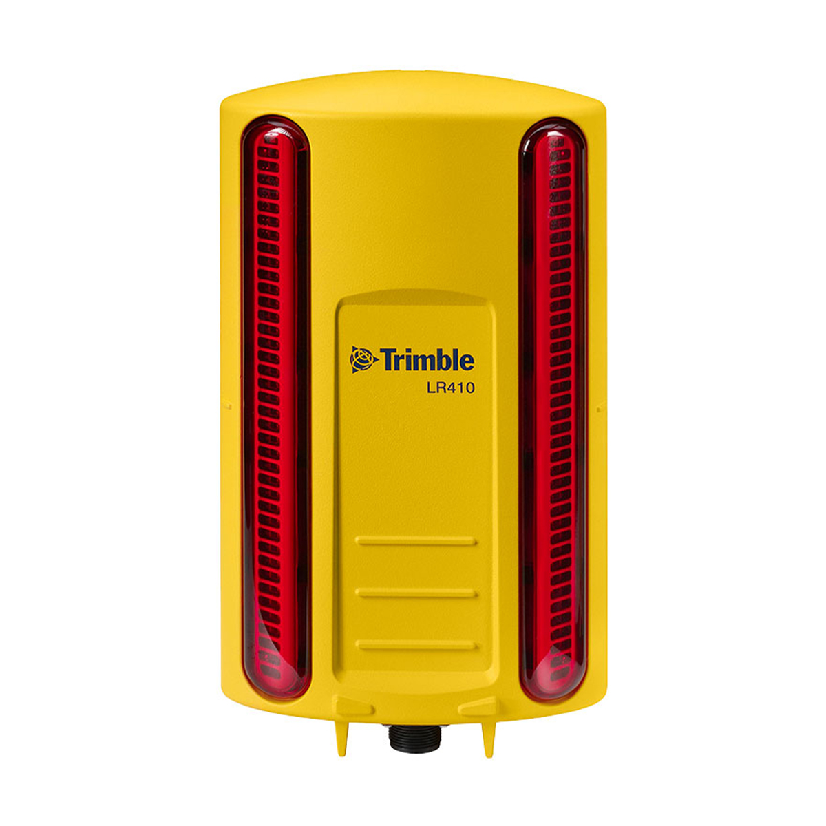
Trimble 66491-05 LR410 Laser Receiver
Call for PriceONLY AVAILABLE FOR DELIVERY IN ALASKA.
Trimble 66491-05 LR410 Laser Receiver
The LR410 is mounted to an electric mast on the blade and connected to the machine hydraulics to control lift to an accuracy of 3-6 millimeters (0.01 to 0.02 feet).
Quick View -

Trimble Business Center Field Data – Dongle License
Call for Price
Trimble Business Center Field Data – Dongle License
Call for PriceONLY AVAILABLE FOR DELIVERY IN ND, SD, MN, CO, AK, MT, ID, HI, WY, OR, & WA.Quick View -

Trimble Catalyst DA2 109695-00 Receiver
Call for Price


Trimble Catalyst DA2 109695-00 Receiver
Call for PriceONLY AVAILABLE FOR DELIVERY IN ND, SD, MN, CO, AK, MT, ID, HI, WY, OR, & WA.Trimble Catalyst DA2 109695-00 ReceiverSimply precise.
Powered by the Trimble® Catalyst™ GNSS positioning service, the DA2 receiver, combined with a Catalyst service subscription, delivers centimeter to sub-meter accuracy to location-enabled Android and iOS field apps and workflows.Quick View -
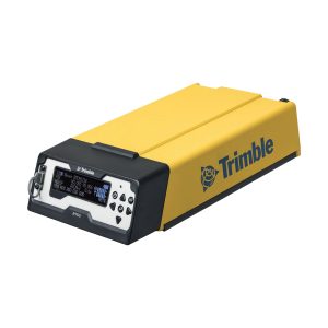
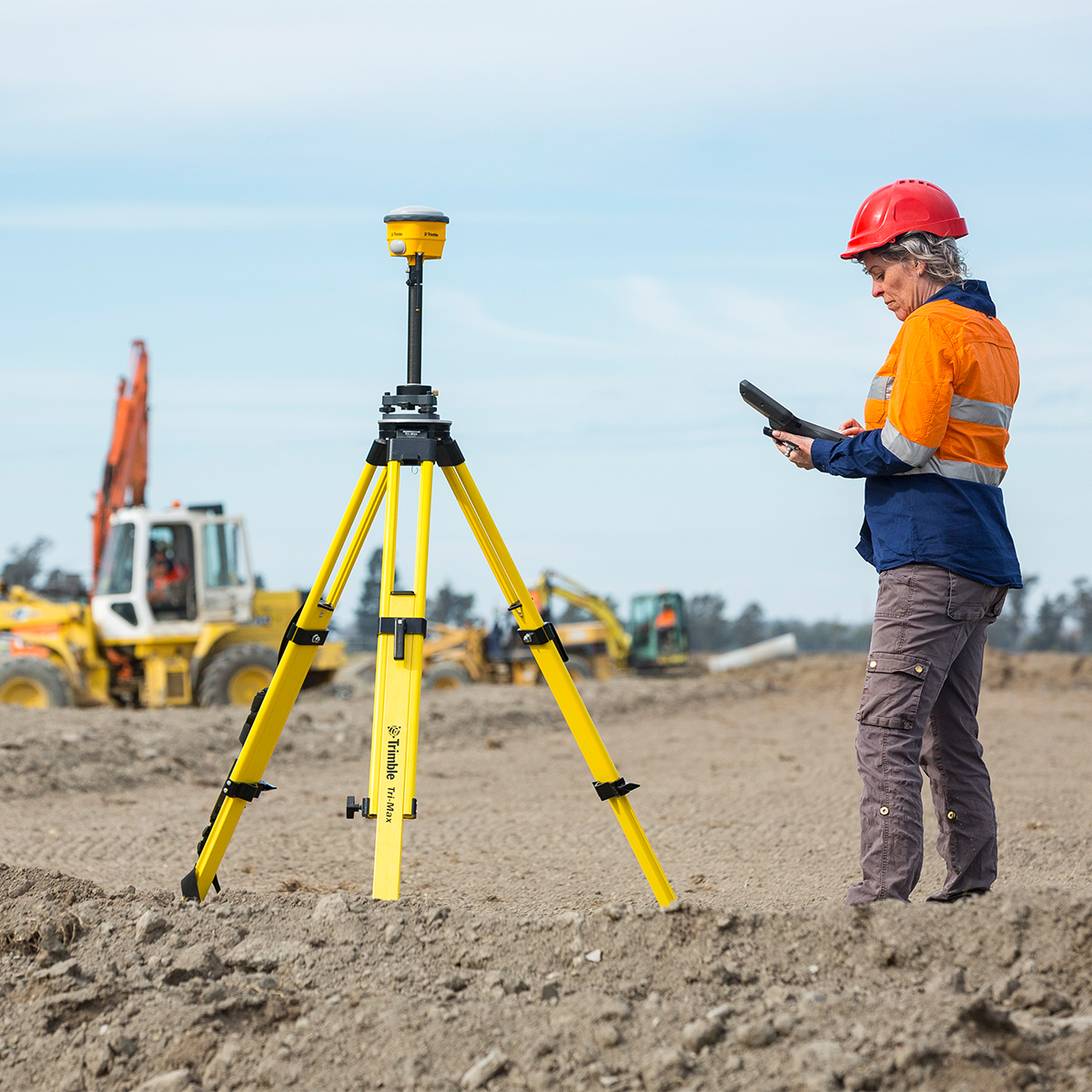
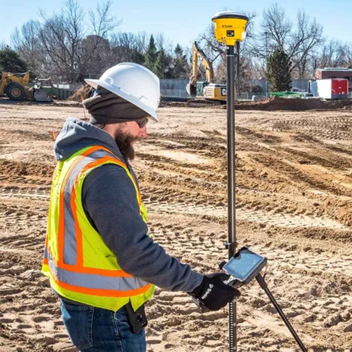
Trimble CON-R750-2-50 R750 Model 2 Modular GNSS Receiver
Call for Price
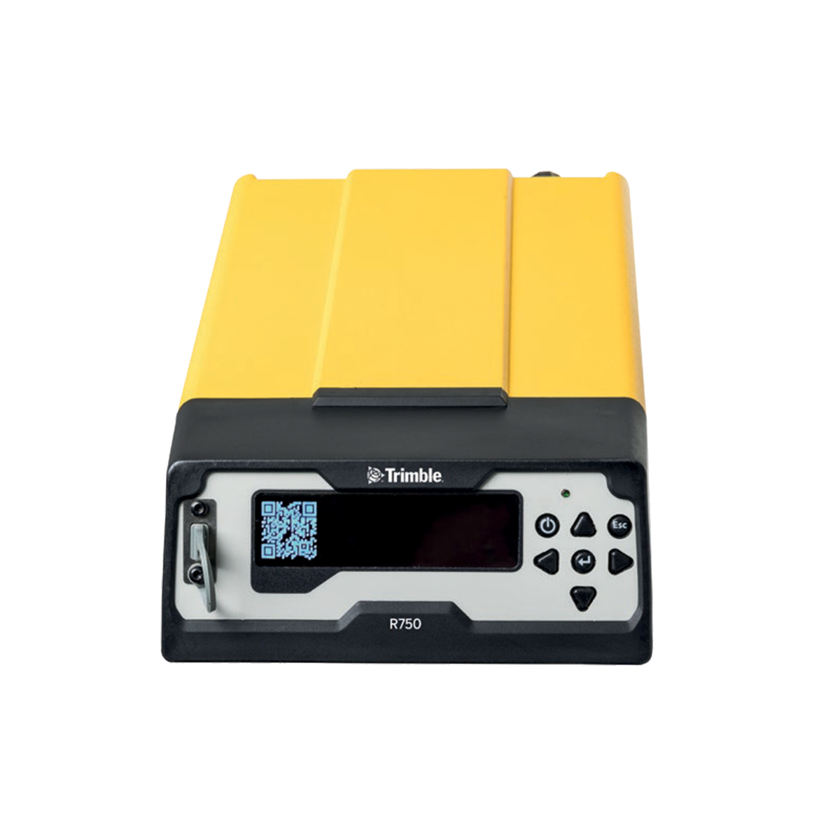
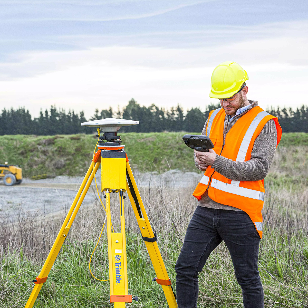
Trimble CON-R750-2-50 R750 Model 2 Modular GNSS Receiver
Call for PriceONLY AVAILABLE FOR DELIVERY IN ALASKA.
Trimble CON-R750-2-50 R750 Model 2 Modular GNSS Receiver
Connected Receiver for Precise Jobsite Measurement
Whether you need a reliable GNSS base station or a rugged rover, the Trimble® R750 Model 2 modular GNSS receiver gives you the connectivity and flexibility to meet the exact needs of your GNSS-based workflow. As a permanent or semi-permanent base station, it provides GNSS corrections for site measurements and machine control. As a vehicle-mounted rover it can be used for fast, effective grade checking and surface mapping.Quick View -

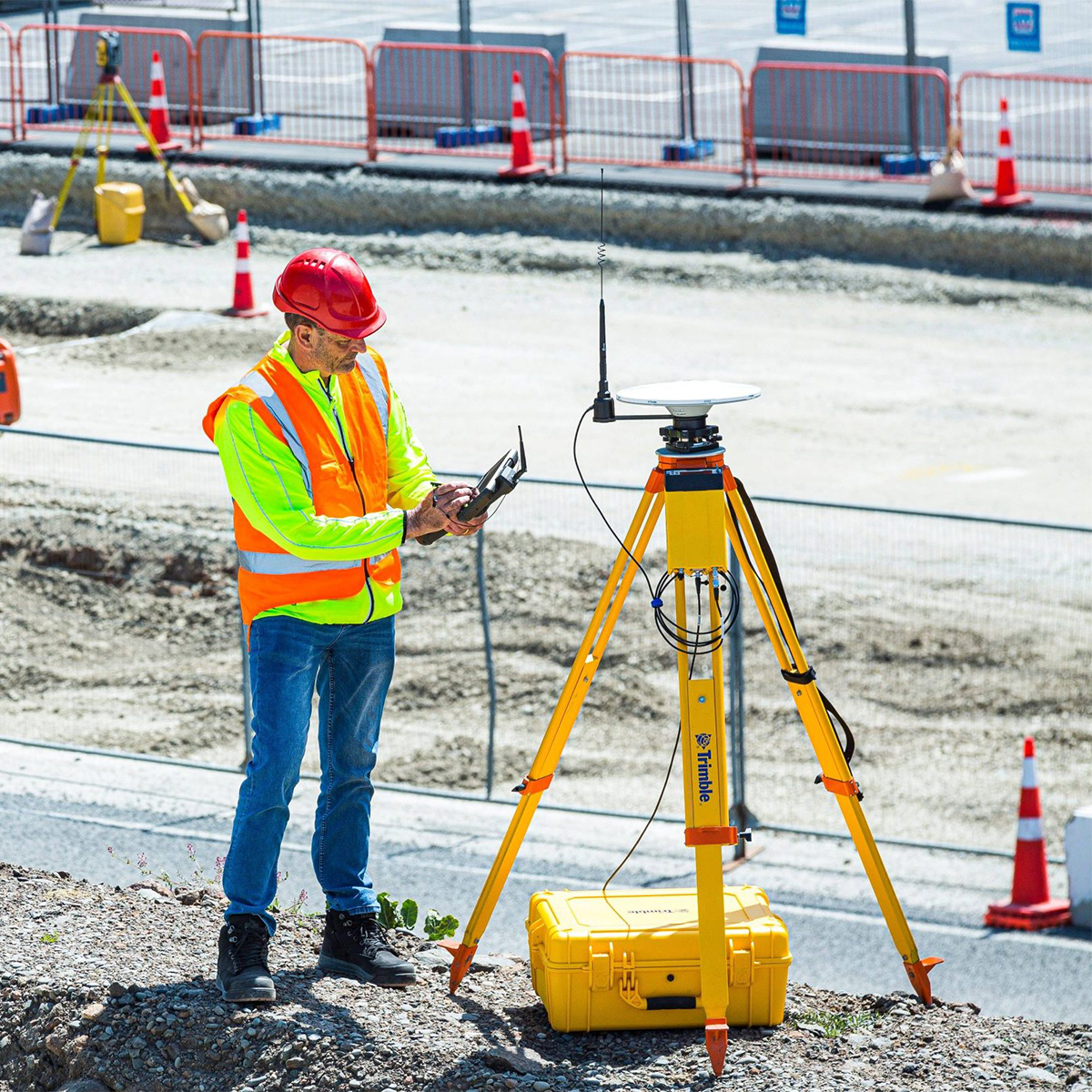
Trimble CON-R780-02-50 R780 GNSS Smart Antenna
Call for Price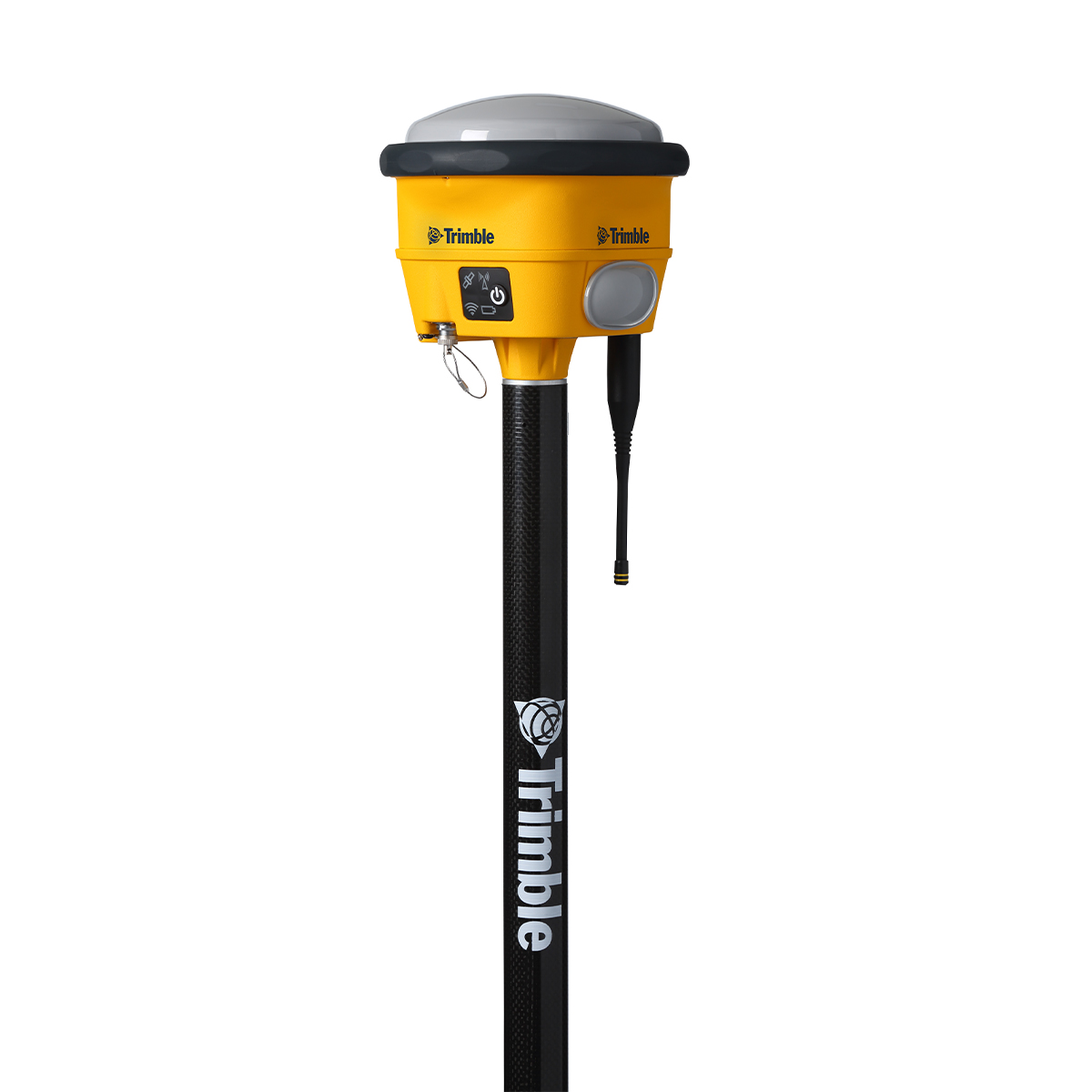
Trimble CON-R780-02-50 R780 GNSS Smart Antenna
Call for PriceONLY AVAILABLE FOR DELIVERY IN ALASKA.
Trimble CON-R780-02-50 R780 GNSS Smart Antenna
Rugged, Reliable Positioning
The ultra-rugged Trimble® R780 GNSS Smart Antenna offers unmatched reliability for construction site positioning. Ideal for use on small and large job sites, the R780 can serve as a GNSS rover or as a base station for other GNSS operations, including machine control.Quick View -
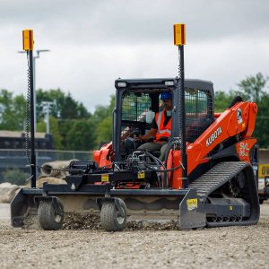
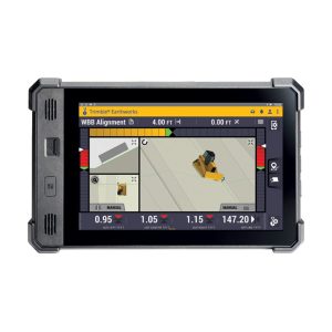
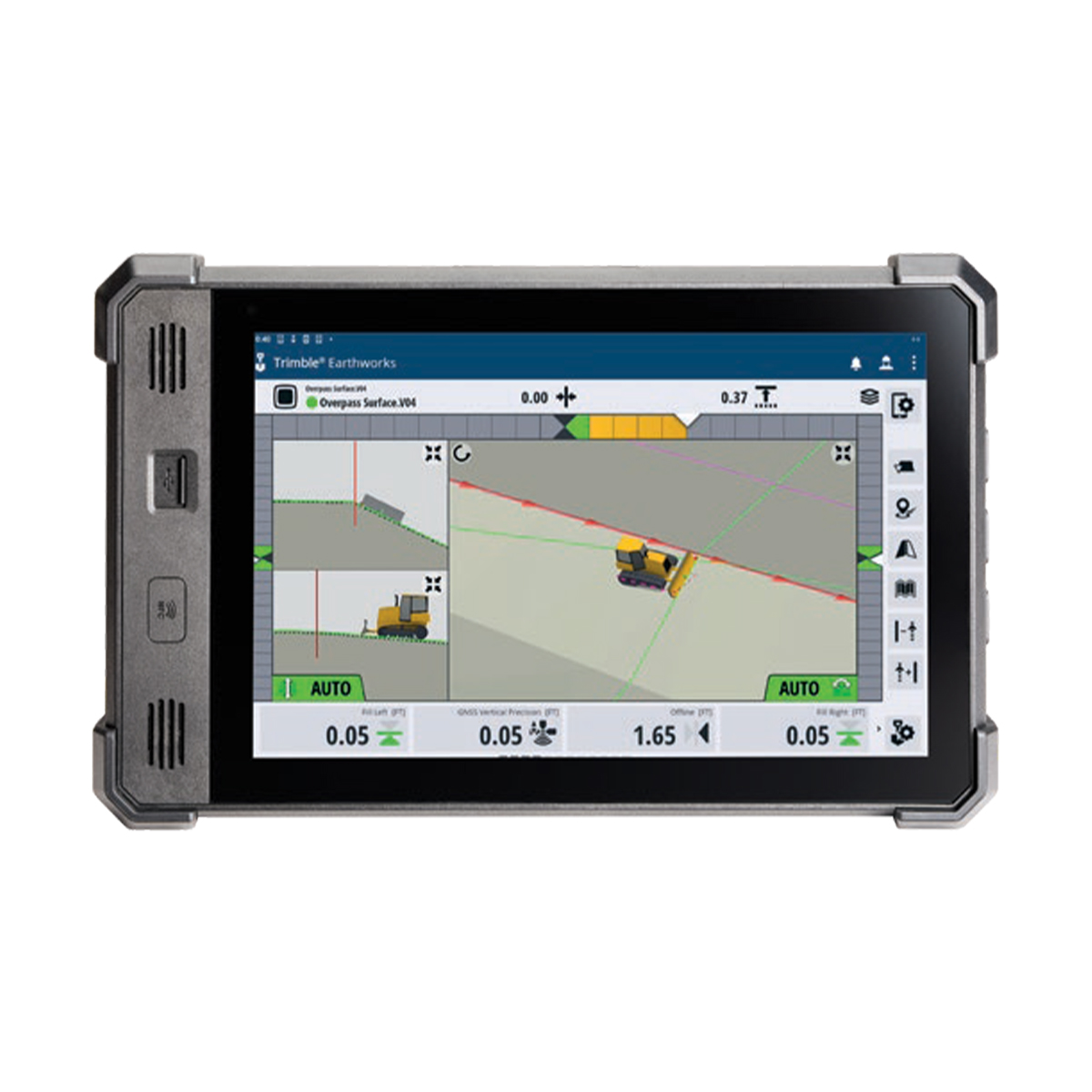
Trimble Earthworks
Call for Price


Trimble Earthworks
Call for PriceONLY AVAILABLE FOR DELIVERY IN ALASKA.
Trimble Earthworks
Trimble Earthworks is an advanced grade control platform designed to help you work smarter, faster, and more efficiently. Built on an intuitive Android-based interface, it’s easy to use and compatible with a wide range of tablets, including the proprietary Trimble TD520 touchscreen display. Earthworks integrates seamlessly across mixed construction and landscaping fleets, with fully customizable views and interfaces that adapt to your workflow.
Quick View -
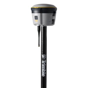
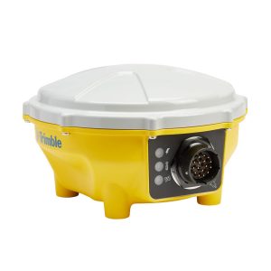
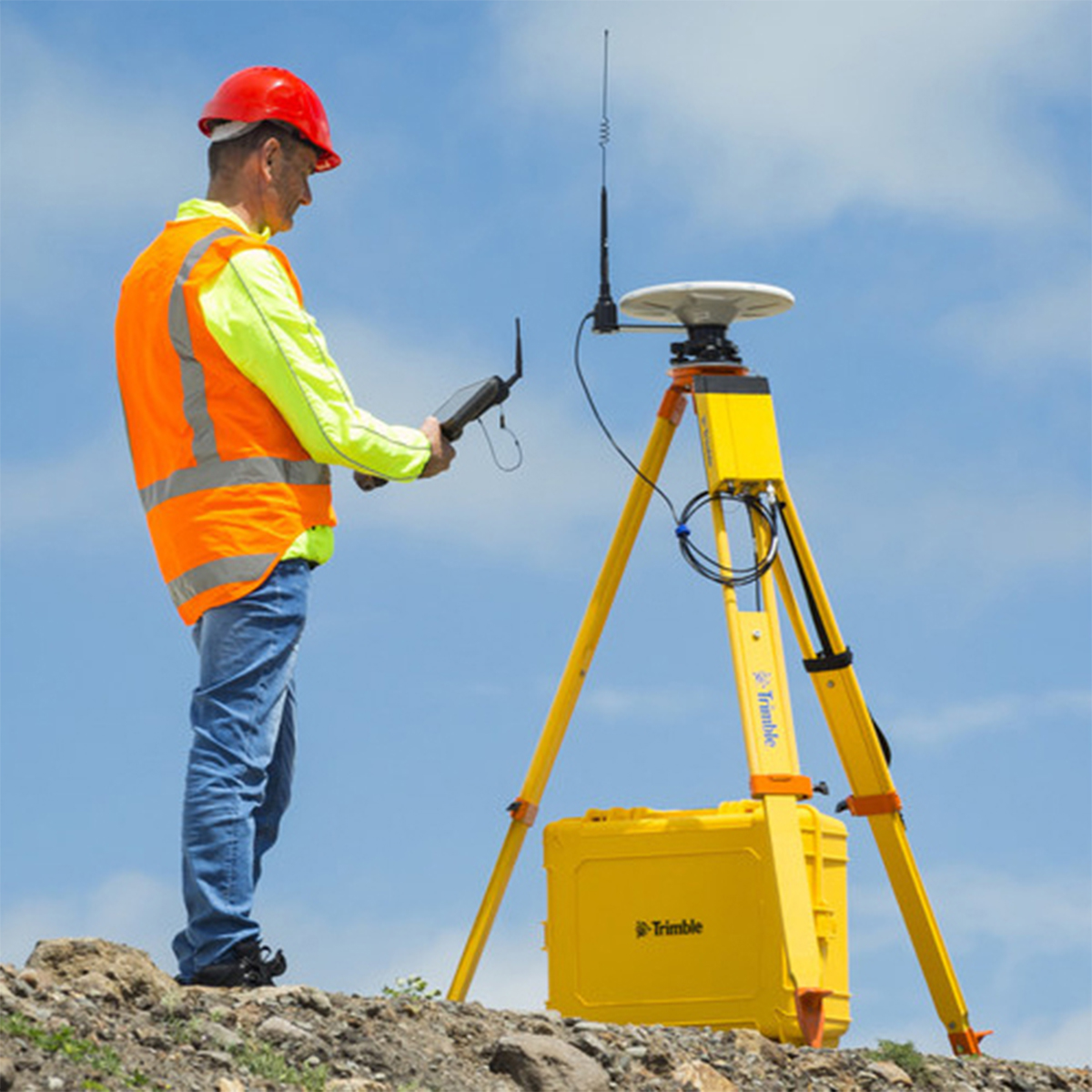
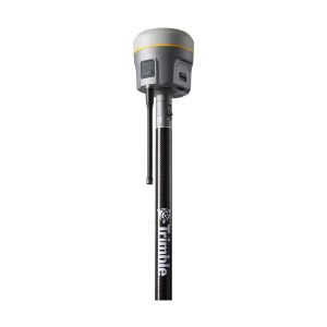
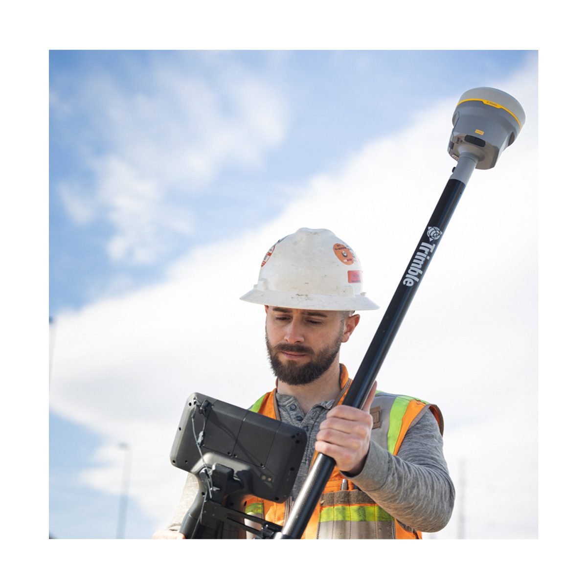
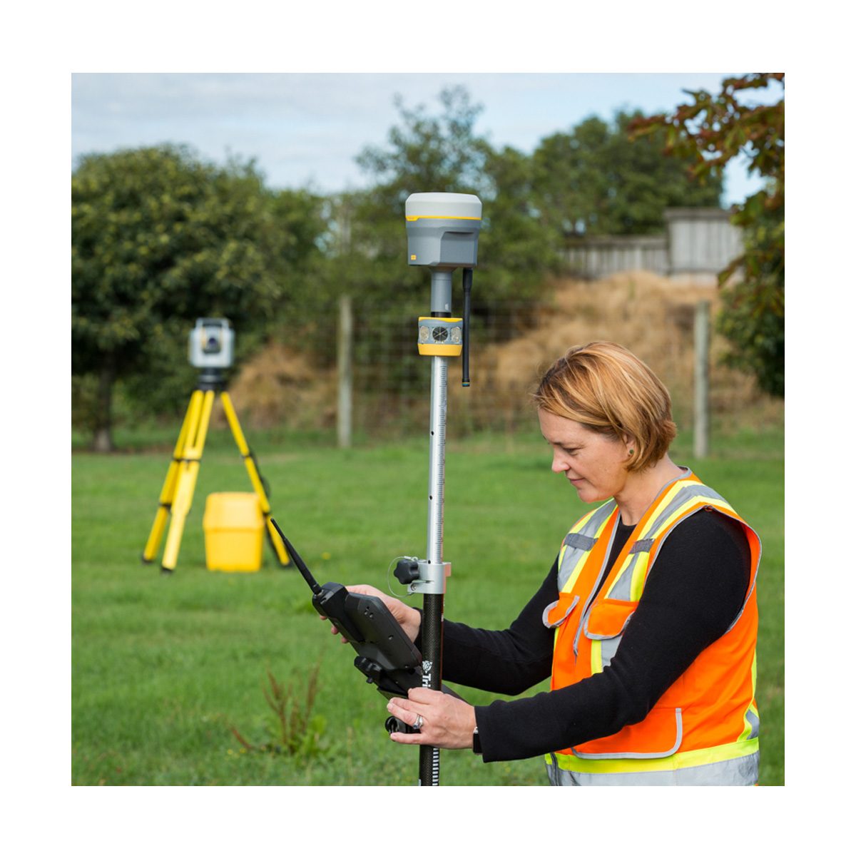
Trimble R580 GNSS System
Call for Price


Trimble R580 GNSS System
Call for PriceONLY AVAILABLE FOR DELIVERY IN ND, SD, MN, CO, AK, MT, ID, HI, WY, OR, & WA.
Call 1-800-359-3703 for pricing and quote on configuration.
Quick View -
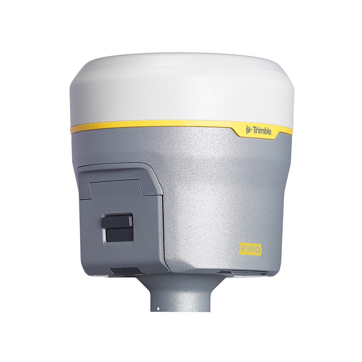
Trimble R980-101-50-01 R980, Model 50, ROW
Call for Price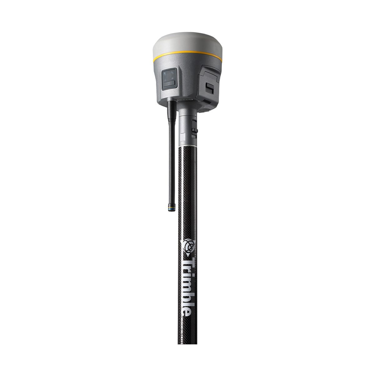
Trimble R980-101-50-01 R980, Model 50, ROW
Call for PriceONLY AVAILABLE FOR DELIVERY IN ND, SD, MN, CO, AK, MT, ID, HI, WY, OR, & WA.Trimble R980, Model 50, ROWQuick View -

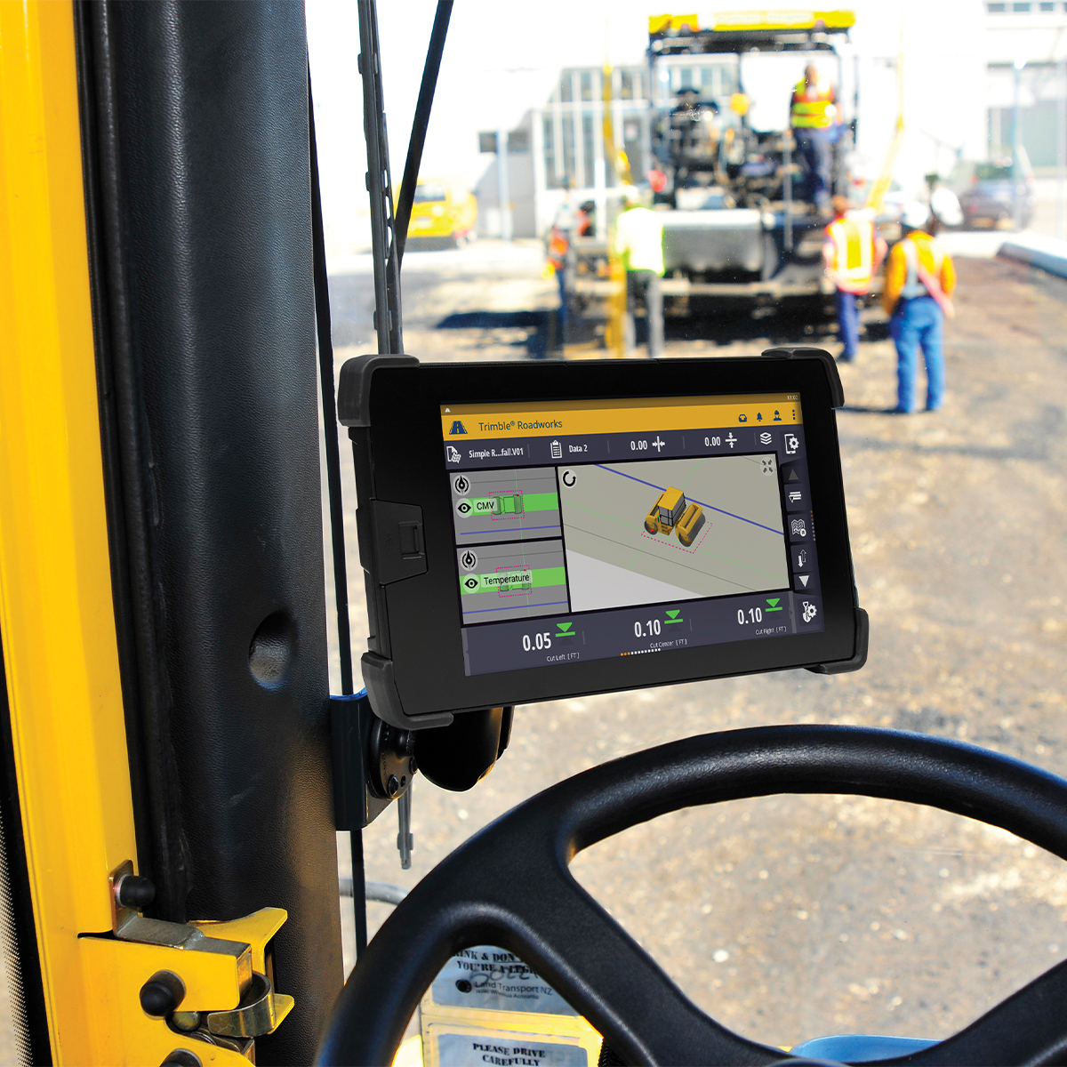
Trimble Roadworks Paving Control Platform for Asphalt Compactors
Call for Price


Trimble Roadworks Paving Control Platform for Asphalt Compactors
Call for PriceONLY AVAILABLE FOR DELIVERY IN ALASKA.
Trimble Roadworks Paving Control Platform for Asphalt Compactors
Trimble® Roadworks Paving Control Platform for Asphalt Compactors is the next generation 3D paving control system designed to help operators of all levels improve the speed, accuracy and ease of asphalt compaction.
Quick View -

Trimble Roadworks Paving Control Platform for Asphalt Pavers
Call for Price


Trimble Roadworks Paving Control Platform for Asphalt Pavers
Call for PriceONLY AVAILABLE FOR DELIVERY IN ALASKA.
Trimble Roadworks Paving Control Platform for Asphalt Pavers
The Trimble® Roadworks Paving Control Platform for Asphalt Pavers is designed to help you do more in less time. Our innovative, next-generation paving control platform features intuitive, easy-to-learn software that runs on an Android™ operating system. State-of-the-art software and hardware give operators of all skill levels the ability to work faster and more productively than ever before.
Quick View -

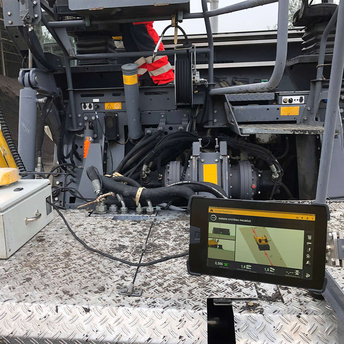
Trimble Roadworks Paving Control Platform for Mills and Cold Planers
Call for Price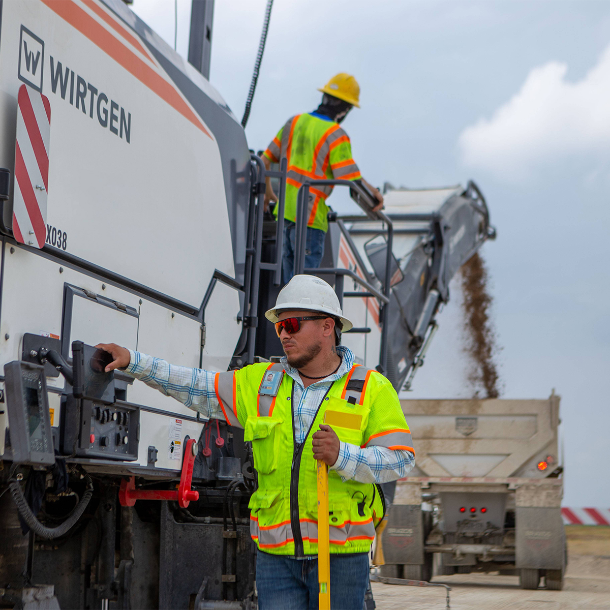

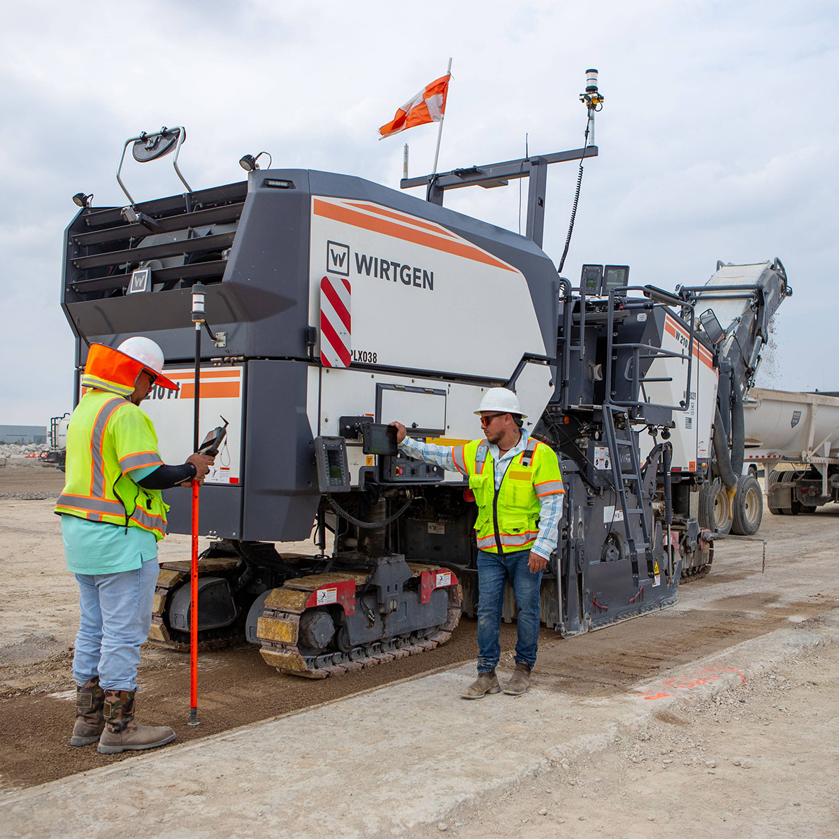
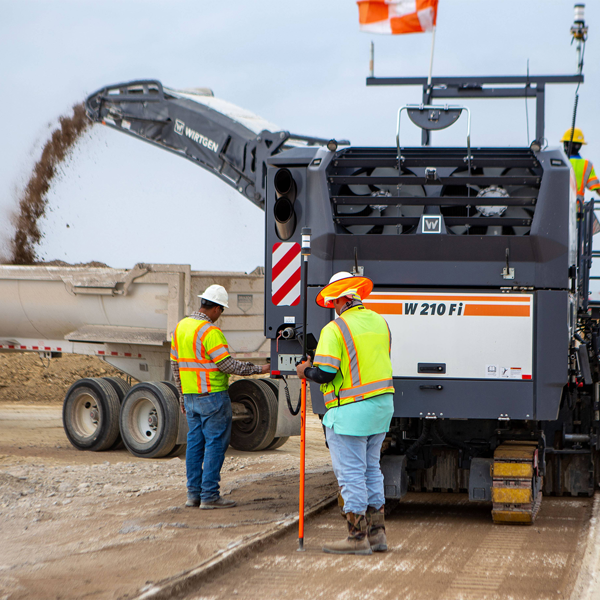
Trimble Roadworks Paving Control Platform for Mills and Cold Planers
Call for PriceONLY AVAILABLE FOR DELIVERY IN ALASKA.
Trimble Roadworks Paving Control Platform for Mills and Cold Planers
Trimble® Roadworks Paving Control Platform for Mills and Cold Planers is the next generation 3D paving control system designed to not only meet milling specifications, but exceed them.
Quick View -

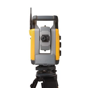
Trimble S9 0.5 sec. Robotic, DR HP, Trimble VISION, FineLock
Call for Price

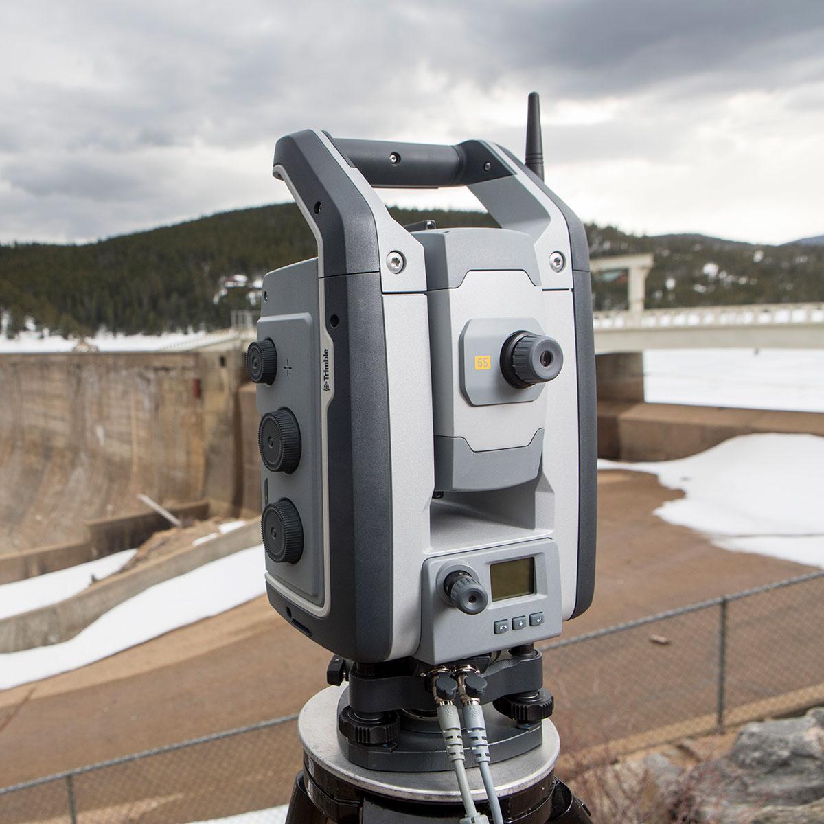
Trimble S9 0.5 sec. Robotic, DR HP, Trimble VISION, FineLock
Call for PriceONLY AVAILABLE FOR DELIVERY IN ND, SD, MN, CO, AK, MT, ID, HI, WY, OR, & WA.
Quick View -

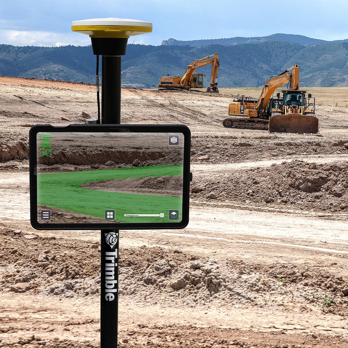
Trimble SiteVision Field Software
Call for Price
Trimble SiteVision Field Software
Call for PriceONLY AVAILABLE FOR DELIVERY IN ND, SD, MN, CO, AK, MT, ID, HI, WY, OR, & WA.
Trimble SiteVision Field Software | Augmented Reality System
Visualize Data in the Field
Trimble® SiteVision® Software brings spatial data to life in real-world environments so you can easily visualize, explore and understand complex designs — right on your own mobile device. With centimeter-level accuracy, this user-friendly tool provides reliable visuals that are stable and smooth. SiteVision plays a key role in all stages of the construction life cycle: planning and initial visualization, checking progress, and preventing issues to reduce cost and increase efficiency.Quick View -

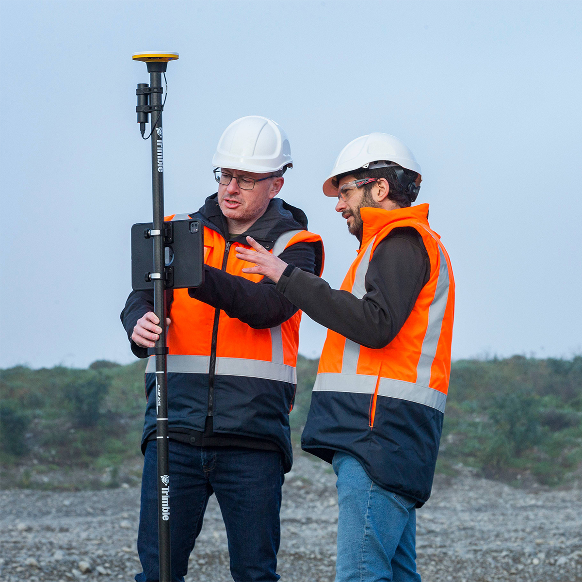
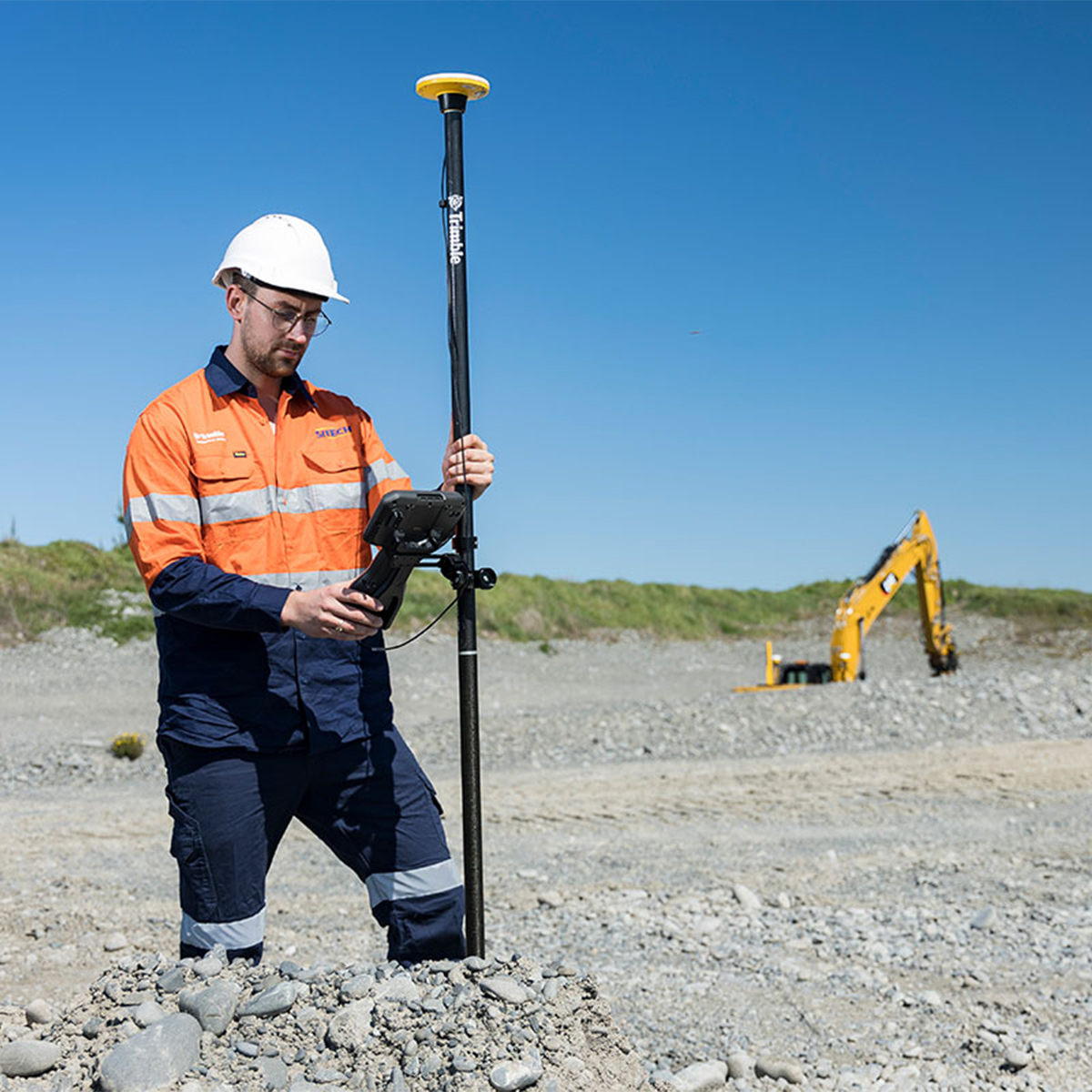
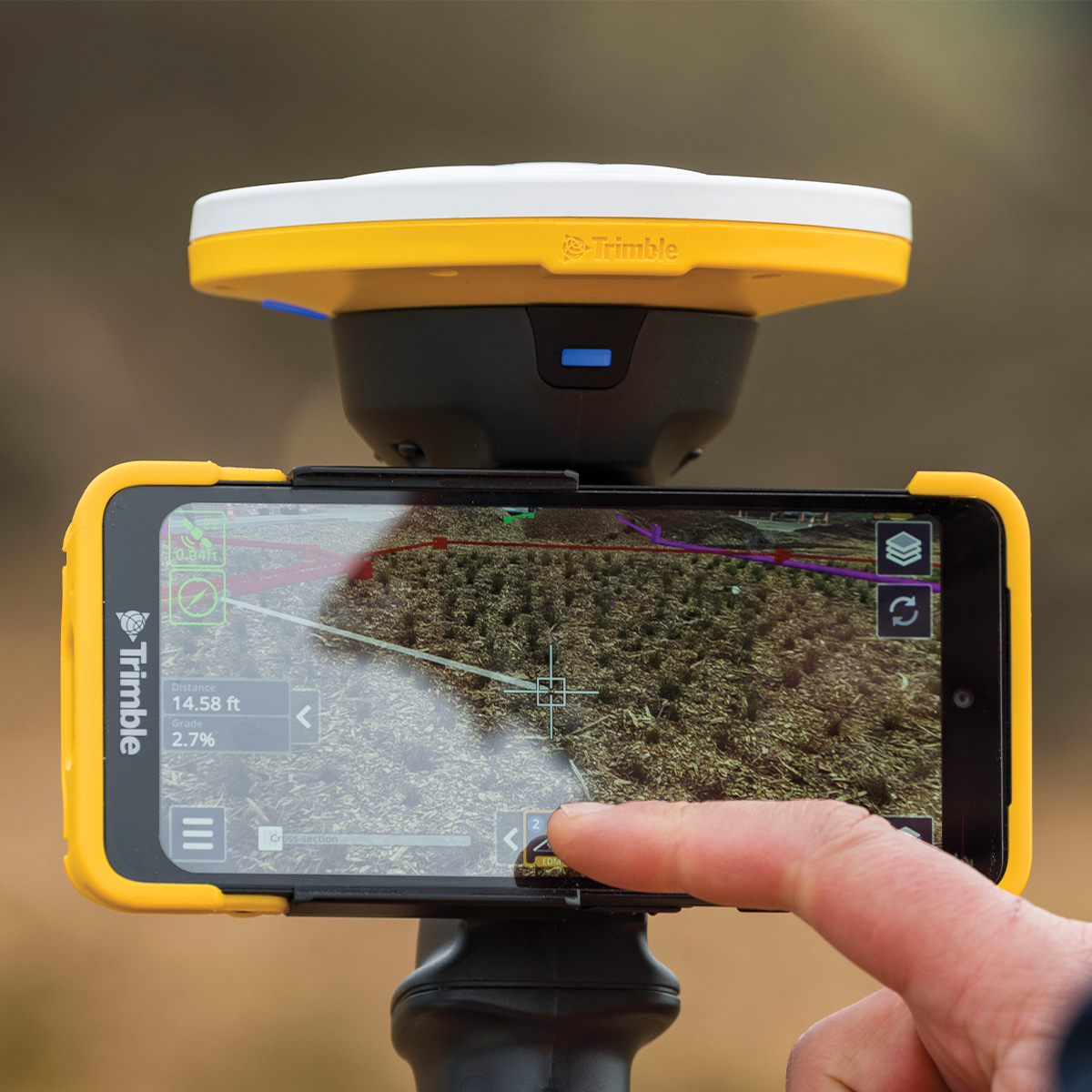
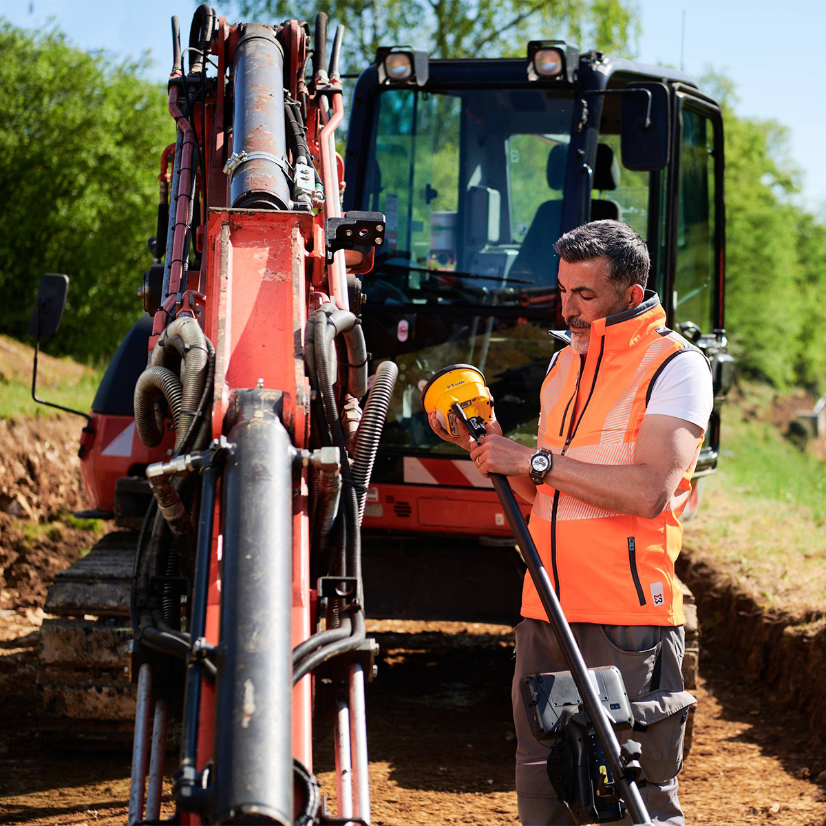
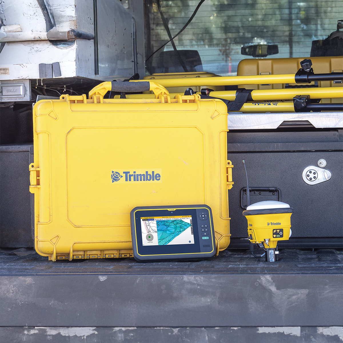
Trimble Siteworks
Call for Price


Trimble Siteworks
Call for PriceONLY AVAILABLE FOR DELIVERY IN ALASKA.
Trimble Siteworks
Siteworks Positioning Systems
Trimble Siteworks Positioning Systems are designed to eliminate downtime by making every minute more productive. Handle complex files and 3D data sets quickly, so you can spot issues and solve problems before they slow you down.Quick View -

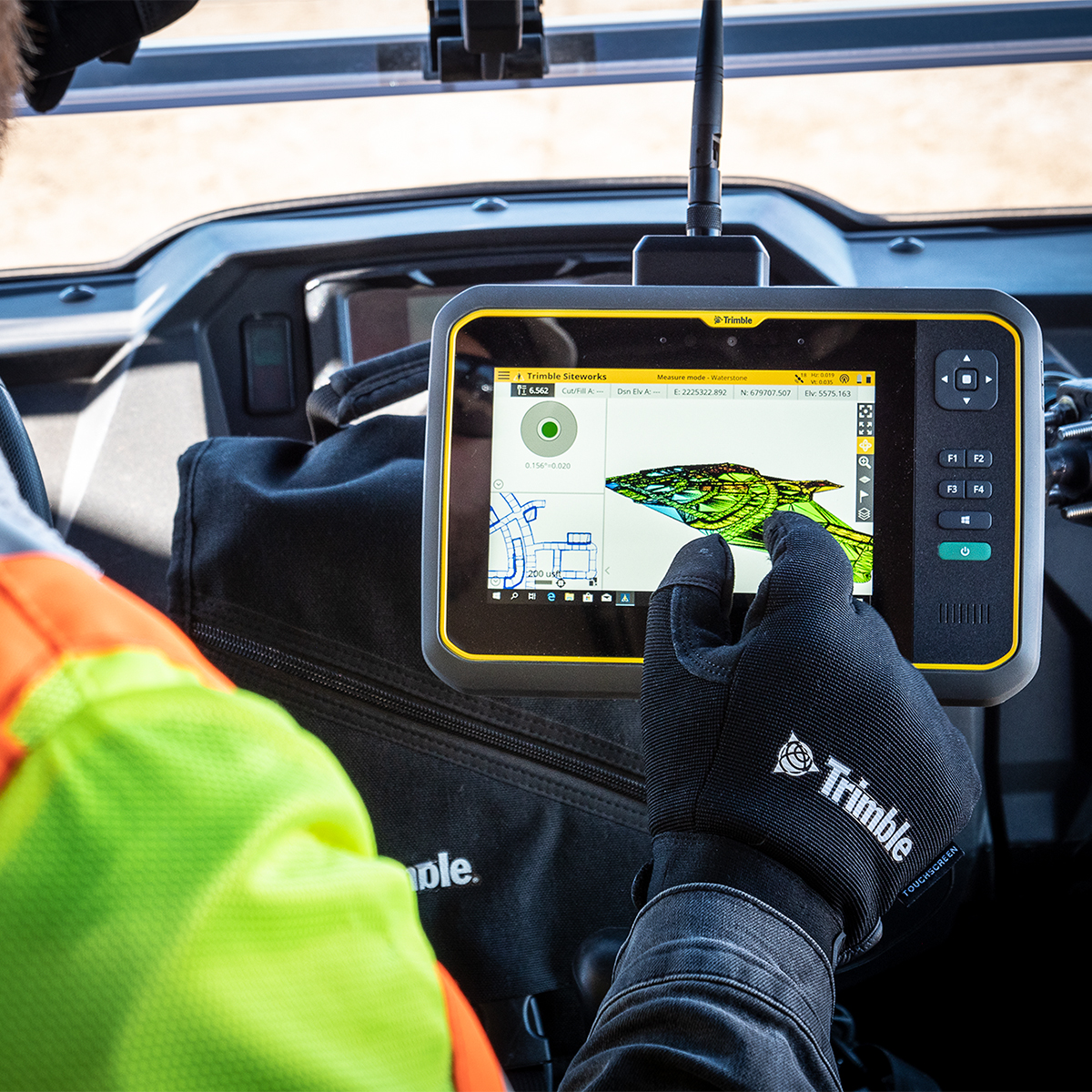
Trimble Siteworks Field Software
Call for Price


Trimble Siteworks Field Software
Call for PriceONLY AVAILABLE FOR DELIVERY IN ALASKA.
Trimble Siteworks Field Software
Software for Construction Surveying | More Productive and Precise Positioning
Trimble® Siteworks Software is easy‑to‑use field software that enables grade checkers, site engineers, site surveyors, supervisors and foremen to do their jobs more efficiently by taking the constructible model into the field. From initial site reconnaissance to finished as‑built collection, Siteworks offers an efficient way to collect and distribute site measurements, perform stake out tasks, manage multiple work orders and job sites, monitor progress, and report the results.
Quick View -

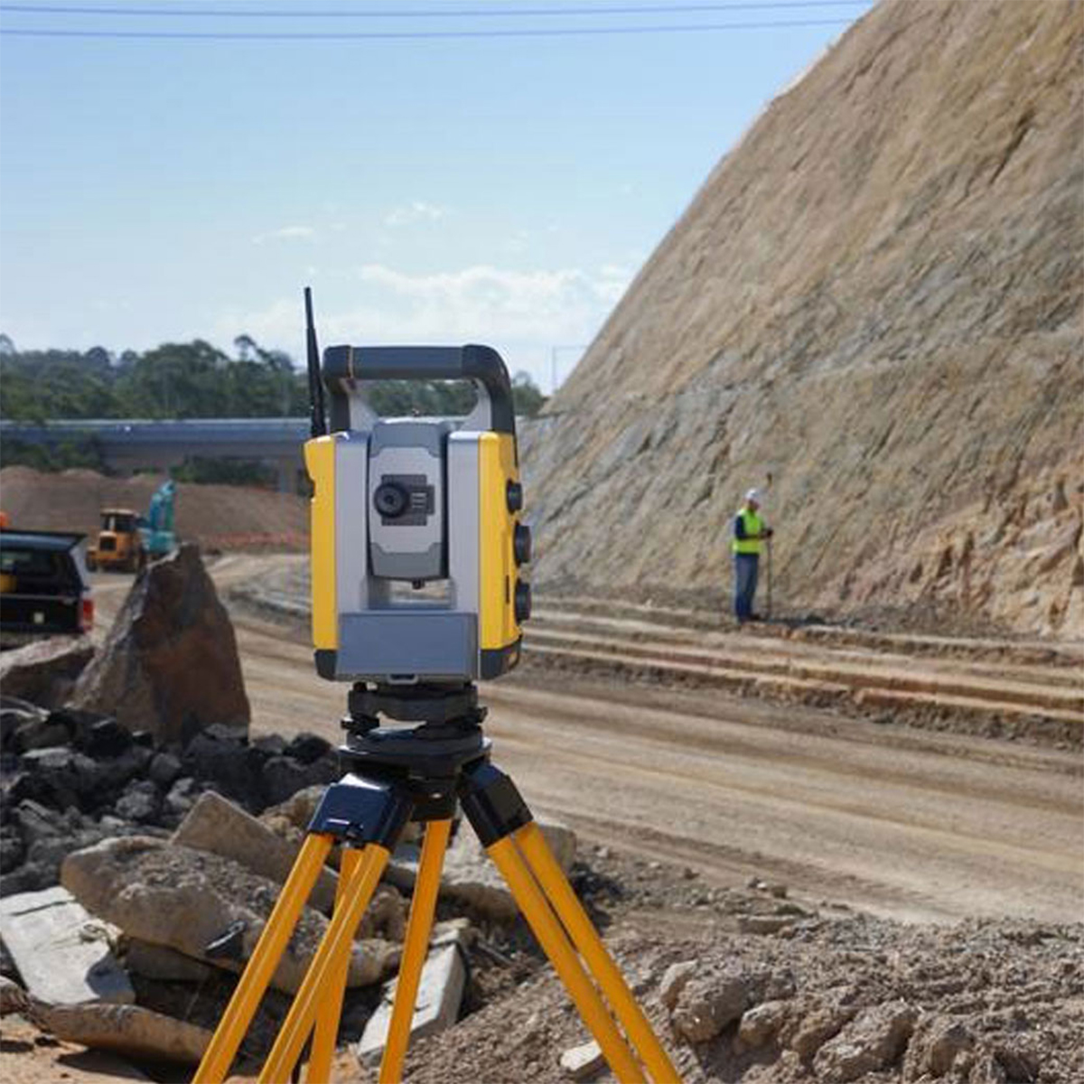
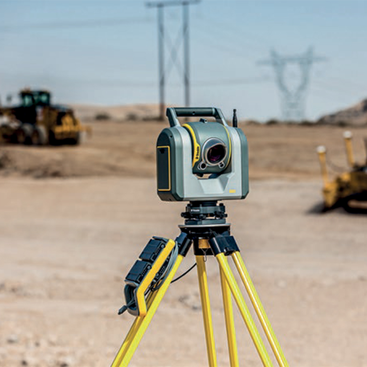
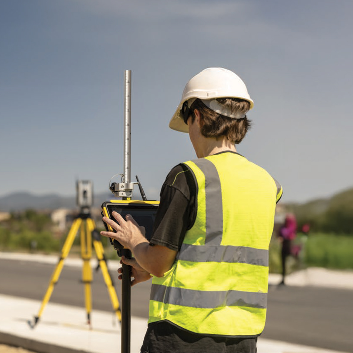
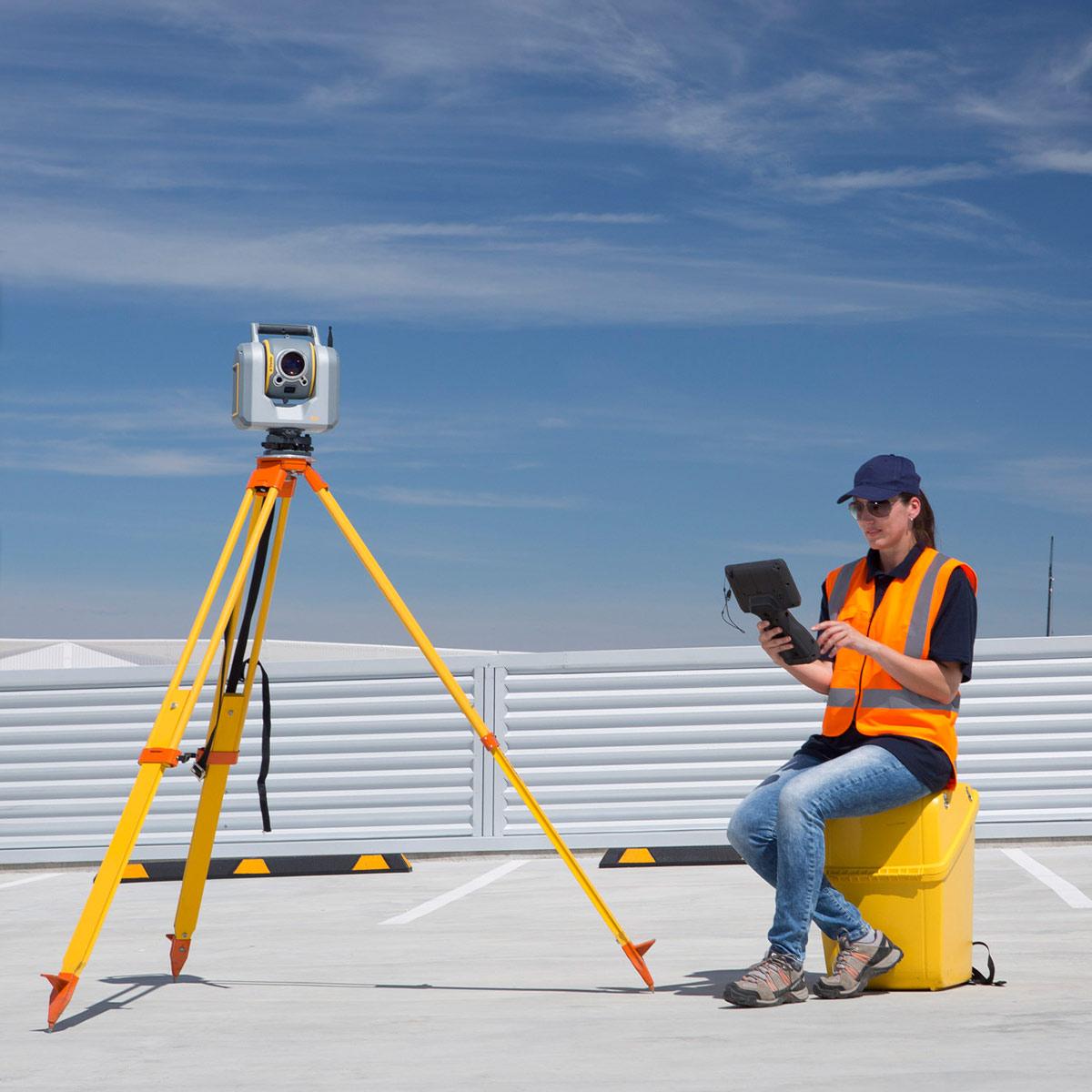
Trimble SPS720252210 Robotic Total Station
Call for Price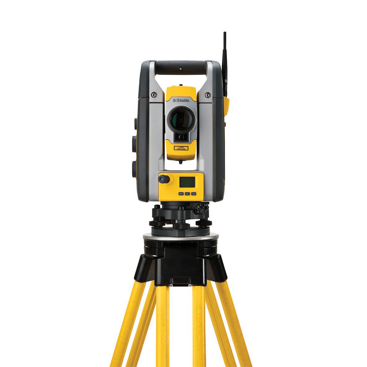
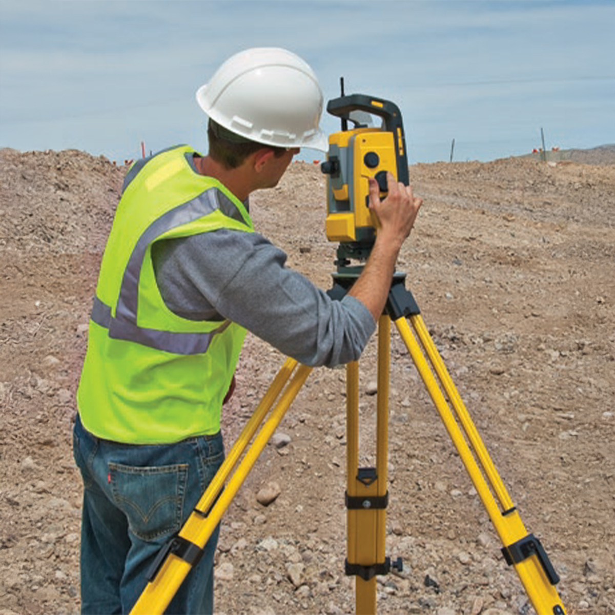
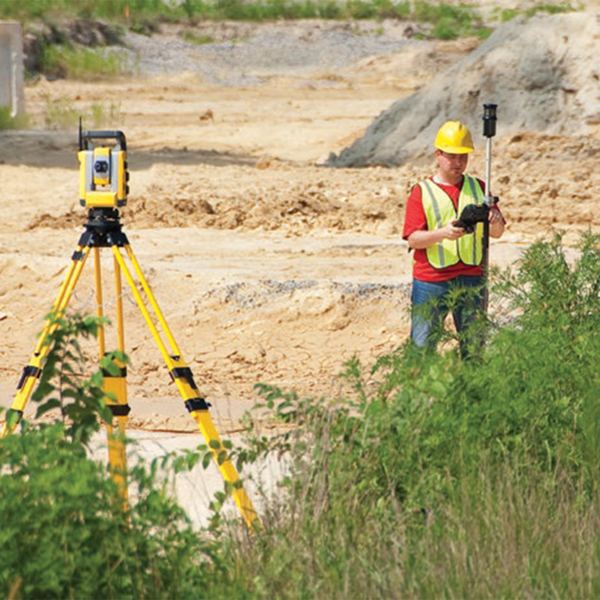
Trimble SPS720252210 Robotic Total Station
Call for PriceONLY AVAILABLE FOR DELIVERY IN ALASKA.
Trimble SPS720252210 Robotic Total Station
The all-in-one Robotic Total Station
Keep it accurate, but keep it simple. The Trimble® SPS720 Robotic Total Stations are perfect for one-person operation on smaller site operations and work on structures such as bridges or culverts, offering very high accuracy and reliability for construction site positioning, stakeout and measurement.Quick View -
Trimble SPS930152200 Universal Total Station
Call for Price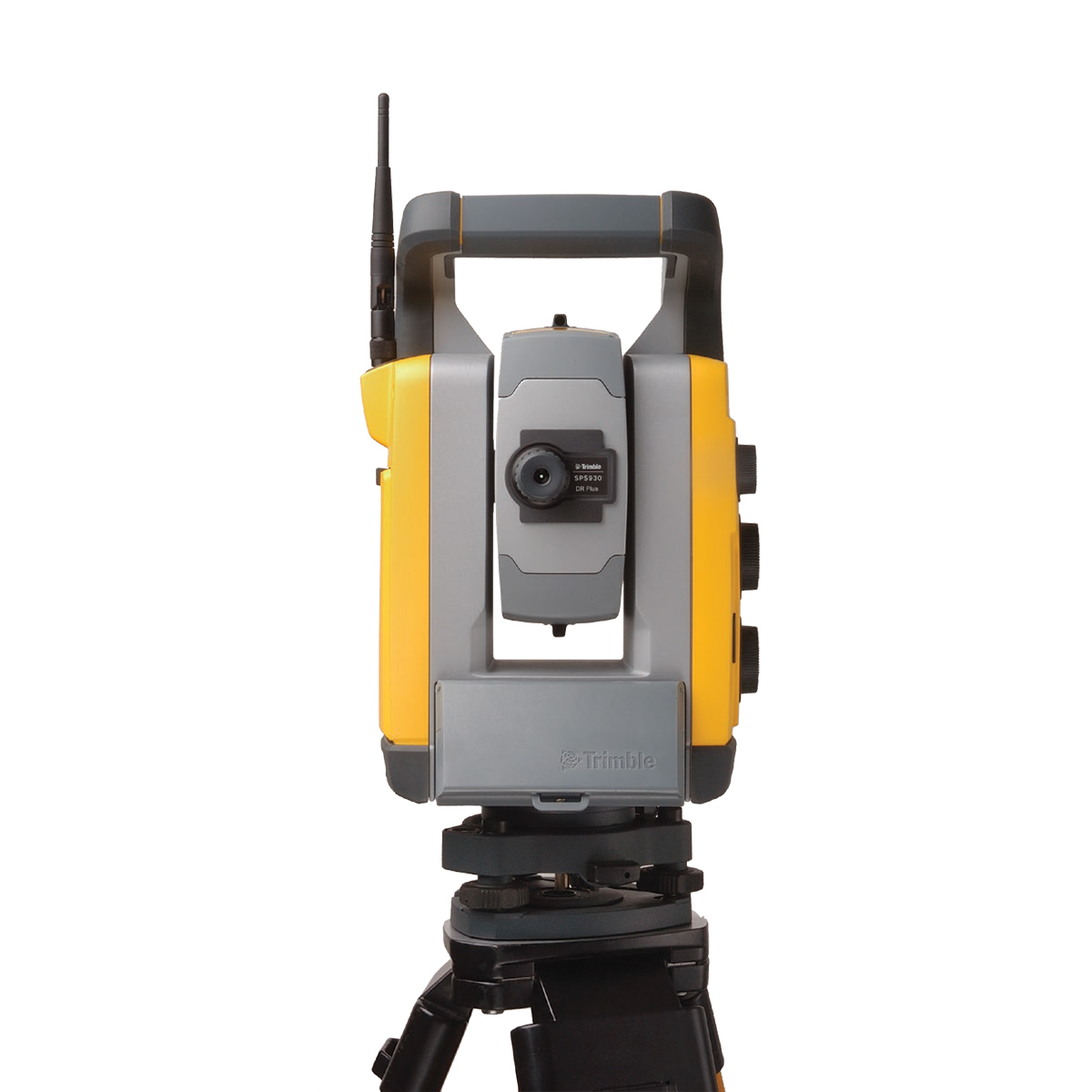
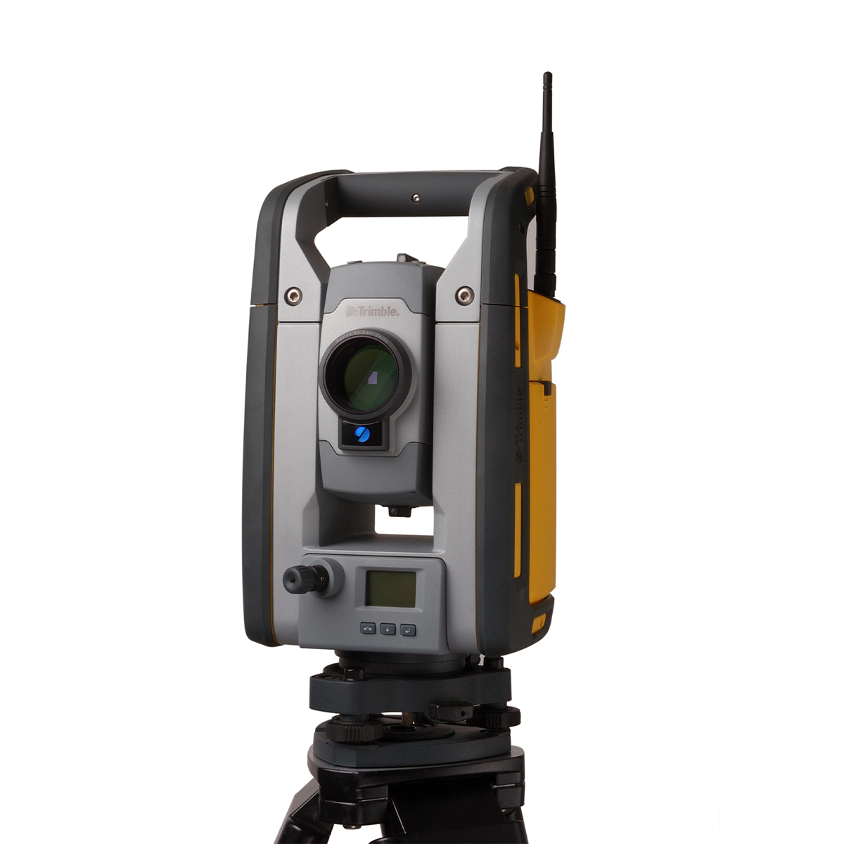
Trimble SPS930152200 Universal Total Station
Call for PriceONLY AVAILABLE FOR DELIVERY IN ALASKA.
Trimble SPS930152200 Universal Total Station
The all-in-one Universal Total Station
The Trimble® SPS930 Universal Total Stations can tackle any measurement, stakeout, or machine control task on the job site — all from the same instrument.Quick View -
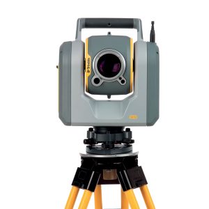
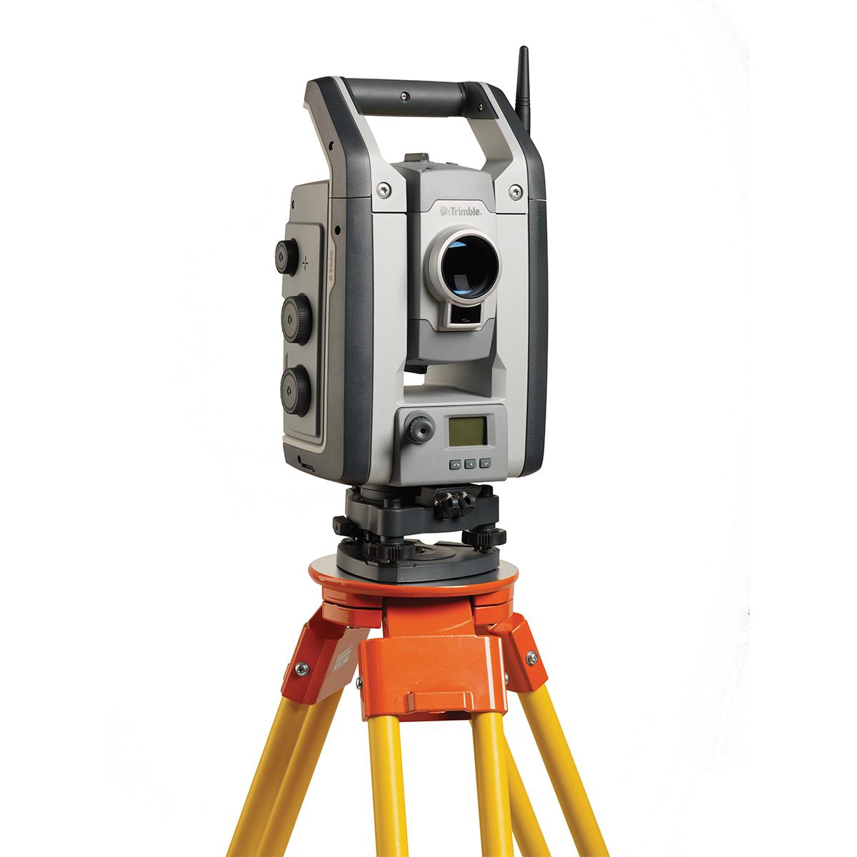
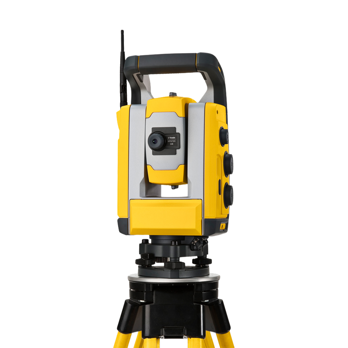
Trimble SX12-001-HH Scanning Total Station
Call for Price

Trimble SX12-001-HH Scanning Total Station
Call for PriceONLY AVAILABLE FOR DELIVERY IN ALASKA.
Trimble SX12-001-HH Scanning Total Station
The all-in-one Survey Total Station and Scanner
The Trimble® SX12 Scanning Total Station combines a Total Station and Scanner into one superior instrument. Get everything you need from a Robotic Total Station, along with high-end 3D laser scanning and imagery.Quick View -
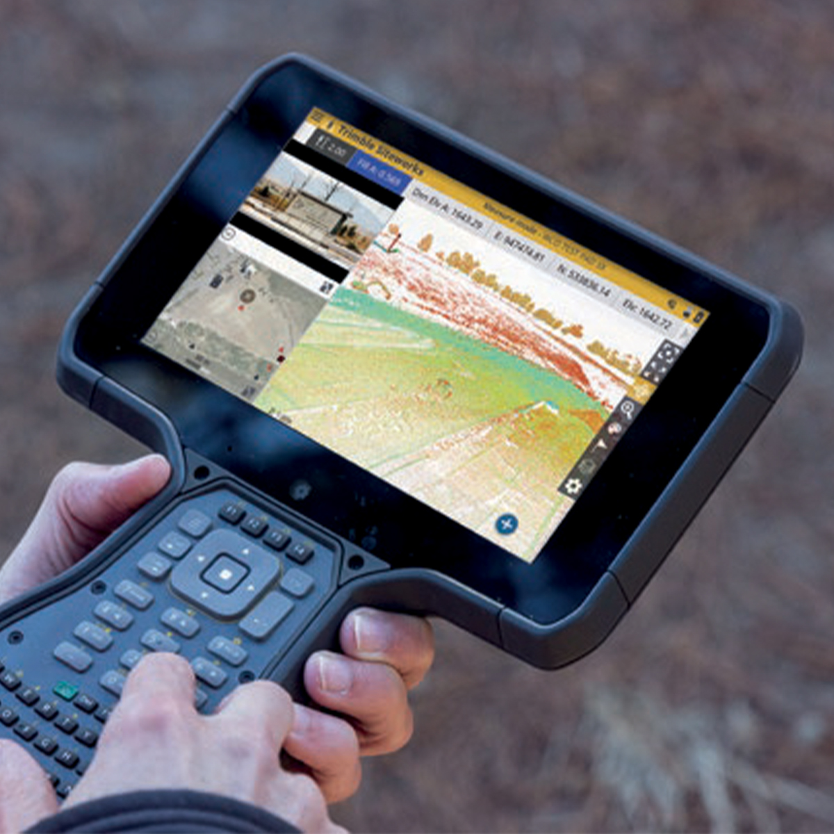
Trimble T110 114050-50-1 T110 – Survey Data Collector
Call for Price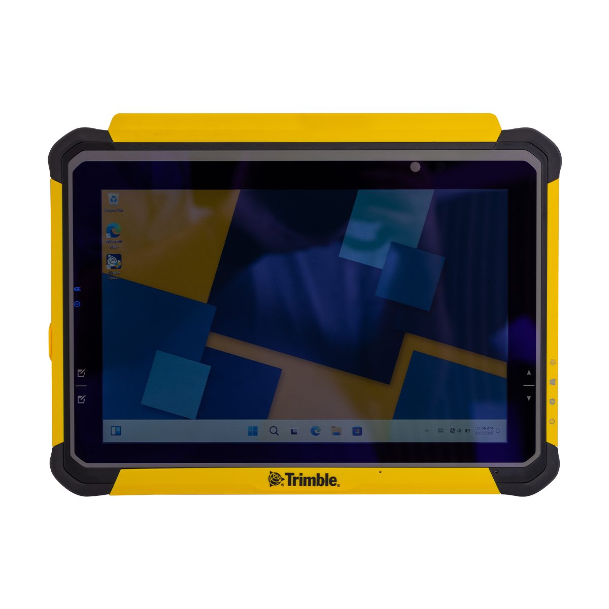
Trimble T110 114050-50-1 T110 – Survey Data Collector
Call for PriceONLY AVAILABLE FOR DELIVERY IN ND, SD, MN, CO, AK, MT, ID, HI, WY, OR, & WA.Trimble T110 114050-50-1 T110 – Survey Data Collector
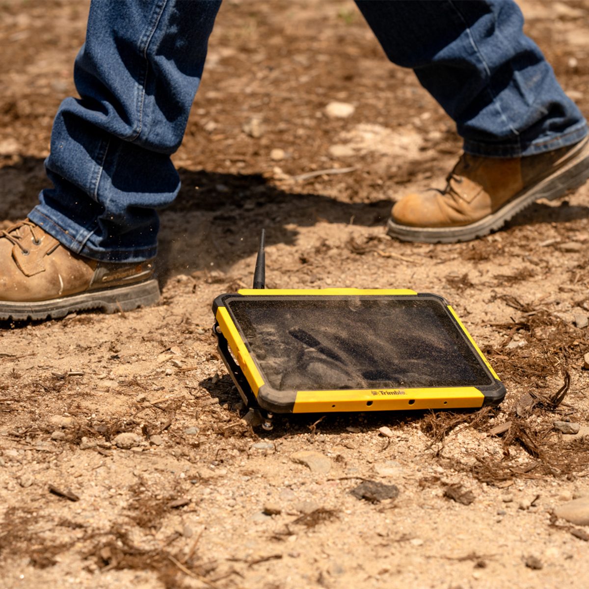
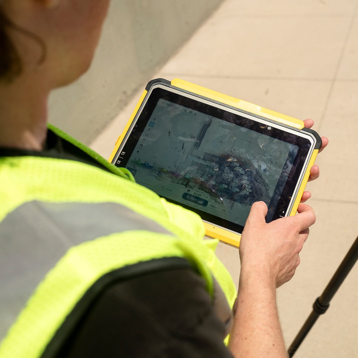
Connect to a Better Way to Work
Boost your productivity in reality capture, survey and construction workflows with the high-performance Trimble® T110 tablet. Enjoy unmatched speed, seamless data flow and reliable, uninterrupted operation.Quick View -
Trimble T110 114050-50-1-FTG – Field Technology Group Data Collector
Call for Price Trimble T110 114050-50-1-FTG – Field Technology Group Data Collector
Call for PriceONLY AVAILABLE FOR DELIVERY IN ND, SD, MN, CO, AK, MT, ID, HI, WY, OR, & WA.Trimble T110 114050-50-1-FTG – Field Technology Group Data Collector
Connect to a Better Way to Work
Boost your productivity in reality capture, survey and construction workflows with the high-performance Trimble® T110 tablet. Enjoy unmatched speed, seamless data flow and reliable, uninterrupted operation.Quick View -
Trimble T110 114050-50-1-HH – Heavy Civil Construction Data Collector
Call for Price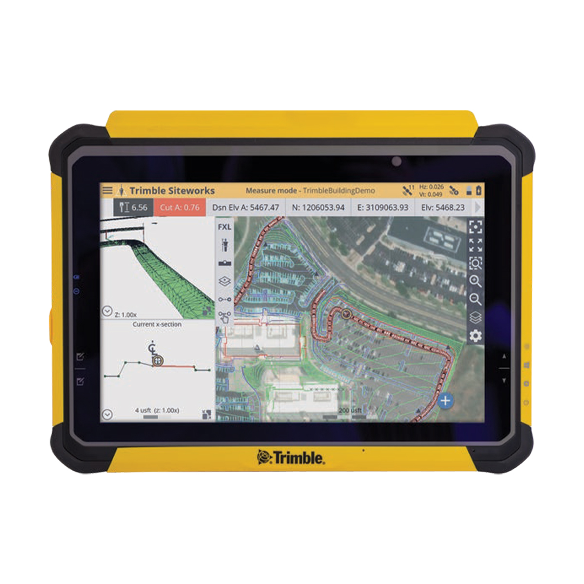


Trimble T110 114050-50-1-HH – Heavy Civil Construction Data Collector
Call for PriceONLY AVAILABLE FOR DELIVERY IN ND, SD, MN, CO, AK, MT, ID, HI, WY, OR, & WA.Trimble T110 114050-50-1-HH – Heavy Civil Construction Data Collector
Connect to a Better Way to WorkBoost your productivity in reality capture, survey and construction workflows with the high-performance Trimble® T110 tablet. Enjoy unmatched speed, seamless data flow and reliable, uninterrupted operation.
Quick View -
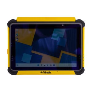
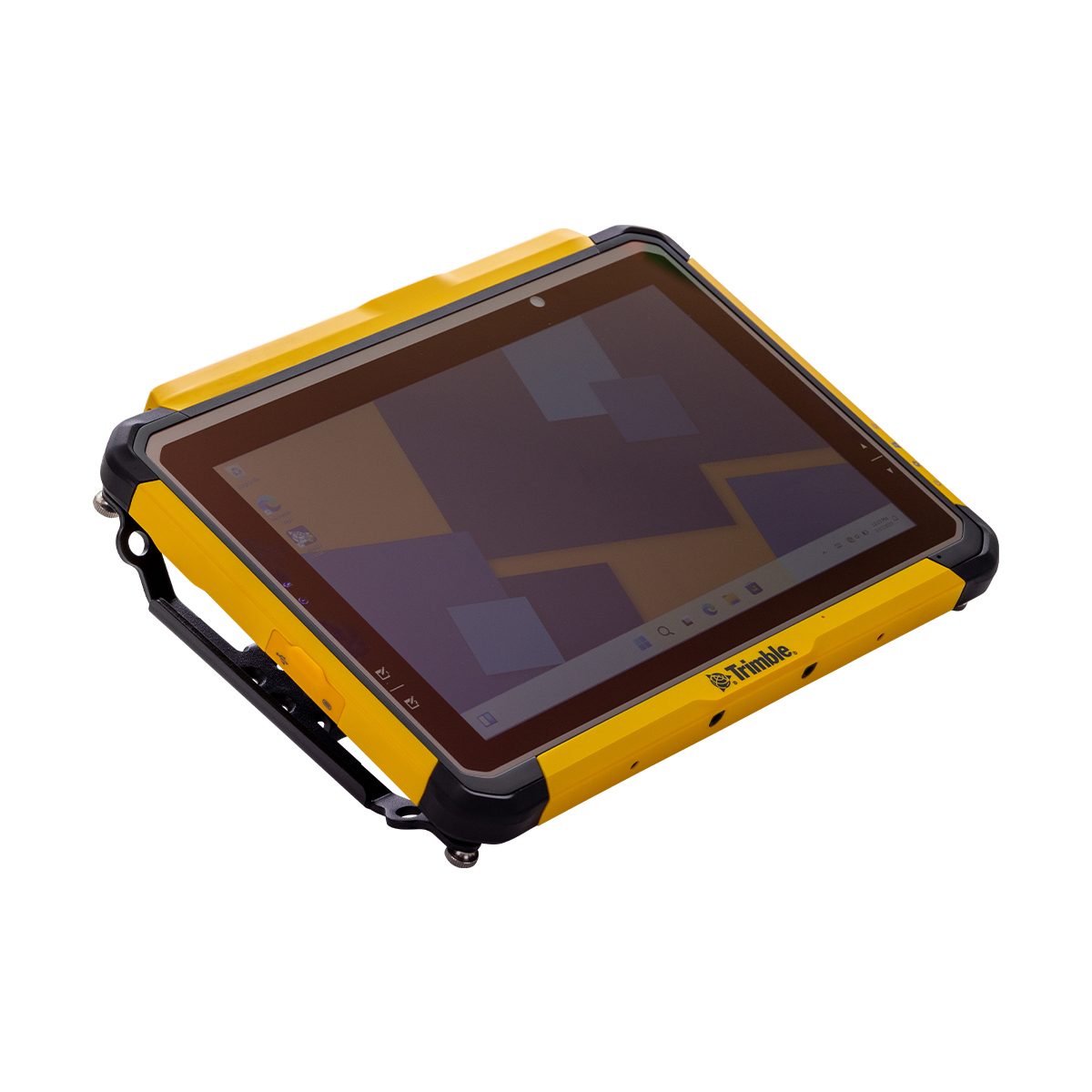
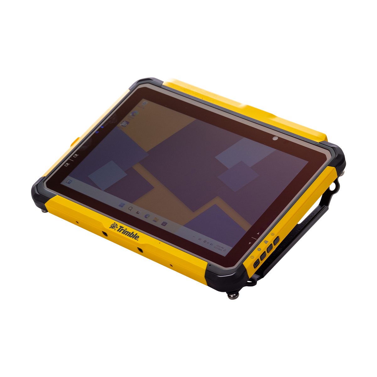
Trimble TABT703 T7 Tablet
Call for Price


Trimble TABT703 T7 Tablet
Call for PriceONLY AVAILABLE FOR DELIVERY IN ND, SD, MN, CO, AK, MT, ID, HI, WY, OR, & WA.
Trimble TABT703 T7 Tablet
Tough, Portable and Connected Compact Field Computer
The Trimble® T7 Tablet is a lightweight, rugged handheld controller for GNSS or total station operations. The easy-to-use T7 Tablet allows contractors to work with larger, more complex 3D data sets more effectively in the field, connect to the office for on-the-spot approvals and communicate changes to field crews. From the field, to the truck cab, to the office, teams stay connected and work faster.Quick View -

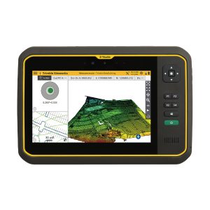
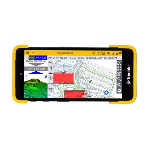
Trimble TDC600
Call for Price


Trimble TDC600
Call for PriceONLY AVAILABLE FOR DELIVERY IN ND, SD, MN, CO, AK, MT, ID, HI, WY, OR, & WA.Quick View -
Trimble TDC601 TDC6 Handheld Data Collector
Call for Price
Trimble TDC601 TDC6 Handheld Data Collector
Call for PriceONLY AVAILABLE FOR DELIVERY IN ALASKA.
Trimble TDC601 TDC6 Handheld Data Collector
Tough, Cost-effective and Connected Compact Field Computer
The Trimble® TDC6 Handheld Data Collector is a lightweight, rugged controller for GNSS operations. The easy-to-use TDC6 allows contractors to work with complex 3D data sets more effectively in the field, connect to the office for on-the-spot approvals and communicate changes to field crews. The TDC6 is a high-performing data controller that offers a cost-effective solution to connect a larger number of operators and enhance field communications.Quick View -
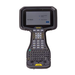
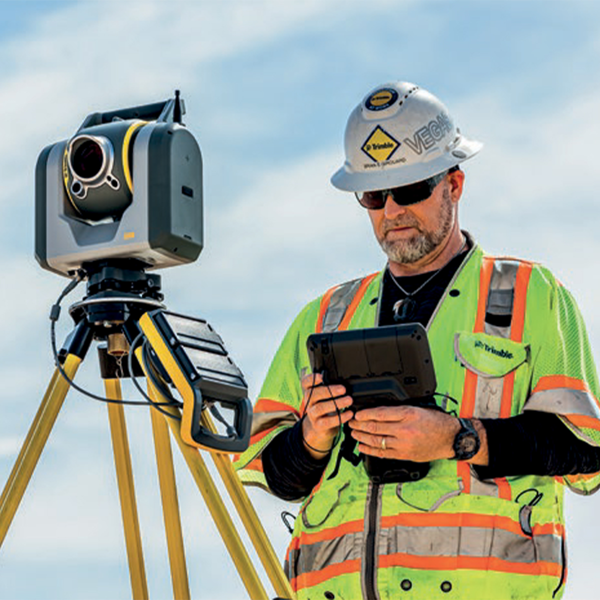
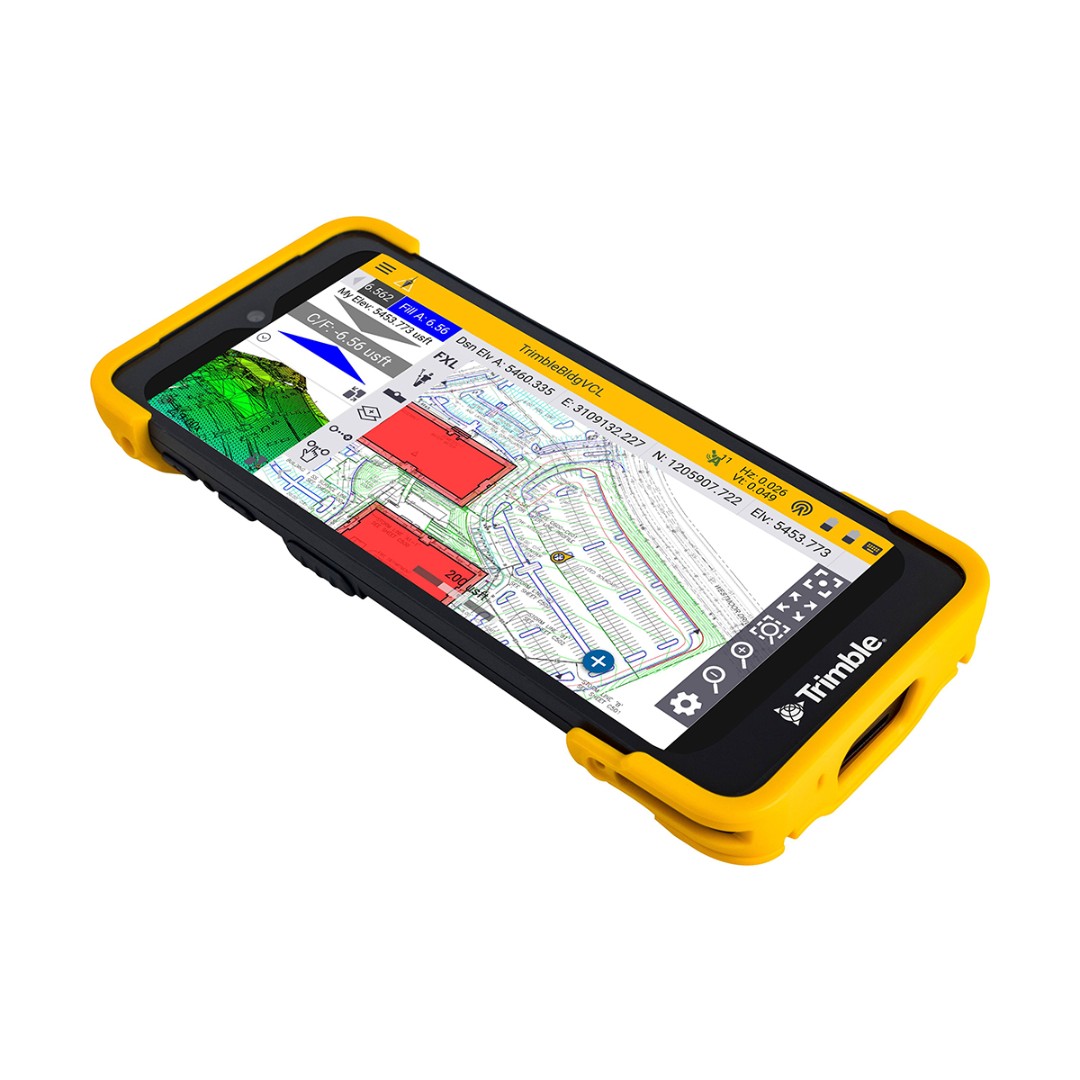
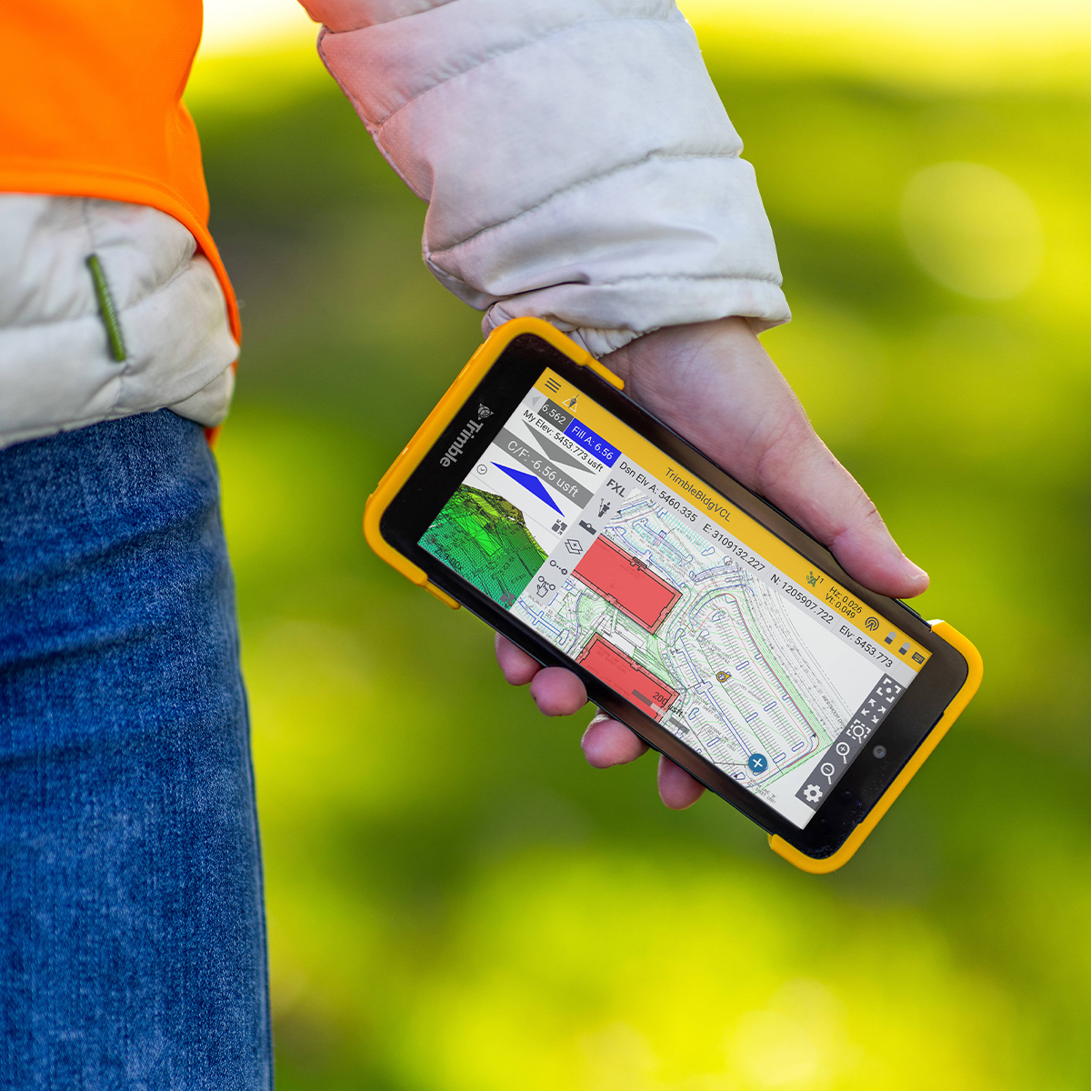
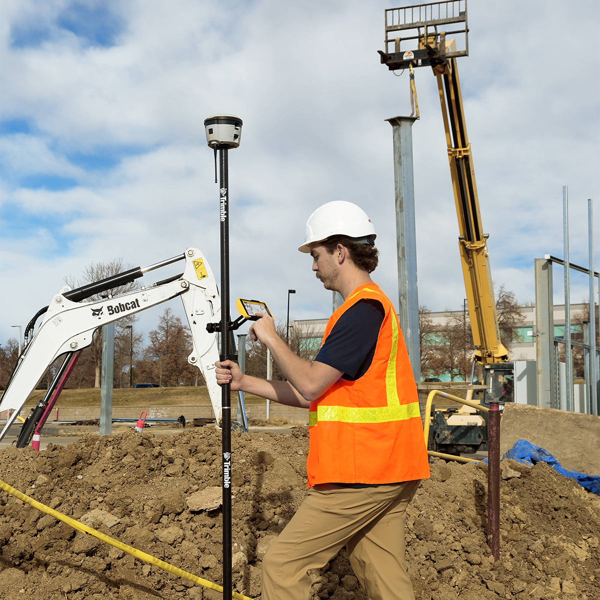
Trimble TSC510-1-1100-00 TSC510 Survey Controller
Call for Price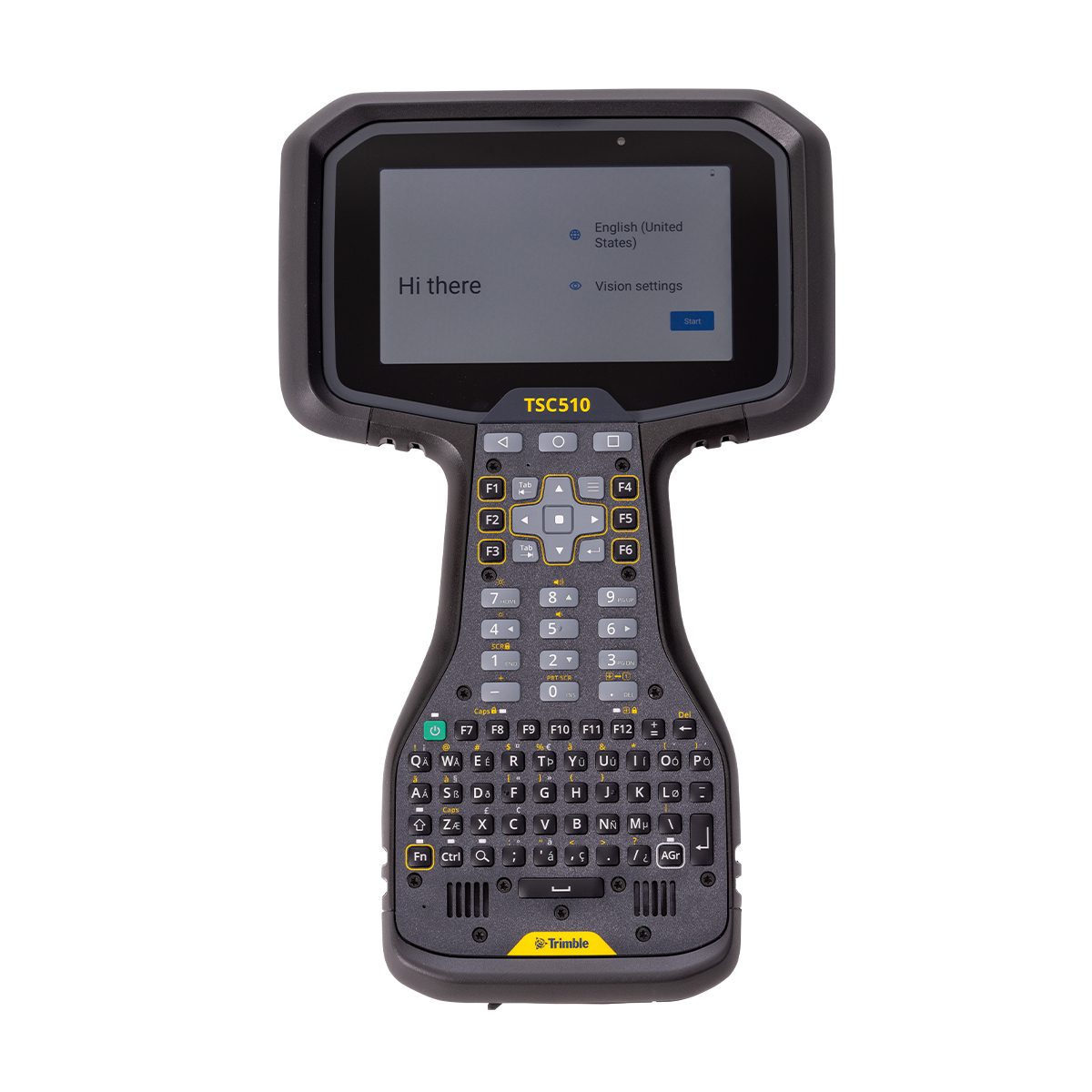
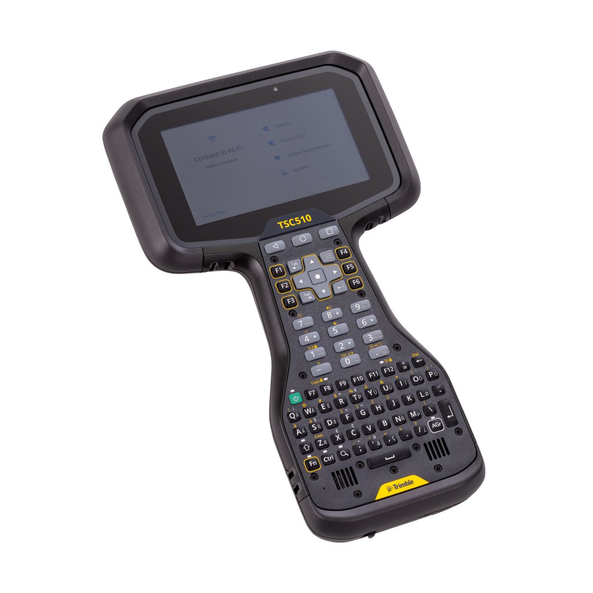
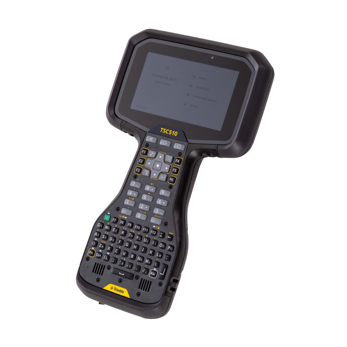
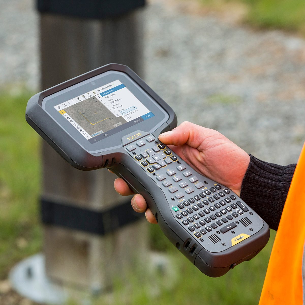
Trimble TSC510-1-1100-00 TSC510 Survey Controller
Call for PriceONLY AVAILABLE FOR DELIVERY IN ND, SD, MN, CO, AK, MT, ID, HI, WY, OR, & WA.
Trimble TSC510-1-1100-00 TSC510 Survey Controller
Get to work immediately with this fully connected, powered-up, and rugged solution.
Boost your field efficiency with the Trimble® TSC510 controller. Designed for optimal performance, this robust handheld device is built to streamline your data collection and surveying tasks. Its intuitive interface and powerful processing capabilities ensure accuracy and speed, even on complex projects. With a focus on durability and connectivity, the TSC510 is equipped to handle challenging environments while keeping your team connected through various communication options. Experience seamless workflows and reliable data management with the TSC510, your essential partner for productive field operations.
Quick View -
Trimble TSC510-1-1100-00-HH TSC510 Heavy Civil Construction Controller
Call for Price
Trimble TSC510-1-1100-00-HH TSC510 Heavy Civil Construction Controller
Call for PriceONLY AVAILABLE FOR DELIVERY IN ND, SD, MN, CO, AK, MT, ID, HI, WY, OR, & WA.
Trimble TSC510-1-1100-00-HH TSC510 Heavy Civil Construction Controller
Get to work immediately with this fully connected, powered-up, and rugged solution.
Boost your field efficiency with the Trimble® TSC510 controller. Designed for optimal performance, this robust handheld device is built to streamline your data collection and surveying tasks. Its intuitive interface and powerful processing capabilities ensure accuracy and speed, even on complex projects. With a focus on durability and connectivity, the TSC510 is equipped to handle challenging environments while keeping your team connected through various communication options. Experience seamless workflows and reliable data management with the TSC510, your essential partner for productive field operations.
Quick View -
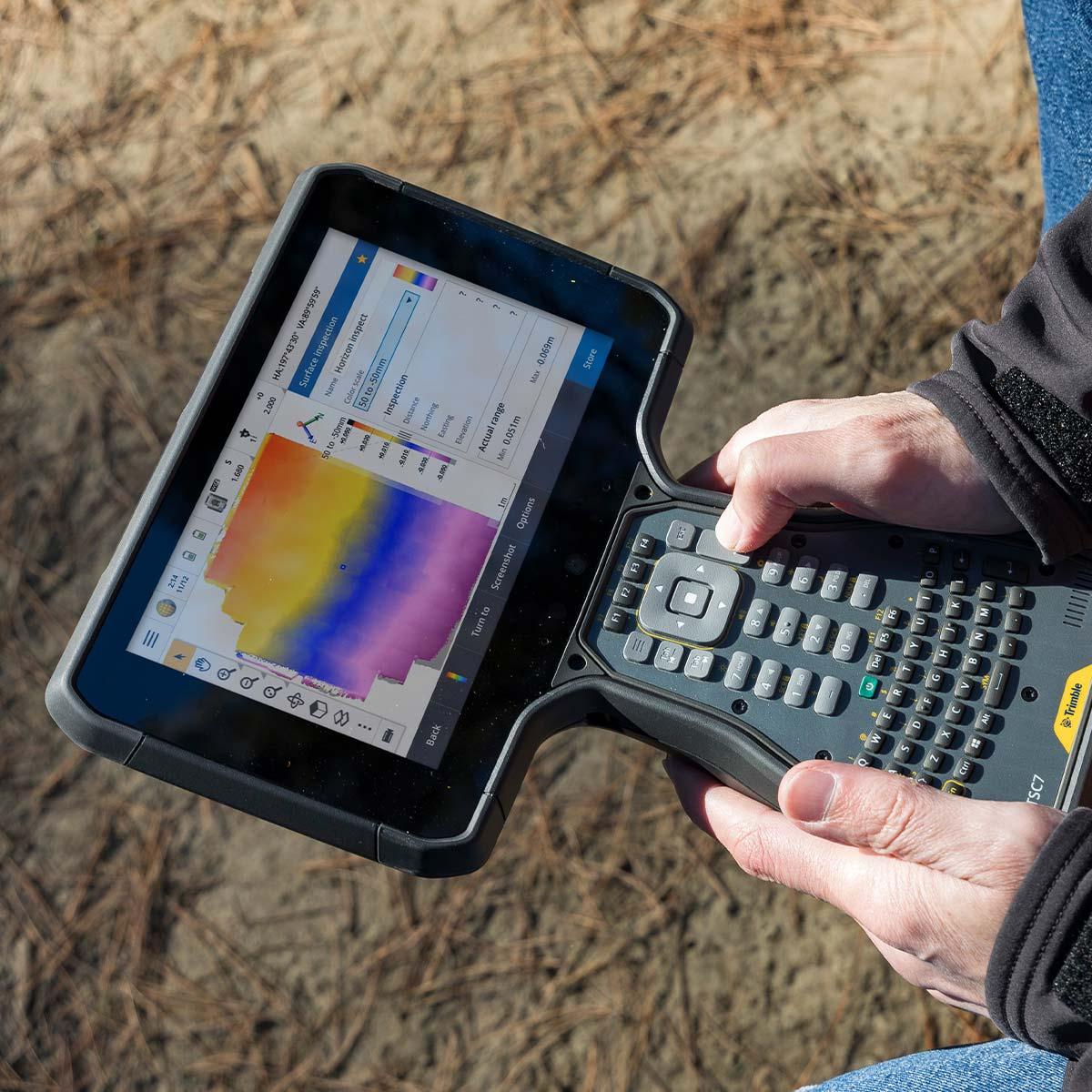
Trimble TSC7-2-1111-00 TSC7 V2 Controller – QWERTY keypad, USB/Serial boot, NA/EMEA region, Standalone
Call for Price
Trimble TSC7-2-1111-00 TSC7 V2 Controller – QWERTY keypad, USB/Serial boot, NA/EMEA region, Standalone
Call for PriceONLY AVAILABLE FOR DELIVERY IN ND, SD, MN, CO, AK, MT, ID, HI, WY, OR, & WA.
Quick View -
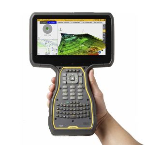
Trimble TSC703 TSC7 Controller
Call for Price
Trimble TSC703 TSC7 Controller
Call for PriceONLY AVAILABLE FOR DELIVERY IN ALASKA.
Trimble TSC703 TSC7 Controller
Built for the Construction Site
The Trimble TSC7 Controller is a wirelessly connected, rugged handheld controller for GNSS or total station operations. It gives construction surveyors, grade checkers, and site engineers total control over their on-site tasks. Designed for construction site operations, the TSC7 offers integrated Wi-Fi and Bluetooth, built-in cameras, and GPS in a lightweight, shock, dust and water resistant package.Quick View -
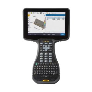
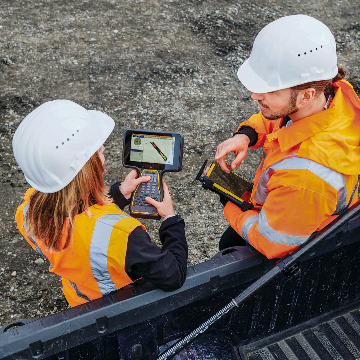
Trimble TSC710-1-1100-00 TSC710 Survey Controller
Call for Price
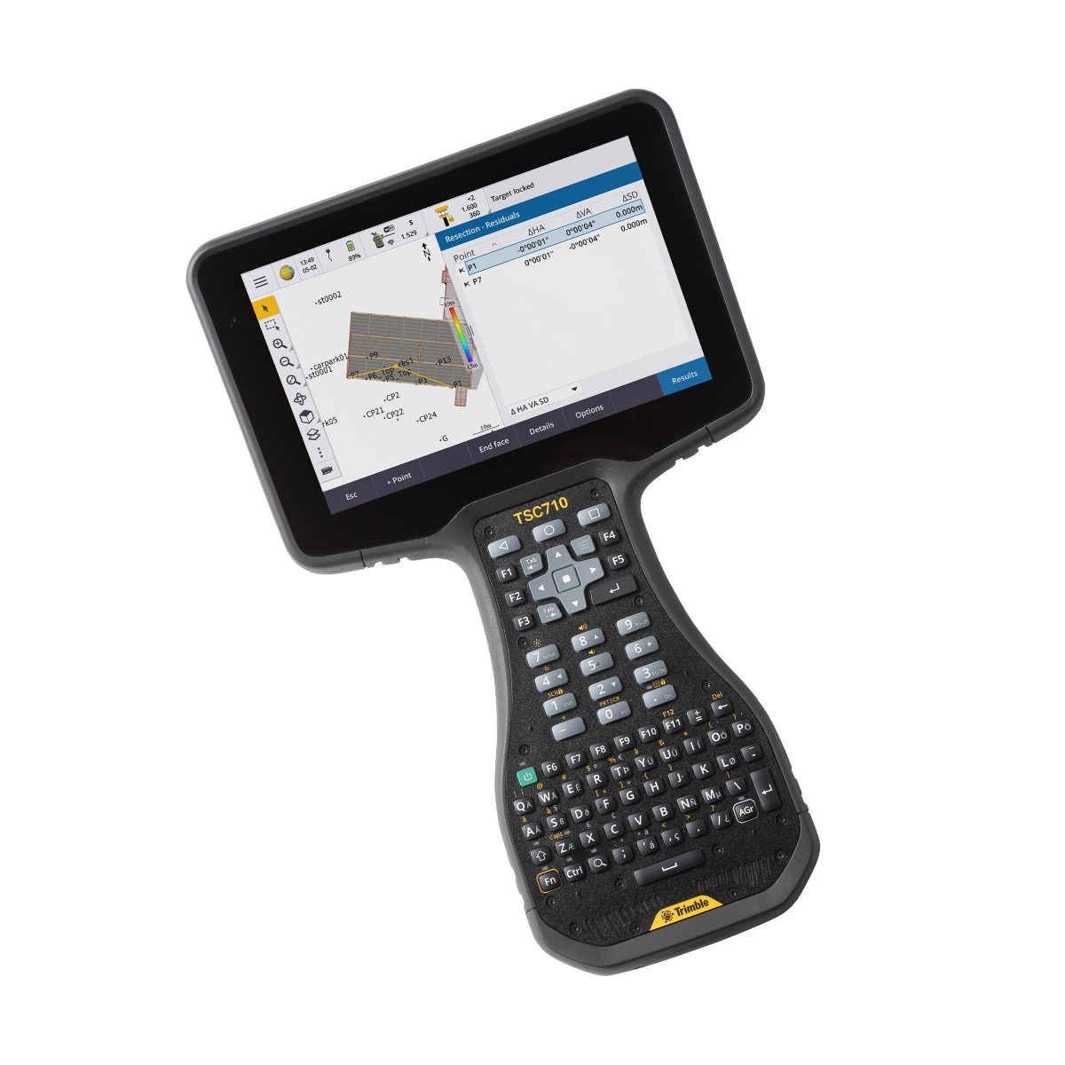
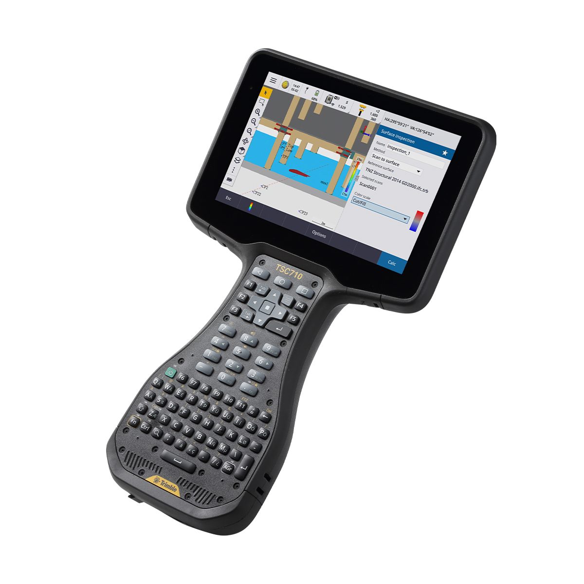
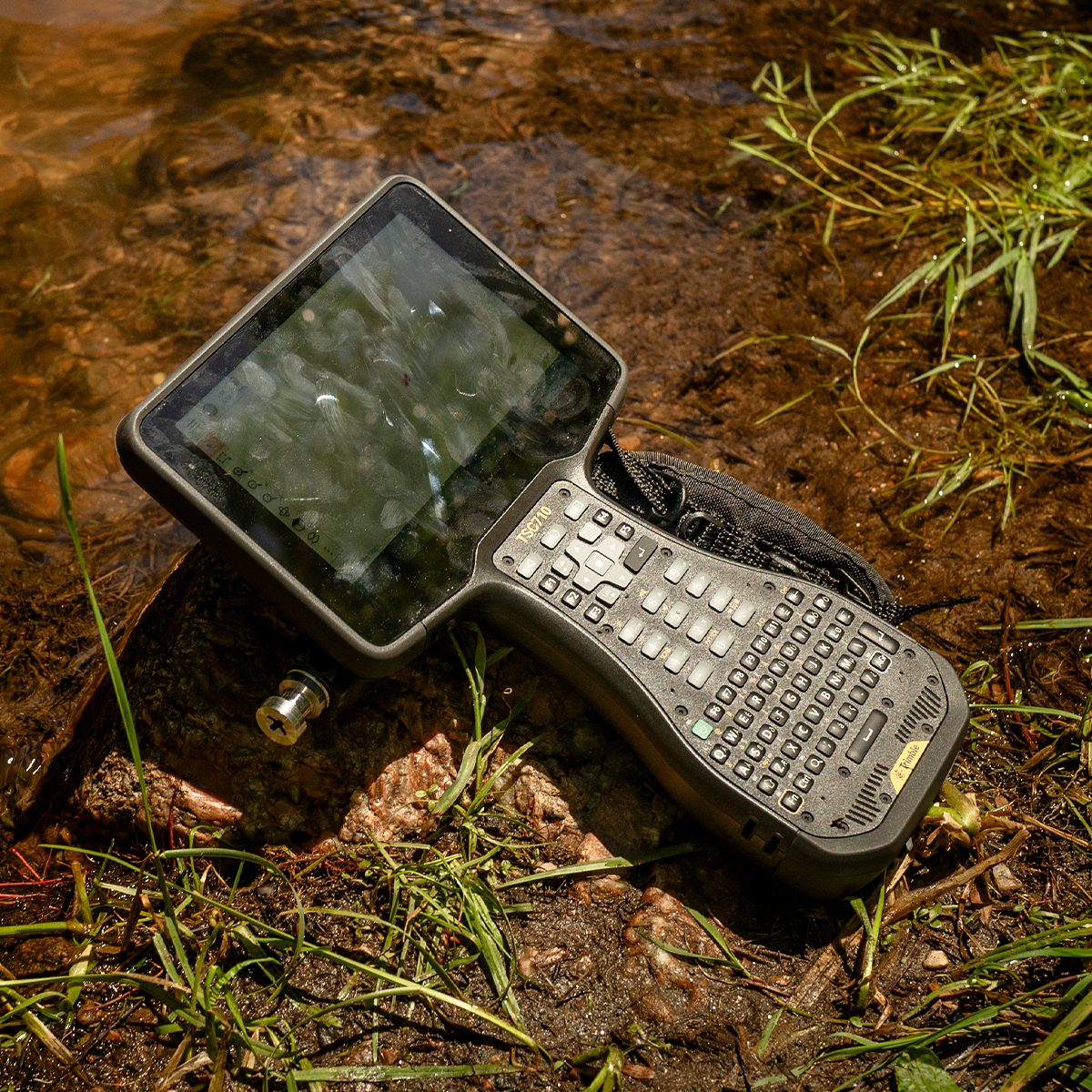
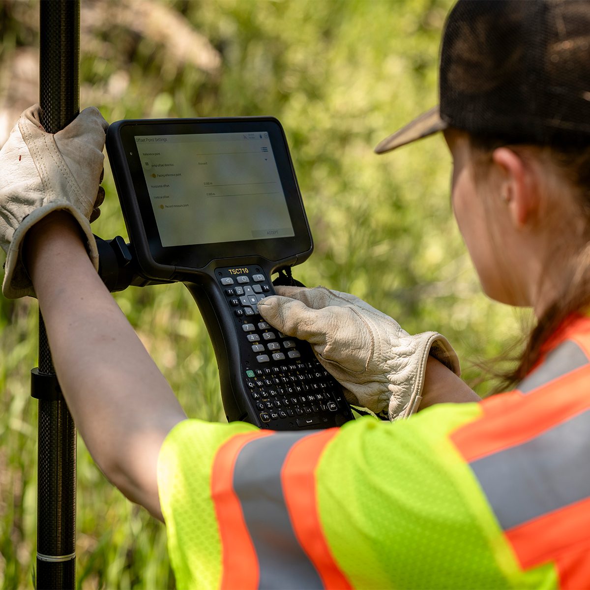
Trimble TSC710-1-1100-00 TSC710 Survey Controller
Call for PriceONLY AVAILABLE FOR DELIVERY IN ND, SD, MN, CO, AK, MT, ID, HI, WY, OR, & WA.
Trimble TSC710-1-1100-00 TSC710 Survey Controller
Connect to a Better Way to Work
The Trimble® TSC710 controller boosts your performance with more memory and power. Its 7-inch screen, full keyboard and robust processing in a compact design ensure seamless field-to-office connectivity with versatile communication capabilities.Quick View -
Trimble TSC710-1-1100-00-HH TSC710 Heavy Civil Construction Controller
Call for Price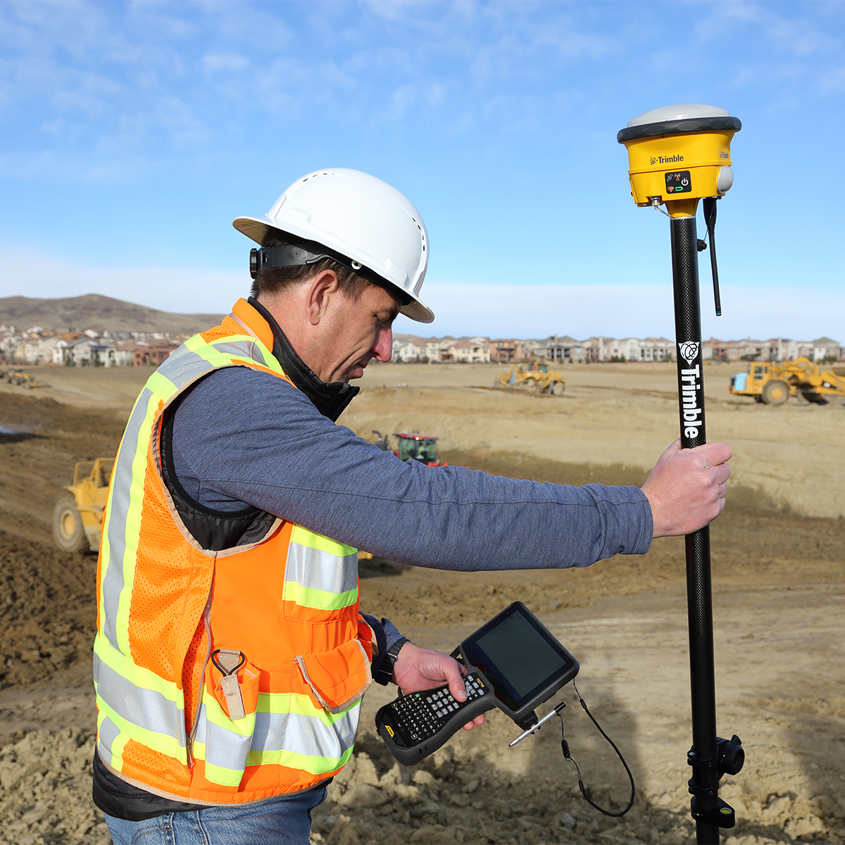

Trimble TSC710-1-1100-00-HH TSC710 Heavy Civil Construction Controller
Call for PriceONLY AVAILABLE FOR DELIVERY IN ND, SD, MN, CO, AK, MT, ID, HI, WY, OR, & WA.
Trimble TSC710-1-1100-00-HH TSC710 Heavy Civil Construction Controller
Connect to a Better Way to Work
The Trimble® TSC710 controller boosts your performance with more memory and power. Its 7-inch screen, full keyboard and robust processing in a compact design ensure seamless field-to-office connectivity with versatile communication capabilities.Quick View -
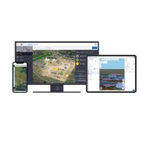
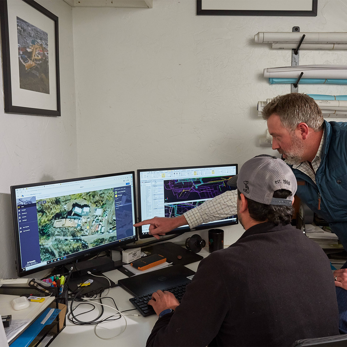
Trimble WorksManager Office Software for Construction
Call for Price


Trimble WorksManager Office Software for Construction
Call for PriceONLY AVAILABLE FOR DELIVERY IN ALASKA.
Trimble WorksManager Office Software for Construction
Trimble® WorksManager is a mobile-friendly site-management software that keeps machine operators and survey crews connected to the information they need to get the job done right the first time. Easily transfer data to the jobsite without leaving the office, reducing delays and minimizing downtime.
Quick View -
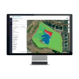
Trimble WorksOS Office Software
Call for Price


Trimble WorksOS Office Software
Call for PriceONLY AVAILABLE FOR DELIVERY IN ALASKA.
Trimble WorksOS Office Software | Jobsite Progress Monitoring Software
Monitor Jobsite Activity and Progress-to-plan
Trimble® WorksOS software collects information straight from your machines, giving site supervisors and project managers real-time visibility into civil construction jobsite progress and project status. This insight empowers better decision-making and enables you to make proactive adjustments to stay on budget and on schedule. The software’s intuitive interface makes it easy to create and configure activities. Monitor jobsite metrics without needing to understand or set up complex filter settings. Remotely push design updates to machines direct from the office, reducing unnecessary site visits and machine idling.Quick View -

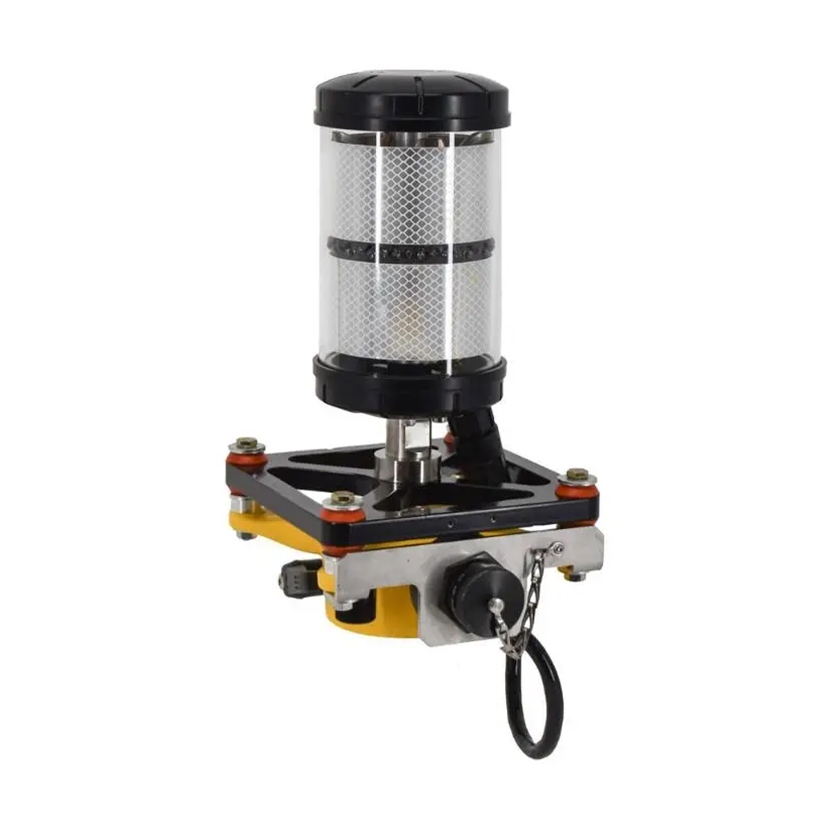
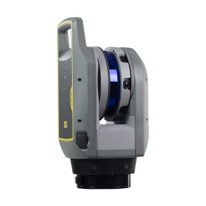
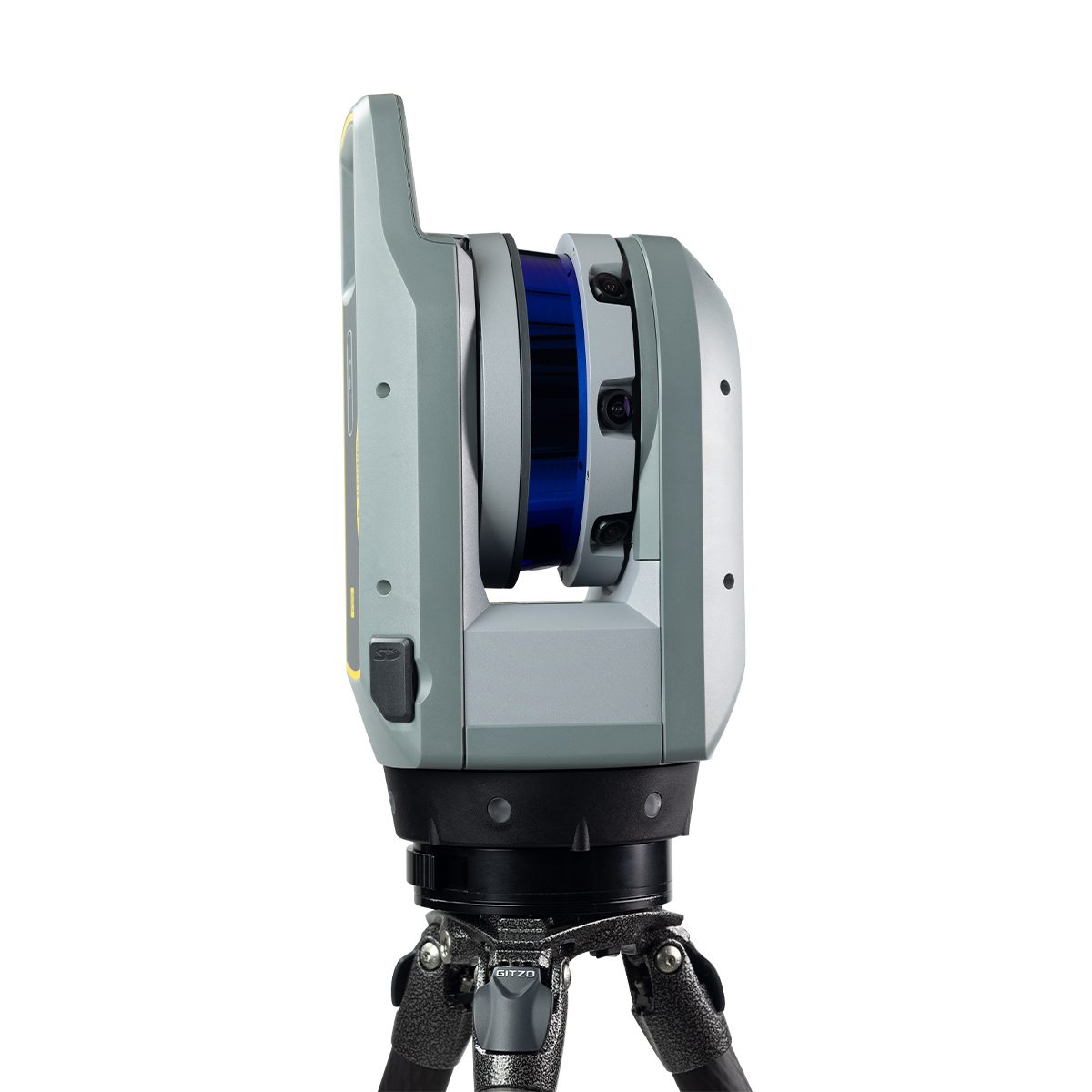
Trimble X12 Kit with T10x Tablet
Call for Price

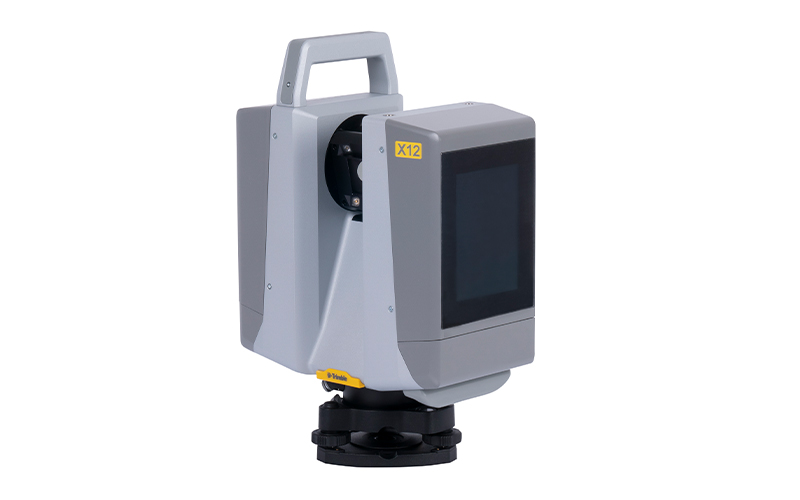

Trimble X12 Kit with T10x Tablet
Call for PriceONLY AVAILABLE FOR DELIVERY IN ND, SD, MN, CO, AK, MT, ID, HI, WY, OR, & WA.
Call 1-800-359-3703 for pricing and quote on configuration.
Quick View -
Trimble X9-100-01-GEO X9 3D Laser Scanning System
Call for Price
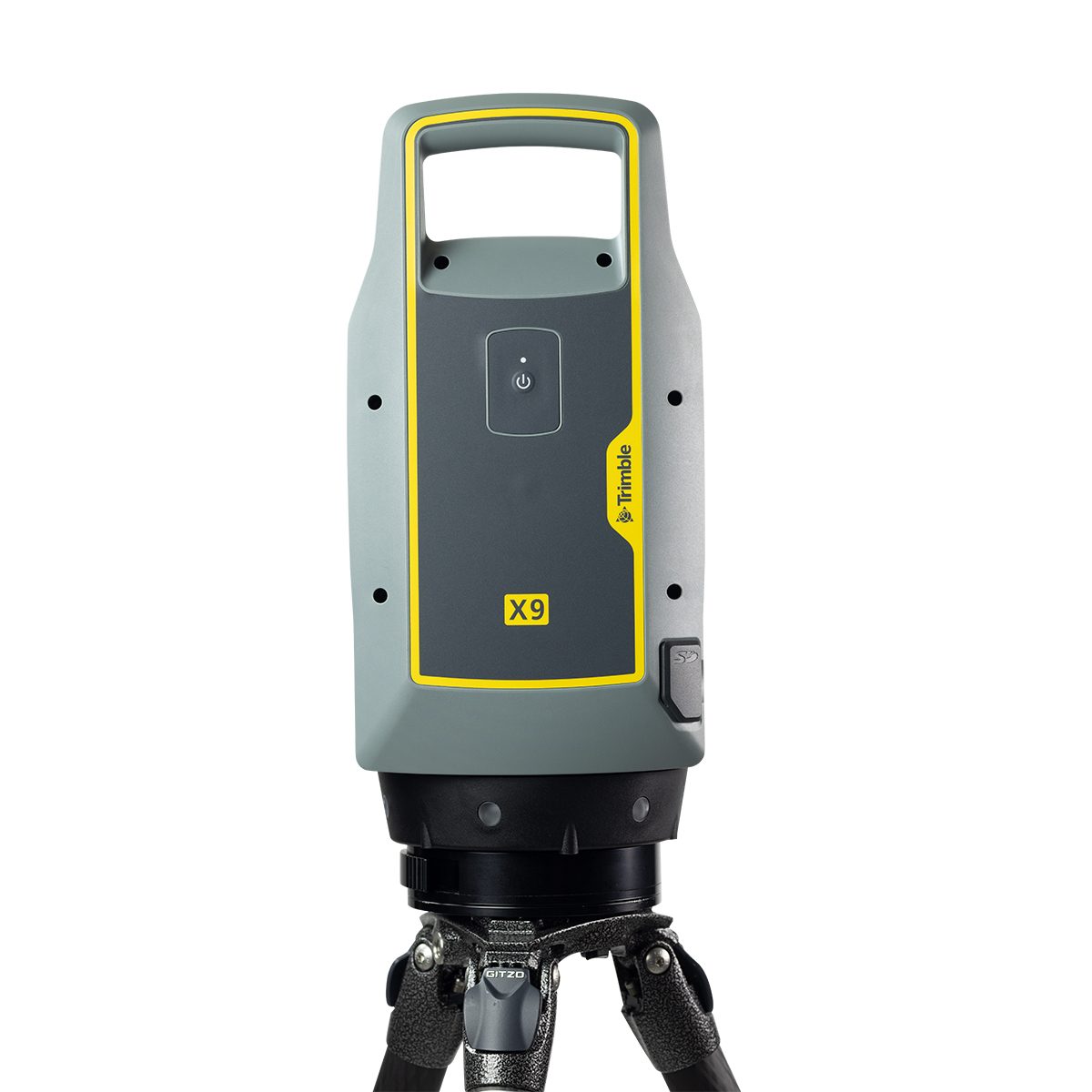
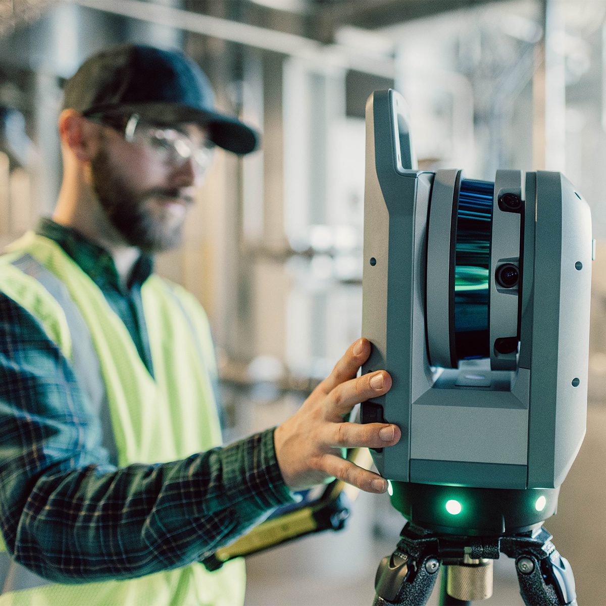
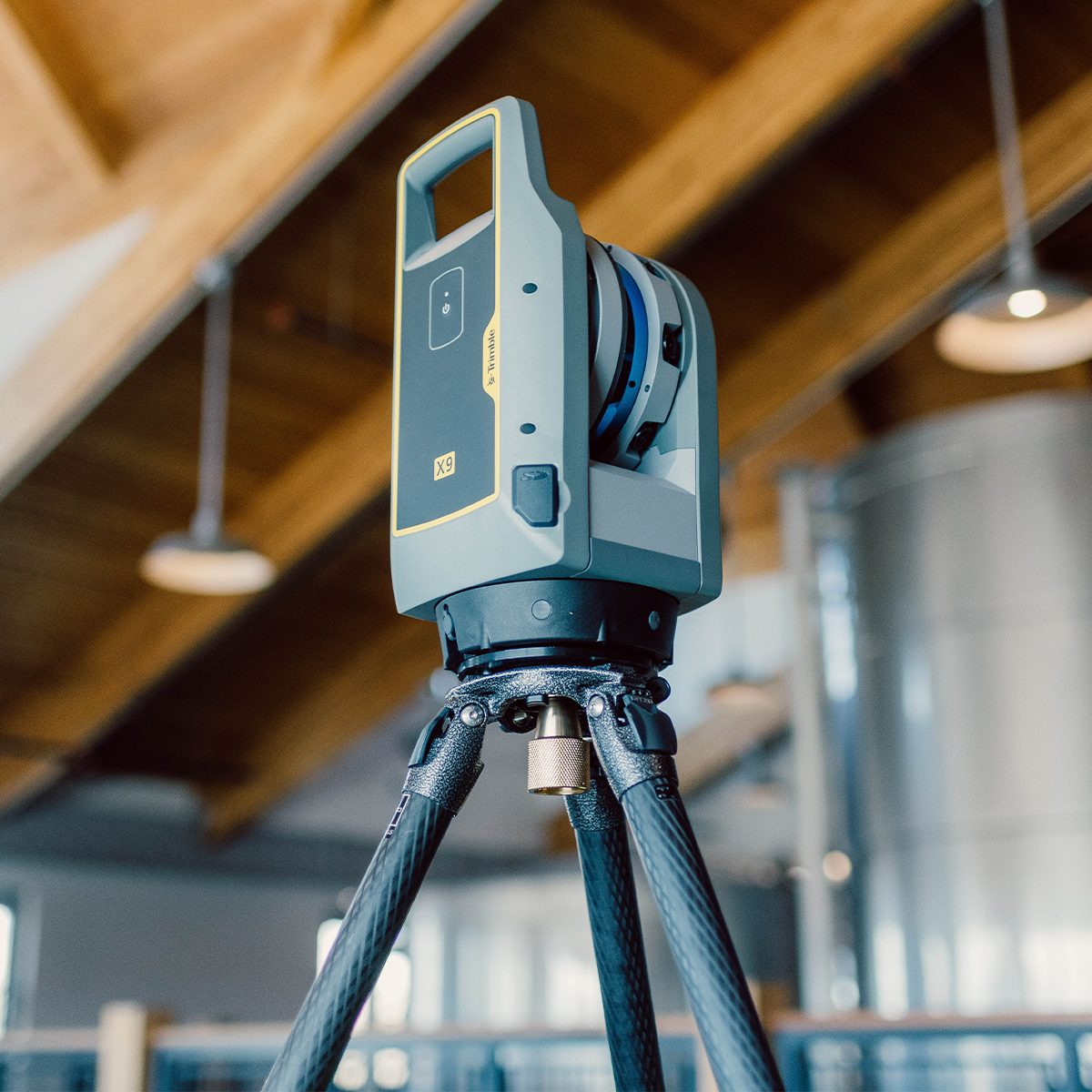
Trimble X9-100-01-GEO X9 3D Laser Scanning System
Call for PriceONLY AVAILABLE FOR DELIVERY IN ND, SD, MN, CO, AK, MT, ID, HI, WY, OR, & WA.
Trimble X9-100-01-GEO X9 3D Laser Scanning System
The power to do more, on your terms.The Trimble® X9 3D laser scanning platform leverages proven Trimble technology to deliver the range, accuracy, speed and sensitivity you need to do more. With flexible licensing plan options, choose the scanning functionality that fits your project needs.
Quick View