")
Juniper Systems Uinta 29120 Software (3-Year) – Professional License
Call for Price
Juniper Systems Uinta 29120 Software (3-Year) – Professional License
Your Data. Your Way.
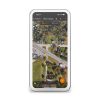
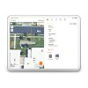
With Uinta, field data collection has never been easier. Our intuitive software allows users to effortlessly gather accurate data using customizable forms and real-time GPS integration ensures that your data is not only accurately mapped but also easily accessible for further analysis and reporting. Whether you are conducting environmental surveys, managing assets, or performing inspections, Uinta’s user-friendly interface helps you capture critical information quickly and accurately. The software supports a wide range of data types, including text, photos, and geospatial coordinates, making it versatile enough to handle any project. Cloud storage back-up allows you to save your data in a more accessible place, and when you are offline, Uinta saves your data locally and will upload once connection is reestablished.


Juniper Systems Uinta 29120 Software (3-Year) - Professional License
Mapping and Data Collection Software
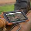
Uinta’s versatility makes it an ideal solution for a wide range of industries. Environmental scientists can track wildlife and vegetation, utilities can manage infrastructure, and mines can monitor activities for safety adherence. Available for Windows, Android, and Apple iOS, the adaptability of Uinta ensures that it can be customized to meet the specific requirements of your field, providing you with a powerful tool to enhance your data collection and mapping efforts.
CUSTOMIZABLE
Create custom map features and data-entry forms without any programming knowledge.
USER-FRIENDLY
Simple interface allows users to be trained and collecting data in minutes.
BACKED BY FREE SUPPORT
Receive unmatched support from Juniper Systems’ in-house customer success team.
PROFESSIONAL MAPPING
Quickly map points, lines, and areas. High-accuracy mapping supported.
EFFICIENT DATA CAPTURE
Replace paper forms with efficient electronic data entry forms. Use forms with or without maps.
SHARE DATA AND REPORTS
Export your data to common file types, print professional PDF reports, create optional cloud projects, and more.
As a U.S. manufacturer of ultra-rugged tablets and GPS receivers, Juniper Systems created Uinta to put the finishing touch on this industry-leading mapping and data collection powerhouse solution.
Related products
-

Catalyst 1 – Annual (12 month expiry)
Call for Price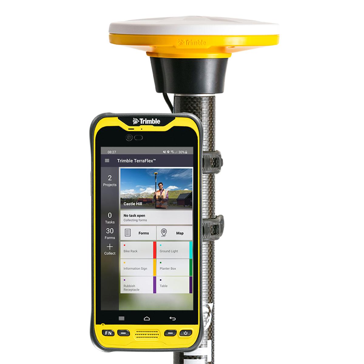
Catalyst 1 – Annual (12 month expiry)
Call for PriceONLY AVAILABLE FOR DELIVERY IN ND, SD, MN, CO, AK, MT, ID, HI, WY, OR, & WA.
Quick View -

Juniper Systems Uinta 29117 Software (1-Year) – Windows 10 Professional License
Call for Price
Juniper Systems Uinta 29117 Software (1-Year) – Windows 10 Professional License
Call for PriceJuniper Systems Uinta 29117 Software (1-Year) – Windows 10 Professional License
Your Data. Your Way.
With Uinta, field data collection has never been easier. Our intuitive software allows users to effortlessly gather accurate data using customizable forms and real-time GPS integration ensures that your data is not only accurately mapped but also easily accessible for further analysis and reporting. Whether you are conducting environmental surveys, managing assets, or performing inspections, Uinta’s user-friendly interface helps you capture critical information quickly and accurately. The software supports a wide range of data types, including text, photos, and geospatial coordinates, making it versatile enough to handle any project. Cloud storage back-up allows you to save your data in a more accessible place, and when you are offline, Uinta saves your data locally and will upload once connection is reestablished.
Quick View -

Catalyst 1 Meter
Call for Price
Catalyst 1 Meter
Call for PriceONLY AVAILABLE FOR DELIVERY IN ND, SD, MN, CO, AK, MT, ID, HI, WY, OR, & WA.
Quick View -

Catalyst On Demand – 1,000 Hour Pack (12 month expiry)
Call for Price
Catalyst On Demand – 1,000 Hour Pack (12 month expiry)
Call for PriceONLY AVAILABLE FOR DELIVERY IN ND, SD, MN, CO, AK, MT, ID, HI, WY, OR, & WA.
Quick View