by SCS Cloud | Jun 15, 2024
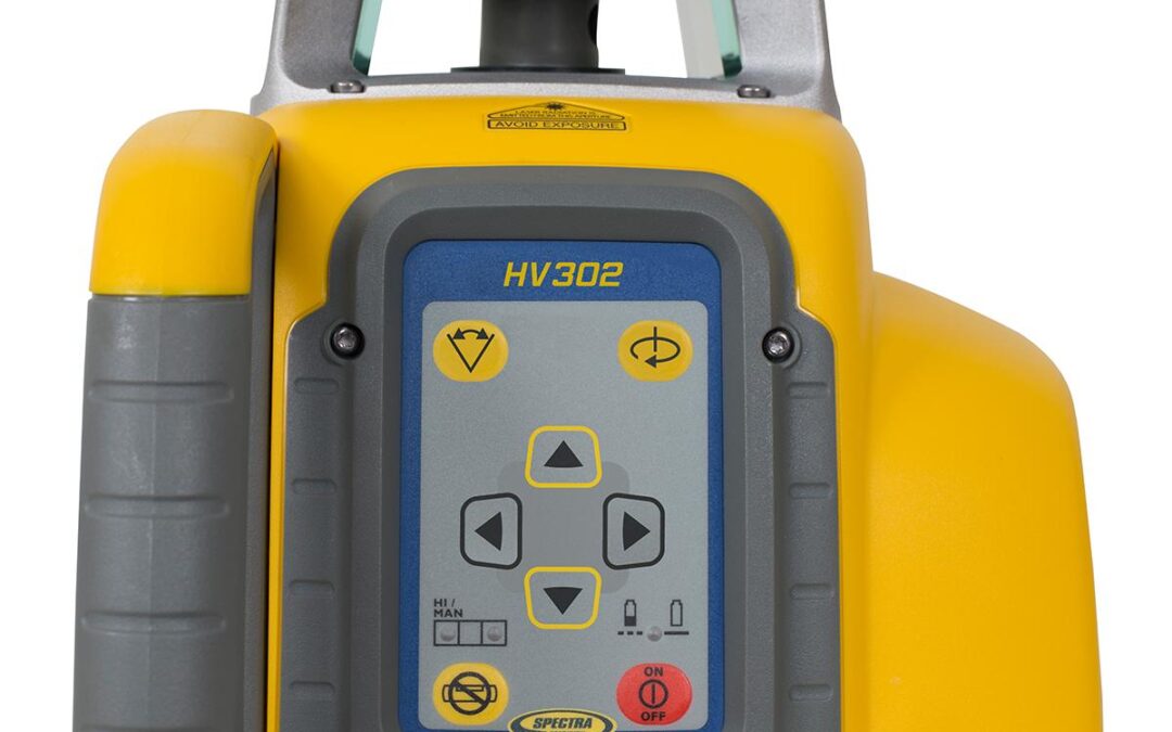
HV302 HORZ/VERT LASER W HL760 RCVR, C70 CLAMP, RC402N W ALKALINES
by SCS Cloud | Jun 15, 2024
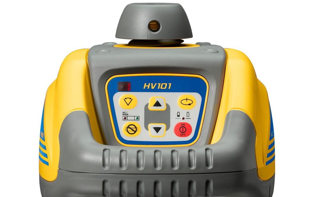
HV101 LASER, W M101 WALLMOUNT, RC601 REMOTE, 1176 CEILING TGT & GLASSES

by SCS Cloud | Jun 15, 2024
Spectra Precision HL700 Laser Receiver Measure once, get it right. Done. The patented anti-strobe filter eliminates false readings from LED lights that are commonly found on the job site such as vehicle hazard warning strobe lights. And with the digital readout models...
by SCS Cloud | Jun 15, 2024
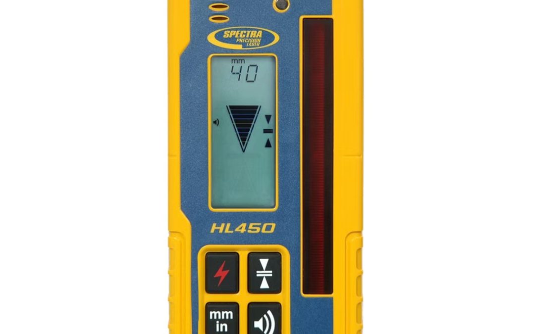
Spectra Precision HL450 Laser Receiver No one needs a laser receiver that’s easily distracted on the job site. The patented anti-strobe filter eliminates false readings from LED lights that are commonly found on the job site such as vehicle hazard warning strobe...
by SCS Cloud | Jun 15, 2024
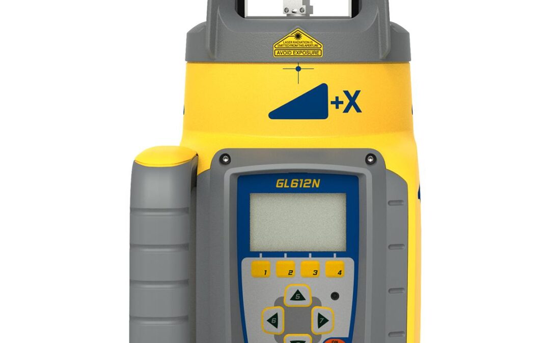
GL612N LASER W RC602N REMOTE, HL760 RECEIVER, CLAMP, NIMH & UNIVERSAL CHARGER
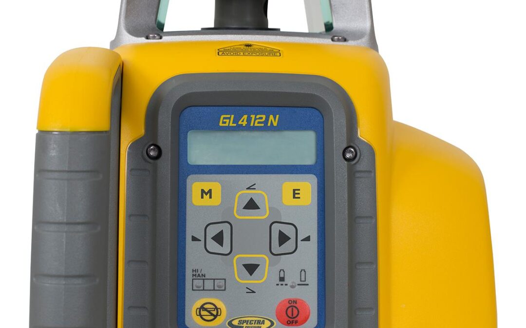
by SCS Cloud | Jun 15, 2024
Maximum control of your site with our advanced features. The rugged GL412N laser can withstand drops of up to one meter (three feet) onto concrete and tripod tip-overs up to 1.5 meters (five feet). This strength, combined with full weatherproofing and dustproofing,...
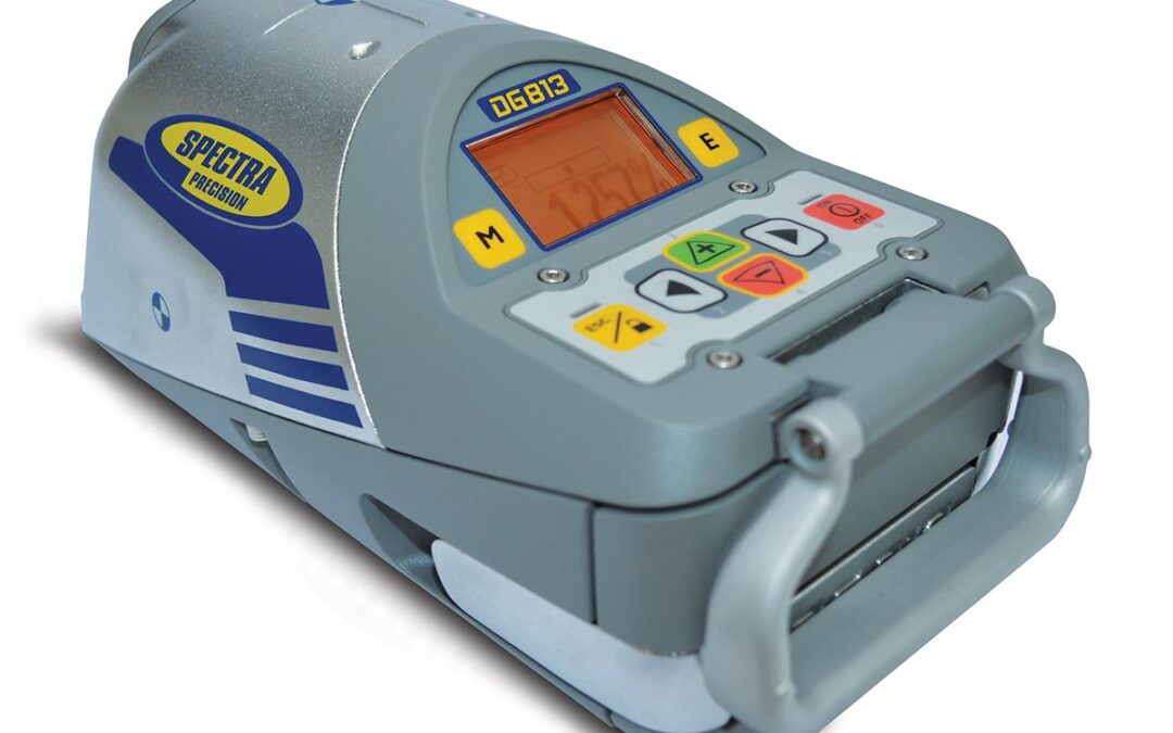
by SCS Cloud | Jun 15, 2024
Spectra Precision DG813 Pipe Laser | DG813. Professional Grade. Line Alert This unique feature is ideal for working in high-vibration or wet conditions where the pipe lasers may be disturbed. The beam flashes to notify you that the setup line has been disturbed,...
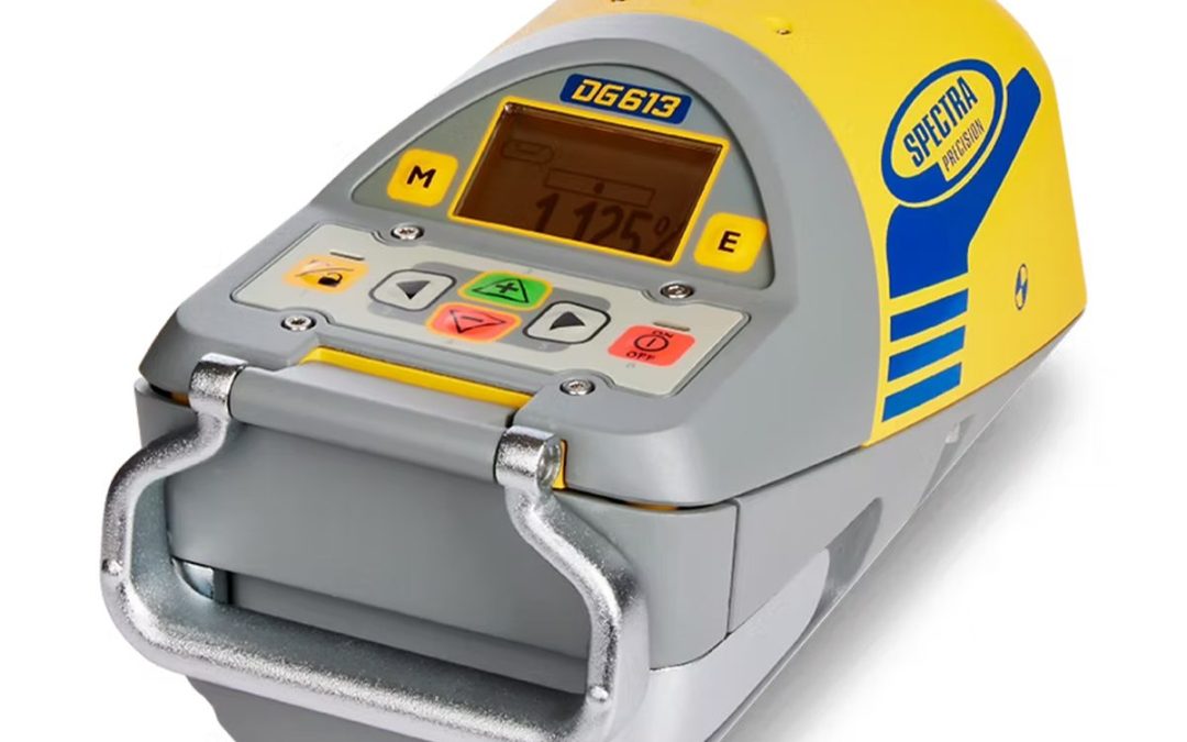
by SCS Cloud | Jun 15, 2024
Compact, tough and smart – perfection in a pipe. Designed to fit around tighter inverts, the Spectra Precision DG613 delivers one of the most productive pipe laying experience in the market. They are extremely rugged and thrive in demanding underground conditions....
by SCS Cloud | Jun 15, 2024
The C5 offers the easy setup Trimble users have come to expect. The autofocus powered by Nikon enables the C5 to quickly and precisely focus on the anticipated distance, so users can simply sight, shoot and go. That means any day spent in the field can be highly...
by SCS Cloud | Jun 15, 2024
• Incremental encoding detection system with dual digital displays• Automatic power shut-off• Coaxial tangent and clamp screws provide ease of use in sighting and alignment• Built-in battery pack can be attached and detached by a single action• Water resistant, sealed...
by Jenn Heinrich | Jan 23, 2026
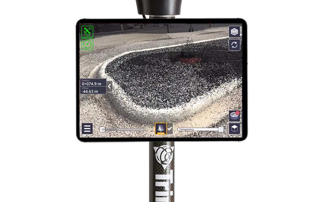
Trimble SiteVision Field Software Simpler Scanning Gain the power of scanning in a simpler, faster and more cost‑effective mobile solution. Capture 3D data on LiDAR‑equipped devices* in a fraction of the time it takes to set up and move expensive laser scanners. Work...
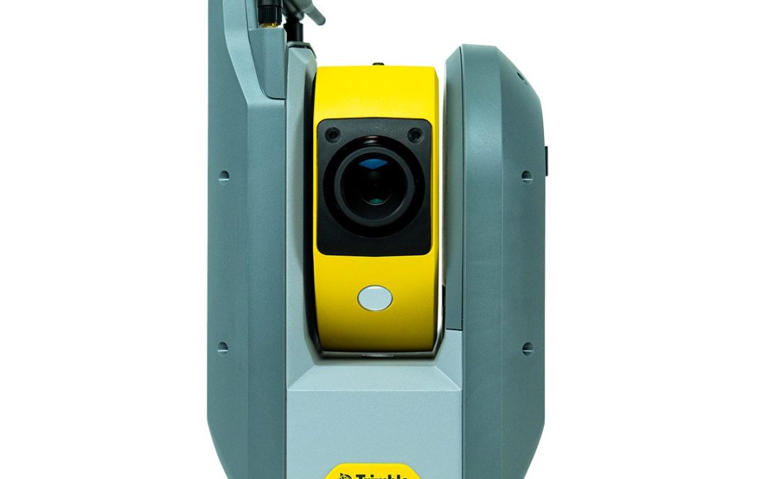
by Marco Ryan | Dec 18, 2025
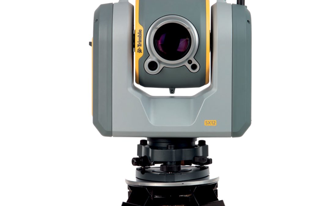
Trimble SX12-001-HH Scanning Total Station Work Smarter Don’t miss a thing with the Trimble SX12. Collect more data, more effectively and avoid rework and costly site revisits with additional site information from scan data, images and point clouds. Collect with...
by Marco Ryan | Dec 18, 2025
Trimble 163170-500 Earthworks GO! 2.0 System Features iOS and Android™ compatibility allows operators to use their smart device as the primary machine interface Trimble technology enables full sensing technology with no mounting hardware required Simple harnessing...
by Marco Ryan | Jul 8, 2025
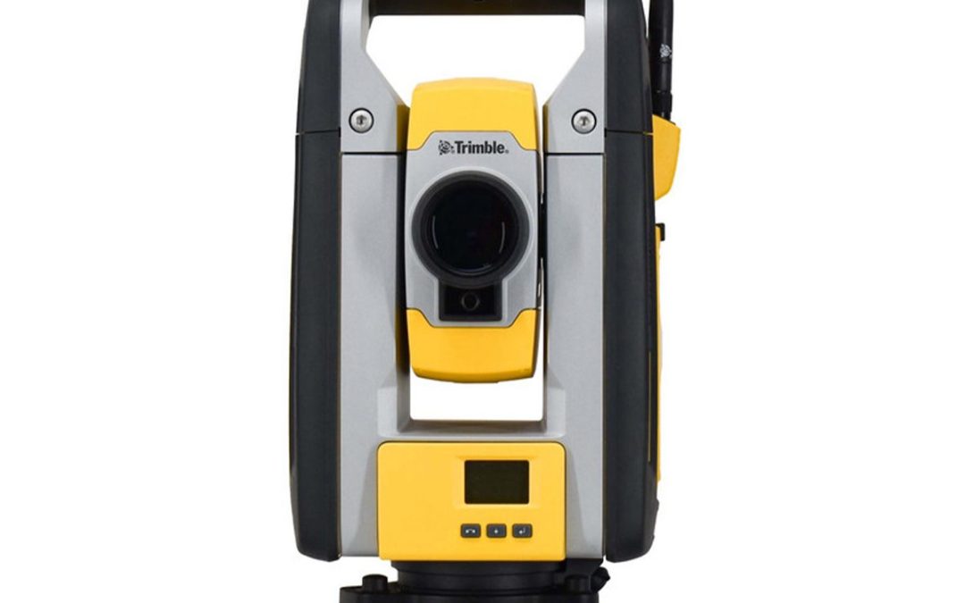
Trimble RTS873-FT Robotic Total Station Measurements made easy. Robotic total stations (RTS) are total stations with the ease of remote operation. With one operator, you can perform calculations and inspections in less time than with a traditional total station....
by Marco Ryan | Jul 8, 2025
Trimble RTS773-FT Robotic Total Station Measurements made easy. Robotic total stations (RTS) are total stations with the ease of remote operation. With one operator, you can perform calculations and inspections in less time than with a traditional total station....
by Marco Ryan | Jul 8, 2025
Trimble RTS573-FT Robotic Total Station Measurements made easy. Robotic total stations (RTS) are total stations with the ease of remote operation. With one operator, you can perform calculations and inspections in less time than with a traditional total station....
by Marco Ryan | Jul 8, 2025
Trimble 78501046-FTG Ri Robotic Total Station Increase productivity with Trimble Ri. The right addition to your team. Built for Every Contractor The Ri is designed to improve layout speed and accuracy across all trades. From general contractors managing a complex...
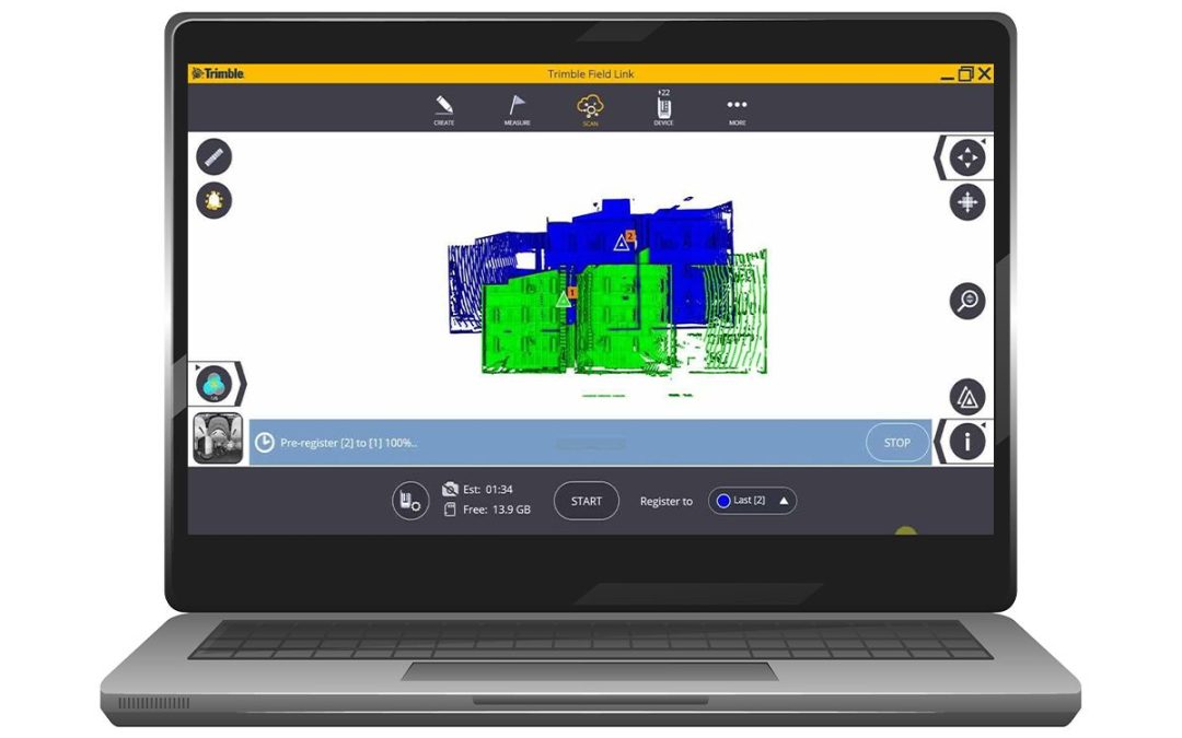
by Marco Ryan | Jun 5, 2025
Trimble TFL-SCANMODOFF-YR-VW FieldLink Scan Module Office Software – Annual Subscription FieldLink Office Data Prep and Validation Use Trimble FieldLink Office to streamline your data prep process by easily creating detailed points for field layout, no matter the size...
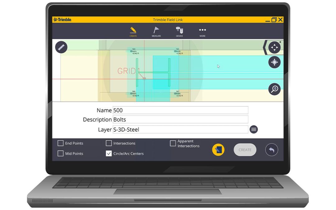
by Marco Ryan | Jun 5, 2025
Trimble TFL-OFFICE-YR-VW FieldLink Office Software – Annual Subscription FieldLink Office Data Prep and Validation Use Trimble FieldLink Office to streamline your data prep process by easily creating detailed points for field layout, no matter the size of...
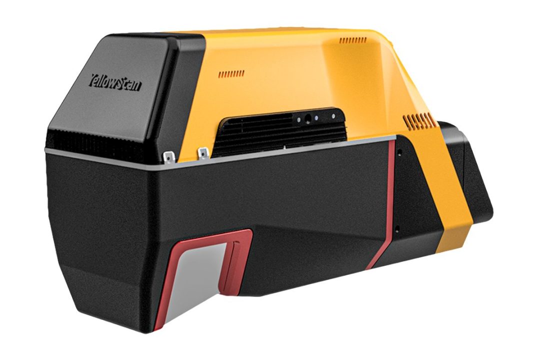
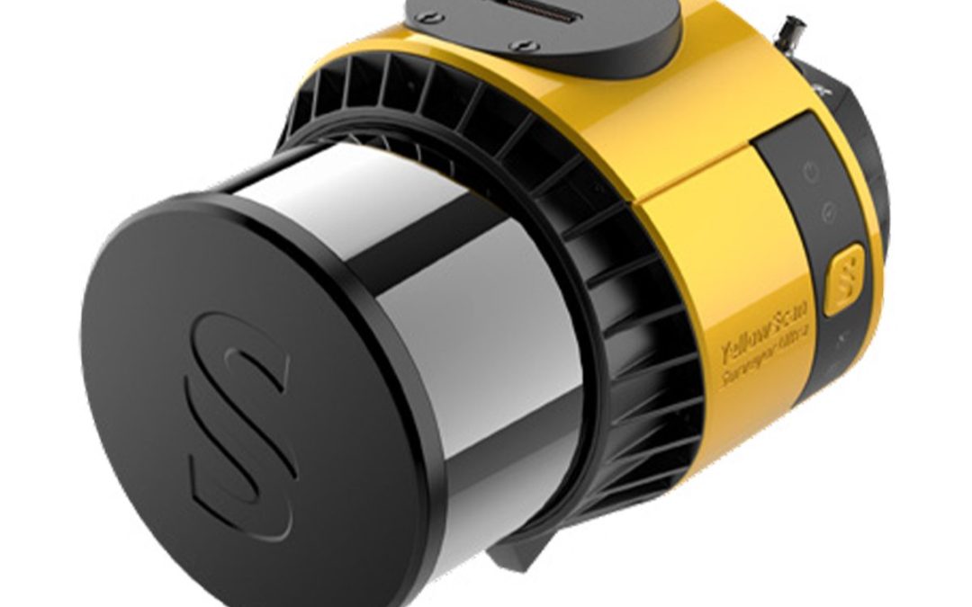
by Marco Ryan | Mar 17, 2025
The YellowScan Voyager is our highest range LiDAR solution, with a range of up to 440m. Its laser scanner’s wide field of view of 100° and its extremely fast data acquisition rate of up to 2.4 MHz, makes this solution the best option for projects requiring the highest...

by Marco Ryan | Mar 17, 2025
A higher-grade INS integration for more productivity in operation, all in an even lighter package. We’ve kept the great 32-beam, 360° laser scanner and combined it with an INS to reach its full potential at higher altitudes and in Fly & Drive with many...
by Marco Ryan | Mar 17, 2025
A higher-grade INS integration for more productivity in operation, all in an even lighter package. We’ve kept the great 32-beam, 360° laser scanner and combined it with an INS to reach its full potential at higher altitudes and in Fly & Drive with many...

by Marco Ryan | Mar 17, 2025
The YellowScan Navigator is an innovative bathymetric LiDAR solution for mapping underwater and ground topography with a single-button operation. Its compact design allows for operating on various UAV platforms without compromising water penetration. Technologies...
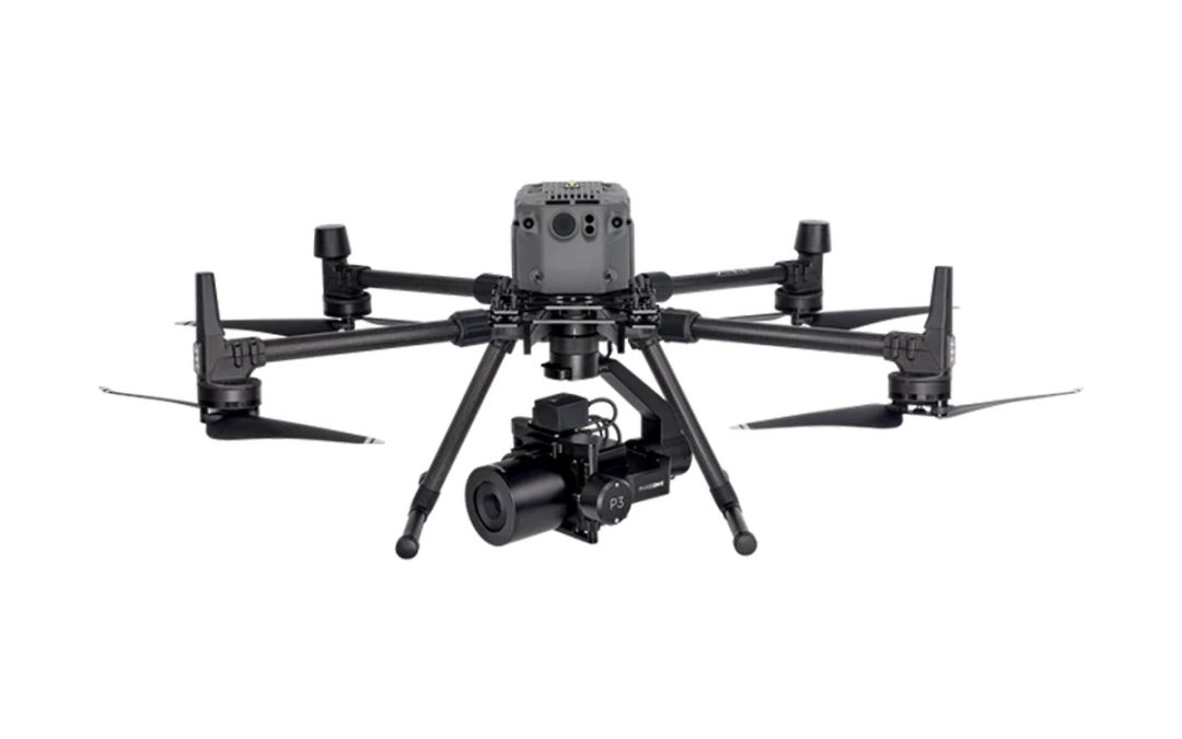
by Morgan Hartze | Feb 18, 2025
The P3-iXM100 for DJI M300/M350 with PhaseOne Platinum support 1-Year is a state-of-the-art drone imaging solution designed to enhance the productivity of inspection and mapping missions. It features a Phase One iXM 100MP camera, a range of RSM lenses, and a new...
")