by Morgan Hartze | Feb 17, 2025
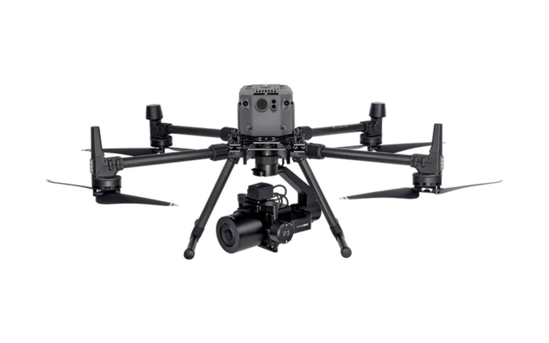
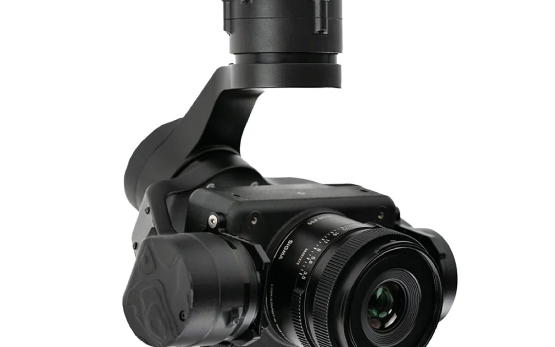
The Phase One P3 Payload provides a customizable solution for all your inspection needs. Choose your drone, your camera, and your lens, from our selection, to get all the finest details in one shot. Our iXM cameras are uniquely designed for UAVs and are fast, highly...
by Marco Ryan | Jan 7, 2025
The LR1 Payload is well suited for high-resolution mapping and imaging missions with the Freefly Astro. The LR1 Payload natively mounts to your Astro with the Freefly Smart Dovetail system.* This connection provides power and data communication from the camera to the...
by Marco Ryan | Jan 7, 2025
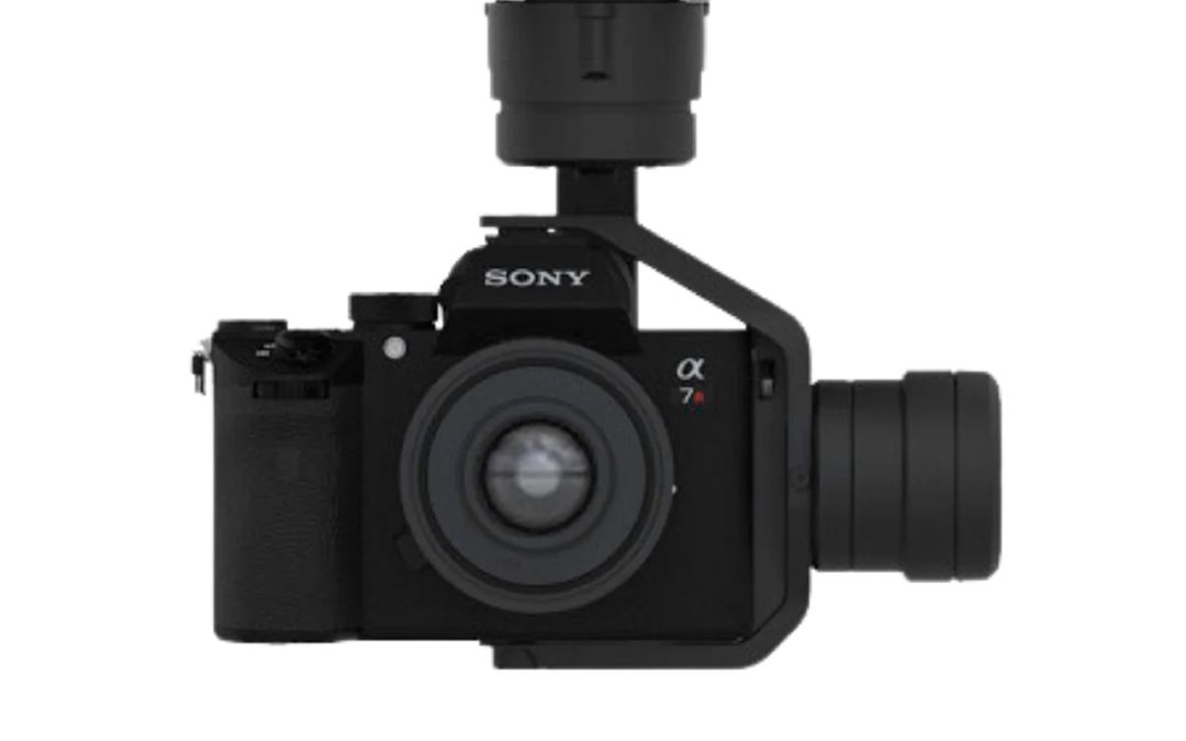
Freefly ASTRO Mapping Payload ONLY Each Mapping Payload includes a Freefly mapping gimbal, 61MP Sony Alpha 7R IVA, a 24mm lens, a USB drive to capture geo-tagged images and a foam insert that nests under the Astro in the Astro travel case. The Mapping Gimbal natively...
by Jenn Heinrich | Nov 26, 2024
Many products have several units available. The cost MAY differ due to condition, accompanying accessories, or other factors. Contact Bobbi at 320-654-6411 to discuss what options are available for your Used equipment needs! Your Name(Required) First Last Your...
by Marco Ryan | Sep 2, 2024
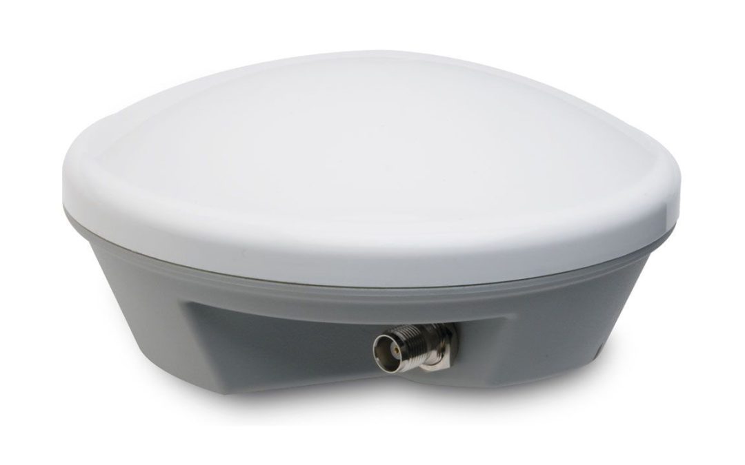
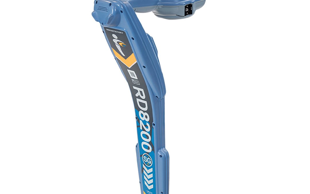
RD8200SG – Survey Grade Create and Maintain Utility Maps in a Single Operation Map while you locate Integrate utility locating into your mapping procedures Integrate mapping into your utility locating procedures, fluently Flexibility to work with the system that...
by SCS Cloud | Jun 15, 2024
The YellowScan Mapper is the next generation of integrated LiDAR solutions. Its low weight, mid-range capability, great point density as well as advanced accuracy and precision, makes the Mapper the best value for money in our portfolio. Technologies Inside: Applanix...
by SCS Cloud | Jun 15, 2024
The YellowScan Mapper+ is the next generation of integrated LiDAR solutions. This particularly lightweight system with long range capabilities, high-end point density, as well as advanced accuracy and precision, make it the perfect UAV LiDAR mapping tool for...
by SCS Cloud | Jun 15, 2024
Save Time and Money• No need to learn diverse software – UgCS enables supports for the majority of drones• The import and route creation from customer provided KML data will save 50% of your time• Save days of traveling and before leaving the site, validate acquired...
by SCS Cloud | Jun 15, 2024
FEATURES:• Waypoints, linear, circle, perimeter, and area scan tools• LiDAR Toolset• Automatic photogrammetry, vertical (facade) scan, corridor mapping, and SAR tools• Immersive 3D mission planning environment• KML/CSV data import• DEM import• Elevation profile and...
by SCS Cloud | Jun 15, 2024
• LiDAR Survey Planning Tools• Live Video Stream from UgCS for DJI to UgCS (currently compatible only with Android and Win)• Multiple SDK Connections• ADS-B Transponder• Compatible with UgCS Mapper to Perform Live Video Mapping

by SCS Cloud | Jun 15, 2024
Stabilized X32 Zoom Thermal Imagery | 4K Visual ExcellenceThe 32x zoom allows operators to see details clearly from up to 2 km (1.2 mi) away.The zoom image is coupled (blended) with images from ANAFI USA’s FLIR camera. This enables operators to detect hot spots with...
by SCS Cloud | Jun 15, 2024
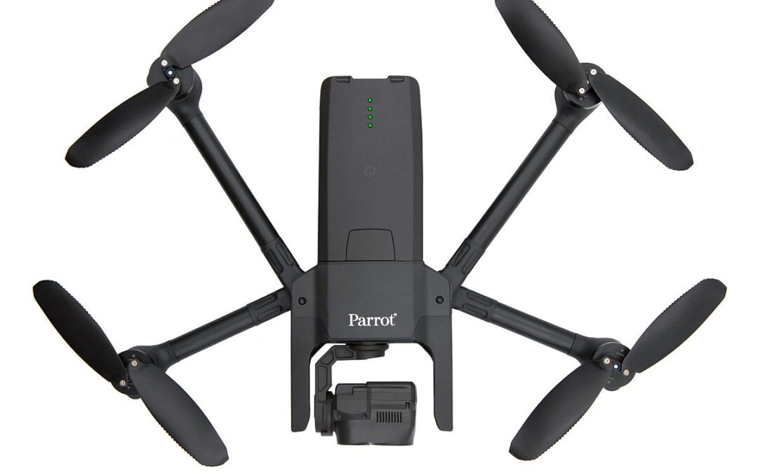
Parrot ANAFI Ai sets new standards and capabilities for professionals. It is a compact professional drone, built for work, setting a new communications standard, open to developers, with a full open source app, autonomous 1 click photogrammetry and new levels of...
by SCS Cloud | Jun 15, 2024
Stabilized X32 Zoom Thermal Imagery | 4K Visual ExcellenceThe 32x zoom is designed around two 21-megapixel cameras, allowing operators to see details clearly from up to 2 km (1.2 mi) away.The zoom image is coupled (blended) with images from ANAFI USA’s FLIR camera....
by SCS Cloud | Jun 15, 2024
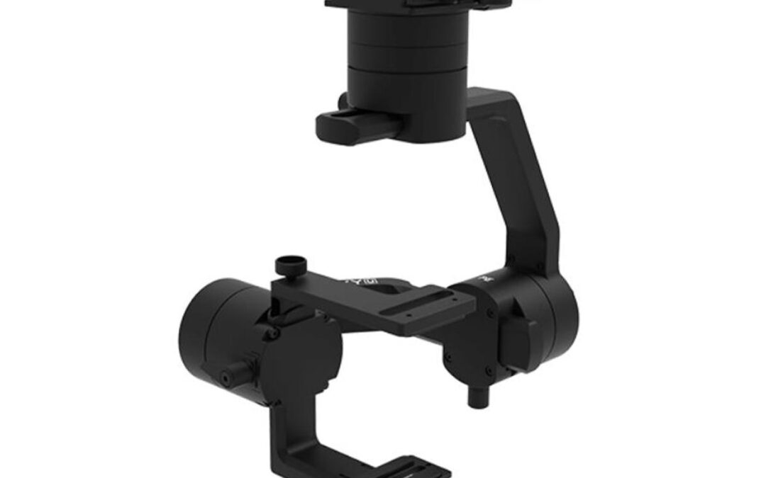
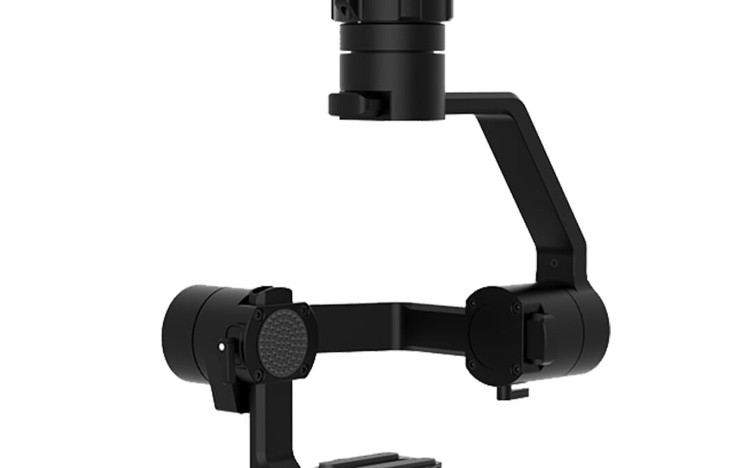
Support Open-architecture Pixhawk PlatformsAdhering to the Pixhawk Payload Bus standard, Gremsy PE is equipped with a new quick-release operating on a sliding mechanism, helping PE gimbals plug and play with the most Pixhawk-based platforms including Skynode, Pixhawk,...
by SCS Cloud | Jun 15, 2024
• Operation Modes: Motor On/Off; Lock; Follow / Mapping; Inverted / Front• Temperature Sensor• Gremsy Specialized Gimbal Drive Motors with Encoders• Micro USB Connection• Gremsy Advanced 32-Bit high performance ARM microprocessor• S-Bus/PPM Receiver Supported• Weight:...
by SCS Cloud | Jun 15, 2024
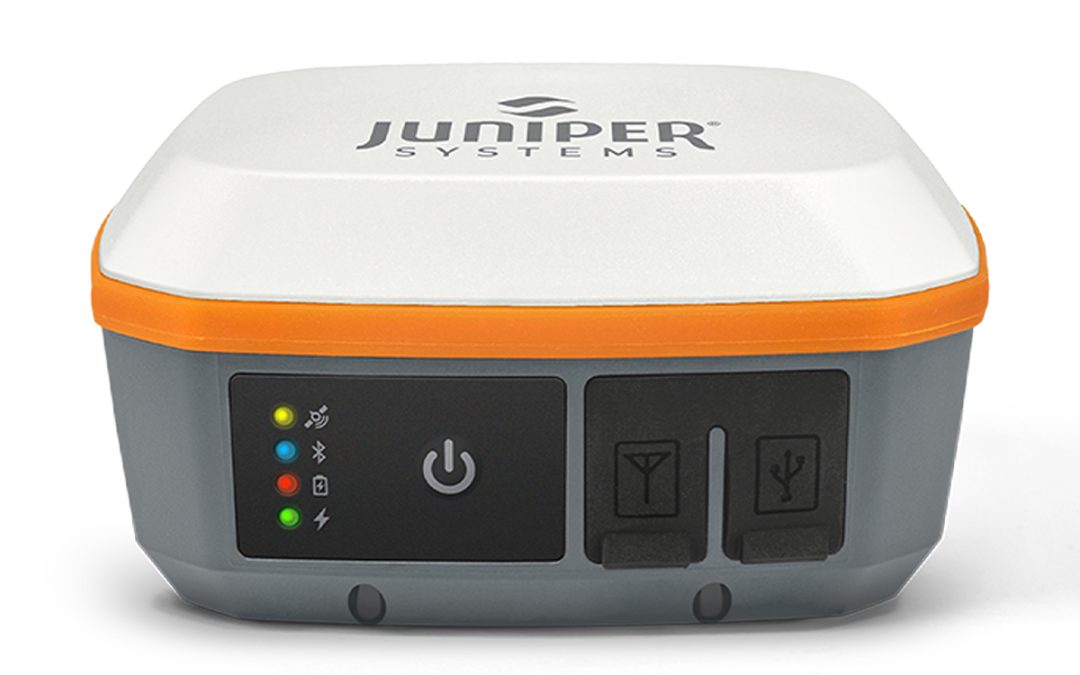
Scalable Accuracy The Geode GNS3 provides sub-meter, sub-foot, decimeter and centimeter accuracy options which include SBAS Corrections, RTK, Atlas, and the new Galileo High Accuracy Service. Open Interface (BYOD) Use Geode with any of Juniper Systems’ handhelds...
by SCS Cloud | Jun 15, 2024
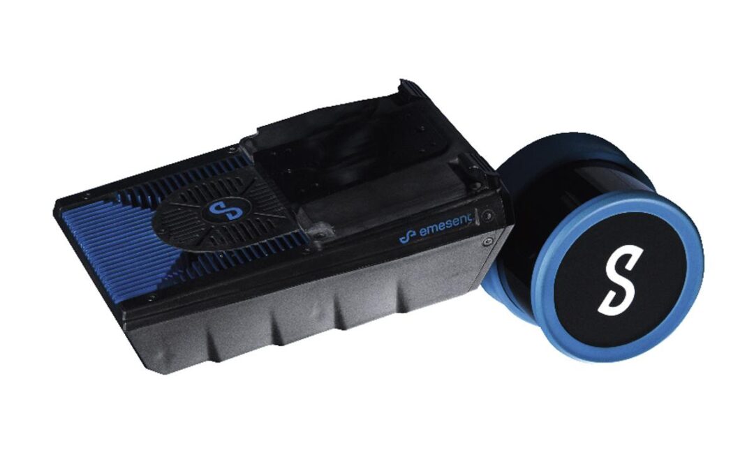
Home / Search results for “mapping” / Page 2 Emesent E00-HSTX-KIT Hovermap ST-X Kit Call for Price Emesent E00-HSTX-KIT Hovermap ST-X Kit Fast, Accurate, High-detail Mobile Data Capture Hovermap incorporates the latest in LiDAR sensing technology to offer...
by SCS Cloud | Jun 15, 2024
Your Go-to Tool for Aerial Photogrammetry Extraordinary Efficiency The P1 includes a full-frame, low-noise high-sensitivity sensor that can take a photo every 0.7s during the flight, and covering 3 km² [2] in a single flight. Remarkable Accuracy Equipped with a global...
by SCS Cloud | Jun 15, 2024
• Compact and Portable• 4/3 CMOS Wide Camera [1]• 56x Hybrid Zoom• 640 x 512px Thermal Camera [2]• 45-minute Maximum Flight Time [3]• DJI O3 Enterprise Transmission• Centimeter-level Positioning with RTK [4]• High-volume Loudspeaker [4]Compact and PortableStreamlined...
by SCS Cloud | Jun 15, 2024
• Compact and Portable• 4/3 CMOS Wide Camera [1]• 56x Hybrid Zoom• 640 x 512px Thermal Camera [2]• 45-minute Maximum Flight Time [3]• DJI O3 Enterprise Transmission• Centimeter-level Positioning with RTK [4]• High-volume Loudspeaker [4]Compact and PortableStreamlined...

by SCS Cloud | Jun 15, 2024
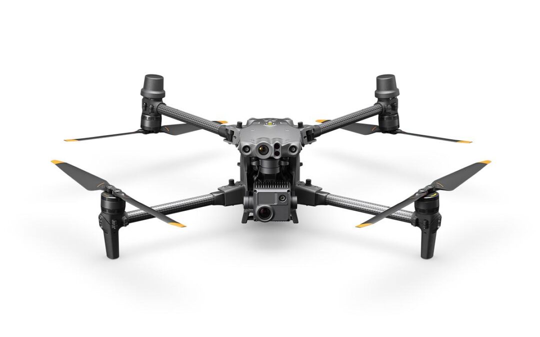
Capture Everything The M30 Series integrates wide, zoom, and thermal cameras (M30T only) with a laser rangefinder, which together can capture the aerial data you need, when you need it. Wide Camera • Equivalent Focal Length: 24mm, DFOV: 84° • 12MP 1/2in CMOS Sensor •...
by SCS Cloud | Jun 15, 2024
Capture Everything The M30 Series integrates wide, zoom, and thermal cameras (M30T only) with a laser rangefinder, which together can capture the aerial data you need, when you need it. Wide Camera • Equivalent Focal Length: 24mm, DFOV: 84° • 12MP 1/2in CMOS Sensor •...
by SCS Cloud | Jun 15, 2024
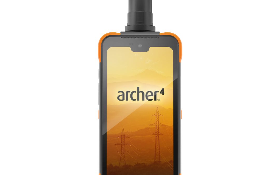
Reliable Mobile Operating System The Archer 4 runs on the Android 14 operating system and will support upgrades through Android 18, providing security and compatibility for years to come. The Archer 4 is also Google Mobile Services certified to provide users with a...
by SCS Cloud | Jun 15, 2024
SPECIFICATIONS: • 50kg spreading payload [1] • 40kg spraying payload [1] • Active Phased Array Radar + Binocular Vision • Dual Atomized Spraying System • Supports flight spraying / spreading and RC mapping • Core Modules IPX6K [2] • EFI Generator 15% fuel saving [3] •...
")