")
SHOP UNMANNED SOLUTIONS
EVERY PLACE IS IN REACH WITH OUR UNMANNED SOLUTIONS
FEATURED UNMANNED PRODUCTS
Showing 341–352 of 352 results
-

Juniper Systems Uinta 29117 Software (1-Year) – Windows 10 Professional License
Call for Price

Juniper Systems Uinta 29117 Software (1-Year) – Windows 10 Professional License
Call for PriceJuniper Systems Uinta 29117 Software (1-Year) – Windows 10 Professional License
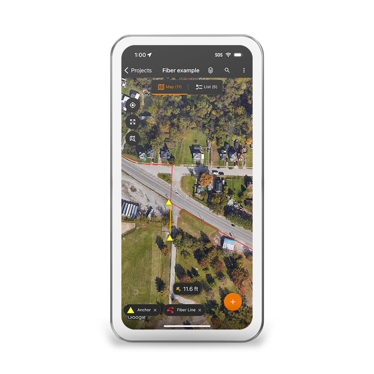
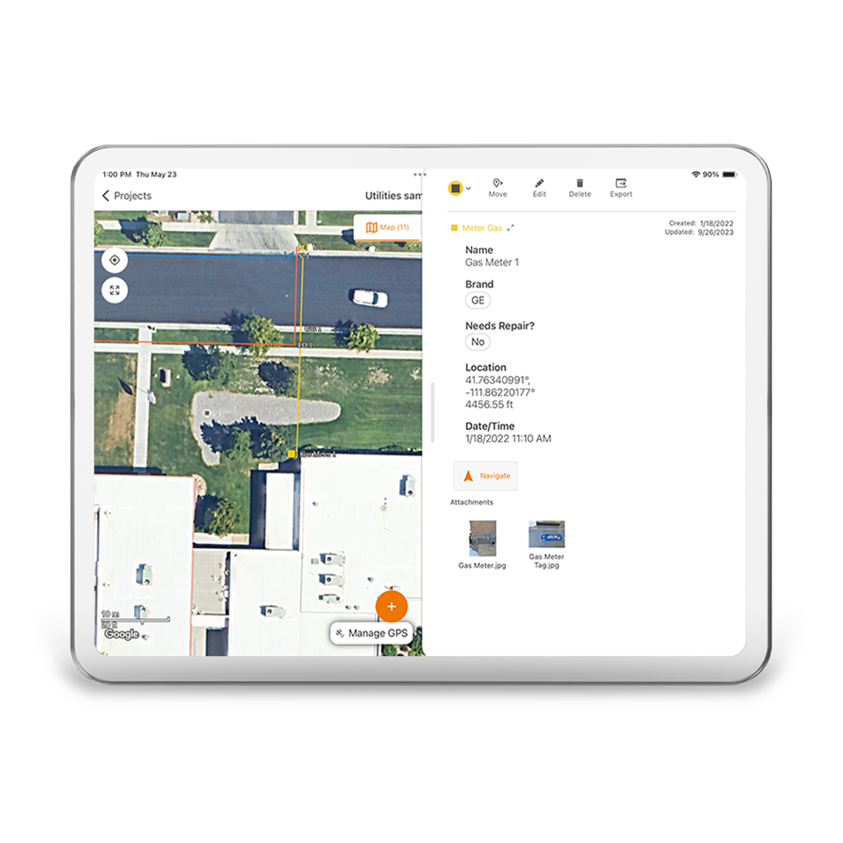
Your Data. Your Way.
With Uinta, field data collection has never been easier. Our intuitive software allows users to effortlessly gather accurate data using customizable forms and real-time GPS integration ensures that your data is not only accurately mapped but also easily accessible for further analysis and reporting. Whether you are conducting environmental surveys, managing assets, or performing inspections, Uinta’s user-friendly interface helps you capture critical information quickly and accurately. The software supports a wide range of data types, including text, photos, and geospatial coordinates, making it versatile enough to handle any project. Cloud storage back-up allows you to save your data in a more accessible place, and when you are offline, Uinta saves your data locally and will upload once connection is reestablished.
Quick View -
Juniper Systems Uinta 29118 Software (3-Year) – License
Call for Price Juniper Systems Uinta 29118 Software (3-Year) – License
Call for PriceJuniper Systems Uinta 29118 Software (3-Year) – License
Your Data. Your Way.
With Uinta, field data collection has never been easier. Our intuitive software allows users to effortlessly gather accurate data using customizable forms and real-time GPS integration ensures that your data is not only accurately mapped but also easily accessible for further analysis and reporting. Whether you are conducting environmental surveys, managing assets, or performing inspections, Uinta’s user-friendly interface helps you capture critical information quickly and accurately. The software supports a wide range of data types, including text, photos, and geospatial coordinates, making it versatile enough to handle any project. Cloud storage back-up allows you to save your data in a more accessible place, and when you are offline, Uinta saves your data locally and will upload once connection is reestablished.Quick View -
Juniper Systems Uinta 29119 Software (1-Year) – Extra Field License
Call for Price Juniper Systems Uinta 29119 Software (1-Year) – Extra Field License
Call for PriceJuniper Systems Uinta 29119 Software (1-Year) – Extra Field License
Your Data. Your Way.
With Uinta, field data collection has never been easier. Our intuitive software allows users to effortlessly gather accurate data using customizable forms and real-time GPS integration ensures that your data is not only accurately mapped but also easily accessible for further analysis and reporting. Whether you are conducting environmental surveys, managing assets, or performing inspections, Uinta’s user-friendly interface helps you capture critical information quickly and accurately. The software supports a wide range of data types, including text, photos, and geospatial coordinates, making it versatile enough to handle any project. Cloud storage back-up allows you to save your data in a more accessible place, and when you are offline, Uinta saves your data locally and will upload once connection is reestablished.
Quick View -
Juniper Systems Uinta 29120 Software (3-Year) – Professional License
Call for Price Juniper Systems Uinta 29120 Software (3-Year) – Professional License
Call for PriceJuniper Systems Uinta 29120 Software (3-Year) – Professional License
Your Data. Your Way.
With Uinta, field data collection has never been easier. Our intuitive software allows users to effortlessly gather accurate data using customizable forms and real-time GPS integration ensures that your data is not only accurately mapped but also easily accessible for further analysis and reporting. Whether you are conducting environmental surveys, managing assets, or performing inspections, Uinta’s user-friendly interface helps you capture critical information quickly and accurately. The software supports a wide range of data types, including text, photos, and geospatial coordinates, making it versatile enough to handle any project. Cloud storage back-up allows you to save your data in a more accessible place, and when you are offline, Uinta saves your data locally and will upload once connection is reestablished.
Quick View -
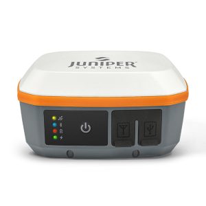
Juniper Systems Geode GNS3H-CFG(13759) Single-Frequency Antenna Model Receiver
Call for Price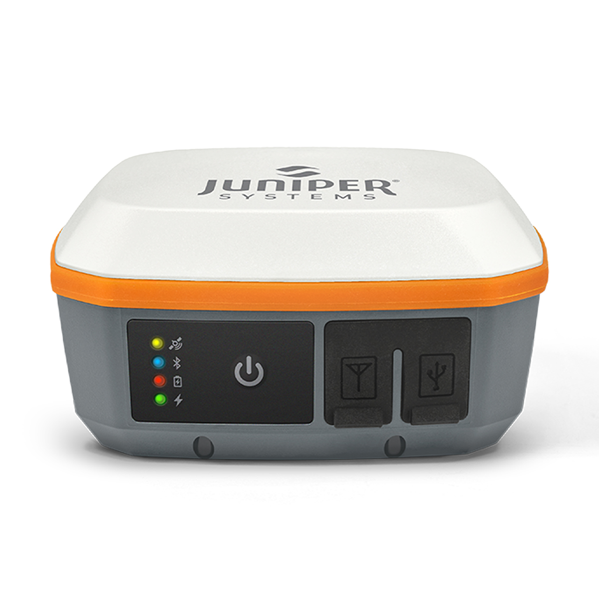
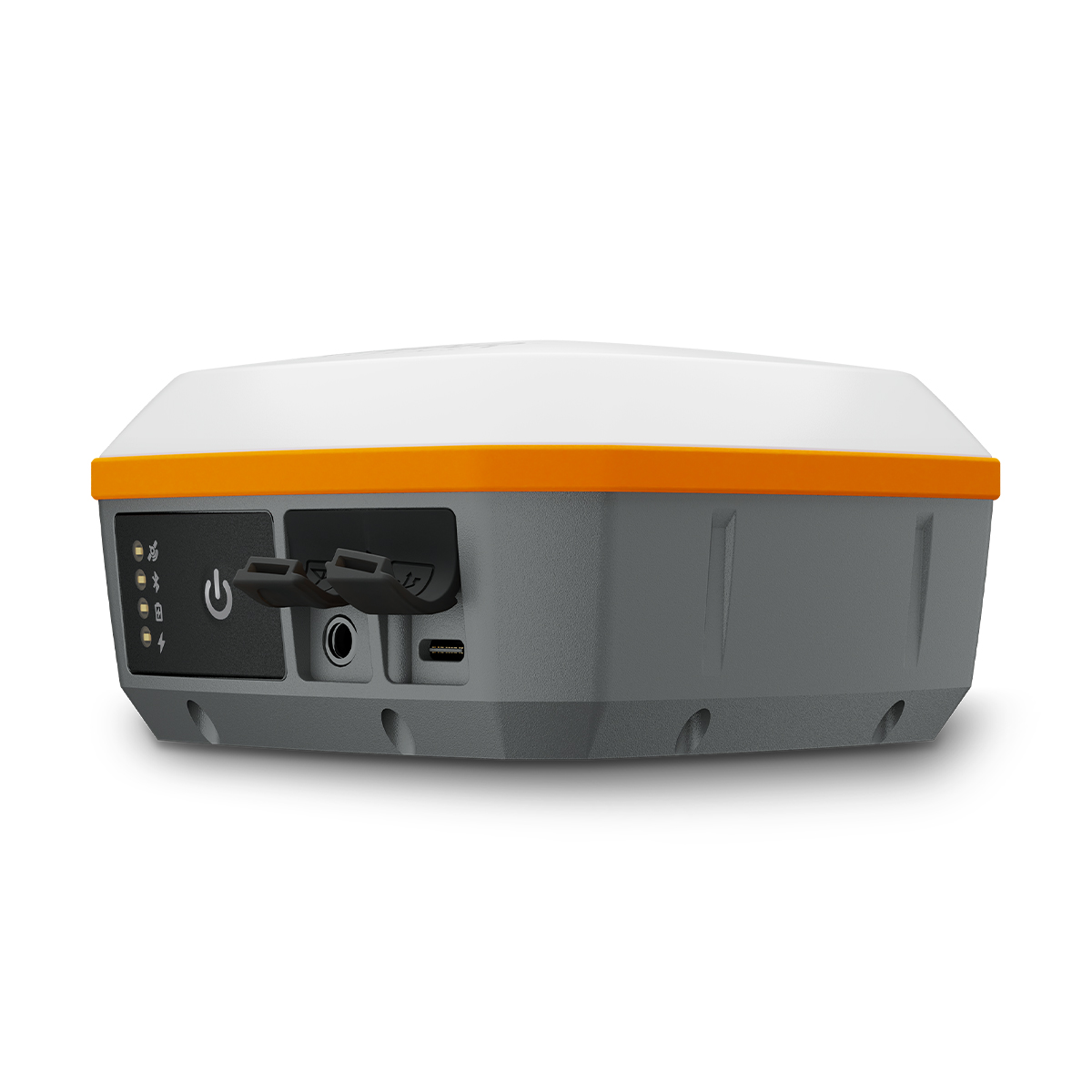
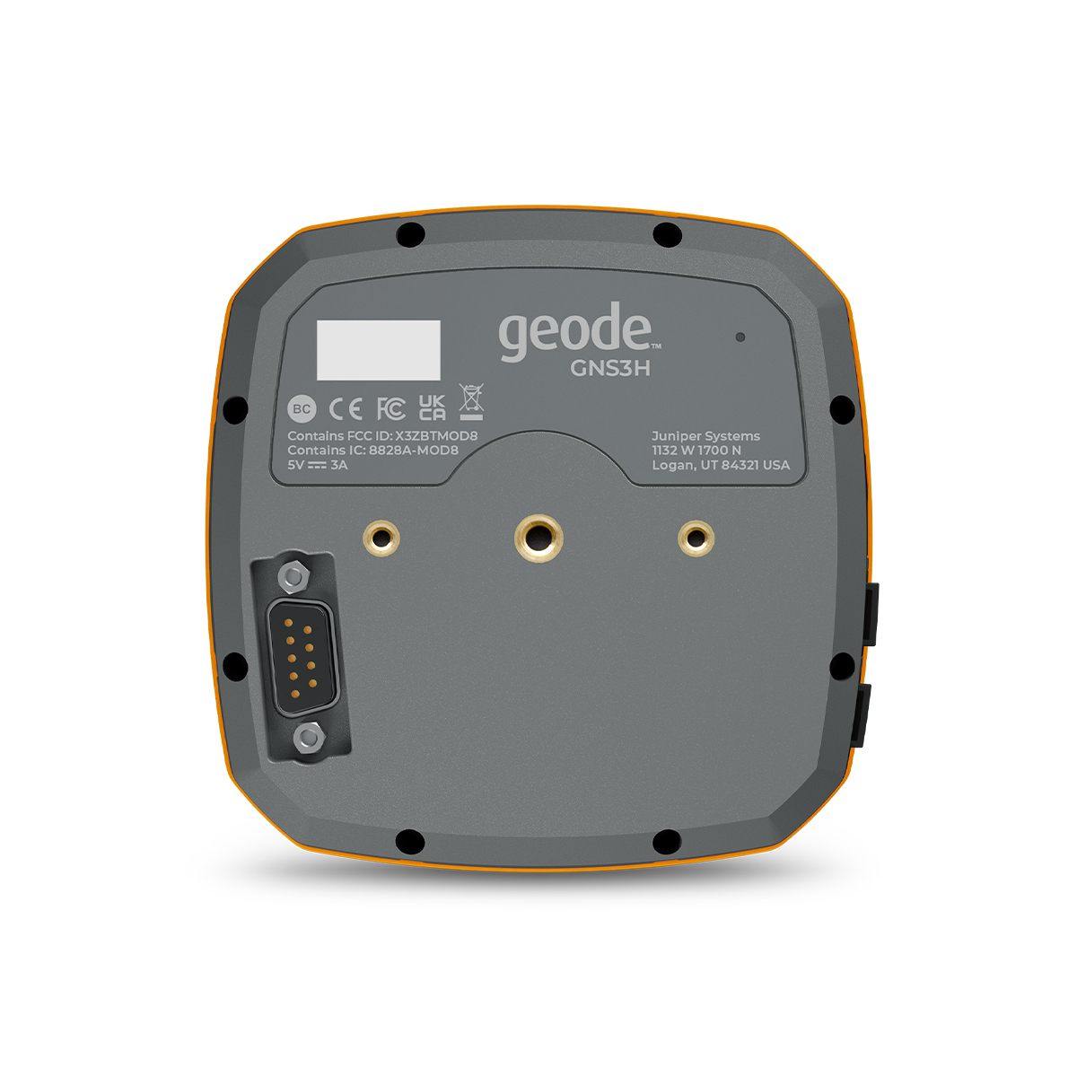
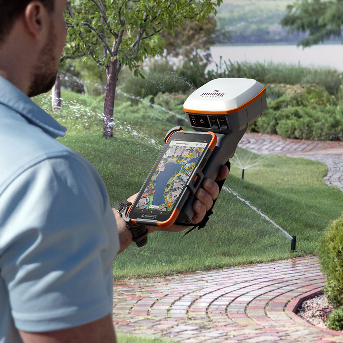
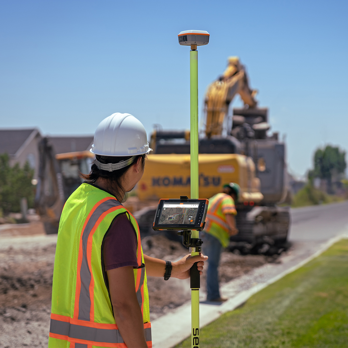
Juniper Systems Geode GNS3H-CFG(13759) Single-Frequency Antenna Model Receiver
Call for PriceQuick View -

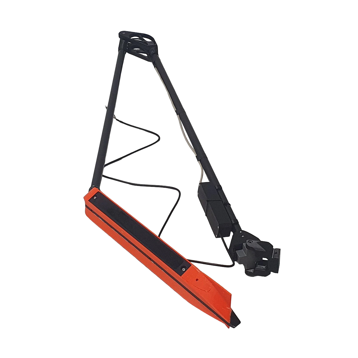
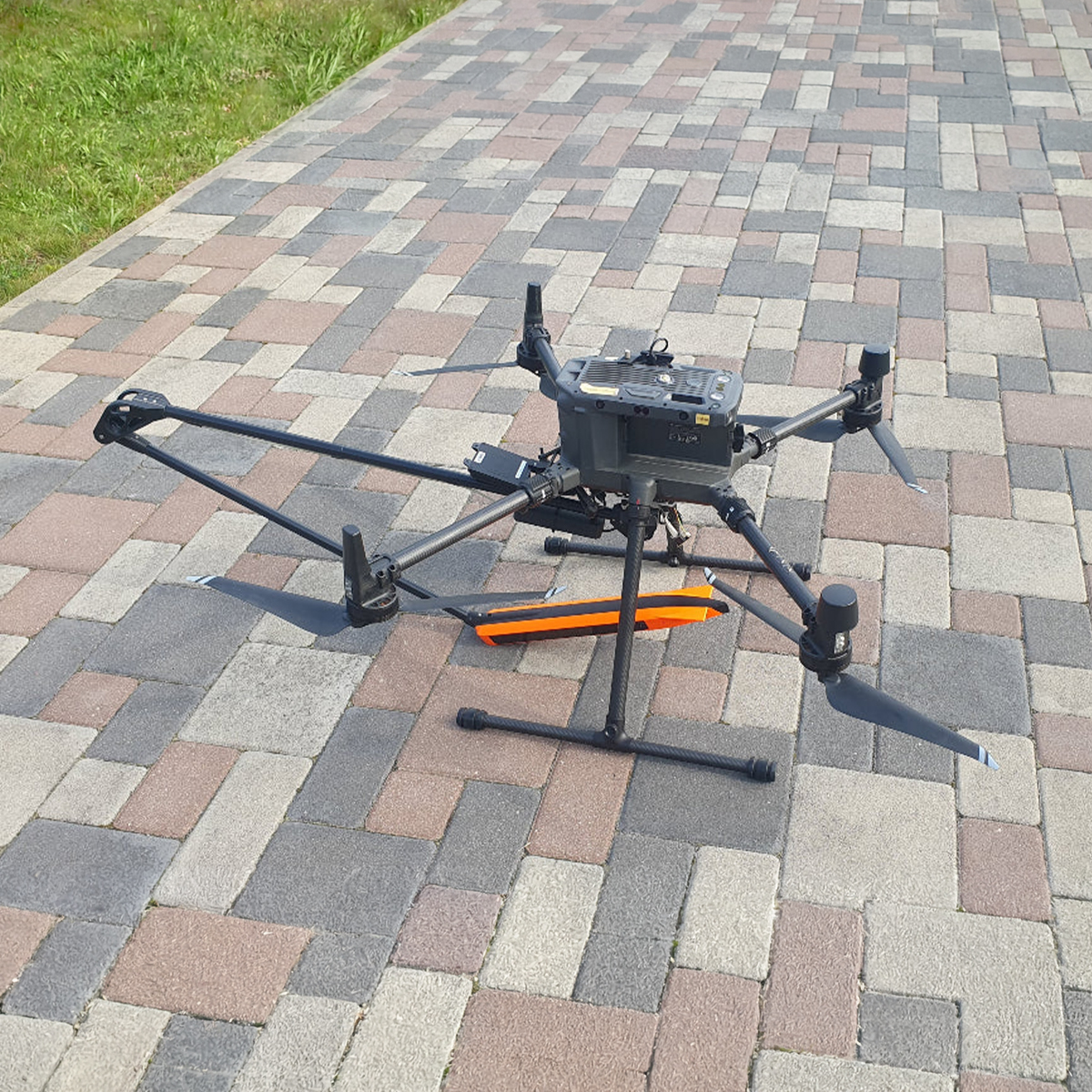
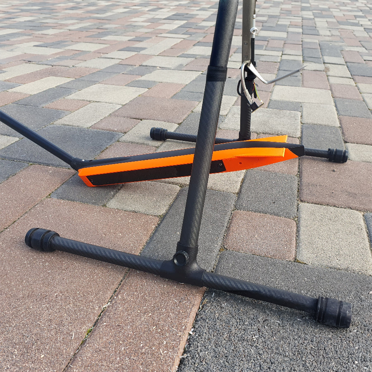
YellowScan Venturer YSVENTKIT-AP LiDAR System
Call for Price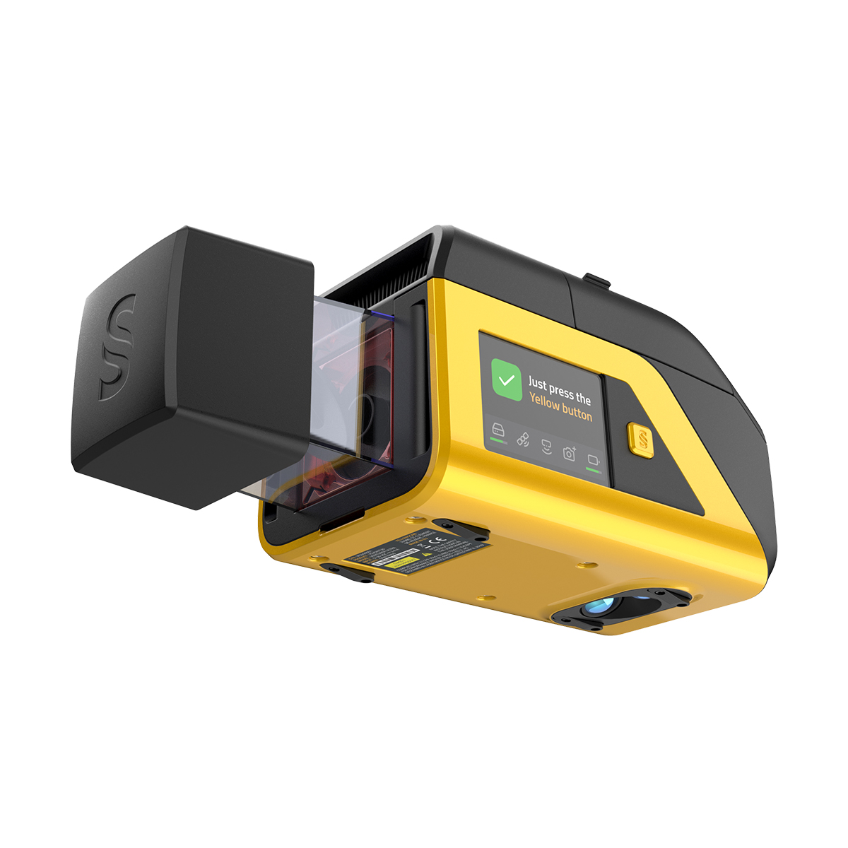

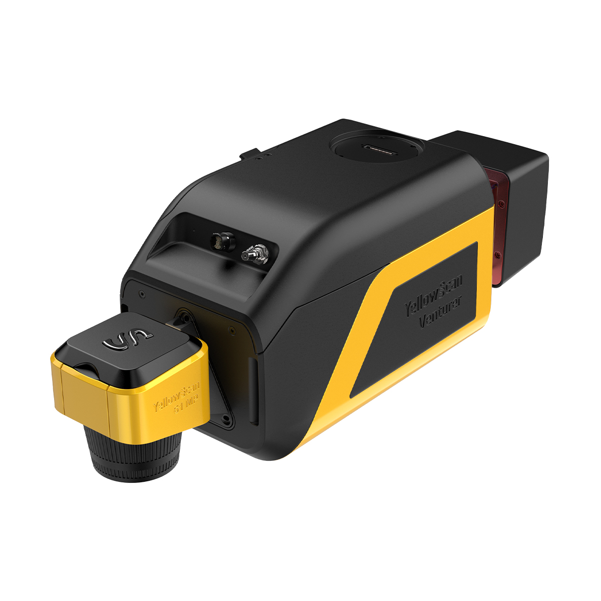
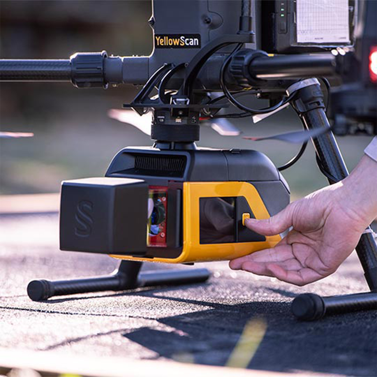
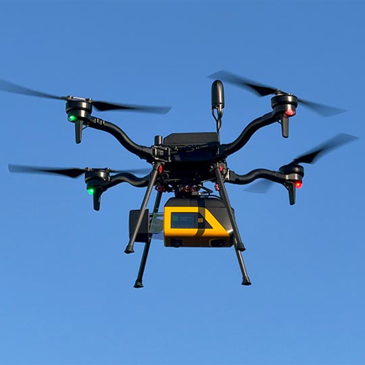

YellowScan Venturer YSVENTKIT-AP LiDAR System
Call for PriceYellowScan Venturer YSVENTKIT-AP LiDAR System
Confidence When it Matters Most
Built for survey and government missions where there is no second chance to fly, the YellowScan Venturer is an NDAA-compliant, survey-grade LiDAR system designed to remove uncertainty in the field. It gives teams confidence at takeoff, reliable results and full control over locally processed data through our dedicated CloudStation software.
Quick View -
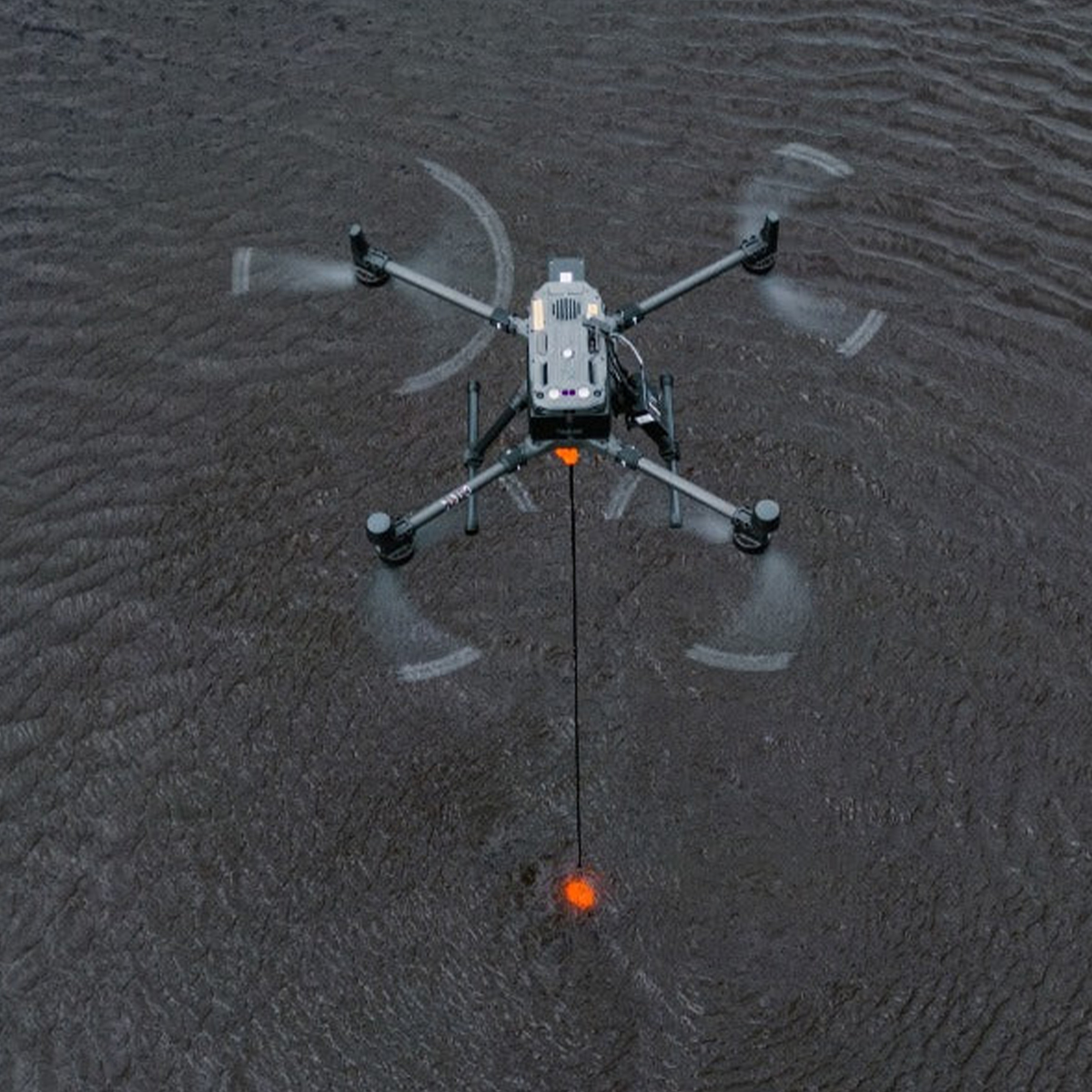
SPH Engineering EchoNIMBUS-MBES Multibeam Echosounder Payload
Call for Price


SPH Engineering EchoNIMBUS-MBES Multibeam Echosounder Payload
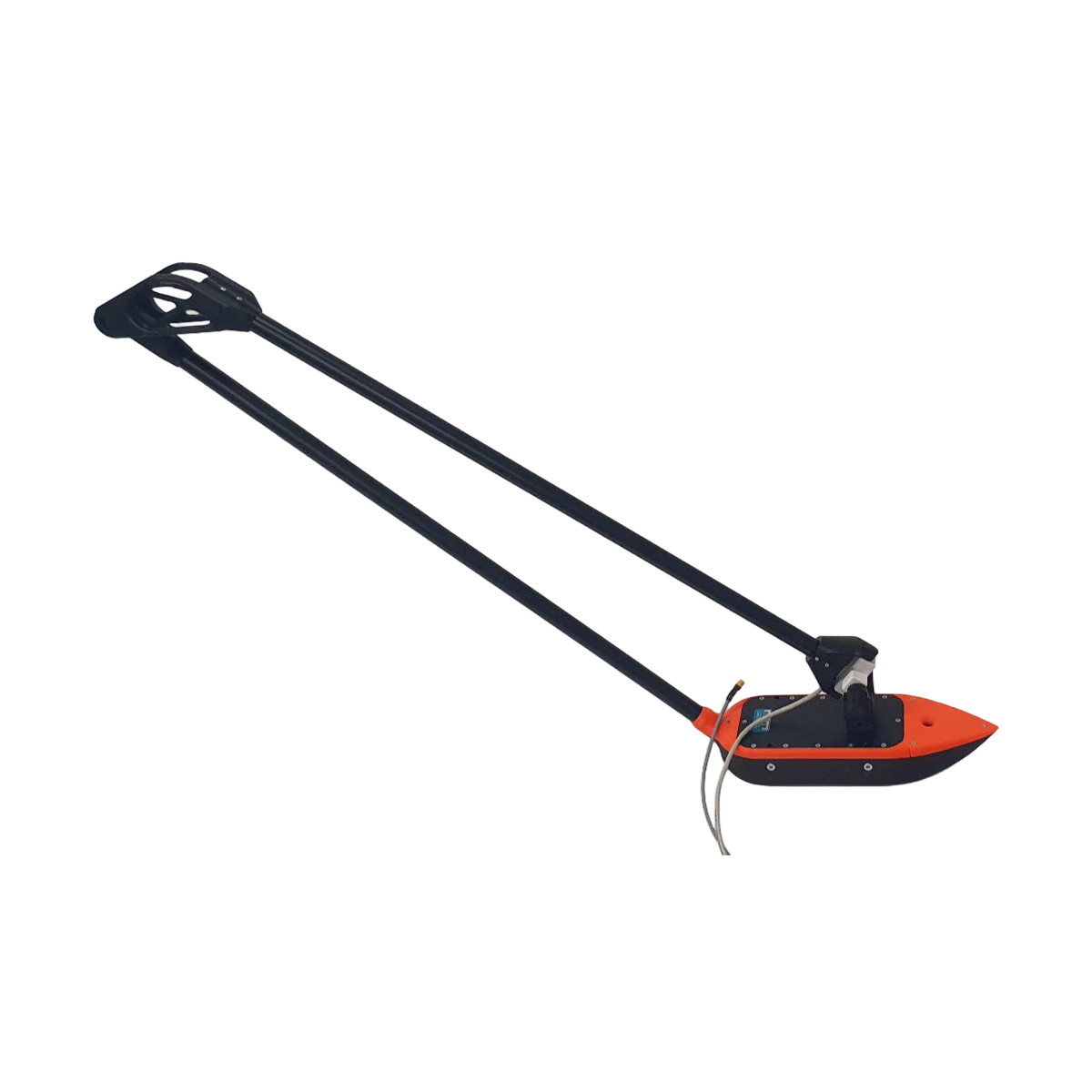
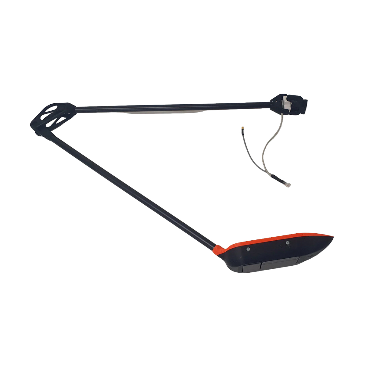
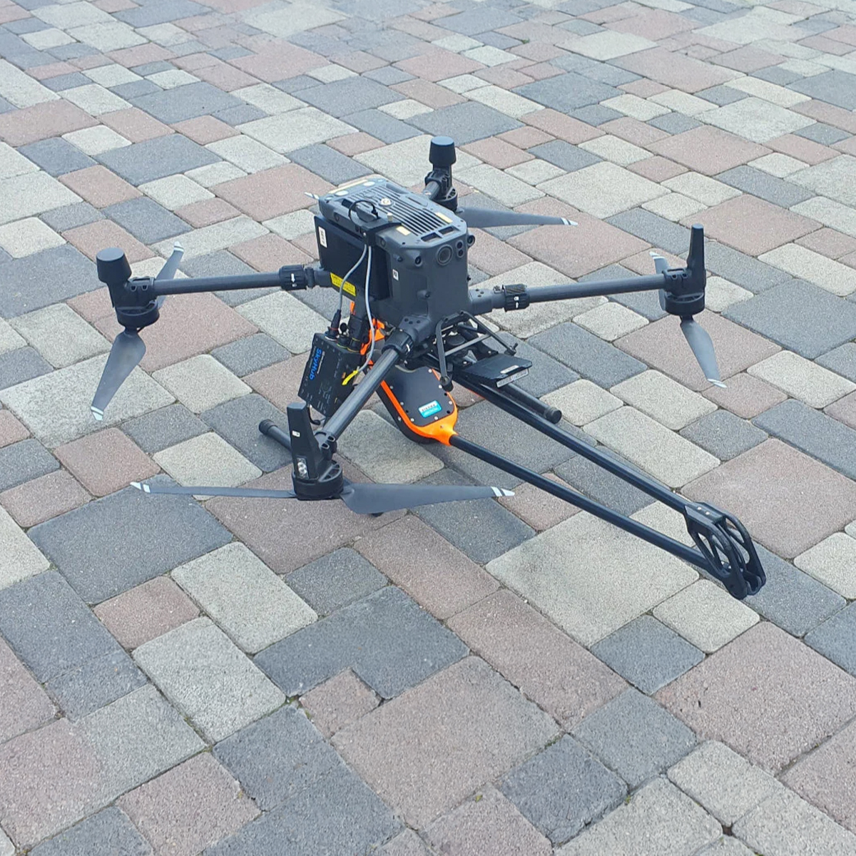
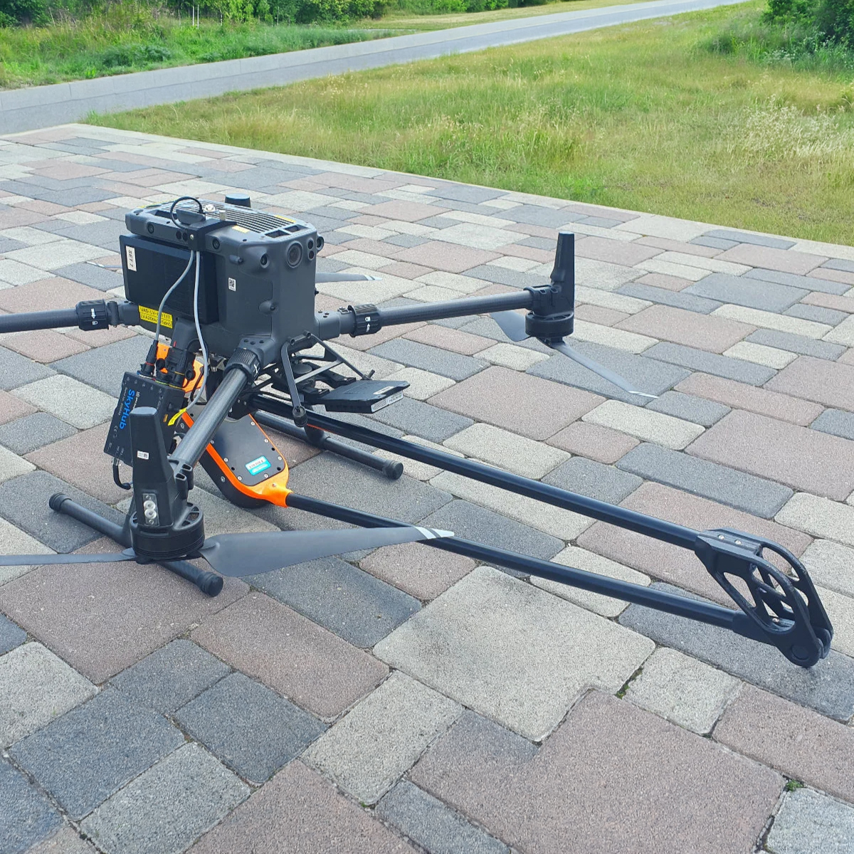
Call for PriceEchoNIMBUS-MBES – Drone-Based Multibeam Echosounder
The EchoNIMBUS-MBES integrated with SPH Engineering’s UgCS SkyHub system transforms UAVs into efficient bathymetric survey tools. Mounted beneath a drone and operated from the air, the EchoNIMBUS-MBES captures precise 3D bathymetric data over shallow and difficult-to-access waters, such as reservoirs, rivers, ponds, or flooded areas. This drone-based solution eliminates the need for manned boats, providing a safer and faster workflow. Each flight collects dense bathymetric coverage for high-fidelity bottom modeling, making it ideal for engineering, environmental, and hydrographic applications.
Quick View -
New!

SPH Engineering EchoNIMBUS-SSS Side-scan Sonar Payload
Call for Price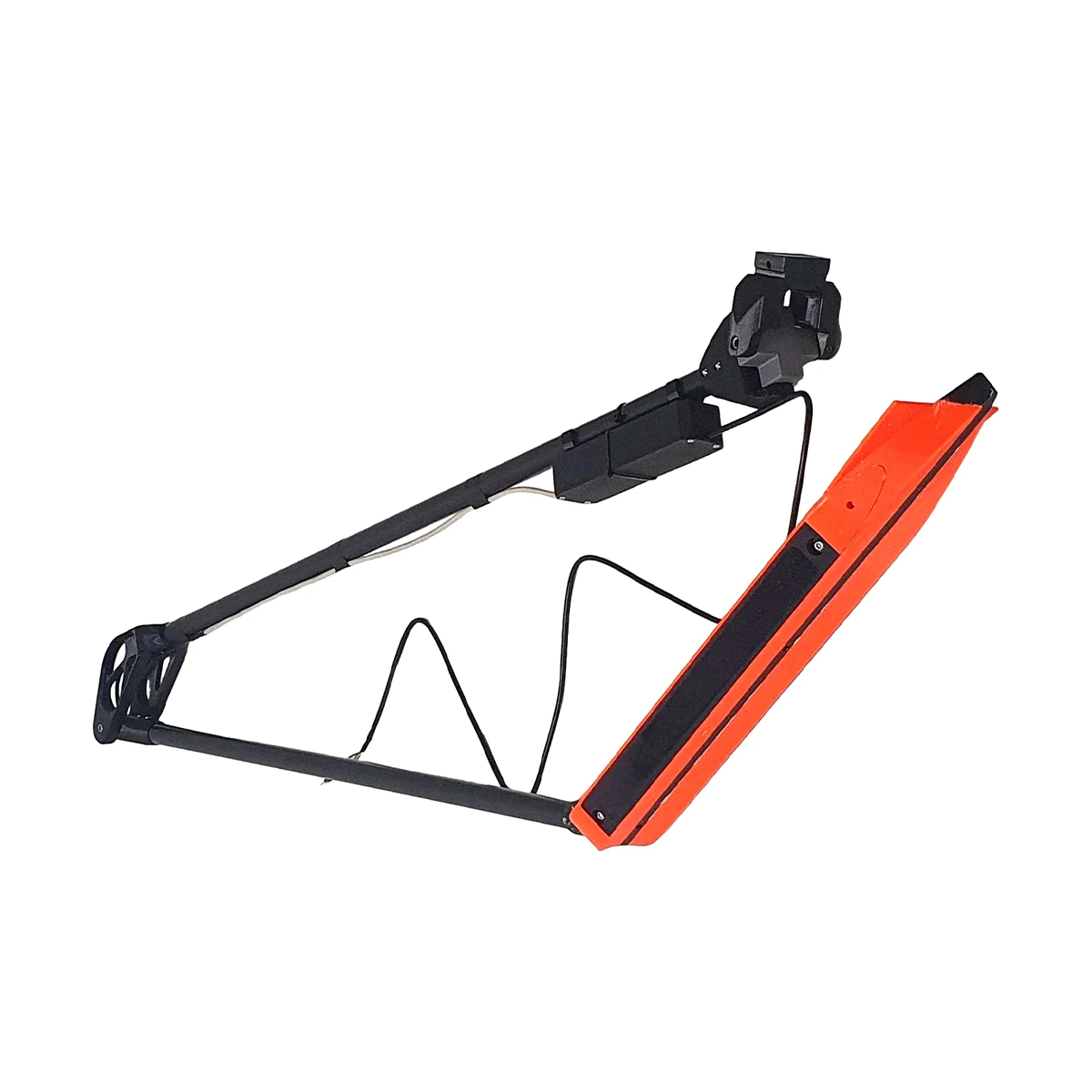


SPH Engineering EchoNIMBUS-SSS Side-scan Sonar Payload
Call for PriceSPH Engineering EchoNIMBUS-SSS Side-scan Sonar Payload
Omniscan 450SS is a traditional side-scan sonar with separate transducer and PCBA. It has a tall and very narrow fan beam for high along-track resolution and long range. The Omniscan 450 SS has a long 150 m range rating and 0.5 degree beam width for high along-track resolution. Cross track resolution is user settable up to 1/1200th of range.
Quick View -
New!

SPH Engineering IS-EL-ECT-400S EchoLogger Echo Sounder
Call for Price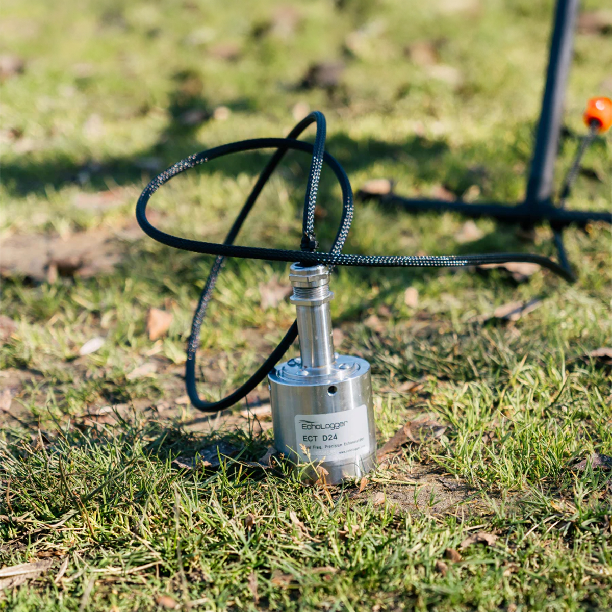
SPH Engineering IS-EL-ECT-400S EchoLogger Echo Sounder
Call for PriceSPH Engineering IS-EL-ECT-400S EchoLogger Echo Sounder
EchoLogger ECT 400S echo sounder with tilt and temperature sensor, harness, housing, and mountings for the drone.
Quick View -
New!

SPH Engineering IS-EL-ECT-D052S EchoLogger Echo Sounder
Call for Price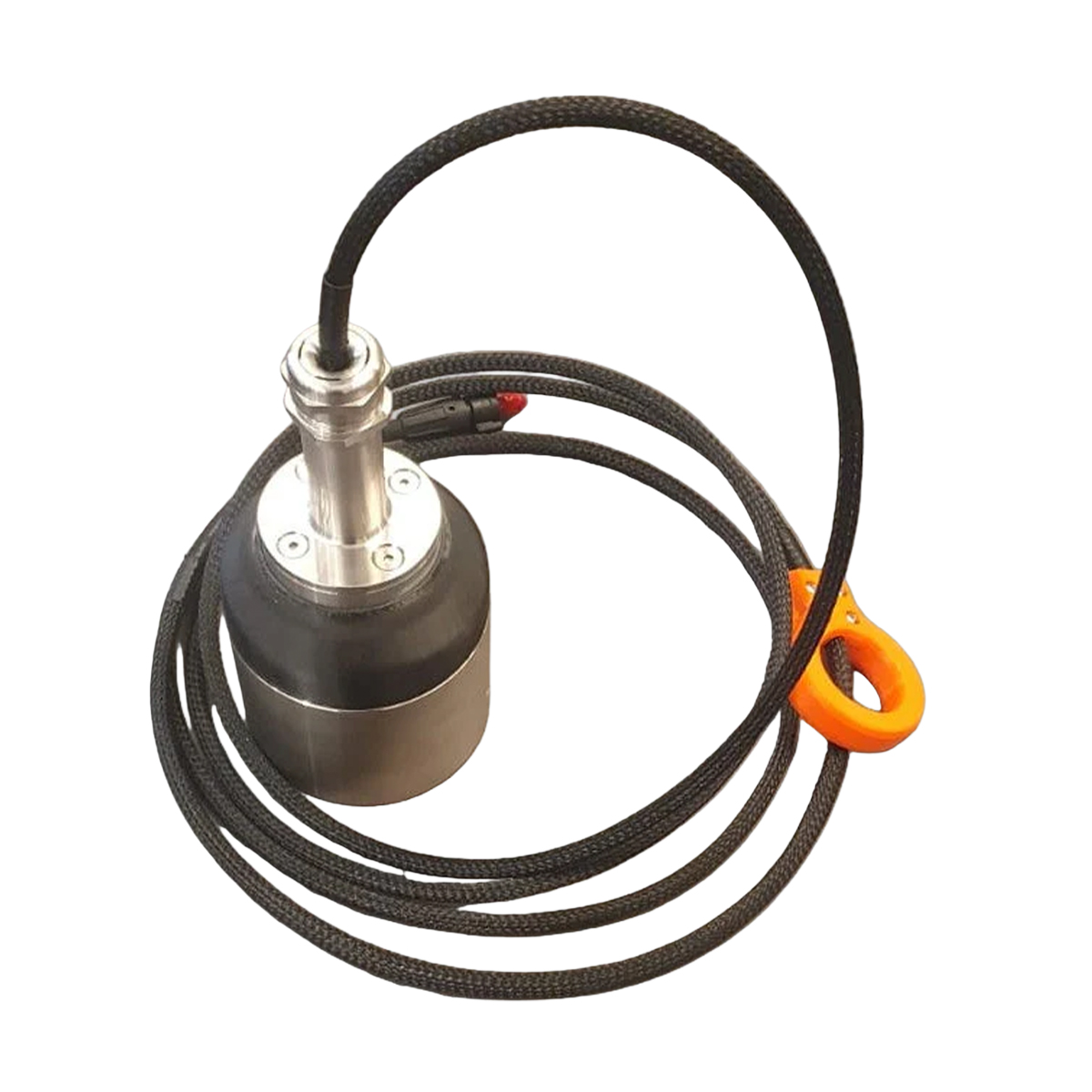
SPH Engineering IS-EL-ECT-D052S EchoLogger Echo Sounder
Call for PriceSPH Engineering IS-EL-ECT-D052S EchoLogger Echo Sounder
EchoLogger ECT D052S dual-frequency echo sounder with tilt and temperature sensor, harness, housing, and mountings for the drone.
Quick View -
New!

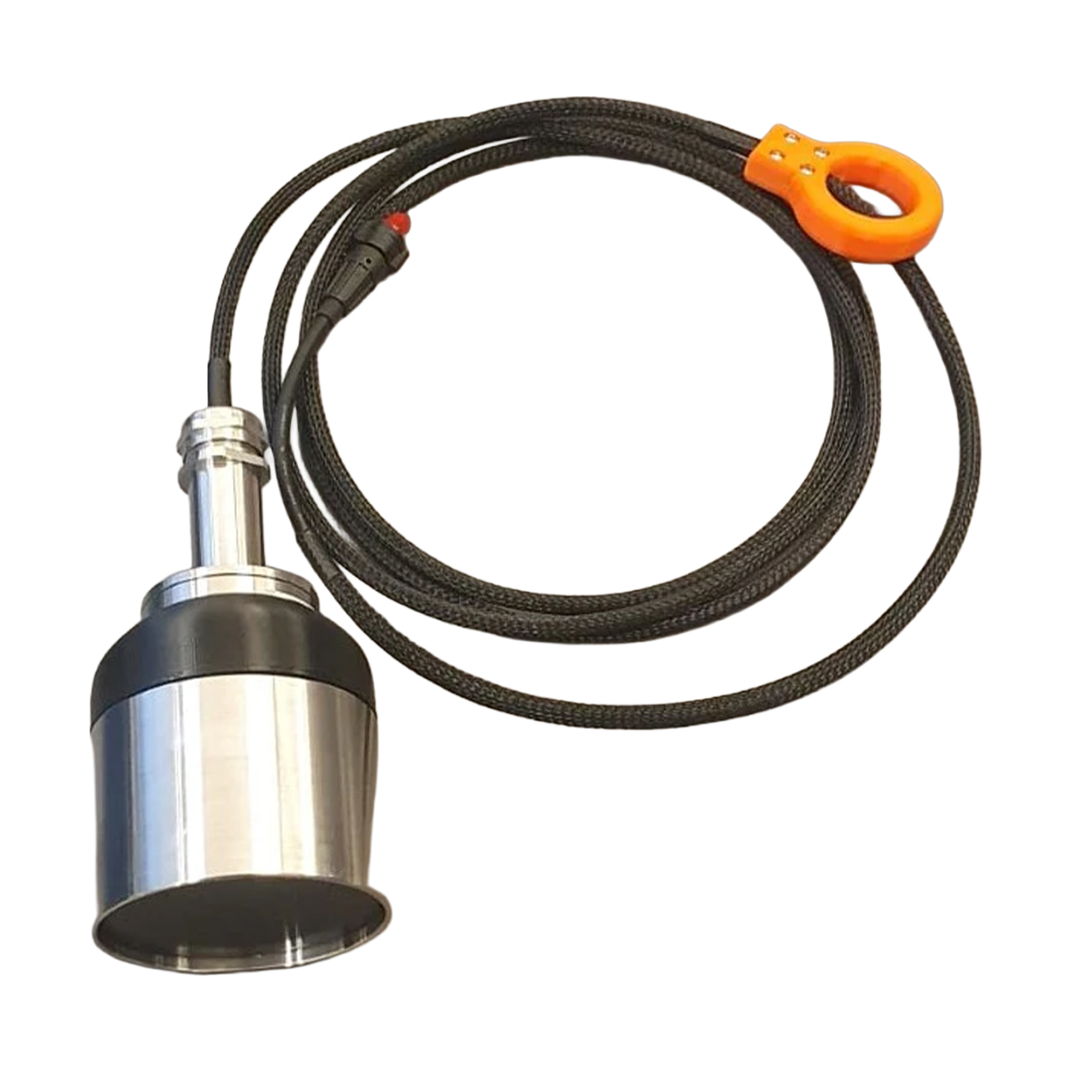
SPH Engineering IS-EL-ECT-D24S EchoLogger Echo Sounder
Call for Price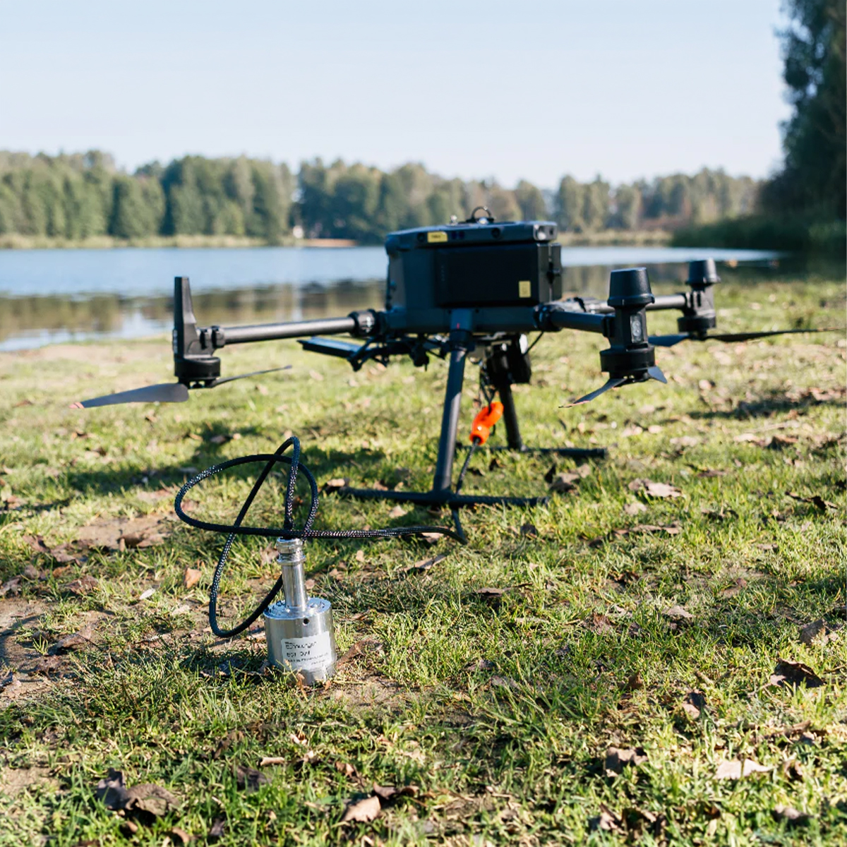
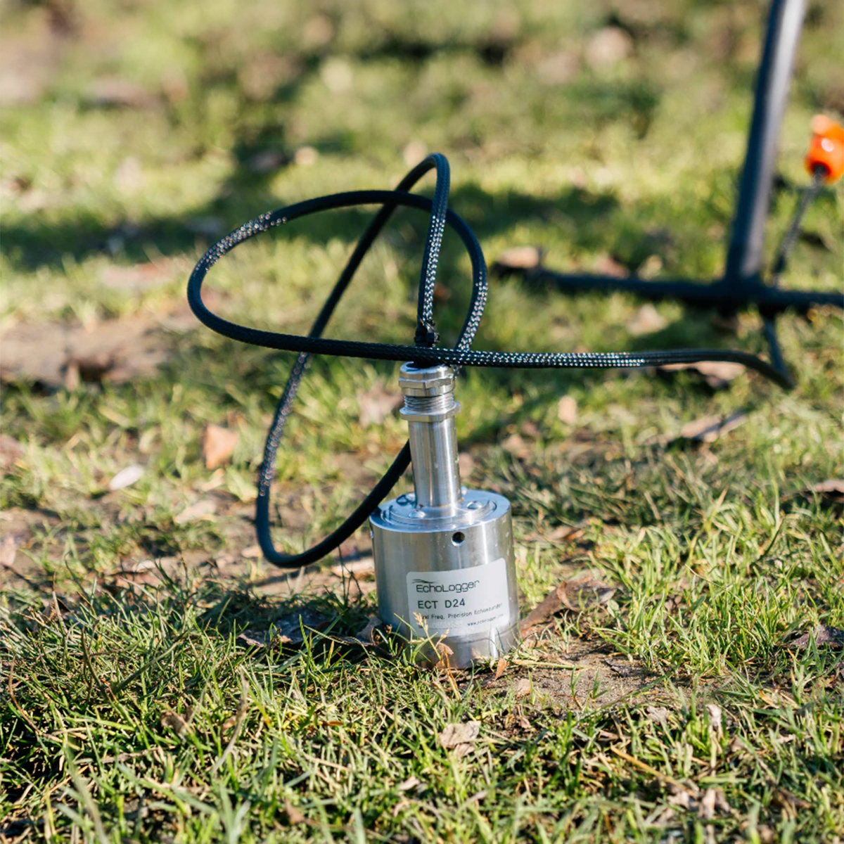
SPH Engineering IS-EL-ECT-D24S EchoLogger Echo Sounder
Call for PriceSPH Engineering IS-EL-ECT-D24S EchoLogger Echo Sounder
EchoLogger ECT D24S dual-frequency echo sounder with tilt and temperature sensor, harness, housing, and mountings for the drone.
Quick View -
New!

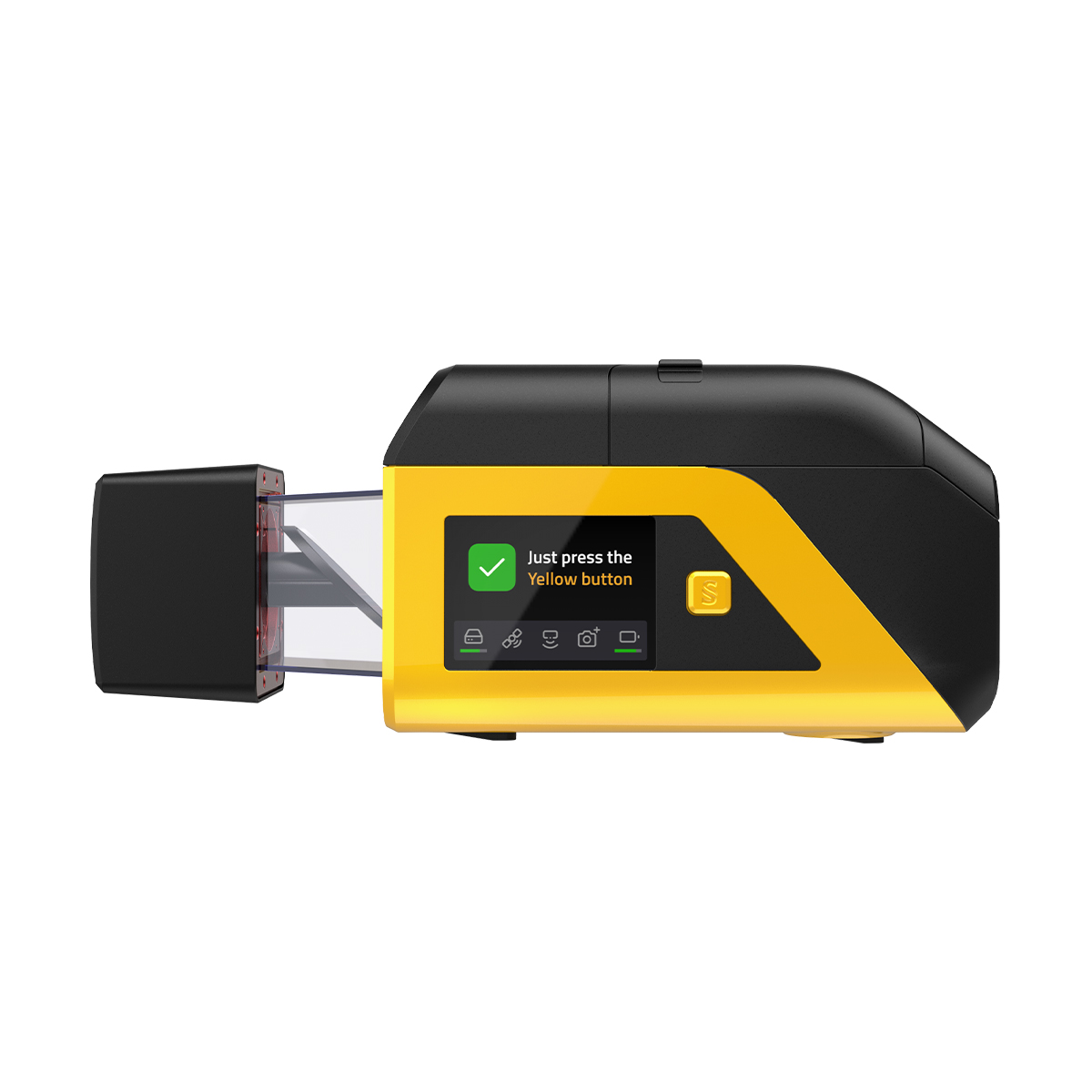
Emesent E00-GX1 RTK SLAM Scanner
Call for Price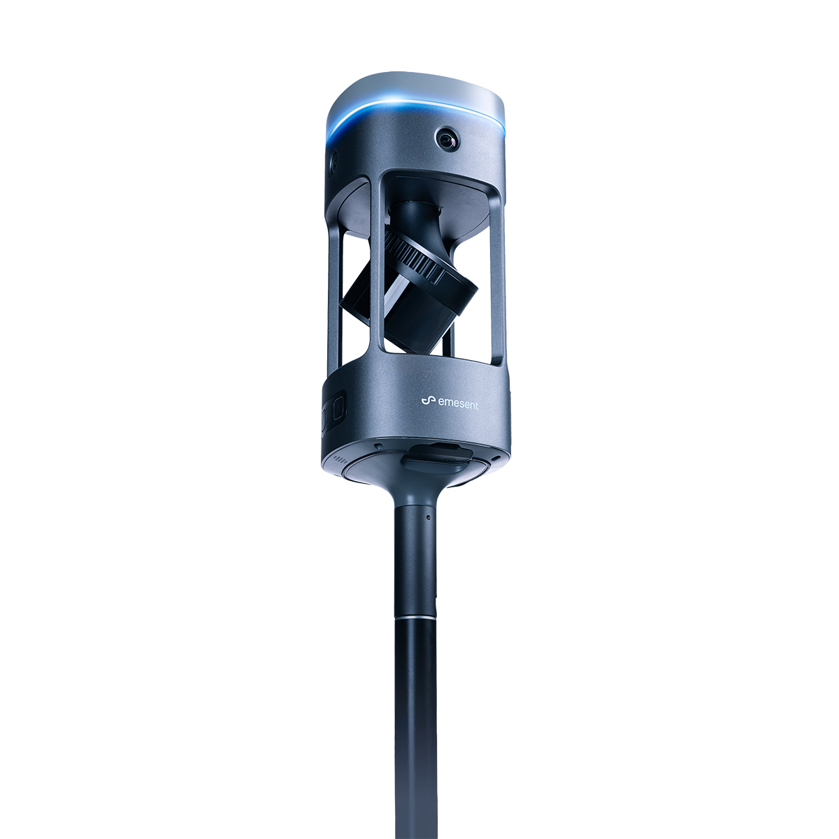
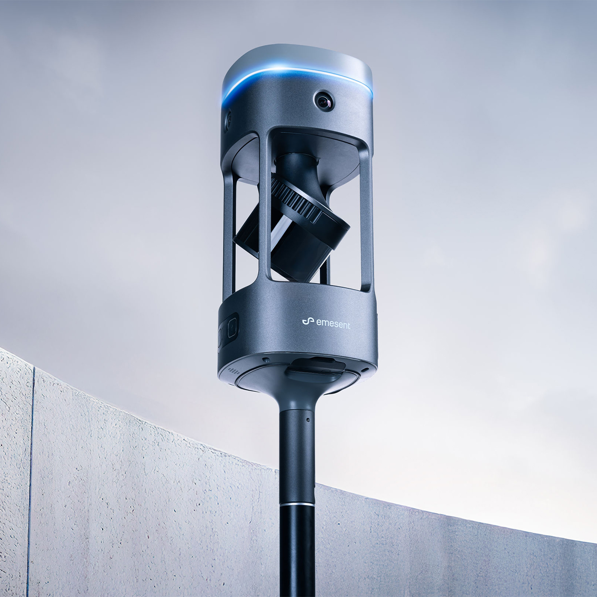


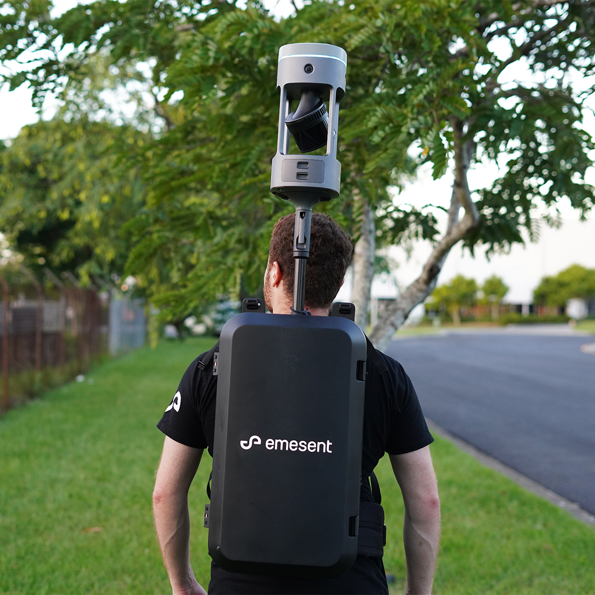
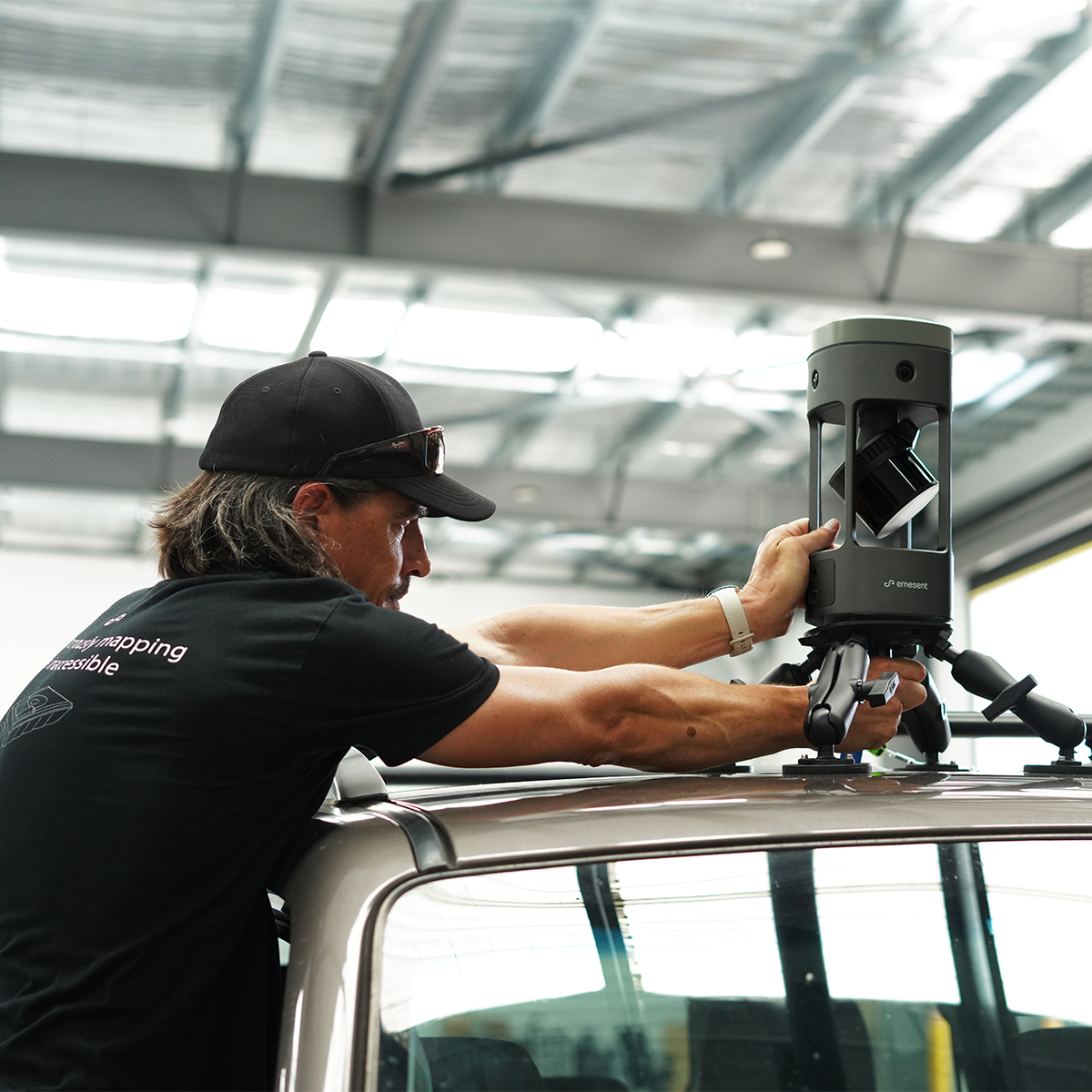

Emesent E00-GX1 RTK SLAM Scanner
Call for PriceEmesent E00-GX1 RTK SLAM Scanner
Reliable, highly accurate SLAM that works in any environment.
Emesent GX1 is the world’s most accurate RTK SLAM scanner, delivering 5-10mm global accuracy with integrated premium RTK georeferencing.Quick View