by Tovah Danielson | Sep 27, 2024
The Trimble® MX60 mobile mapping system delivers powerful mobile scanning and imaging for asset management. Intuitive Easy installation of trusted, field proven Trimble® mobile mapping hardware. Connect and get collecting quickly, with familiar single cable...
by bebizzy | Jul 27, 2026
by Jenn Heinrich | Jul 9, 2026
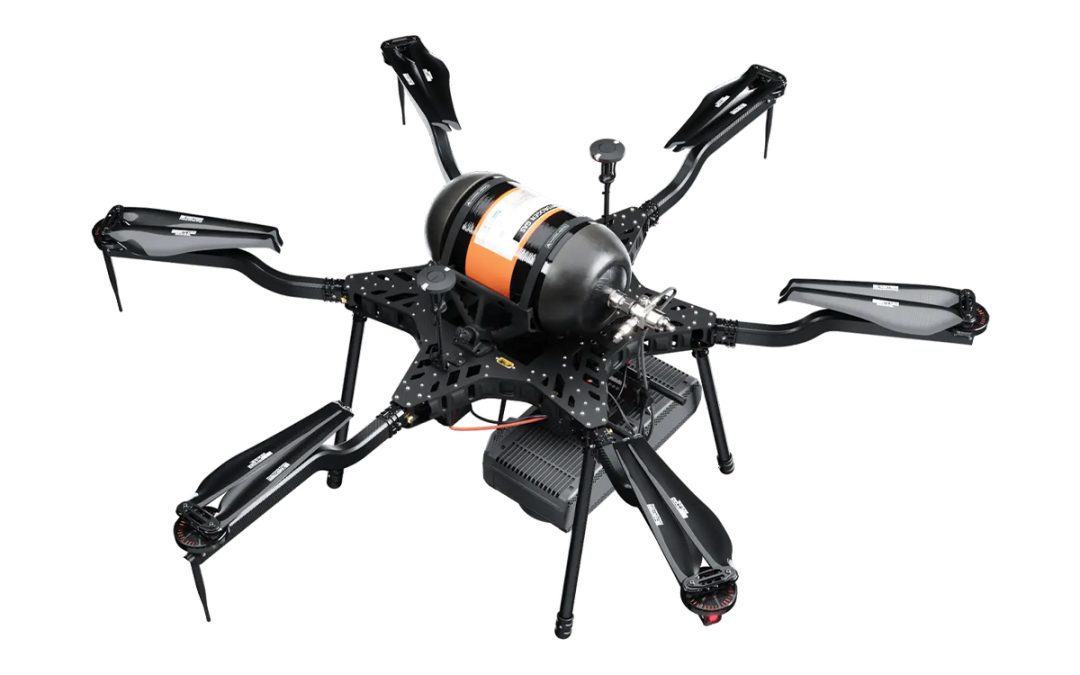
Harris Aerial H6 Hydrone Next-Generation | Hydrogen Power. Hydrogen Endurance. | Stealth Profile. A foldable hexacopter frame, top-mounted hydrogen cylinder, and a 2.4 kW fuel cell working in concert — engineered for missions where extended endurance and acoustic...

by Jenn Heinrich | Jul 9, 2026
Harris Aerial H6 Electric Drone Adaptable Powerful Versatile Built Different | Performs Different Patent-pending battery rack, modular power conversion, and a foldable hexacopter frame engineered for the missions where reliability is non-negotiable — from precision...

by Jenn Heinrich | Jul 8, 2026
Harris Aerial H4C Quad Drone Engineered for Maximum Impact Minimum Footprint Built Different | Performs Different Proprietary airframe design, military-grade electronics, and a modular payload bay engineered for every mission profile — from precision agriculture to...
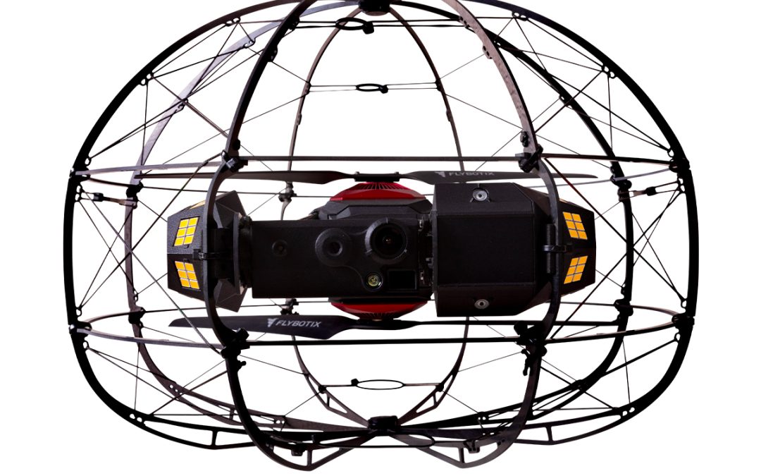
by Marco Ryan | Jun 22, 2026
Flybotix KMC0001.02.00_Nd ASIO X Drone – NDAA Approved Streamlined inspection process. Fast decision making. Developed by Flybotix, the ASIO X features a patented coaxial propulsion design housed within a highly durable, crash-resistant protective cage. This...
by Marco Ryan | Jun 15, 2026
Flybotix KMC0001-02.00_BuHo ASIO X Drone – Blue Herelink Streamlined inspection process. Fast decision making. Developed by Flybotix, the ASIO X features a patented coaxial propulsion design housed within a highly durable, crash-resistant protective cage. This...
by Marco Ryan | Jun 15, 2026
Flybotix KMC0001-02.00_BaHo ASIO X Drone – Black Herelink Streamlined inspection process. Fast decision making. Developed by Flybotix, the ASIO X features a patented coaxial propulsion design housed within a highly durable, crash-resistant protective cage. This...

by Marco Ryan | Jun 15, 2026
Flybotix AMO0179-00.00 UXV Ground Control Station Featuring 2x 2-axis joysticks with built-in buttons, 2x 1-axis joysticks with built-in buttons, and 12x additional buttons, the Navigator Tab 5 is designed to meet customers’ needs for button mapping. The...
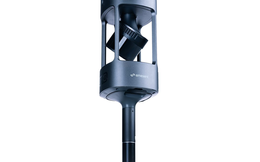
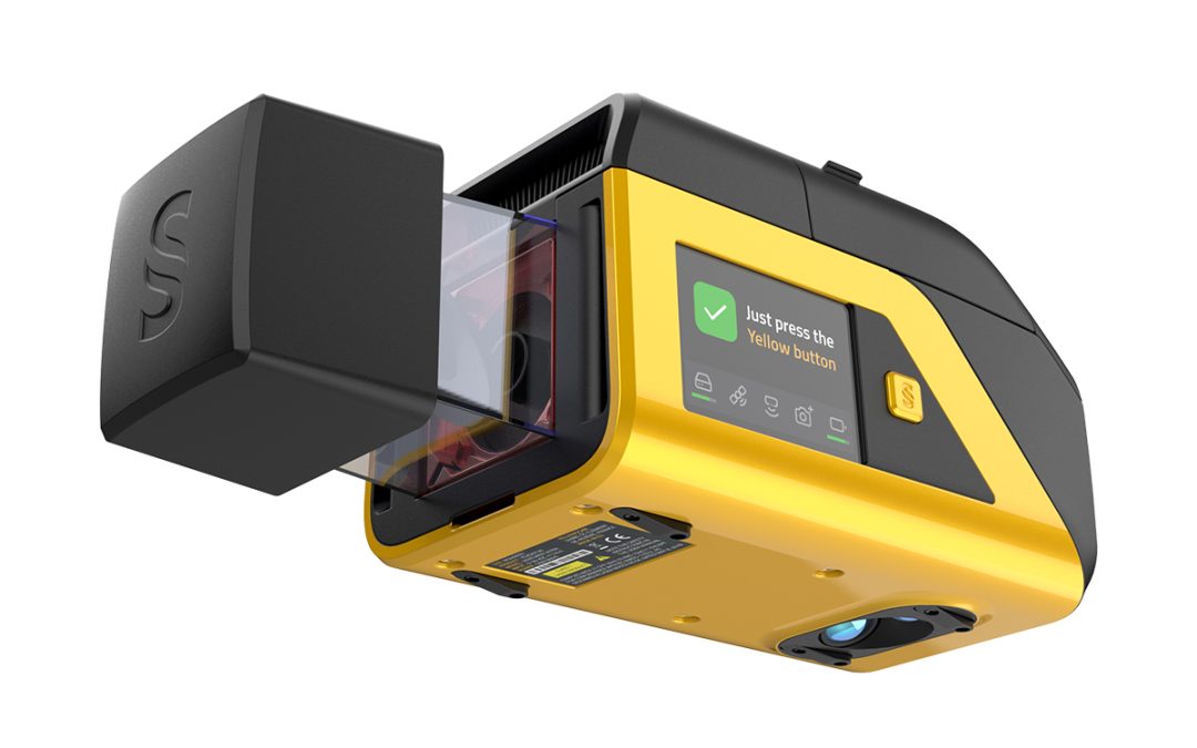
by Marco Ryan | Jun 1, 2026
Emesent E00-GX1 RTK SLAM Scanner Emesent GX1 gives surveyors what they’ve been asking for: mobile scanning speed with accuracy you can rely on, time and time again. Delivering 5-10mm global accuracy with integrated premium RTK georeferencing, GX1 eliminates the...
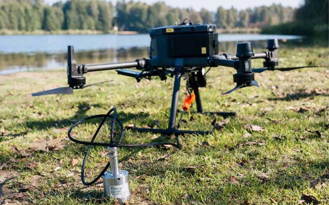
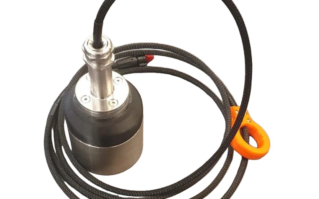
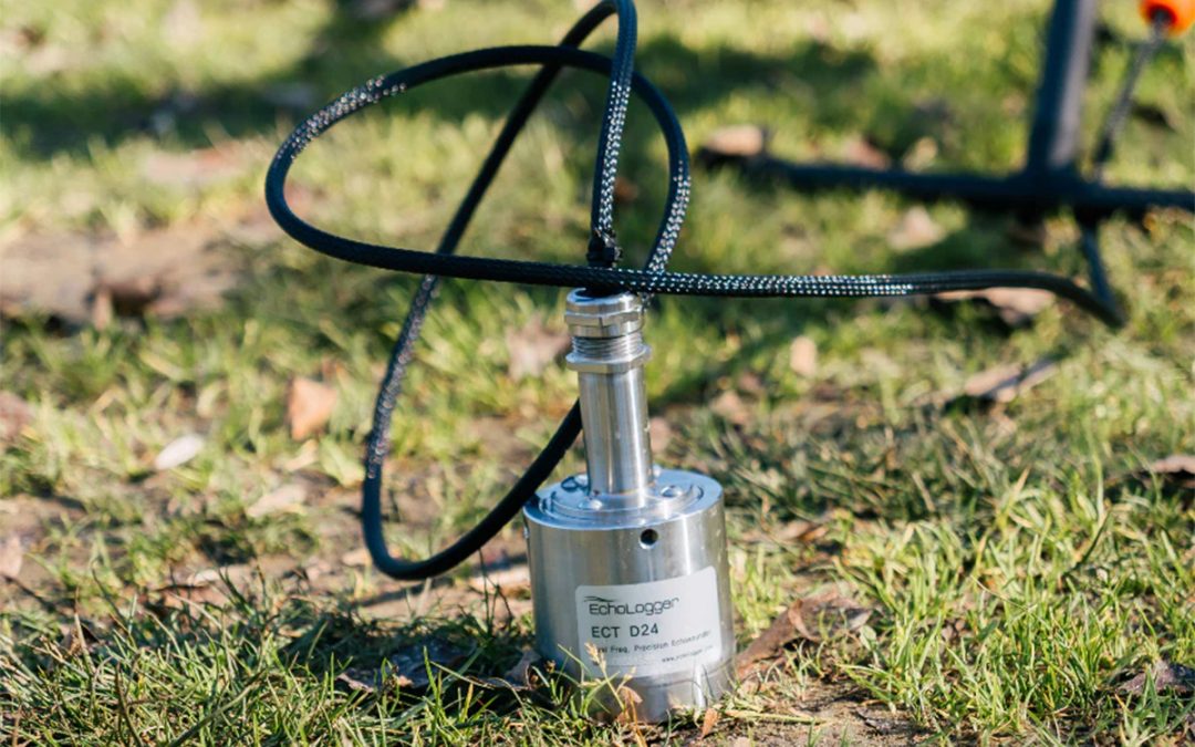
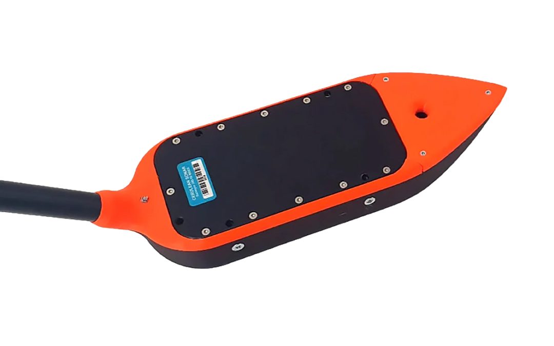
by Marco Ryan | May 7, 2026
SPH Engineering IS-EL-ECT-D24S EchoLogger Echo Sounder The echo sounder cable is protected by a plastic sleeve which also supports the echo sounder and housing weight. ECT D24S has optimal combination of frequencies for shallow ponds/lakes/rivers with a lot of...
by Marco Ryan | May 7, 2026
SPH Engineering IS-EL-ECT-D052S EchoLogger Echo Sounder The echo sounder cable is protected by a plastic sleeve, which also supports the echo sounder and housing weight. Comes with an RS232 interface and connector for SkyHub. Please note that additional components and...
by Marco Ryan | May 7, 2026
SPH Engineering IS-EL-ECT-400S EchoLogger Echo Sounder The echo sounder cable is protected by a plastic sleeve, which supports the echo sounder and housing weight. Comes with an RS232 interface and connector for SkyHub. Please note that additional components and...
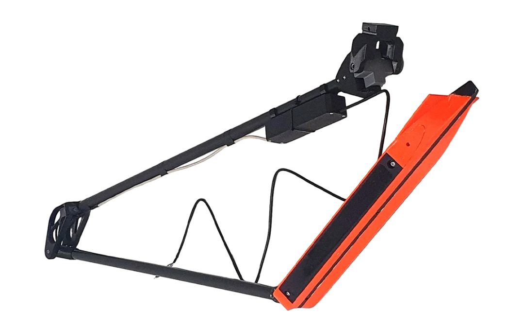
by Marco Ryan | May 7, 2026
EchoNIMBUS-SSS payload includes: 2x Cerulean Omniscan 450SS side-scan sonar Foldable mount and electronics housing Ethernet switch module Explorer transport case EchoNIMBUS-SSS has 2x Omniscan 450SS transducers. Comes with an Ethernet interface and connector...
by Marco Ryan | Apr 29, 2026
SPH Engineering EchoNIMBUS-MBES Multibeam Echosounder Payload Main Features: 240 kHz multibeam sonar with 16 beams for high-definition bathymetry Fully integrated with SkyHub – Drone onboard computer Real-time depth measurements through UgCS Custom Payload Monitor...
by Marco Ryan | Apr 13, 2026
YellowScan Venturer YSVENTKIT-AP LiDAR System UAV NDAA LiDAR for Trusted and Compliant Data Acquisition Explore Without Limits In demanding survey environments, uncertainty is costly. Survey missions are often constrained by tight timelines, limited access, regulated...

by Marco Ryan | Mar 4, 2026
Juniper Systems Uinta 29120 Software (3-Year) – Professional License Mapping and Data Collection Software Uinta’s versatility makes it an ideal solution for a wide range of industries. Environmental scientists can track wildlife and vegetation, utilities can...
by Marco Ryan | Mar 4, 2026
Juniper Systems Uinta 29119 Software (1-Year) – Extra Field License Mapping and Data Collection Software Uinta’s versatility makes it an ideal solution for a wide range of industries. Environmental scientists can track wildlife and vegetation, utilities can...
by Marco Ryan | Mar 4, 2026
Juniper Systems Uinta 29118 Software (3-Year) – License Mapping and Data Collection Software Uinta’s versatility makes it an ideal solution for a wide range of industries. Environmental scientists can track wildlife and vegetation, utilities can manage...
by Marco Ryan | Mar 4, 2026
Juniper Systems Uinta 29117 Software (1-Year) – Windows 10 Professional License Mapping and Data Collection Software Uinta’s versatility makes it an ideal solution for a wide range of industries. Environmental scientists can track wildlife and vegetation,...
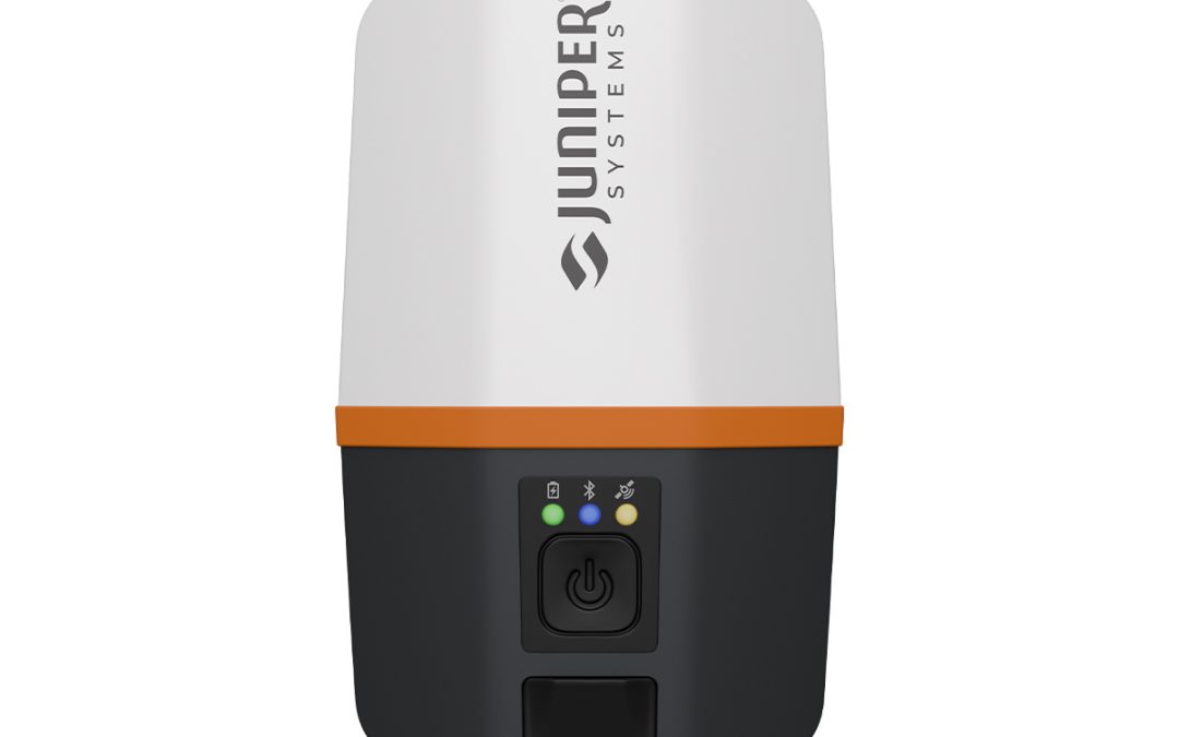
by Marco Ryan | Feb 10, 2026
Juniper Systems Spire SP1-CFG(1457) Real-time Ready Receiver Location, simplified. Whether you’re working in remote areas or urban settings, this receiver adapts to your accuracy needs with support for SBAS, Network RTK, and future correction services. Gather...

by Jenn Heinrich | Jan 27, 2026
Trimble Roadworks Paving Control Platform for Asphalt Compactors Ask for the next generation of machine control. From the company that invented machine control. The intuitive Android™ interface on a large, friendly touch screen enables you to easily view real time...
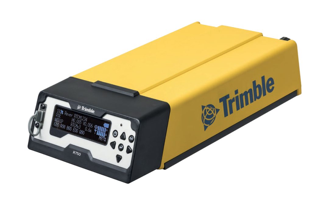
by Marco Ryan | Dec 18, 2025
Trimble CON-R750-2-50 R750 Model 2 Modular GNSS Receiver The R750 Model 2 receiver can access all available satellite signals and provides improved performance and reliability in challenging GNSS conditions using constellation-agnostic Trimble ProPoint® technology....
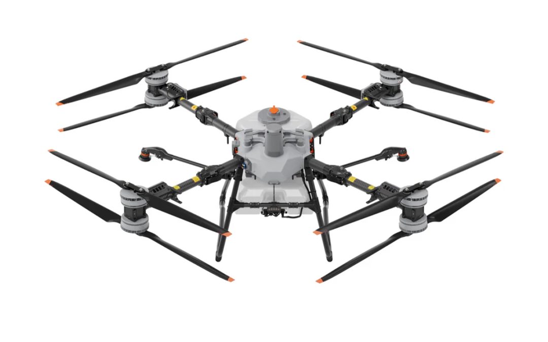
by Marco Ryan | Nov 25, 2025
DJI Agras-T100 Sprayer Drone Powerful Spraying. Maximum Efficiency Equipped with a 100L tank and dual atomizing centrifugal sprinklers, the T100 takes your spraying to the next level, covering more ground, flying faster, and boosting efficiency across large fields....
")